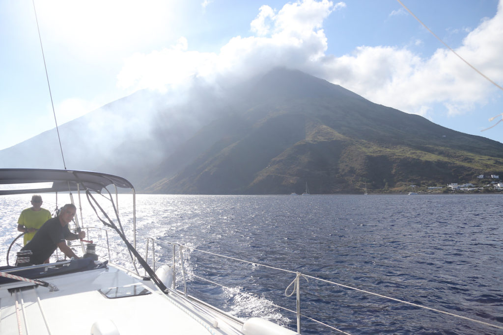
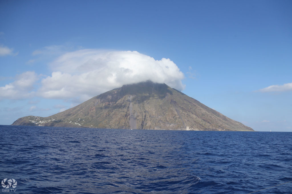
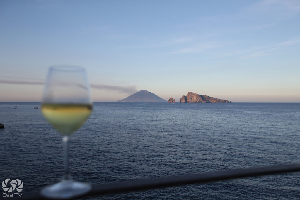
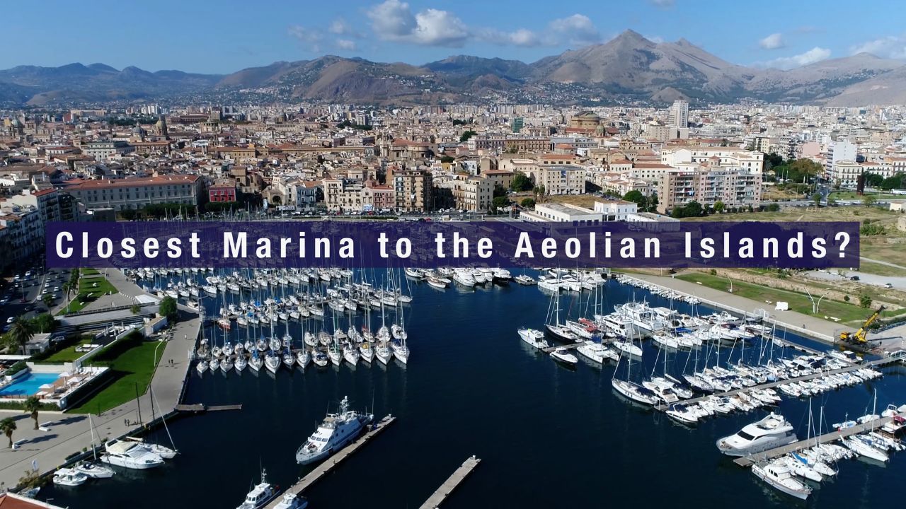
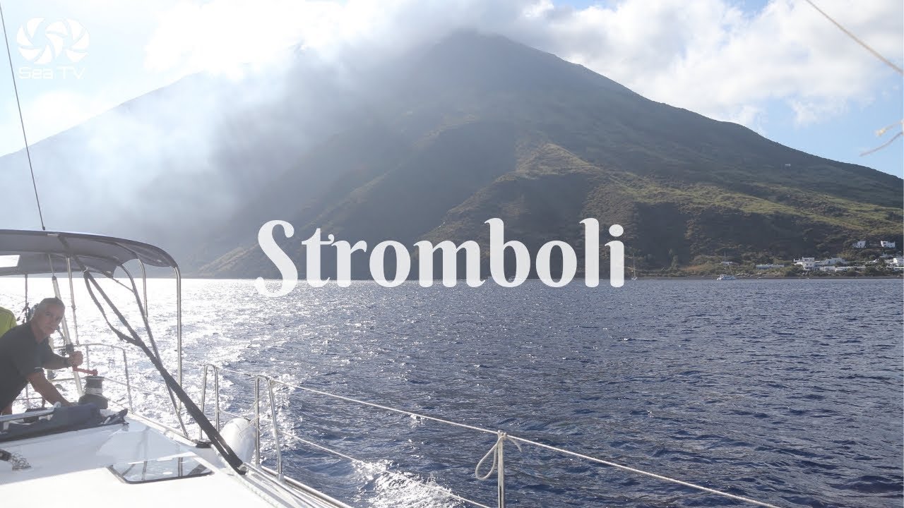
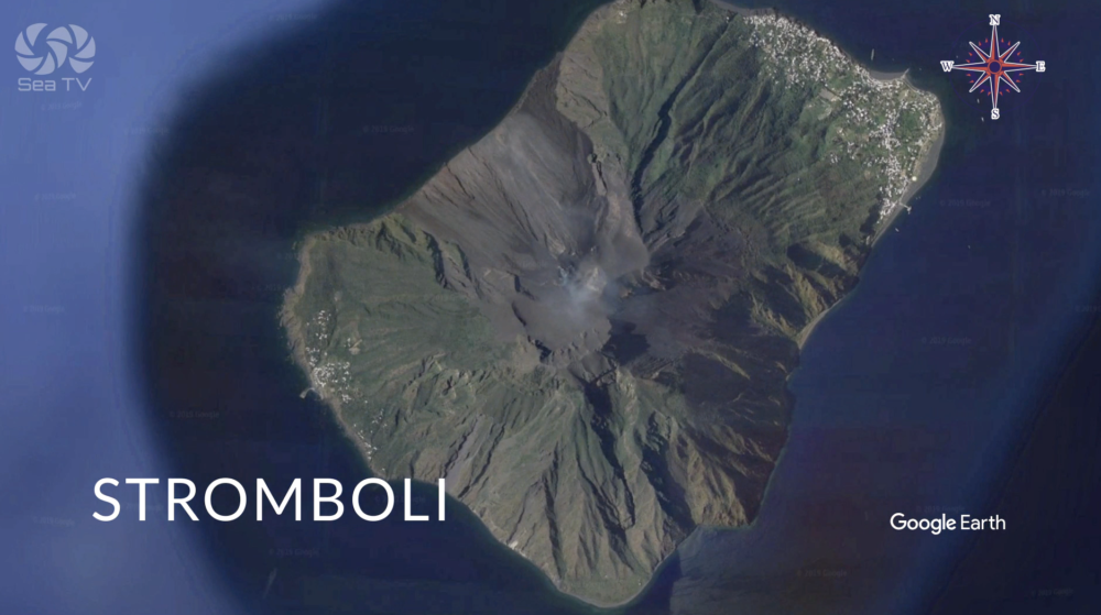
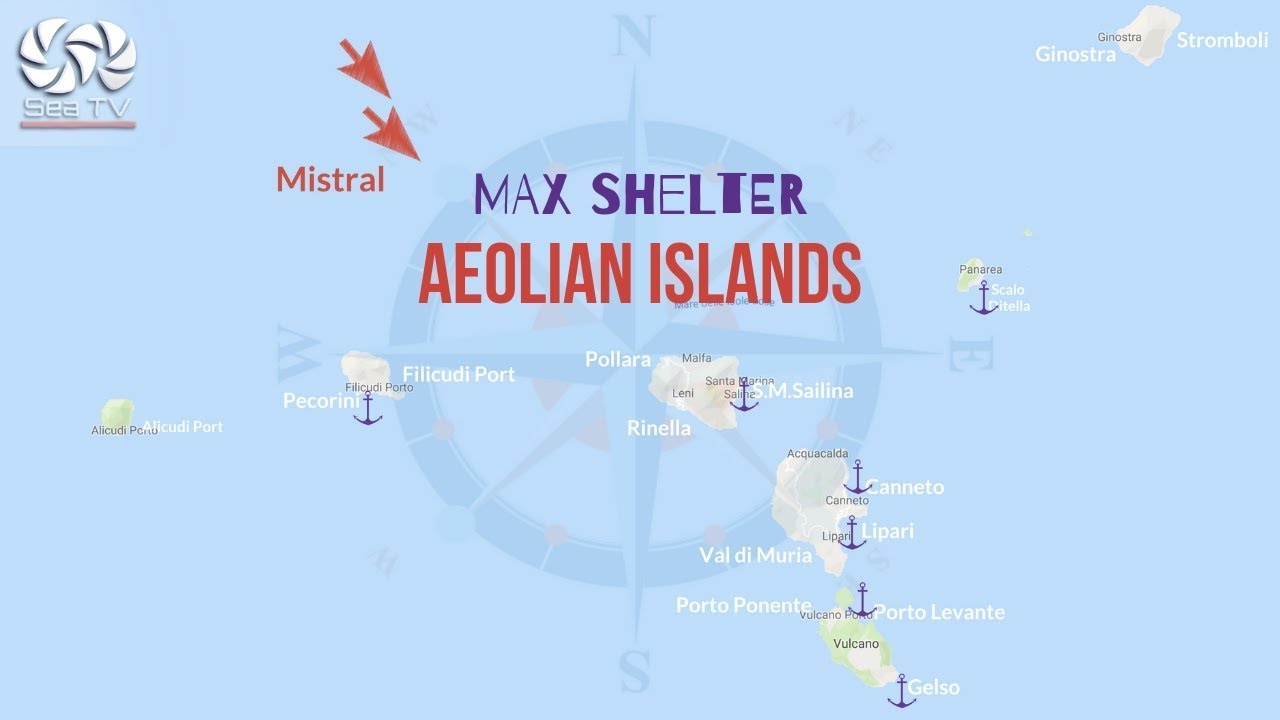
Stromboli is the most remote and the most extraordinary of the Aeolian Islands — a near-perfect volcanic cone rising 924 metres from the sea, 50 nm from Portorosa, with a continuously active volcano that has been erupting for over 2,000 years. Ancient Greek and Roman sailors called it the Lighthouse of the Mediterranean; at night its intermittent glow is visible from 30 miles. The famous Sciara del Fuoco (Stream of Fire) on the island’s NW flank channels most lava flows down the steep slope directly into the sea — glowing red trails descending through the darkness are the defining experience of sailing the Aeolians. Stromboli has no cars, no street lights by municipal decree, and a population of about 500. It rewards an overnight stay more than any other island in the archipelago.
⚠ No sheltered harbour: Stromboli has no protected marina. All anchorages are open roadsteads suitable only in calm to moderate conditions. Never plan to stay overnight at Stromboli in strong wind forecasts — you must be prepared to leave quickly. The anchorages can become untenable rapidly if conditions deteriorate.
⚓ Anchorages — Quick Facts
| Anchorage | Coordinates | Depth | Notes |
| Scari / San Vincenzo (buoy field) | 38°48.044’N / 15°14.648’E | 6–12m | Main anchorage NE coast. Buoys N of jetty (VHF 16/77, tel. 090.986390). Black volcanic dust bottom — good grip but uncertain holding. Depths drop quickly S of ferry pier. |
| Ficogrande | NE coast, N of Scari | ~10m | Rocky bottom — holding can be uncertain. Black sand beach. View of Strombolicchio. Calmer than Scari in light NE winds. |
| Ginostra | SW coast | 8–10m | Tiny village. Anchor E or W of Punta Lazzaro. Reachable only by sea — no road connection to Stromboli village. Quieter alternative. |
| NW coast — lava viewing | NW side, Sciara del Fuoco | Deepwater drift | Motor around at nightfall to watch the lava show from sea. Do not anchor here — Sciara del Fuoco slope is unstable; keep moving. Safe distance minimum 200m. |
Approach & Navigation
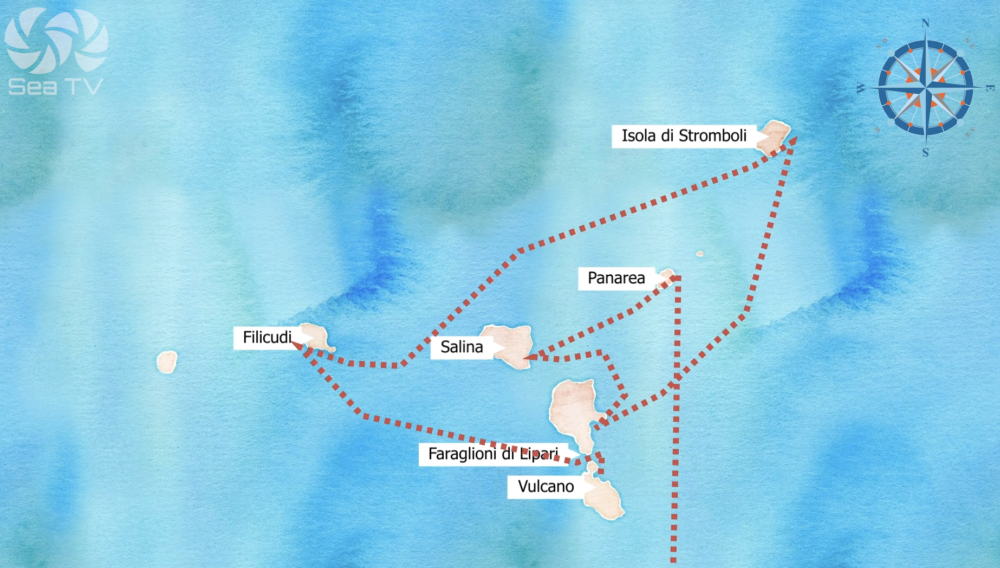
Stromboli is 50 nm from Portorosa and 25 nm from Salina — plan an early departure or an overnight passage. Approach the main anchorage at Scari from the NE. The recommended spot is approximately 400 metres south of town in 6–12m — the black volcanic dust bottom provides reasonable grip. Anchor clear of the pier where ferries and hydrofoils berth.
⚠ Underwater cables: Underwater cables are marked on the charts around Stromboli — keep clear. Depths drop off quickly south of the ferry pier. The seas around the island are frequently coated with a fine layer of floating pumice — normal, but check your sea strainer.
One mile north-northeast of the main anchorage lies Strombolicchio — a solitary volcanic rock stack rising dramatically from the sea. Anchoring here is impossible even in calm weather. It is a spectacular sight under sail; approach for a close look but do not attempt to stop.
The Lava Show — Night Viewing
The Sciara del Fuoco on the island’s NW flank is the primary attraction — an enormous natural steep channel that funnels lava, volcanic bombs, and glowing rock fragments directly down to the sea. After dark, the sight of red-hot lava sliding down the mountainside into the water with plumes of steam and sparks is genuinely extraordinary. Eruptions occur roughly every 10–20 minutes, with 3 active crater vents that reshape constantly.
From the boat: Motor around to the NW side of the island after sunset. Maintain a minimum of 200m from the shore under the Sciara. Keep engines running — do not anchor here. Stop engines briefly to listen: the hiss of hot lava hitting the sea, and the deep rumble of the eruption reaching you across the water, are what makes this different from any photograph. Your boat may be lightly dusted with volcanic ash by morning — rinses off easily.
From shore: The Osservatorio restaurant at Punta Labronzo offers a landside viewpoint of the Sciara del Fuoco. Boat excursions at sunset depart from Scari and provide the closest safe sea-level view.
Crater Hike — Rules & Practicalities
The summit hike to the active craters (924m) is one of the most memorable experiences in the Mediterranean — but it is strictly regulated.
| Guide required? | Yes — mandatory above 400m. Guides bookable at Scari jetty area. |
| Helmet required? | Yes — provided by guides. |
| Duration | ~5 hours round trip. Departures late afternoon to arrive at crater for dark. |
| Fitness level | Moderate to demanding. Only attempt if confident of fitness. |
| Equipment rental | Boots and trekking poles available at Scari. Bring torch (no street lights on island). |
| Eco tax | €2.50/pp (Apr, May, Oct) — €5.00/pp (Jun–Sep) |
| ⚠ Closures | When volcanic activity is rated high, crater area is placed off-limits. Can never be guaranteed — check current status on arrival. |
Book in advance in July–August — daily visitor numbers are limited. Guides advertise along the Scari waterfront and the lane to San Vincenzo village.
️ Beaches
- Ficogrande — largest and most organised beach. Black volcanic pebbles and intense blue water. Umbrellas, sunbeds, refreshments. Views of Strombolicchio.
- Scari — near the ferry jetty. Quiet and clean. Fishing boats on the volcanic sand.
- Forgia Vecchia — directly below the volcano slope. Transparent water, black pebbles. On foot from Scari.
- Spiaggia Lunga (Piscità) — northern coast. Wild, unorganised, nude-friendly. No amenities.
- Punta Lena — secluded, only by boat. Crystal-clear water.
️ What Else to See
- Casa Rossa — the house in San Vincenzo where director Roberto Rossellini and Ingrid Bergman lived while filming Stromboli (Terra di Dio) in 1949.
- Chiesa di San Vincenzo — the island’s principal church on the small piazza of the same name.
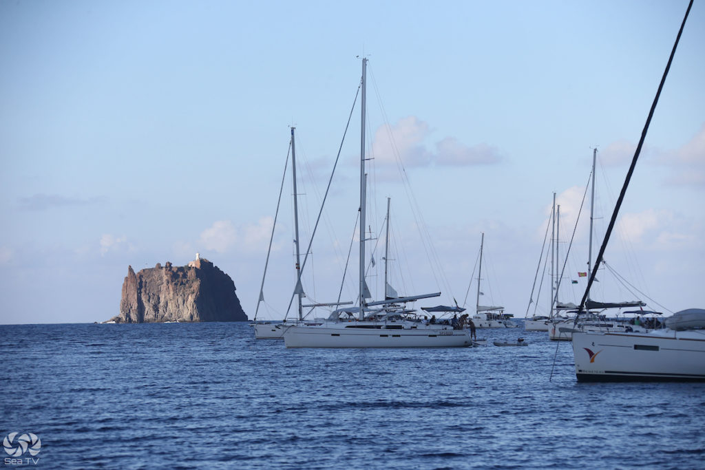
- Strombolicchio — the volcanic sea stack 1 nm NE, with a small lighthouse. View by boat.
- Ginostra — the tiny SW hamlet reachable only by sea. Donkeys for transport. Connected to electricity only since 2004. A few restaurants and a deep quiet.
Sailor’s tip: Arrive at Scari by early afternoon, anchor and take the crater hike (book the guide first thing on arrival). Return to the boat for sunset, then motor NW to watch the lava from the sea after dark — stop engines and listen. Spend the night at anchor. The island at night without street lights, with the volcano glowing above, is one of those things that doesn’t translate well into words. Stromboli requires an overnight stay; a day visit from Salina or Panarea misses most of what makes it unique.
✅ Safety Checklist
- No sheltered harbour — all anchorages open; be ready to leave at short notice
- Underwater cables on charts — check before anchoring
- Buoy field at Scari: VHF 16/77 or tel. 090.986390
- Black volcanic dust bottom — good grip but verify holding before leaving the boat
- Depths drop quickly S of ferry pier — anchor clear
- Sciara del Fuoco viewing: engines running, minimum 200m from shore, no anchoring
- Crater hike: guide mandatory above 400m; closure possible if activity high — verify on arrival
- Floating pumice around the island — check sea strainer regularly
- No street lights on island — bring torch for going ashore at night
- Provisioning very limited — stock up at Salina or Lipari before arriving