SeaTV · Greece · Dodecanese Islands
Dodecanese Islands — The Layered Aegean Archipelago Off the Turkish Coast
The southeastern Aegean island group running from Patmos in the north down through Leros, Kalymnos, Kos, Nisyros, Tilos, Symi, Chalki, and Rhodes, and ending at Kastellorizo a stone’s throw from the Turkish coast. Knights of St John fortifications, Italian colonial architecture, the active Nisyros volcano, the prehistoric Tilos dwarf elephants, the world climbing capital at Kalymnos, and the UNESCO old town at Rhodes — the most layered Greek-island archipelago for sailors. Plus Captain Rahav’s audio briefing on the wind regime that shapes every leg.
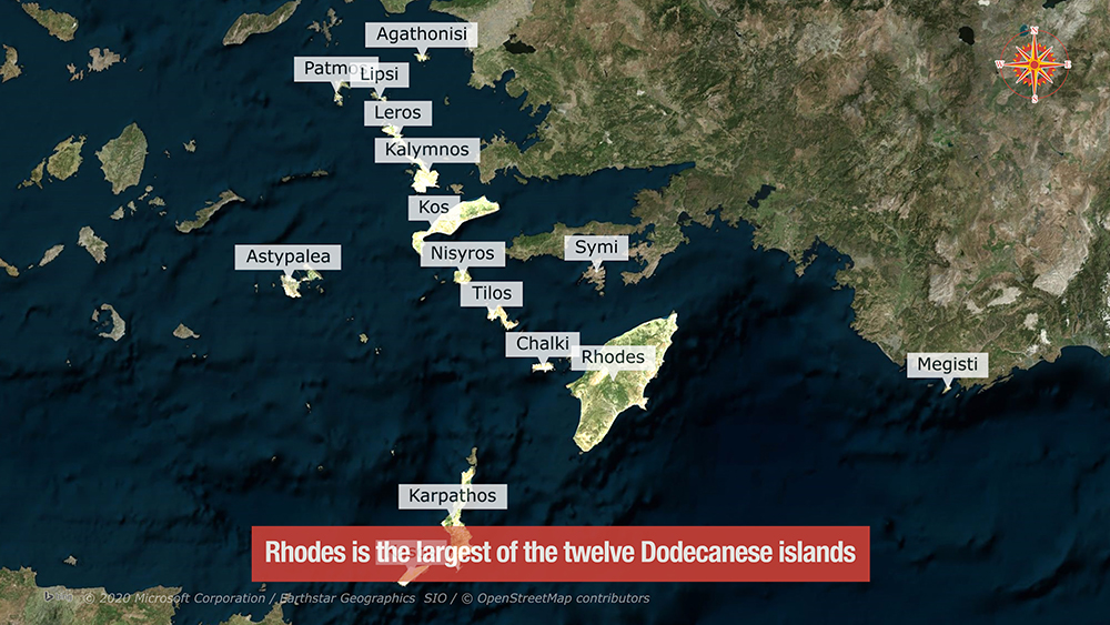
The Dodecanese (“twelve islands” — though there are actually 15 inhabited and many more uninhabited) sit in the southeastern corner of the Aegean, running along the Turkish coast from Patmos in the north to Kastellorizo (the easternmost Greek island) ~1.25 NM from Turkish Kaş in the south. Each island carries its own distinct identity layered over millennia of occupation: the Knights of St John (1309-1522) built fortified cities and inland castles, the Italian colonial period (1912-1947) overlaid Italian Rationalist and Art Deco architecture, and the underlying ancient Greek and Byzantine history runs through everything. For sailors, the Dodecanese offers the most varied and culturally rich Greek-island sailing — the active volcano of Nisyros, the renewable-energy island of Tilos, the world climbing capital of Kalymnos, the Knights’ UNESCO old town at Rhodes, and the neoclassical harbour at Symi all within a 10-14 day southern-Dodecanese charter window.
Sailors’ Tip — Captain Rahav on Dodecanese Wind Patterns
Listen to Captain Azriel Rahav explain the wind regime around the Dodecanese islands · the Meltemi behaviour, the seasonal patterns, the local effects from the Turkish coast, and the planning advice that separates a comfortable summer charter from a difficult one. Essential listening before you set out.
Capt. Azriel Rahav — The weather patterns in the Dodecanese islands, Greece
⚠ Reality check for Dodecanese sailing:
→ N-NW Meltemi prevails in summer · strongest July-August (often 25-35 knots)
→ Many islets, rocks, and reefs · careful chart navigation around every island
→ S-wind surge at Symi Town and Kos exposed bays · know your bolt-holes
→ Submarine cables at multiple islands (Nisyros Mandraki, Chalki, Kardamena) — plot before approach
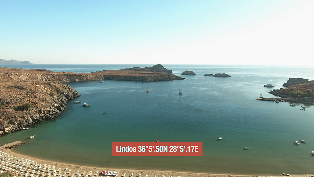
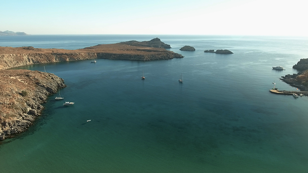
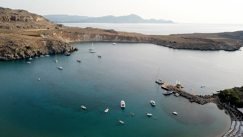
→ Daytime arrival required at Lindos (no harbour lights) and recommended at most stops
⚓ The Dodecanese Islands — A Sailor’s Map
From north to south, the SeaTV-recommended sailing islands of the Dodecanese:
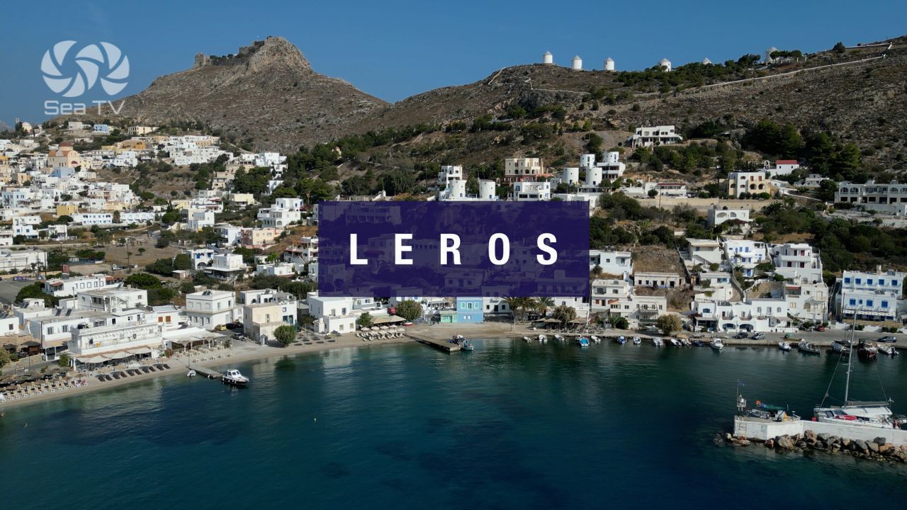
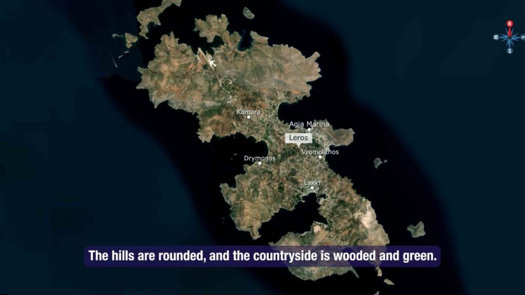
Leros · Italian Naval Town & Pandeli Castle
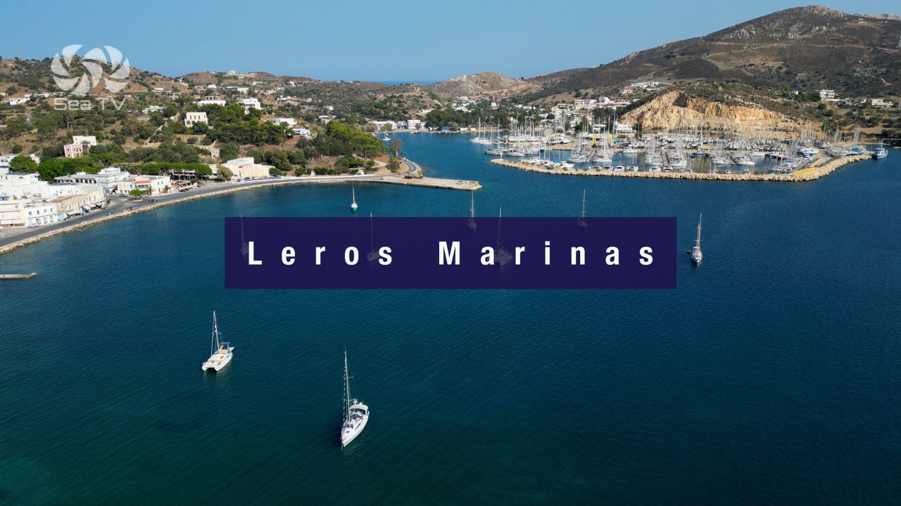
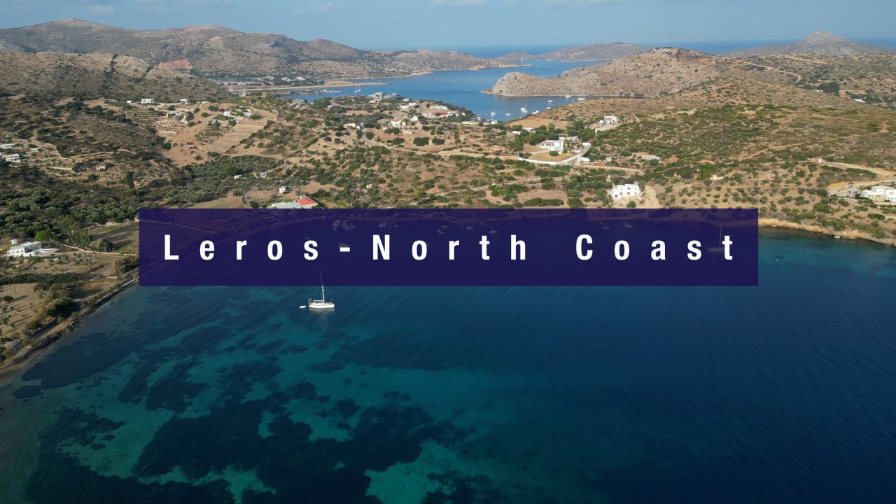
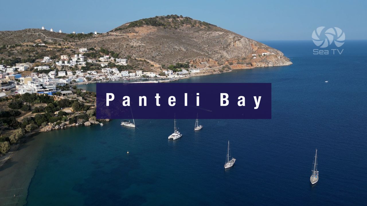
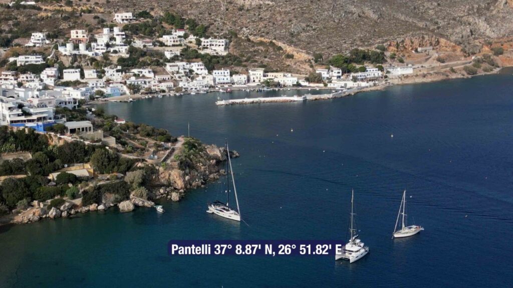
Wooded green hills (rare for the Dodecanese), the Italian Royal Navy base + Mussolini-era Italian Rationalist town at Lakki, and the Pandeli Castle on the NE postcard side. Marina Leros at Lakki has 220 berths and all-weather shelter. See Leros Island · Leros Marinas · North Coast of Leros · Panteli Bay.
Kalymnos · Sponge-Diver Capital + 4,000+ Climbing Routes
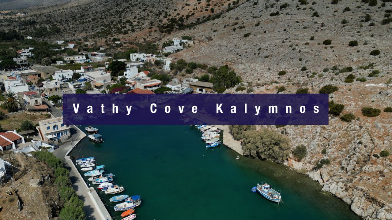
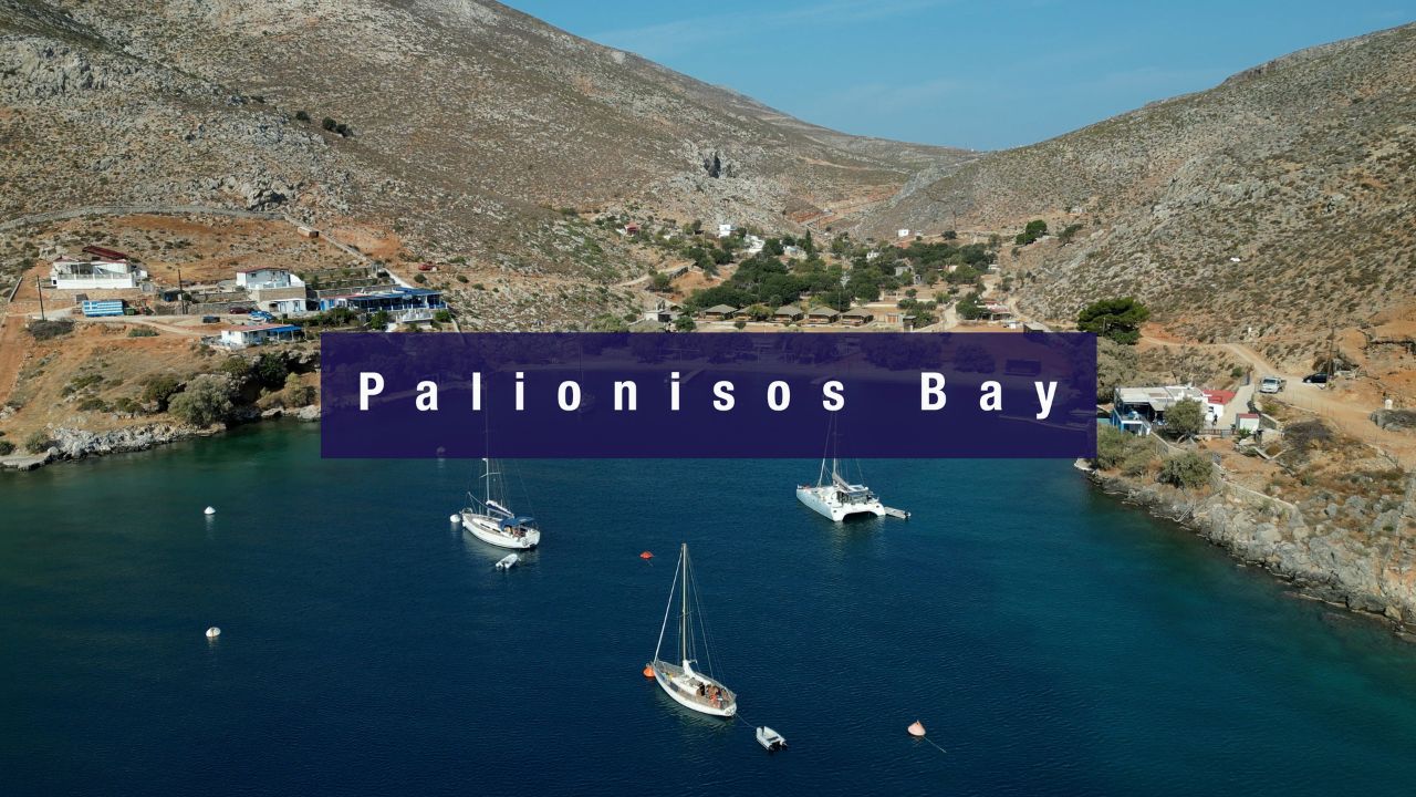
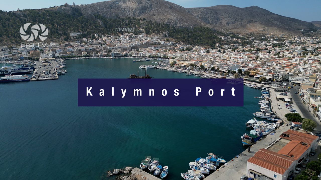
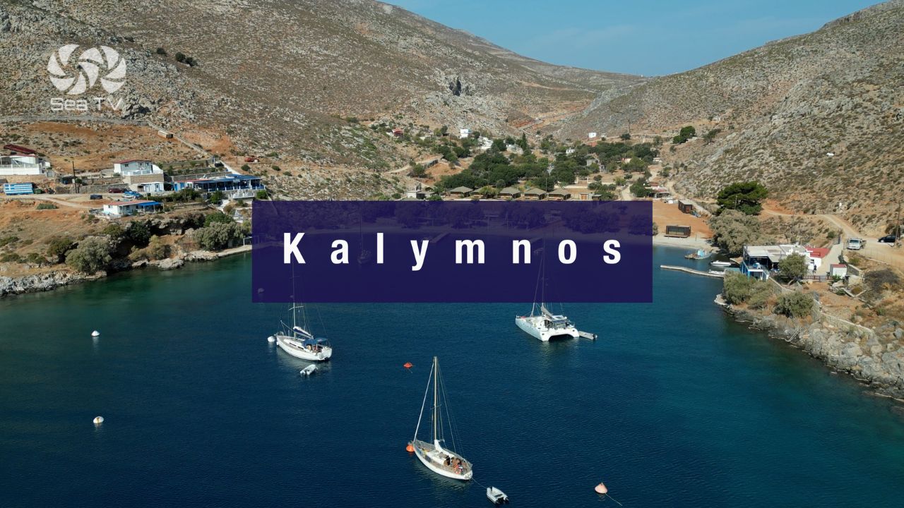
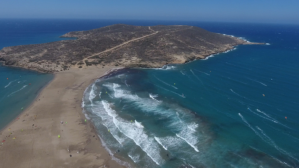
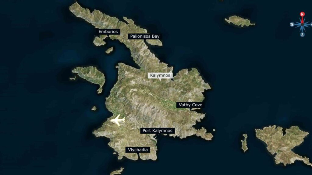
2,000+ years of sponge-diving heritage layered with the world climbing economy that emerged in the 1990s · three distinct sailing stops: Pothia Port (government marina, low rates), Vathy Cove (narrow fjord with citrus valley), Palionisos (NE-coast climbing bay with 17 taverna mooring buoys). See Kalymnos Island · Pothia Port · Vathy Cove · Palionisos.
Kos · Hippocrates’ Birthplace + Asklepieion
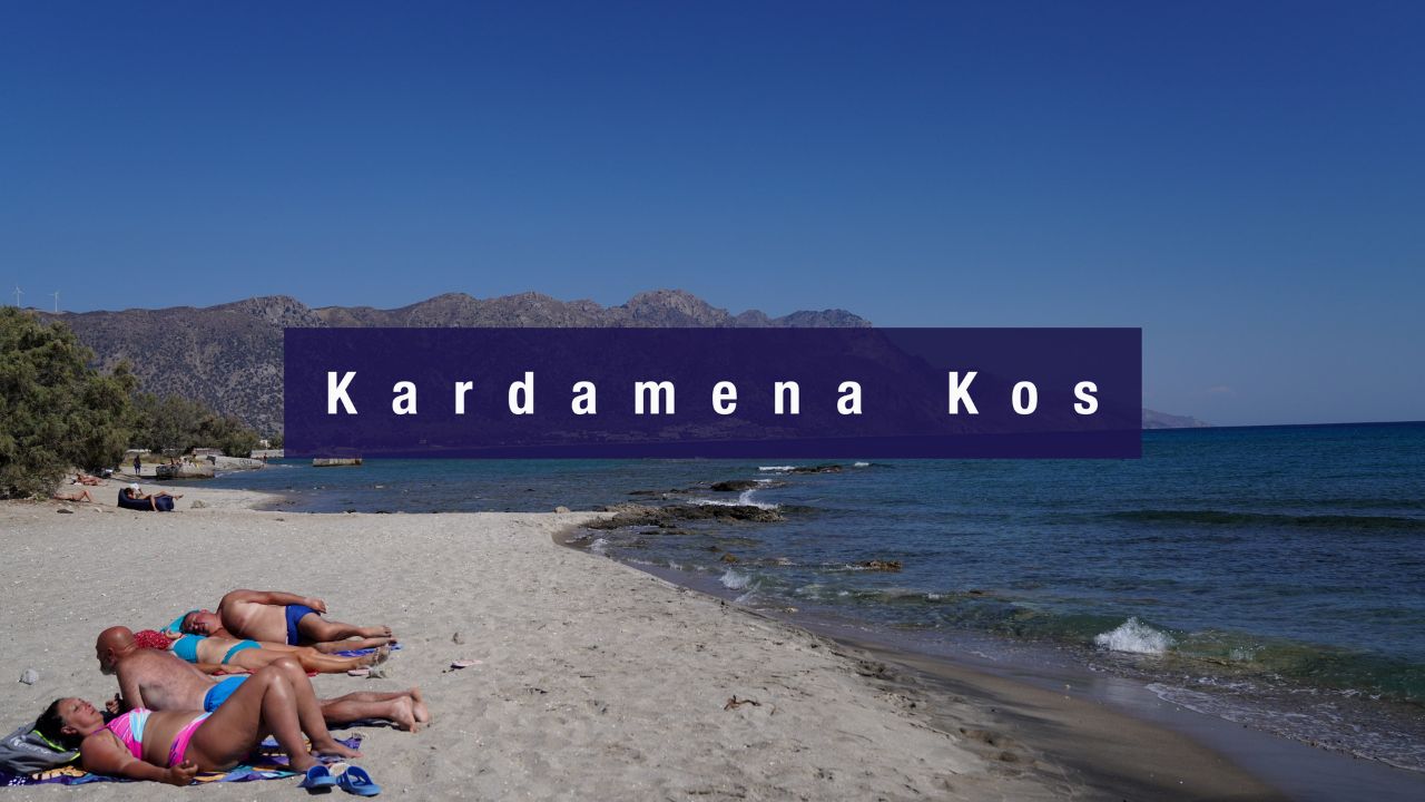
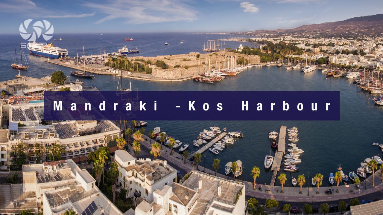
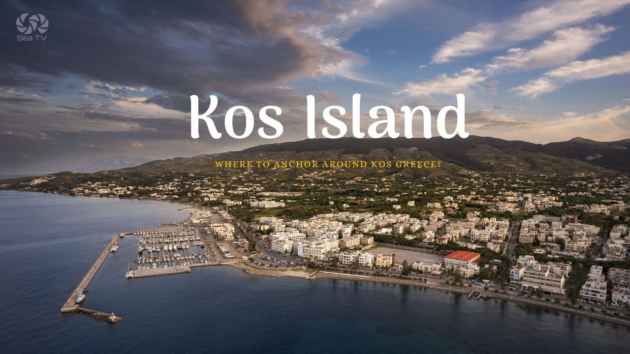
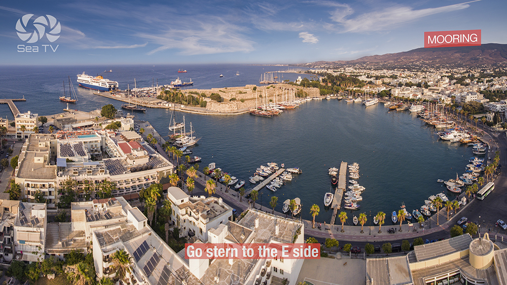
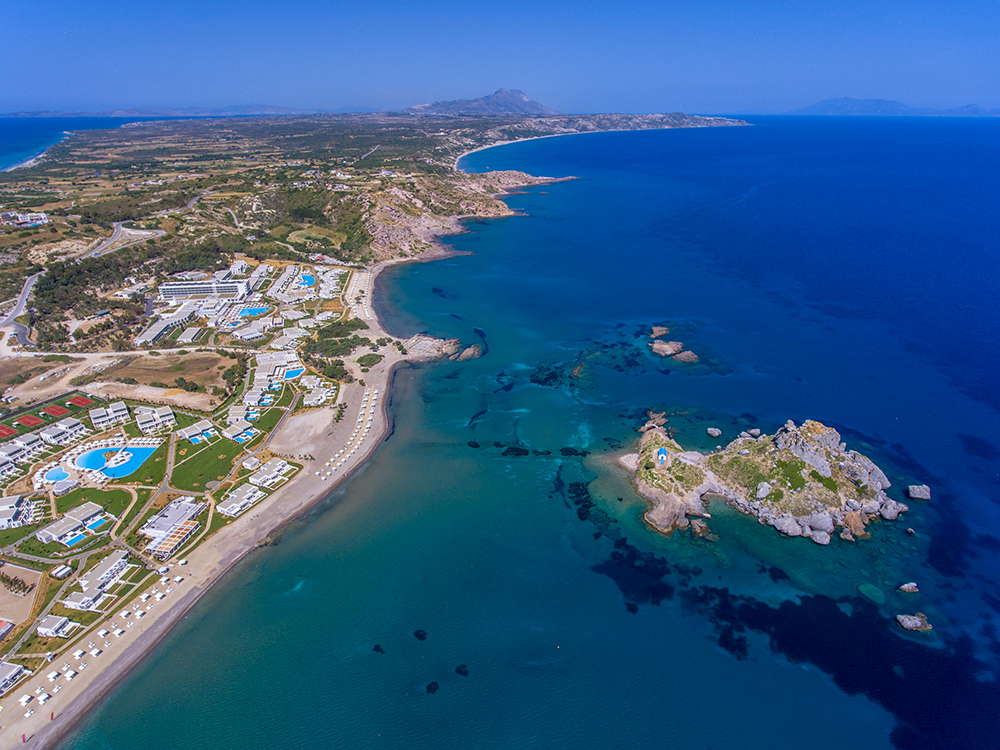
The cultural-heavy Dodecanese island where Western medicine was institutionalised at the Asklepieion · two sailing bases: Mandraki on the NE coast (capital, old town, Italian Art Deco) and Kardamena on the south (10 min from Antimachia airport, Nisyros ferry hub). See Kos Island · Mandraki Kos · Kardamena.
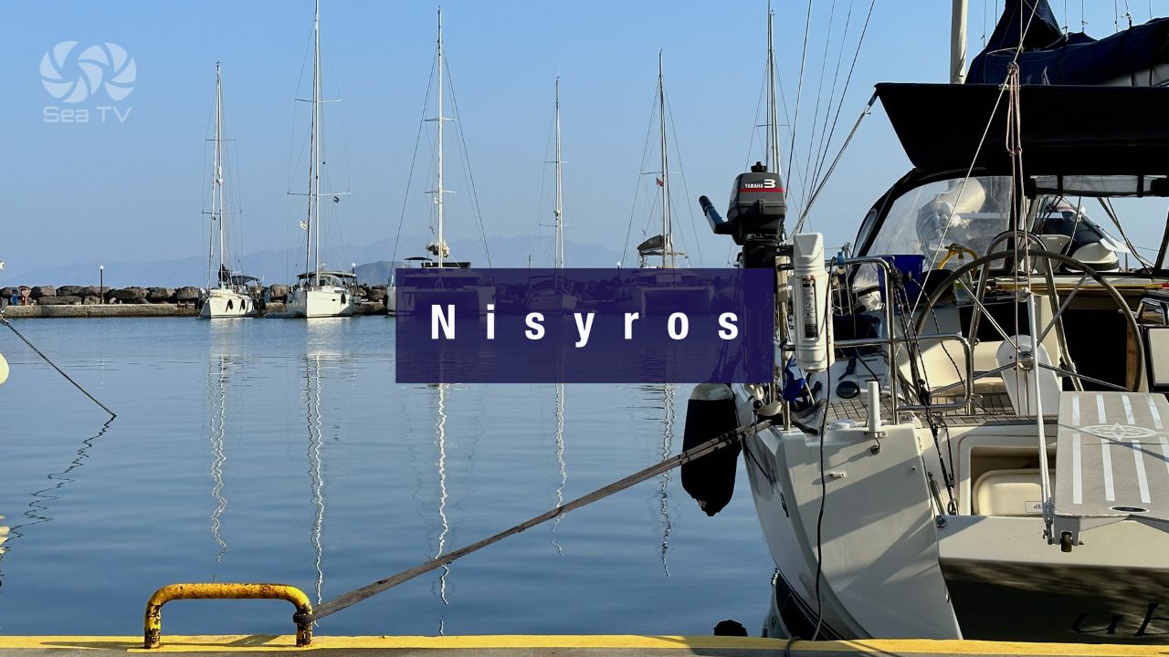
Nisyros · Active Volcano You Can Walk Into
~8 NM SE of Kos · the Stefanos Crater (260 m wide, 30 m deep) with active fumaroles and bubbling sulphur is one of very few active-volcano experiences accessible by sailing yacht in the Mediterranean. Port of Palon for practical mooring + Mandraki for calm-weather day-stops. See Nisyros Island.
Tilos · Mediterranean’s First 100% Renewable Energy Island
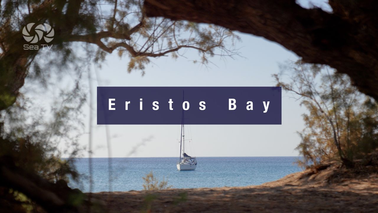
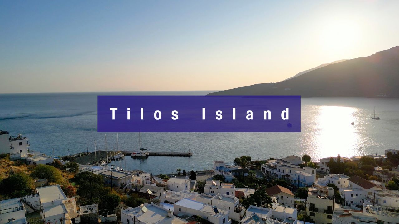
Quiet, ecologically distinctive, with the prehistoric Charkadio Cave dwarf elephants, the abandoned Mikro Chorio, the Saint Panteleimon Monastery, and Eleonora’s falcons (Natura 2000). Livadia E coast for berthing (Panagiotis the bar owner is harbourmaster) + Eristos S coast sandy bay for swimming. See Tilos Island · Eristos Bay.
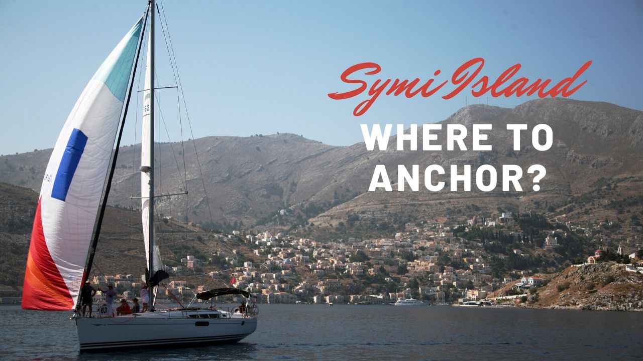
Symi · The Neoclassical Postcard Harbour
Deep harbour ringed with one of the most-photographed neoclassical waterfronts in the Aegean (paid for by 18-19th c shipbuilding wealth). Three stops: Symi Town (⚠ S-wind surge dangerous), Pedi (over-the-hill alternative), Panormitis (SW-corner monastery, all-weather refuge). See Symi Island.
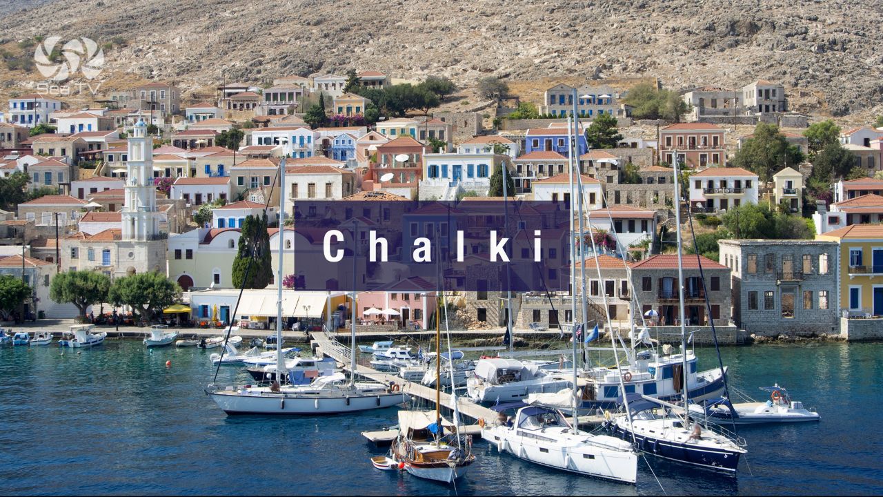
Chalki · The Smaller Symi
5 NM W of Rhodes · neoclassical waterfront at Nimborio, abandoned medieval Chorio with Knights’ castle, Tarpon Springs Florida sponge-diver diaspora roots. ⚠ Submarine cables S and NE (180 m no-anchor zones). See Chalki Island.
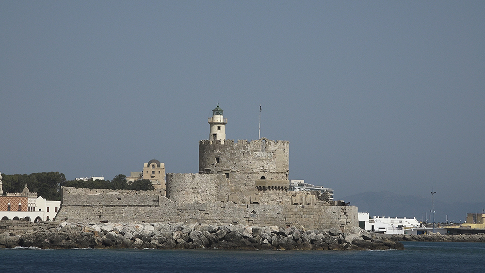
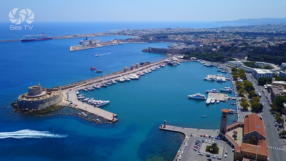
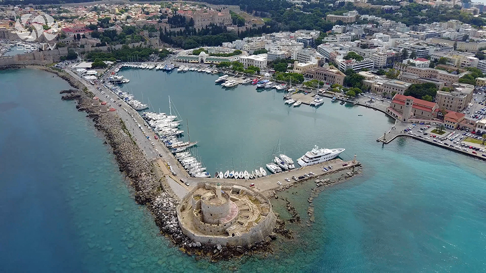
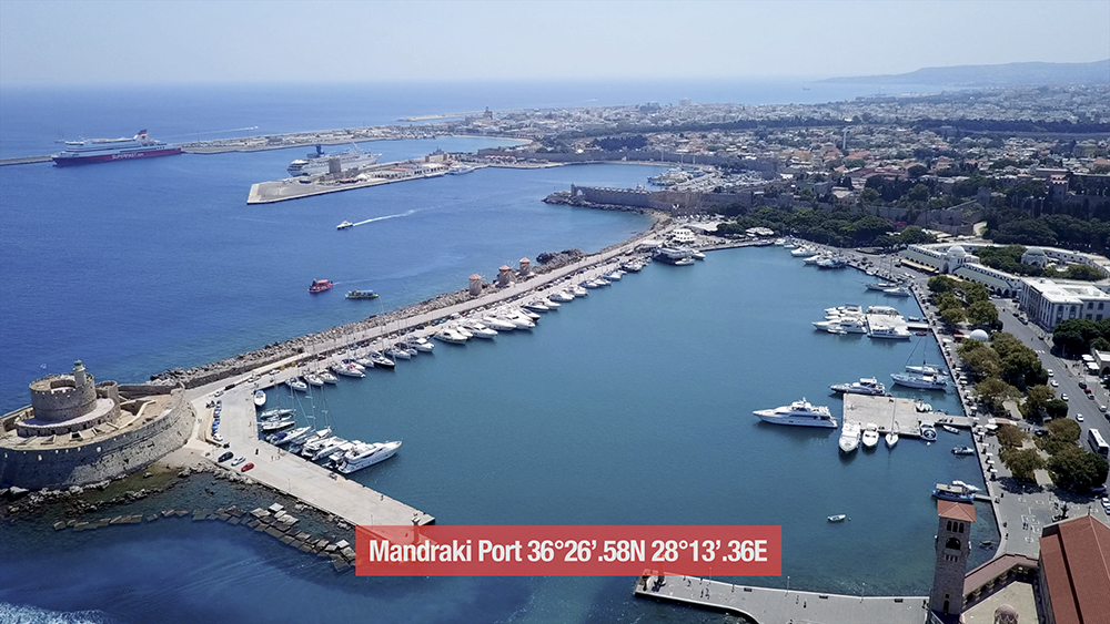
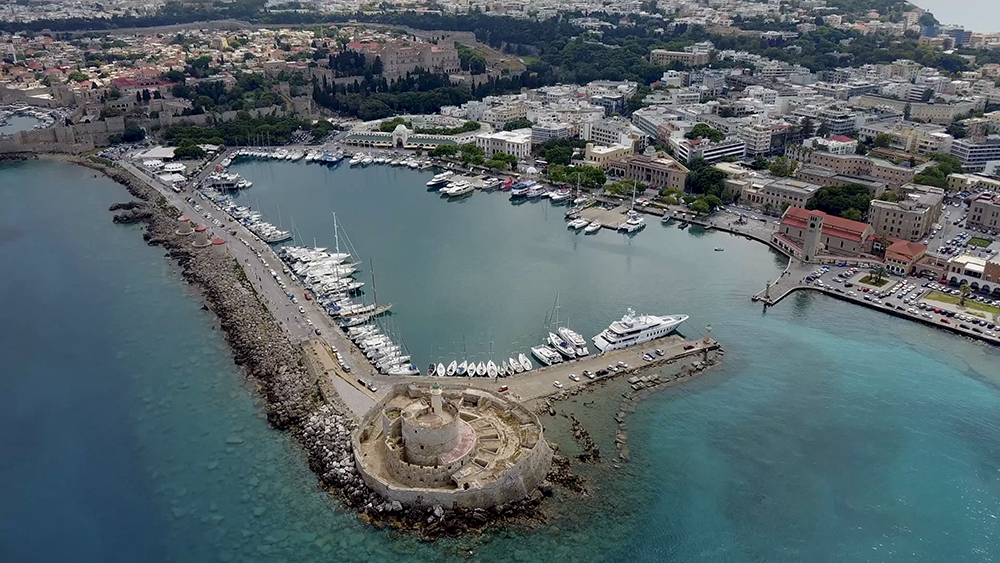
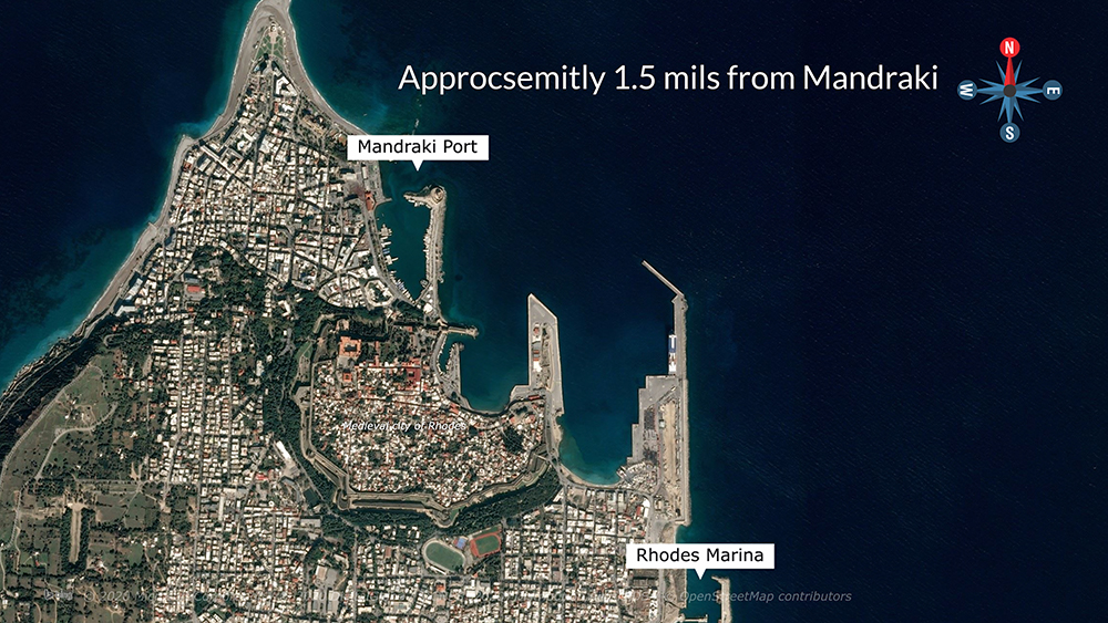
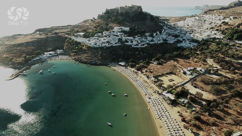
Rhodes · UNESCO Old Town & Lindos Acropolis
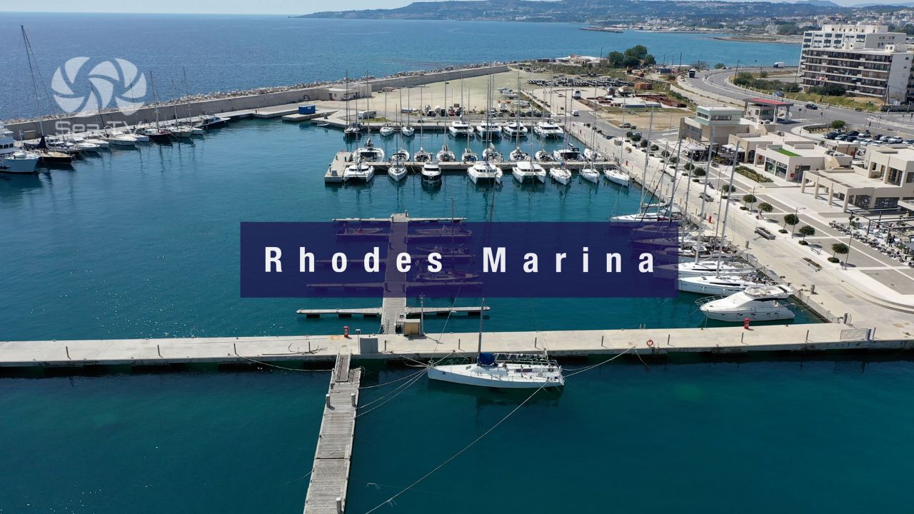
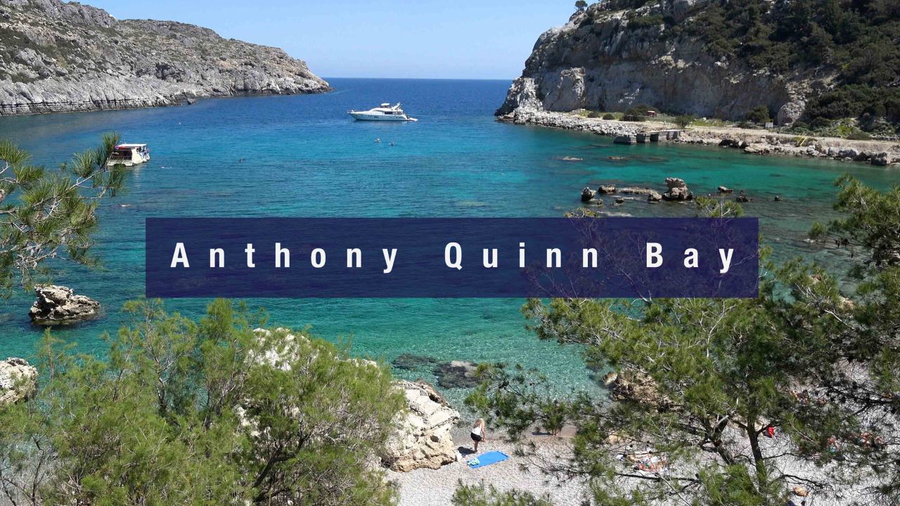
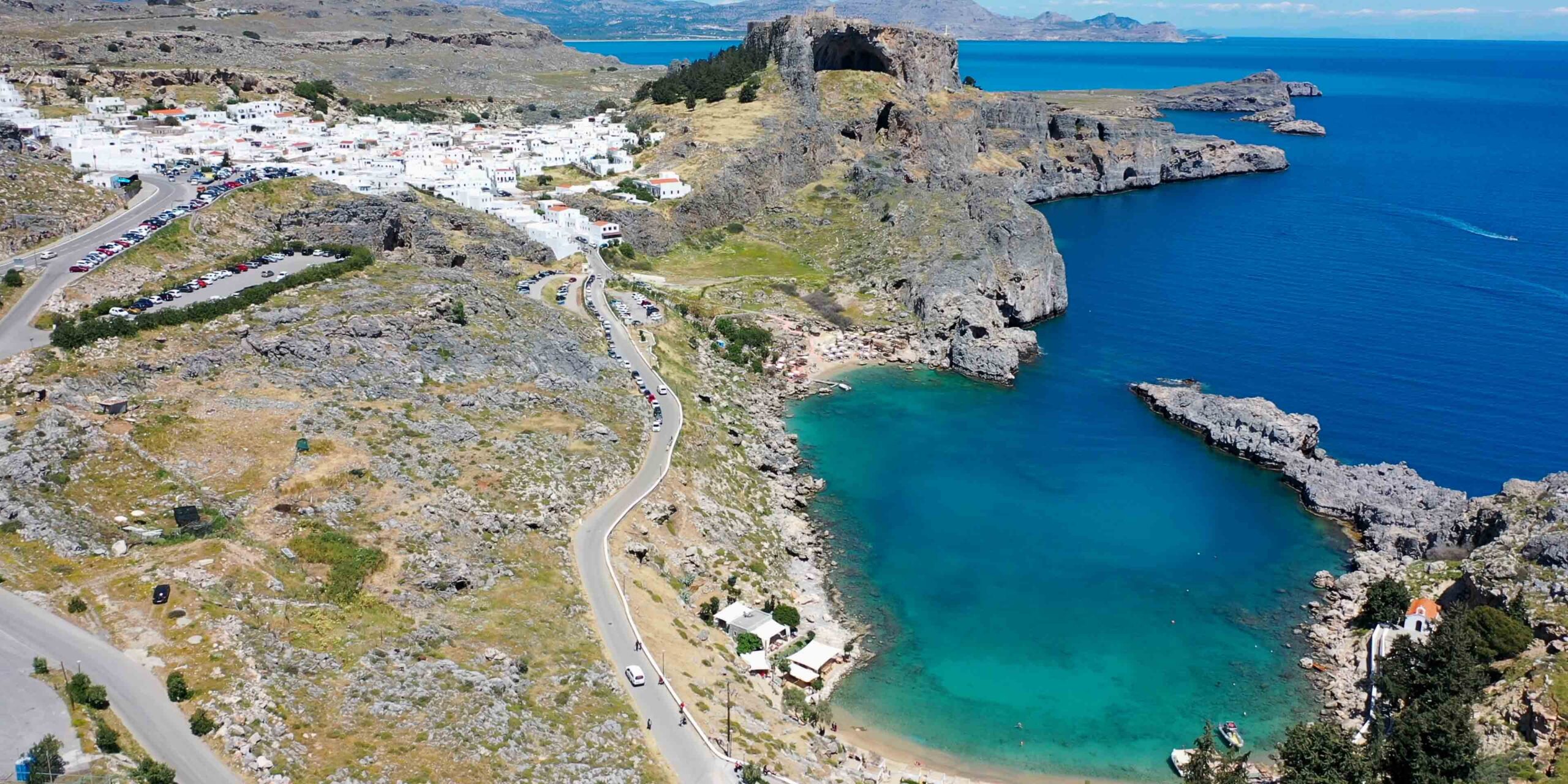
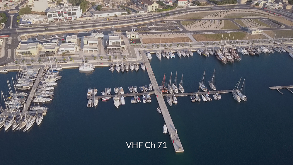
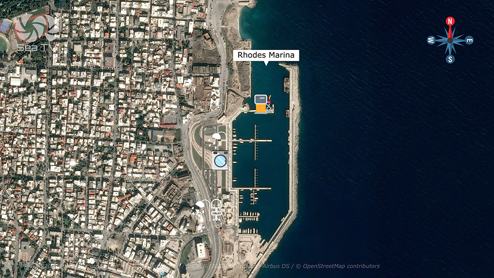
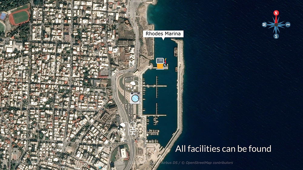
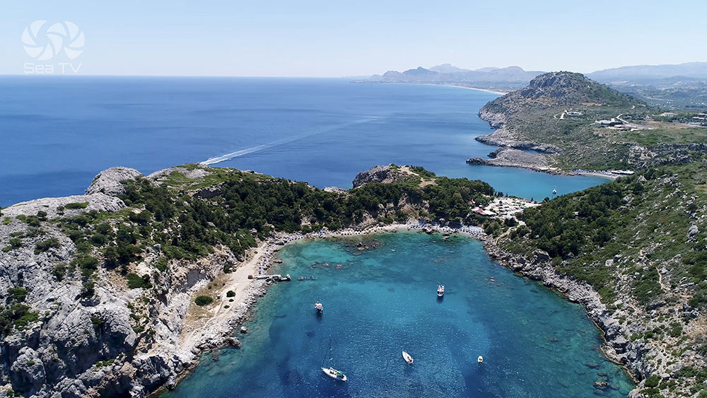
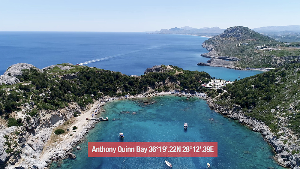
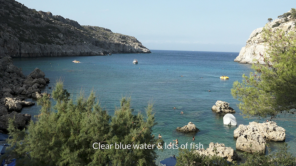
The largest Dodecanese island · UNESCO medieval Knights’ old town · the cliff-top Lindos acropolis 24 NM SE with three civilisations stacked on the 116 m cliff (4th c BC Doric Temple, Byzantine, Knights’ castle). Two mooring bases: Mandraki Port (historic, max LOA 40 m) + Rhodes Marina (modern, max LOA 60 m). See Rhodes Island · Rhodes Marina · Anthony Quinn Bay · Lindos.
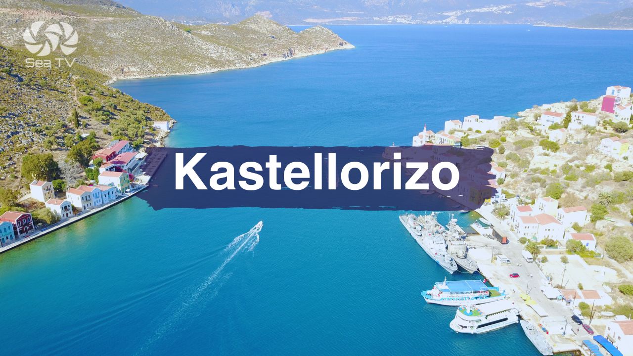
Kastellorizo · The Easternmost Greek Island
~70 NM E of Rhodes · just 1.25 NM from Turkish Kaş · the Blue Cave (Parastas), the cliff-top Knights’ Castle (the source of the name Castel Rosso), and the “Mediterraneo” 1991 Italian Oscar-winning film legacy. ⚠ Reef ~55 m NW of port light · anchorage inside port prohibited. See Kastellorizo.
The Layers of Dodecanese History
Knights of St John · 1309-1522
The Knights ruled Rhodes for over two centuries · their fortified capital is now the UNESCO old town · the network of inland castles (Kritinia, Monolithos, Lindos, Kastellorizo, Chalki Chorio, Pandeli on Leros) extended their control across the archipelago. The Knights surrendered to Suleiman the Magnificent in 1522 after a six-month siege.
Italian Colonial Period · 1912-1947
Italy ruled the Dodecanese for 35 years · the period left the Italian Rationalist (Razionalismo) town at Lakki on Leros (one of the most-preserved such ensembles outside Italy itself), the Art Deco architecture in Rhodes Town and Kos Town (rebuilt after the 1933 earthquake), and the colonial-era public works across the archipelago. The Italian period also conducted the major archaeological excavations at the Asklepieion on Kos and at the Lindos acropolis.
Maritime Industries · Sponges & Shipbuilding
Sponge-diving (centred on Kalymnos and Symi) and shipbuilding (Symi specifically) shaped the 18th and 19th-century Dodecanese economy · the wealth from these industries built the neoclassical waterfronts at Symi, Chalki, and parts of Kalymnos · the decline of both in the 20th century caused mass emigration (Kastellorizians to Australia, Symians to Egypt, Halki residents to Tarpon Springs Florida).
Sailing Routes
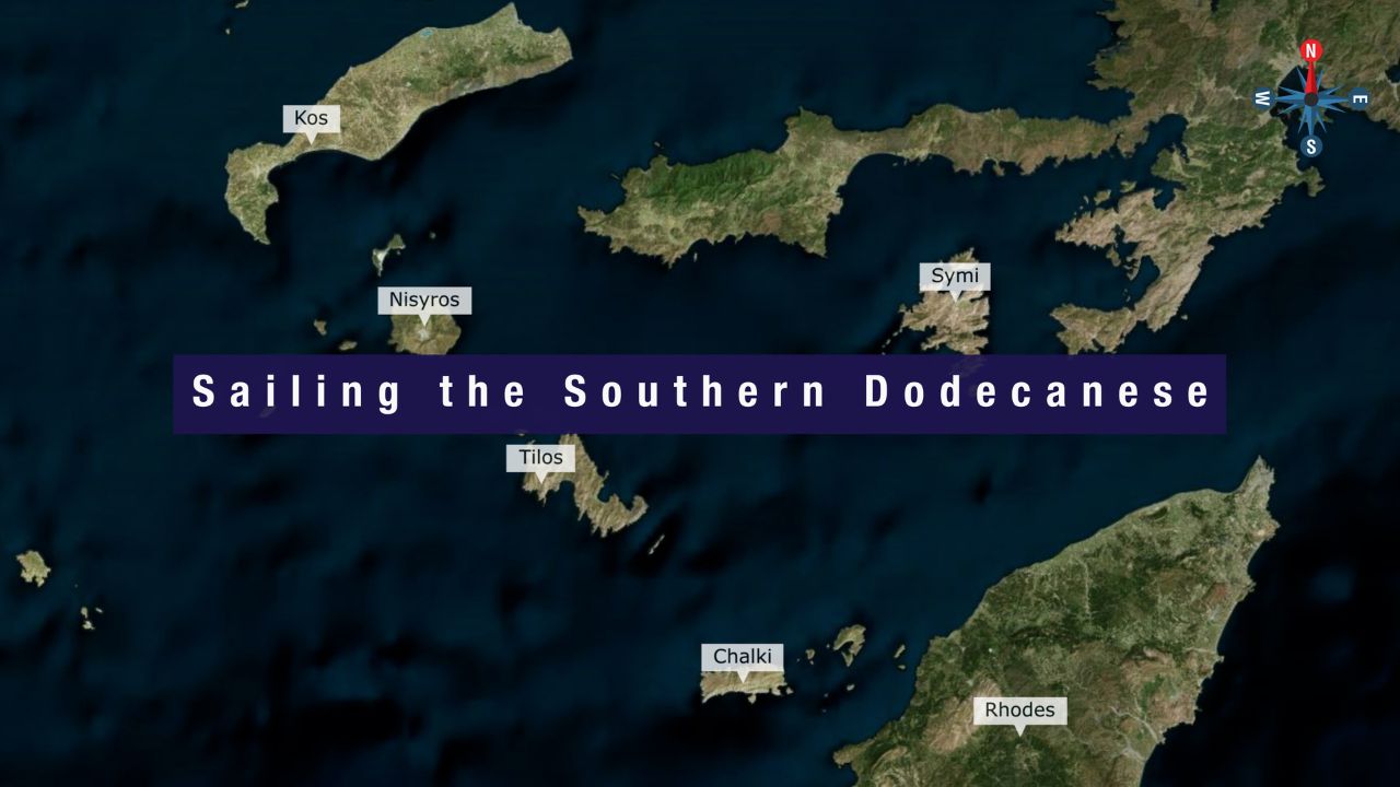
Southern Dodecanese Route · 10-14 days · ~150 NM
Kos → Nisyros → Tilos → Halki → Rhodes → Symi (and back to Kos for charter return). The most popular Dodecanese charter route · covers the active volcano, the renewable-energy island, the smaller Symi, the UNESCO old town and Lindos, and the postcard harbour. See full detail at Dodecanese — Our Route.
Northern Dodecanese Route · Separate Charter
Patmos → Leros → Kalymnos (Pothia + Vathy + Palionisos) → Kos. Covers the Italian-Rationalist Lakki, the climbing capital, the sponge-diving heritage, and the religious centre at Patmos. Don’t try to combine N + S in a single 10-14 day window.
When to Sail
Late May to mid-June and September to early October: The most settled conditions · less crowded · cooler temperatures for cultural visits and inland excursions. Optimum charter windows.
July-August: Most reliable Meltemi but also the strongest winds (often 25-35 knots) and the most boats · book moorings well in advance · expect crowds at popular stops.
⚠ Off-season (November-April): Most charter operations close · ferry connections reduce · S-wind events more common · only suitable for experienced winter sailors with all-weather yachts.
Listen to Captain Rahav above for the detailed wind regime briefing.
Emergency Numbers — Dodecanese
European Emergency: 112
Greek Coastguard: 108
Coastguard Distress (VHF Ch. 16): Universal
Marina Leros (Lakki): +30 22470 24733/26600/26601 · VHF Ch 10
Kalymnos Marina (Eleni · WhatsApp): +30 6980104127
Mandraki Kos: +30 22420 23115 · VHF Ch 74
Rhodes Marina: +30 2241 440970 · VHF Ch 71
Kastellorizo Port: VHF Ch 35
All Dodecanese Pages
North to South — Island Overview Pages
Detail Pages — Specific Mooring Stops
Adjacent Greek Cruising Areas
Sailing the Dodecanese?
Listen to Captain Rahav above · pick the southern route (Kos to Symi via Nisyros, Tilos, Halki, Rhodes) or the northern route (Patmos to Kos via Leros and Kalymnos) · 9 islands, 4 heritage layers, the most varied Greek-island sailing on offer.
→ Southern Route · Kos · Rhodes · Symi
“The Dodecanese is the southeastern Aegean island group running along the Turkish coast — twelve islands in the name and fifteen inhabited ones in fact, every one with its own distinct identity layered over millennia of occupation. The Knights of St John built the UNESCO old town on Rhodes and the network of inland castles, the Italian colonial period overlaid Italian Rationalist Lakki and Art Deco Kos and Rhodes, and the underlying ancient Greek and Byzantine layers run through everything. Listen to Captain Rahav’s audio above before you set out, pick southern (Kos to Symi) or northern (Patmos to Kos) for your charter window, and the most varied and culturally rich Greek-island sailing on offer opens up across an archipelago that pays back the longer eastern Aegean detour.”
— SeaTV Visual Pilot · Dodecanese Edition