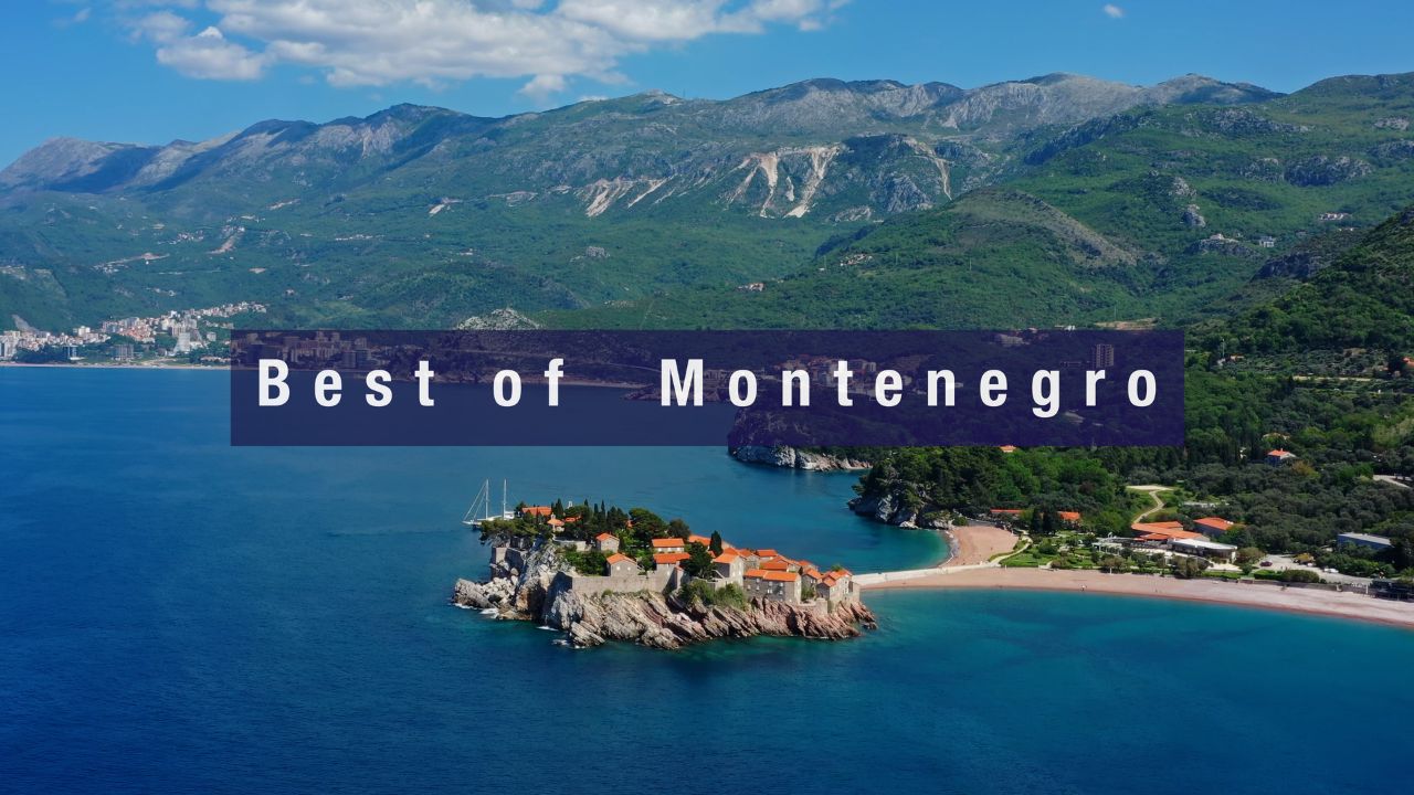
SeaTV · Cruising Areas · Montenegro
Sailing Montenegro — Boka Kotorska, Europe’s Southernmost Fjord · 8 Docking Pages · 1 Suggested Itinerary
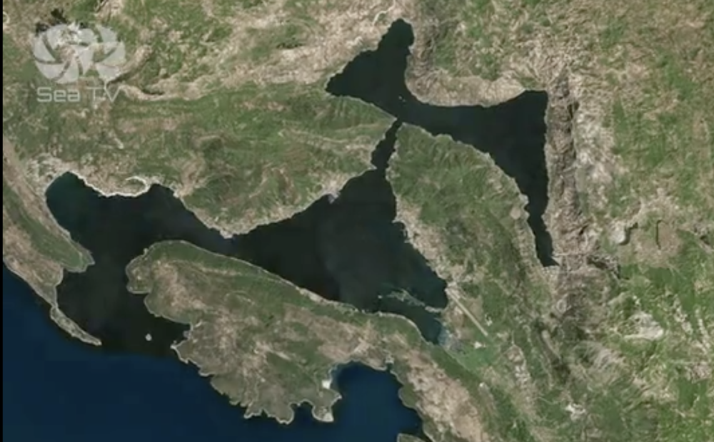
~42°17’N to 42°33’N · ~18°27’E to 18°50’E · the short but cruising-rich Adriatic coastline of Montenegro · home of Boka Kotorska (Bay of Kotor) often called Europe’s southernmost fjord · UNESCO World Heritage since 1979 · 8 SeaTV docking pages cover 7 anchorages + marinas + the Best Anchorages overview · the natural cruising bridge between Croatia (Dalmatia) to the N and Albania + Greek Ionian to the S.
Mountains rising from the sea · Venetian baroque villages · UNESCO old town in Kotor · superyacht hub at Porto Montenegro Tivat · port of entry at Zelenika (Herceg Novi) · currency: Euro (€) · NOT in EU/Schengen
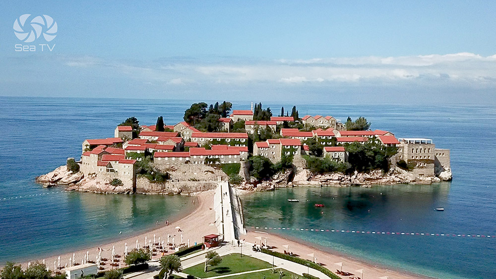
Welcome to SeaTV’s video guide for Montenegro — the Balkan country known for its rugged mountains, medieval villages, and narrow strip of beaches along its Adriatic coastline, offering a sailing experience unlike any other on the Mediterranean. The crown of Montenegro’s cruising is Boka Kotorska (Bay of Kotor) — often called Europe’s southernmost fjord, a deep series of inlets surrounded by mountains rising directly from the sea, declared a UNESCO World Cultural and Natural Heritage Site in 1979. Outside the Bay, the open Adriatic coast offers the lively Budva Riviera, the iconic Sveti Stefan walled-village islet, and the wild Lustica Peninsula coves with some of the clearest waters in the Adriatic. For sailors: this guide covers 8 SeaTV docking pages — Herceg Novi (NW · port of entry), Rose Village (S/SE shelter), Porto Montenegro Tivat (superyacht hub), Perast (2 famous islets · Venetian baroque village), Kotor (UNESCO old town · 1,350-step climb to San Giovanni Fortress), Trašte Bay/Bigova/Lustica Bay (open Adriatic), Budva (Riviera + 2,500-year-old old town), and the Best Anchorages overview. A 7-day suggested itinerary covers the full coastline (~50 NM total, 6 stops). For cruisers: Montenegro is the natural staging point between the Croatian Dalmatian coast (Dubrovnik ~30 NM N) and the Albanian + Greek Ionian coasts to the S — a short cruising distance with concentrated cultural + natural depth packed in.
⚠ Montenegro cruising — the realities every sailor must know:
→ ⚠ Bora wind · NE katabatic from Dinaric Alps · 50+ kt possible in spring + autumn · check forecast every morning · the wind that will catch you if you don’t plan
→ ⚠ Maestral wind · summer afternoon NW thermal · 15-25 kt · ideal for sailing · plan SE-bound routes accordingly
→ ⚠ Port-of-entry clearance at Zelenika (just E of Herceg Novi) · do this before exploring further
→ ⚠ Porto Montenegro Tivat · MUST contact 24h marina staff before arrival + departure
→ ⚠ Currency: Euro (€) · Montenegro uses Euro despite NOT being in EU or Schengen
→ ⚠ NOT in Schengen · passport stamp on arrival · keep documents handy
→ VHF Ch 16 · monitor for coastguard or naval vessels
→ Best season: early May to late October · sweet spot late spring (May-June) + early autumn (Sep-Oct) · July-August peak crowds
⚓ Montenegro at a Glance
Coastline span
~95 km · ~30 NM (Adriatic)
Heritage
UNESCO Boka Kotorska (1979)
SeaTV docking pages
8 (7 destinations + 1 overview)
Highest peak
Mt Lovćen 1,749 m (national symbol)
Port of entry
Zelenika (Herceg Novi)
Premier marina
Porto Montenegro Tivat
Currency
Euro (€) · NOT in EU/Schengen
Closest airport
Tivat International (TIV)
Climate (summer)
27°C / 81°F (July-August)
Climate (spring/autumn)
20°C / 68°F
Distance · Croatia (Cavtat)
~6 NM N of Herceg Novi
Distance · Dubrovnik
~30 NM N
Weather, Wind & Navigation
Best times to sail
→ Optimal season: early May to late October · warm weather + stable sea conditions
→ Avoid high-season crowds: late spring (May-June) or early autumn (September-October) for fewer crowds + pleasant temperatures
Wind patterns — the 2 you need to know
→ Maestral: afternoon NW thermal breeze · 15-25 kt · ideal for sailing · the summer wind
→ ⚠ Bora (Bura): strong NE katabatic from Dinaric Alps · 50+ kt possible · most common in spring + autumn · creates challenging conditions in Bay of Kotor with little warning
Navigation tips
→ Well-marked routes with good navigational aids
→ VHF Channel 16: monitor for coastguard or naval vessels
→ Sea temperature: 22-26°C summer · 18-20°C shoulder seasons
→ Tides: negligible (~0.3 m typical Adriatic)
⛵ The 8 SeaTV Docking Pages — Detailed Coverage
Listed clockwise from NW · the geographical order you’d typically sail in:
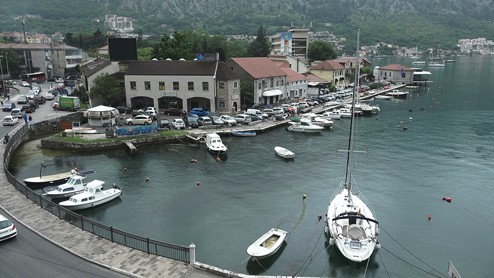
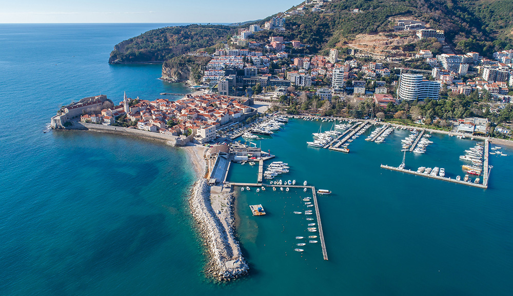
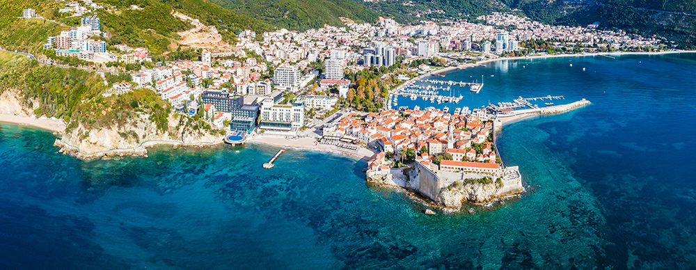
1 · NW · The entrance
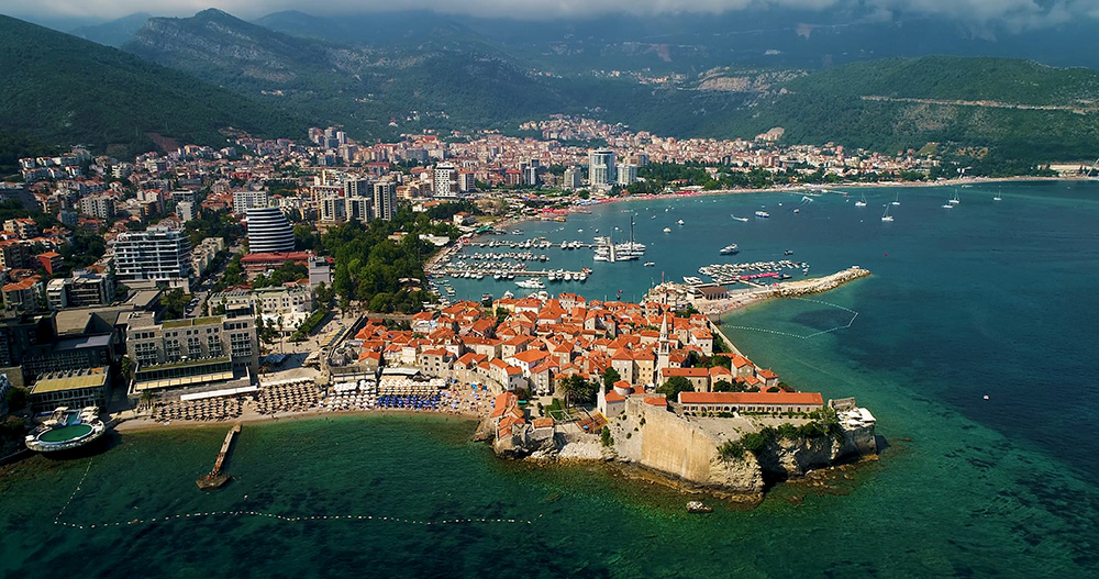
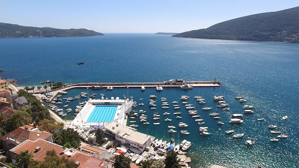
42°27’N · 18°32′.3E · port of entry at Zelenika · 40 berths · max LOA 20 m · max draft 2.5 m · ⚠ rocks E + SE of harbour entrance · ⚠ harbour light hard to spot at night · medieval old town founded 1382 · Forte Mare + Kanli Kula fortresses · Blue Cave nearby
2 · Lustica N · The S/SE shelter
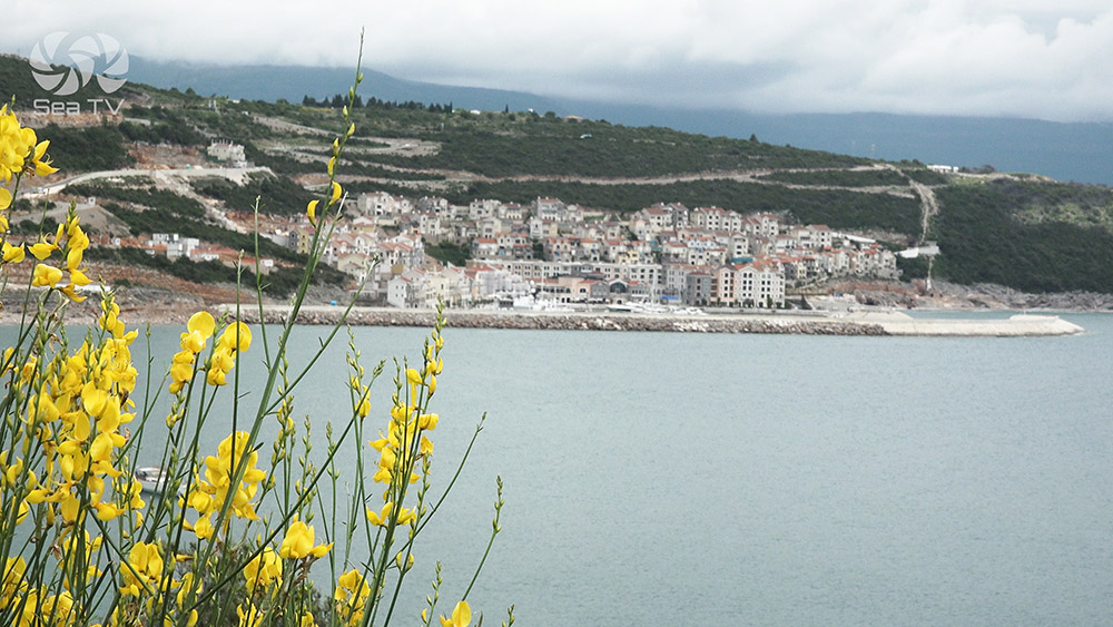
42°25′.7N · 18°34′.7E · the first place inside Boka Kotorska that offers shelter from S + SE winds · ~3 NM SE of Herceg Novi · stone-built fishing cottages + harbour-side tavernas
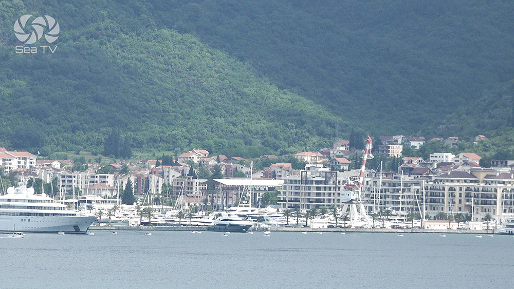
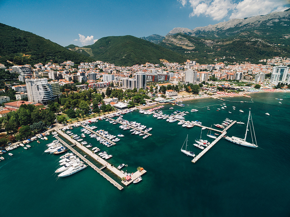
3 · Mid-Boka · The superyacht hub
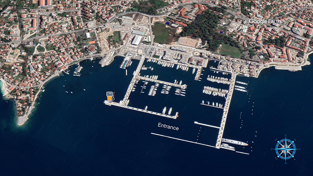
42°26′.03N · 18°41′.33E · Adriatic’s flagship superyacht marina · approach from N between 2 breakwaters · superyacht berths on S side · ⚠ MUST contact 24h marina before arrival + departure · 5 km from Tivat International Airport (TIV) · Naval Heritage Collection (2 Yugoslav-era subs)
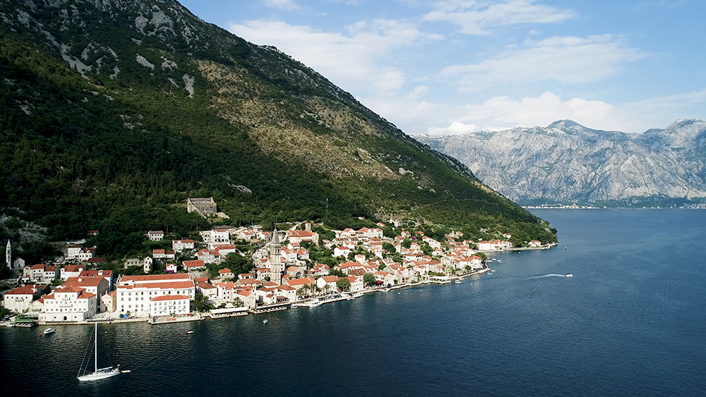
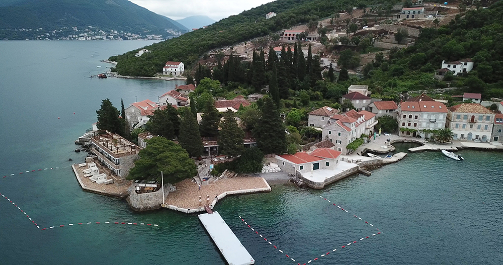
4 · Inner Boka · The 2 famous islets
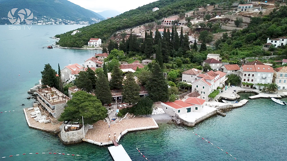
~42°29’N · 18°42’E · Venetian baroque village · 16 churches + 17 baroque palaces in 1 km · 2 famous islets: St George (Sveti Đorđe) with 12th-century Benedictine monastery · Our Lady of the Rocks (Gospa od Škrpjela) — the only artificial island in the Adriatic, built since 1452 · the 22 July Fašinada ceremony
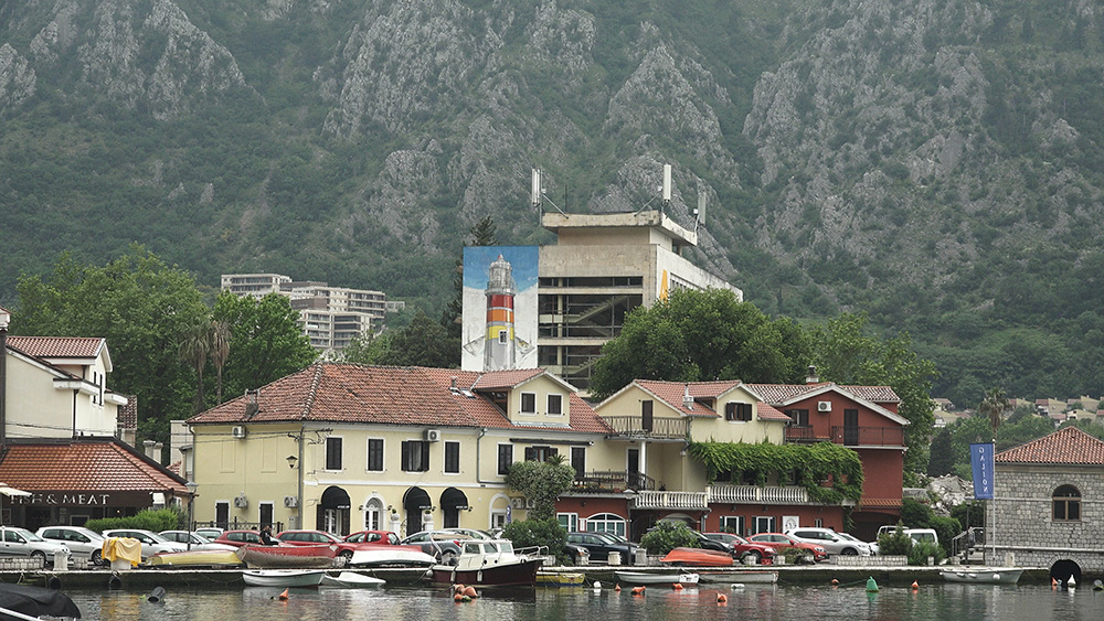
5 · End of fjord · UNESCO & the climbing-walls
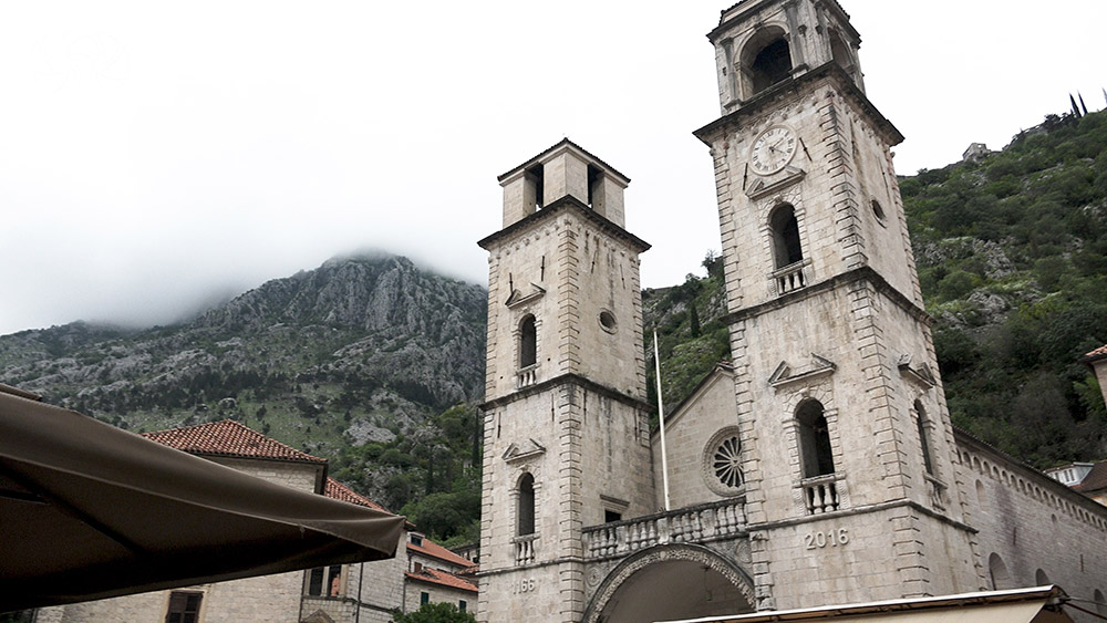
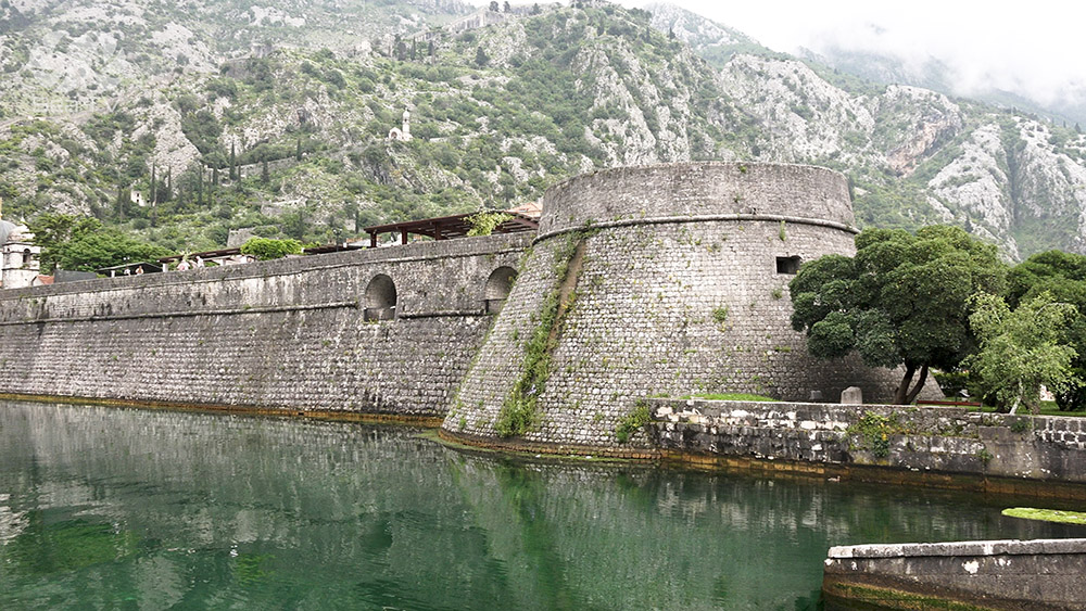
42°25′.5N · 18°46′.4E · UNESCO World Cultural and Natural Heritage Site · 4.5 km city walls climbing to San Giovanni Fortress (~280 m elevation · 1,350 steps) · Cathedral of St Tryphon (1166 AD) · Maritime Museum · Mt Lovćen 1,749 m behind
6 · Open Adriatic · Lustica’s outside
Trašte Bay · Bigova · Lustica Bay
42°23’00″N · 18°40’00″E · 3 NM SE-NW bay on open Adriatic side of Lustica · ⚠ Cape Trašte shallow strip + lighthouse · ⚠ Kalafat rocks 1.8 NM SE · Bigova Cove SE = safest shelter · 8 mooring buoys at 3-7 m depth
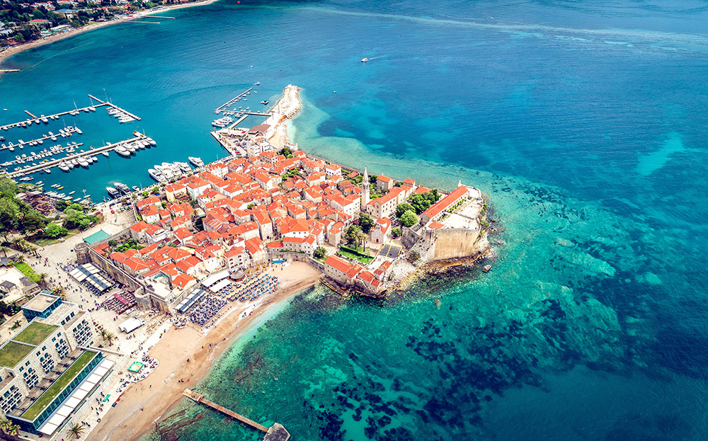
7 · S · The Riviera
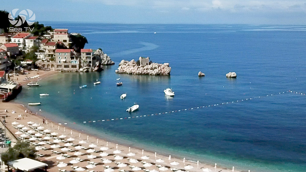
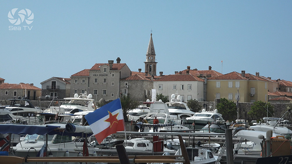
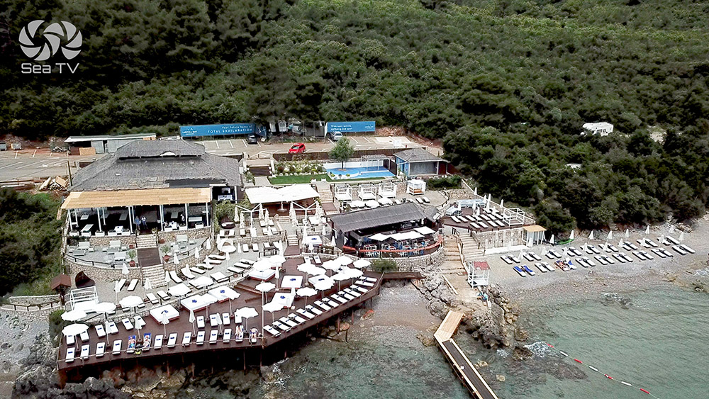
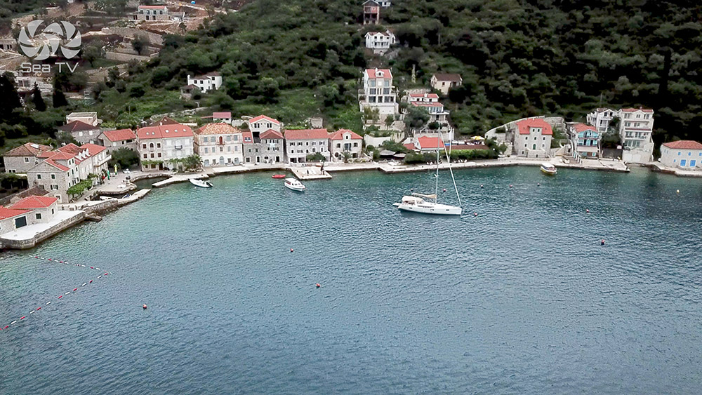
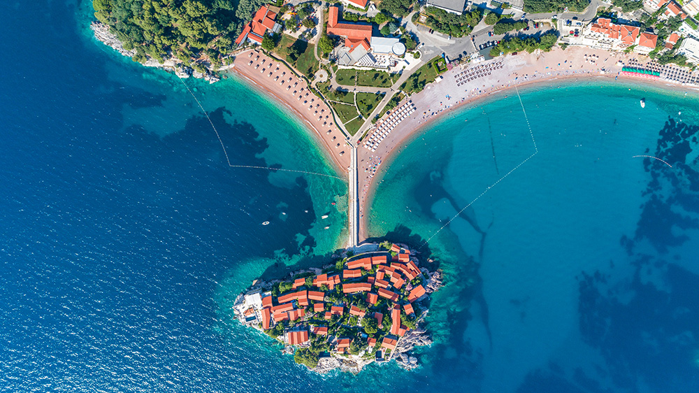
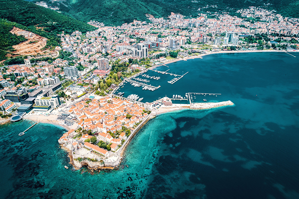
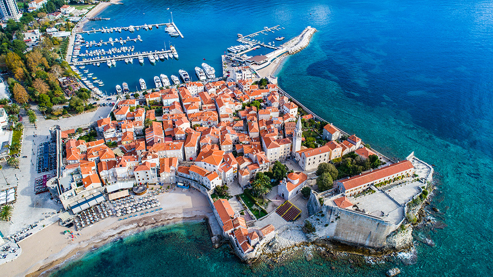
~42°17’N · 18°50’E · 2,500-year-old fortified Old Town (5th century BCE origins) · medieval Venetian walls (30 min walking circuit) · Sveti Nikola Island (“Hawaii”) just offshore · Sveti Stefan iconic walled-village islet 5 NM S · Riviera nightlife
8 · Overview · The 7 best anchorages
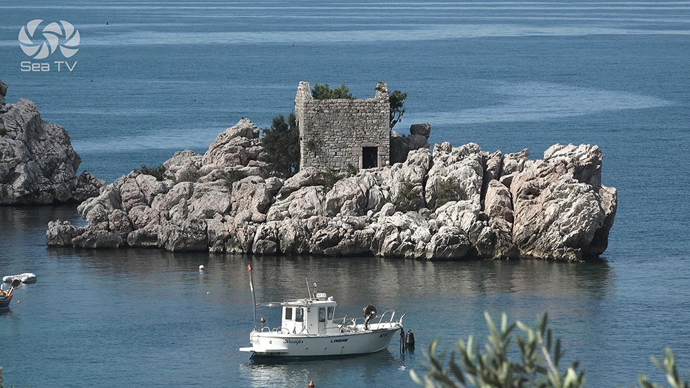
A SeaTV-tested guide to 7 sheltered stops covering: Bay of Kotor (UNESCO) · Bigova Bay · Blue Cave (Herceg Novi) · Sveti Stefan area · Lustica Peninsula coves (Žanjic + Mirišta) · Budva area · Rose Village area · plus general anchoring tips
Suggested Itineraries
7-day classic Montenegro itinerary
→ Day 1: Kotor · UNESCO old town
→ Day 2: Kotor → Perast (2 islets) → Herceg Novi
→ Day 3: Herceg Novi → Blue Caves (Rose) → Bigova Bay overnight
→ Day 4: Bigova → Budva · Old Town walls + Riviera nightlife
→ Day 5: Budva surroundings · Sveti Stefan lunch · King’s Beach · return Budva
→ Day 6: Budva → Porto Montenegro Tivat
→ Day 7: Departure 09:00 · TIV airport access
3-day Boka Kotorska weekend
→ Day 1: Tivat charter check-in · sail to Perast (2 islets) overnight
→ Day 2: Perast → Kotor · UNESCO old town + 1,350-step climb to fortress
→ Day 3: Kotor → Tivat check-out · ~5 NM
Adriatic transit · Croatia–Montenegro–Albania
→ From Croatia (Cavtat / Dubrovnik): ~6 NM S to Herceg Novi · port-of-entry clearance at Zelenika
→ Through Montenegro: 7-day classic route or 3-day Boka loop
→ From Budva to Albania: ~30 NM S to Saranda · or continue ~120 NM S to Greek Ionian (Corfu / Lefkas)
→ Continue to Greek Ionian: Ionian Islands
Montenegrin Food & Local Specialities
→ Black risotto (Crni Rižoto) · squid-ink + seafood risotto · the Adriatic classic
→ Buzara · mussels or shrimp in white wine + garlic + tomato · the harbour-restaurant staple
→ Ćevapi · grilled minced meat fingers · the Balkan grill standard
→ Kotor cheese (Kotorski sir) · firm cow’s milk cheese · regional speciality
→ Pršut · dry-cured ham · Negotin region speciality
→ Vranac wine · Montenegrin red · the country’s signature varietal
→ Krstač wine · the local white from the Plantaže winery
→ Rakija · the Balkan brandy · plum (šljivovica) or grape variants
Inland Day Trips · From the Coast
→ Lovćen National Park · 30 km inland from Kotor · 1,749 m peak · Petar II Petrović-Njegoš mausoleum at the summit (461 steps from the parking) · the symbolic mountain of Montenegro
→ Cetinje · the former royal capital · 30 min from Kotor · museums + monasteries · the heart of Montenegrin history
→ Skadar Lake (Skadarsko Jezero) · the largest lake in the Balkans · 1 hr drive · pelican habitat · wine villages on the shore
→ Ostrog Monastery · 2 hr drive · 17th-century Serbian Orthodox · cliff-face cave church · ~1 million pilgrims annually
→ Durmitor National Park · 3 hr drive · UNESCO · alpine peaks 2,500 m · Tara Canyon (deepest in Europe at 1,300 m) · rafting
→ Old Bar (Stari Bar) · 1 hr drive S from Budva · medieval ruined city + Roman aqueduct · OG fortress town
Practical Information
Port of entry: Zelenika (just E of Herceg Novi) · clear in here before exploring further
Premier marina: Porto Montenegro Tivat · ⚠ MUST contact 24h marina before arrival + departure
Closest airport: Tivat International (TIV) · 5 km from Porto Montenegro · regular EU connections + summer charters
Secondary airport: Podgorica International (TGD) · 90 km from coast · the country’s main hub
Emergency: 112 · VHF Ch 16
Currency: Euro (€) · Montenegro uses Euro despite NOT being in EU or Schengen
Schengen status: NOT in Schengen — passport stamp on arrival
Languages: Montenegrin (Crnogorski) · English widely spoken in marinas + tourist areas · Serbian, Croatian, Bosnian mutually intelligible
⛵ Continue Exploring · The Adriatic Coast
Adjacent SeaTV cruising areas:
→ Greek Ionian Islands · ~120 NM S · the natural S continuation · Corfu/Lefkas/Kefalonia
→ Italy · across the Adriatic to the W
→ Croatia (Dalmatia) · ~6 NM N to Cavtat · ~30 NM N to Dubrovnik · the natural cruising partner
All SeaTV cruising areas: SeaTV global hub
Suggested Itinerary & Pages Index
Routes:
→ 7-Day Sailing Route in Montenegro · Kotor-to-Tivat full coastline tour
Docking pages (8):
→ Best Anchorages in Montenegro
→ Perast
→ Kotor
→ Trašte Bay · Bigova · Lustica Bay
→ Budva
“Welcome to SeaTV’s video guide for Montenegro the Balkan country known for its rugged mountains and medieval villages and narrow strip of beaches along its Adriatic coastline offering a sailing experience unlike any other on the Mediterranean · the crown of Montenegro’s cruising is Boka Kotorska often called Europe’s southernmost fjord a deep series of inlets surrounded by mountains rising directly from the sea declared a UNESCO World Cultural and Natural Heritage Site in nineteen seventy nine · outside the Bay the open Adriatic coast offers the lively Budva Riviera and the iconic Sveti Stefan walled village islet and the wild Lustica Peninsula coves with some of the clearest waters in the Adriatic · for sailors this guide covers eight SeaTV docking pages from Herceg Novi the northwest port of entry through Rose and Porto Montenegro Tivat and Perast with the two famous islets and Kotor the UNESCO old town and Trašte Bay on the open Adriatic to Budva the two thousand five hundred year old Riviera town · a seven day suggested itinerary covers the full coastline approximately fifty nautical miles total with six stops · Montenegro is the natural staging point between the Croatian Dalmatian coast to the north and the Albanian and Greek Ionian coasts to the south a short cruising distance with concentrated cultural and natural depth packed in · sail accordingly.”
— SeaTV · Montenegro · 8 Docking Pages + 1 Route · The Adriatic’s Most-Concentrated Cruising Ground