SeaTV · Spain · Balearic Islands · Menorca Cruising Hub
Menorca Cruising Hub — The Quiet Sister · UNESCO Biosphere · Two Coasts, Two Worlds
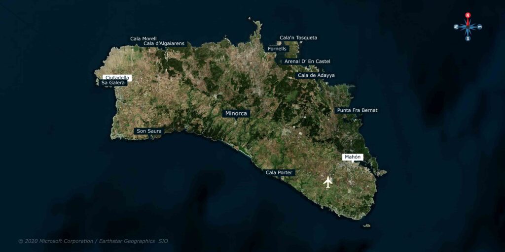
~702 km² · ~51 km E-W × ~19 km N-S · ~95,000 residents · capital Maó (Mahón) · old capital Ciutadella · ~216 km of coastline · UNESCO Biosphere Reserve since 1993 (entire island) · UNESCO World Heritage Site “Talaiotic Menorca” since 2023 · Camí de Cavalls 185 km coastal footpath · the second-largest Balearic island after Mallorca · officially Catalan (Menorquí dialect) + Spanish · main season May-October · prevailing summer wind: Tramontana from N · Posidonia regulations enforced.
Schengen · Spain · clear in/out at Palma if from outside EU · the only Balearic island where the entire territory is a UNESCO Biosphere
Menorca is the Balearic that decided not to follow Mallorca and Ibiza into mass tourism. The decision came in 1993 when UNESCO designated the entire island a Biosphere Reserve — a status that put strict caps on coastal development, capped roads, and protected the wild N coast as a national park. The result, three decades later, is an island where the cala you anchor in tonight likely has the same skyline it had during the Roman period: pine + holm-oak forest, low limestone cliffs, sandy beaches, and prehistoric Talaiotic stone towers visible from the sea. For cruisers Menorca offers two completely different cruising worlds: the south coast, with its protected white-sand calas sheltered from the Tramontana, lined with pine and accessible to families · and the north coast, the rugged Tramuntana, exposed to N winds, wilder, redder, with virgin beaches you reach by boat or by hiking the Camí de Cavalls. The two coasts are 19 km apart and feel like different countries. In 2023 UNESCO added a second status to the island: World Heritage for “Talaiotic Menorca,” recognising the prehistoric stone-tower civilisation that flourished here from ~1600 BCE through Roman conquest in 123 BCE. You’ll see the towers and the burial-cave necropolises throughout — including from the deck of your boat at Cala Morell and Cales Coves.
⚠ Reality check before you cruise Menorca:
→ ⚠ Posidonia rules ENFORCED · €1,200+ fines for anchoring on seagrass · use the Posidonia Maps app (Govern de les Illes Balears, free)
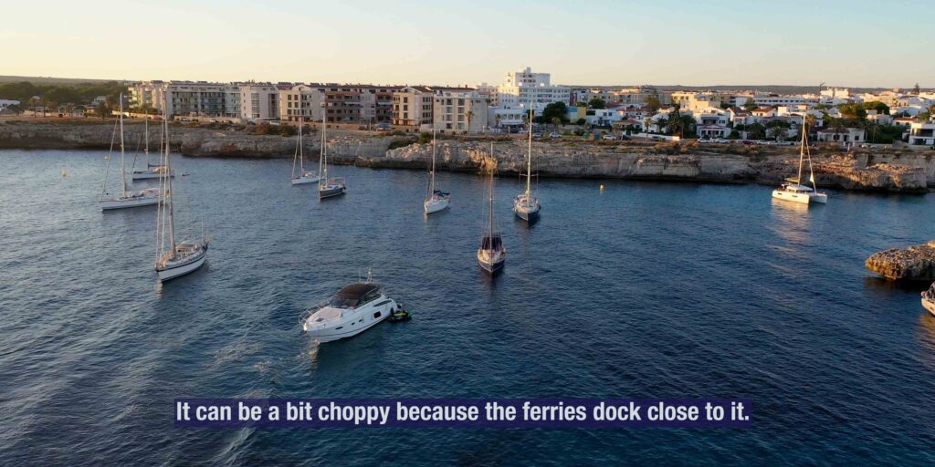
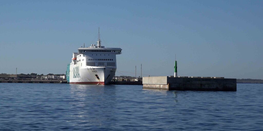
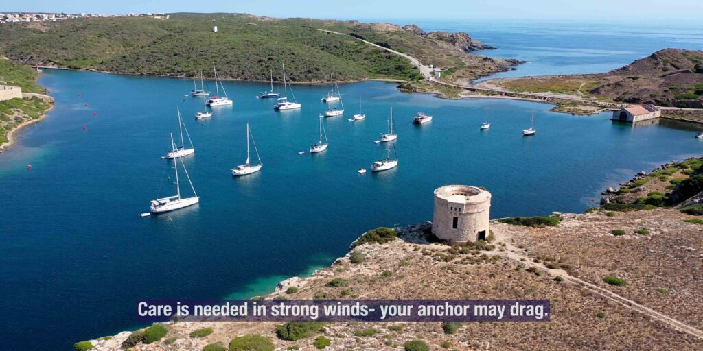
→ ⚠ Tramontana blow · the N wind that defines summer here · 30+ kt for days at a time · the N coast becomes untenable
→ ⚠ Limited marina capacity · only Maó + Ciutadella + Addaia have proper marinas · book ahead in July-August
→ ⚠ Only one public hospital · Hospital Mateu Orfila in Maó · +34 971 487 000
→ ⚠ The N coast is exposed · the Tramuntana coastline (Cap de Cavalleria, Pregonda, Algaiarens, Morell) is a calm-weather playground only
→ Cellular signal: good in S coast resorts + Maó · spotty on N coast wilderness · plan offline charts
⚓ Menorca at a Glance
Area
~702 km² · 2nd largest Balearic
Dimensions
~51 km E-W × ~19 km N-S
Coastline
~216 km · ~100 calas + beaches
Population
~95,000
Capital
Maó (Mahón)
Old capital
Ciutadella · medieval, NW
UNESCO Biosphere
Designated 1993 · entire island
UNESCO World Heritage
Talaiotic Menorca · 2023 · 9 archaeological zones
Highest point
Monte Toro · 358 m · centre of island
Languages
Catalan (Menorquí dialect) + Spanish
Currency · Time
EUR · CET (UTC+1) / CEST
Airport
Menorca-Maó (MAH) · 4.5 km from Maó
Two Coasts, Two Worlds
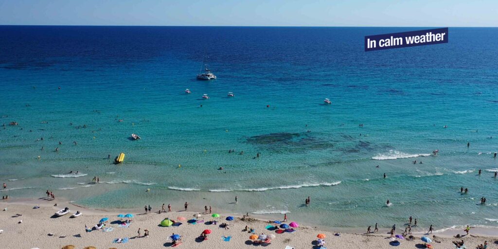
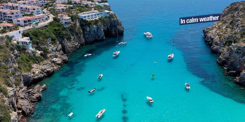
South coast — pine + sand + family calas
→ Geological character: low white-limestone cliffs interrupted by pine-fringed sandy calas · turquoise water · gentle slopes · easy beach access
→ Climate: sheltered from N quadrant Tramontana by the island mass · summer is the safest cruising
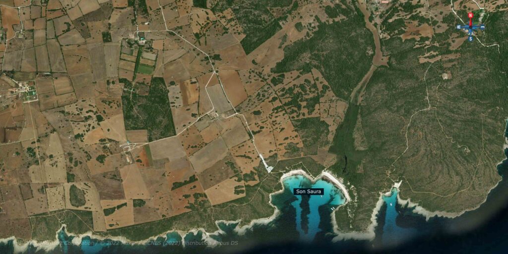
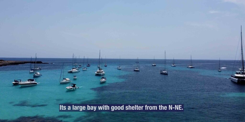
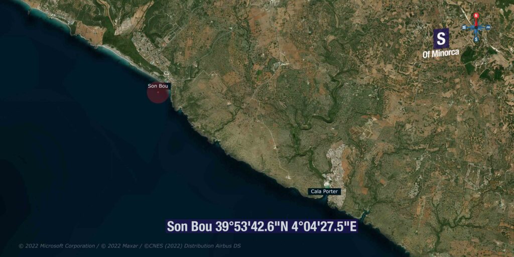
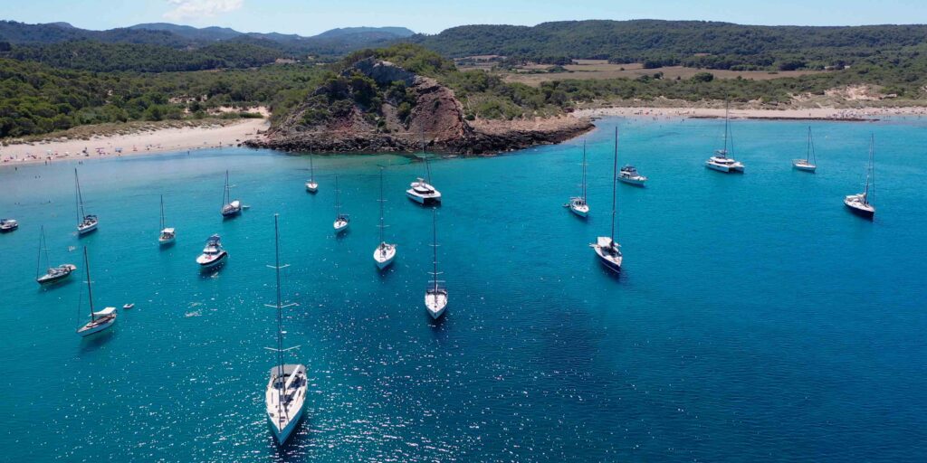
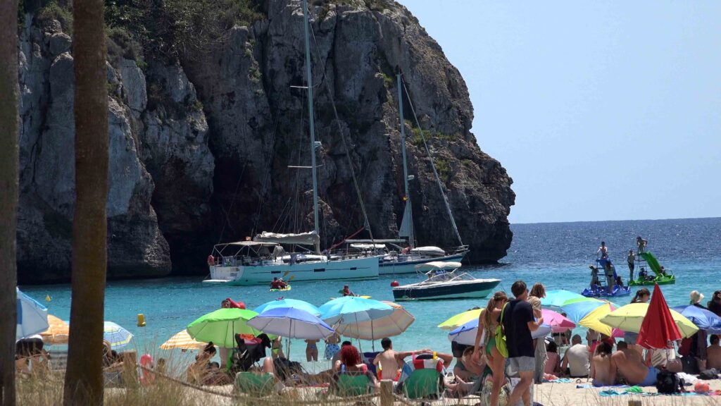
→ Famous calas (W to E): Cala’n Bosch · Son Saura · Cala des Talaier · Cala Turqueta · Macarella + Macarelleta · Cala Galdana · Mitjana · Trebalúger · Escorxada · Sant Tomàs · Es Canutells · Cala’n Porter
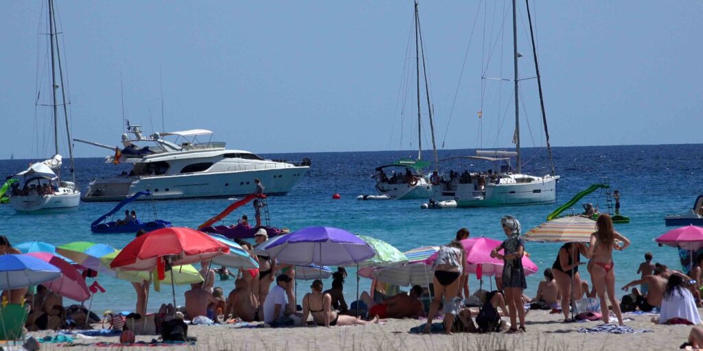
→ ⚠ Open to S quadrant winds · summer Sirocco from N Africa makes the S coast untenable · move N when it blows
→ Posidonia patches throughout · find sandy patches only · use Posidonia Maps app
North coast (Tramuntana) — red rock + cliffs + virgin beaches
→ Geological character: rugged · older rock formations including Triassic red sandstone · cliffs more pronounced · landscape feels Cornish or Sardinian
→ Climate: exposed to N winds (Tramontana) · in any N forecast, the entire coast becomes untenable · move S
→ Famous spots (W to E): Cala Morell · Cala Algaiarens (La Vall) · Cala Pilar · Cala Pregonda · Cap de Cavalleria · Cala Tirant · Fornells Bay · Cala’n Tosqueta · Cala Pudent · Es Grau / Illa d’en Colom · Cap de Favàritx
→ Marine Reserve of North Menorca · designated 1999 · fishing restrictions · superb snorkelling
→ Sailing rule of thumb: do the N coast first when forecast is clear · save the S coast as your weather refuge
Wind & Weather Patterns
The dominant winds:
→ Tramontana (N/NW) — the prevailing summer wind · cold dry air from the Pyrenees · 25-40 kt for 2-5 days at a time · MUST move to S coast when it blows
→ Mestral (W/NW) — Provençal cousin of Tramontana · usually gentler · brings cool clear weather
→ Sirocco / Llevant (E/SE) — from N Africa · warm humid · brings dust + occasional rain · summer thunderstorms
→ Migjorn (S/SW) — light summer thermal · tolerable on most calas
→ ⚠ The Rissaga (Ciutadella only) — meteotsunami event specific to Ciutadella harbour · 1.5-4 m oscillations · April-September · see Port de Ciutadella for details
Cruising season:
→ May-June: ideal · water 19-22°C · few crowds · stable weather
→ July-August: peak · water 24-26°C · busy · book marina berths weeks ahead
→ September: excellent · water still 23°C · post-festival quiet · best month for many
→ October: end of season · cooler · most beach services close · good for wild-coast hikers
⚓ Three Marina Bases for Menorca
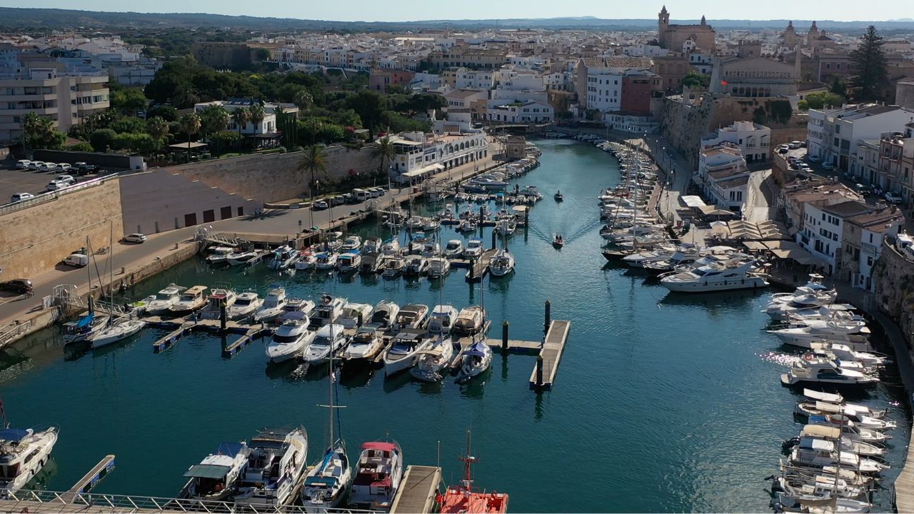
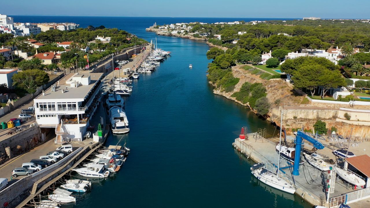
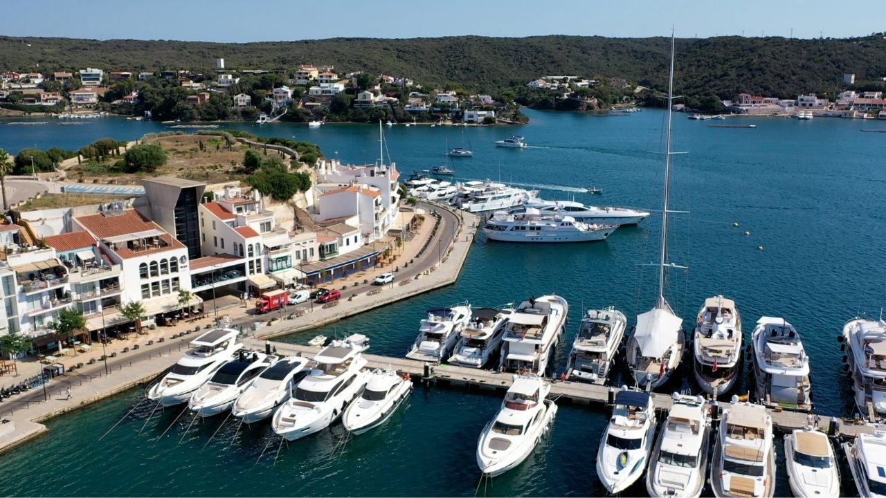
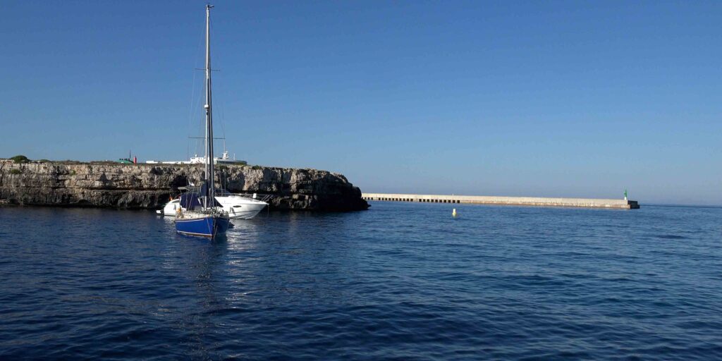
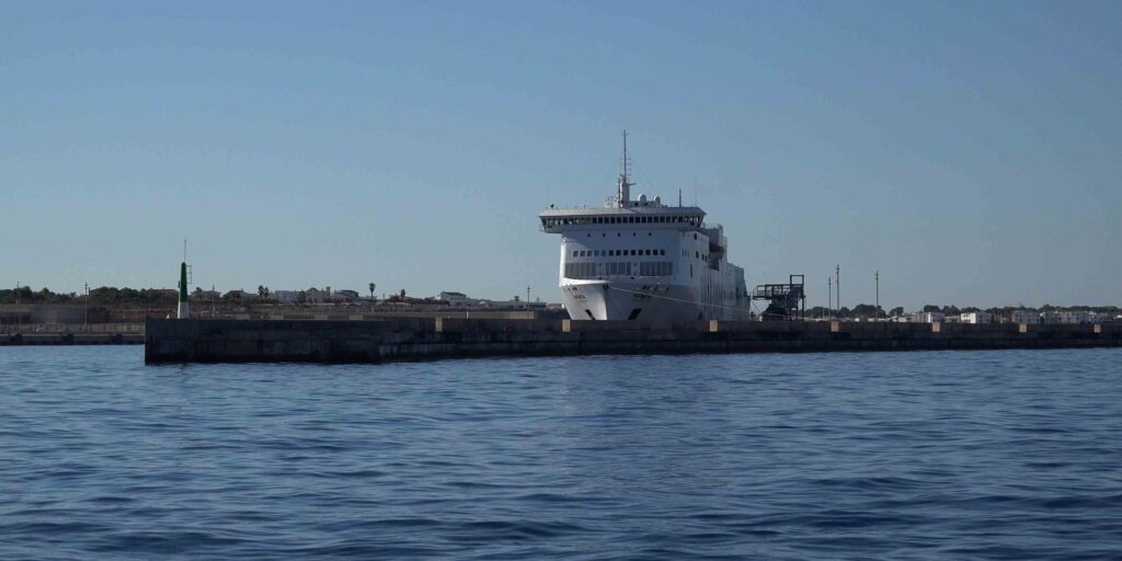
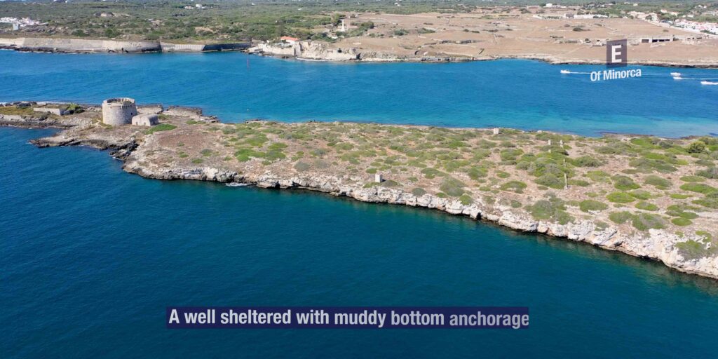
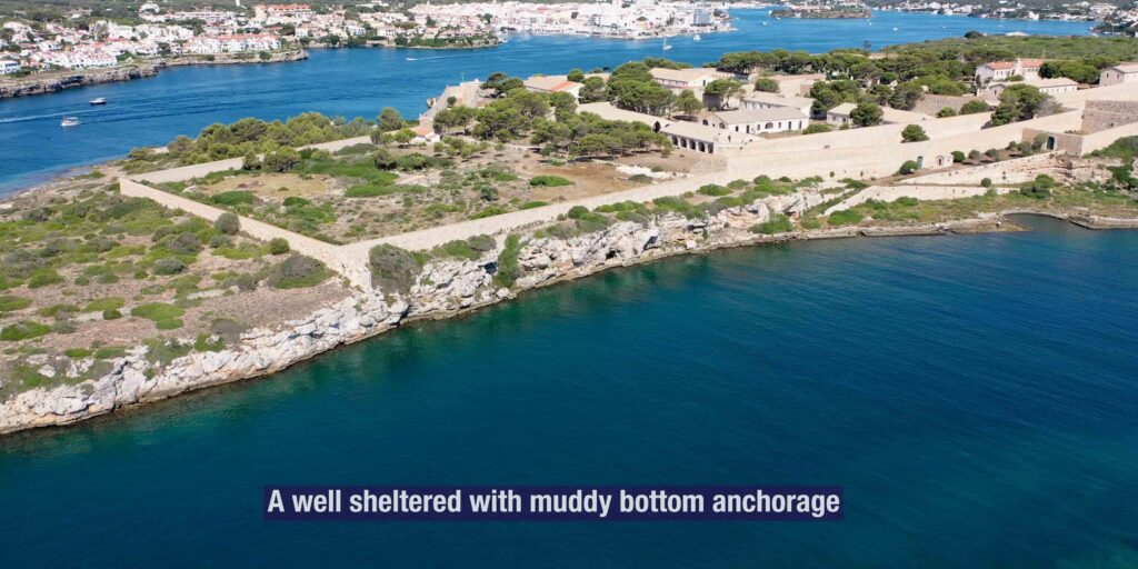
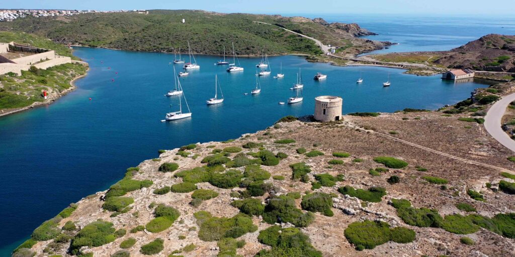
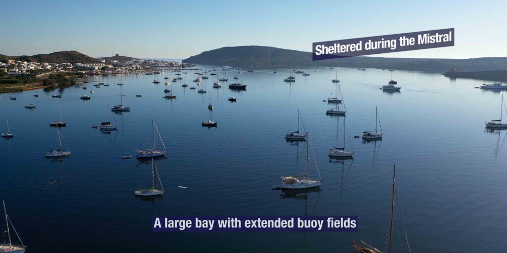
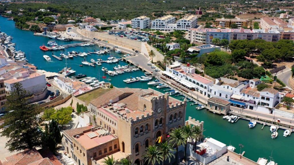
1 · Maó (Mahón) — the world-class natural harbour
→ 5 km long natural inlet · one of the four largest natural harbours in the world (Sydney, Pearl Harbor, Halifax, Maó)
→ Multiple marinas: Marina Menorca, Marina Deportiva, Club Marítimo de Mahón, plus visitor moorings
→ Capital of Menorca · full provisioning · airport 4.5 km · ferry to Barcelona + Mallorca
→ Best for: arrival/departure · charter base · serious provisioning · all-weather shelter
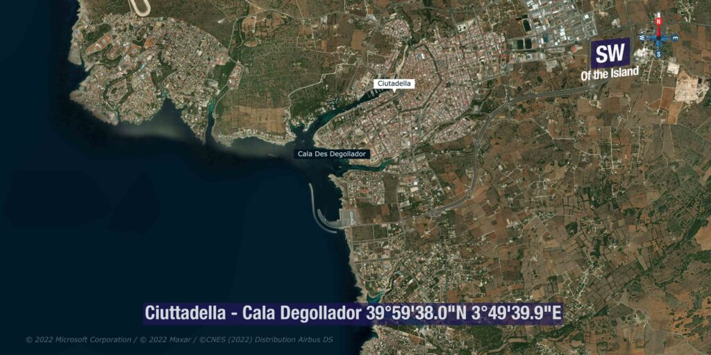
2 · Ciutadella — the medieval old capital
→ 1,170 m natural inlet · 296 berths at Club Nàutic Ciutadella + Ports IB visitor zone
→ Medieval old town · Festes de Sant Joan 23-24 June · gastro destination
→ Gateway to S-coast cala chain (Galdana, Macarella, Turqueta, Son Saura) + N-coast wilderness (Algaiarens, Morell)
→ ⚠ Rissaga meteotsunami · 1.5-4 m harbour oscillations specific to Ciutadella · monitor forecasts
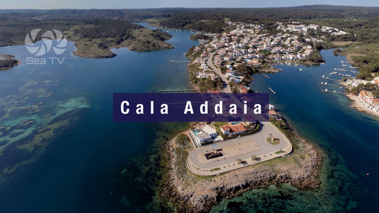
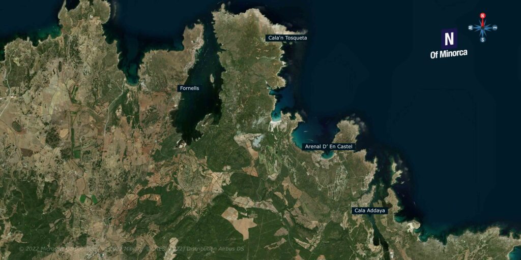
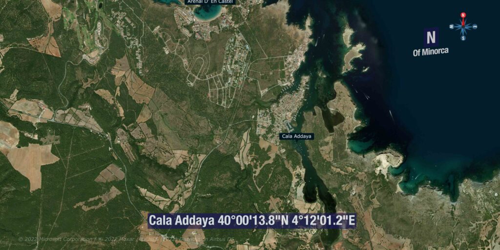
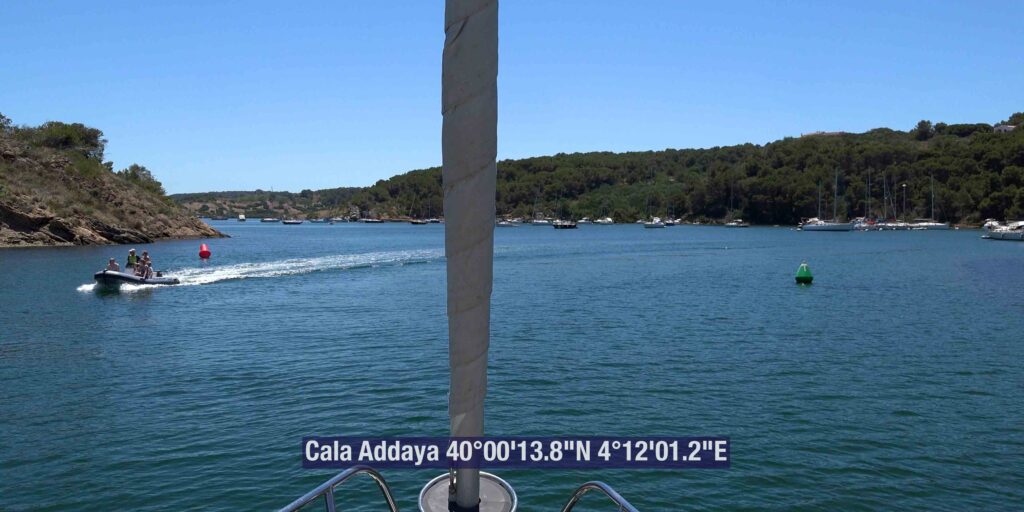
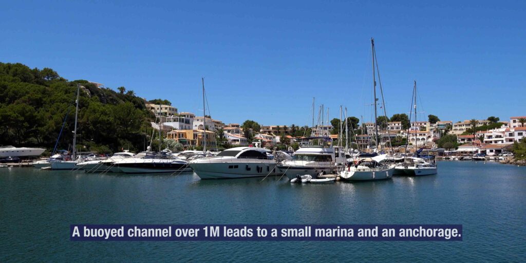
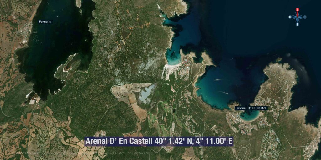
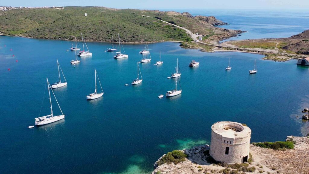
3 · Port d’Addaia — the NE coast natural marina
→ 168 berths · max LOA 15 m · max draft 3 m · Ports IB · the only marina on N + NE coast
→ Adjacent to S’Albufera des Grau Natural Park · UNESCO Biosphere core
→ Sheltered natural inlet · Tramontana refuge once inside
→ Best for: N-coast cruising base · UNESCO park access · authentic village atmosphere
All Menorca Anchorages on SeaTV
9 detailed pages live · cruising west to east, then anti-clockwise around the island:
⚓ Marinas (formal berths)
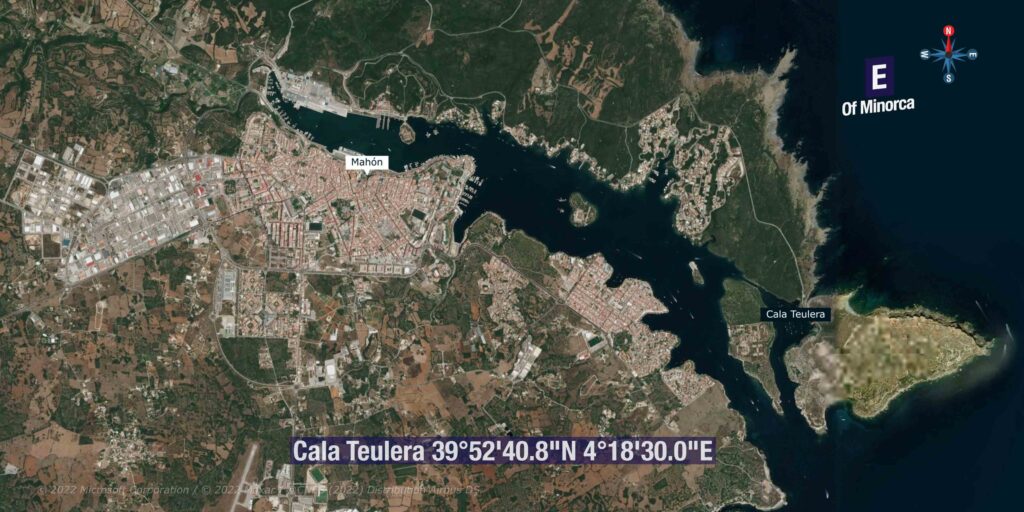
→ Port de Ciutadella · Ports IB — 1,170 m natural inlet · 39°59.7’N · 3°49.4’E · ~175 vessels · home of the Rissaga meteotsunami
→ Ciutadella Harbour Marina (Club Nàutic Ciutadella) — 296 berths · ~20 visitor · max LOA 30 m · VHF Ch 9 · +34 971 383 918
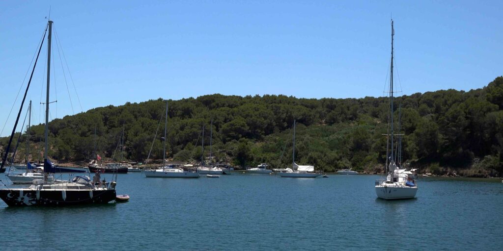
→ Cala Addaia · Port d’Addaia — 40°00.5’N · 4°12.0’E · 168 berths · max LOA 15 m · max draft 3 m · the only N/NE coast marina · +34 971 188 871
South coast anchorages
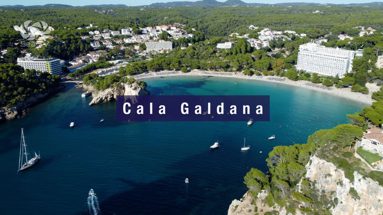
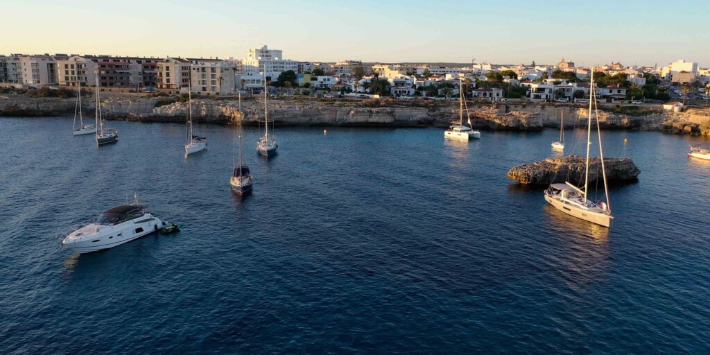
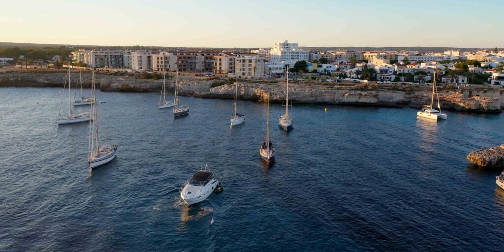
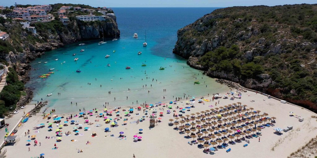
→ Cala Galdana — ~39°56’N · 3°58’E · the 400 m horseshoe Blue Flag anchorage · “Queen of the Calas” · the most sheltered S-coast bay · Algendar ravine outlet
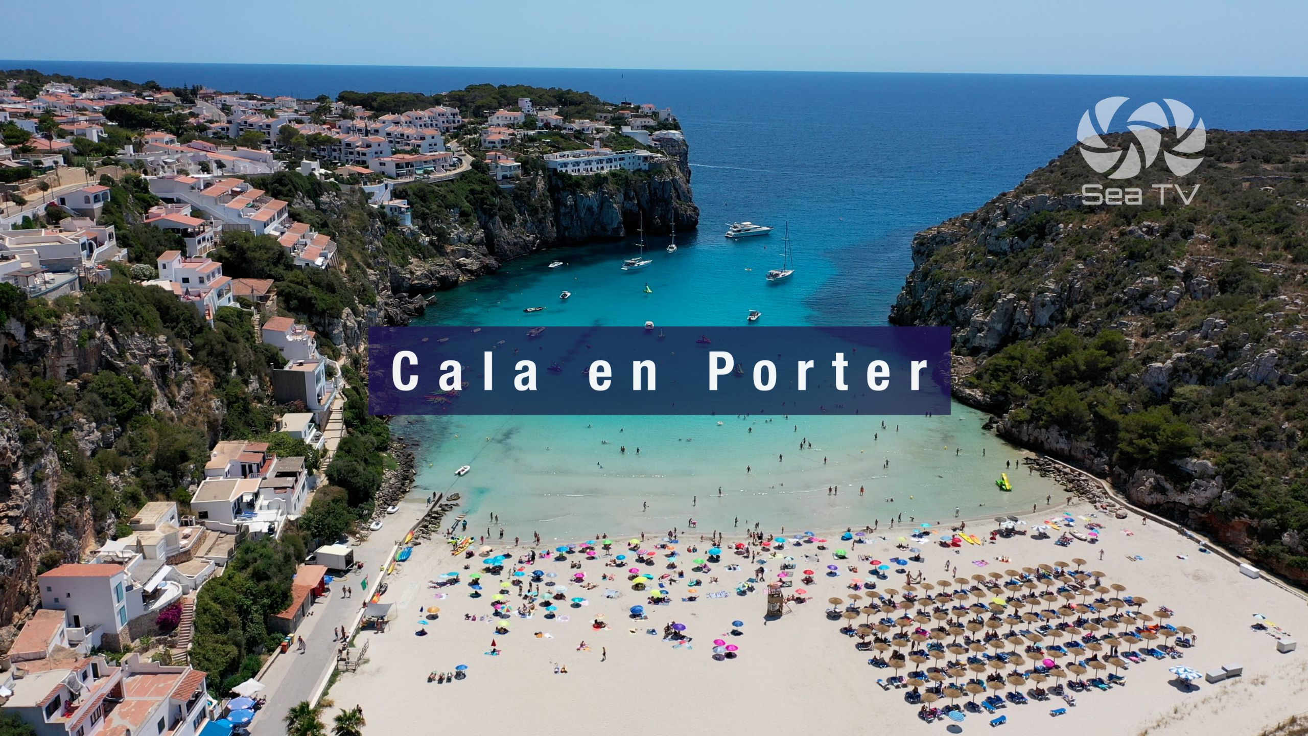
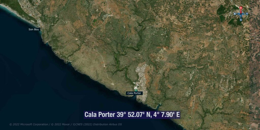
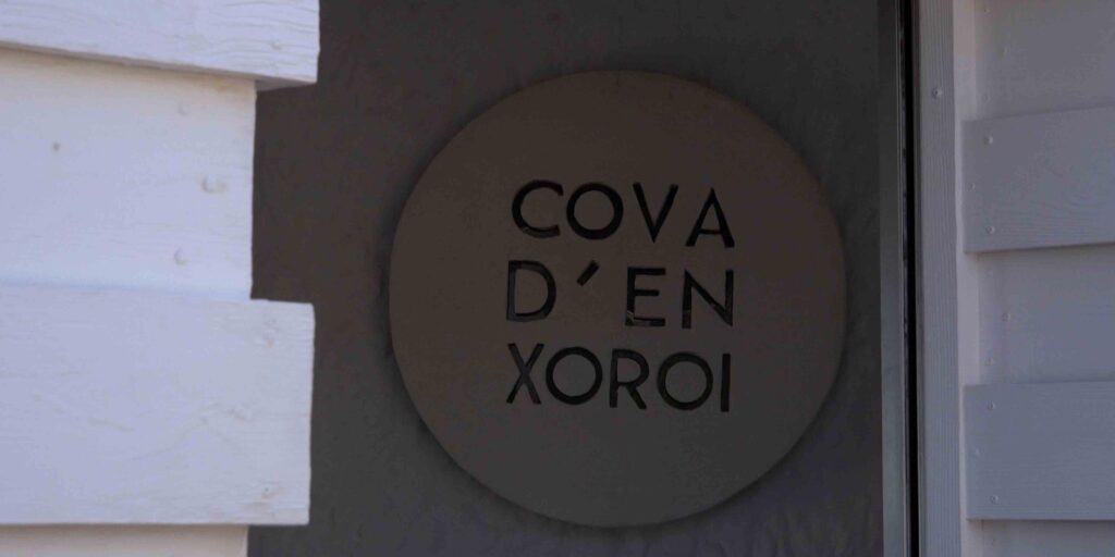
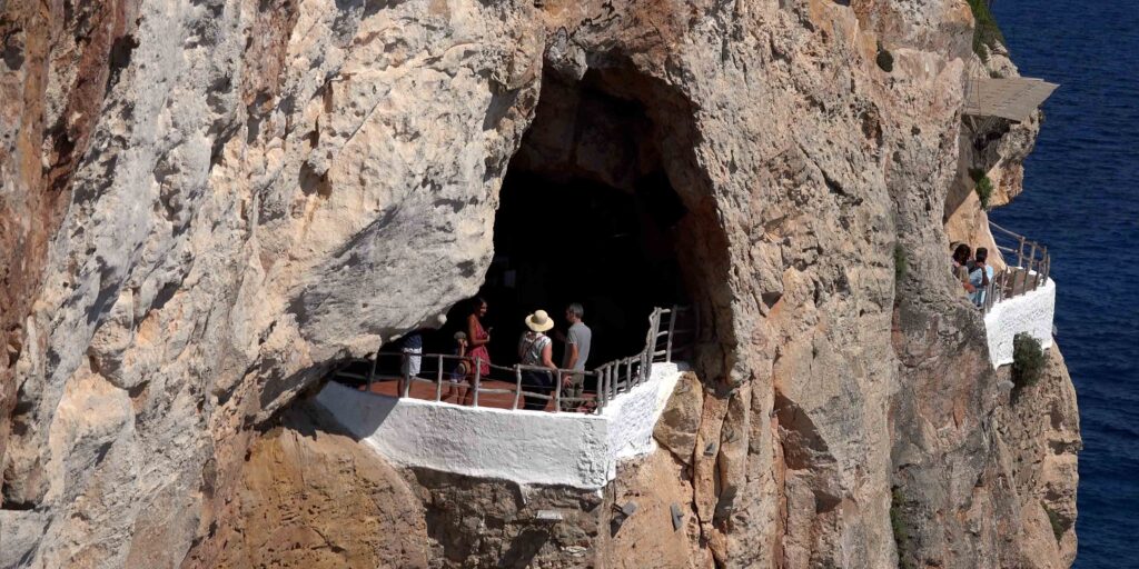
→ Cala’n Porter — ~39°52’N · 4°08’E · the cliff-edge anchorage below the Cova d’en Xoroi cliff bar · closest cala to MAH airport · open to S
North coast anchorages
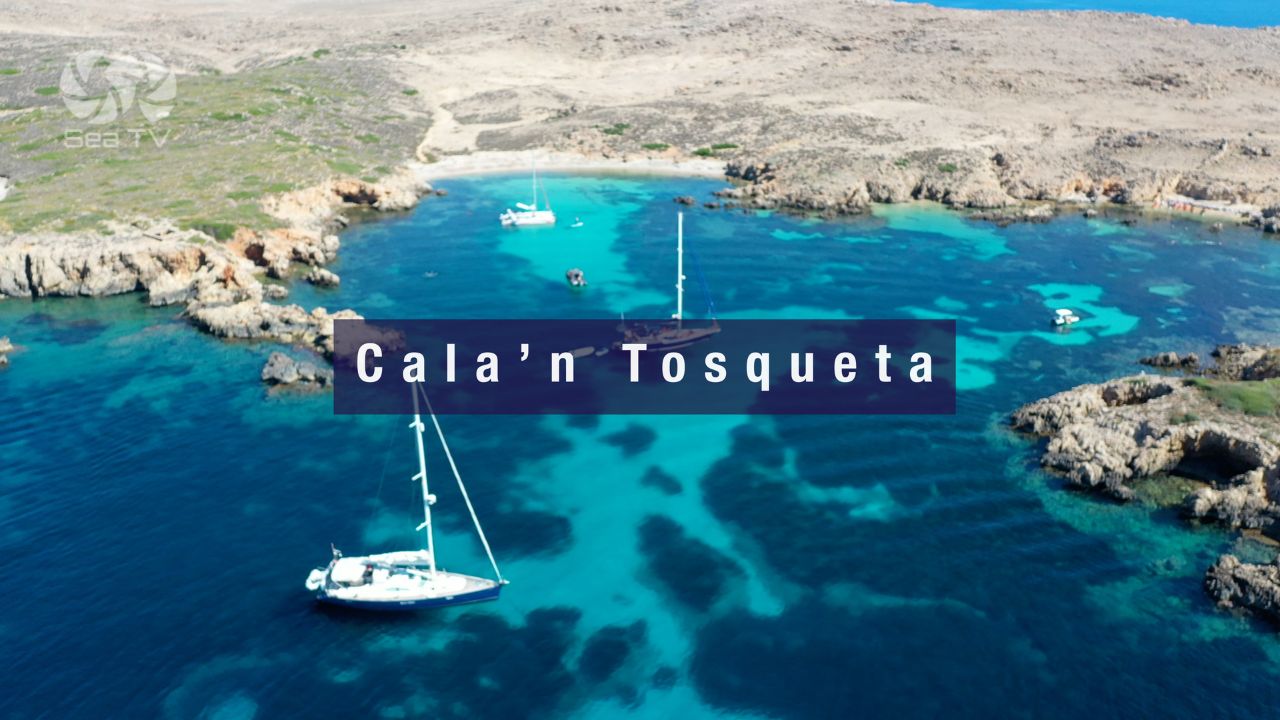
→ Cala’n Tosqueta — N coast of Mola de Fornells peninsula · ~50 m hidden sand cove · sheltered from all wind directions including Tramontana · Marine Reserve
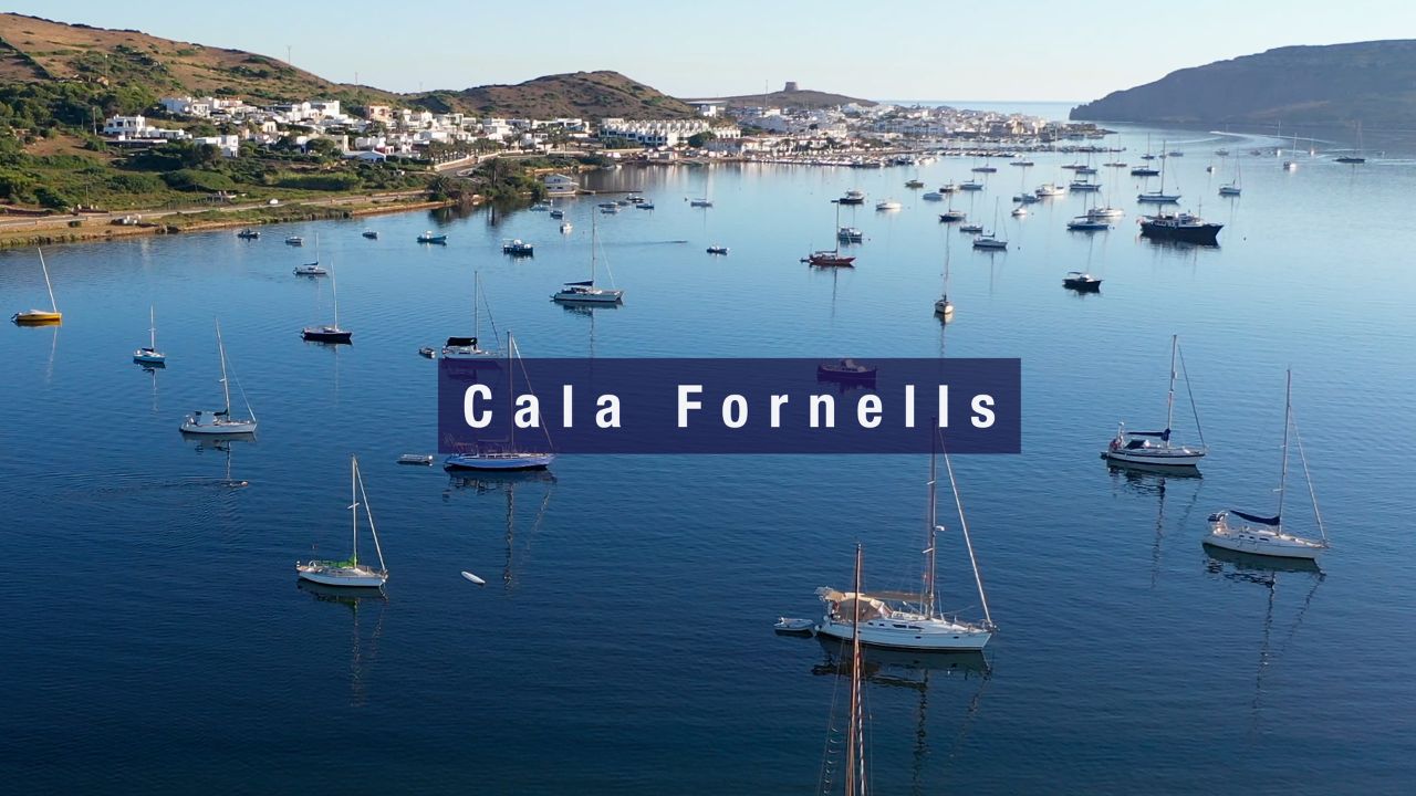
→ Cala Fornells — small rocky village swimming spot inside Fornells village · NOT to confuse with Fornells Bay (the actual sailing harbour) · ~400 m walk N of marina
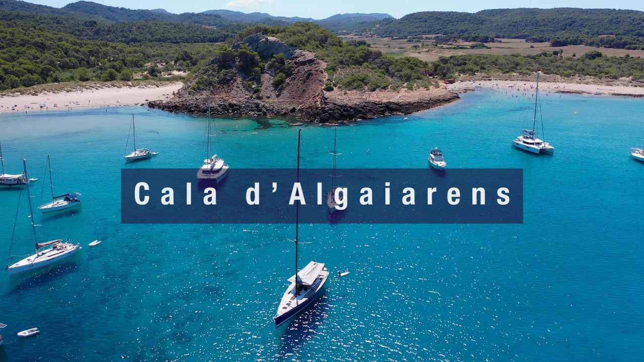
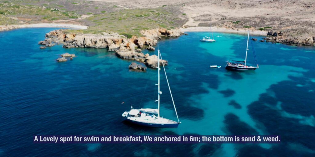
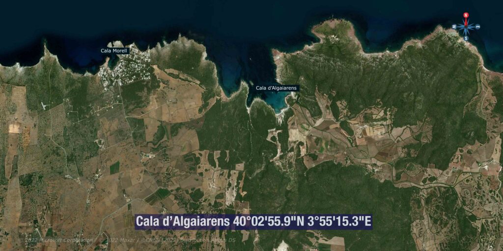
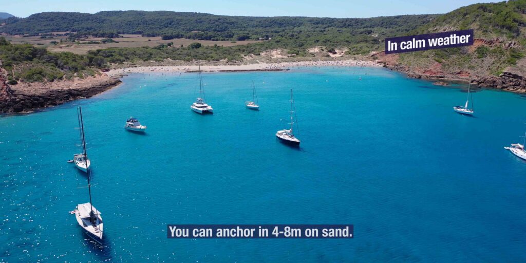
→ Cala Algaiarens · La Vall — NW coast virgin double bay · Platja des Tancats + Platja des Bot · golden sand · Natura 2000 protected · ~6 NM N of Ciutadella
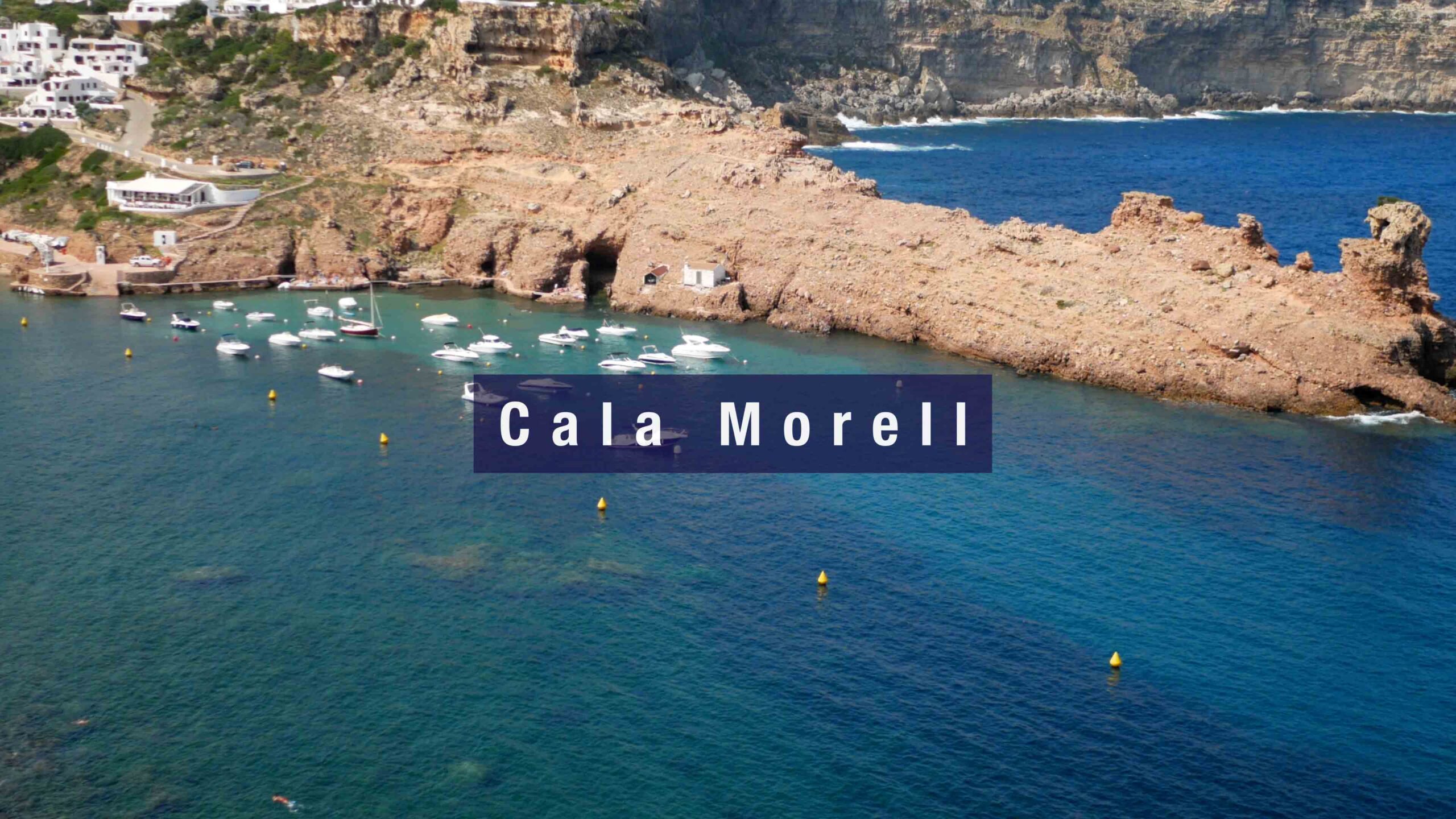
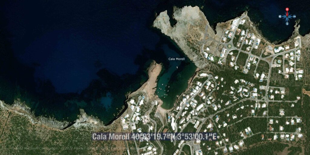
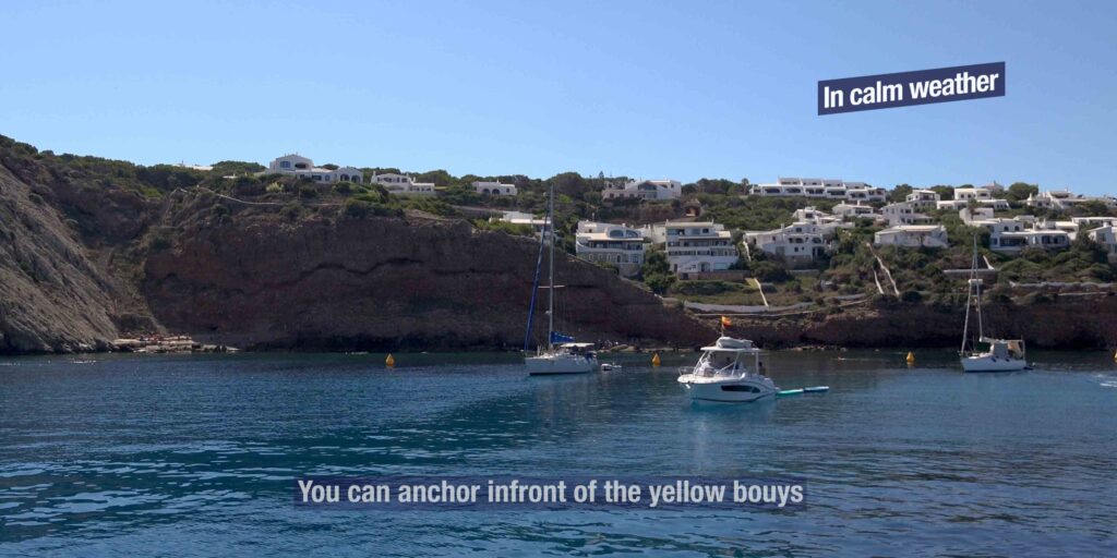
→ Cala Morell — ~40°03’N · 3°53’E · small NW natural harbour + the prehistoric necropolis (14 burial caves carved into limestone, in use 1600 BCE-2nd c. AD)
⛵ A 7-Day Menorca Itinerary
A typical week-long charter loop, anti-clockwise from Maó (the natural starting point with charter bases + airport):
Day 1 · Maó → Cala’n Porter (~12 NM W) · day-stop swim · sunset drinks at Cova d’en Xoroi · return to Maó or anchor short-stop in calm forecast
Day 2 · Maó → Cala Galdana (~50 NM W around the SE corner, or via airport stop) · the horseshoe bay · overnight in the protected anchorage
Day 3 · Galdana → Macarella + Turqueta + Son Saura · day-hop the iconic S-coast virgin calas · overnight in Macarella in calm
Day 4 · S coast → Ciutadella (~10 NM W) · medieval old town · provisioning · gastro dinner · marina overnight
Day 5 · Ciutadella → Cala Algaiarens (La Vall) → Cala Morell · day-hop the NW virgin coast · necropolis visit at Morell · overnight in Algaiarens (calm) or back to Ciutadella
Day 6 · NW → Pregonda → Cavalleria → Fornells · the iconic N coast in calm · overnight in Fornells Bay
Day 7 · Fornells → Addaia → Maó · pass Cap de Favàritx · UNESCO park views · return to Maó
⚠ This loop assumes calm weather. If Tramontana is forecast, reverse direction or skip the N coast entirely · the south coast remains usable.
Posidonia — The Rules That Matter
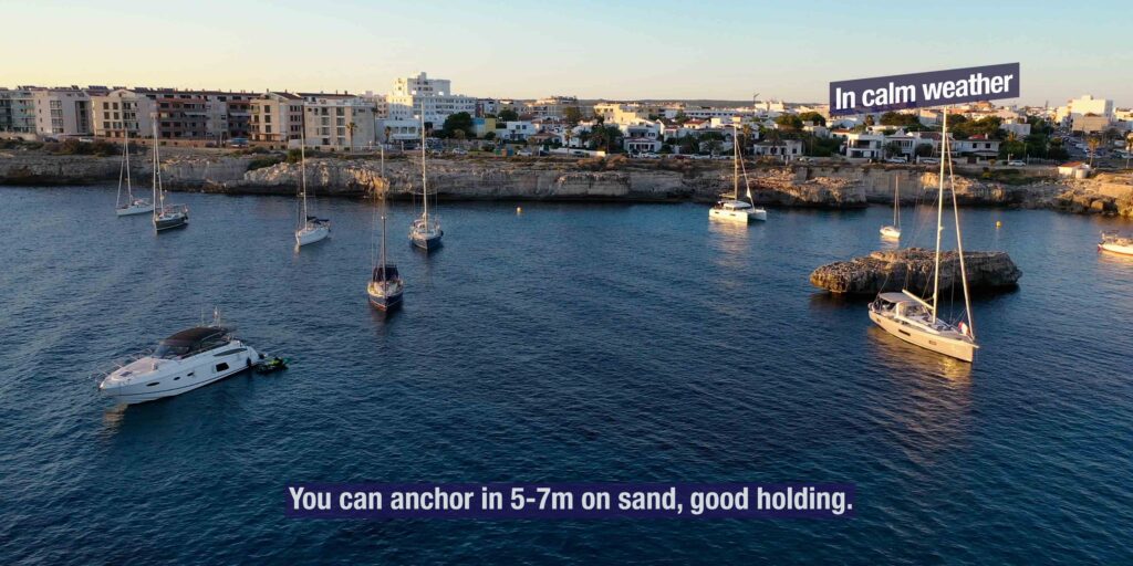
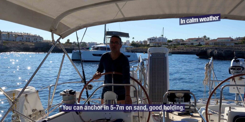
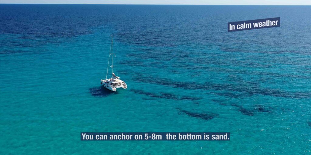
Posidonia oceanica is the Mediterranean seagrass that carpets much of the Balearic seabed. It produces oxygen, stabilises sand, and shelters fish · it grows ~1 cm/year and takes centuries to recover from anchor damage. The Balearic government enforces strict rules:
→ FINES start at €1,200 for anchoring on Posidonia · up to €100,000 for repeated commercial offenders
→ Surveillance: drone patrols, snorkel inspectors, harbour-master rounds during peak season
→ The free official app: “Posidonia Maps” by Govern de les Illes Balears (iOS + Android) · shows real-time seagrass + sand zones
→ Visual ID: in clear water, sand = white/pale yellow patches · Posidonia = dark green/brown patches
→ Smart approach: drop in clearly identified sand · reverse hard to confirm hold · verify by snorkel if any doubt · move if you’re on grass
Camí de Cavalls — The 185 km Coastal Path
The Camí de Cavalls is Menorca’s circumnavigating footpath — 185 km of trail that loops the entire island, divided into 20 numbered stages of 5-13 km each. The path was originally cut for the British cavalry to patrol the coastal watchtowers (1726-1802), then fell into disuse, then was restored as a public trail in 2010. For cruisers the path connects most of the calas you’ll anchor in: walk inland from one bay, see the next bay over the cliff, then walk back. Stages relevant to the SeaTV anchorages we cover:
→ Stage 4: Es Grau ↔ Favàritx (8.6 km) · passes Salines de Addaia + Hipogeos
→ Stage 5: Favàritx ↔ Arenal d’en Castell (13.7 km)
→ Stage 8: Cala Algaiarens ↔ Cala Morell (5.4 km · 90 min) · pine forest + necropolis
→ Stage 9: Algaiarens ↔ Els Alocs / Cala Pilar (~9 km) · agricultural valley
→ Stage 13: Cala Galdana ↔ Cala Turqueta (6.5 km · 2 hr) · passes Macarella + Macarelleta
→ Stage 14: Cala Galdana ↔ Sant Tomàs (10 km · 3 hr) · passes Mitjana + Trebalúger
Talaiotic Menorca — UNESCO World Heritage 2023
Menorca was added to the UNESCO World Heritage List in 2023 for its prehistoric Talaiotic culture — a Bronze Age and Iron Age civilisation that built distinctive stone structures across the island from ~1600 BCE through Roman conquest in 123 BCE. The inscription covers 9 archaeological zones across the island. The Talaiotic culture was characterised by:
→ Talaiots — the stone watchtowers that gave the culture its name · Cyclopean masonry without mortar · ~250 surviving on the island
→ Taulas — T-shaped stone monuments unique to Menorca · inside enclosed sanctuaries · function debated (astronomical? religious?)
→ Navetas — boat-shaped collective tombs · Naveta des Tudons (in use 1200-750 BCE, ~100 burials)
→ Hypogea + necropolises — burial caves carved into limestone cliffs · the major examples are visible from the sea
→ Hypostyle halls — multi-pillar stone-roof chambers
Visible from the boat:
→ Cala Morell necropolis — 14 burial caves (covered in detail in the Cala Morell page)
→ Cales Coves — 100+ burial caves near Cala’n Porter · the largest necropolis on the island
→ Hipogeos de Addaia — burial chambers above the salt flats N of Port d’Addaia
Menorcan Food & Drink — What to Eat Where
The signature dishes:
→ Caldereta de langosta — spiny-lobster stew · the regional dish · best in Fornells village (the official home) · multiple specialists · €100+/person for the genuine version
→ Mahón cheese (Queso de Mahón-Menorca DOP) — semi-cured cow’s milk cheese · pressed by hand · square-edge shape from cloth-wrapping technique · Mahón is the world capital
→ Sobrasada — soft spreadable cured pork sausage with paprika · Balearic specialty
→ Oliagua amb figues — peasant tomato-bread soup with figs · summer cold soup
→ Ensaimada — spiral pastry dusted with icing sugar · breakfast classic
→ Coca de Sant Joan — flat sweet bread · only at Festes de Sant Joan in June
The drinks:
→ Pomada — Xoriguer gin + cloudy lemonade · the official drink · British-occupation legacy (1708-1802) · drink it cold all summer
→ Xoriguer gin (IGP) — Mahón-distilled juniper gin · uses wine spirit base (unique in the gin world) · the protected geographical indication brand
→ Menorcan craft beer — small but growing · IGP labels appearing in restaurants
The British Period — Why Menorca Looks Different
Menorca was British 1708-1802 (with French interludes 1756-63 and 1798-1802) — most of the 18th century · the British developed Maó as their Mediterranean naval base, building defensive forts (La Mola, Marlborough), watchtowers along the coast (visible at Fornells, Punta Prima, Sant Esteve), the road network, and the Camí de Cavalls coastal patrol path. The cultural legacy is everywhere:
→ Pomada drink · gin culture from British naval rationing
→ Sash windows on Maó’s old townhouses (rare in Spain)
→ Menorcan loanwords · “boínder” (bow window), “xumaquer” (shoemaker), “mèrvels” (marbles)
→ “Mahón” as Mahonnaise origin · the disputed claim that mayonnaise was invented in Maó in 1756 by the chef of the French Duc de Richelieu
→ Naval architecture · the harbour fortifications + Fortaleza de Isabel II at La Mola
Emergency & Practical Contacts
Emergency: 112 (national, all services)
Maritime SAR (Salvamento Marítimo): 900 202 202
VHF distress: Channel 16
Marina VHF: Channel 9 (working)
Hospital Mateu Orfila (Maó): +34 971 487 000 — only public hospital on the island
Club Nàutic Ciutadella: +34 971 383 918
Port d’Addaia · Ports IB: +34 971 188 871
Posidonia Maps app: Govern de les Illes Balears (free · iOS + Android)
Weather: AEMET (Spanish met office) · Windguru · PredictWind
Charts: Imray M3 + M5 · Navionics Mediterranean · the W coast scale needs zoom for detail
Plan Your Cruise Around the Balearics
→ Balearic Islands main hub — overview of all four islands
→ Spain cruising hub — Costa Brava, Costa Blanca, Spanish coastal anchorages
→ From Menorca to Mallorca: ~30 NM SW from Ciutadella to Port de Pollença · the most common Balearic crossing
Mallorca anchorages on SeaTV:
→ Port de Sóller · NW coast safe harbour
→ Port d’Alcúdia · NE service hub · the closest crossing point from Menorca
→ Cabrera National Park · S Mallorca
→ Port d’Andratx · SW gateway · the closest jump-off to Ibiza
“Menorca is the Balearic that decided not to follow Mallorca and Ibiza into mass tourism · the decision came in nineteen ninety three when UNESCO designated the entire island a Biosphere Reserve and the result three decades later is an island where the cala you anchor in tonight likely has the same skyline it had during the Roman period · pine and holm oak forest low limestone cliffs sandy beaches and prehistoric Talaiotic stone towers visible from the sea · for cruisers Menorca offers two completely different cruising worlds the south coast with its protected white sand calas sheltered from the Tramontana lined with pine and accessible to families plus the north coast the rugged Tramuntana exposed to north winds wilder redder with virgin beaches you reach by boat or by hiking the Camí de Cavalls · the two coasts are nineteen kilometers apart and feel like different countries · in twenty twenty three UNESCO added a second status to the island World Heritage for Talaiotic Menorca recognising the prehistoric stone tower civilisation that flourished here from sixteen hundred BCE through Roman conquest in one twenty three BCE · you will see the towers and the burial cave necropolises throughout including from the deck of your boat at Cala Morell and Cales Coves · three marina bases support the cruise Maó with its five kilometer natural harbour one of the four largest natural harbours in the world plus Ciutadella the medieval old capital with two hundred ninety six berths and the Rissaga meteotsunami plus Port d’Addaia the only marina on the entire north and northeast coast adjacent to the S’Albufera des Grau Natural Park · the Tramontana defines summer twenty five to forty knots for two to five days at a time which means you must move to the south coast when it blows · the Posidonia rules are enforced with twelve hundred euro fines minimum so use the official Posidonia Maps app and find sandy patches only · the Camí de Cavalls connects most of the calas you anchor in one hundred eighty five kilometers of coastal footpath in twenty stages originally cut for the British cavalry to patrol the watchtowers · order the Pomada drink Menorcan gin Xoriguer with cloudy lemonade and order the caldereta de langosta in Fornells village and the Mahón cheese DOP and the sobrasada and the oliagua amb figues · this is not the loud Balearic this is the quiet sister and you will return.”
— SeaTV · Menorca · UNESCO Biosphere · Two Coasts, Two Worlds