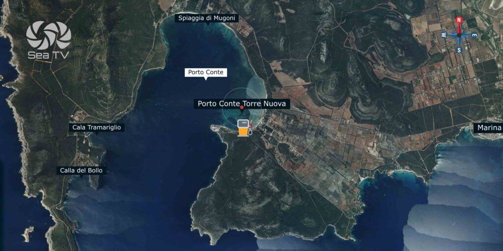
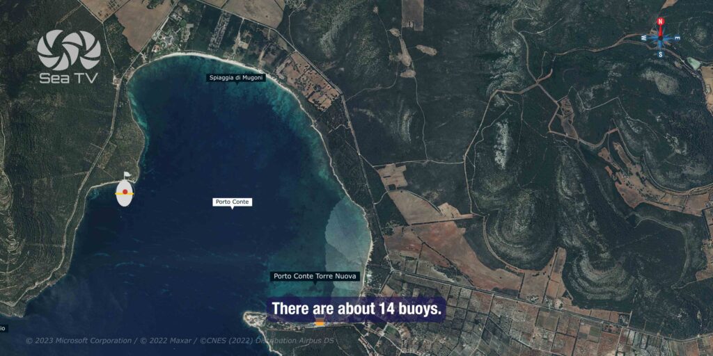
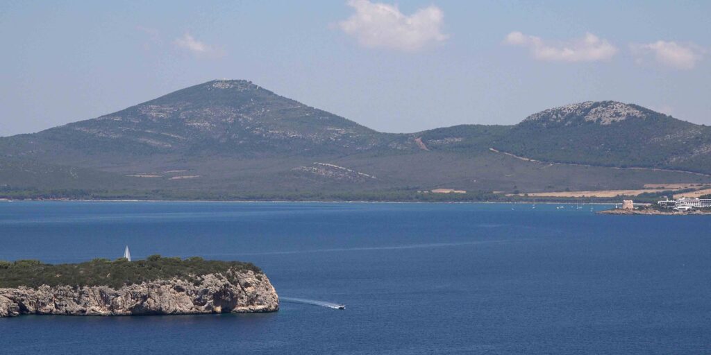
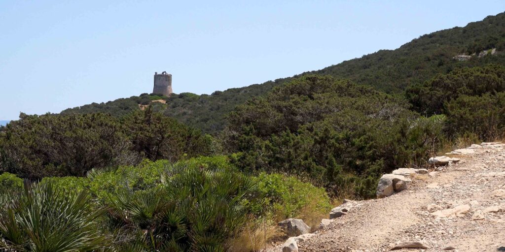
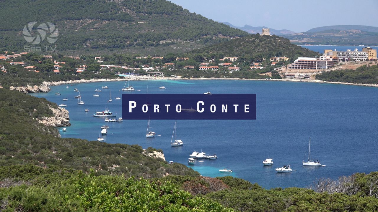
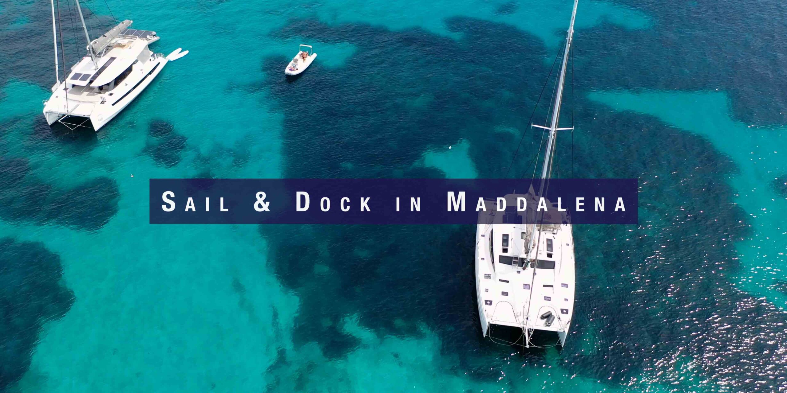
Porto Conte is a large, almost completely landlocked natural bay on Sardinia’s northwest coast, about 6 nautical miles west of Alghero. Framed by the dramatic limestone cliffs of Capo Caccia to the south and wooded hillsides inland, it is considered one of the largest natural harbours in the Mediterranean. The bay offers excellent shelter, clear water, and direct access to the Grotta di Nettuno (Neptune’s Cave) — one of Italy’s most spectacular sea caves. Alghero, a beautifully preserved Catalan-influenced walled town, is a short sail or dinghy ride away.
⚓ Quick Facts for Sailors
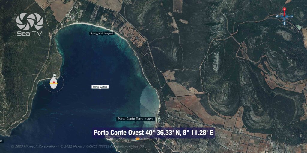
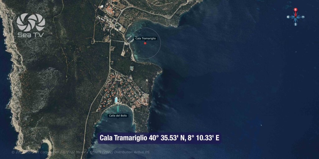
| Bay entrance coordinates | ~40°37’N / 8°11’E |
| Capo Caccia lighthouse | Main approach landmark — tall limestone headland with lighthouse atop |
| Anchoring | Anywhere in the bay in calm weather (see wind warning below) |
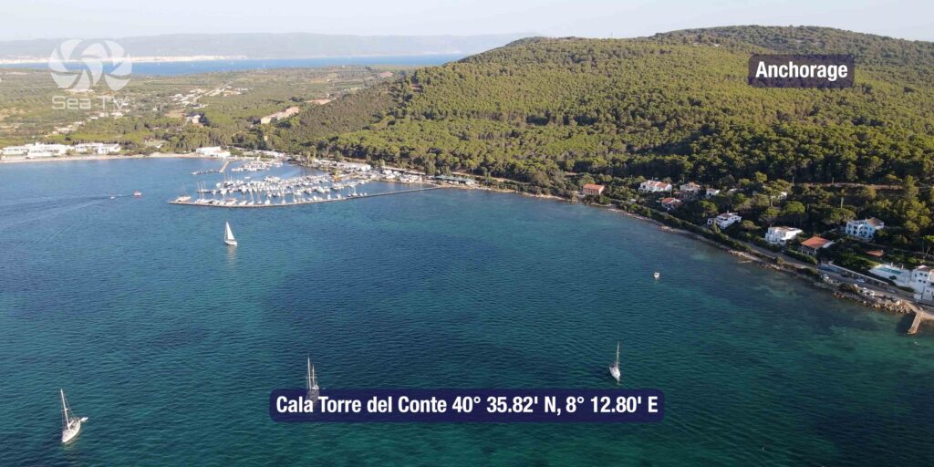
| Best anchorage (strong gusts) | Cala Torre del Conte — most protected option |
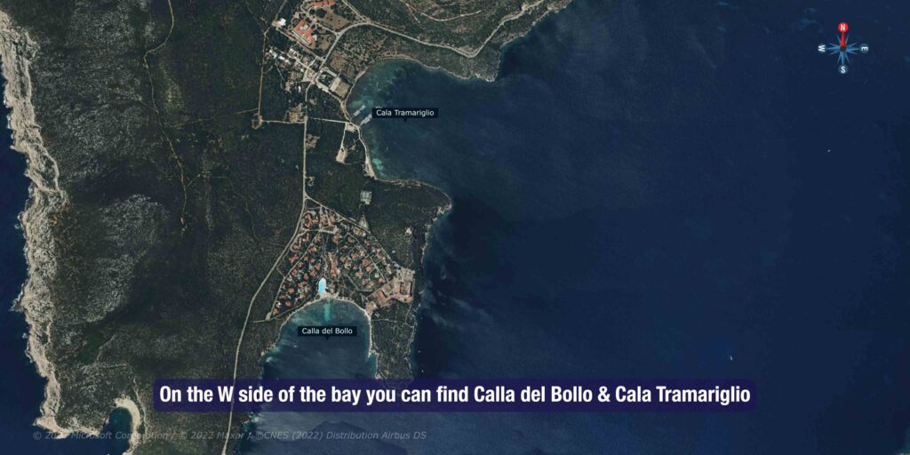
| Anchorage for Neptune’s Cave | Cala del Bollo — near the cave entrance, calm sheltered water |
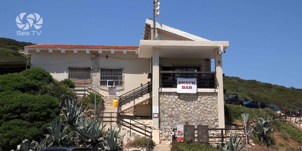
| Cala Dragunara (dinghy pier) | Small pier in Porto Conte park — excursion boats to Neptune’s Cave depart here |
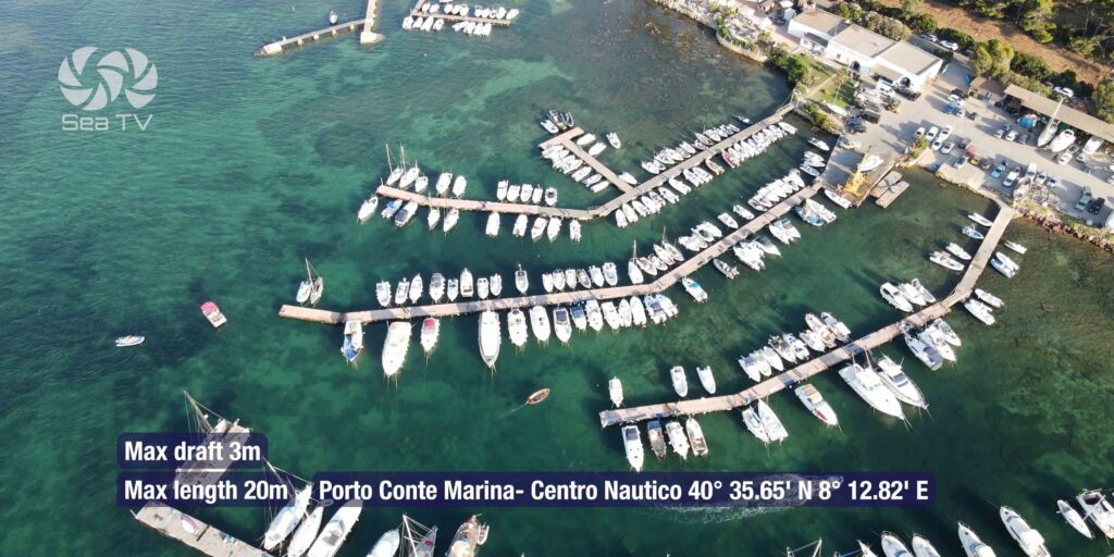
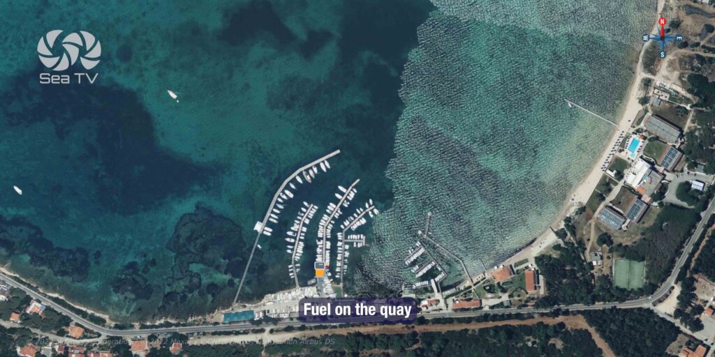
| Alghero marina | 6 nm E — full facilities, fuel, provisioning |
| Best Season | May – October |
Approach & Navigation
Entry Conditions
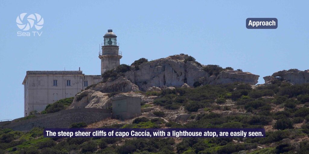
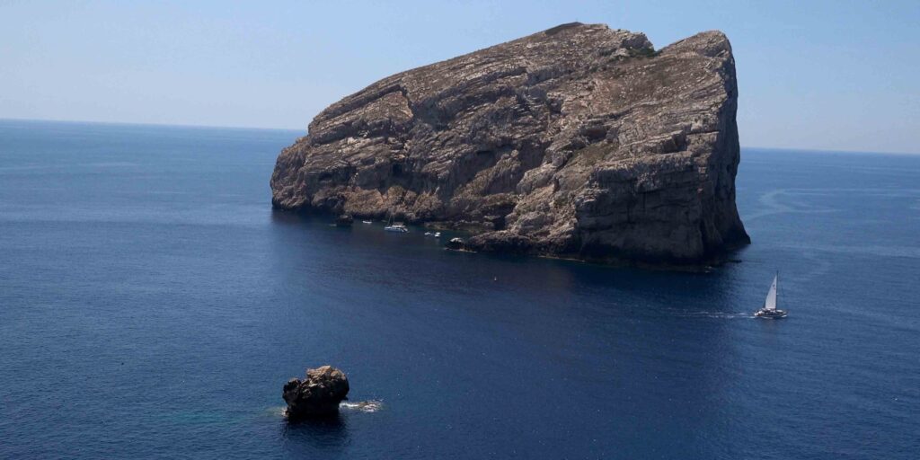
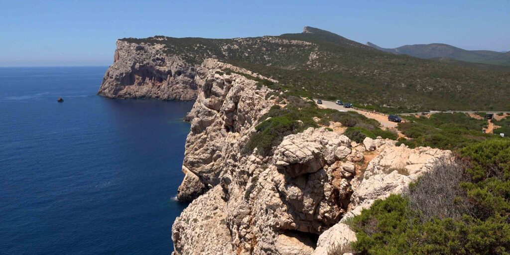
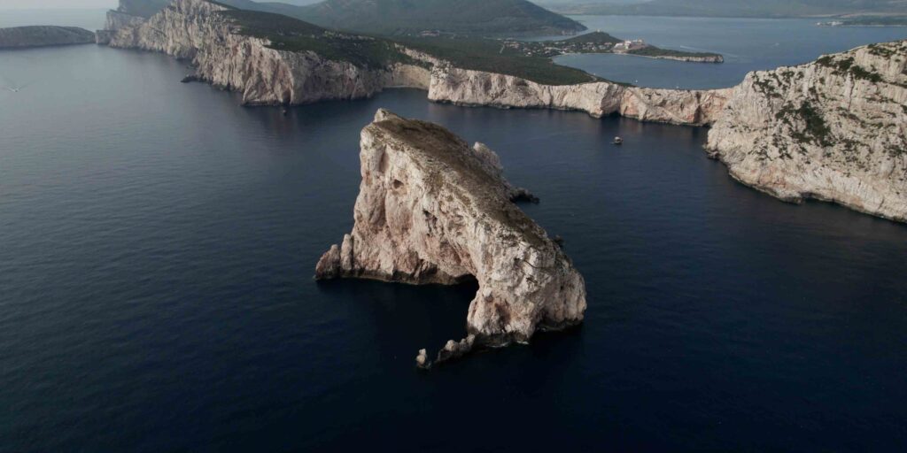
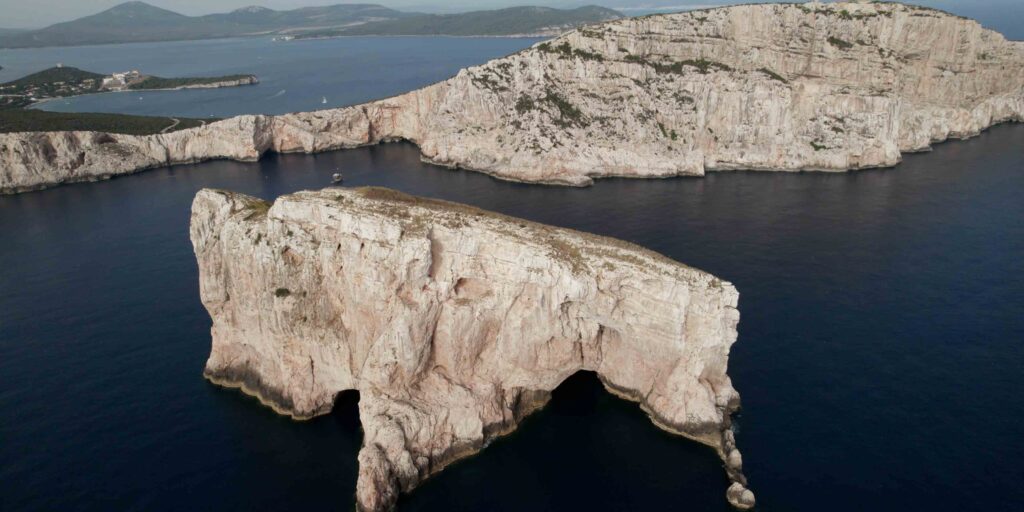
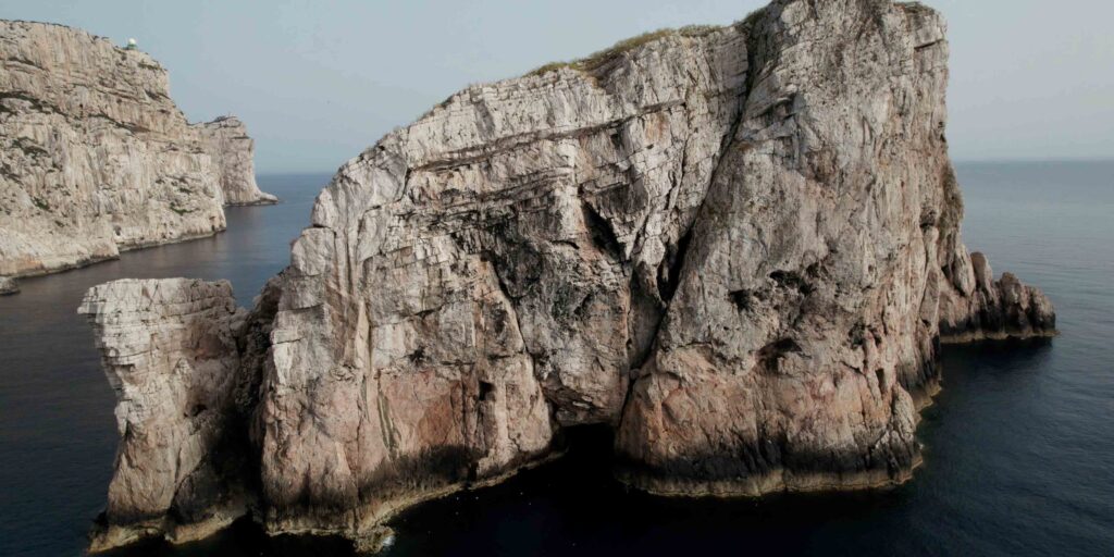
The steep sheer limestone cliffs of Capo Caccia, with the lighthouse on top, are visible from a long distance. The bay opens to the NE between Capo Caccia to the south and Punta Giglio to the north. Entry is straightforward — the bay is wide and deep.
⚠ Wind warning: Strong gusts frequently come off the high ground on the west side of the bay — the Capo Caccia plateau generates katabatic gusts that can reach well above the prevailing wind speed. In these conditions, anchor at Cala Torre del Conte (the most sheltered option) rather than in the open bay. Always set a second anchor or use a longer scope than usual.
Anchorages within the Bay
| Anchorage | Notes |
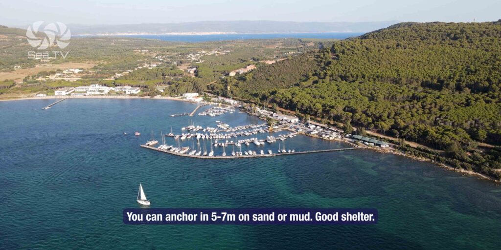
| Cala Torre del Conte | Best shelter in strong Maestrale gusts. Protected from W. Sand bottom. |
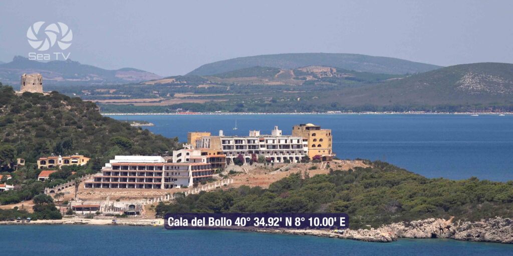
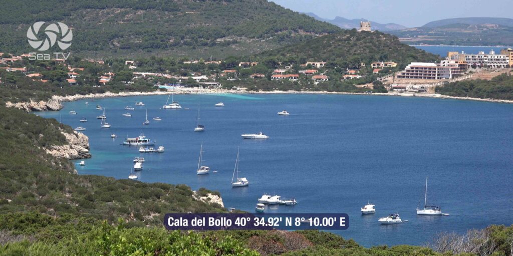
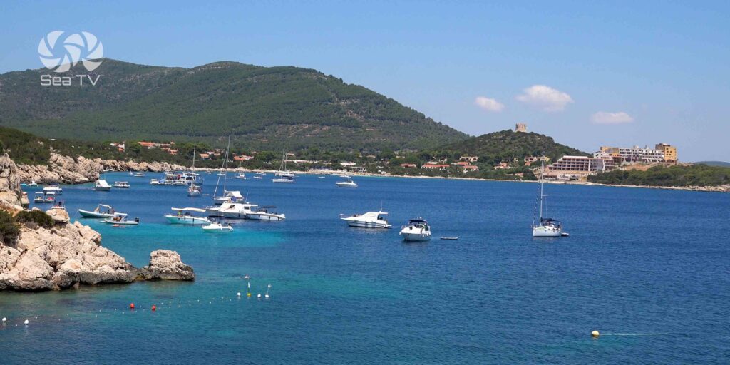
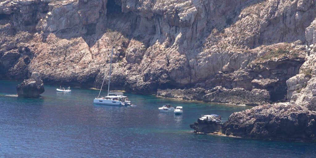
| Cala del Bollo | Small bay at the base of Capo Caccia near the Neptune’s Cave entrance. Sheltered. Use dinghy to access the cave from here. |
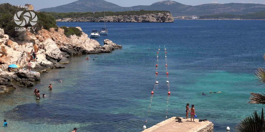
| Cala Dragunara | Small cove with a pier. Excursion boats to Neptune’s Cave depart from here in season. Anchor clear of the pier. |
| Open bay (calm weather) | Anywhere in the bay in settled conditions. Sand and rock bottom throughout. 5–15m depth depending on position. |
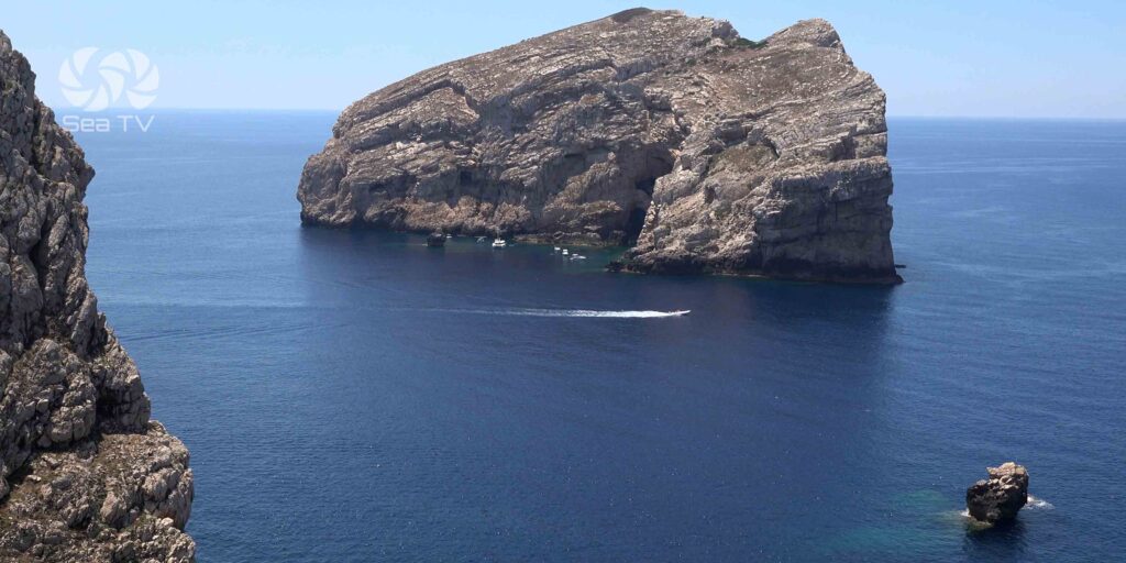
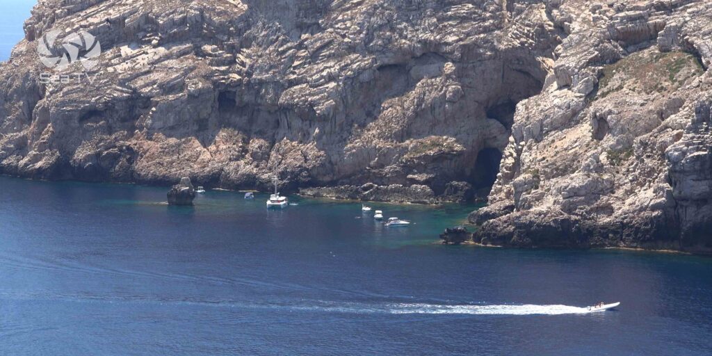
️ Grotta di Nettuno — Neptune’s Cave
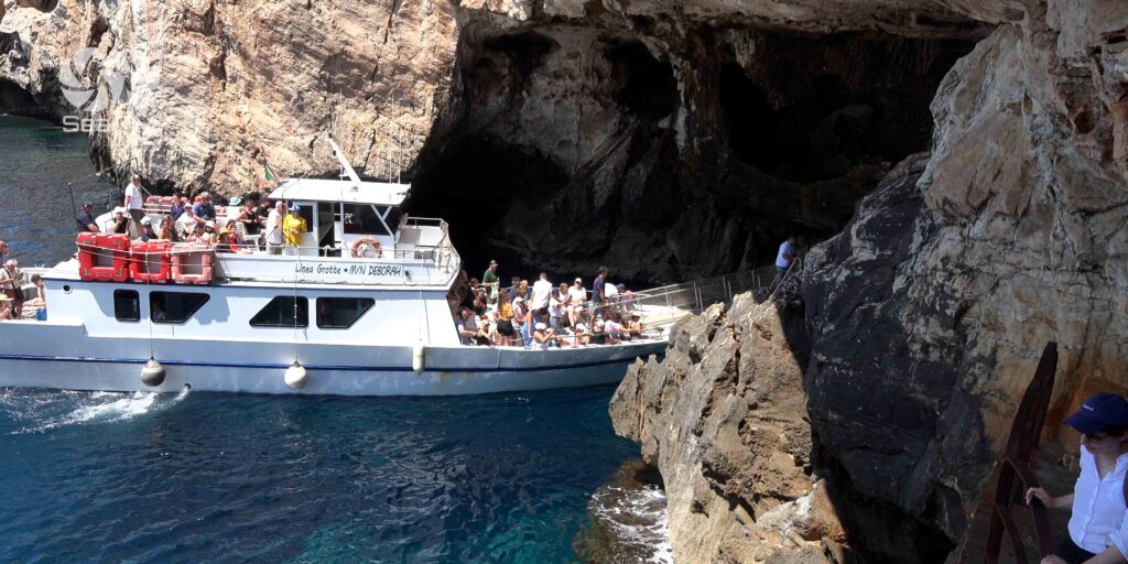
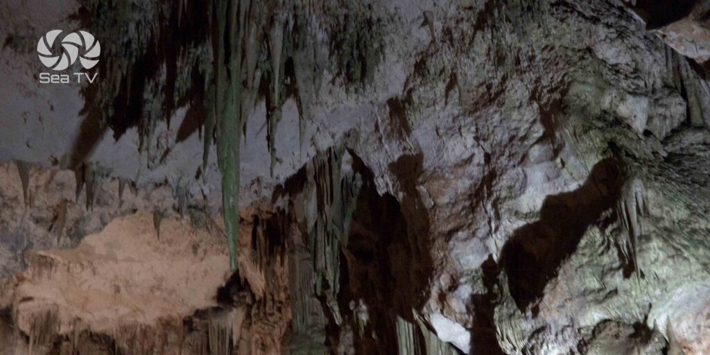
The cave is carved into the base of Capo Caccia at sea level — one of the largest sea caves in Italy, with stalactites, stalagmites, and an underground lake (Lago La Marmora) that formed over two million years. The guided tour covers approximately 1 km of illuminated passageways. From Porto Conte, this is your cave — you are anchored directly opposite its entrance.
| Access option | Details |
| By sea (recommended) | Excursion boats from Cala Dragunara (Porto Conte) or from Alghero harbour. Approaches along the cliff base — spectacular views. Book ahead: +39 345 741 8361 or grottadinettuno.it |
| By land — Escala del Cabirol | 654 steps cut into the cliff face from Capo Caccia car park. Takes ~15 min down, ~15 min up. Views excellent. Reservation compulsory — arrive 40 min before scheduled visit. |
| Opening hours | Daily 9:00–19:00 (last entry). Closed 24–25 Dec. Access suspended in rough sea or strong wind — check before going. |
Important: Reservation is compulsory. Tickets cannot be purchased at the door without prior booking. Book via grottadinettuno.it. In rough sea conditions, sea access is suspended — confirm before departing the anchorage.
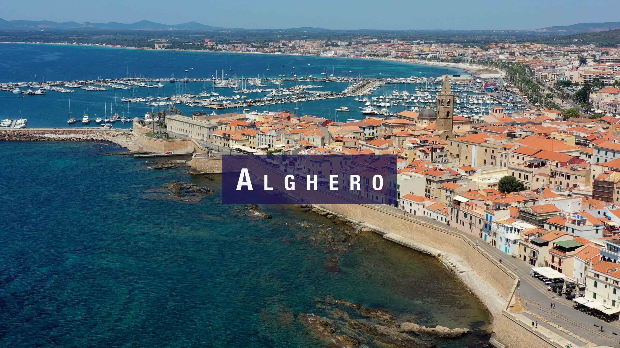
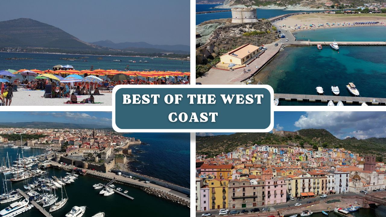
️ Alghero — 6 nm East
Alghero is a walled medieval city with a distinct Catalan identity — the only place in Sardinia where Catalan is still spoken alongside Italian. The old town sits on a small promontory with bastions overlooking the sea. For sailors at Porto Conte, it is an easy day sail or dinghy trip east.
What to see in Alghero
- Le Bastioni — the city walls with sea views; walkable along the entire waterfront perimeter
- Torre di Sulis & Torre di Sant’Elmo — medieval towers along the bastions
- Cattedrale di Santa Maria — 16th-century Gothic-Catalan cathedral in the old town centre
- Centro Storico — narrow cobbled streets, coral jewellery shops (Alghero’s signature craft), trattorias and wine bars
- Beaches: Le Bombarde (5 km south), Lazzaretto — clear water, sandy bottom, accessible by dinghy from Alghero harbour
️ Beaches in Porto Conte Bay
The bay itself has several excellent beaches accessible by dinghy from the anchorages: Mugoni beach (sand, sheltered), Cala Dragunara (small cove, crystal water), and several unnamed coves along the southern shore toward Capo Caccia. All are within the Porto Conte Regional Park — no facilities but undisturbed.
✅ Sailor’s Safety Checklist
- Watch for katabatic gusts off Capo Caccia plateau — can be significantly stronger than forecast
- In strong westerlies: anchor at Cala Torre del Conte, not the open bay
- Neptune’s Cave sea access suspended in rough conditions — check before dinghy trip
- Fuel and water at Alghero marina, 6 nm east — plan stop there for provisioning
- Alghero airport nearby — useful for crew changes
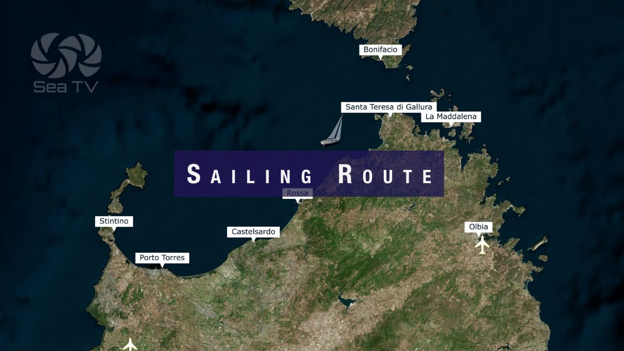
Nearby Destinations
| Destination | Distance | Notes |
| Alghero | 6 nm E | Catalan walled town. Full marina facilities. Neptune’s Cave excursions. |
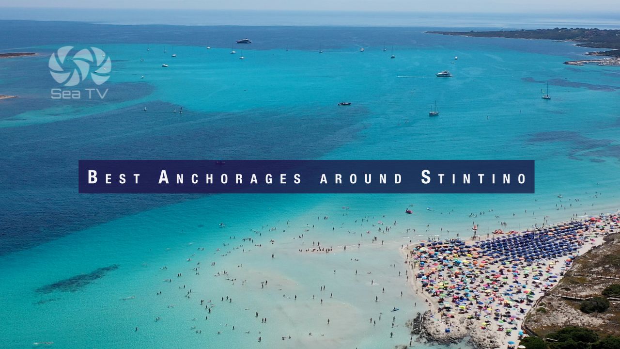
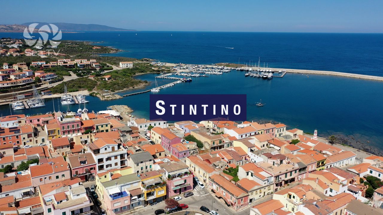
| Stintino | 25 nm N | Fishing village. Fornelli Passage. La Pelosa beach. |
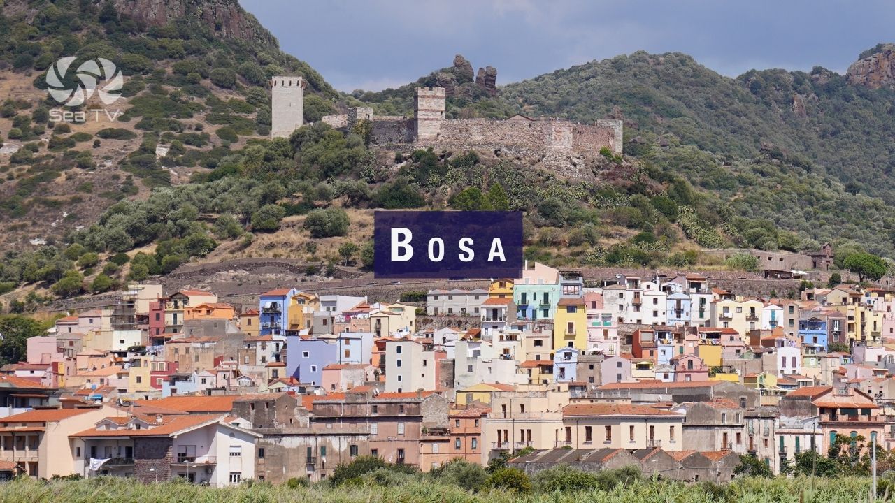
| Bosa | 25 nm S | Temo River. Exposed coastal passage — check forecast. |
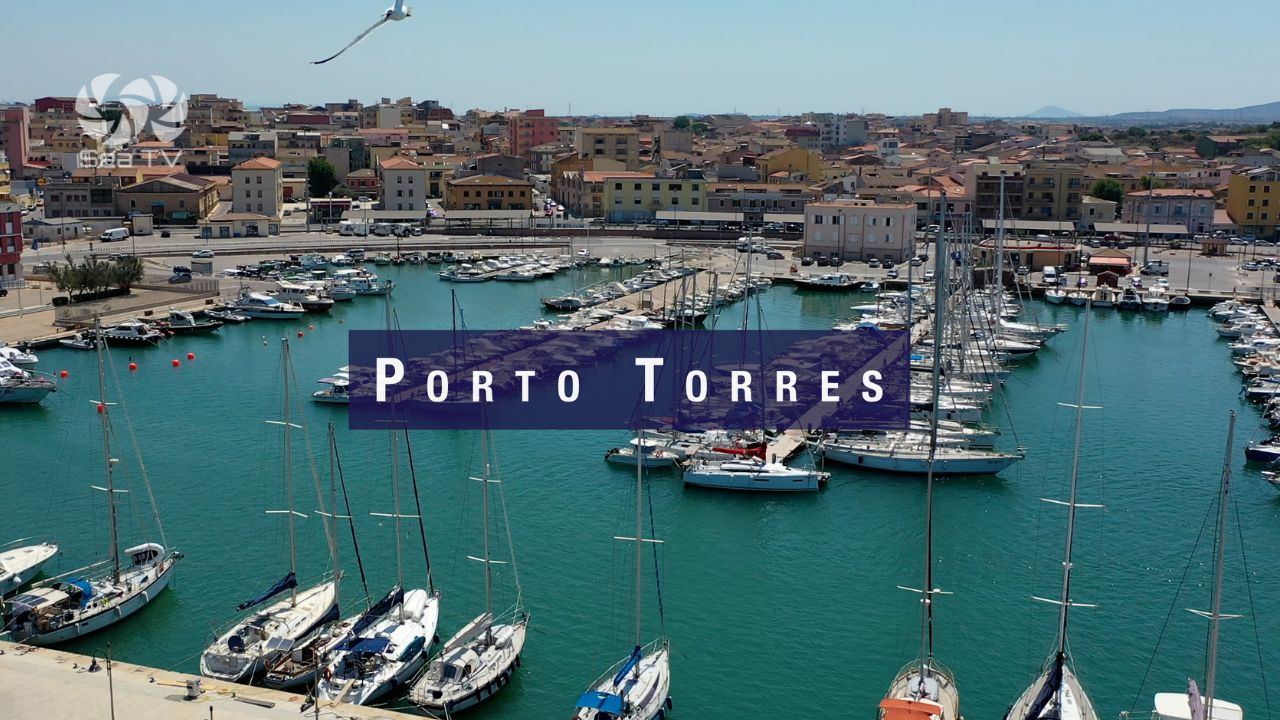
| Porto Torres | 30 nm N | Ferry to mainland Italy. Commercial port. |