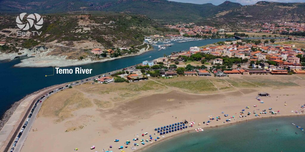
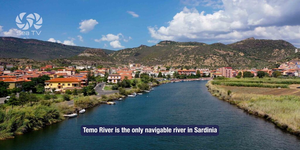
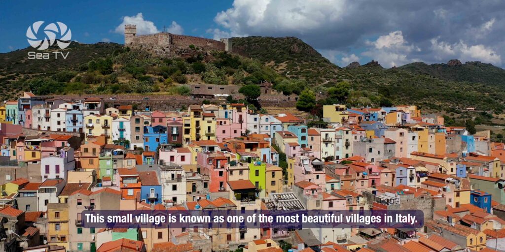
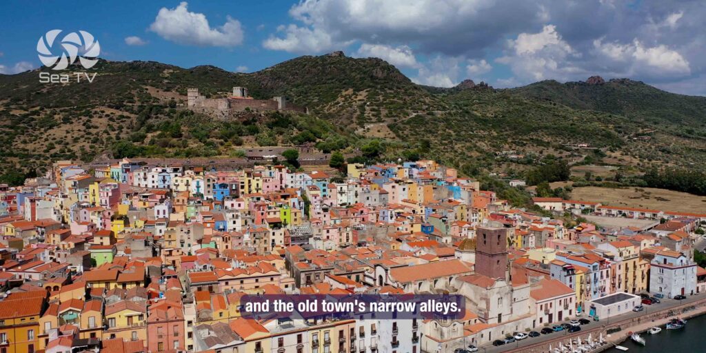
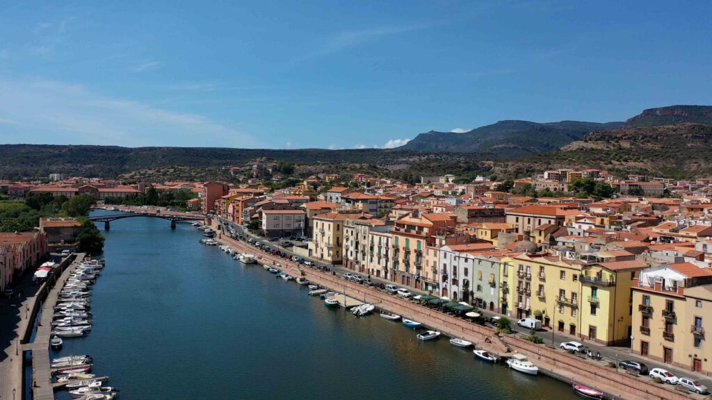
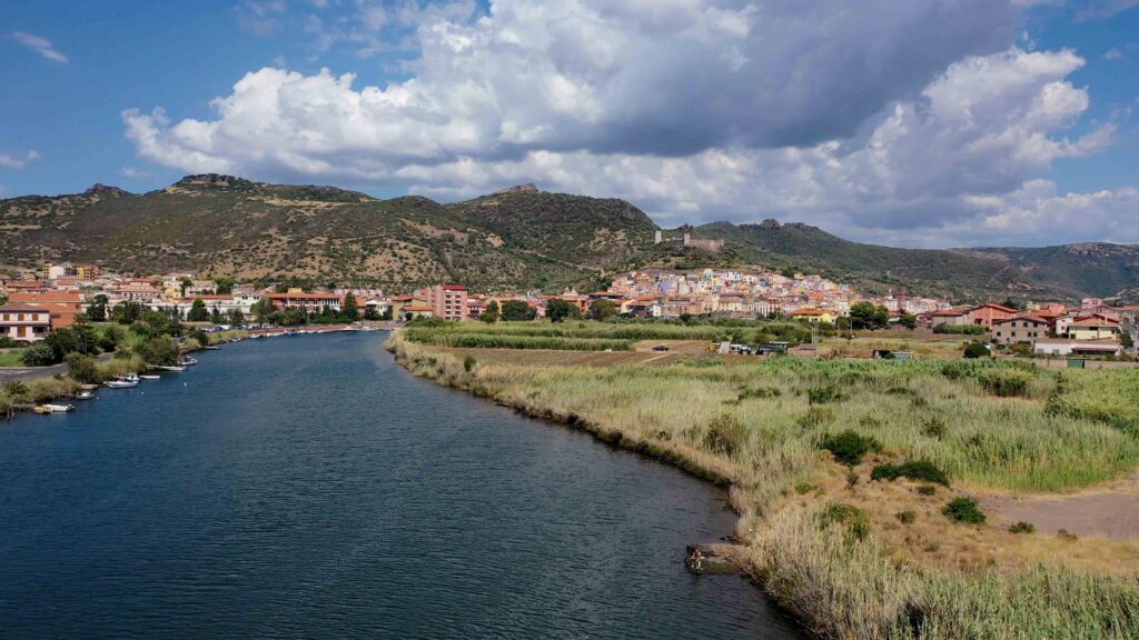
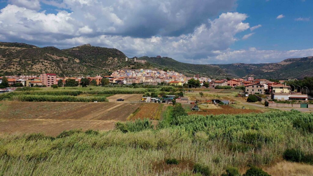
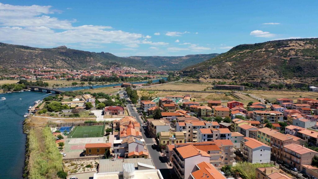
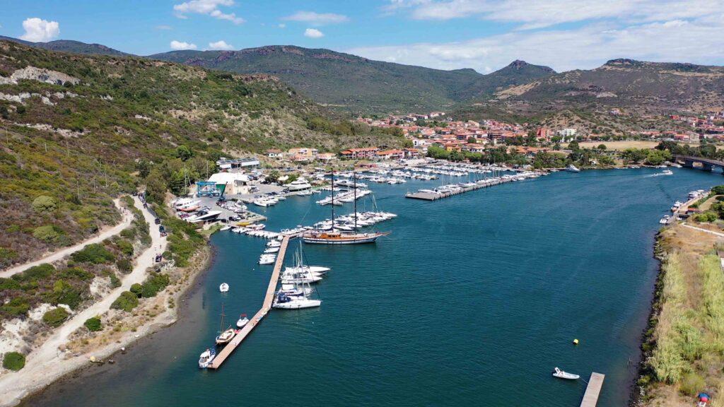
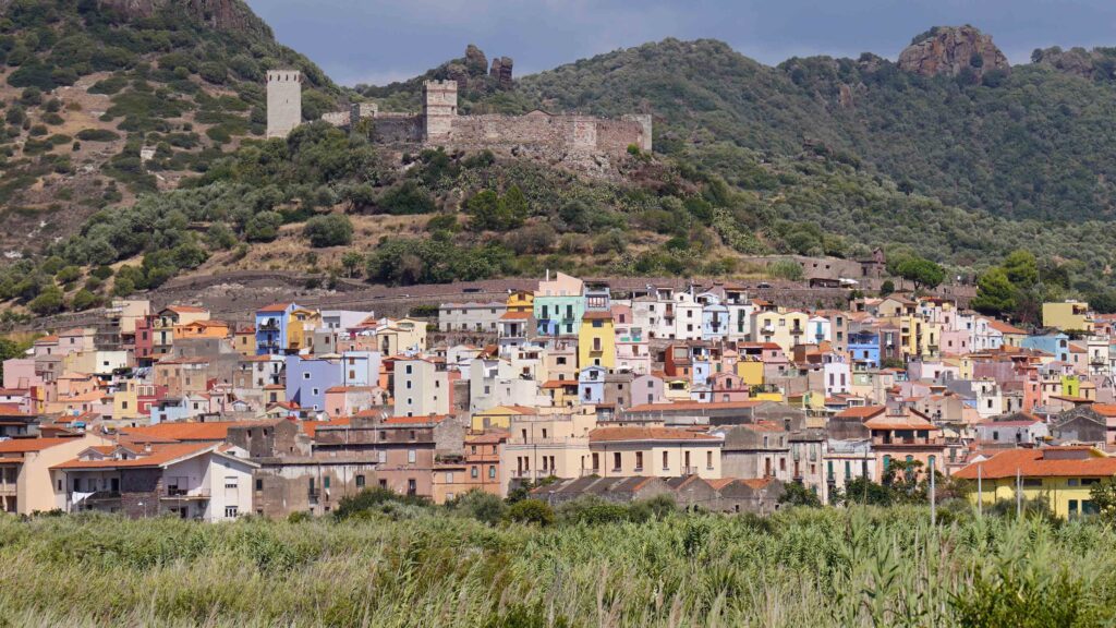
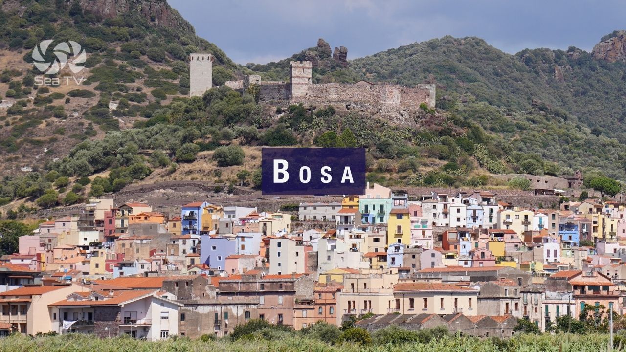
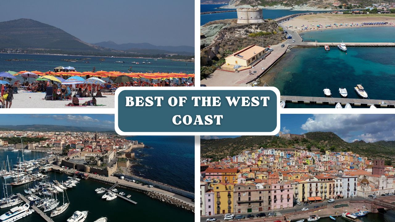
Bosa sits on Sardinia’s west coast where the Temo River — the only navigable river in Sardinia — meets the sea. The town is built on both banks and up the hill to the Malaspina Castle, and it consistently appears on lists of Italy’s most beautiful villages. From a sailor’s perspective it’s an unusual and rewarding stop: a river port with a genuine medieval town 1 mile upstream, minimal tourist infrastructure, and one of the best local wines in Sardinia.
⚓ Quick Facts for Sailors
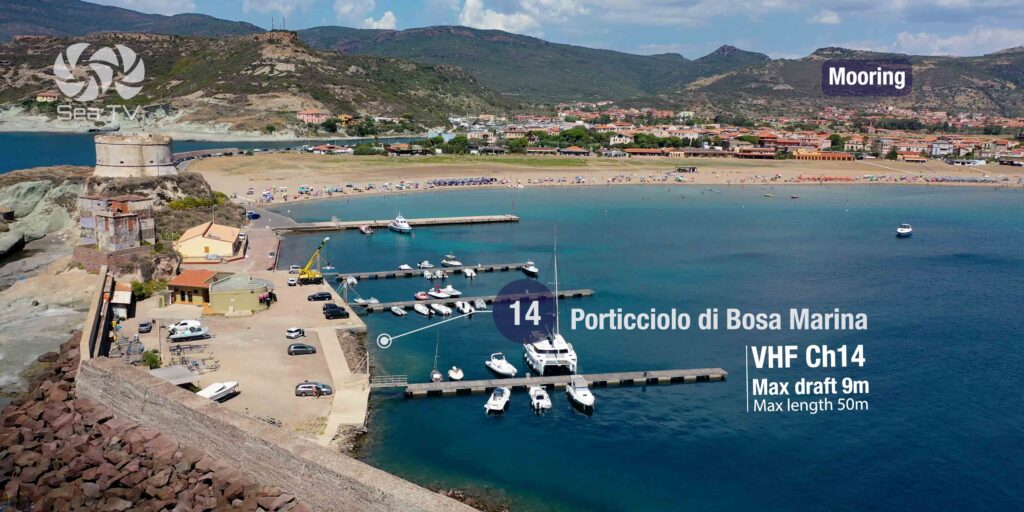
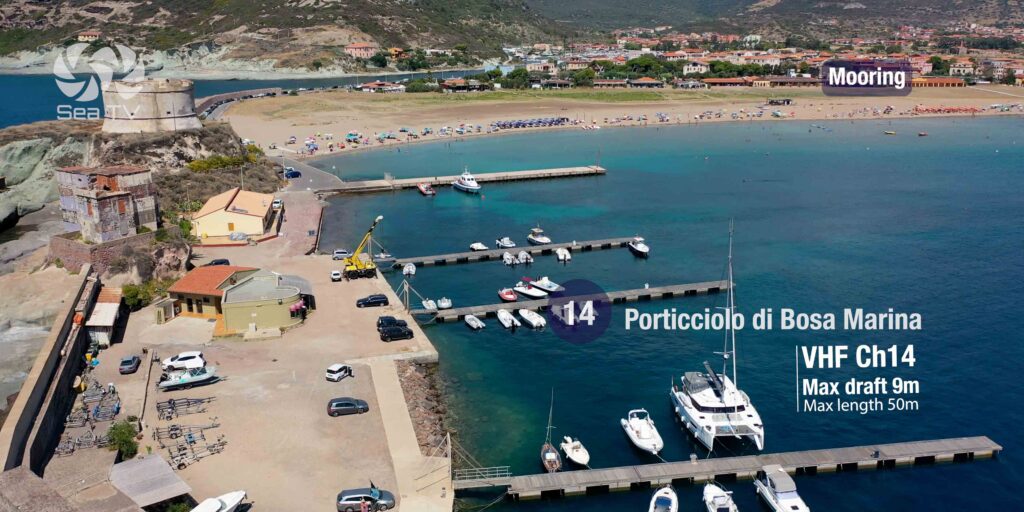
| Marina coordinates | 40°17’13.1″N / 8°28’32.4″E |
| VHF (Porticciolo) | Ch. 14 |
| Max Draft (marina) | 9 m |
| Max Length (marina) | 50 m |
| Phone (Porticciolo) | +39 338 651 2983 |
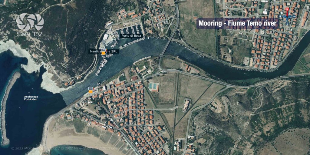
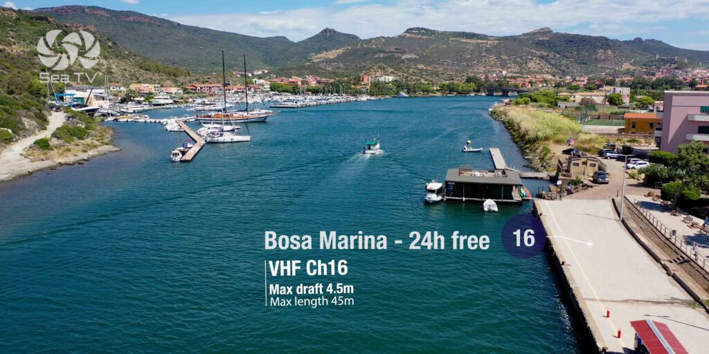
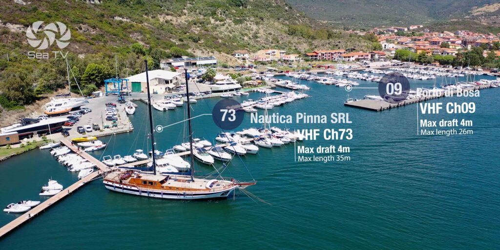
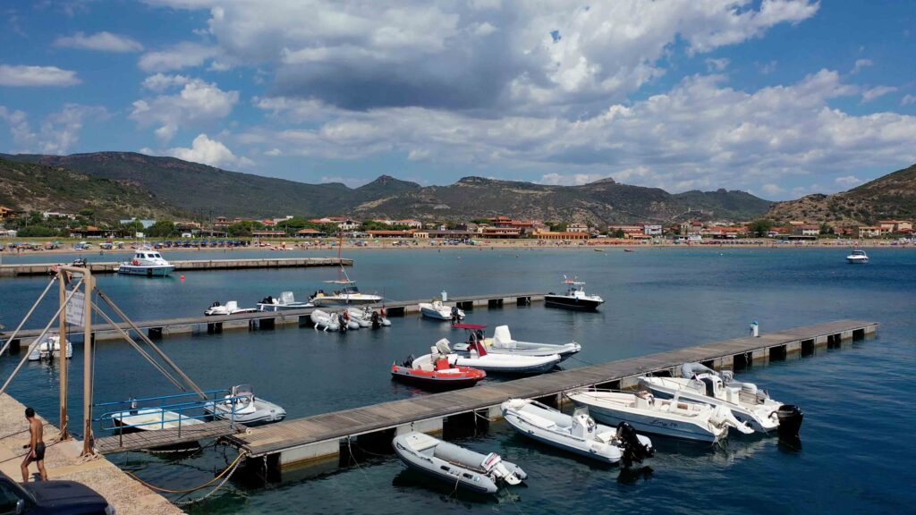
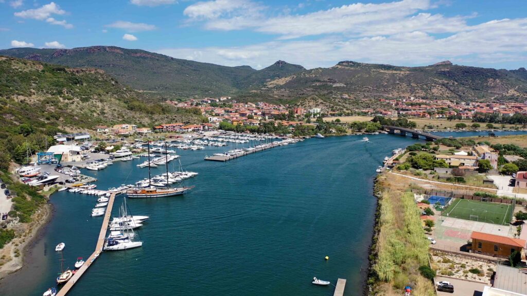
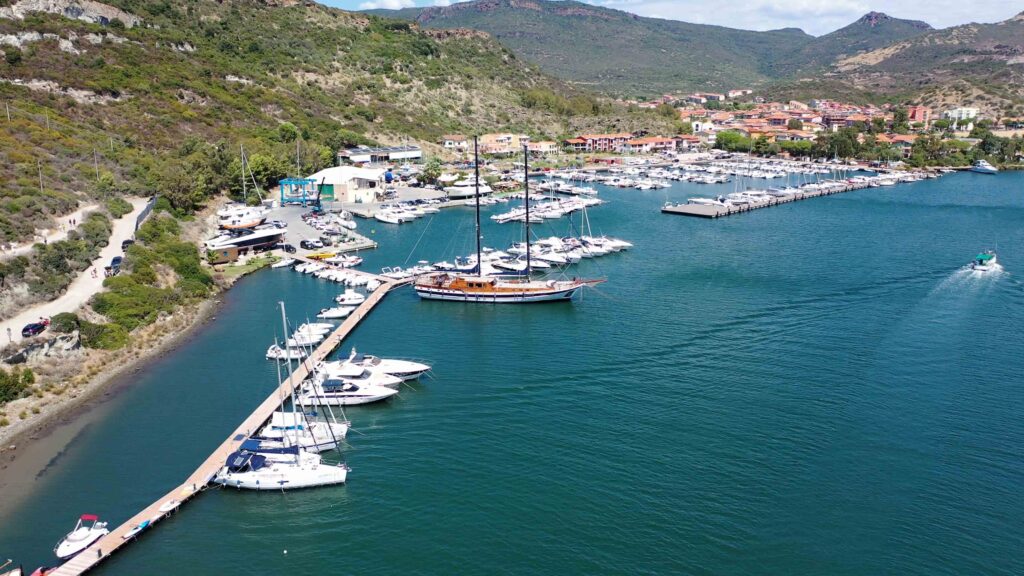
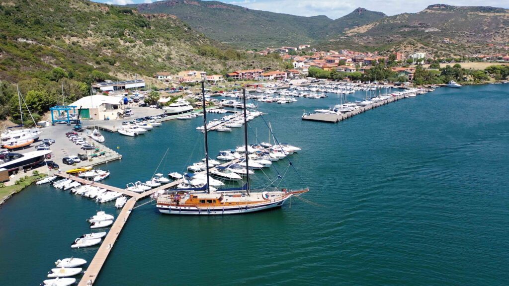
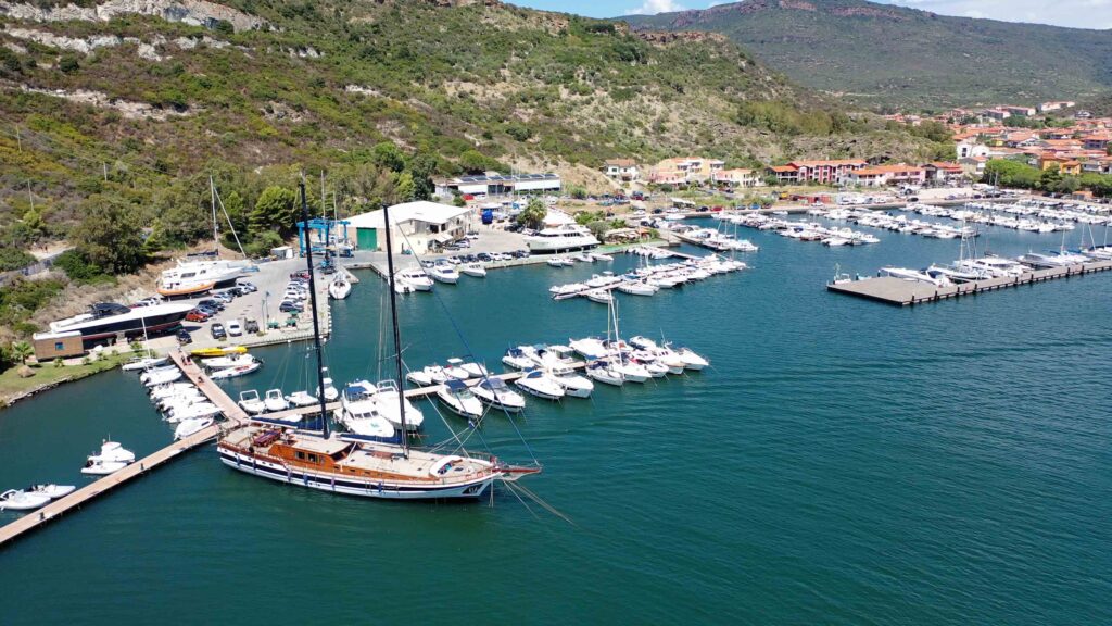
| Fiume Temo berths | 4 free berths (24h) + Nautica Pinna SRL |
| Temo VHF | Ch. 16 (free berths) / Ch. 73 (Nautica Pinna) |
| Max Draft (river) | 4–4.5 m |
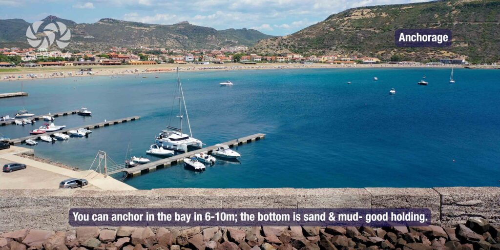
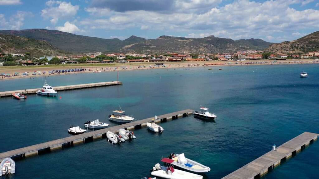
| Anchorage | Bay, 6–10m, sand and mud, good holding |
| Water & Electricity | ✓ on the quay |
| Fuel | ✓ on the quay |
| Best Season | May – October |
Approach & Navigation
Entry Conditions
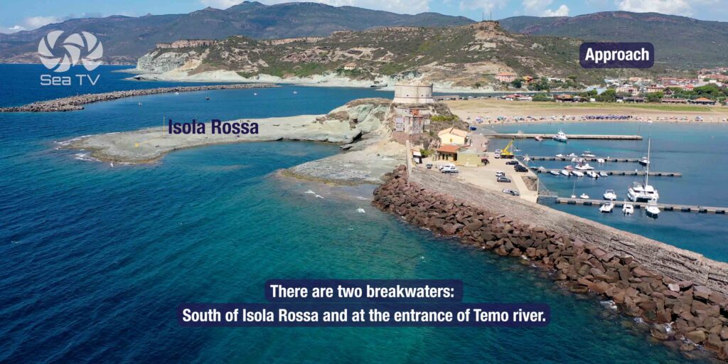
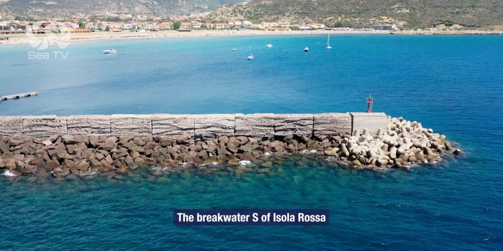
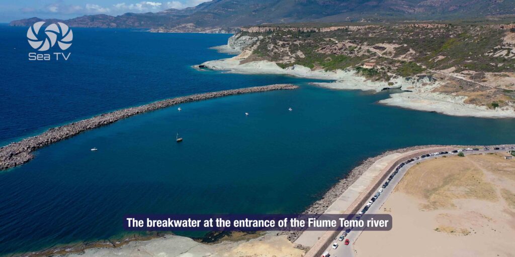
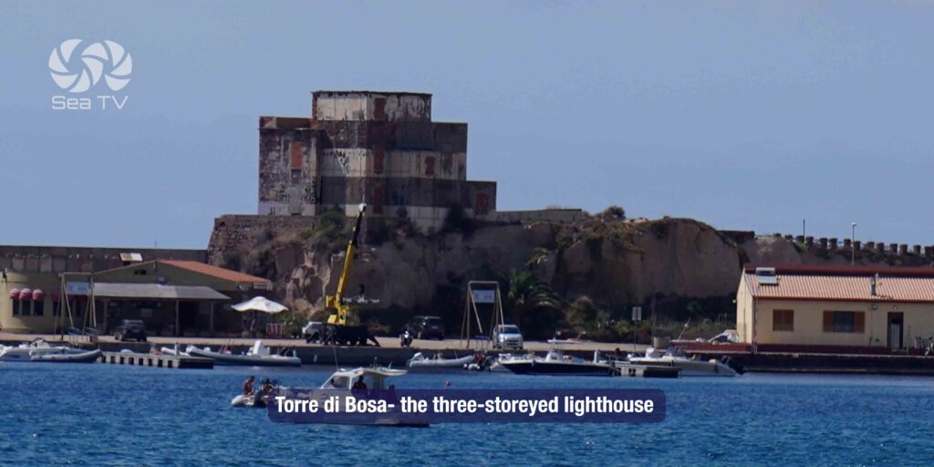
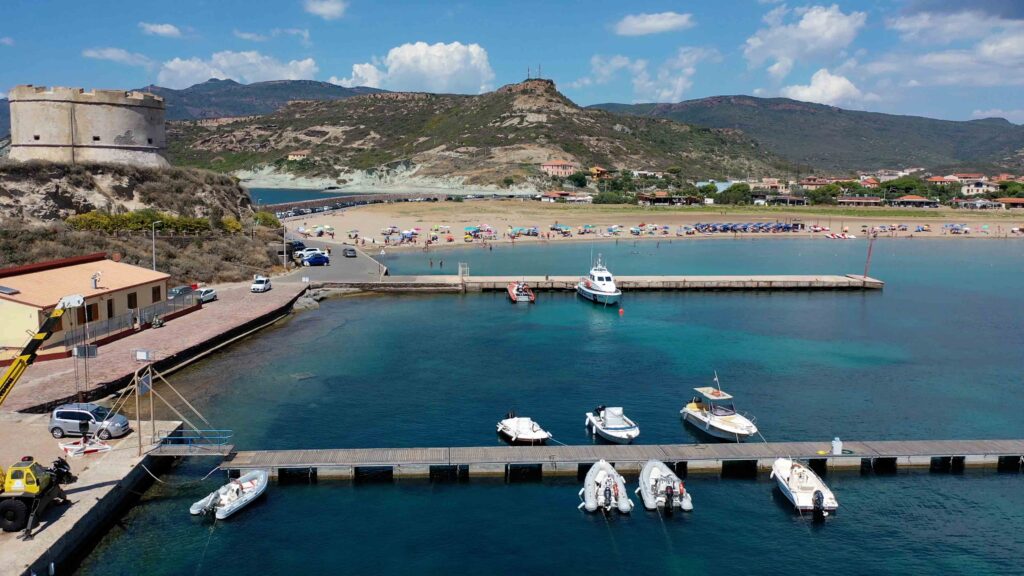
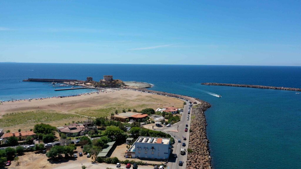
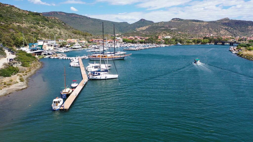
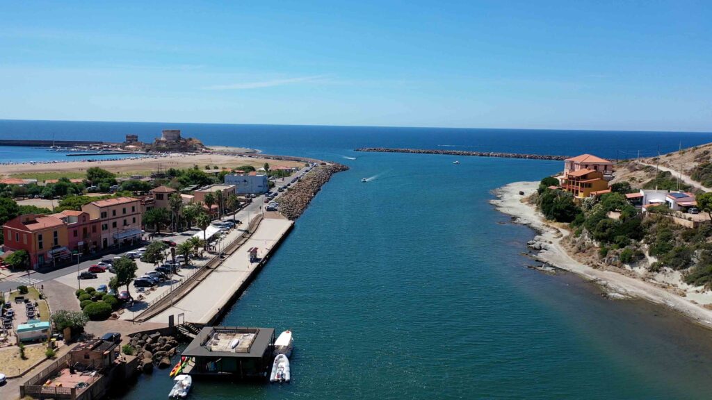
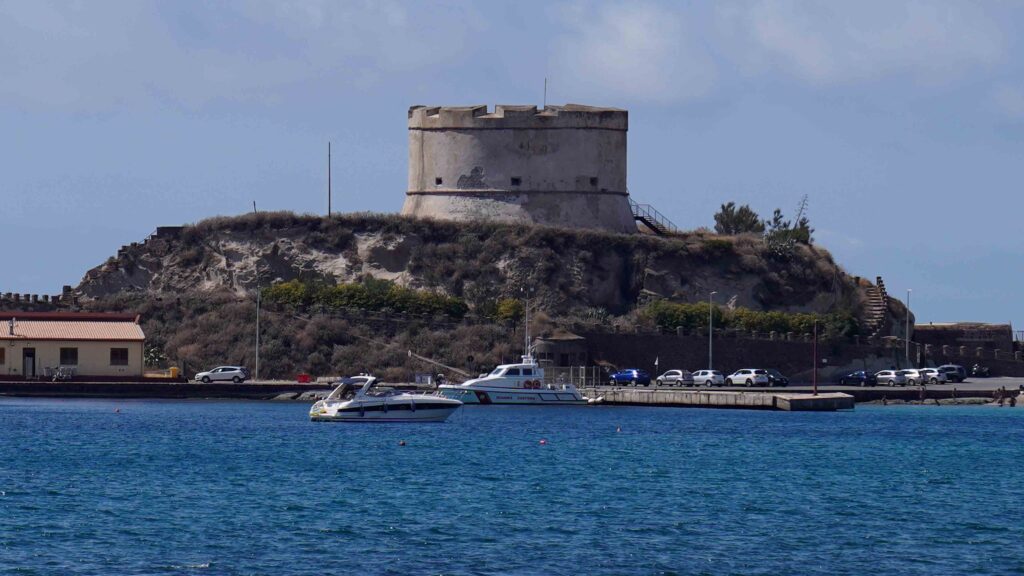
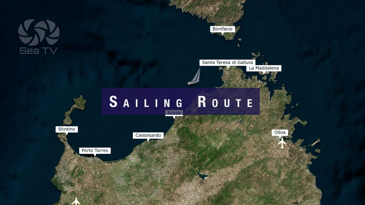
Approach from the NW. Two breakwaters mark the entrance: one south of Isola Rossa and another at the entrance to the Fiume Temo. The main landmark on approach is Torre di Bosa — a three-storey lighthouse. Use it to guide your final approach.
⚠ Navigation note: Do not confuse the lighthouse at Torre di Bosa with the Torre Argentina, located further south along the coast. The coast south of Bosa has several towers — identify the three-storey structure specifically.
River Entry — Fiume Temo
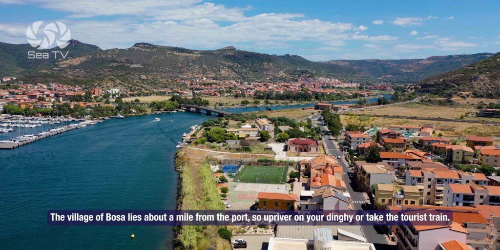
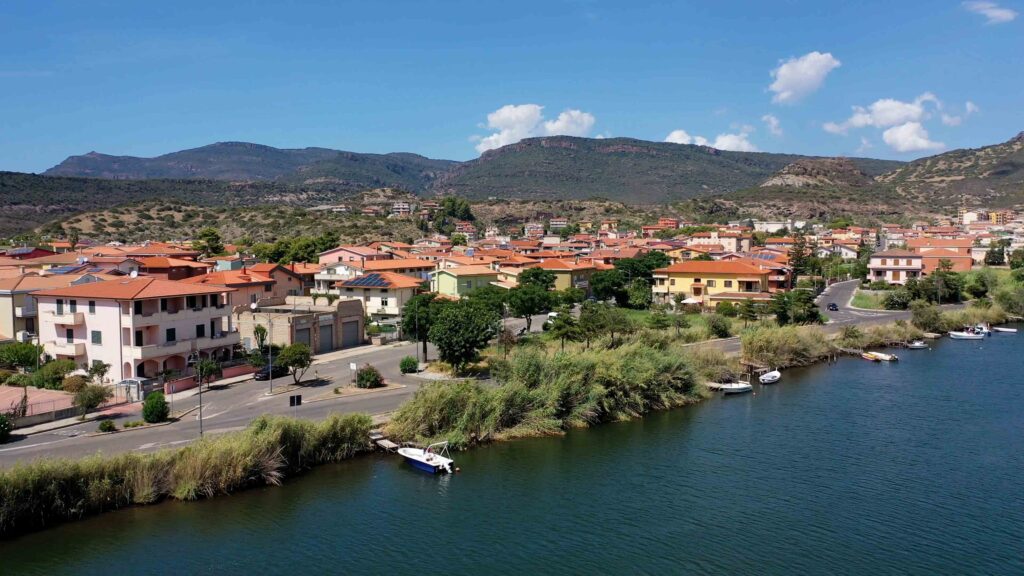
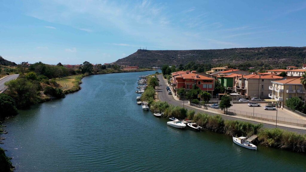
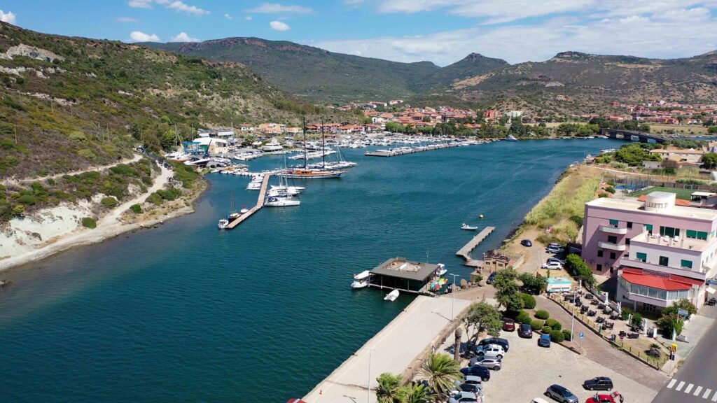
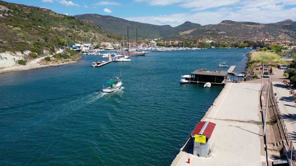
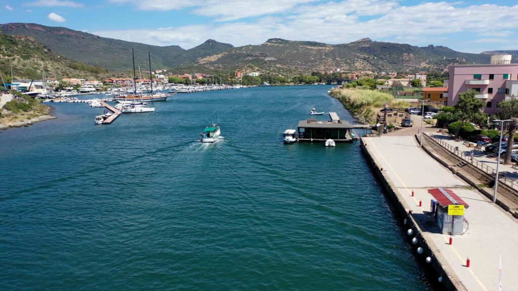
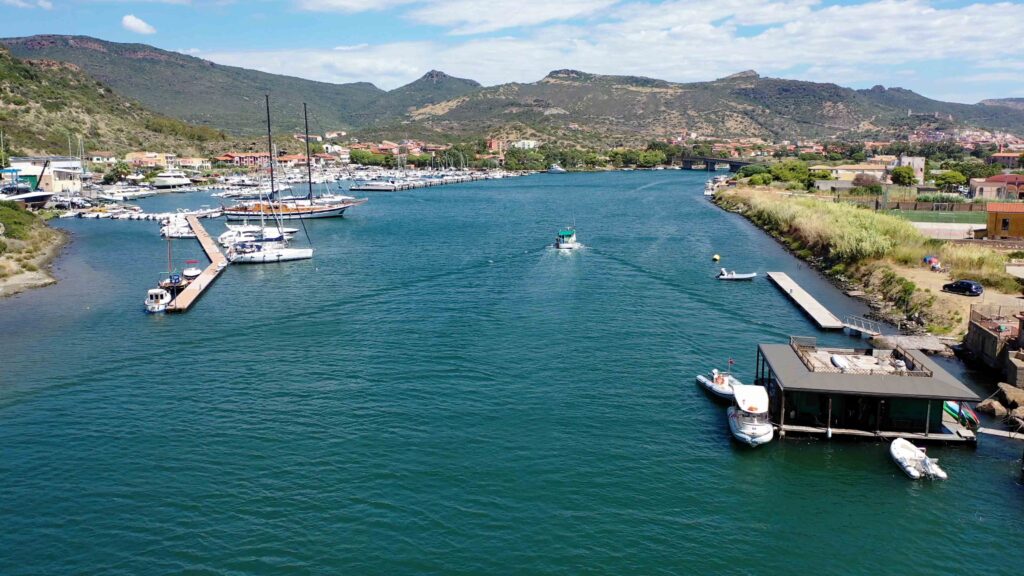
If you want to moor up the river (closer to the town), the Temo is navigable for vessels up to 4.5m draft and 45m LOA. The approach through the river mouth requires attention — depths are adequate but the channel is defined. The berths are approximately 1 mile upstream from the sea, putting you within easy dinghy or tourist train distance of the town centre. 4 free 24h berths are available at Bosa Marina on the river — first come, first served.
Wind & Weather
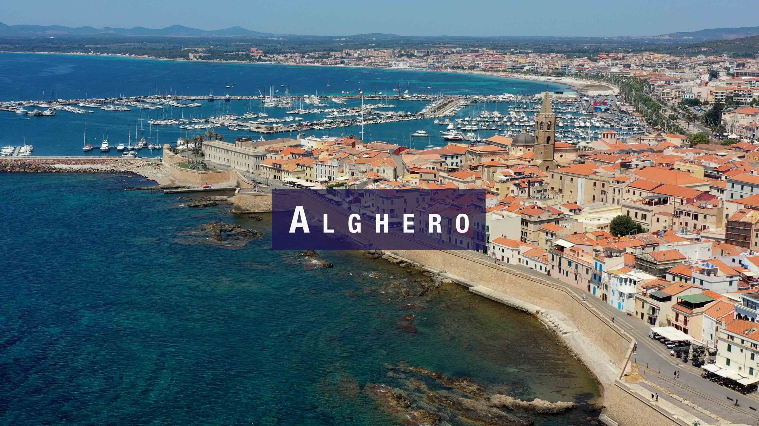
The west coast of Sardinia is exposed to the Maestrale (NW). In strong Maestrale conditions, the bay and approach can be uncomfortable. The river berths offer better protection once inside. The coastline between Bosa and Alghero (45 km north) is among the most dramatic on the island — steep cliffs and no shelter — so plan this passage carefully in unsettled weather.
Facilities & Services
- Water & electricity: ✓ quayside
- Fuel: ✓ quayside
- Showers & toilets: ✓
- Boat rental services: available at the marina
- Tourist train: connects Bosa Marina to town centre
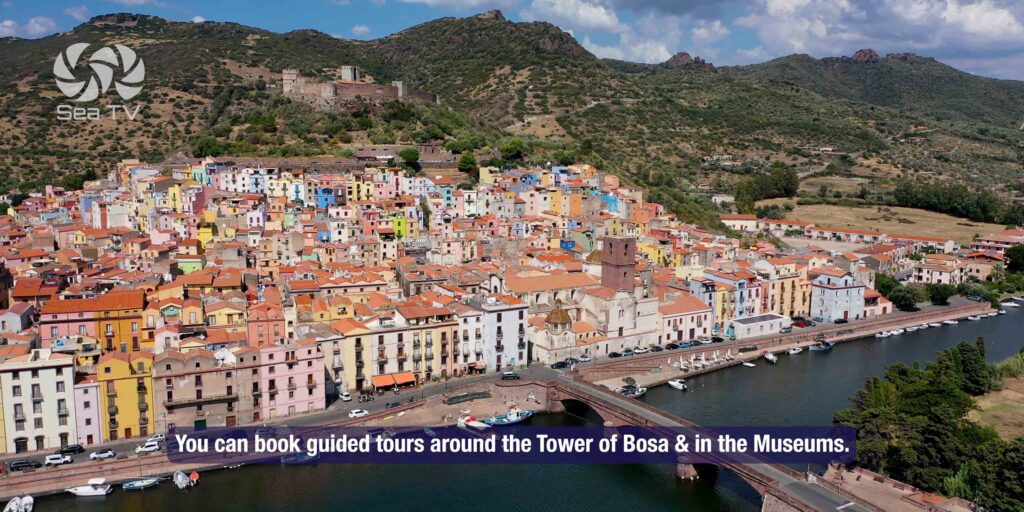
- Guided tours (Tower & Museum): tacsvt.it
Getting to Town
| Dinghy up the Temo | The most enjoyable option — motor or row upstream about 1 mile to Ponte Vecchio. You arrive directly in the historic centre. |
| Tourist train | Runs between Bosa Marina and the town centre. Seasonal — check times locally. |
| On foot / taxi | ~1 mile along the riverbank path. Flat and easy. Taxi available from the marina. |
️ What to See & Do
Castello Malaspina
Built in 1112 by the Malaspina family from Tuscany, the castle sits on Serravalle hill above the town. The climb takes about 20 minutes from the town centre. Inside the walls: the 14th-century chapel of Nostra Signora di Regnos Altos, with Tuscan frescoes considered among the finest medieval paintings in Sardinia. The views from the top — river, sea, and the coloured houses below — are the best in the area. Small entry fee. Call +39 340 395 5048 to verify opening times.
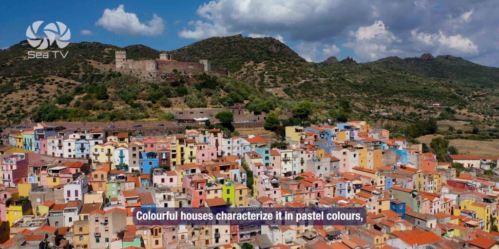
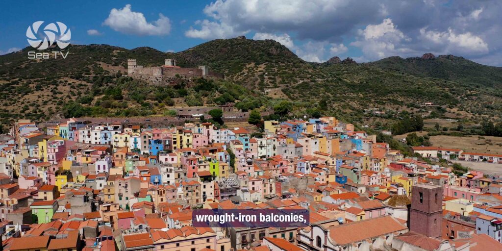
Sa Costa — The Historic Quarter
The medieval quarter that wraps around the castle hill. Narrow cobblestone streets, pastel-coloured houses, and almost no tourist shops — this is a lived-in working town. Walk up through Sa Costa toward the castle rather than taking the direct route for the better experience of the streets.
Sas Conzas — The Old Tanneries
A row of identical 19th-century buildings along the south bank of the Temo — the former leather tanneries that made Bosa prosperous under the Savoys. No longer in operation, but well-preserved and visible from the river. The Museo delle Conce inside tells the full history of the craft.
Church of San Pietro Extra Muros
A 12th-century Romanesque church 2 km upstream from Ponte Vecchio, accessible by walking along the river. One of Sardinia’s oldest Christian sites — clean carved stone, no crowds. Worth the walk.
Temo River Boat Tours
Boat tours depart from Ponte Vecchio (the old bridge) in the town centre and head downstream to the sea, or upstream for nature tours. The AperiTemo combines a river cruise with local wine and Sardinian cheese and meats — a good way to see the tanneries and San Pietro church from the water. Book via Locanda di Corte hotel or online.
Coastal Boat Tours to Capo Marrargiu
Day tours depart from Bosa Marina north along the coast to Capo Marrargiu — dramatic cliffs, small coves, and a sea cave. Swimming stops at Porto Managu and Cumpultittu. The Capo Marrargiu headland is also a protected natural reserve with one of Sardinia’s last griffon vulture colonies.
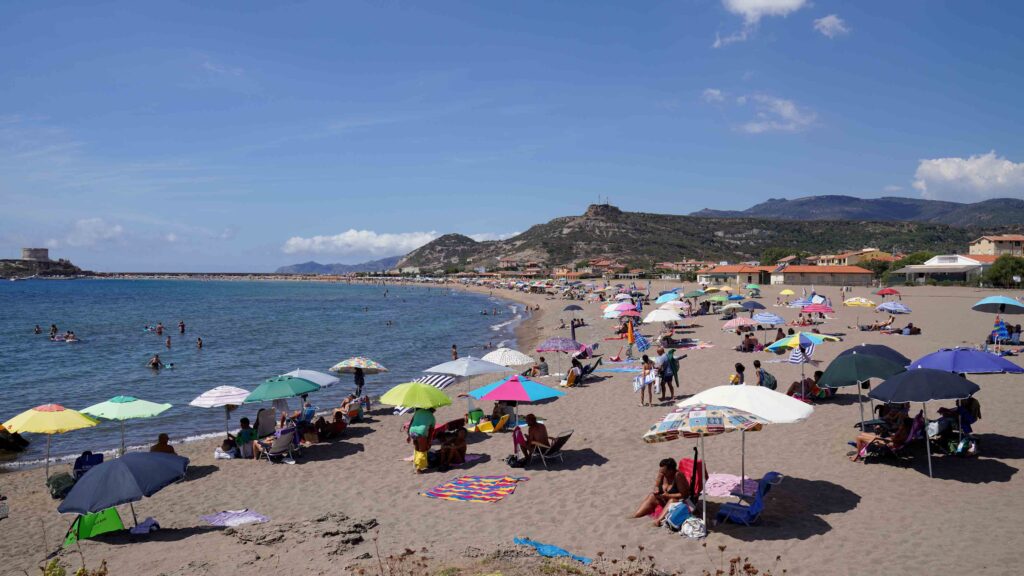
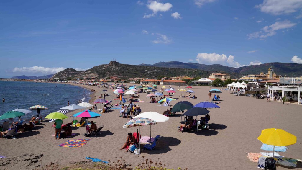
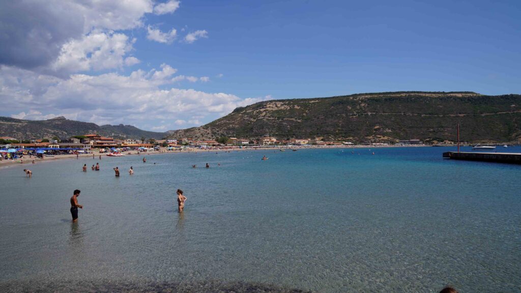
️ Beaches Near Bosa
| Beach | Distance | Notes |
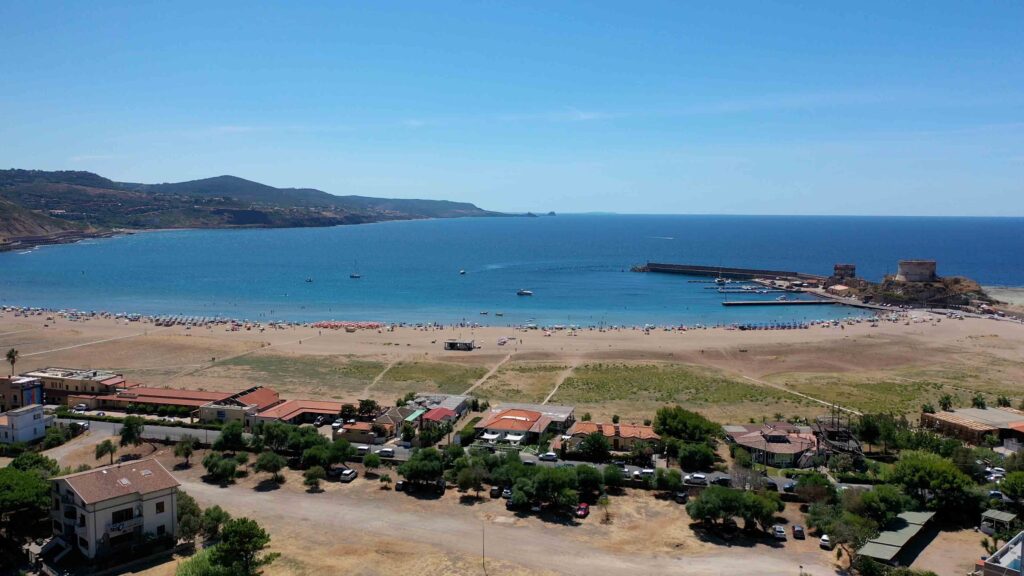
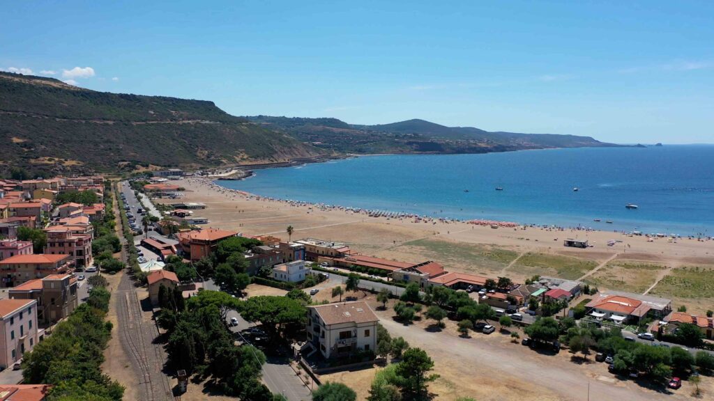
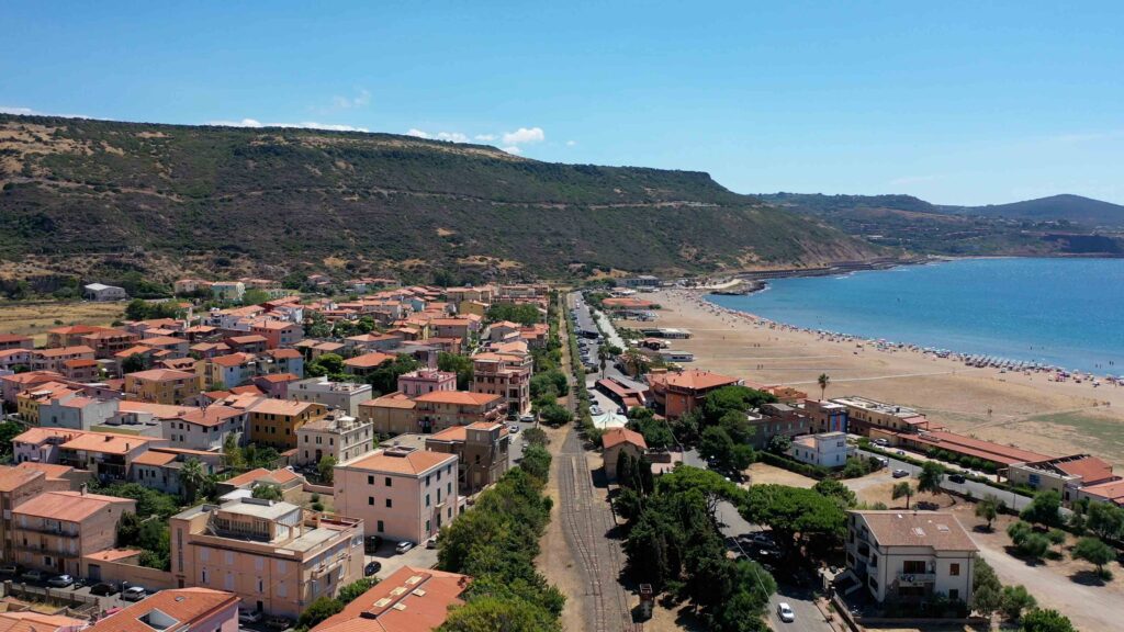
| Bosa Marina | Marina side | Long sandy beach. Shallow entry, family-friendly. Bars and restaurants along the shore. |
| Cumpultittu | 3 nm S | Small cove with white sand and clear water. Accessible by boat — one of the finest on the west coast. Limited space. |
| S’Abba Druche | 1 nm S | 180m beach. Good for kayaking. Gets crowded in season. |
| Porto Managu | 5 nm N | Accessible by boat or coastal tour. Swim stop on the Capo Marrargiu boat tours. |
️ Where to Eat
Ristorante Al Gabbiano
Waterfront at Bosa Marina. Fresh fish and sunset dinners. €€
Sa Pischedda / Ristorante Sa Nassa
Town centre. Traditional Sardinian seafood, local Malvasia wine list. €€
Trattoria Da Giancarlo e Rita
Rustic, local favourite. Homemade pasta and Sardinian specialties. € | Town centre.
Don’t Leave Without Trying: Malvasia di Bosa
Malvasia di Bosa is a DOC dessert wine produced only in the Planargia area around Bosa. Amber-coloured, slightly oxidised, with almond and dried fruit notes — it has almost no equivalent elsewhere in Sardinia. Ask at any bar in town, or arrange a vineyard visit through your accommodation. The Strada della Malvasia connects the local producing villages.
✅ Sailor’s Safety Checklist
- Check Maestrale forecast before departure — the coast north to Alghero has no shelter for 45 km
- River berths: call ahead or VHF Ch. 16 to confirm availability
- Temo depth: max 4.5m draft for river entry — verify current conditions locally
- Fuel available at the marina quay before a long coastal passage
Nearby Destinations
| Destination | Distance | Notes |
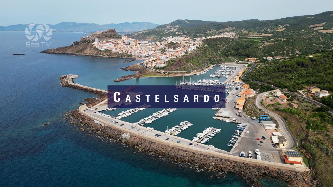
| Alghero | 25 nm N | Catalan-influenced walled town. Exposed coastal passage — check forecast. |
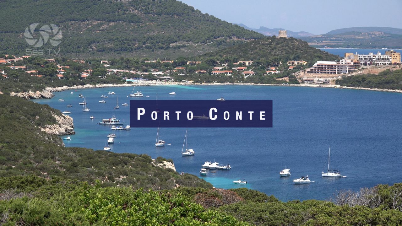
| Porto Conte | 28 nm N | Sheltered natural bay near Alghero. Excellent anchorage. |
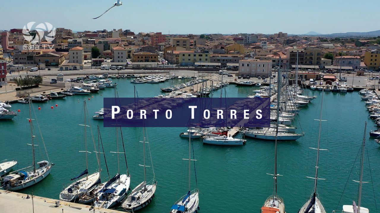
| Porto Torres | 55 nm N | Main commercial port. Ferry connections to mainland Italy. |
| Isola Rossa | 40 nm N | Small anchorage on the NW coast. |