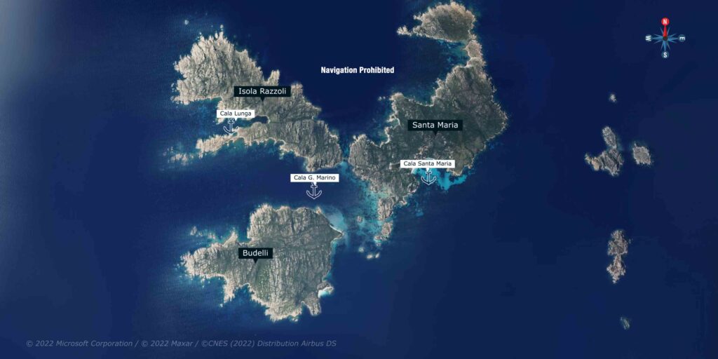
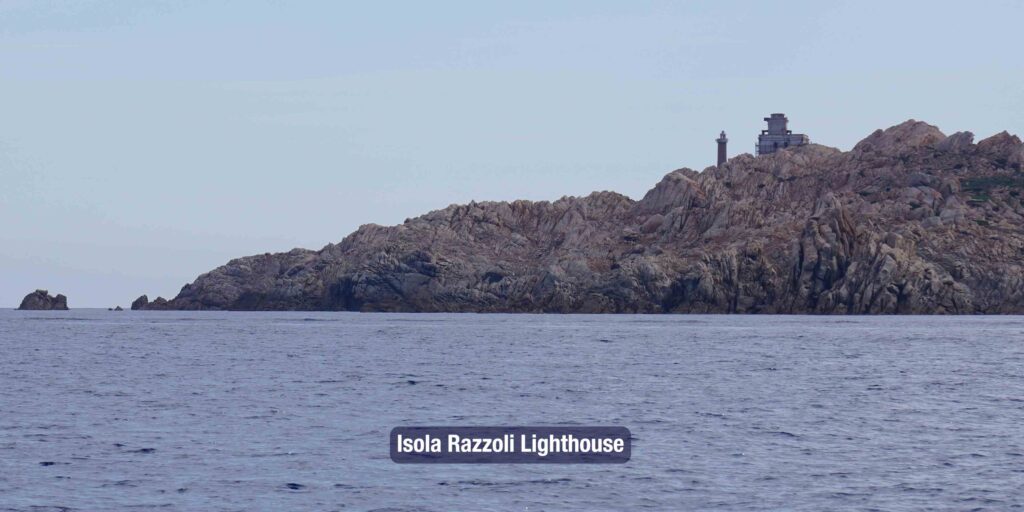
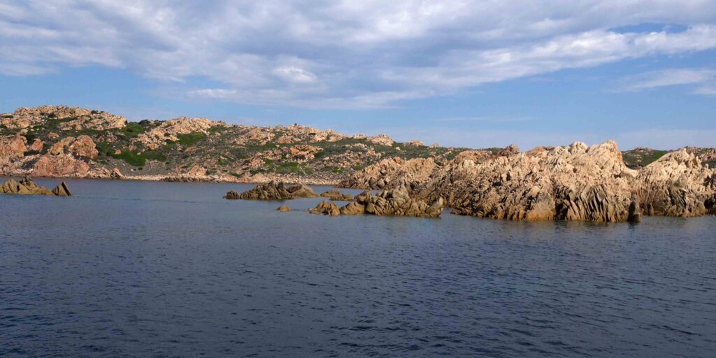
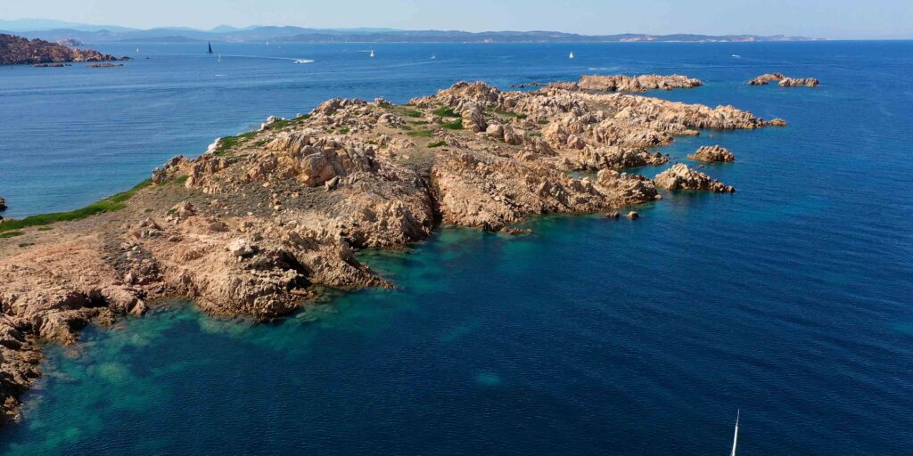
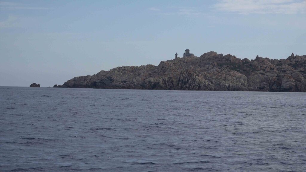
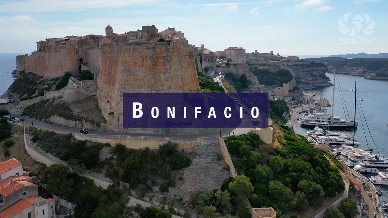
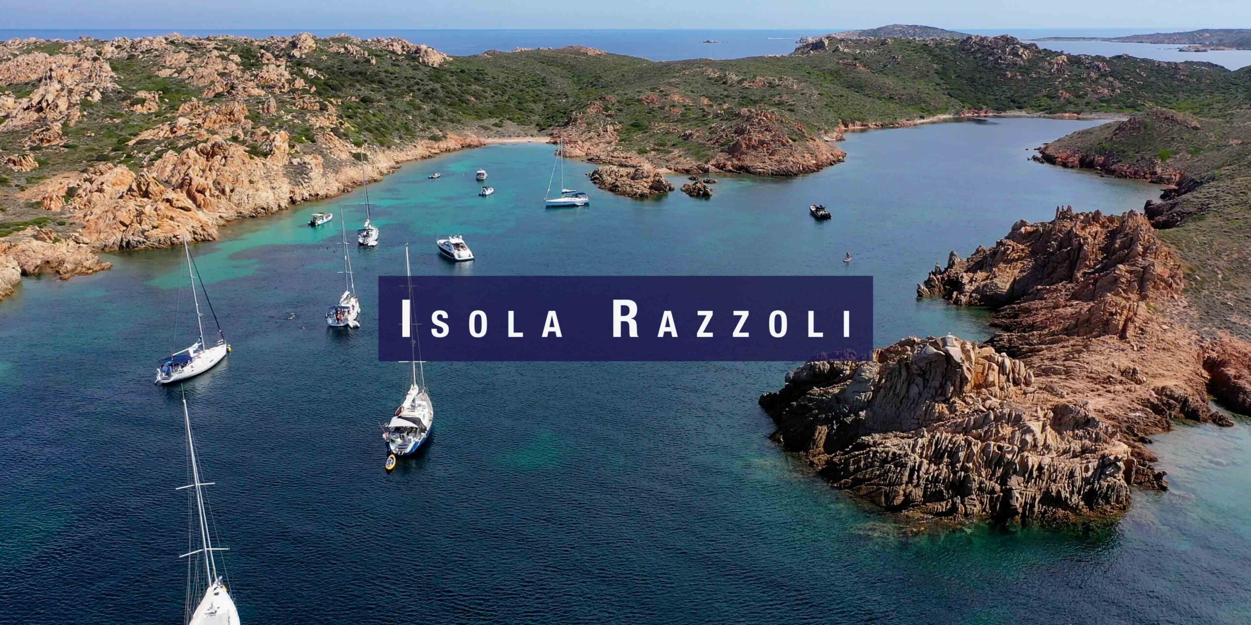
Isola Razzoli is the northernmost island of the La Maddalena Archipelago — 1.5 km², with a summit of 60 metres, lying close to the Bocche di Bonifacio and the border between Italian and French territorial waters. It is uninhabited except for its lighthouse (built 1874, still active). A natural paradise of wild granite coastline, a few accessible coves, and the remarkable anchorage of Cala Lunga on the western side. It is the ideal starting point for a circuit of the northern islands — Budelli and Santa Maria are within easy reach.
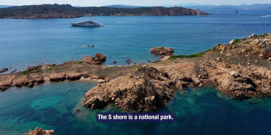
⚠ National Park Permit Required: Razzoli is part of the La Maddalena Archipelago National Park. All vessels must obtain a permit before entering park waters: autorizzazioni.lamaddalenapark.it. The southern shores of Razzoli are a national park zone — access only with an authorised guide. Night anchoring on park buoys only (21:00–08:00).
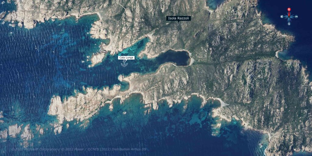
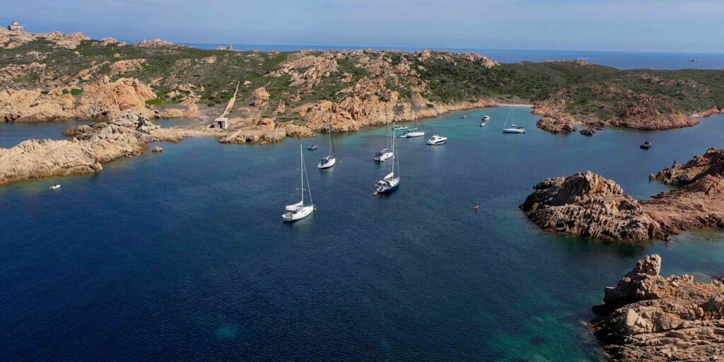
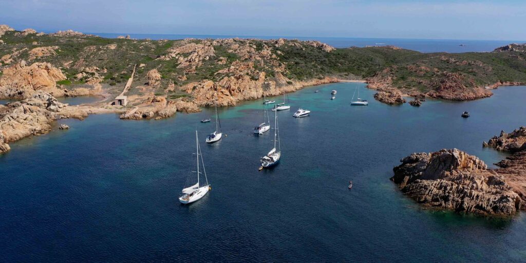
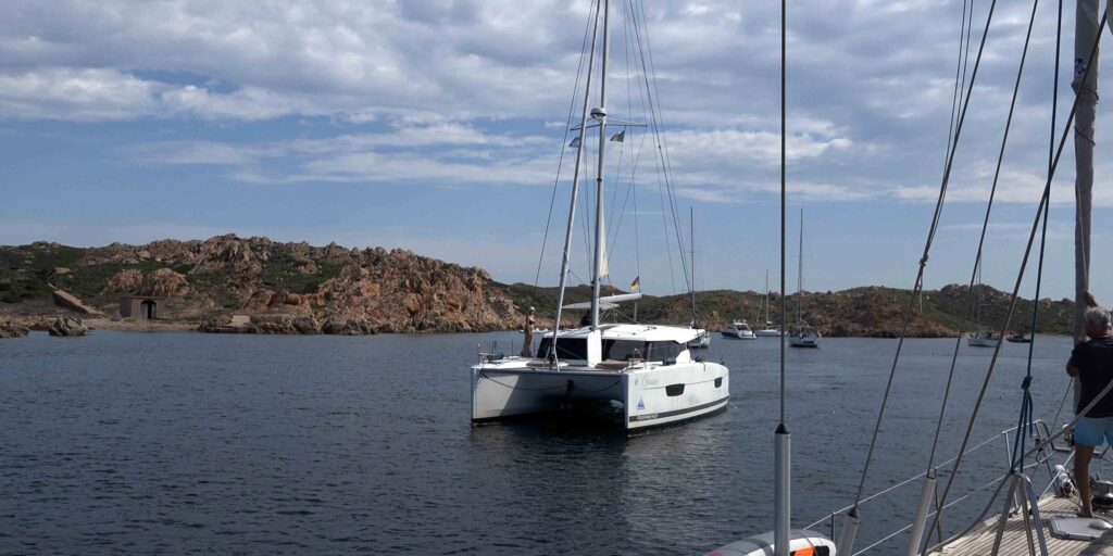
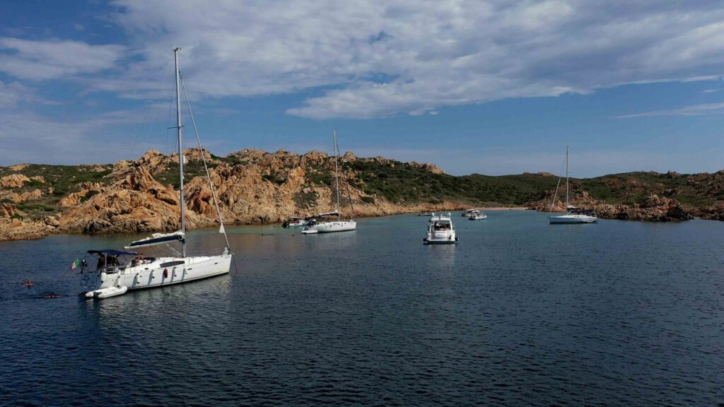
⚓ Cala Lunga — Main Anchorage
| Coordinates | 41°17.93’N / 9°20.60’E |
| Location | Western side of Isola Razzoli |
| Depth | 5–7m, sand with some rocks |
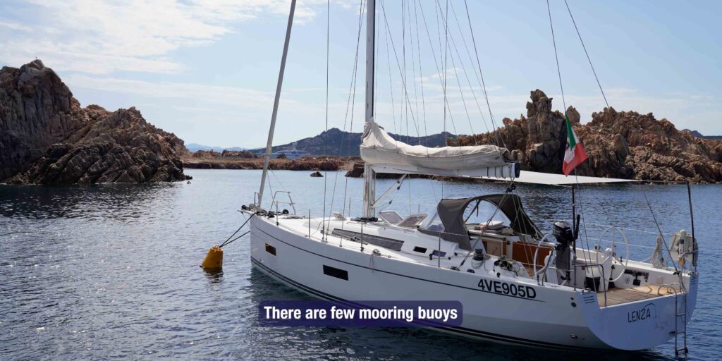
| Mooring buoys | Available — recommended (seabed mixed sand/seagrass) |
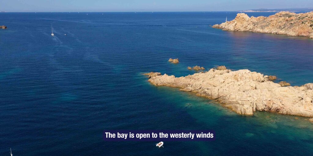
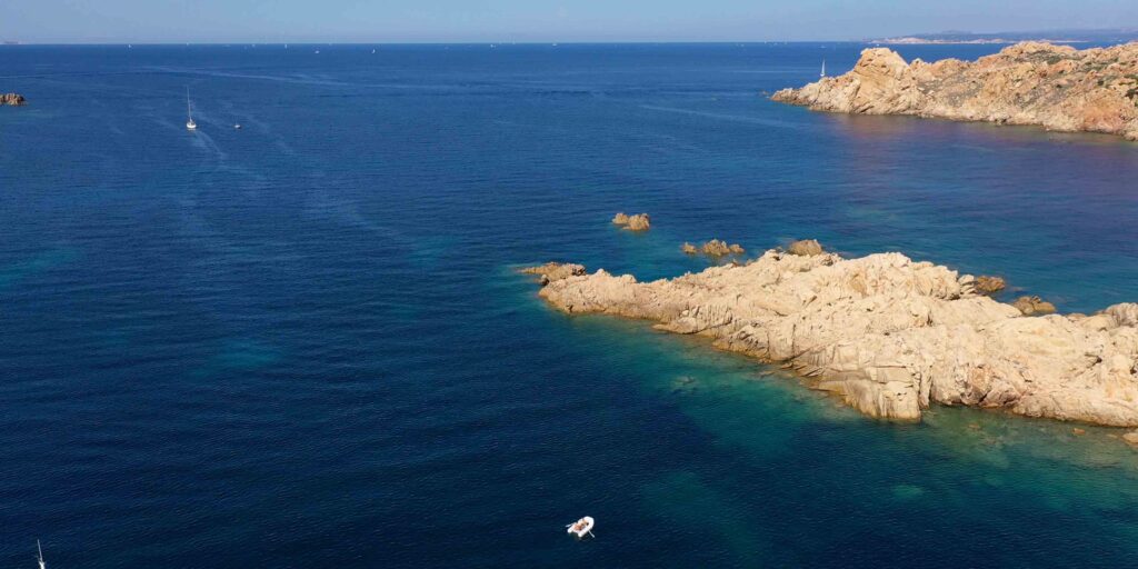
| Shelter | Protected from N and SW. Open to W winds. |
| Overnight | Good in calm weather — one of the more sheltered options in the northern islands |
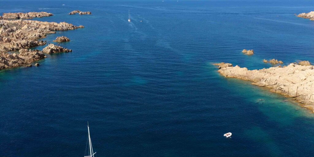
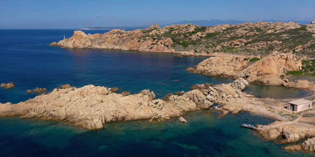
Cala Lunga is the best anchorage on Razzoli and one of the finest in the northern archipelago — translucent water, pink granite walls, complete peace when the wind allows. It is well-protected from N and SW by the island’s western cliffs, though open to W. In strong westerlies, move south to Cala Santa Maria on Santa Maria island.
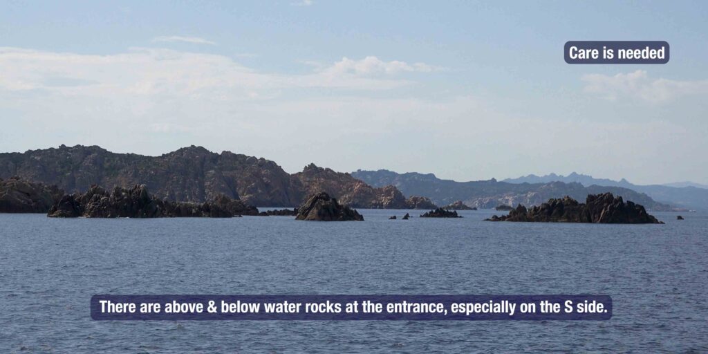
⚠ Rocks at the entrance: Care needed on approach to Cala Lunga — rocks both above and below water, especially on the southern side of the entrance. Enter slowly with crew on bow watching the water. Proceed through the centre of the bay mouth. Use mooring buoys rather than anchoring if possible, as the seabed is a mix of sand and seagrass.
️ Ashore on Razzoli
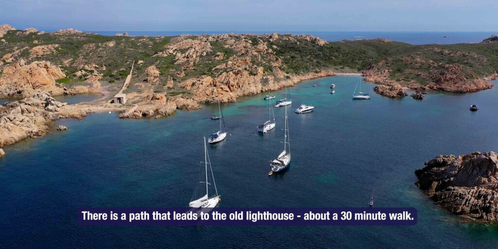
The Lighthouse Path
A path from Cala Lunga leads to the old lighthouse — the same lighthouse active since 1874 that guides entry to the Bocche di Bonifacio from the east. The walk gives views north toward Corsica and south over the other northern islands of the archipelago. Allow 45 minutes for the round trip.
Southern Shores — Park Zone
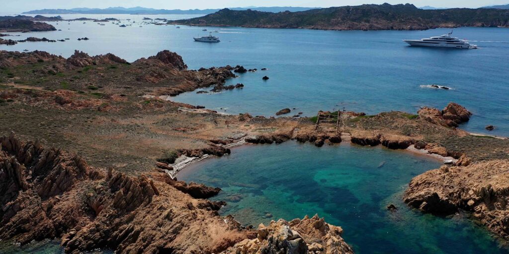
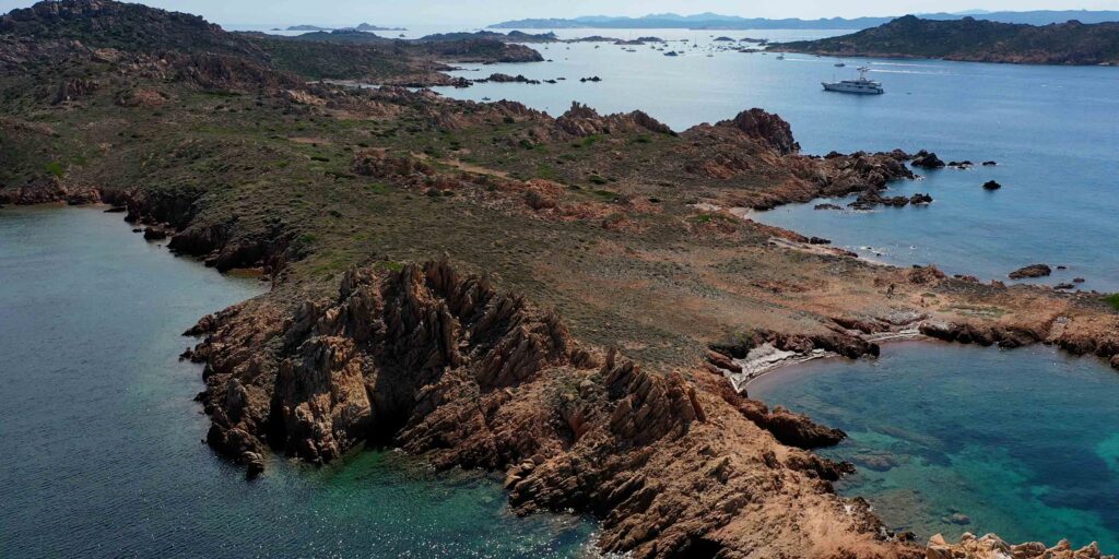
The southern shores of Razzoli are designated national park protection zone. Landing is permitted only with an authorised park guide. The seas around these shores have some of the finest snorkelling in the archipelago — red grouper, sea bream, posidonia beds. Diving is also excellent in the waters between Razzoli and Santa Maria.
Passo degli Asinelli
The narrow channel between Razzoli and Santa Maria — sometimes called Passo degli Asinelli. Very shallow in places. Navigate with extreme care and local knowledge or avoid entirely. The passage is used by inflatable dinghies in calm conditions — not recommended for keelboats without prior local knowledge.
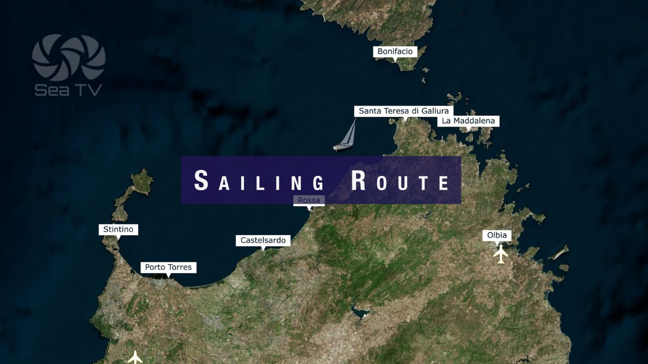
️ Northern Islands Circuit
Razzoli makes a natural starting or ending point for a circuit of the northern islands. From Cala Lunga:
| Next stop | Distance | Notes |
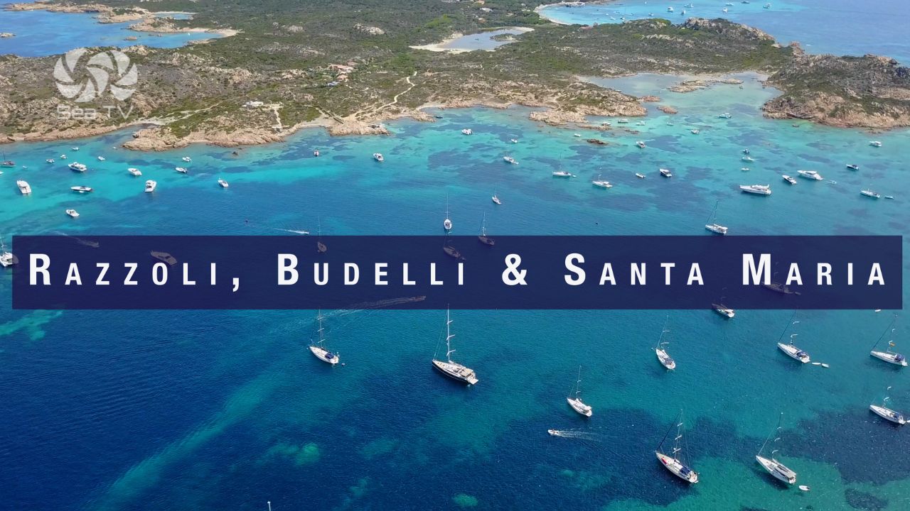
| Cala Santa Maria | 0.8 nm SE | Good anchorage on E side of Santa Maria. Sand, 5–6m. Busy in season. |
| Spiaggia del Cavaliere | 1.5 nm S | Between Budelli and Santa Maria. “The swimming pool.” Anchoring in delimited zone only. The finest waters in the archipelago. |
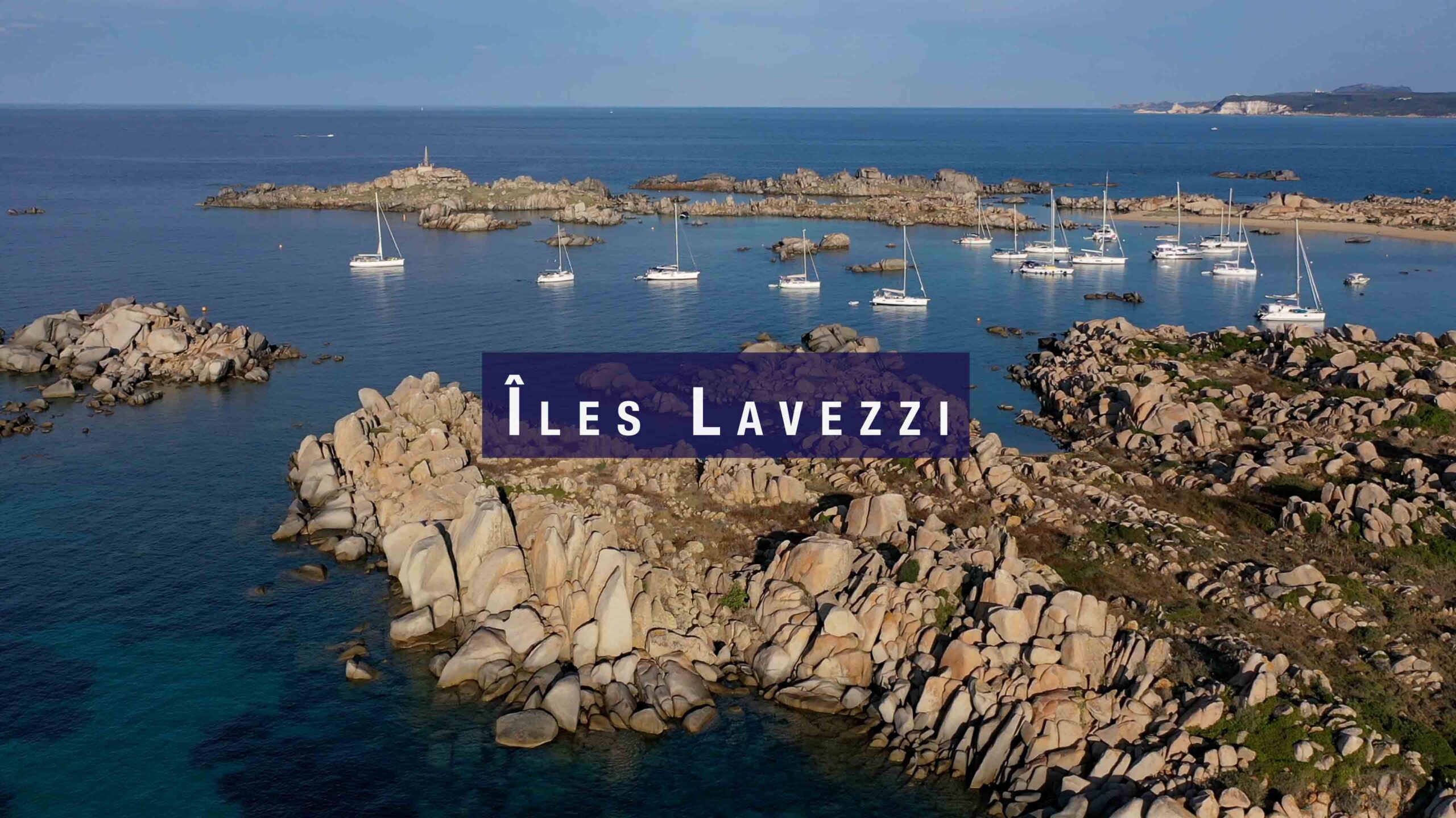
| Îles Lavezzi | 9 nm W | Réserve Naturelle (France). Cala di U Grecu anchorage. Daylight only. |
| Cala Gavetta, La Maddalena | 10 nm S | Full marina. Fuel, provisioning, chandlery. |
✅ Safety Checklist
- Park permit obtained before entering — lamaddalenapark.it
- Cala Lunga entrance — slow approach, rocks on S side, crew on bow
- Mooring buoys preferred over free anchoring — seabed mixed
- Night anchoring only on park buoys (21:00–08:00)
- Southern shores — landing with authorised guide only
- Bocche di Bonifacio: NW wind strengthens rapidly — escape south to Cala Gavetta if weather deteriorates
- Passo degli Asinelli (Razzoli–Santa Maria) — avoid in keelboats