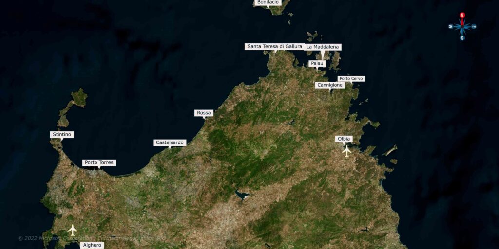
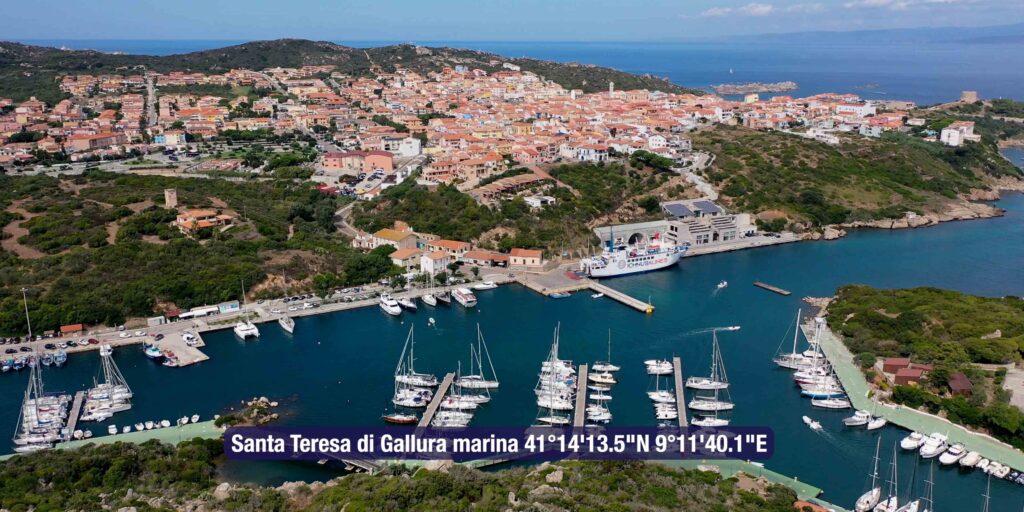
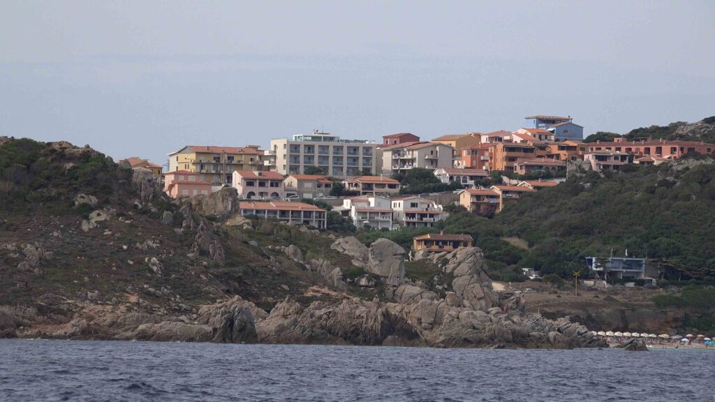
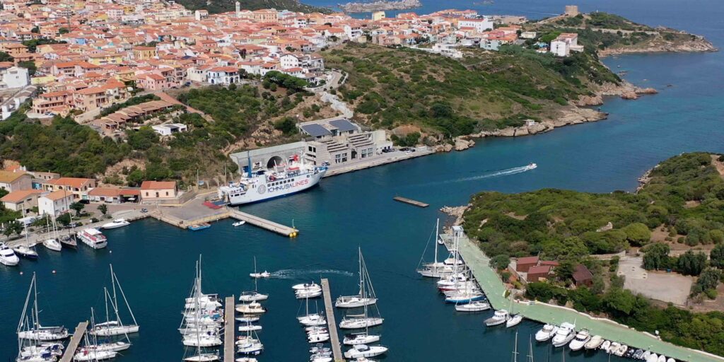
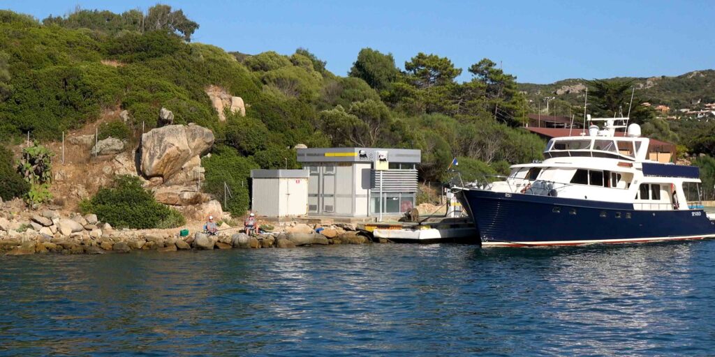
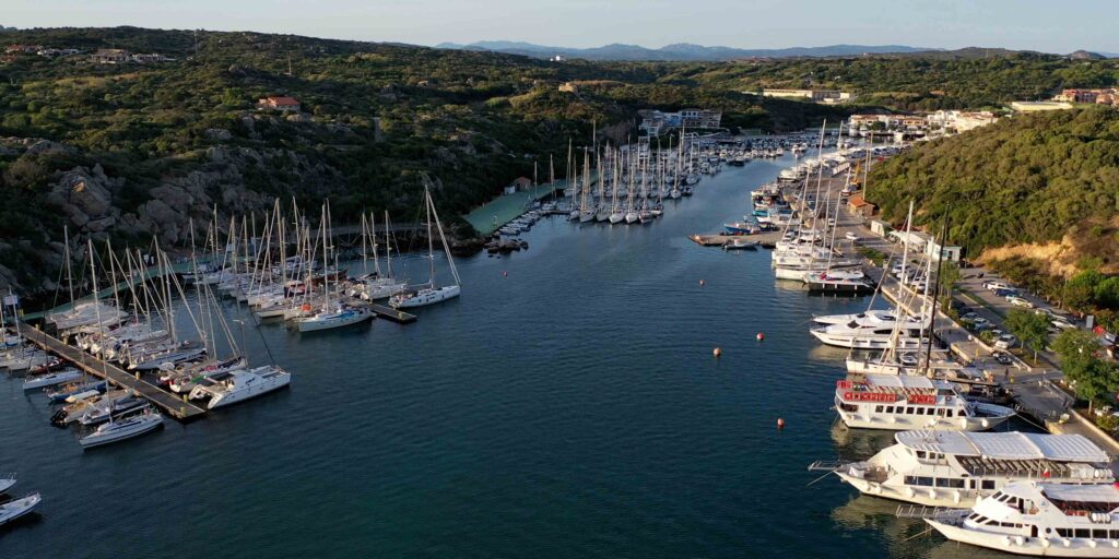
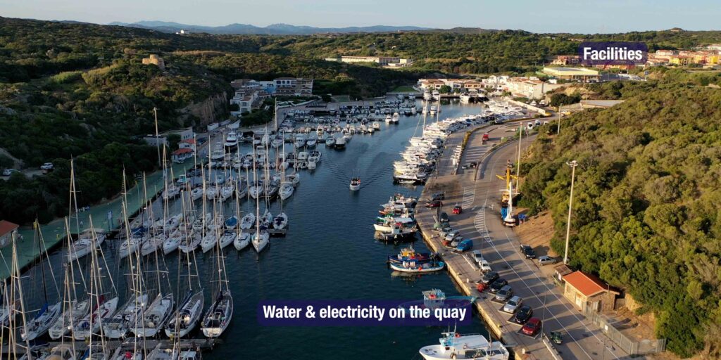
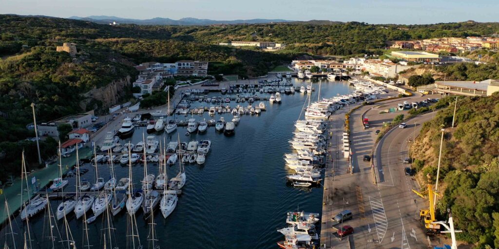
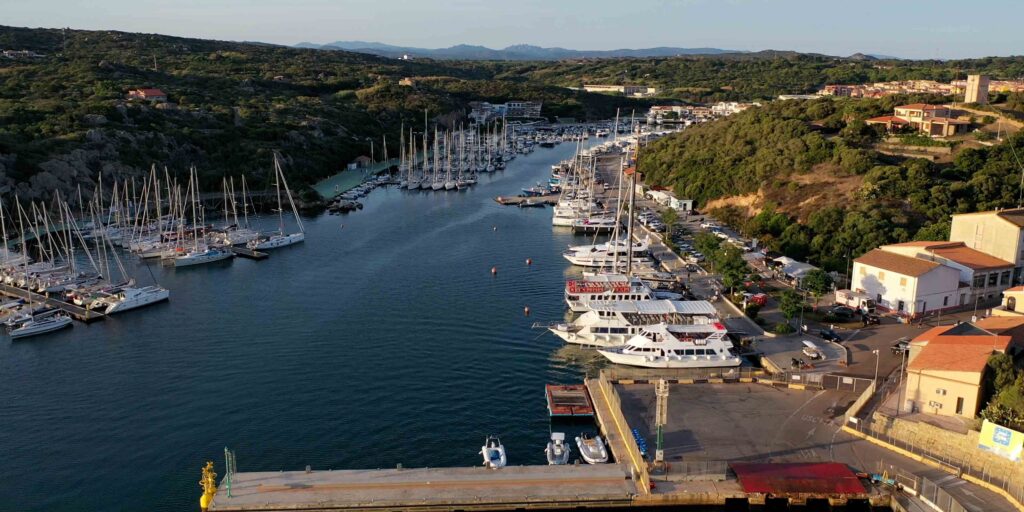
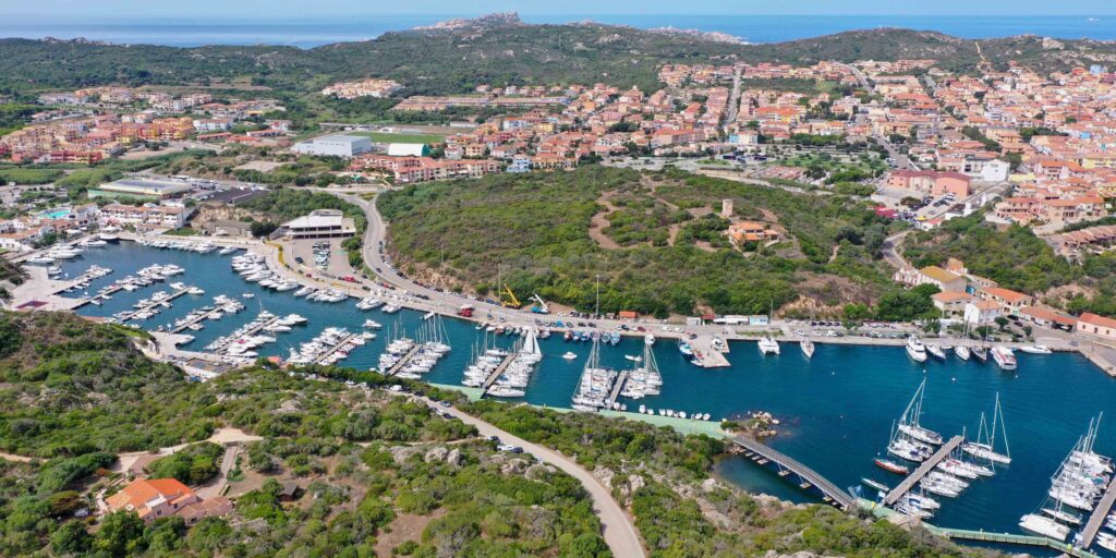
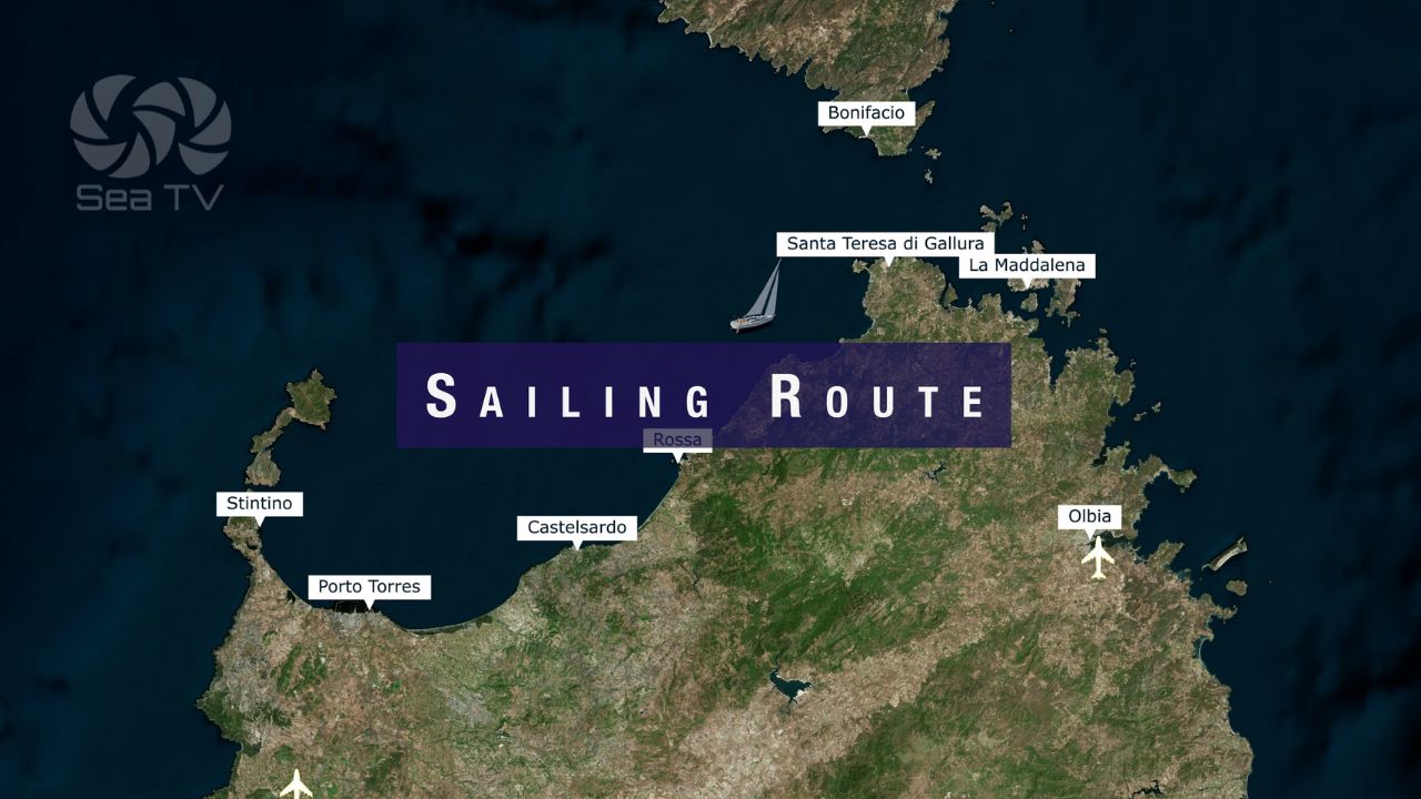
Santa Teresa di Gallura Marina sits at the northernmost tip of Sardinia, 11 nautical miles from the southern coast of Corsica. The port occupies a long, narrow bay flanked by granite headlands and serves as the primary departure point for Corsica, the La Maddalena Archipelago, and the Bocche di Bonifacio strait. SeaTV stored yacht Rachel here for the winter — so this guide comes from direct, hands-on experience.
⚓ Quick Facts for Sailors
| Coordinates | 41°14’13.5″N / 9°11’40.1″E |
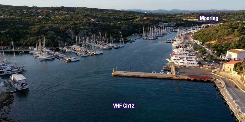
| VHF Channel | Ch. 12 (marina) | Ch. 16 (watch) |
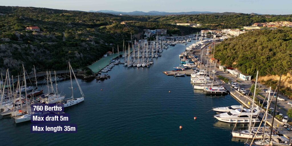
| Max Draft | 5 m |
| Max Length | 35 m |
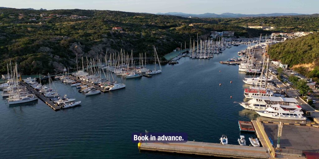
| Berths | ~700 (seasonal — reserve in June/July) |
| Water & Electricity | ✓ on the quay |
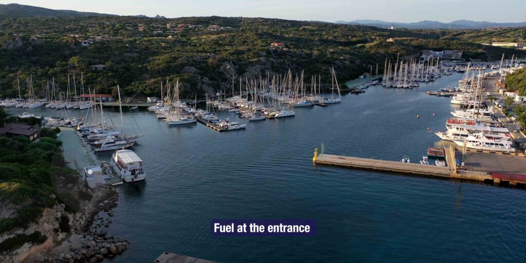
| Fuel | ✓ Fuel dock: 41.238295, 9.195787 |
| Showers & Toilets | ✓ marina facilities |
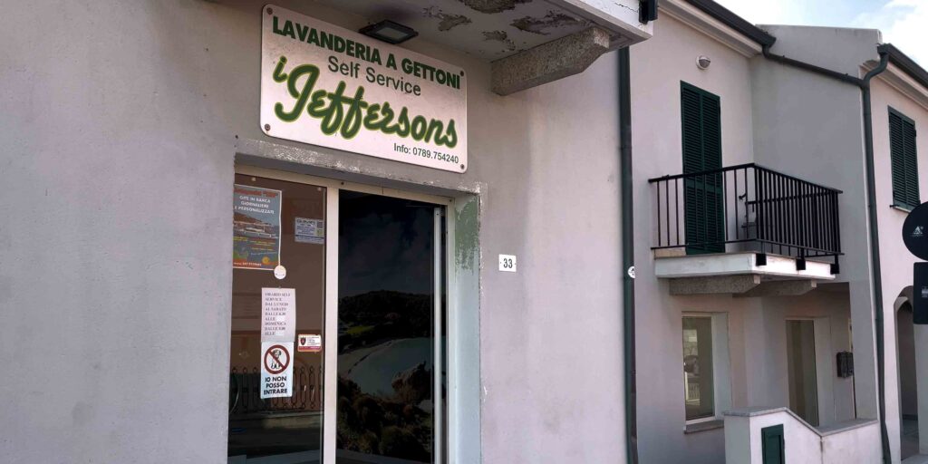
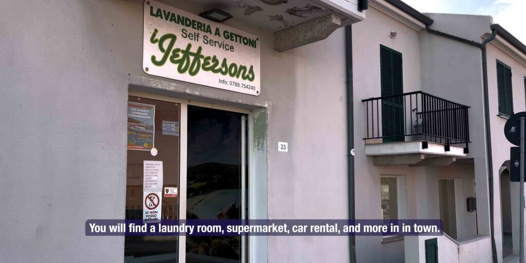
| Laundry | ✓ 5-minute walk from marina |
| Fee (approx.) | €25–55 / night (high season) [VERIFY] |
| Best Season | May – October |
| WhatsApp (marina) | +39 348 734 7267 |
Approach & Navigation
Entry Conditions
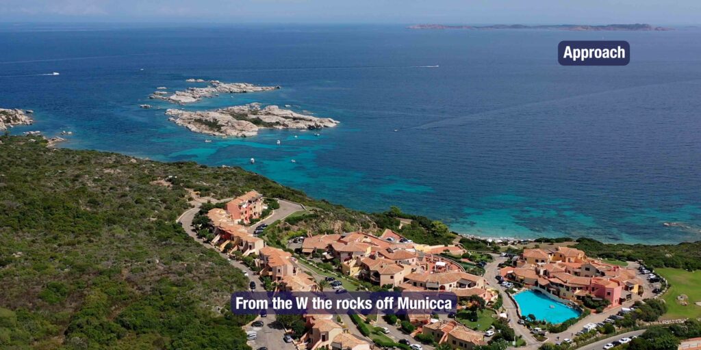
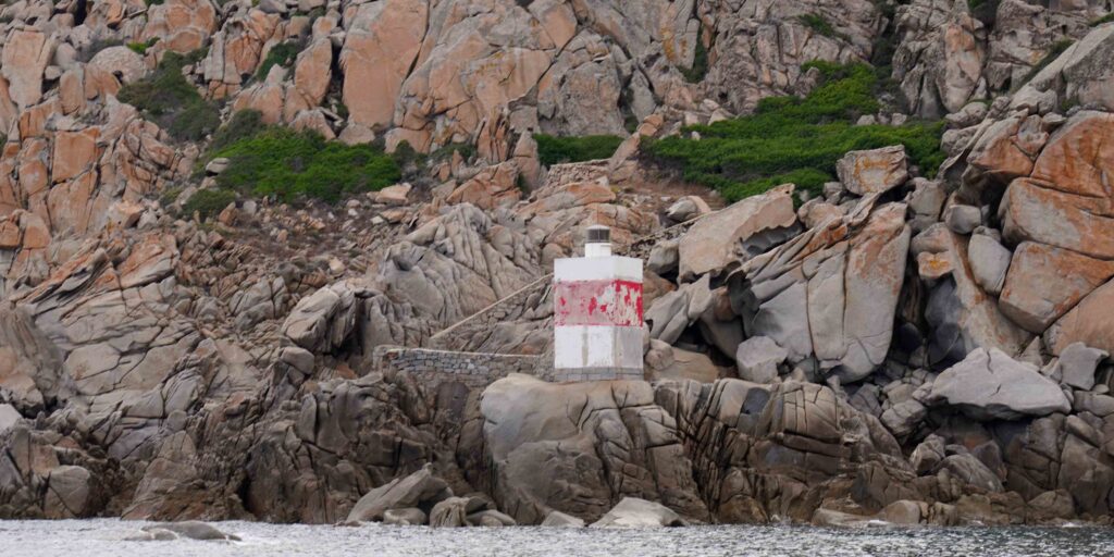
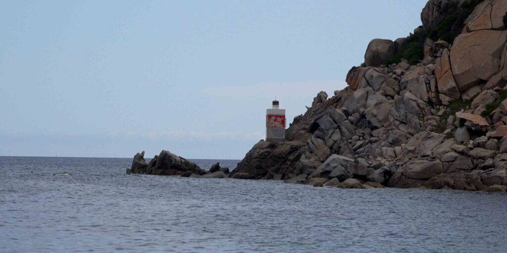
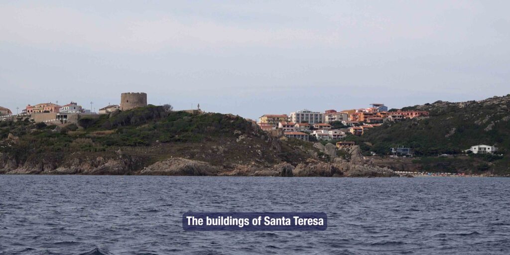
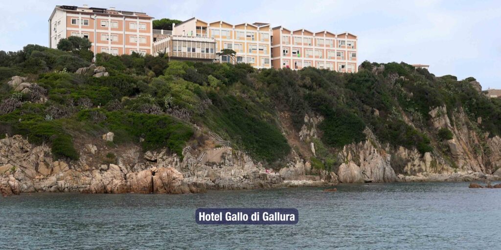
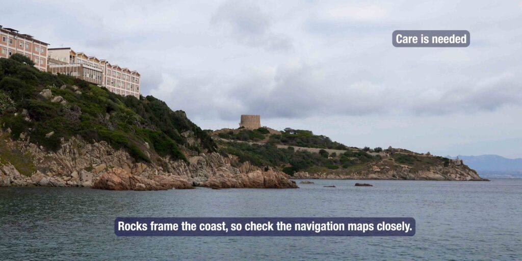
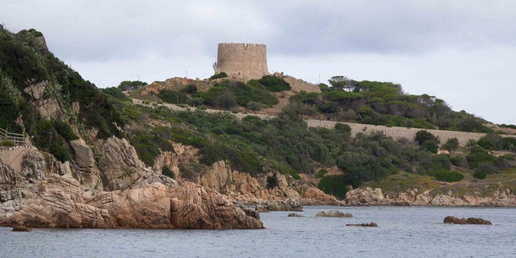
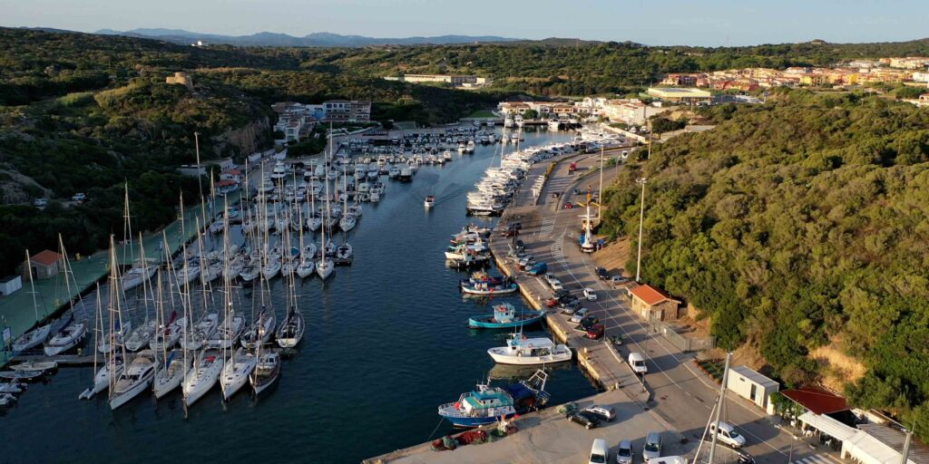
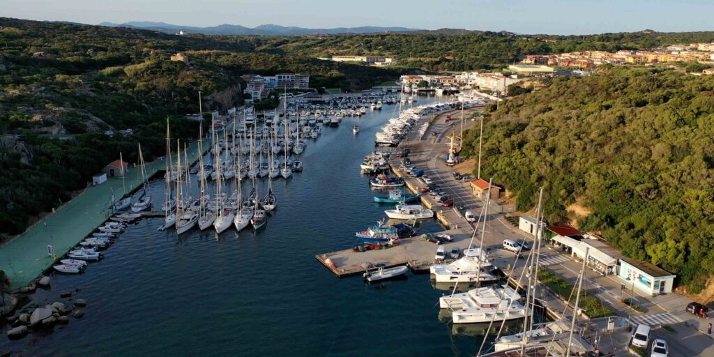
Approach from the west with caution — rocks extend off Punta Municca. The buildings of Santa Teresa di Gallura and the Hotel Gallo di Gallura are visible landmarks from offshore. The bay runs north-south; the marina entrance is on the western shore.
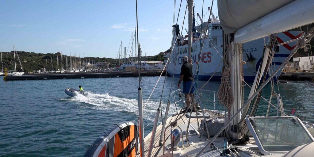
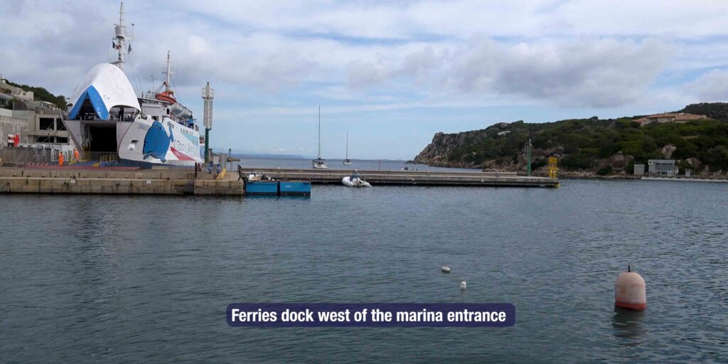
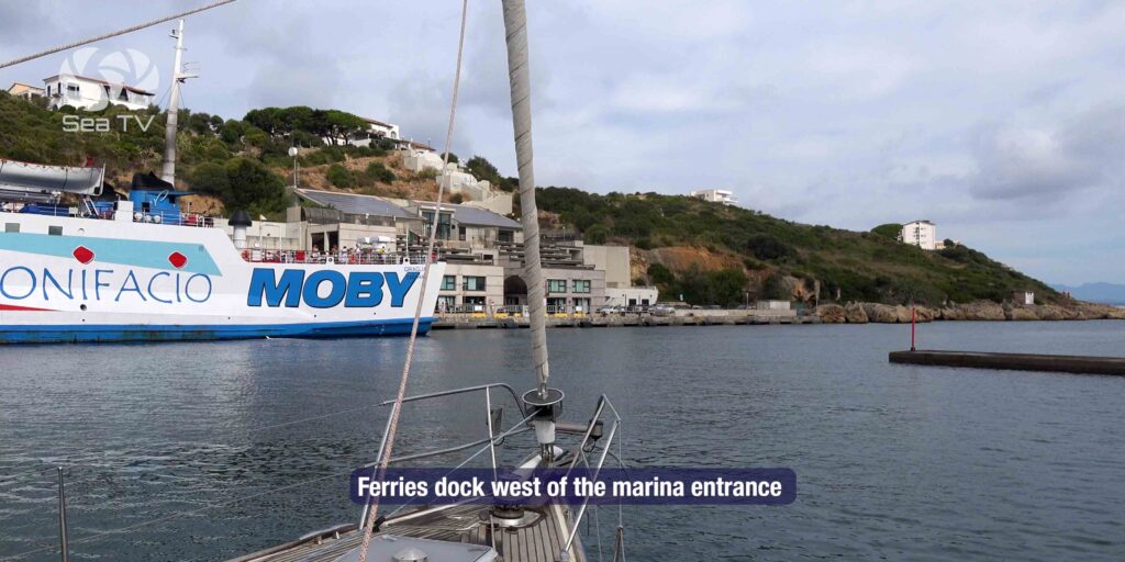
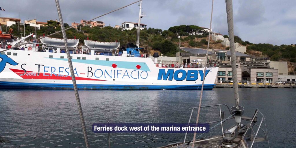
⚠ Warning: The ferry dock is located west of the marina entrance. Ferries to Bonifacio and La Maddalena have right of way — stay clear of their approach lanes. Ferry dock coordinates: 41.238528, 9.194363.
Wind & Weather
The Bocche di Bonifacio strait funnels strong NW winds (Maestrale) that can build quickly, especially from late afternoon. In settled weather the bay offers reasonable protection, but NE winds make the marina uncomfortable. Always check conditions before departing for Corsica — the strait can turn rough without much warning.
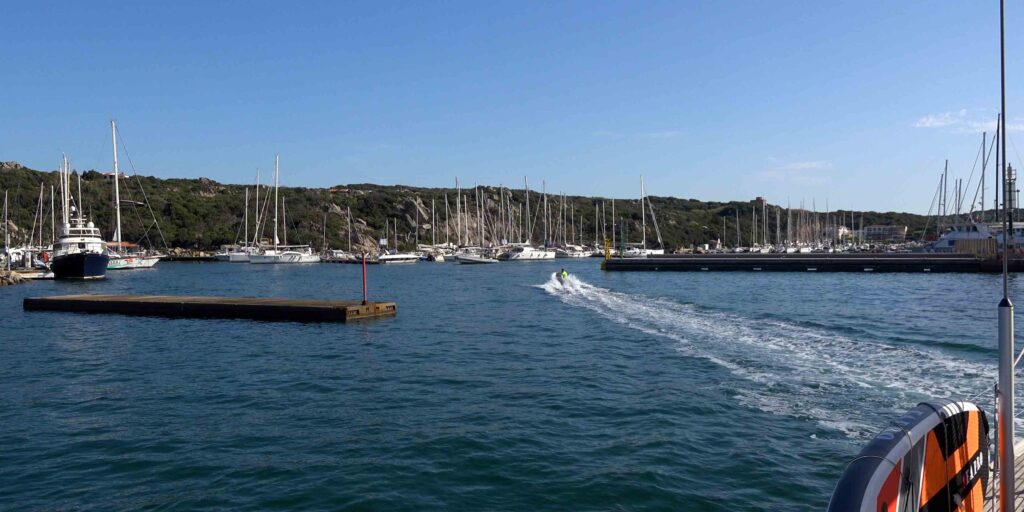
⚓ Mooring
Marina Berths
The marina crew will guide you to your berth on arrival and assist with lines. Stern-to mooring with laid lines is standard. Contact via VHF Ch. 12 before entering in high season. Book ahead for July–August.
Marina office coordinates: 41.234837, 9.194217
Recommended Anchorages (calm weather only)
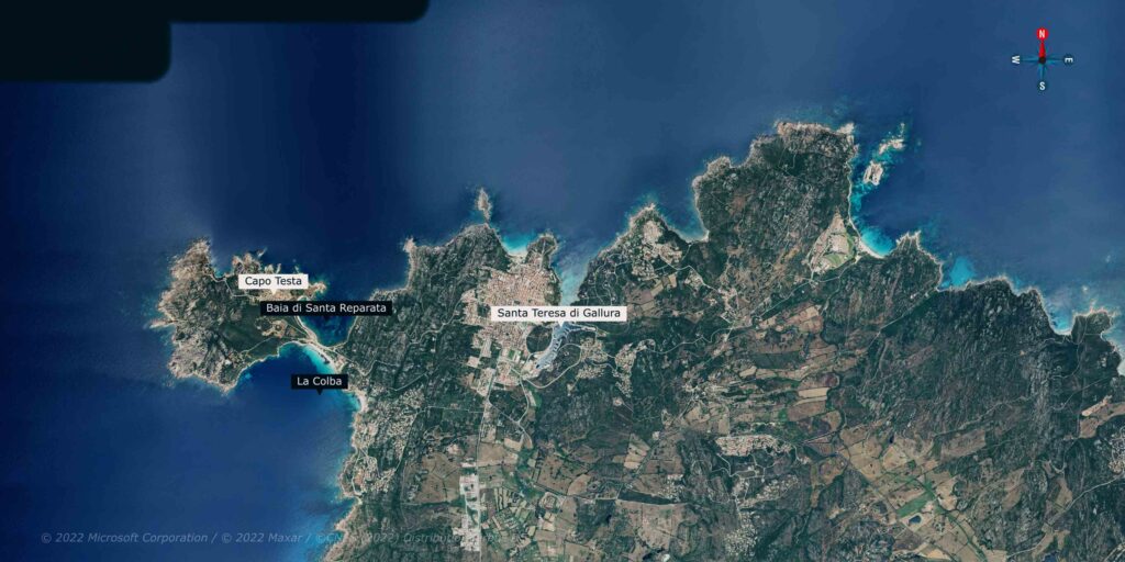
Baia Reparata — 41°14’17.2″N 9°09’45.2″E
Anchor in 4–6m on sand. Open to the north — only in calm settled conditions.
La Colba — 41°13’49.8″N 9°09’41.8″E
Anchor on sand on the south side. More protected than Reparata from NW.
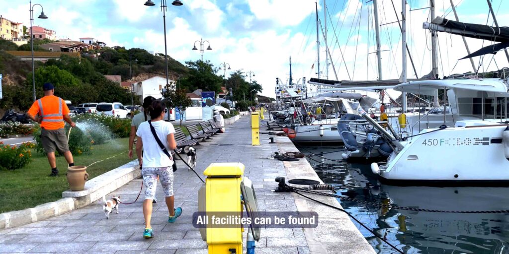
Facilities & Services
On the Dock
- Water & electricity: ✓ all berths
- Fuel dock: ✓ (coordinates above)
- Showers & toilets: ✓
- Laundry: ✓ 5-minute walk
- Wi-Fi: ✓ marina area [VERIFY signal quality]
Provisioning & Shopping
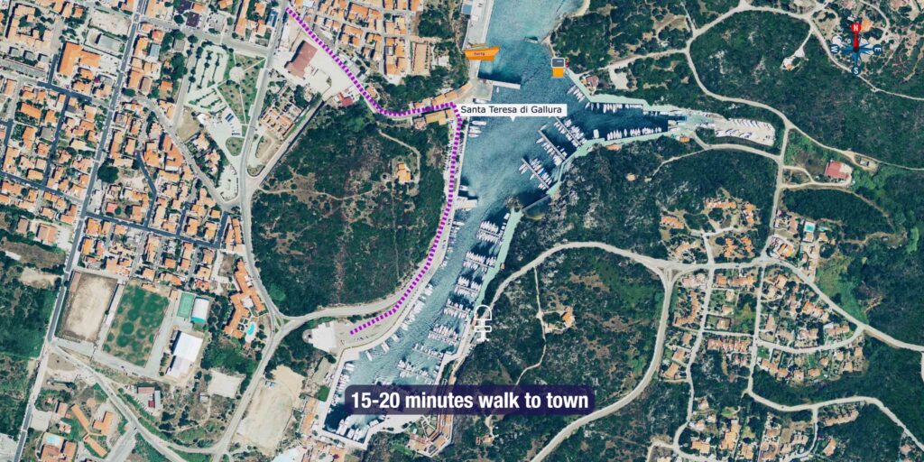
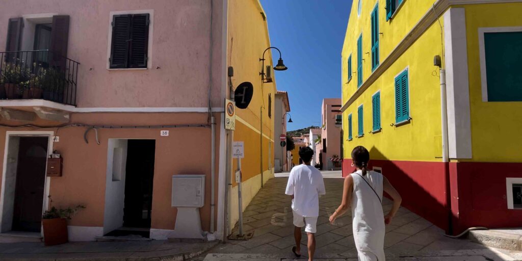
Town centre is 15–20 minutes on foot from the marina. Supermarkets, bakeries, and a daily fresh produce market are available. Car rental is available in town — useful for provisioning runs or day trips to Capo Testa.
Technical Services
Basic boat services available in town. For significant repairs, Olbia (60 km south) has better boatyard facilities [VERIFY local chandlery options].
Getting Around
- Ferry to Bonifacio (Corsica): Moby Lines & Sardinia Ferries — ~1 hour crossing, multiple daily departures in summer
- Car rental: available in town — recommended for Capo Testa, Valle della Luna
- Taxi: available from marina — ask at office
- Bus: ARST regional buses connect Santa Teresa to Olbia and Palau
️ Where to Eat — Sailors’ Picks
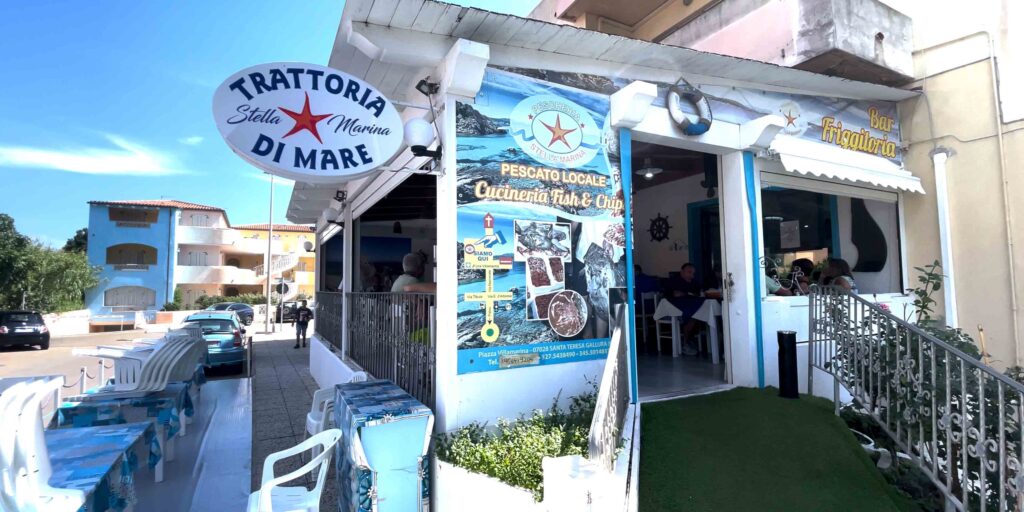
Friggitoria/Cucineria Stella Marina
Casual seafood fry-up, local favourite. Excellent fried fish and seafood pasta. € | Waterfront.
Ristorante da Thomas
Sit-down restaurant, local seafood focus. Known for quality grilled fish. €€ | Town centre.
️ What to See & Do Ashore
Must-See
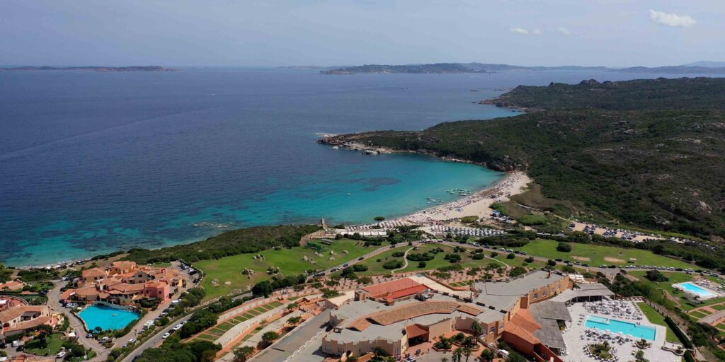
Capo Testa — 5 km west of the marina. A granite peninsula with a lighthouse and direct views across to Bonifacio. The walk out to the cape takes about 40 minutes. One of the best vantage points in northern Sardinia — essential for understanding the Bocche di Bonifacio from a sailor’s perspective.
History & Landmarks
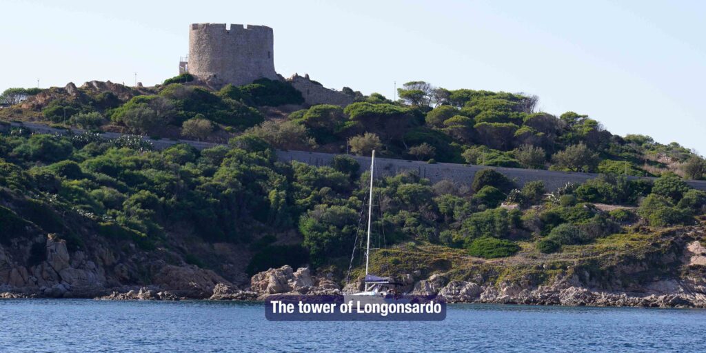
Torre di Longonsardo (Torre Spagnola) — 16th-century Spanish watchtower at the entrance to the bay. Visible from sea as a useful landmark on approach. Short walk from the marina.
Beaches
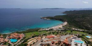
Spiaggia Rena Bianca — the closest beach to the marina, white sand, shallow entry. Walkable from town. Can get crowded in July–August.
Valle della Luna — wild granite cove 3 km west, accessible by car. Far less crowded, dramatic rock formations.
Day Trips
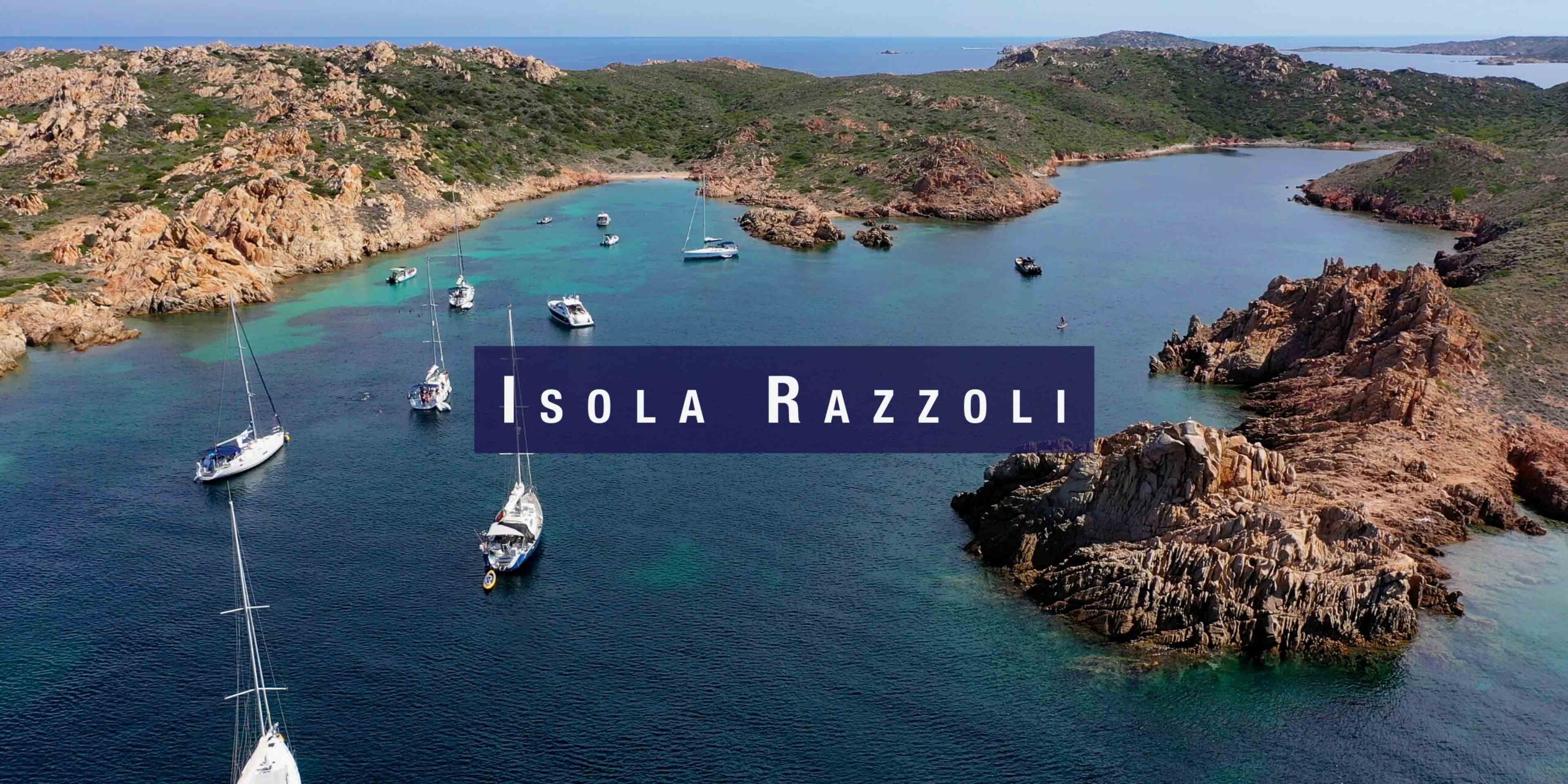
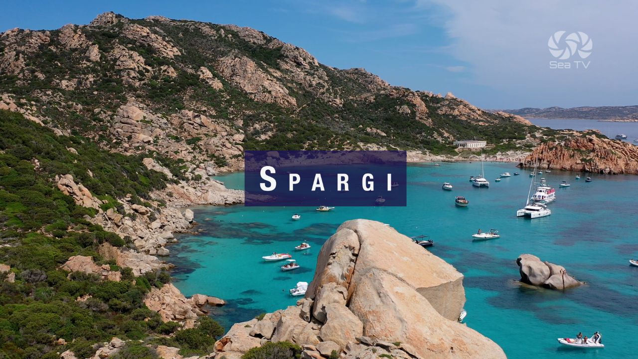
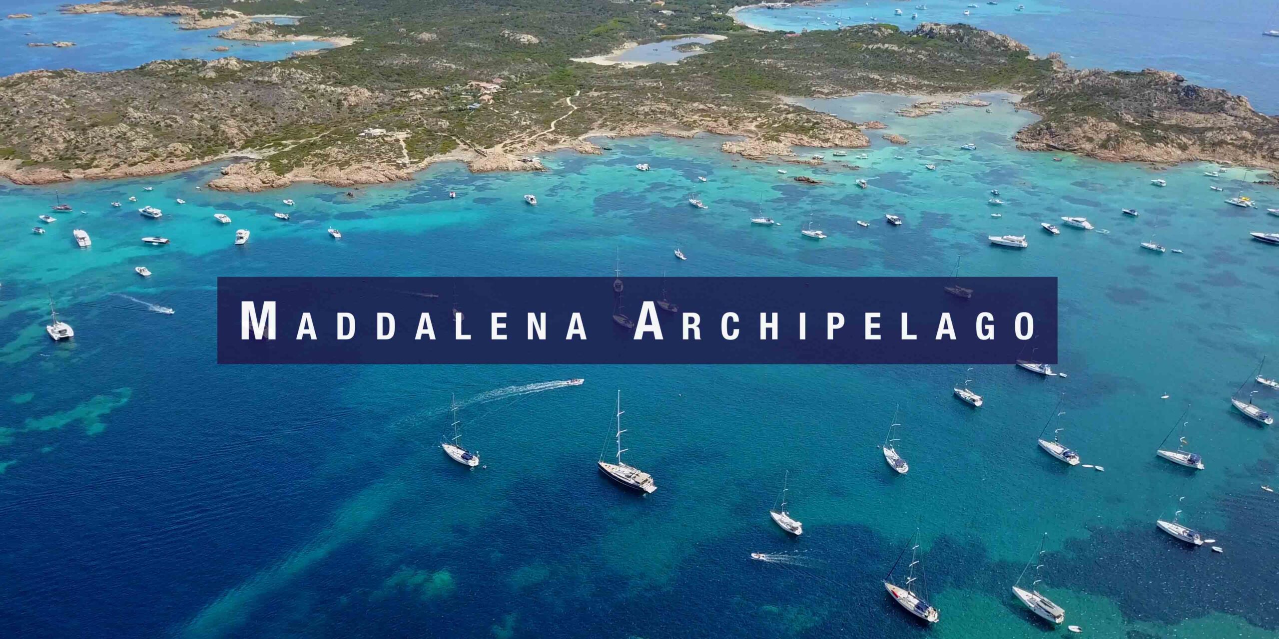
La Maddalena Archipelago — 8 nm south. Day sail or ferry from Palau (30 min drive). National Park — permit required for some anchorages.
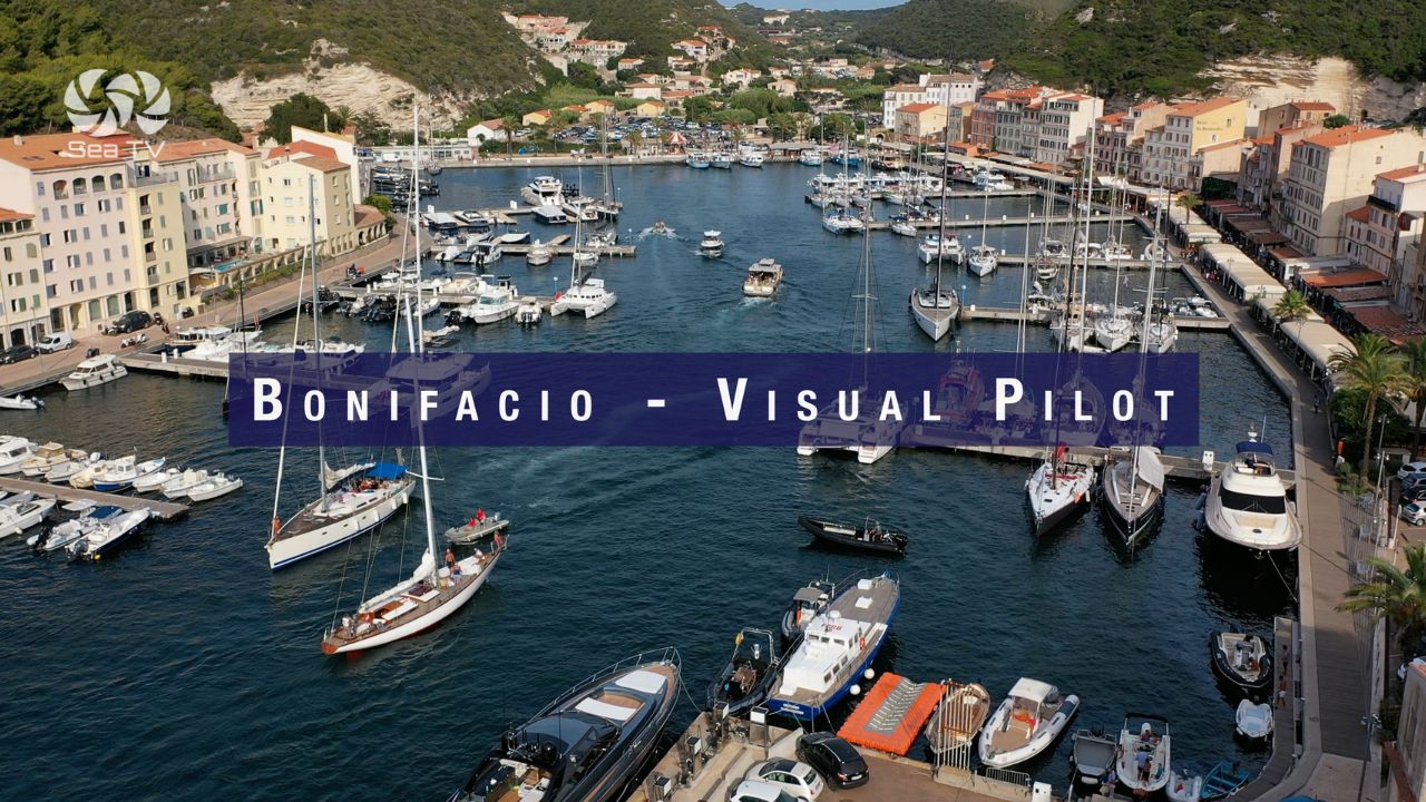
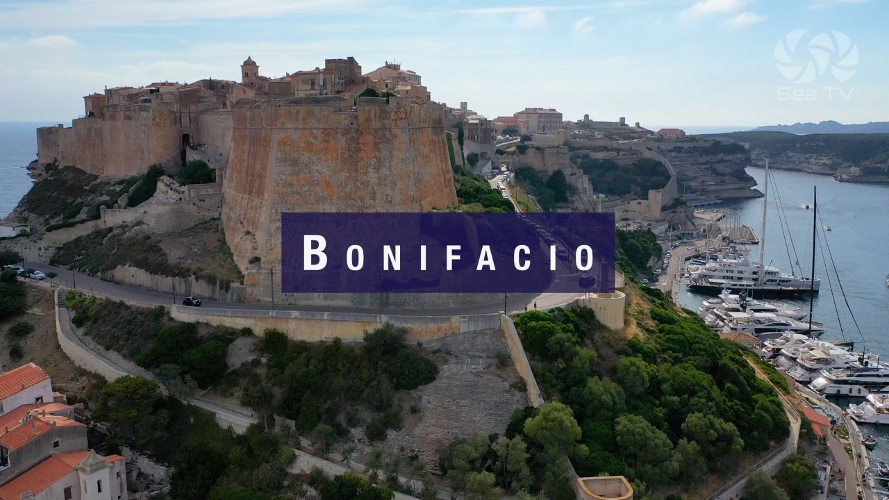
Bonifacio, Corsica — 11 nm north. Day sail in settled conditions or take the ferry. Citadel and sea caves are unmissable.
Events in June
Musica sulle Bocche Jazz Festival — International jazz festival held in Santa Teresa di Gallura in June. Free concerts in the town square and along the waterfront. Check current programme at local tourist office.
Fête de la Musique (21 June) — French national music day, celebrated on the Corsican side of the Bocche. Audible from the harbour on a calm evening.
✅ Sailor’s Safety Checklist — Before Departing
- Check wind forecast for Bocche di Bonifacio (Windy / PoseidonASF) — strait accelerates wind significantly
- Confirm berth availability at Bonifacio if crossing north (book via resaportcorse.com)
- Fuel topped up — next reliable fuelling: Bonifacio or Palau
- Monitor ferry schedules — ferries cross regularly and have right of way
- VHF on Ch. 16 at all times in the strait
Nearby Destinations
| Destination | Distance | Sailing Time (est.) |
| Marina Bonifacio, Corsica | 11 nm | ~1.5–2 hrs |
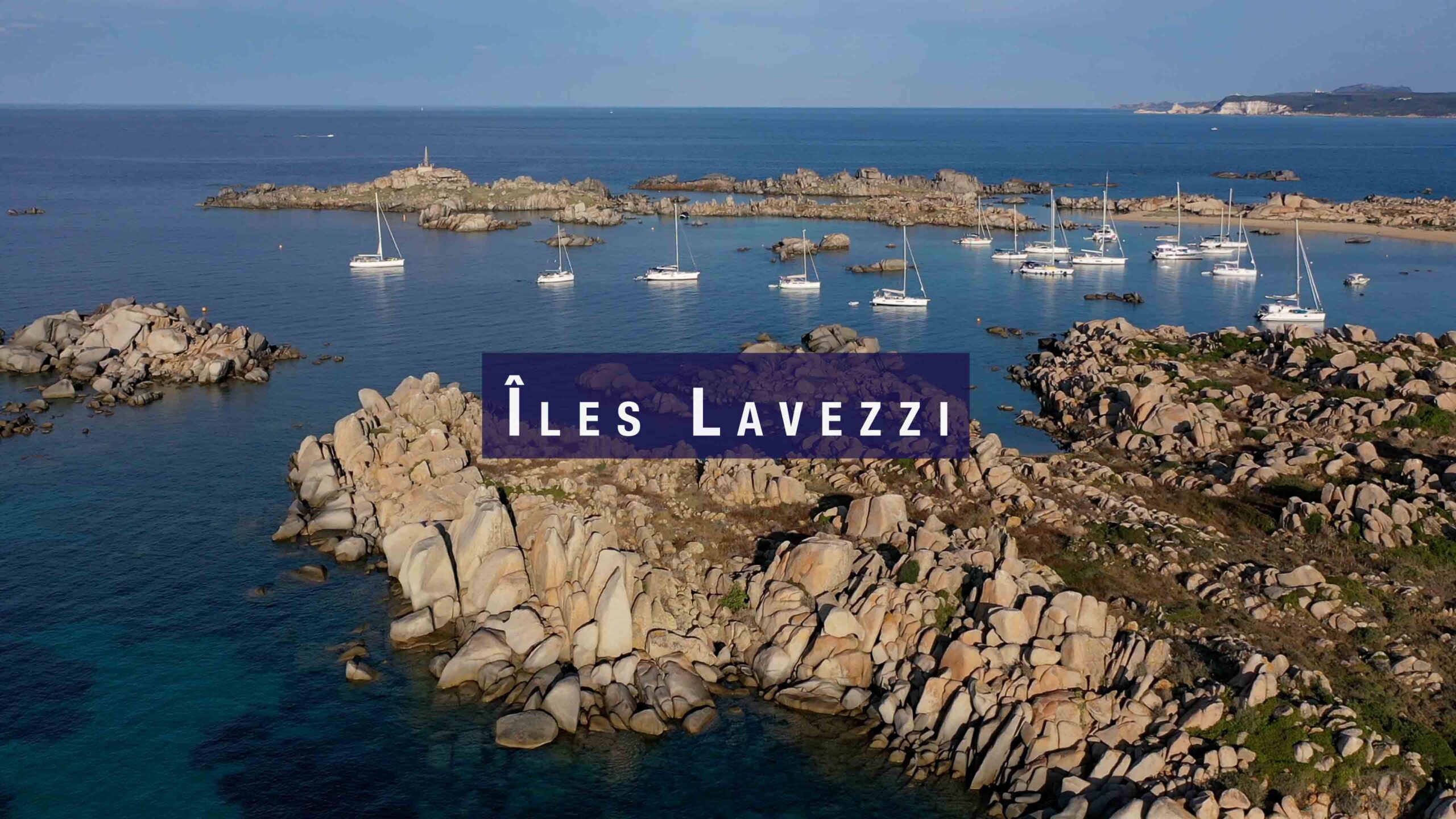
| Îles Lavezzi | 14 nm | ~2–2.5 hrs |
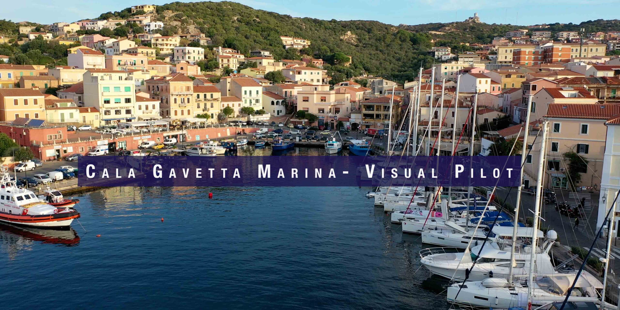
| Cala Gavetta, La Maddalena | 17 nm | ~2.5 hrs |
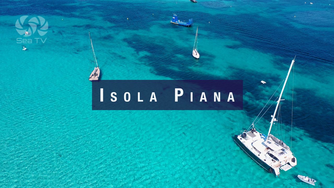
| Isola Piana (Corsica) | 16 nm | ~2 hrs |
| Porto Rafael | 5 nm | ~45 min |
SeaTV Visual Pilot Video
Watch the full visual pilot video of Santa Teresa di Gallura Marina — approach, entry, the ferry lanes, docking, and the surrounding area including Capo Testa. Free for SeaTV members.