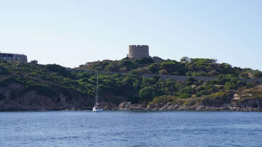
Sardinia is the second-largest island in the Mediterranean — 24,000 km², 1,850 km of coastline, and some of the finest sailing water in the western basin. It sits 112 miles from the Italian mainland and 7 miles from Corsica. A large part of the interior is hilly and mountainous, with a principal range running north to south down the east coast. The island is mysterious, ancient, and stubbornly itself — colonised by Phoenicians, Romans, Arabs, Catalans, Spaniards, and Savoyards, but never truly dominated by any of them. The Nuragic civilisation that built nearly 7,000 stone towers here between 1800 and 500 BC has no obvious parallel anywhere in the world. On the water, Sardinia is a different world again: granite islands, turquoise water, Maestrale, and some of the most tightly controlled marine reserves in Italy.
✈️ Airports & Getting There
| Airport | Nearest Charter Base | Drive |
| Olbia Costa Smeralda (OLB) | Olbia, Cannigione, Portisco, Santa Teresa Gallura | 12–65 min |
| Alghero-Fertilia (AHO) | Alghero, Porto Conte, Stintino | 10–40 min |
| Cagliari Elmas (CAG) | Cagliari, Carloforte | 15 min – 2 hrs |
️ Weather & Sailing Season
The sailing season runs May to October. Sardinia is not an area for beginners — the wind systems here are significant and can build quickly. Always check a reliable marine forecast before leaving port.
| Wind | Direction | Season | Character |
| Maestrale | NW | Year-round, peaks summer | Dominant wind. Strongest on north and west coasts. Accelerates through Bocche di Bonifacio. Can reach F7–8. |
| Ponente | W / SW | Summer afternoons | Thermal wind building from midday. Common on west coast and Porto Pollo. 15–30 knots typical. |
| Tramontana | N | Spring, autumn | Cold, gusty. 6–8 Beaufort possible. Common in the north and channel islands. |
| Scirocco | SE / S | Spring, autumn | Hot and humid from North Africa. Creates uncomfortable swell on south-facing coasts. |
⚠ Bocche di Bonifacio effect: The strait between Sardinia and Corsica accelerates any prevailing wind by 1–2 Beaufort. A forecast of F4 in open water can mean F6 in the strait. Never underestimate this when planning passages between the Maddalena Archipelago, Santa Teresa, and Corsica.
Best months: June and September. July–August have reliable wind but crowded anchorages and higher marina prices. May is excellent for settled weather and empty bays. October can be beautiful but autumn gales are possible.
⚓ Marinas & Infrastructure
Sardinia has nearly 40 marinas along its coastline. The northeast (Costa Smeralda area) has the most modern and well-equipped facilities. The west and south coasts offer better value in season. Several national park and protected marine area rules apply throughout — always check before anchoring.
⚠ La Maddalena Archipelago — National Park Permit: All vessels entering the La Maddalena Archipelago National Park must obtain a permit in advance. Apply online at autorizzazioni.lamaddalenapark.it. Night anchoring restricted to park-authorised buoys (21:00–08:00). No Posidonia anchoring anywhere in the park.
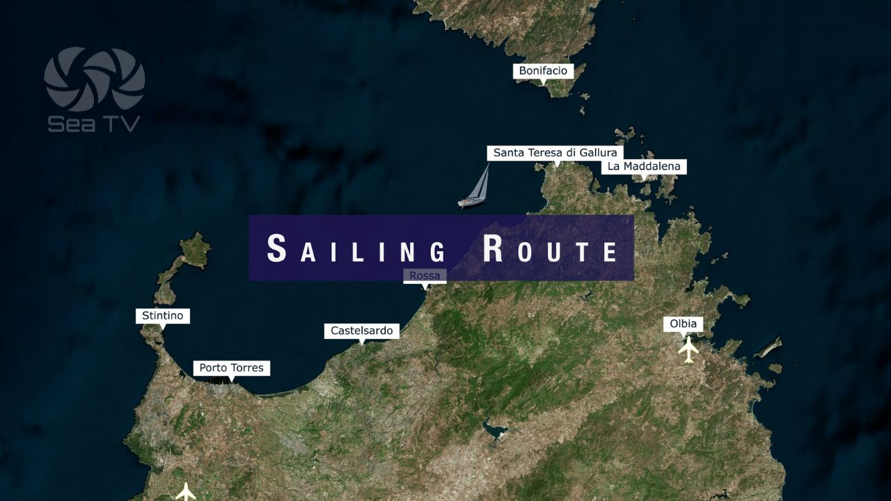
️ Routes to Sardinia
| From | Recommended landfall | Notes |
| Balearic Islands | W or NW coast — Alghero, Porto Torres | Overnight passage ~300 nm. Arrive by day — west coast has limited shelter. |
| Bonifacio (Corsica) | Santa Teresa Gallura or La Maddalena | 7 nm. Bocche di Bonifacio — check forecast carefully, even for a short passage. |
| Porto Vecchio (Corsica) | Razzoli, Maddalena Archipelago | ~20 nm. NW wind can make this passage rough. |
| Italian mainland | Olbia or Cagliari by ferry; Olbia or N coast by sail | 112 nm offshore crossing. Arrive by day. |
️ North Coast — Marinas & Anchorages
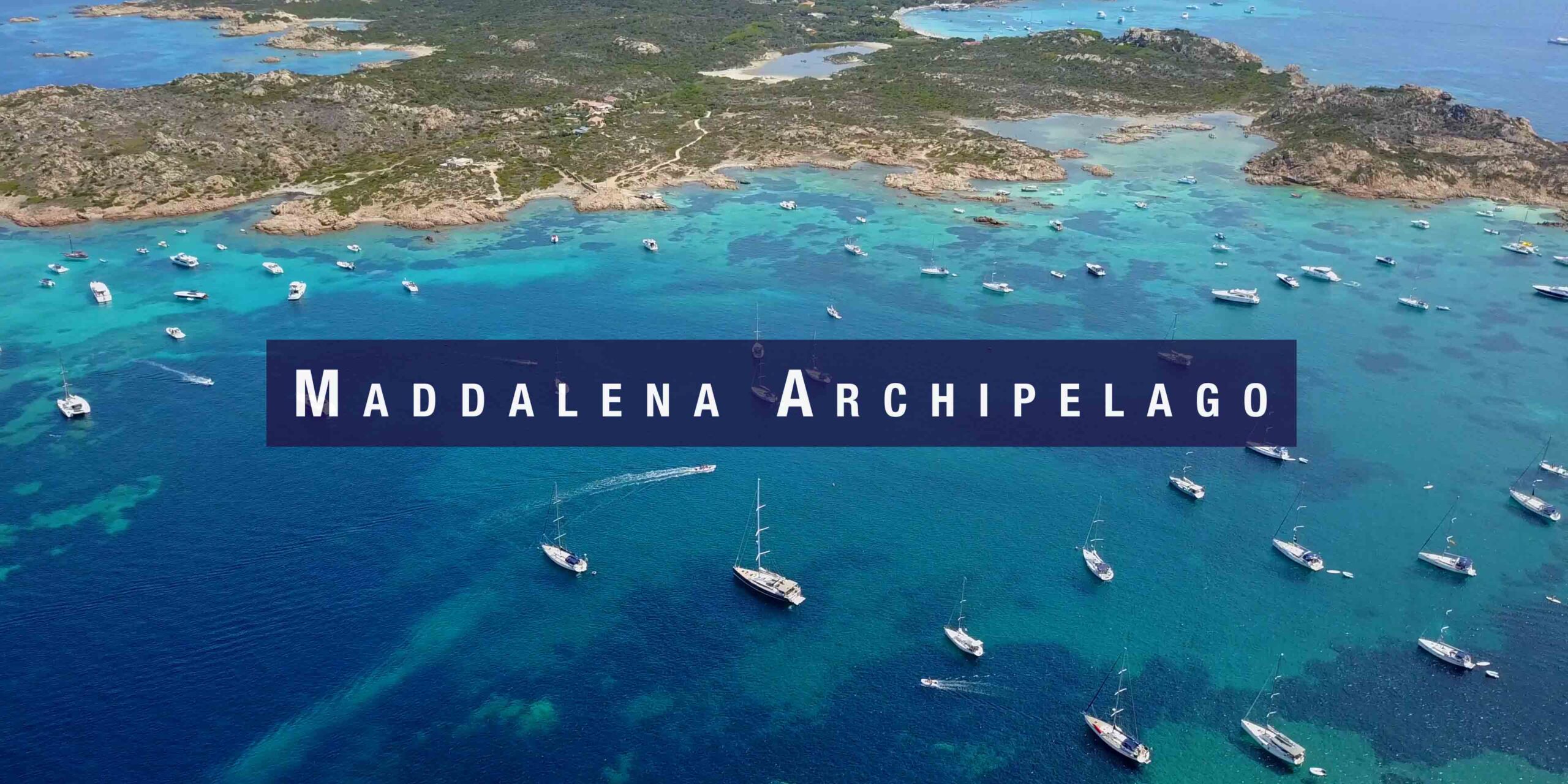
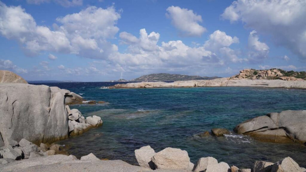
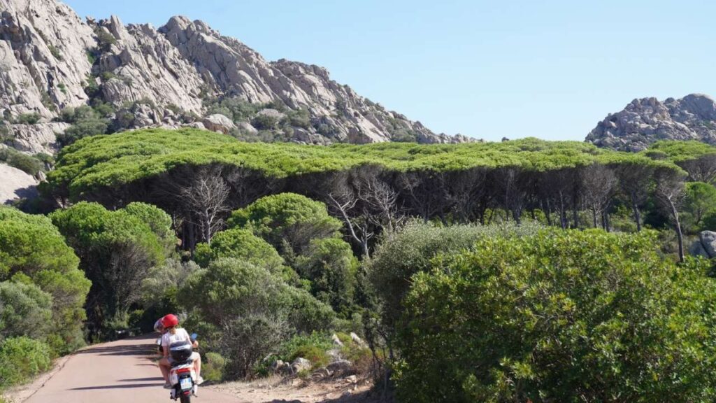
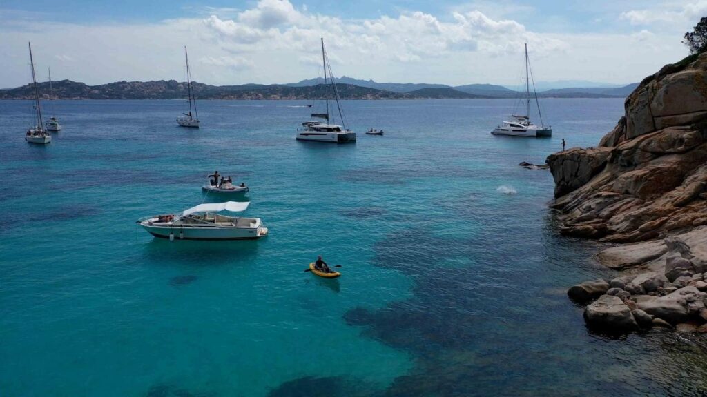
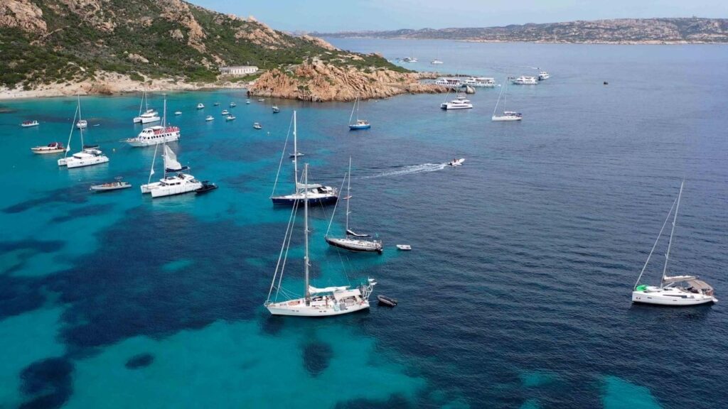
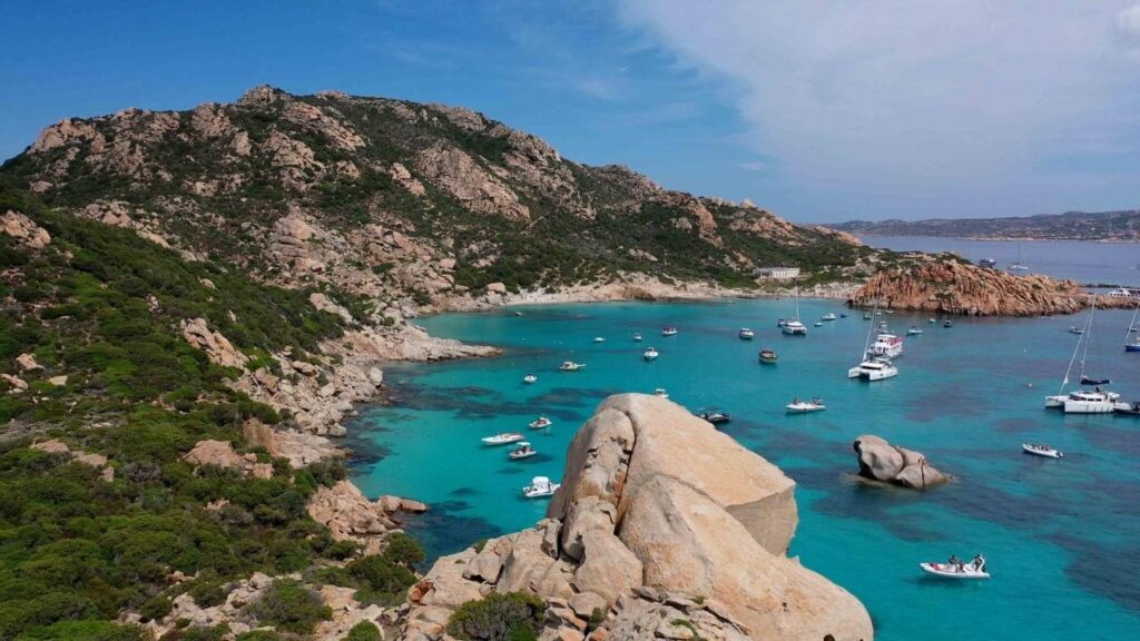
The north coast and La Maddalena Archipelago are the most popular and most dramatic sailing grounds in Sardinia. The combination of granite islands, turquoise water, and the Bocche di Bonifacio means excellent sailing — and significant challenge. Book marinas well ahead for July–August.
| Location | Type | SeaTV Guide |
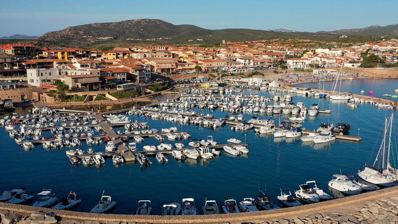
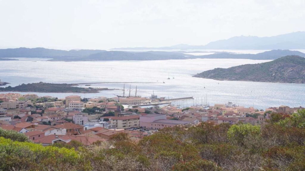
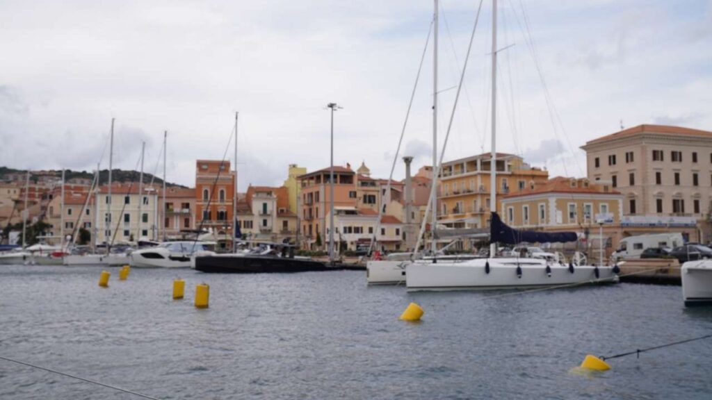
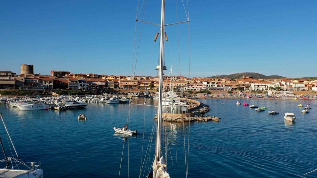
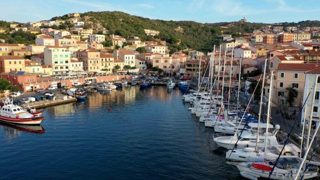
| Santa Teresa Gallura | Marina | Santa Teresa Marina Guide → |
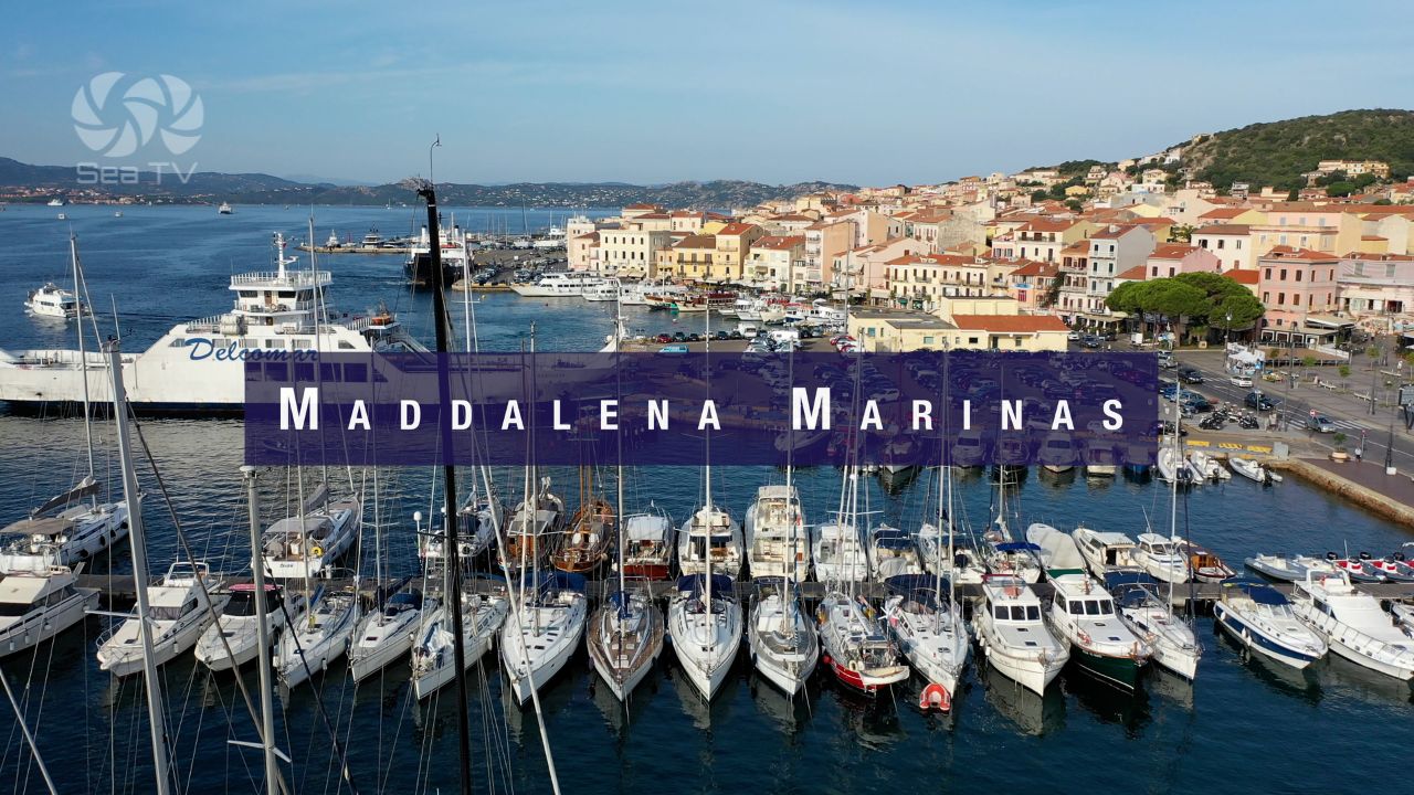
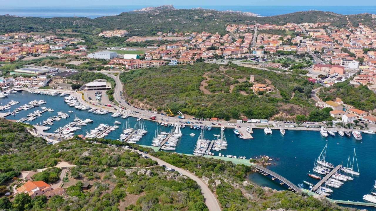
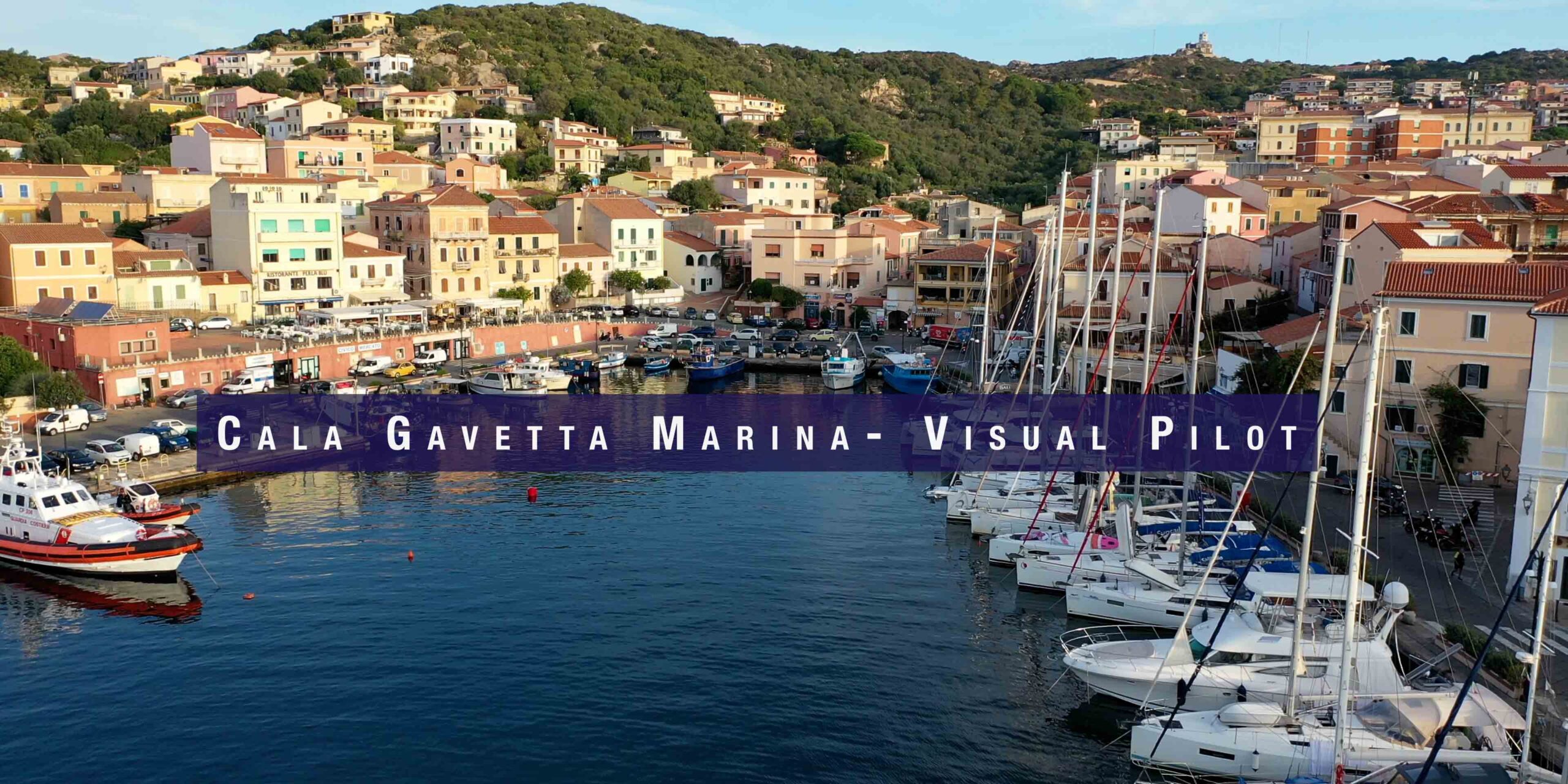
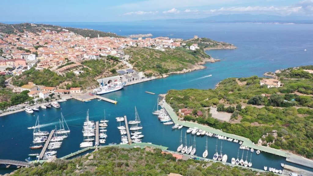
| Cala Gavetta — La Maddalena | Main marina, archipelago hub | Cala Gavetta Guide → |
| All La Maddalena Marinas | Comparison guide | Where to Dock — La Maddalena → |
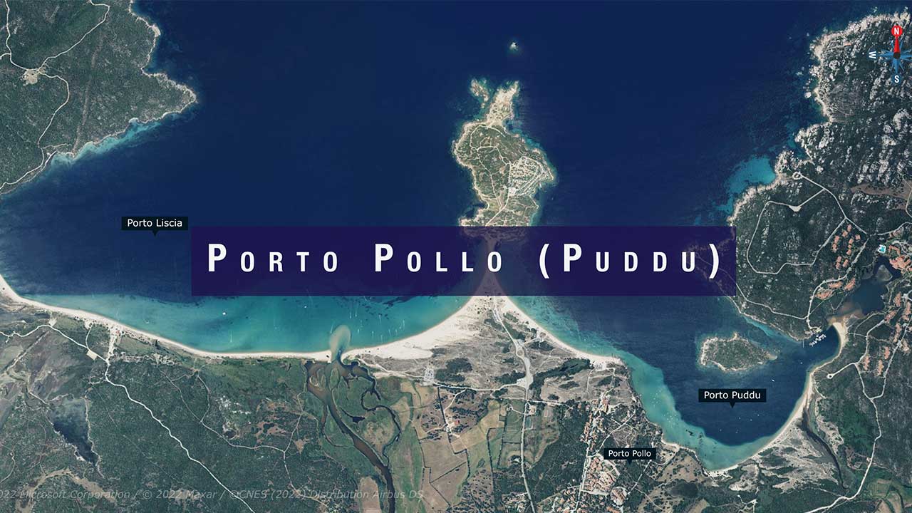
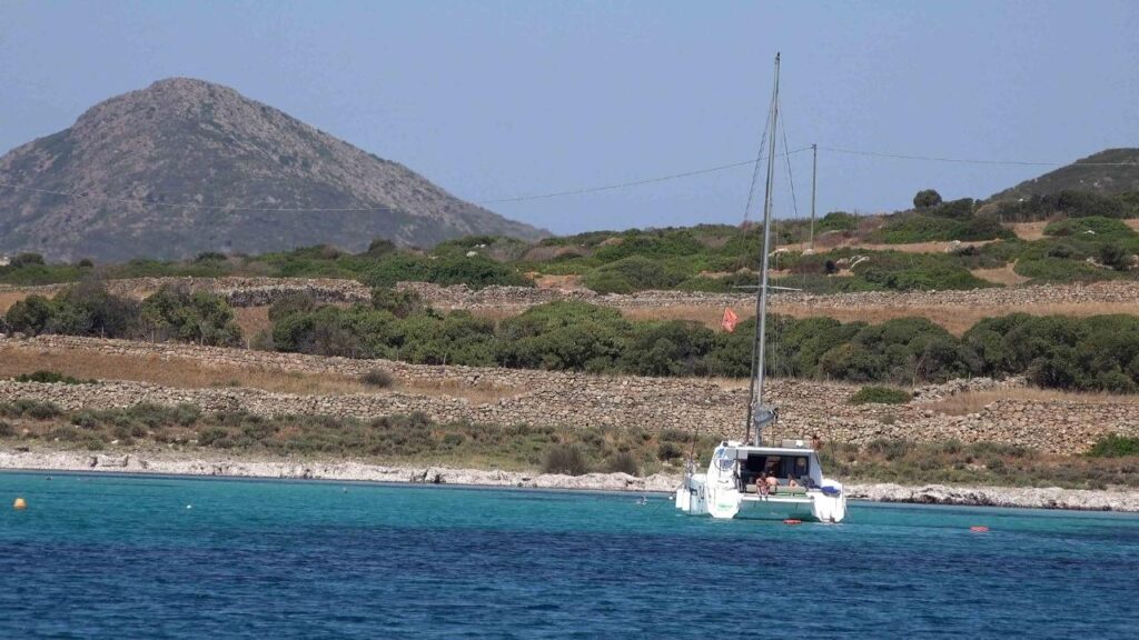
| Porto Pollo | Anchorage — windsport hub | Porto Pollo Guide → |
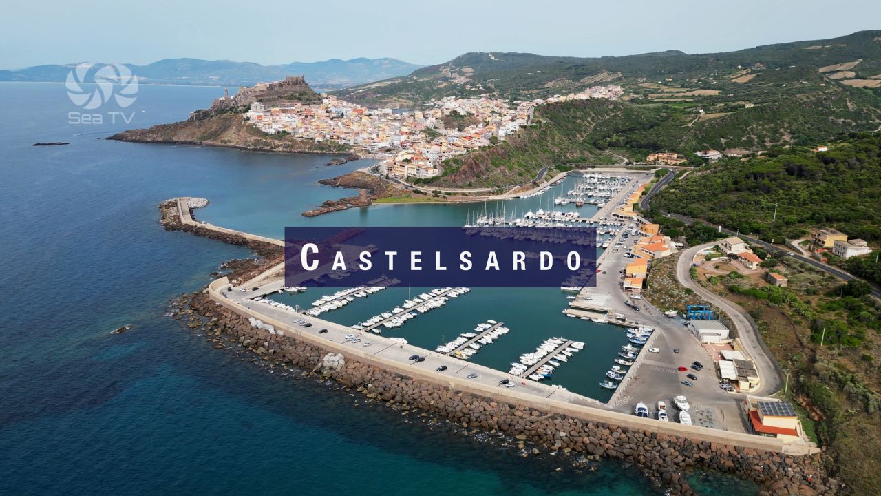
| Castelsardo | Marina | Castelsardo Guide → |
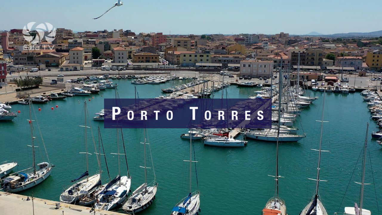
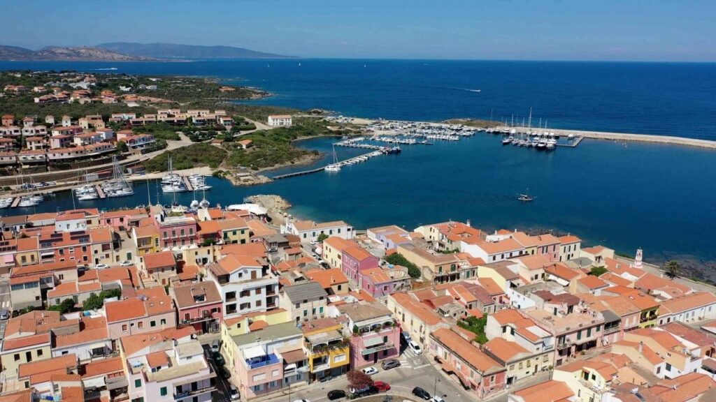
| Porto Torres | Commercial port, ferry hub | Porto Torres Guide → |
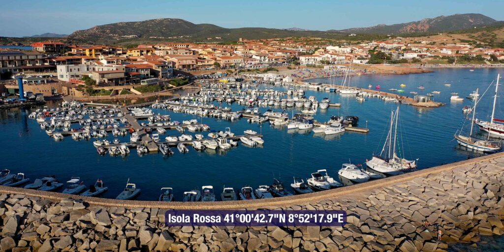
| Isola Rossa | Small anchorage | Isola Rossa Guide → |
️ La Maddalena Archipelago — Anchorages
The archipelago’s 60-plus islands offer some of the finest anchorages in the entire Mediterranean — but all require a national park permit and familiarity with the rules. Night anchoring is permitted only on park buoys. No anchoring on Posidonia.
| Island / Area | Highlights | SeaTV Guide |
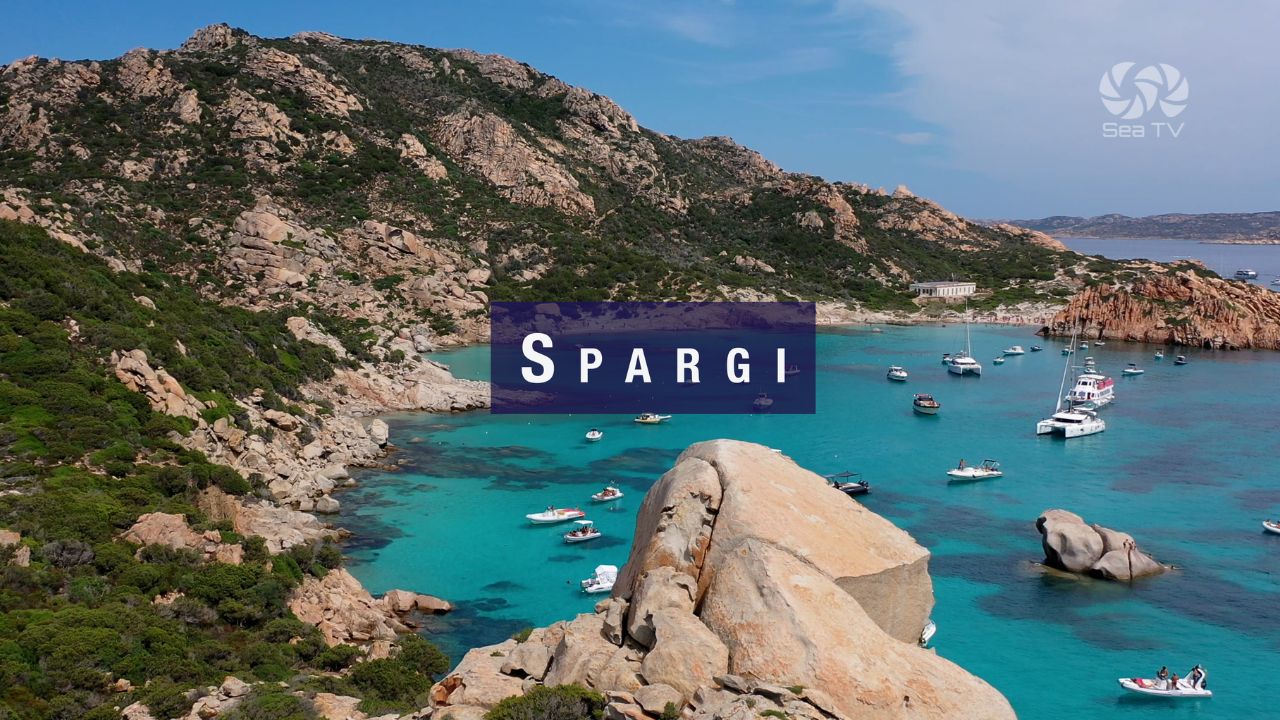
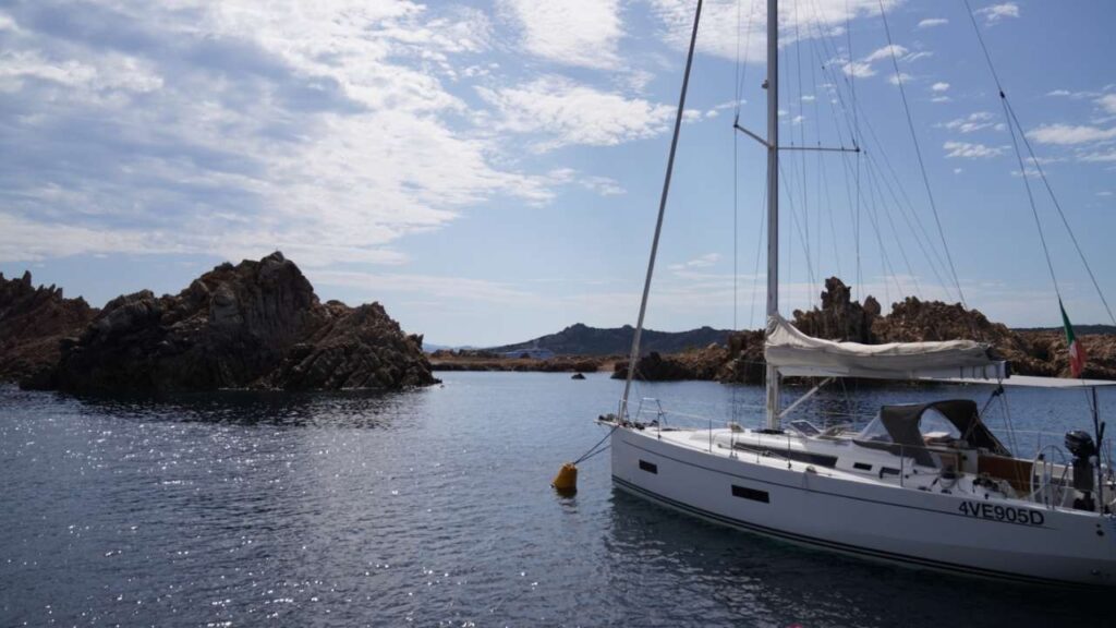
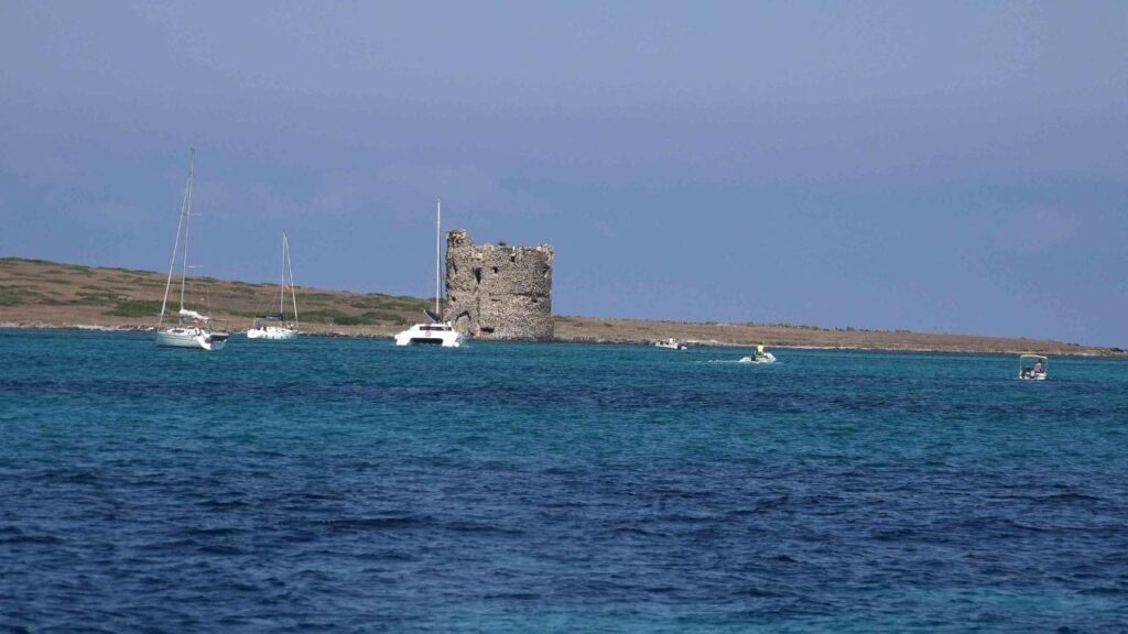
| Spargi | Cala Corsara, Cala Granara, Cala Ferrigno. WWII forts. Witch’s Head rock. | Spargi Guide → |
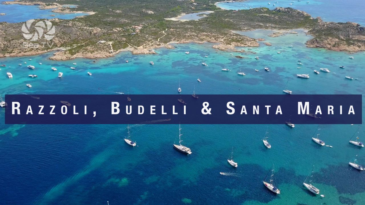
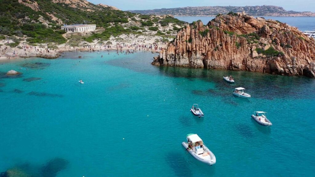
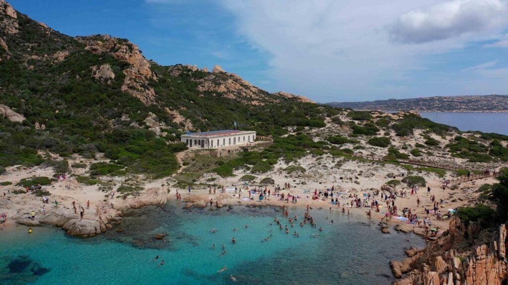
| Razzoli, Budelli & Santa Maria | Spiaggia del Cavaliere (the pool), Pink Beach (Zone A — no access), Cala Santa Maria. | Northern Islands Guide → |
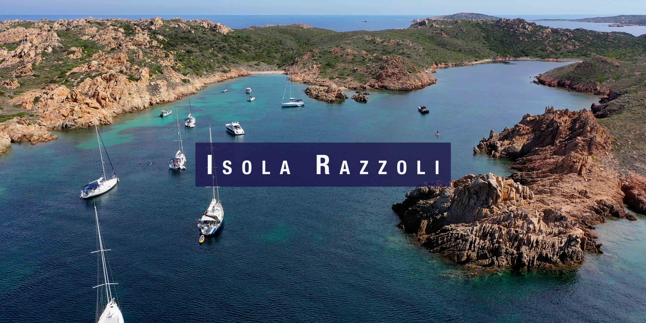
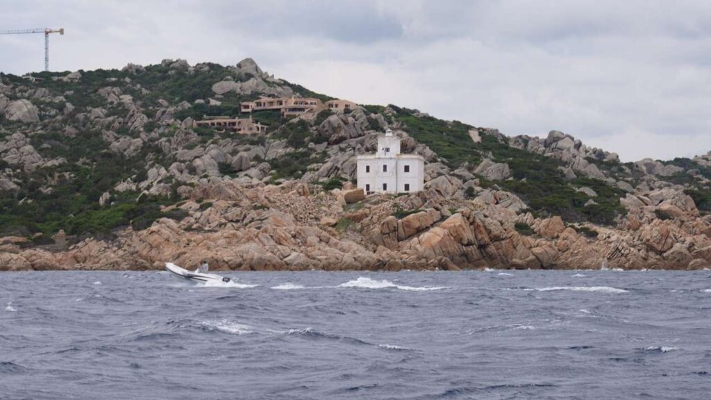
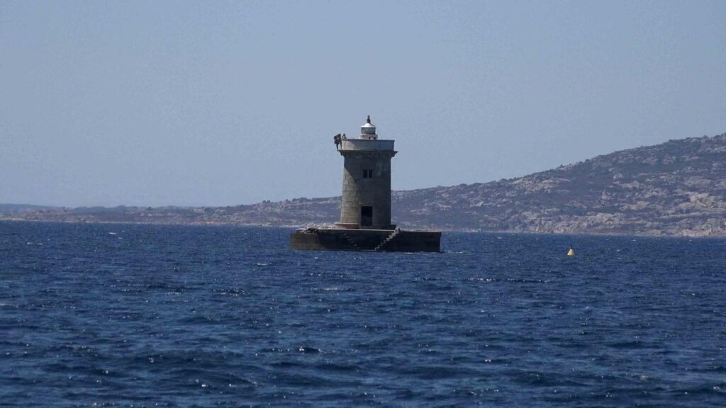
| Isola Razzoli | Cala Lunga — remote, sheltered, granite walls. Lighthouse path. | Razzoli Guide → |
| Best Places to Sail | Overview of the whole archipelago by a local skipper. | Best Sailing in Sardinia → |
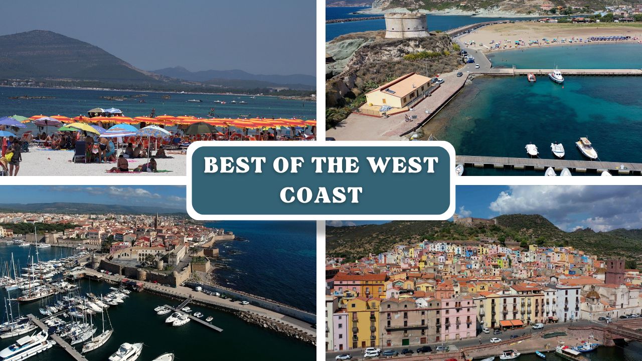
West Coast — Marinas & Anchorages
The west coast is more exposed than the north, but offers some of the island’s most authentic stops — the medieval walled city of Alghero, the Temo River at Bosa, the vast natural harbour of Porto Conte with its Neptune’s Cave, and the remarkable Fornelli Passage at Stintino. Fewer crowds and better value for money than the northeast.
| Location | Highlights | SeaTV Guide |
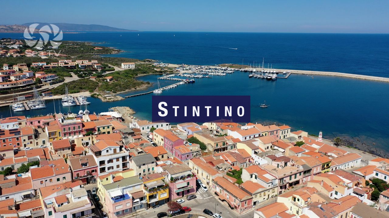
| Stintino | Fornelli Passage, La Pelosa beach, Asinara National Park. | Stintino Guide → |
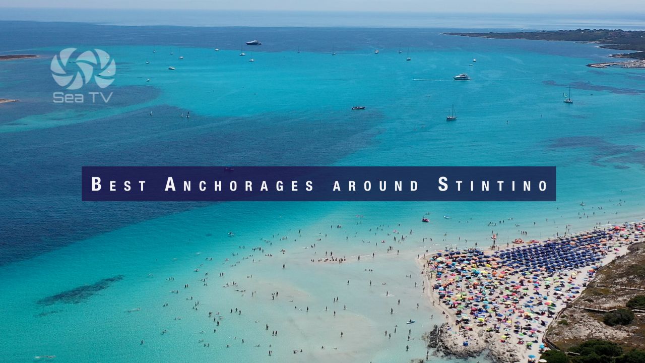
| Best Anchorages around Stintino | La Pelosa, Fornelli Passage, Asinara east coast, flamingo lagoon. | Stintino Anchorages → |
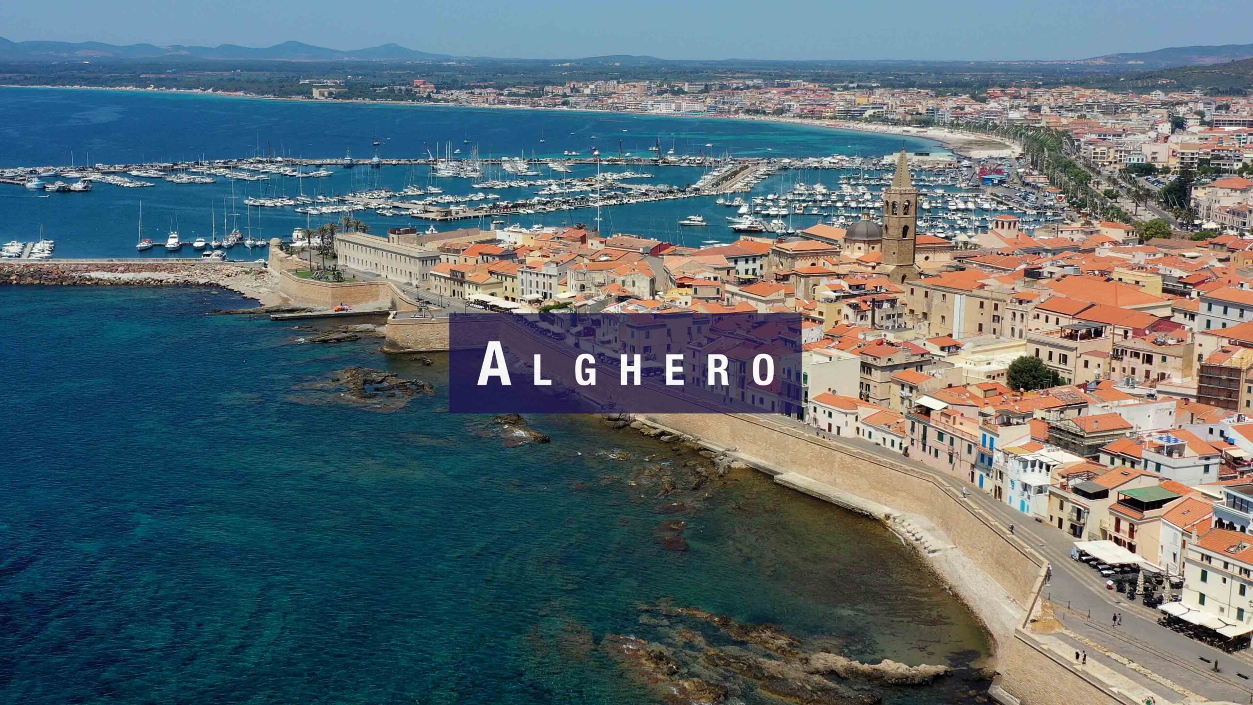
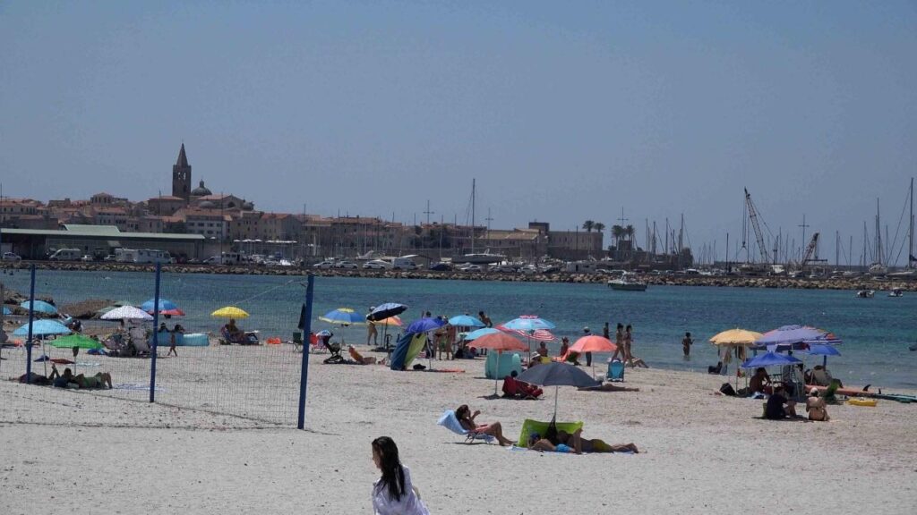
| Alghero | Catalan walled city, 2,500 berths, Riviera del Corallo, dolphins. | Alghero Guide → |
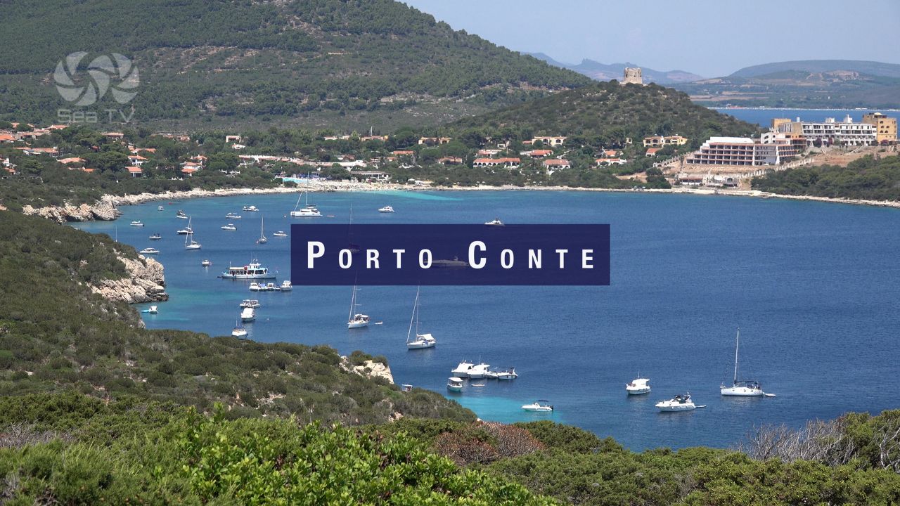
| Porto Conte | Largest natural port in Med. Grotta di Nettuno. Katabatic gusts. | Porto Conte Guide → |
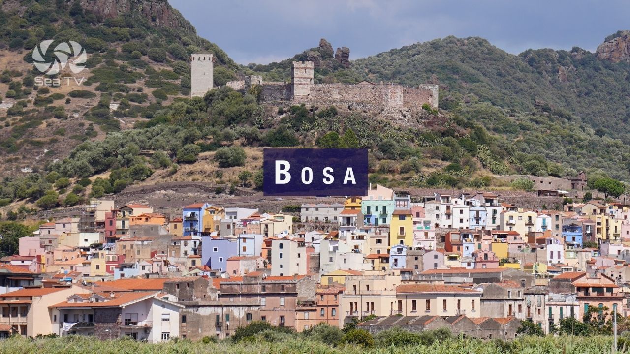
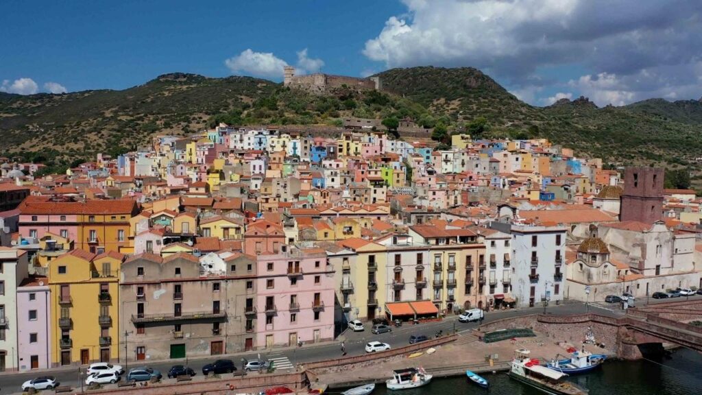
| Bosa | Only navigable river in Sardinia. Malaspina Castle. Malvasia wine. | Bosa Guide → |
| The Best of the West Coast | Route overview — west coast from Stintino south to Bosa. | West Coast Overview → |
️ Corsica — South Coast
Seven miles north of Santa Teresa Gallura, Bonifacio and the surrounding islands are within easy day-sailing range of northern Sardinia. The Bocche di Bonifacio ferry crosses in 50 minutes — the sailing passage in an hour to two hours depending on wind. These are some of the most dramatic anchorages in the western Mediterranean.
| Location | Highlights | SeaTV Guide |
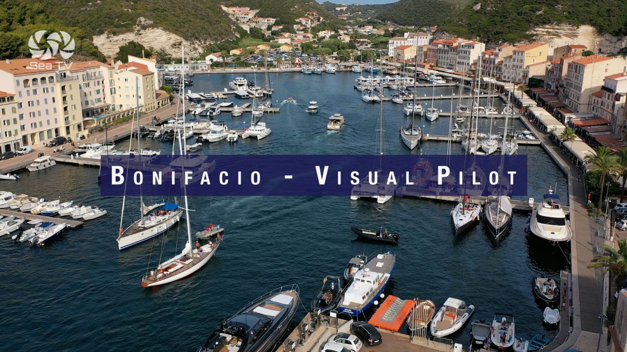
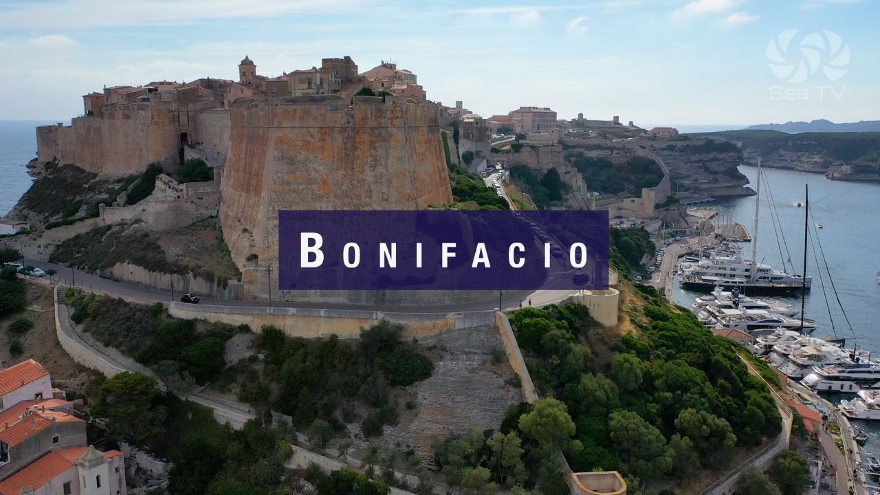
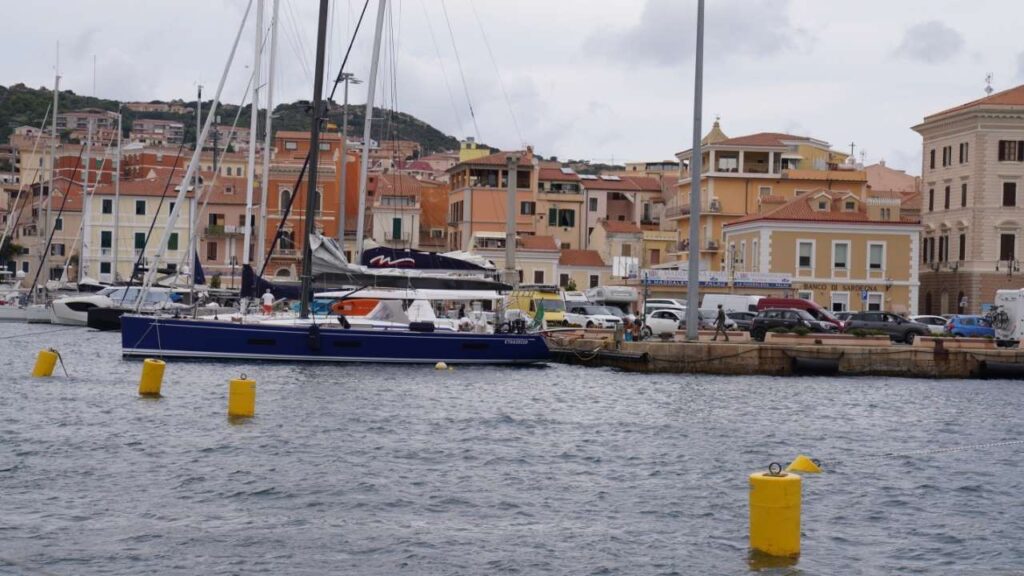
| Marina Bonifacio | Goulet fjord entry, citadel, Escalier du Roy d’Aragon. Book ahead. | Bonifacio Guide → |
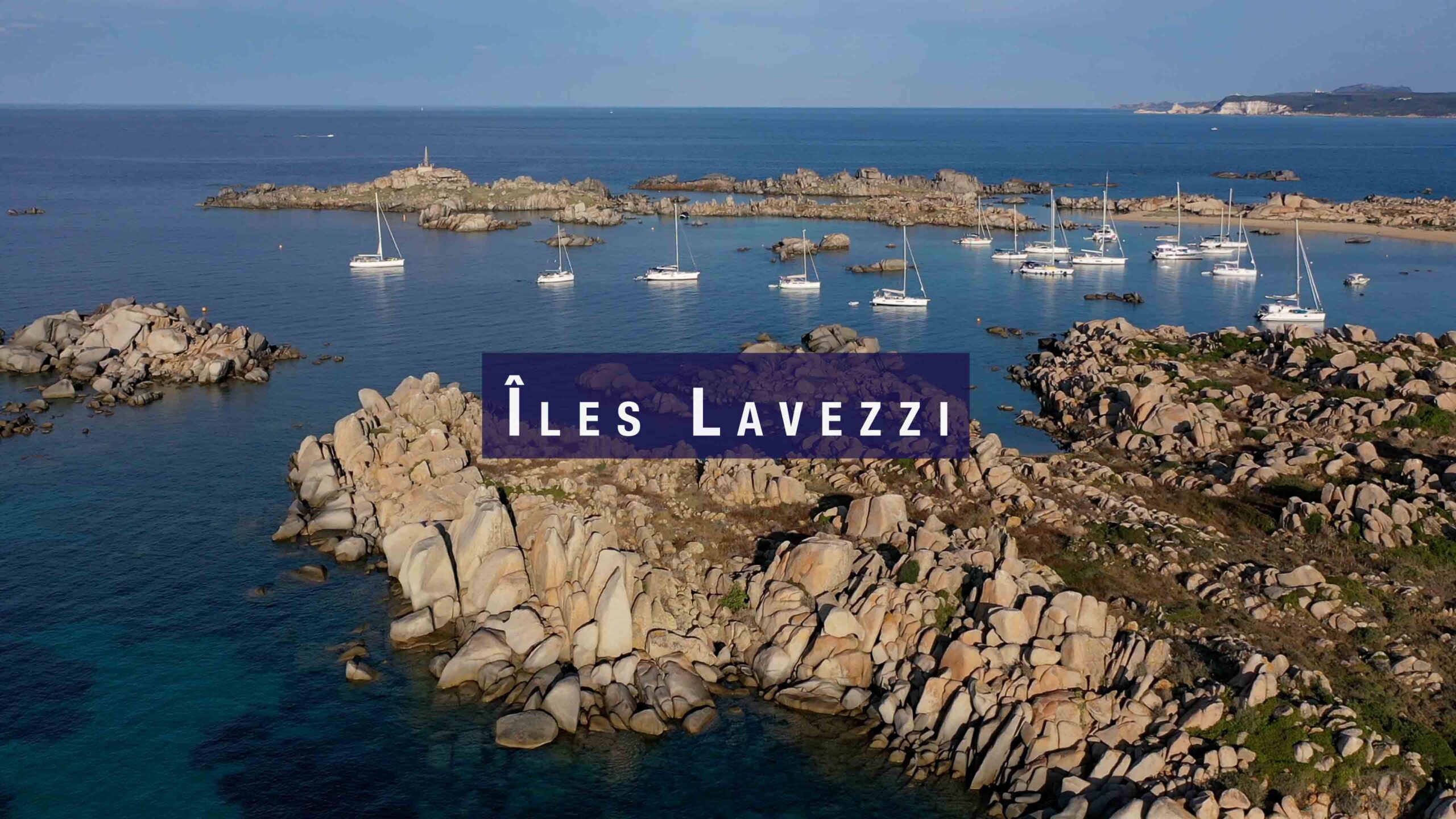
| Îles Lavezzi | French nature reserve. Pink granite. Sémillante 1855 wreck. Daylight only. | Lavezzi Guide → |
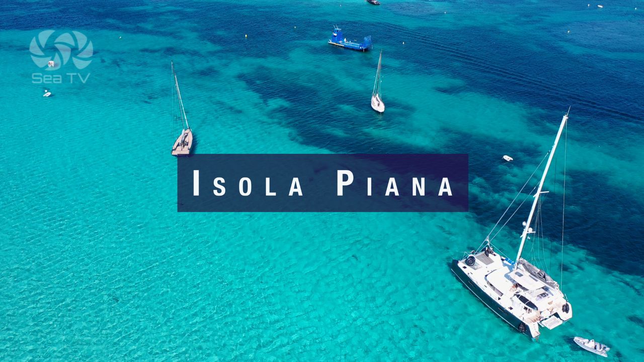
| Isola Piana | Best day anchorage near Bonifacio. Two perfect beaches. Birds nesting. | Isola Piana Guide → |
| Bonifacio — Town Guide | Old town, history, restaurants, katabatic wind warning. | Bonifacio Town Guide → |
️ Suggested Sailing Routes
| Route | Duration | Character |
| Olbia → La Maddalena → Bonifacio loop | 7–10 days | Classic north Sardinia circuit. Island hopping, granite anchorages, Corsica day trip. |
| Alghero → Stintino → Santa Teresa → Maddalena | 7–10 days | West coast to north. Fornelli Passage, La Pelosa, and into the archipelago. |
| Sardinia–Corsica crossing | Day passage | Santa Teresa Gallura → Bonifacio (7 nm). Must check Bocche di Bonifacio forecast. |
| Full Sardinia–Corsica Route | 2–3 weeks | Complete SeaTV recommended itinerary combining both islands. |
⚠️ Key Rules — Marine Protected Areas
- La Maddalena Archipelago National Park — Permit required for all vessels: lamaddalenapark.it. Night anchoring on park buoys only (21:00–08:00). Spiaggia Rosa (Budelli) — Zone A, 70m exclusion zone. No Posidonia anchoring. Speed limit: 7 knots within 300m of coast.
- Asinara National Park (west of Stintino) — Anchoring on authorised buoys only. Berthing on island prohibited for pleasure craft. Cala Arena and Cala S. Andrea permanently closed. Check parcoasinara.org.
- AMP Capo Caccia – Isola Piana (Alghero) — Zone speed limits apply. Check zone map at coralsailalghero.it/amp.
- La Pelosa beach (Stintino) — Daily visitor limit 1,500. Entry fee €3.50. Arrive early in summer.
- No Posidonia anchoring is enforceable throughout Sardinia — heavy fines apply.
All SeaTV Guides — Sardinia & South Corsica
North Coast
- Castelsardo — Medieval hilltop. Castello dei Doria. Elephant Rock.
- Porto Torres — Ferry hub. Oil terminal warning. Basilica di San Gavino.
- Isola Rossa — Small anchorage, NW coast.
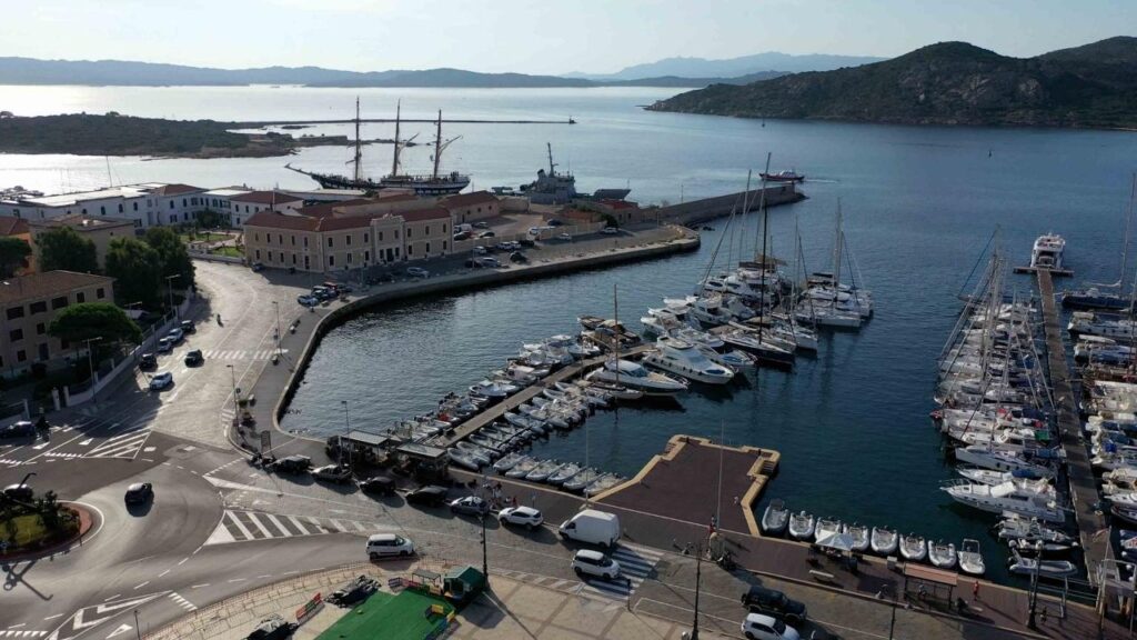
- Santa Teresa Gallura — Ferry to Corsica. Jazz festival in June.
La Maddalena Archipelago
- Cala Gavetta Marina — Main harbour. Full facilities.
- Where to Dock — All La Maddalena Marinas — Complete comparison.
- Spargi Island — Cala Corsara, Cala Granara, Cala Ferrigno. WWII forts.
- Razzoli, Budelli & Santa Maria — Spiaggia del Cavaliere. Pink Beach rules.
- Isola Razzoli — Cala Lunga — Remote overnight. Rocks at entrance.
- Porto Pollo — Windsurf & kite paradise. Good shelter.
- Best Places to Sail in Sardinia — La Maddalena overview.
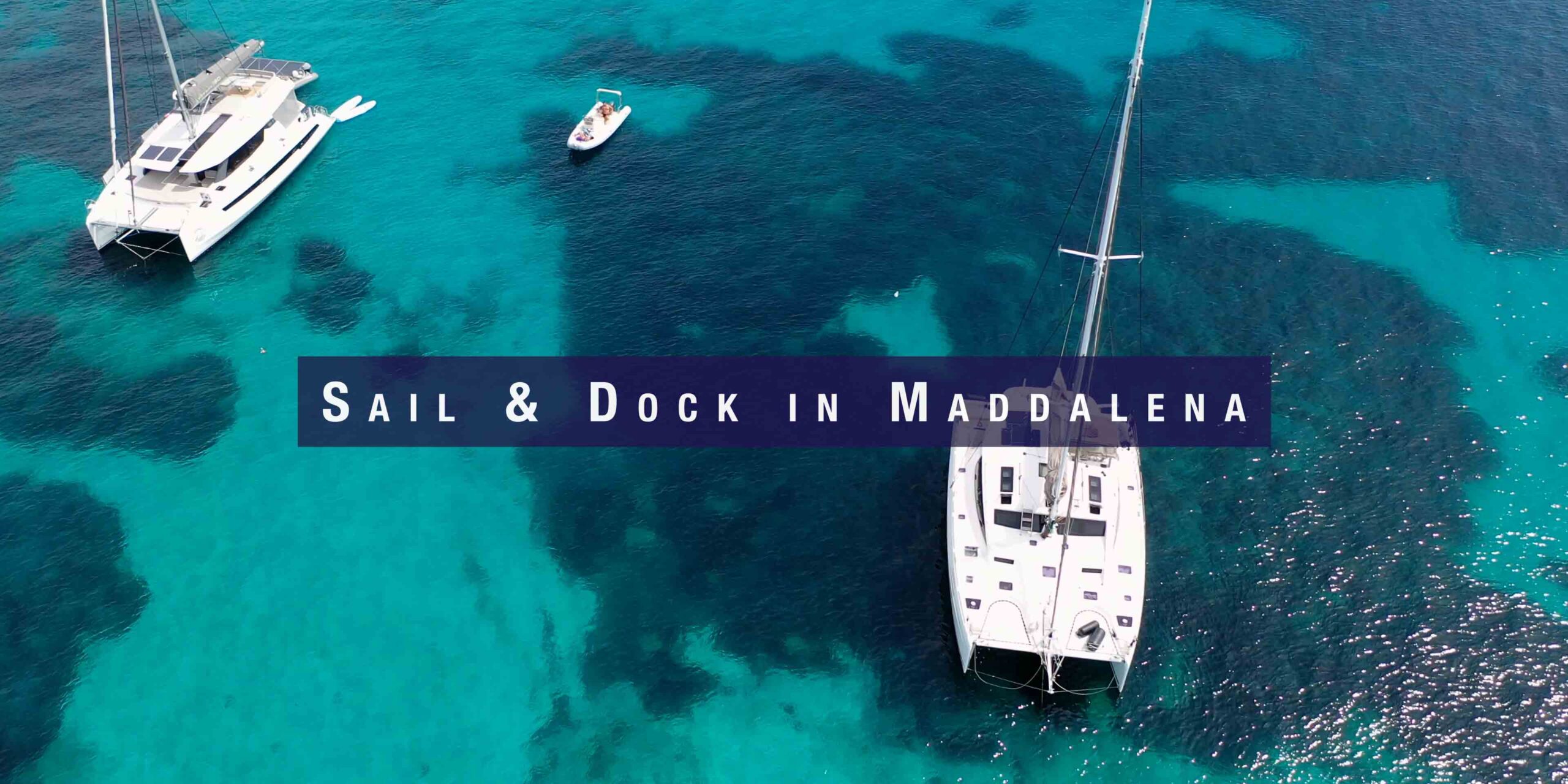
- Sail & Dock in Maddalena
West Coast
- Stintino — Fornelli Passage guide. La Pelosa. Asinara.
- Best Anchorages around Stintino — La Pelosa, Fornelli, Asinara east coast.
- Alghero — 2,500 berths. Catalan old town. Coral Riviera. Dolphins.
- Porto Conte — Grotta di Nettuno. Katabatic gusts. Largest natural port in Med.
- Bosa — Temo River. Malaspina Castle. Malvasia DOC wine.
- The Best of the West Coast — Route overview.
South Corsica (within day-sail of N Sardinia)
- Marina Bonifacio — Full guide. Goulet entry. Katabatic wind.
- Bonifacio Town — Citadel, restaurants, Escalier du Roy d’Aragon.
- Îles Lavezzi — French nature reserve. Cala di U Grecu. Sémillante wreck.
- Isola Piana — Best breakfast anchorage near Bonifacio. Bird nesting rules.
Itinerary
- Sailing Route — Sardinia & Corsica — Complete SeaTV recommended route.