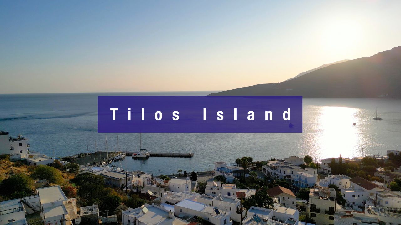
SeaTV · Greece · Dodecanese Islands · Tilos Island
Tilos Island — Livadia Port, Eristos Beach & Greece’s First Renewable-Energy Island
A small quiet Dodecanese island between Nisyros and Chalki — ~750 inhabitants, the first Mediterranean island to run on 100% renewable energy (2019), prehistoric dwarf elephants in the Charkadio Cave, the Saint Panteleimon Monastery, the abandoned medieval village of Mikro Chorio, and unspoiled beaches on every coast. Livadia is the main port + marina on the east; Eristos is the sandy swim bay on the south.
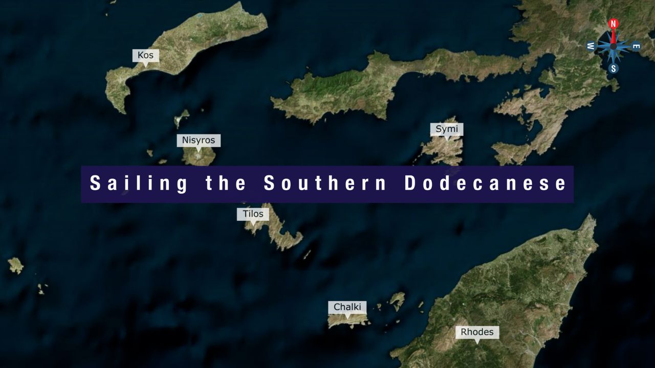
Tilos sits between Nisyros to the NW and Chalki to the SE — one of the smallest, quietest, and most ecologically distinctive islands in the Dodecanese. The combination of unspoiled beaches, hiking-friendly hills, the abandoned medieval settlement of Mikro Chorio, the prehistoric pygmy elephant fossils in the Charkadio Cave, and the wind farm that powers the entire island makes Tilos a genuinely unusual stop. SeaTV-recommended sailing infrastructure: Livadia port + Livadia Marina on the E coast (the main mooring options) plus the sandy Eristos Beach on the S for swimming.
⚠ Reality check:
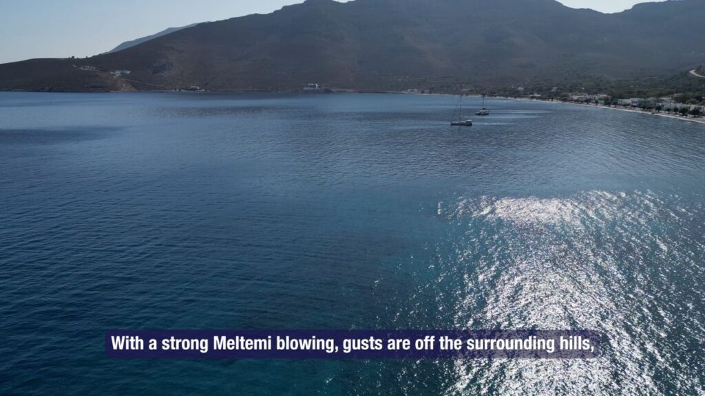
→ Meltemi gusts off hills at Ormos Livadia · swell into the bay in strong wind
→ Only ONE mooring line at Livadia Marina · bring your own ground tackle
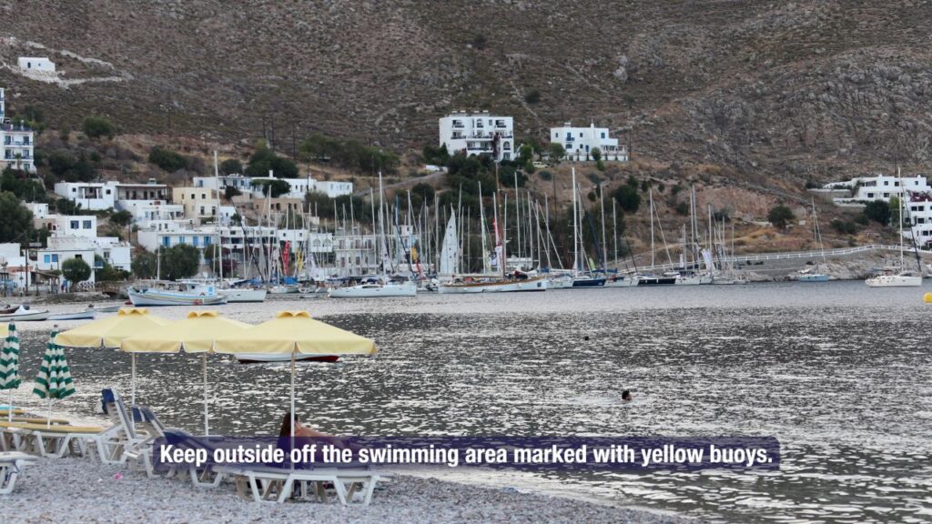
→ Stay outside swimming areas marked with yellow buoys
→ Don’t anchor on seagrass · sand patches only
→ Small island · ~750 inhabitants · provisions limited · stock up at Kos or Rhodes first
⚓ Tilos at a Glance
Position
Between Nisyros (NW) and Chalki (SE)
Size · Population
~63 km² · ~750 residents
Capital
Megalo Chorio (inland)
Main port
Livadia · E coast
Energy
First 100% renewable Mediterranean island (2019)
Status
Natura 2000 wildlife refuge
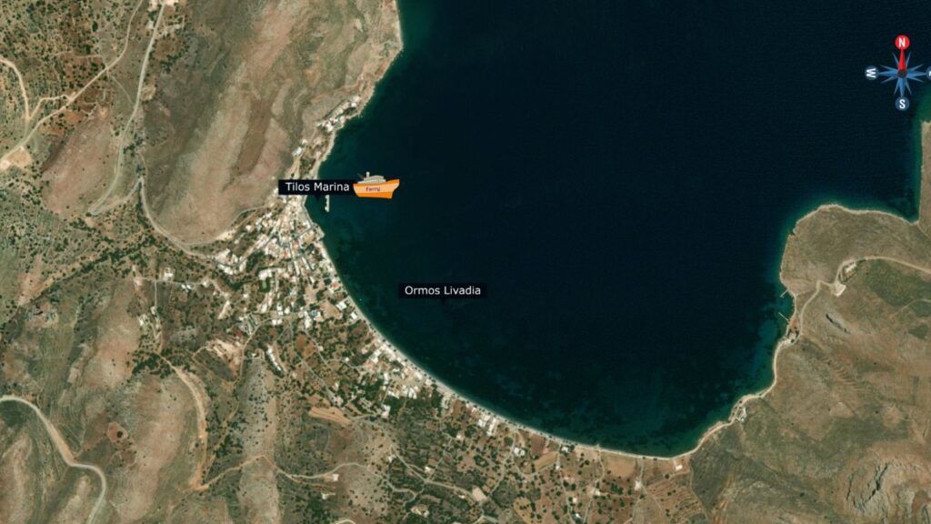
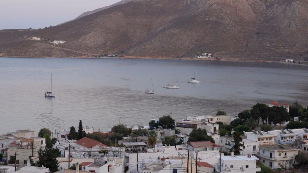
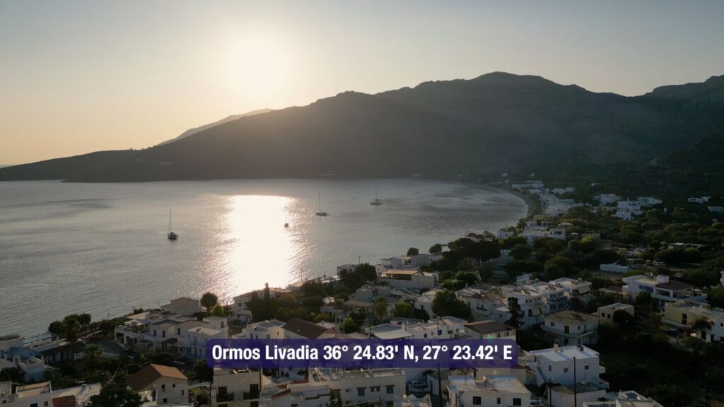
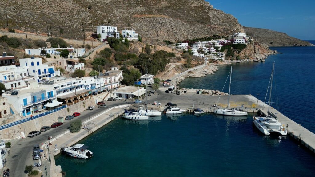
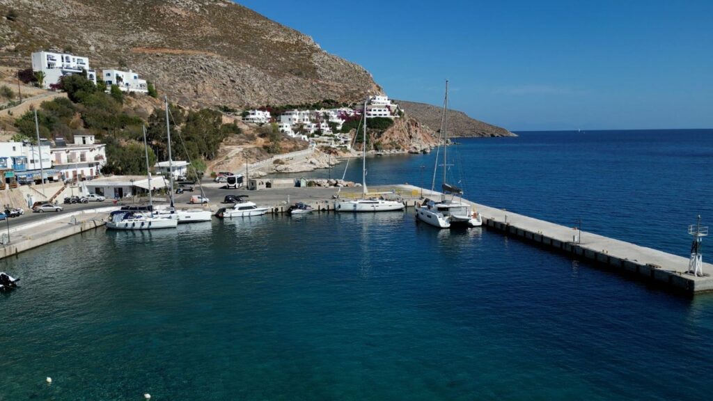
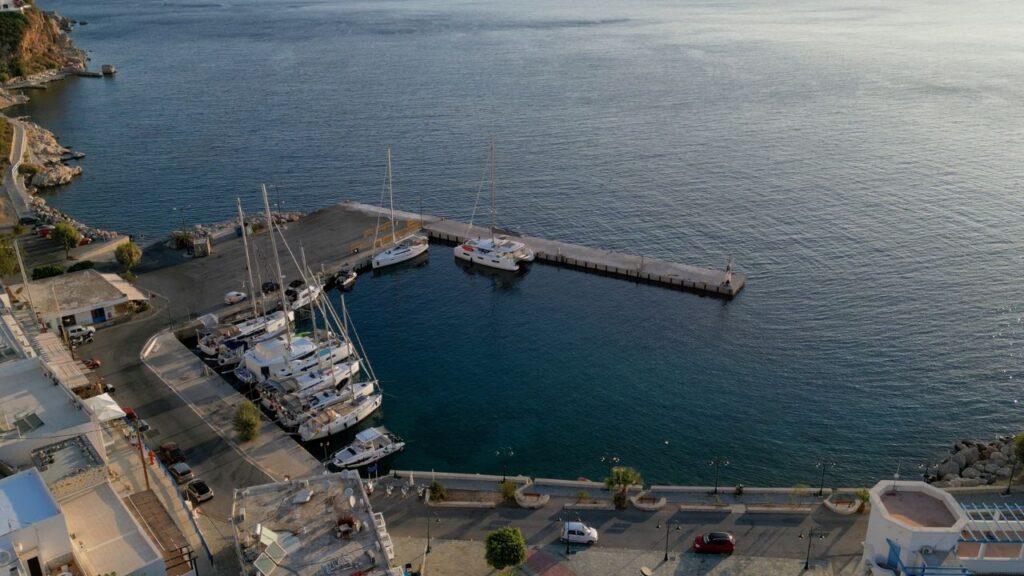
⚓ 1. Ormos Livadia — The Anchorage
Position · 36°24′.83N · 27°23′.42E · East Coast
Ormos Livadia — Large East-Coast Bay
Position: Large bay on the east coast of Tilos · the main natural anchorage area · the village of Livadia sits at the head of the bay with the marina on the W side.
Bottom: Sand and seagrass · ⚠ do not anchor on seagrass (Posidonia protected + poor holding).
Yellow buoys: Stay outside the swimming area marked with yellow buoys · enforce-able · keep clear of the marked zone.
⚠ Meltemi reality: With strong Meltemi blowing, gusts come off the surrounding hills · swell works its way into the bay · uncomfortable in >20-knot Meltemi · move into the marina or sail elsewhere if a serious blow is forecast.
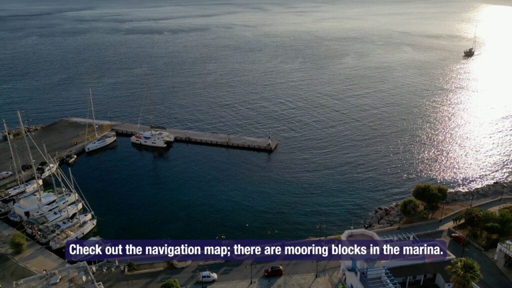
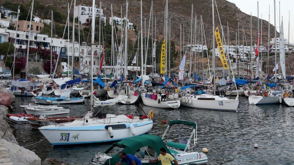
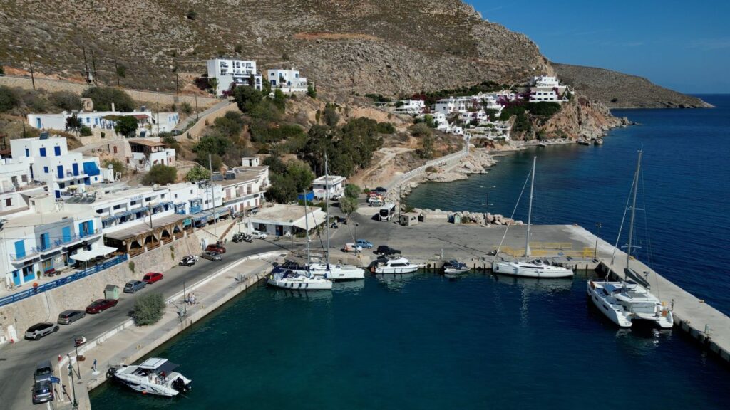
⚓ 2. Livadia Marina — Main Berth
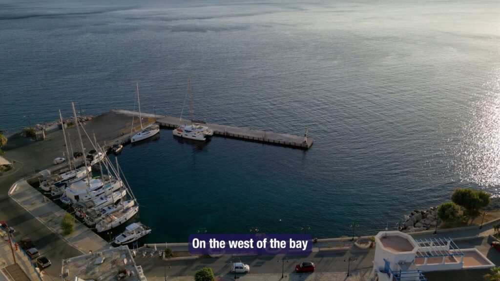
Position · 36°25′.00N · 27°23′.15E · West Side of Bay
Livadia Marina
Position: West side of Ormos Livadia · sheltered behind the village.
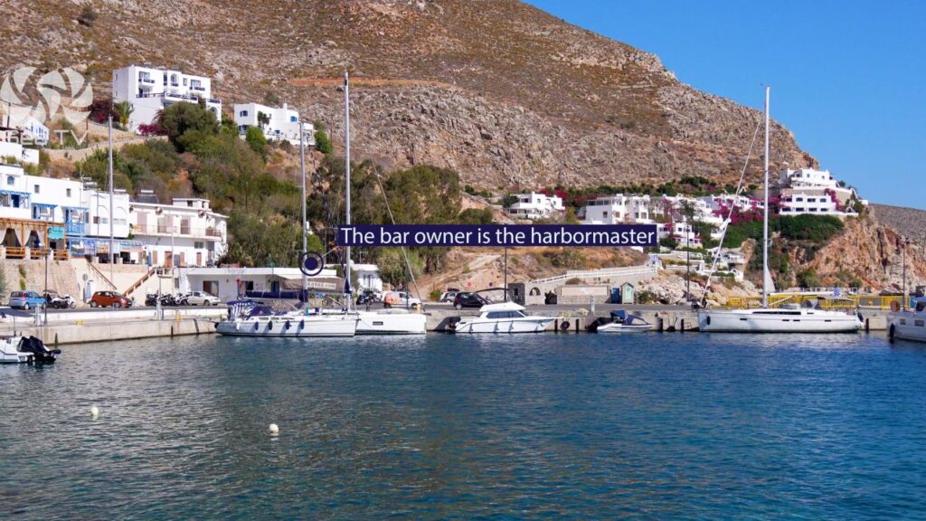
Harbourmaster: Panagiotis · the local bar owner serves as harbourmaster · phone +30 698 665 3695 · this is the genuine Greek-island procedure · contact him on arrival.
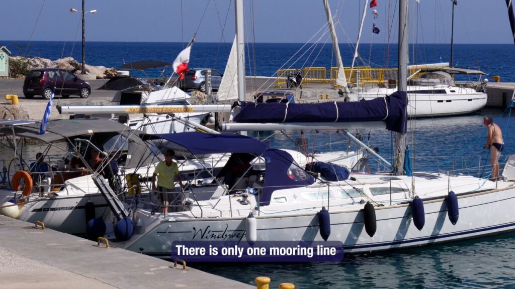
⚠ Only ONE mooring line: The marina has just one mooring line · plan to anchor or use your own lines for stern-to · don’t expect lazylines on most berths.
Mooring blocks: Check the navigation map for mooring blocks in the marina · don’t drop anchor over them.
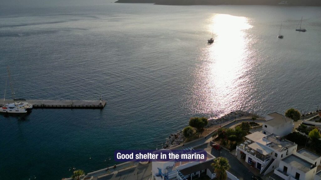
Shelter: Good shelter inside the marina basin.
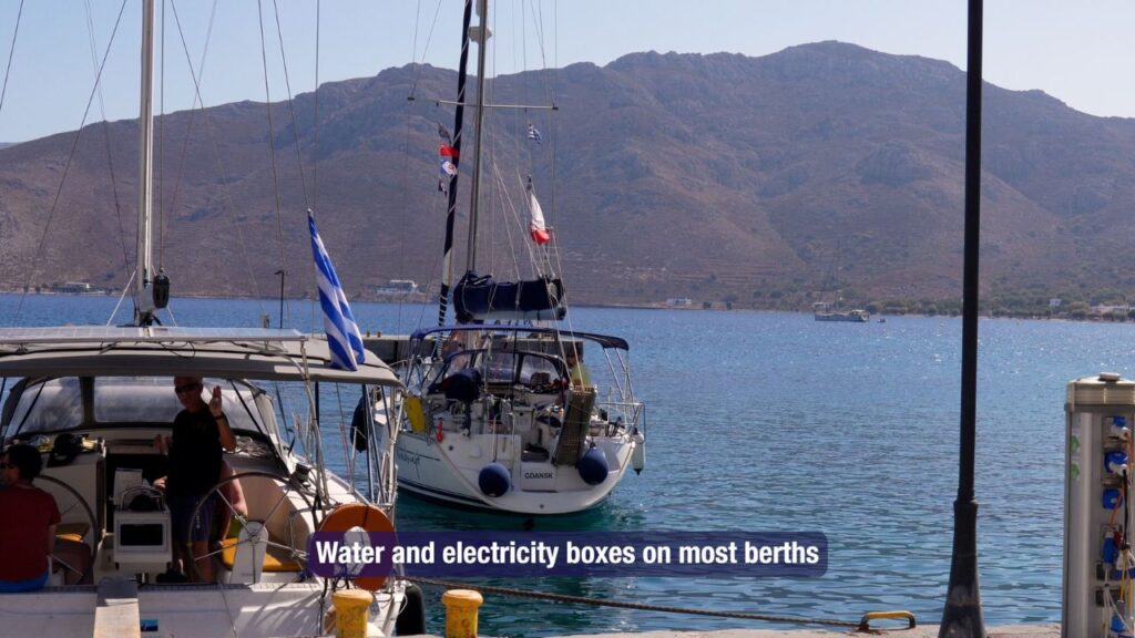
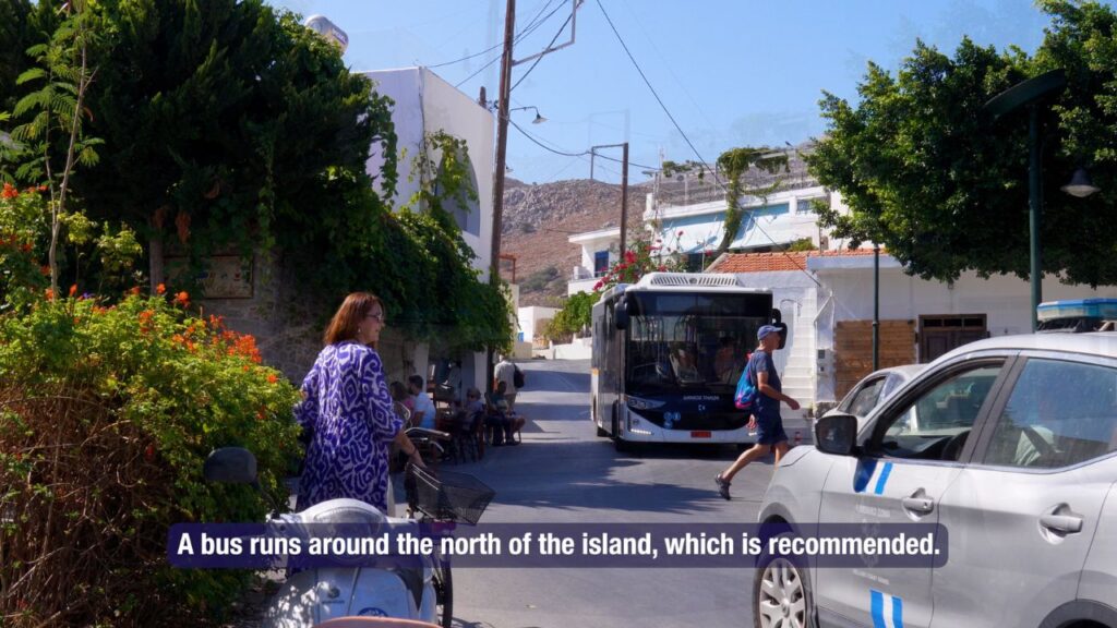
Facilities: Water + electricity boxes at most berths · restaurants + shops around the marina · car rental at the port · bus service around the N of the island.
The Beaches of Tilos
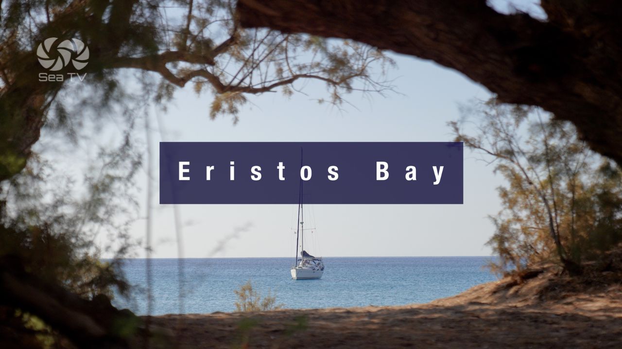
Eristos Beach — The Sailing Anchorage Bay
Position: 36°25′.83N · 27°20′.98E · S coast · 3 km S of Megalo Chorio.
Large S-coast bay with crystal-clear water · sand bottom anchoring 3-5 m · partial Meltemi shelter (gusts/swell in strong wind) · the most distinctive sailing beach on Tilos.
Full detail: See Eristos Bay (Tilos).
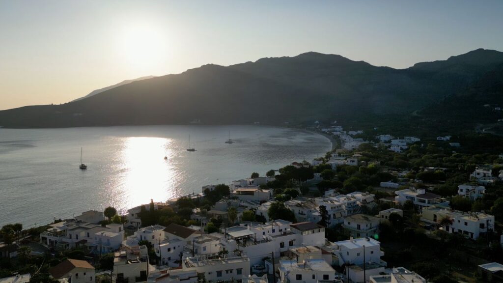
Livadia Beach — The Organized One
Position: 7 km SE of Megalo Chorio · the village of Livadia and its beach.
The only organized beach on Tilos — closest to the tourist facilities · clean water · pebbled shore (not sandy). Walking distance from the marina · the practical option for a quick swim ashore.
Agios Antonios Beach — N Coast
Position: 2 km W of Megalo Chorio · N side of the island.
A calm beach on the island’s northern side · no tourist amenities nearby · the seabed gets deep and rocky in places. Use only for a brief swim · not a primary anchorage.
Plaka Beach — The Narrow One
Position: 5 km W of Megalo Chorio.
A narrow bay close to the capital · some bushes along the shore provide shade · seabed gets rocky in places · settled-weather only.
Tilos Culture & History
100% Renewable Energy — Mediterranean First
In 2019, Tilos became the first Mediterranean island to run on 100% renewable energy via the EU-funded TILOS project — wind turbines, solar panels, and battery storage. The wind turbine on the ridge above the island is visible from sea on approach. A reference case for European island sustainability.
Charkadio Cave — Prehistoric Dwarf Elephants
Discovered 1971 · fossils of Palaeoloxodon tiliensis, prehistoric pygmy elephants ~1.6 m tall, that lived on Tilos until ~4,000 BC before going extinct. They evolved from mainland mammoths isolated by rising sea levels — insular dwarfism over thousands of generations. The Tilos archaeological museum in Megalo Chorio displays the finds.
Saint Panteleimon Monastery — The Island’s Protector
The Monastery of Saint Panteleimon, the spiritual protector of Tilos, sits on the W side of the island in a remote valley · a 15th-century Byzantine foundation · frescoes and a small museum · accessible by hired car or hike. The monastery feast day in late July is the island’s main religious festival.
Mikro Chorio — Abandoned Medieval Village
“Small Village” was the medieval mountain settlement of Tilos · abandoned in the 1960s when residents moved closer to Livadia harbour for tourism work. The stone houses, church, and small castle remain as an atmospheric ruin · easy walk from Megalo Chorio · one of the most evocative cultural visits on the island.
Wildlife Refuge — Eleonora’s Falcons
Tilos is part of the European Natura 2000 protected-area network · significant Eleonora’s falcon nesting populations on the cliffs · Bonelli’s eagles and migratory species use the island as a stopover. Hunting is banned across the entire island — uncommon in Greek-island contexts and a marker of how seriously Tilos takes its environmental status.
Wind & Shelter
Meltemi (NW summer): The dominant Aegean summer wind · Livadia gets gusts off the surrounding hills + swell into the bay in strong Meltemi · the marina basin gives better shelter than the open anchorage.
⚠ S winds: Eristos (S coast) is exposed · move to Livadia (E coast) for shelter from southerlies.
Best season: May-June and September-October are quality windows · August has the strongest Meltemi and the most crowds.
Pro Tips for Tilos
Contact Panagiotis on arrival. +30 698 665 3695 · the local bar owner is also the harbourmaster · genuine Greek-island procedure.
Bring your own lines for stern-to. Only ONE mooring line at Livadia Marina · don’t rely on lazylines · plan for stern-to with bow anchor and shore lines.
Rent a car or use the bus. Bus around N of island recommended · car rental at the port · the Charkadio Cave + dwarf elephant museum + Mikro Chorio + Saint Panteleimon Monastery are all inland.
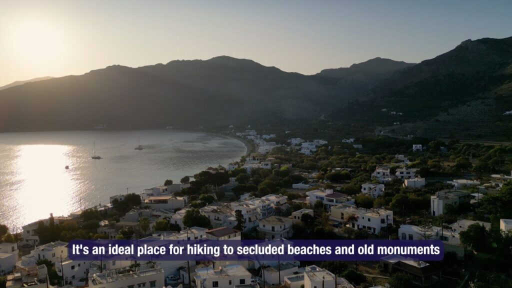
Hike the marked paths. Tilos has many marked hiking paths · the island’s quiet character + wildlife refuge status make it one of the best Aegean walking islands. Plan a half-day or full-day hike if conditions allow.
Pair Livadia + Eristos. Livadia (E) for berthing + provisioning + culture · Eristos (S) for swimming · use both for a complete Tilos experience.
Visit the Charkadio Cave. Prehistoric dwarf elephant fossils + the museum in Megalo Chorio · the most distinctive cultural visit in the southern Dodecanese.
Routes from Tilos
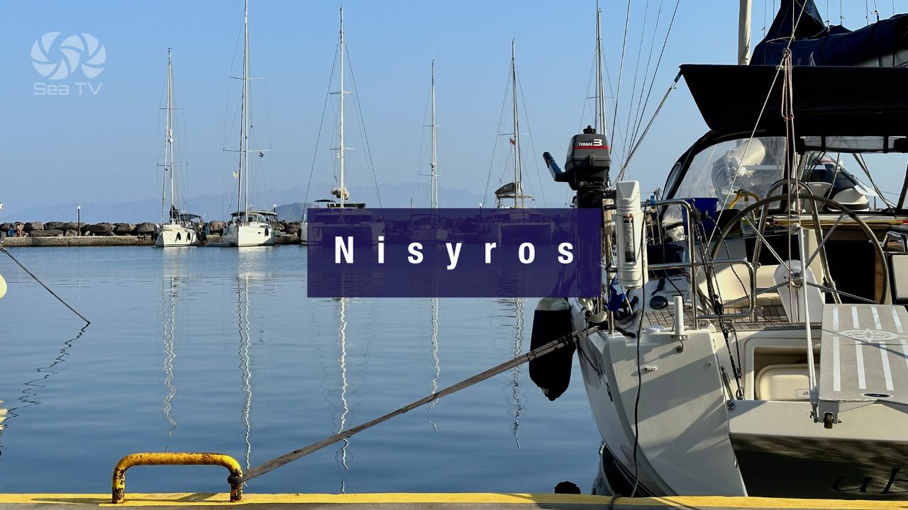
NW to Nisyros: ~10-15 NM NW · active volcano. See Nisyros Island.
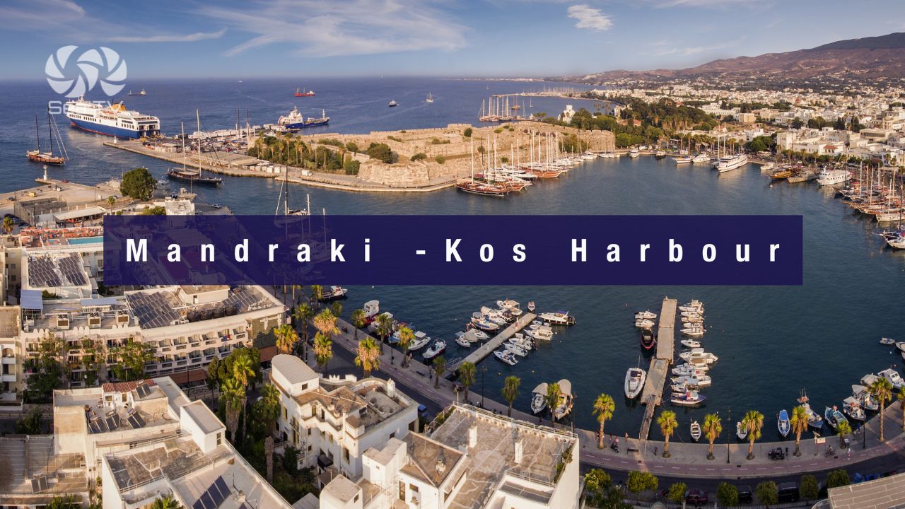
N to Kos: ~30 NM. See Mandraki Kos · Kardamena.
SE to Symi: ~20 NM. See Symi.
SE further to Rhodes: ~40 NM. See Rhodes.
W to Chalki: ~25 NM. See Chalki.
Dodecanese full route: See Dodecanese — Our Route.
Contact & Emergency Numbers — Tilos
European Emergency: 112
Greek Coastguard: 108
Coastguard Distress (VHF Ch. 16): Universal
Tilos Port Authority (Livadia): +30 22460 44350
Panagiotis (Livadia harbourmaster): +30 698 665 3695
Watch the SeaTV Visual Pilot Video
Drone passes Ormos Livadia bay with the village at the head and Livadia Marina on the W side, the wind turbine on the ridge that powers the entire island, the Charkadio Cave inland, the abandoned medieval Mikro Chorio on its hilltop, the Saint Panteleimon Monastery in its remote valley, and Eristos Beach on the south coast. Free for members.
Related SeaTV Pages
Tilos Detail Pages
→ Eristos Bay (Tilos) · sandy S-coast swim anchorage
North to Kos · Kalymnos · Leros
Sailing to Tilos?
Livadia port + marina on the E · Eristos sandy bay on the S · prehistoric dwarf elephants · Saint Panteleimon Monastery · 100% renewable energy · the quietest layered island in the southern Dodecanese.
“Tilos sits between Nisyros and Chalki — small, quiet, ecologically distinctive, and the first Mediterranean island to run on 100% renewable energy. Livadia port and marina on the east handle the sailing infrastructure (Panagiotis the bar-owner-harbourmaster will see you in), Eristos Beach on the south handles the swimming, the Saint Panteleimon Monastery and the abandoned Mikro Chorio handle the cultural visits, and the prehistoric dwarf elephants in the Charkadio Cave handle the wildcard. Bring your own lines, hike the marked paths, watch for Eleonora’s falcons, and Tilos opens up as the layered quiet stop in the southern Dodecanese.”
— SeaTV Visual Pilot · Dodecanese Edition