SeaTV · Greece · Dodecanese Islands · Lindos (Rhodes)
Lindos, Rhodes — The 116 m Cliff-Top Acropolis & the Best Natural Port on Rhodes
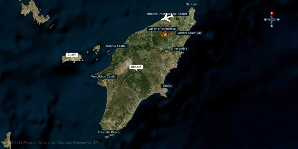
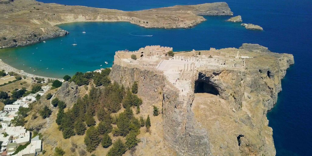
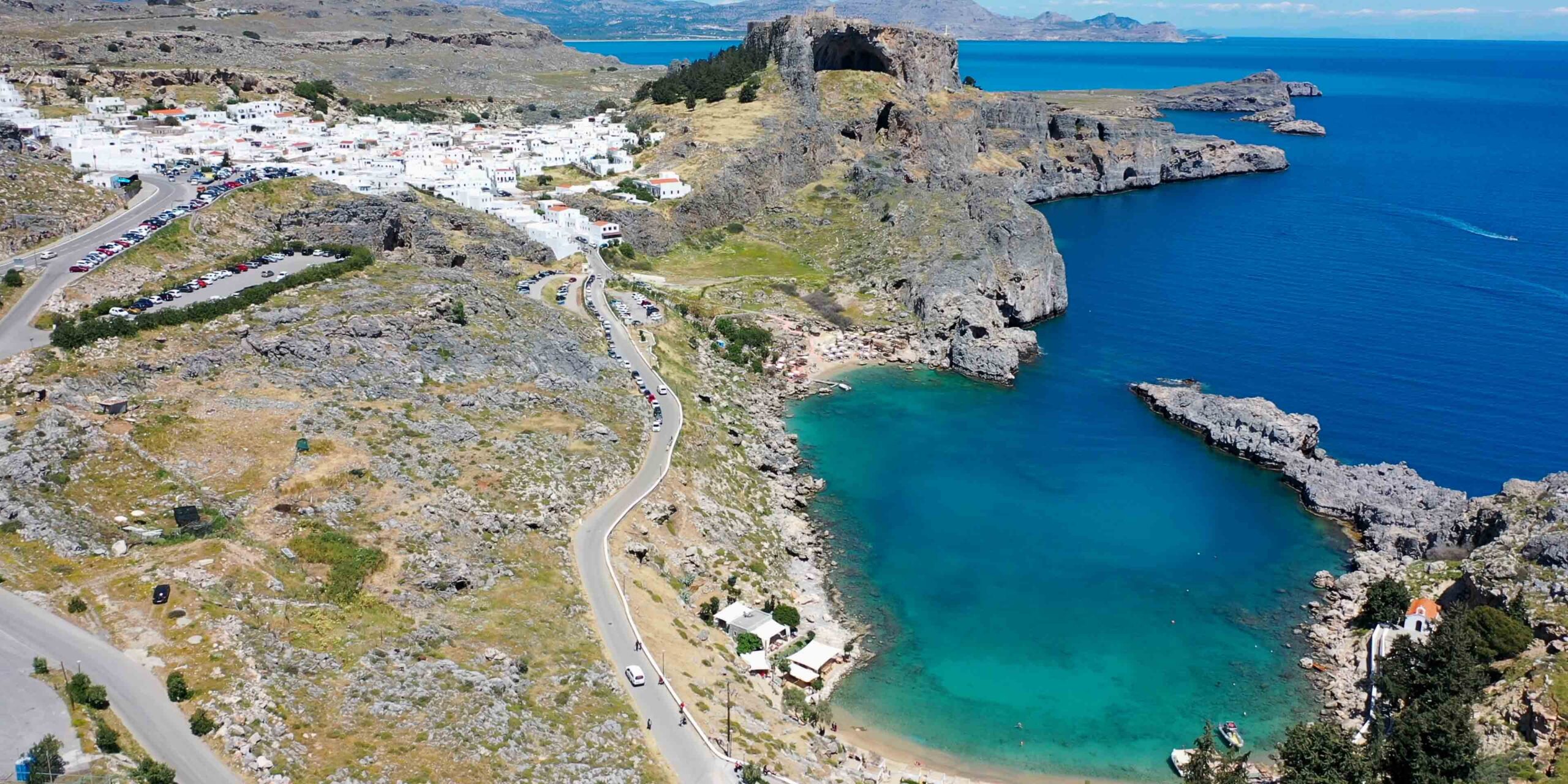
36°05′.50N · 28°05′.17E · approximately 24 NM SE of Rhodes old town. The most distinctive sailing visit on Rhodes — a layered acropolis climbing 116 m above a natural-port bay, with the 4th-c BC Doric Temple of Athena Lindia, a Byzantine church, and a Knights’ castle stacked on the cliff. The bay opens east, offers good shelter from SW and NW winds, and has depths 6-20 m inside. ⚠ Two rocky islets NE, large 3 m bottom rocks, and no harbour lights at night — daytime arrival only.
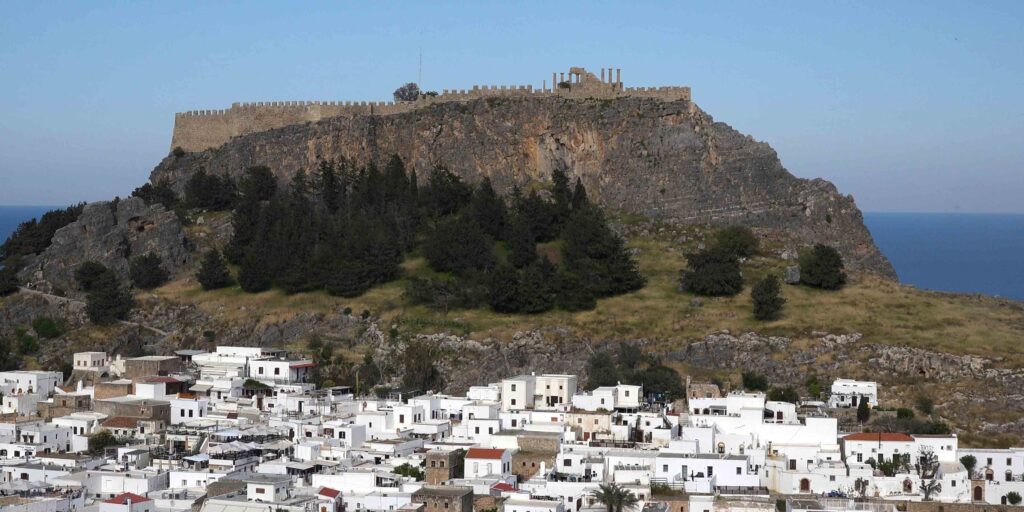
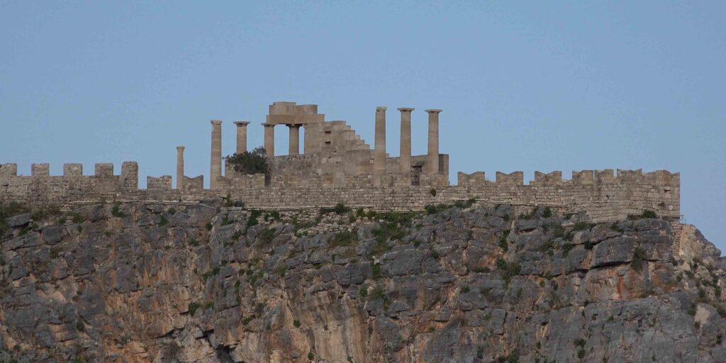
Lindos sits on the eastern coast of Rhodes about 24 nautical miles SE of the old town · the bay is open to the east and forms a natural port at the foot of the cliff that holds the acropolis. The site has been continuously occupied for ~3,500 years — the Doric Greek city-state, the Byzantine continuation, and the medieval Knights’ fortifications all stack on top of each other on the 116-metre cliff. From the water, the white village climbing the slope below the acropolis is one of the most photographed views in the eastern Aegean. The car-free village’s narrow alleys, courtyards, and captain’s houses preserve the look of pre-modern Aegean architecture.
⚠ Reality check:
→ NO LIGHTS at night · daytime arrival only · don’t approach in the dark
→ Two rocky islets NE of the bay · plot before approach
→ Large rocks up to 3 m on the bottom · careful anchoring · check holding
→ Bay opens to the east · easterlies blow swell straight in
→ Crowded in season · day-tour boats arrive midday
⚓ Lindos at a Glance
Position
36°05′.50N · 28°05′.17E
Distance from Rhodes Old Town
~24 NM SE
Depths inside bay
6-20 m
Bottom
Rocky with some sand
Acropolis height
116 m above the bay
Shelter
Good from SW + NW · open E
Approach & Bay Geography
Daytime Only · Two Rocky Islets NE · 3 m Bottom Rocks
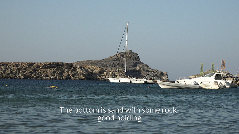
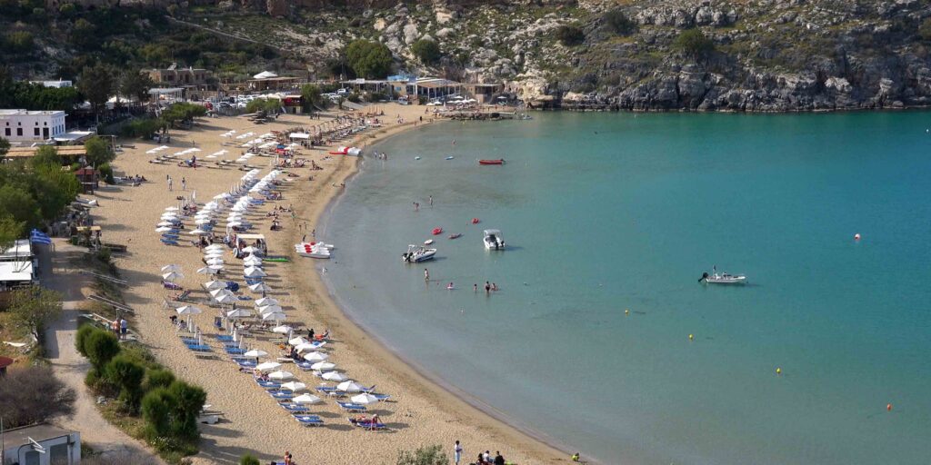
The bay: Lindos forms a natural port at the foot of the acropolis cliff · opens to the east · the bay holds depths of 6-20 m inside.
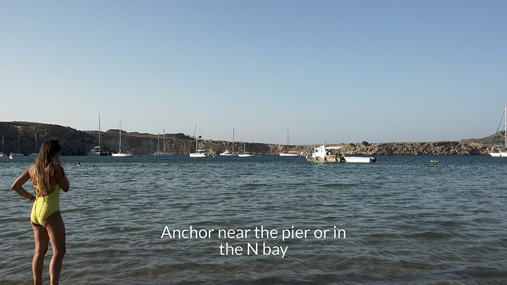
Two small coves: Two smaller coves sit at the NW and SW corners of the bay — useful for sheltering from specific wind angles.
⚠ Two rocky islets NE: Plot the islets to the NE before approach · give them sea room.
⚠ Large rocks on bottom: Up to 3 m tall rocks on the bottom · check the chart before dropping anchor · drop in clear sand patches only.
⚠ NO LIGHTS at night: The bay has no harbour lights · daytime approach only · don’t try to enter in the dark.
Shelter: Good from SW and NW winds · the cliffs and the headlands protect from those angles · open and exposed to E.
⚓ Mooring at Lindos
Anchoring · Bay Body · 6-20 m
Anchoring in the Bay
Depths: 6-20 m inside the bay · pick the depth that suits your scope.
Bottom: Rocky with some sand · drop on a clear sand patch · re-set if you don’t bite cleanly.
⚠ Watch for 3 m bottom rocks · careful where you drop.
Stern-To · West Side of Breakwater · Small Boats Only
Stern-To at the Breakwater
Small boats can stern-to the western side of the breakwater · this gives quick access to the village and reduces the dinghy run · only suitable for smaller yachts and only in calm conditions.
The Acropolis of Lindos
Three Civilisations Stacked on a 116 m Cliff
The Lindos acropolis is one of the most layered archaeological sites in Greece · three major civilisations have built on the same 116-metre cliff over 3,500 years:
→ 4th c BC Doric Temple of Athena Lindia — the original sanctuary, with a Hellenistic stoa added later · the column drums and architrave fragments still standing on the summit are the remains of this temple
→ Byzantine Church of Saint John (~13th c) — the Christian continuation in the same sacred precinct
→ Knights of St John castle (1309-1522) — the medieval fortifications that wrap around the earlier ruins, including the gateway, the inner walls, and the cisterns
Climbing to the Top — On Foot or by Donkey
Two options to reach the acropolis:
→ On foot — about 30-40 minutes climb up the stepped path through the village · steep · not for those with mobility issues
→ Donkey ride — a Lindos tradition · donkeys carry visitors up the steep path for a fee · arrange at the foot of the climb
The View from the Top
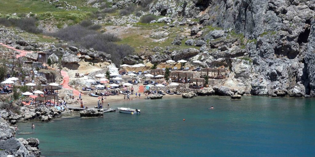
From the acropolis ramparts you look directly down into Lindos Bay below, across to the second small bay south of the castle (“St Paul’s Bay” — a narrow cliff-walled cove with its own white chapel), and far out across the eastern Aegean. One of the most distinctive elevated coastal views in Greece.
The Lindos Village
Car-Free Stone Village
The village below the acropolis is car-free · narrow whitewashed alleys, traditional flagstone courtyards (chochlakia — black-and-white pebble mosaics), and shops/restaurants in the renovated old houses. The ban on cars preserves the pre-modern look of the village in a way few Greek-island settlements still manage.
Captain’s Houses · 15th-19th Century
Lindos was a wealthy maritime community in the medieval and early-modern period · the “captain’s houses” (kapetanospita) belonged to local merchant captains and date from the 15th-19th centuries · their distinctive carved doorways, decorated courtyards, and interior wood carvings can be visited at several preserved examples open to the public.
Visit Strategy — Early or Late
Visit Lindos early in the morning or late in the afternoon · midday in season is crowded with day-tour buses from Rhodes town · the village’s character returns once the buses leave. The walk through narrow shady alleys is the experience the village is built for.
Wind Strategy at Lindos
SW winds: Good shelter · the cliffs and the SW headland protect the bay.
NW Meltemi: Good shelter · the bay’s east-facing position keeps the prevailing summer wind off your beam.
⚠ E winds: Direct exposure · swell straight in · move on if any E component forecast.
Best time of day to arrive: Late morning · after Meltemi can build · before midday tour-bus crowds peak in the village. Avoid late afternoon arrival because the climb to the acropolis takes time and you don’t want to be coming back down in the dark.
Pro Tips for Lindos
Daytime arrival only. No harbour lights at night · plan to arrive during daylight · plot the rocky islets NE and the bottom rocks before approach.
Drop on a sand patch only. 3 m bottom rocks make rocky-bottom anchoring risky for fouling · pick a clear sand patch and re-set if you don’t bite cleanly.
Visit acropolis early. Climb early morning · cooler · before the tour buses arrive · 30-40 minutes on foot or take a donkey.
Walk the village in the afternoon. After the buses leave · narrow alleys, captain’s houses, courtyards · the village without cars and without crowds.
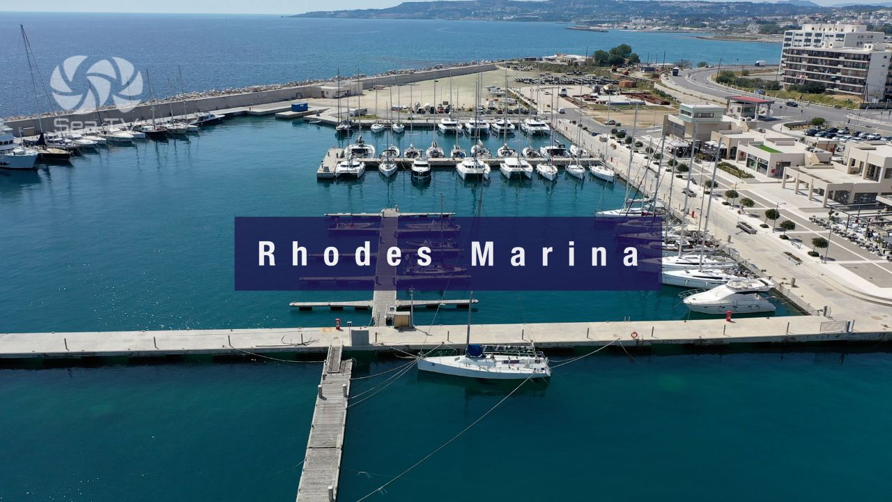
Move on if E winds forecast. Bay is exposed to easterlies · don’t get caught overnight · sail back to Rhodes Marina (~24 NM NW).
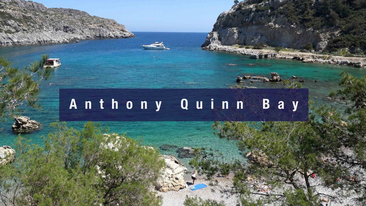
Combine with Anthony Quinn Bay. Day-sail from Rhodes Marina ~7.5 NM SE to Anthony Quinn for a swim, then ~16 NM further to Lindos for the acropolis · the most efficient SE-coast Rhodes day.
Don’t miss St Paul’s Bay. The small bay south of the castle has its own narrow cliff-walled cove and a small white chapel · visible from the acropolis ramparts above.
Routes from Lindos
Back NW to Anthony Quinn: ~16 NM NW. See Anthony Quinn Bay.
NW further to Rhodes Marina: ~24 NM NW. See Rhodes Marina.
S to Prassonisi (windsurfing): ~25 NM S to the southern tip of Rhodes.
Dodecanese full route: See Dodecanese — Our Route.
Emergency Numbers — Rhodes
European Emergency: 112
Greek Coastguard: 108
Coastguard Distress (VHF Ch. 16): Universal
Rhodes Marina (Ch 71): +30 2241 440970
Related SeaTV Pages
Rhodes Detail Pages
Sailing to Lindos?
24 NM SE of Rhodes old town · cliff-top acropolis with three civilisations stacked · car-free village · daytime arrival only · move on if E winds forecast.
“Lindos is the layered acropolis-and-village stop on the eastern coast of Rhodes about twenty-four nautical miles southeast of the old town — the bay is a natural port at the foot of a hundred-and-sixteen-metre cliff, and three civilisations have stacked on top of each other on that cliff over three and a half thousand years (the fourth-century BC Doric Temple of Athena Lindia, the Byzantine continuation, the medieval Knights’ castle). Plot the rocky islets to the NE and the three-metre bottom rocks before approach, drop on a sand patch only, climb the acropolis early before the tour buses, walk the car-free village in the afternoon after they leave, and the most distinctive sailing visit on Rhodes opens up — but only in daylight, because the bay has no harbour lights at night.”
— SeaTV Visual Pilot · Dodecanese Edition