SeaTV · Greece · Dodecanese Islands · Symi Island
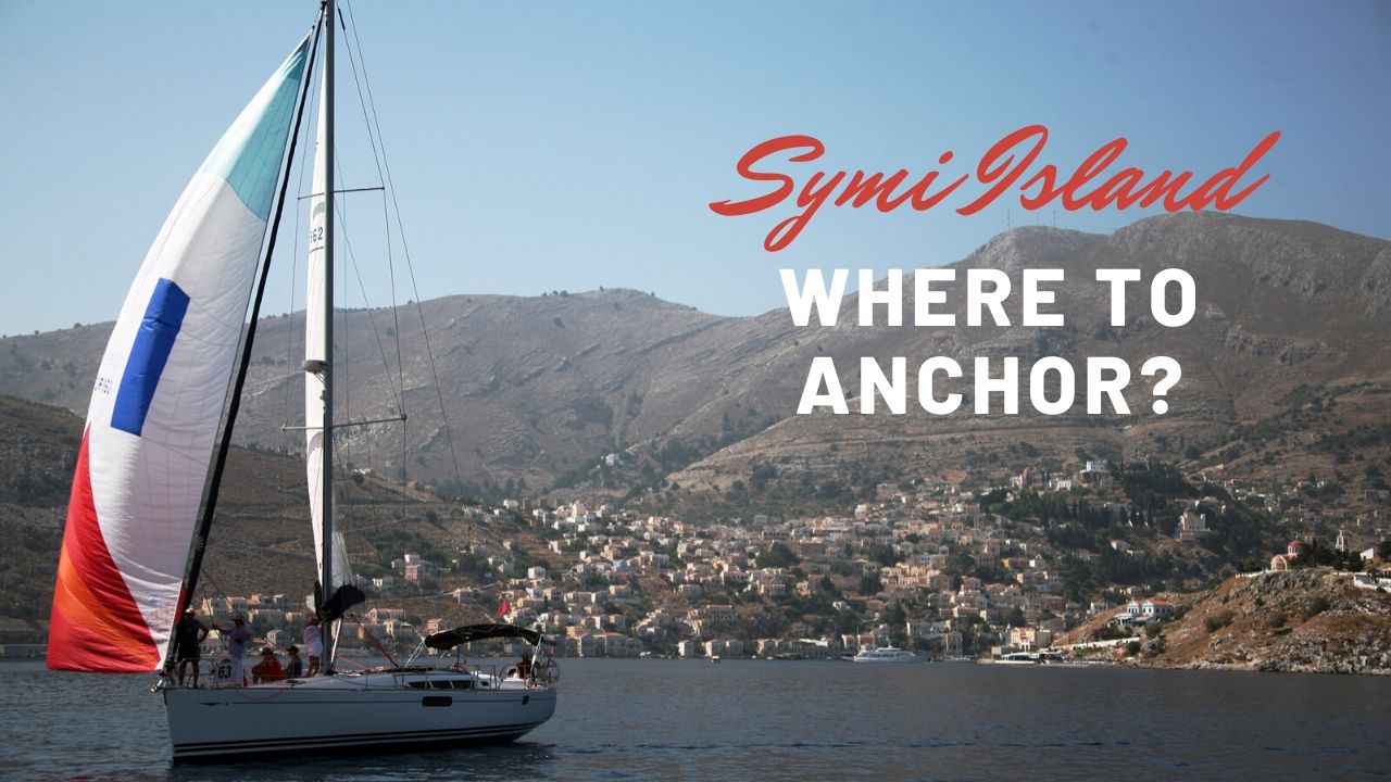
Symi Island — The Neoclassical Postcard Harbour, Pedi Bay & Panormitis Monastery
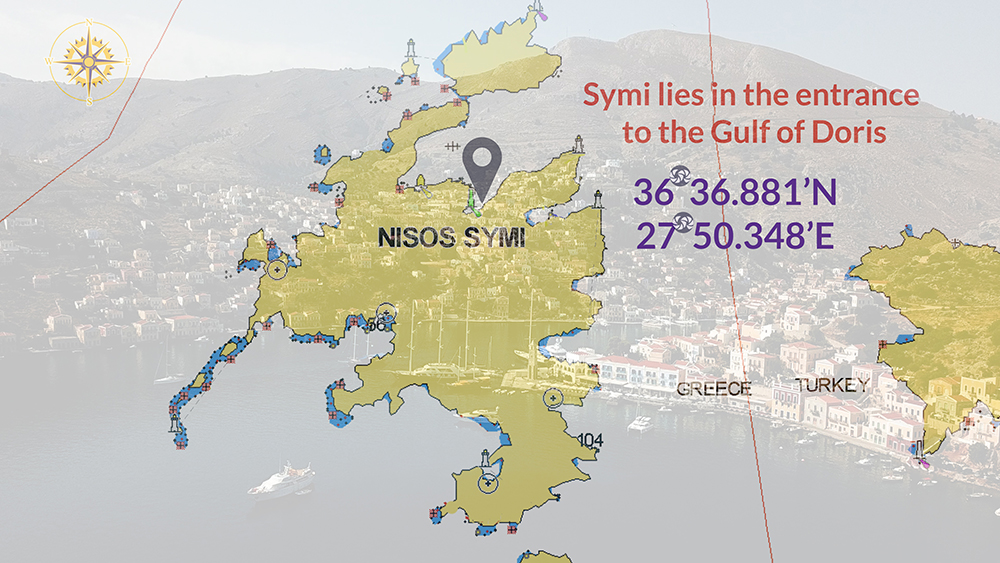
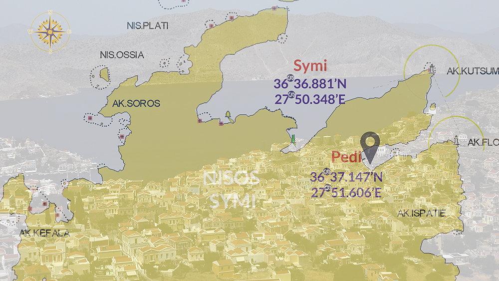
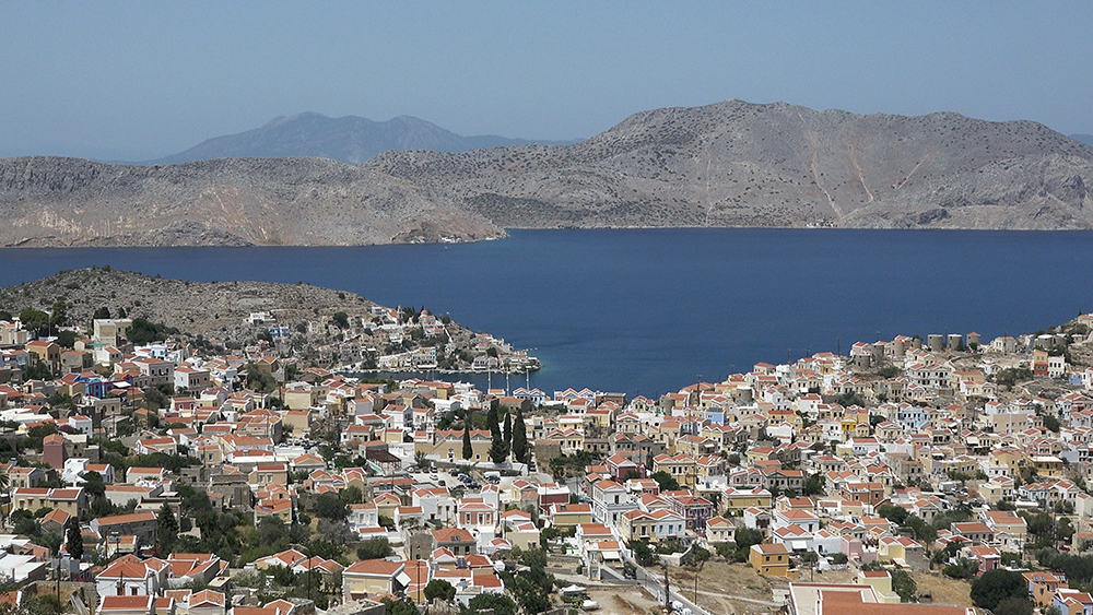
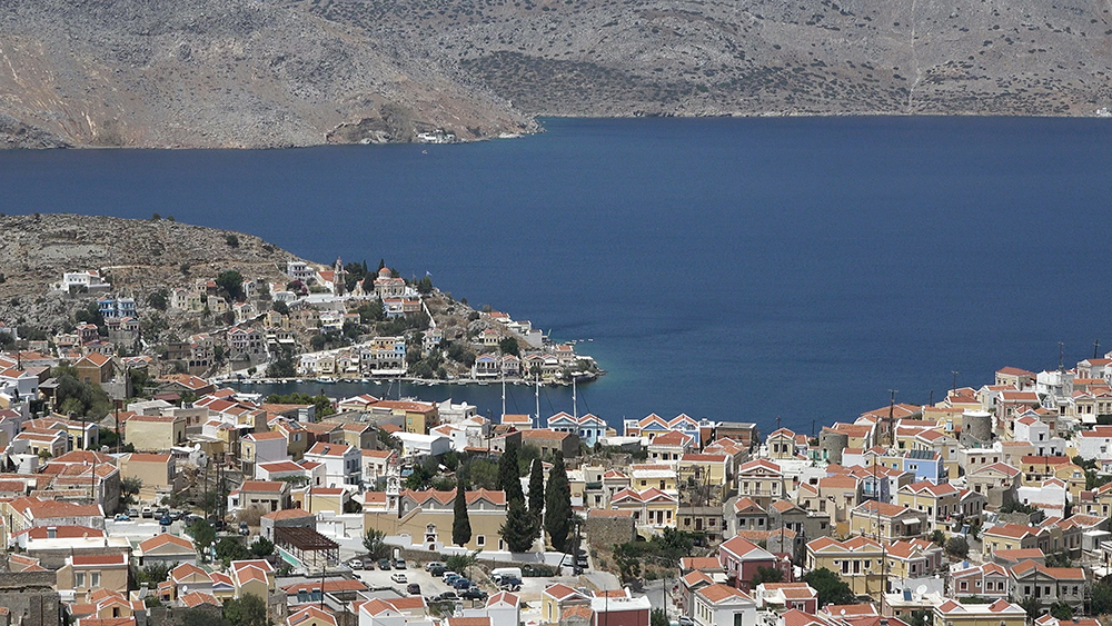
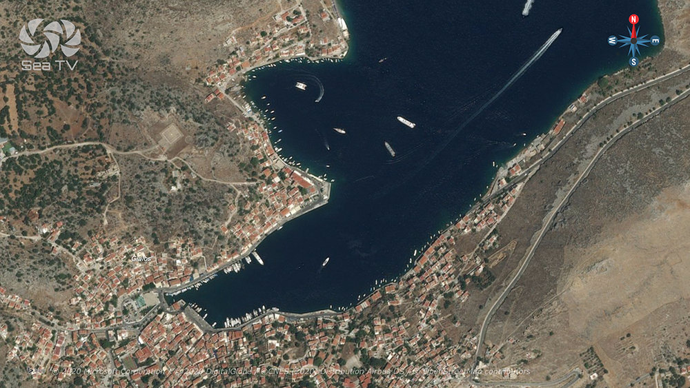
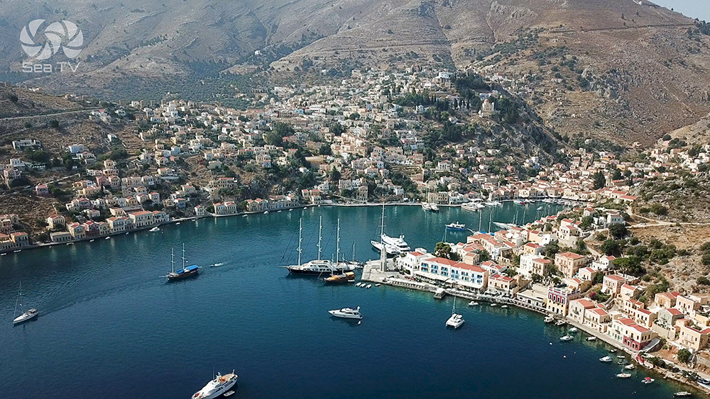
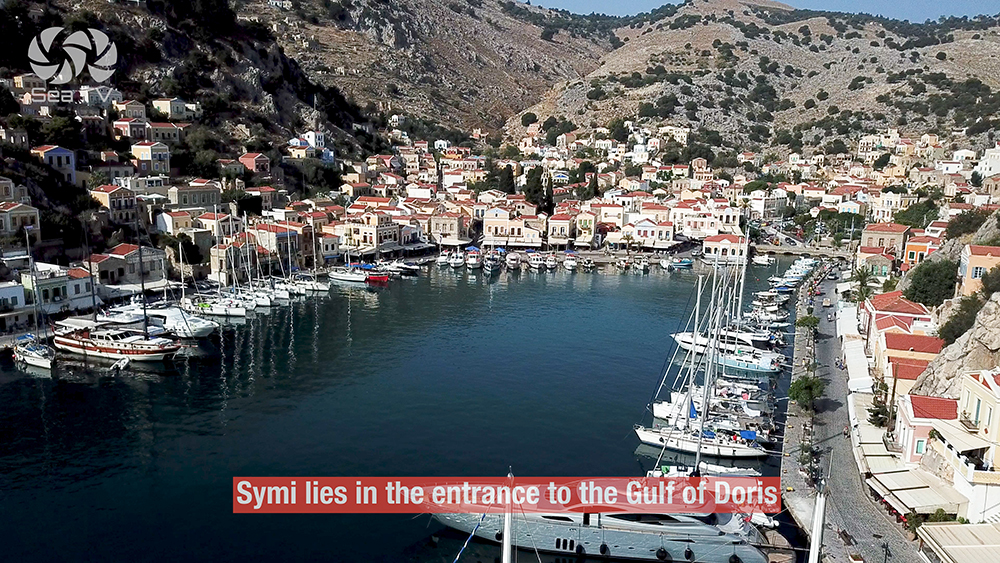
At the entrance to the Gulf of Doris between Rhodes and the Turkish Datça peninsula. Once famous for shipbuilding · the deep harbour at Symi Town is ringed with one of the most photographed neoclassical waterfronts in the Aegean. Three sailing options: Symi Town (deep N+S quay 12-20m, mud+rock holding, ⚠ S-wind surge), Pedi (E coast bay, 6-10m, poor sand+algae+rock holding, ⚠ rock at entrance), Panormitis (SW corner, enclosed bay, 3-6m sand+algae good holding, the monastery anchorage).
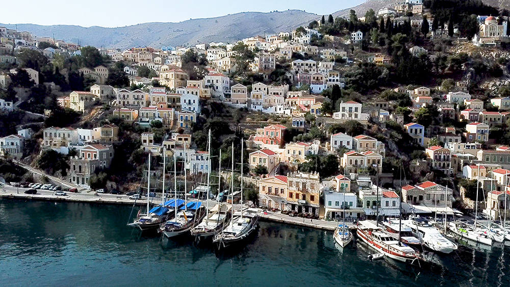
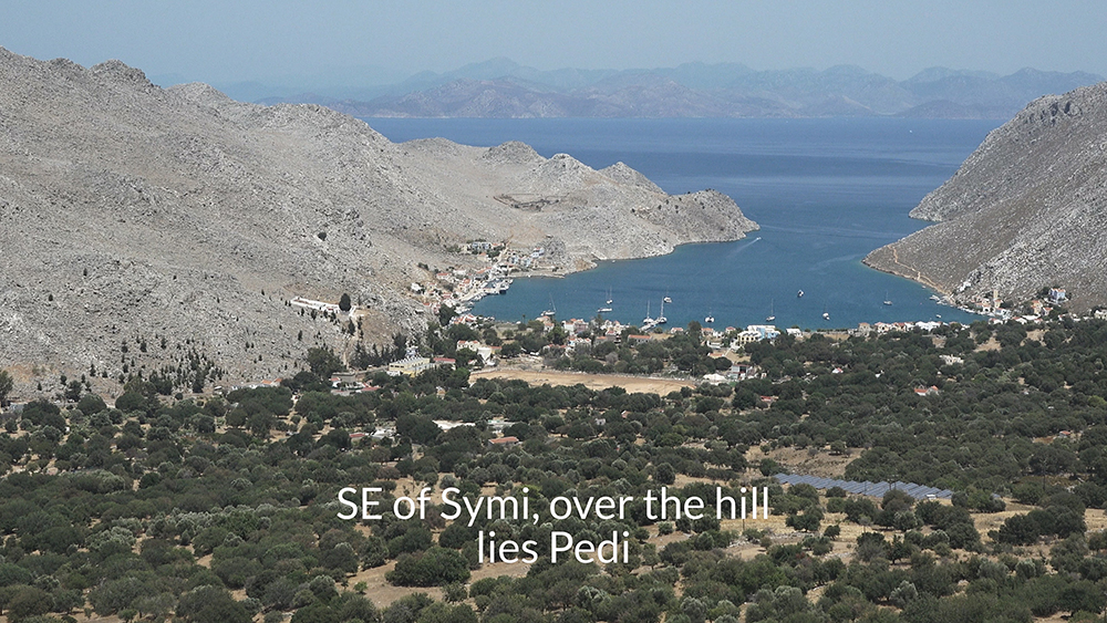
Symi sits at the entrance to the Gulf of Doris, between Rhodes (~25 NM SE) and the Turkish Datça peninsula immediately to the east. The island was famous for shipbuilding in the 18th-19th centuries and the wealth from that industry built the iconic ring of neoclassical waterfront houses in pastel colours that frame the deep harbour at Symi Town — one of the most photographed views in the Aegean. Three SeaTV-recommended sailing stops cover the island: the main town harbour, the smaller Pedi Bay over the hill to the SE, and the enclosed Panormitis Bay on the SW corner with its 18th-century monastery.
⚠ Reality check:
→ Symi Town: massive S-wind surge can become dangerous · move to Panormitis if S forecast
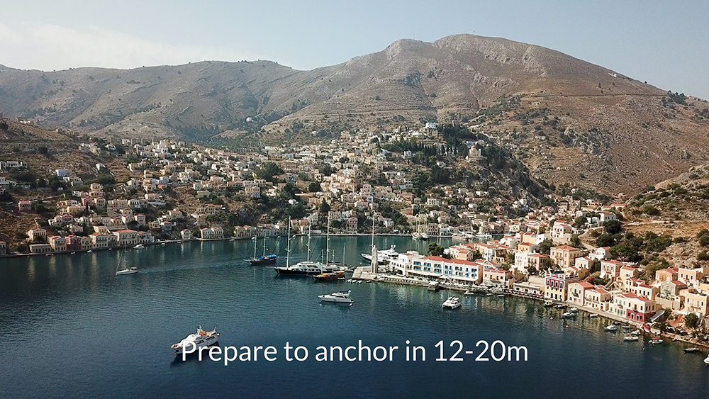
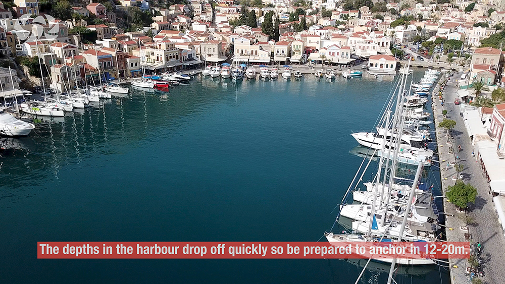
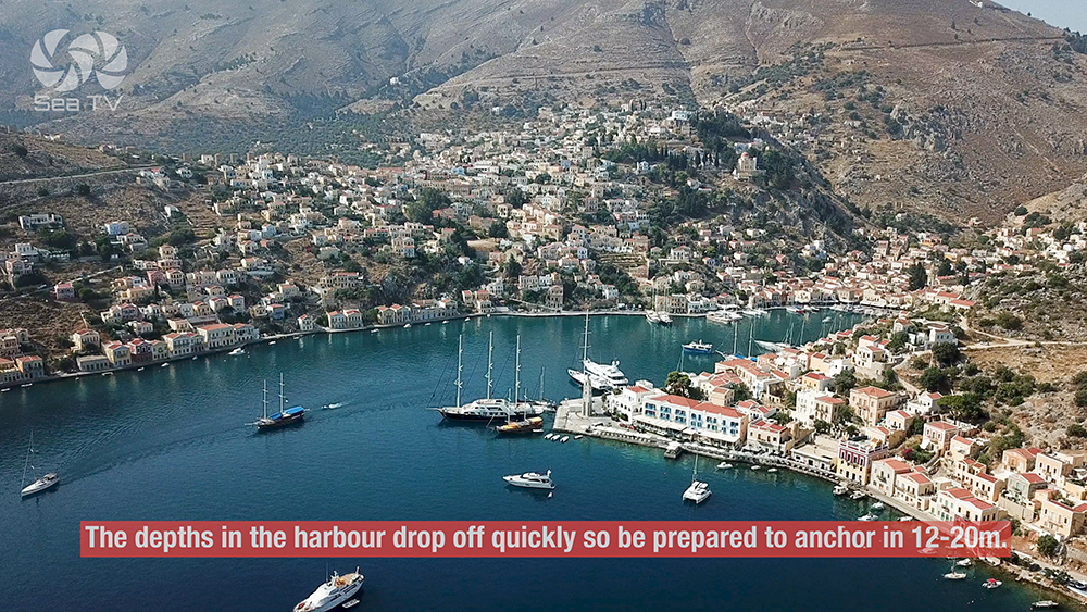
→ Symi Town: depths drop fast · be ready to anchor in 12-20 m
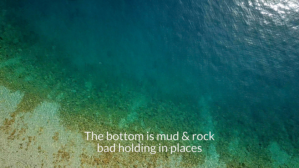
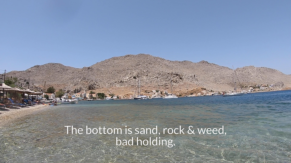
→ Bottom mud and rock · poor holding in places · re-set if needed
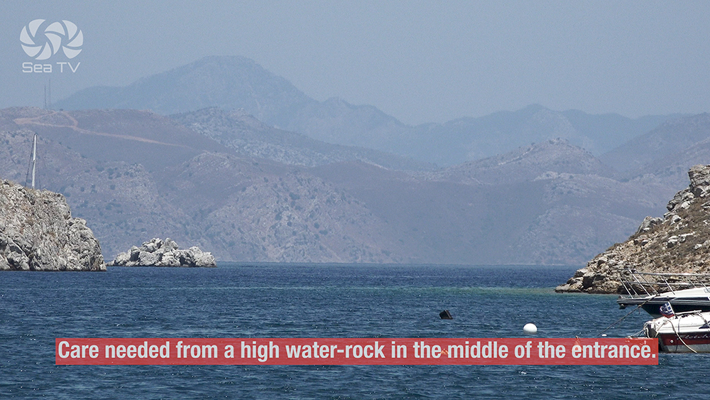
→ Pedi: high rock in middle of entrance · plot before entry
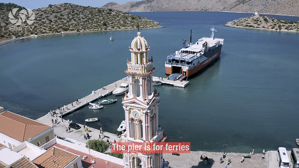
→ Ferry wash in Symi Town · expect violent surges when ferries enter
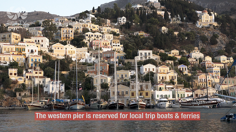
→ W pier reserved for tripper boats and ferries · don’t moor there
⚓ Symi at a Glance
Position
Entrance to Gulf of Doris · NW of Rhodes
Sailing stops
Symi Town · Pedi · Panormitis
Heritage
Shipbuilding + neoclassical waterfront
Distance from Rhodes
~25 NM SE
Distance from Turkey
~3 NM W of Datça peninsula
Best season
May-Oct · avoid S-wind days
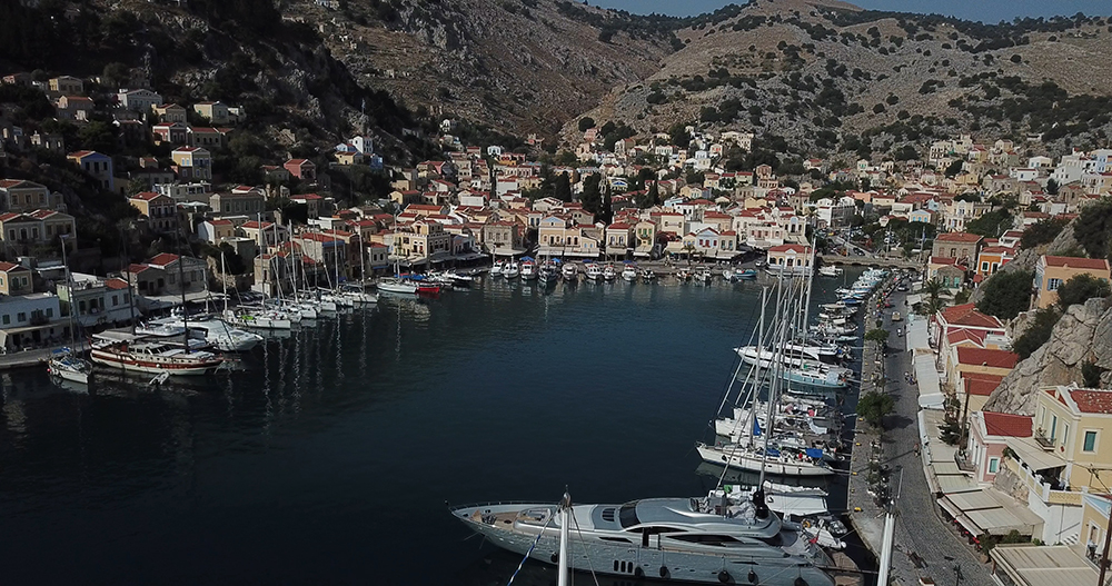
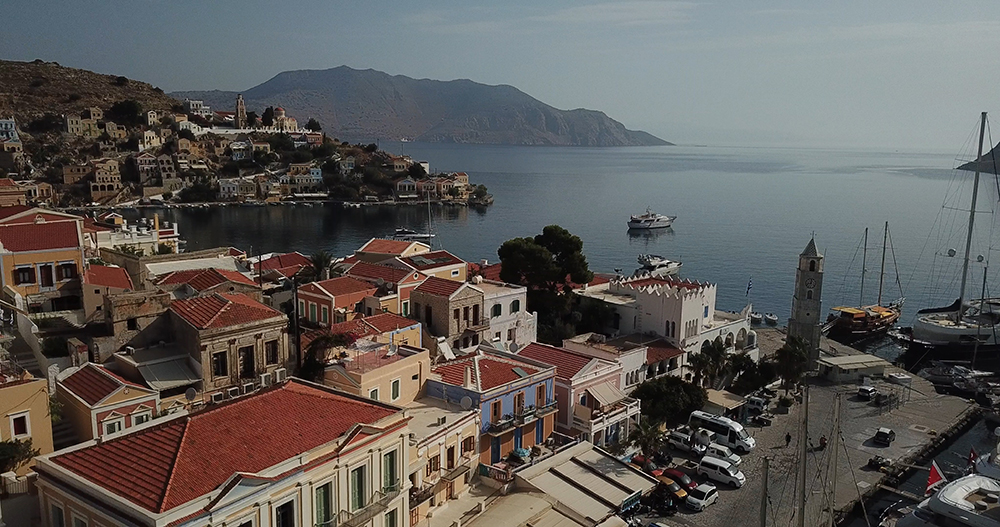
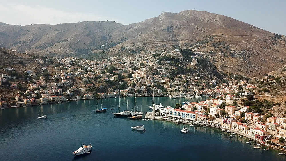
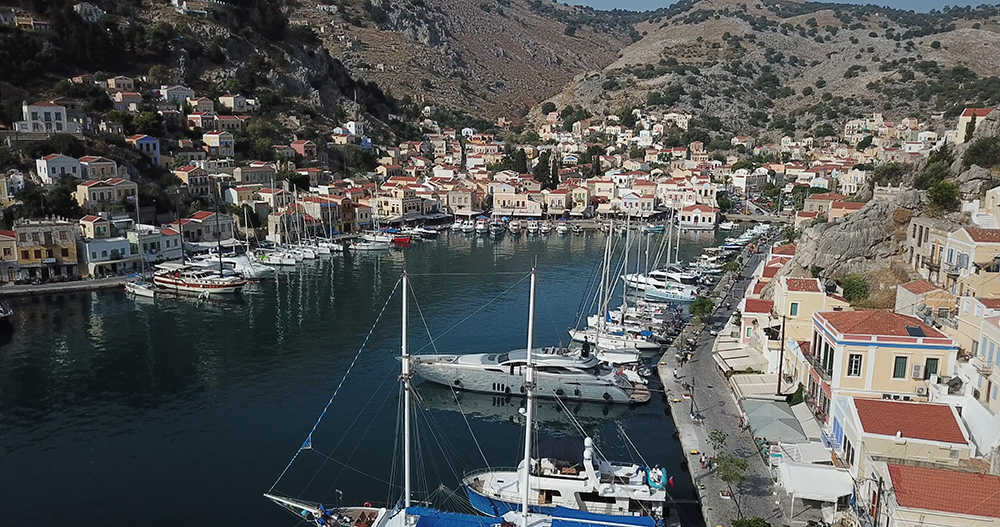
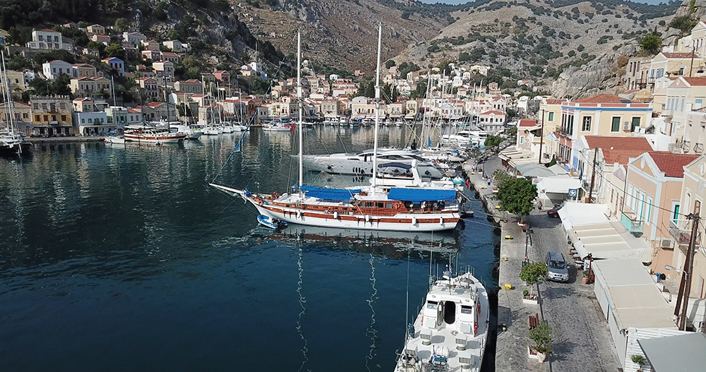
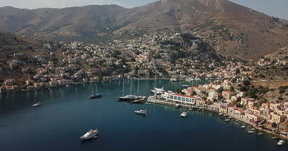
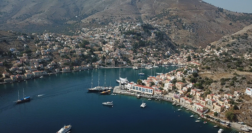
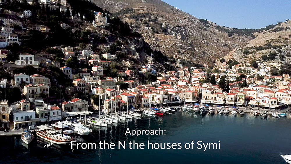
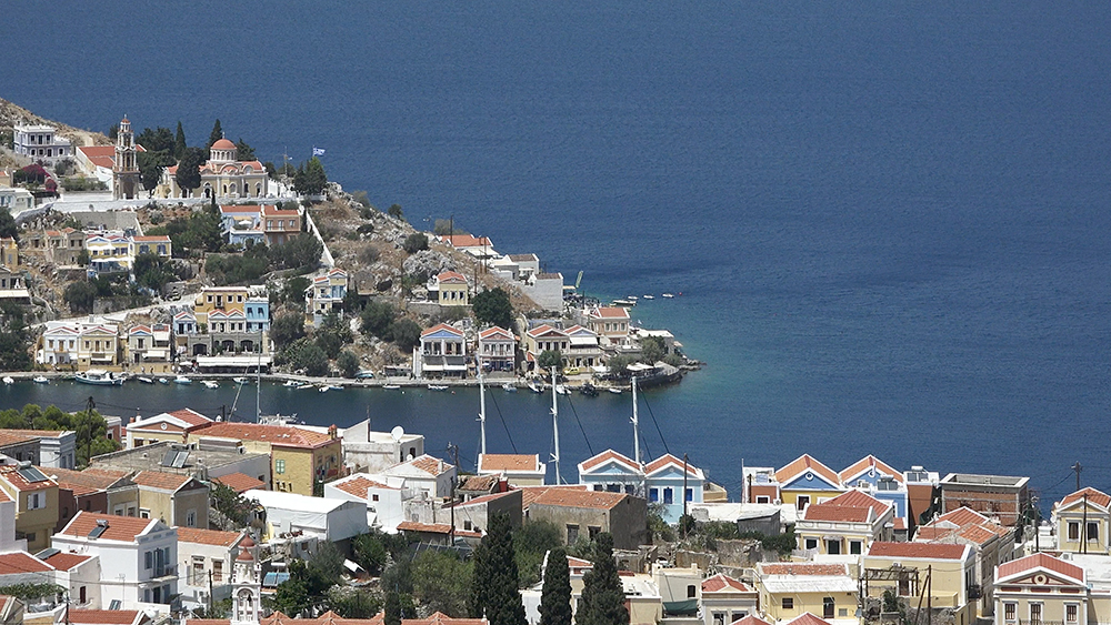
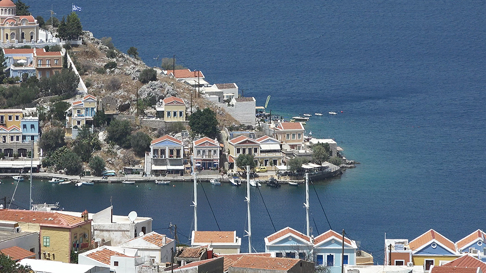
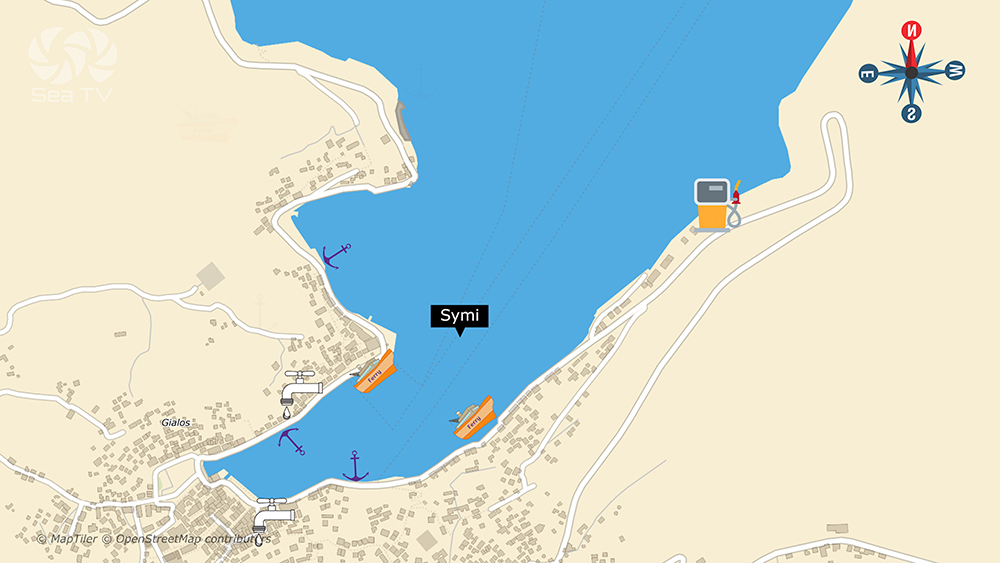
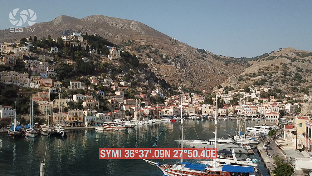
⚓ 1. Symi Town Harbour — The Neoclassical Postcard
N + S Quay · Anchor 12-20 m · Mud and Rock · Watch S Wind
Approach & Mooring
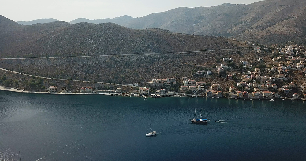
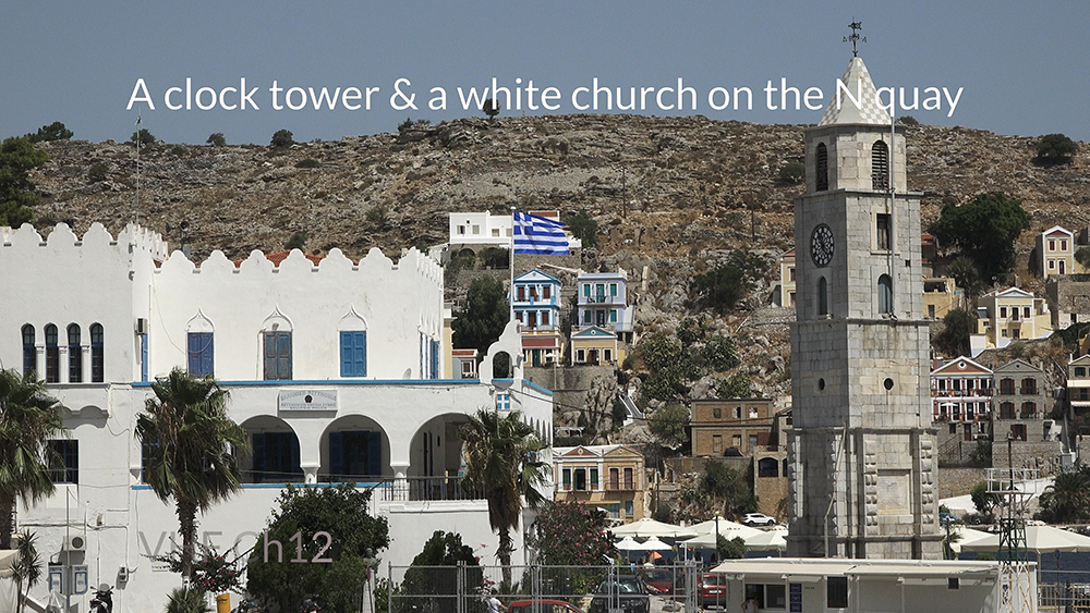
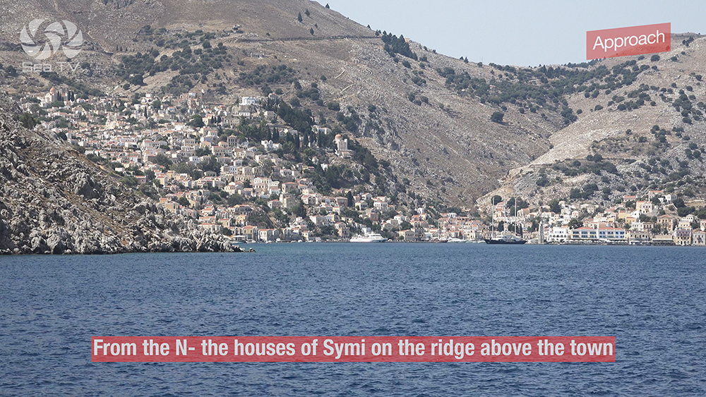
Approach from N: The houses of Symi on the ridge above the town are visible from far out · the natural visual landmark.
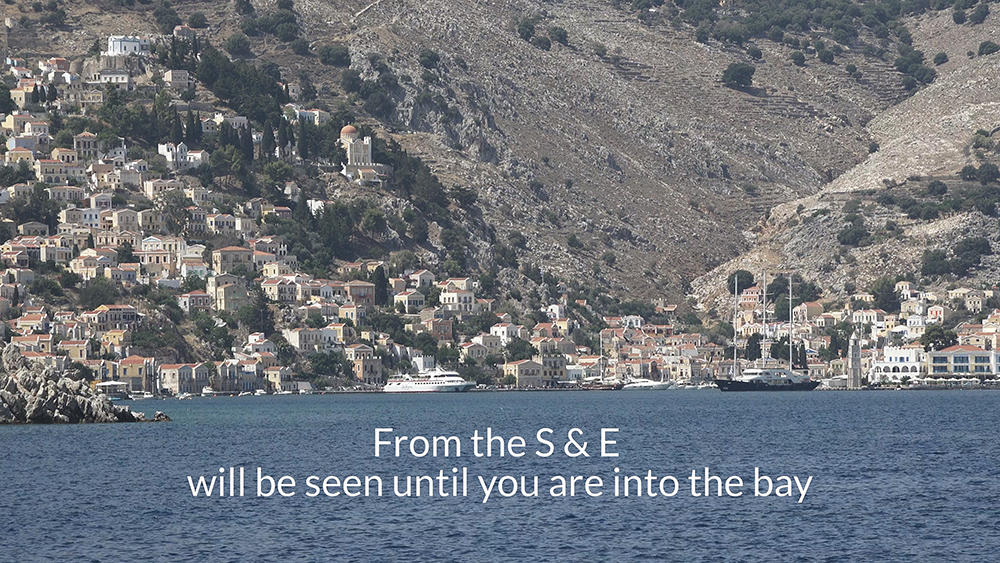
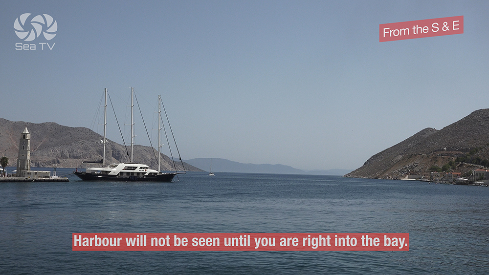
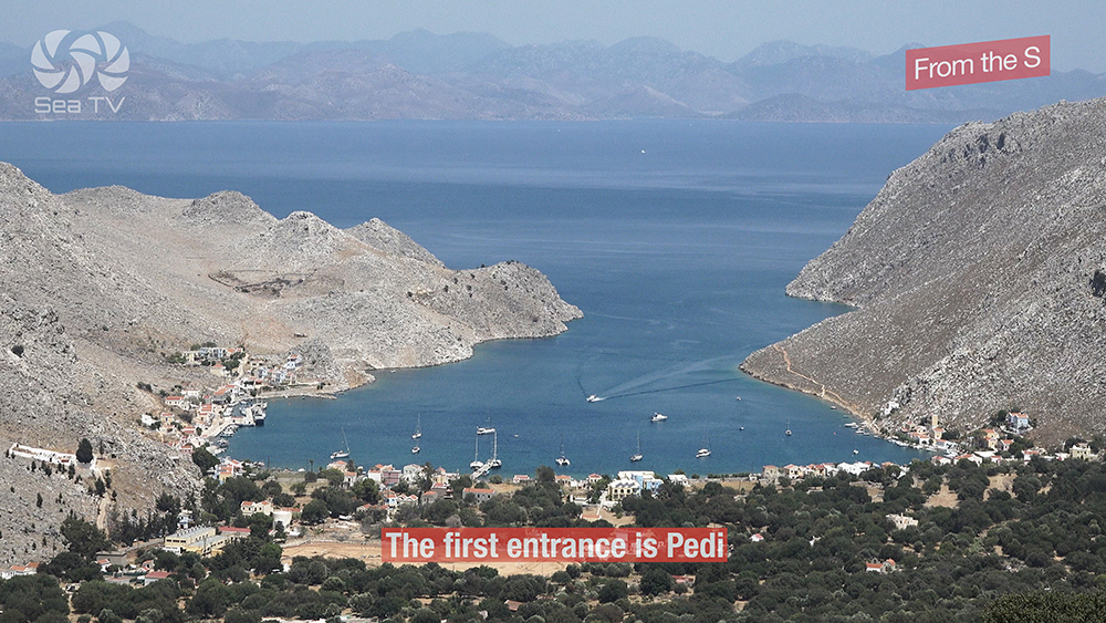
Approach from S and E: The harbour will not be seen until you are right into the bay · don’t expect to see the town from offshore. The first entrance from the south is Pedi.
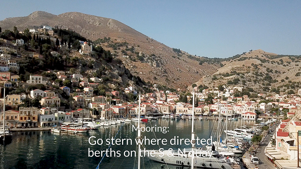
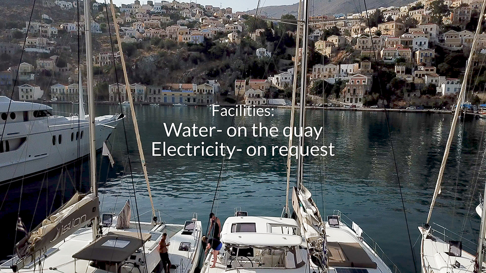
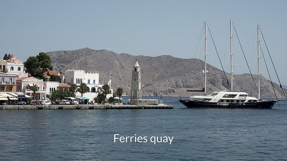
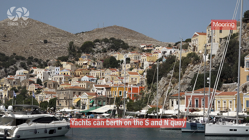
Where to berth: Yachts can berth on the S and N quay. Most of the western pier is reserved for local trip boats and ferries — don’t moor there.
Depths drop quickly: Be prepared to anchor in 12-20 m · the harbour is deep close to the quay.
Bottom: Mud and rock · in some places it’s weak holding · check the set carefully · re-drop if needed.
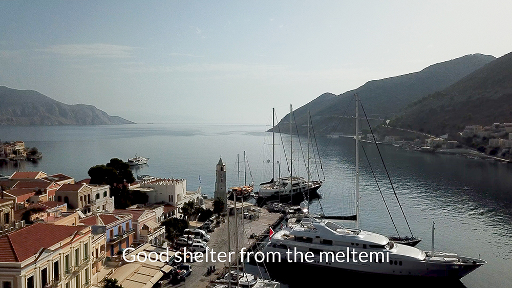
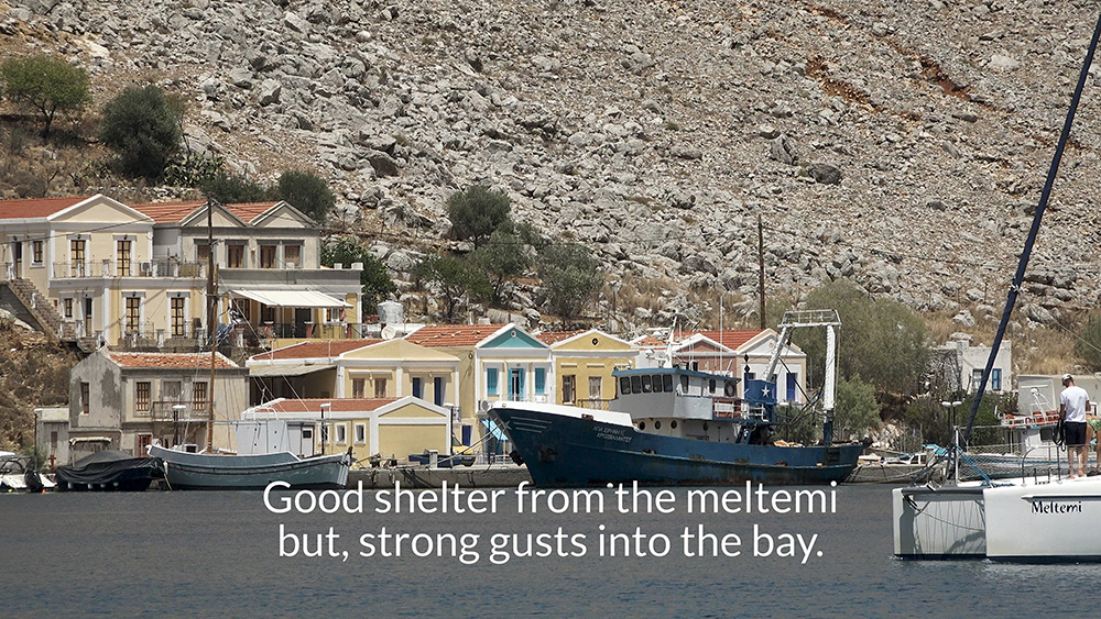
Meltemi shelter: Good shelter from the prevailing summer Meltemi.
⚠ Strong S winds: A massive surge in the harbour can become dangerous · move to Panormitis (SW corner of the island) if S winds forecast.
⚠ Ferry wash: When ferries enter the port, expect strong wash and surge · brace and check lines.
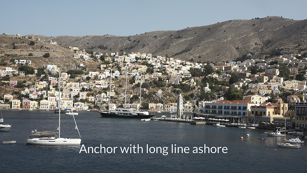
Settled-weather alternative: In settled weather it’s possible to anchor in Ormos Kharani with a long line ashore · care needed.
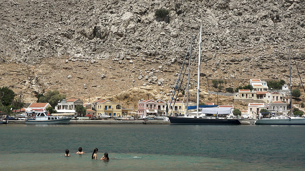
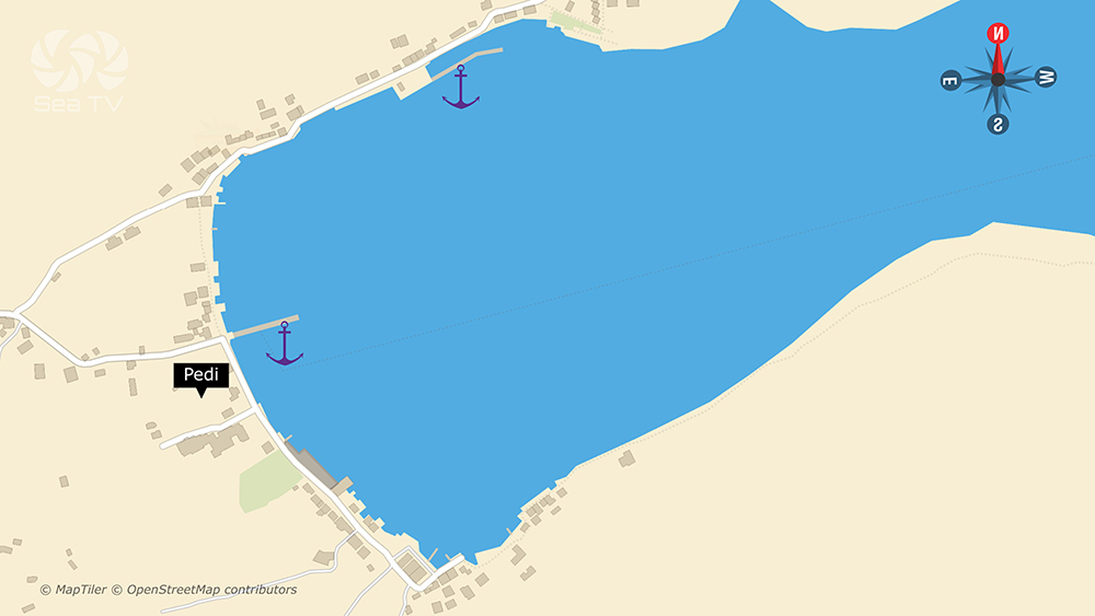
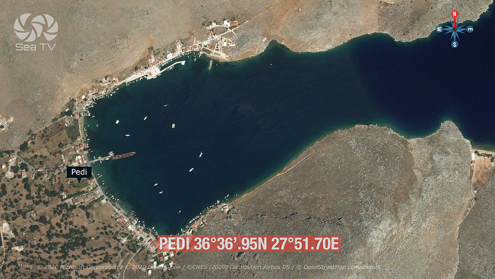
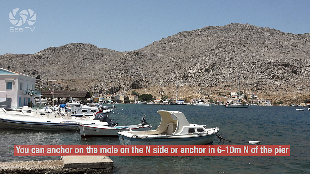
⚓ 2. Pedi Bay — Over the Hill to the SE
36°36′.95N · 27°51′.70E · Anchor 6-10 m · Poor Holding
Pedi Bay
Position: Over the hill to the SE of Symi Town · 36°36′.95N · 27°51′.70E.
⚠ High rock in middle of entrance: Care needed on entry · plot the rock before approach.
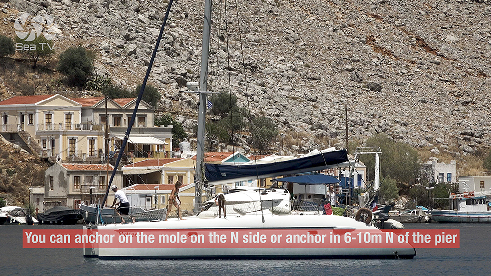
Mooring options: Anchor on the mole on the N side · or anchor in 6-10 m N of the pier · or in front of the hotel on the S side.
⚠ Bottom: sand, rock, and algae · poor holding · re-set if you don’t bite cleanly · use lines ashore where possible.
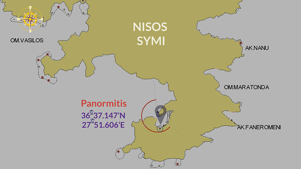
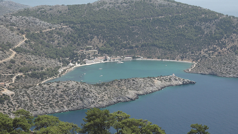
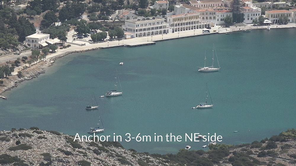
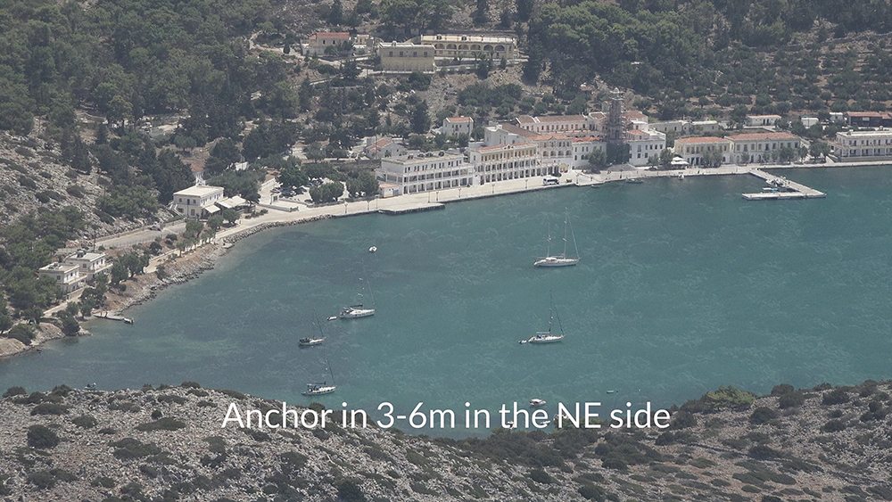
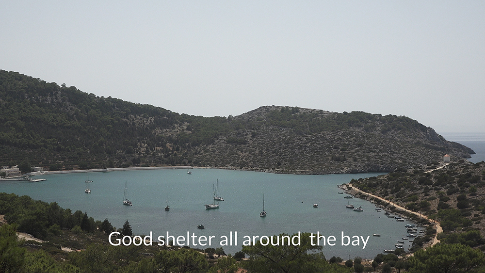
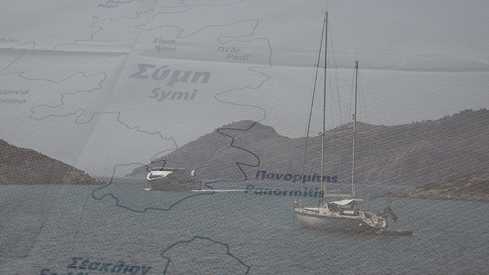
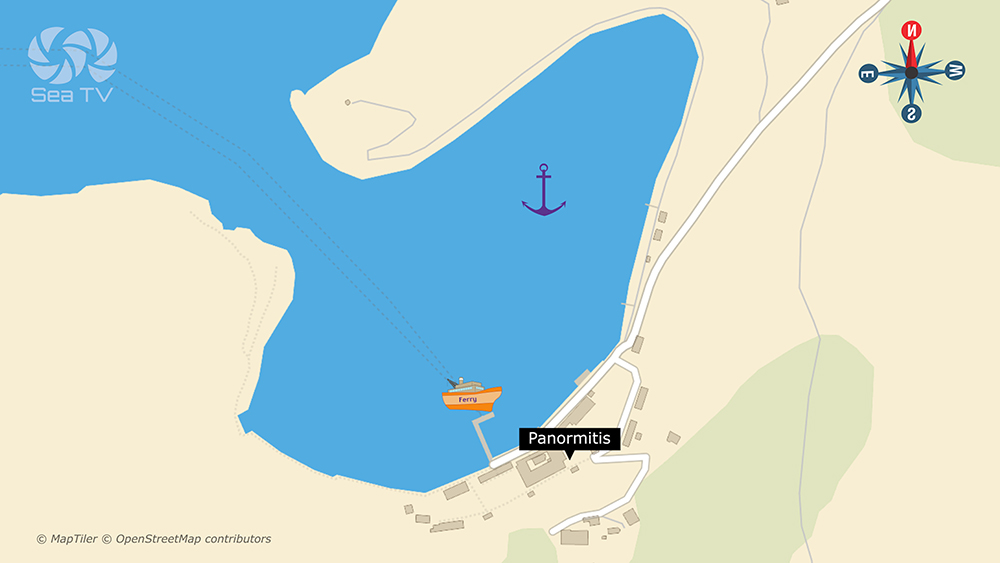
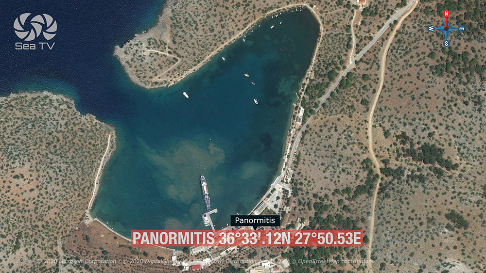
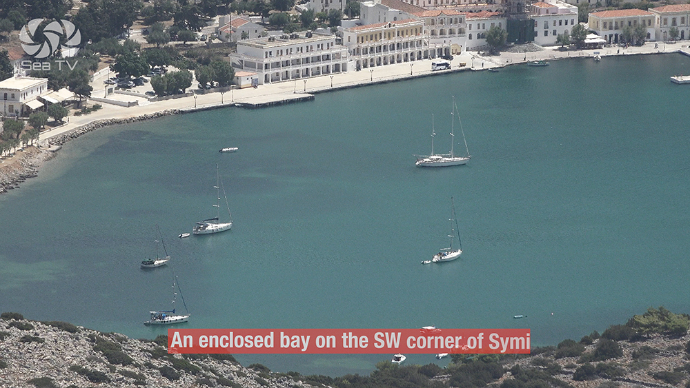
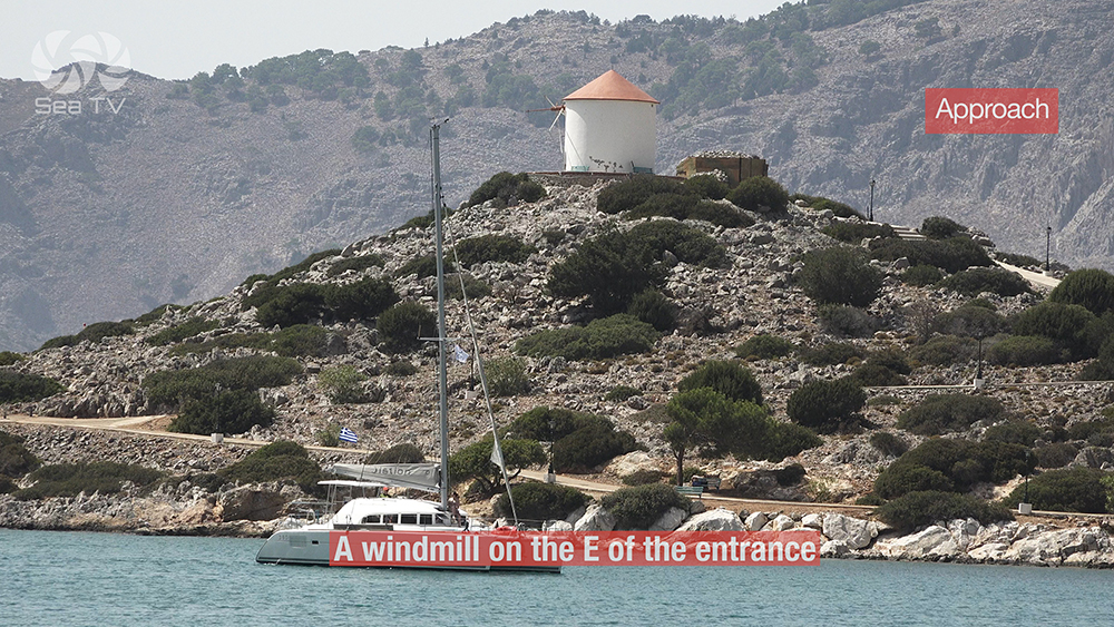
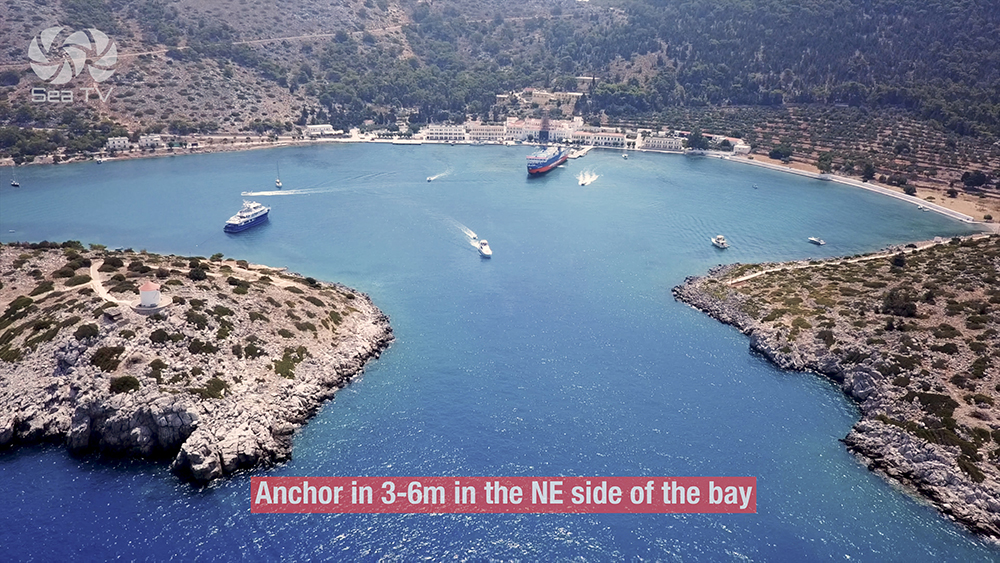
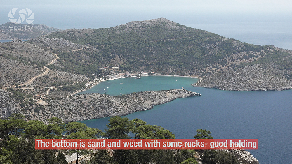
⚓ 3. Panormitis — The SW-Corner Monastery Bay
36°33′.12N · 27°50′.53E · Anchor 3-6 m · Good Holding · Good Shelter
Panormitis Bay
Position: Enclosed bay on the SW corner of Symi · 36°33′.12N · 27°50′.53E.
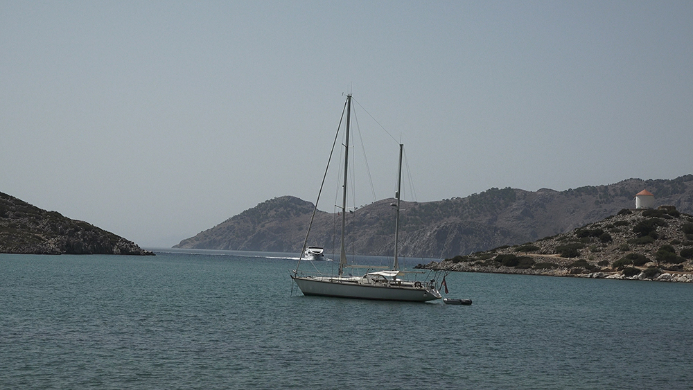
Visual landmarks: A windmill on the E of the entrance and the large white buildings of the monastery complex are visible on approach.
Mooring: Anchor in 3-6 m on the NE side of the bay. The pier is for the ferries — don’t moor there.
Bottom: Sand and algae with some rocks · good holding.
Shelter: Good shelter from most directions including S winds — making this the SW-corner refuge when Symi Town gets the dangerous S surge.
Symi Heritage
The Shipbuilding Wealth Behind the Neoclassical Houses
Symi was once one of the most important shipbuilding centres in the eastern Mediterranean · the island’s pine forests, deep natural harbour, and sheltered bays made it ideal for building wooden vessels in the 18th and 19th centuries · Symi captains owned trading fleets that worked across the Aegean and beyond. The wealth from this trade was poured into neoclassical mansions built in pastel colours along the harbour and up the slopes — the visual character of the harbour that draws today’s day-tour crowds was paid for by 19th-century sea trade. Sponge-diving (centred on Kalymnos) was the other Symi industry, and the decline of both in the 20th century caused mass emigration.
Panormitis Monastery — Archangel Michael
The Monastery of the Archangel Michael of Panormitis on the SW corner of the island is one of the most important religious sites in the Dodecanese · the current monastery dates largely from the 18th century with the silver-clad icon of the Archangel Michael as the central treasure. The complex includes a small museum, a maritime museum (with model ships and sailor offerings to the Archangel as patron of sailors), and a bell tower that’s the visual landmark on approach. Pilgrims arrive year-round · ferries from Rhodes have it as a daily-circuit stop.
Italian Colonial Period · 1912-1947
Like the rest of the Dodecanese, Symi was under Italian rule from 1912 to 1947 · the German surrender of the Aegean to the Allies was signed at Symi in May 1945. The Italian colonial period preserved the neoclassical architecture rather than overlaying it with Italian Rationalist ensembles (as happened at Lakki on Leros) — making Symi’s waterfront one of the best-preserved 19th-century neoclassical maritime towns in Greece.
Which Stop?
Symi Town Harbour — the main visit · neoclassical waterfront · restaurants and shops · provisioning · the postcard view. Use in calm or N wind. Move on if S forecast.
Pedi — quieter alternative over the hill SE · lower depths · the practical option when Symi Town is full · poor holding so use lines ashore where possible.
Panormitis — the all-weather refuge · SW corner · enclosed bay · 3-6 m good-holding sand · the monastery anchorage · sheltered from S winds when Symi Town surges.
Pro Tips for Symi
Move on if S winds forecast. The S-wind surge in Symi Town harbour becomes dangerous · sail to Panormitis on the SW corner for shelter.
Drop heavy chain. Bottom mud-and-rock weak holding in places · use plenty of scope and check the set carefully.
Brace for ferry wash. When ferries enter Symi Town, expect surges · keep crew on deck and watch lines · this is a normal part of the harbour rhythm.
Visit early or late in the day. The day-tour ferries from Rhodes empty the town between 10-11 AM and 4-5 PM · early morning and late afternoon you get the harbour to yourself.
Walk up to Chorio. The upper village above the harbour · 500+ steps (the Kali Strata) · the village around the Knights’ castle has a quieter, more authentic character than the harbour.
Buy a real natural sponge. Symi is one of the historical sponge-diving centres alongside Kalymnos · the sponge shops along the harbour stock genuine natural sponges from local divers.
Visit Panormitis Monastery whichever bay you anchor in. If you’re at Panormitis it’s at the doorstep · if you’re at Symi Town, take a taxi or hire a car for the half-day round trip · one of the most important religious sites in the Dodecanese.
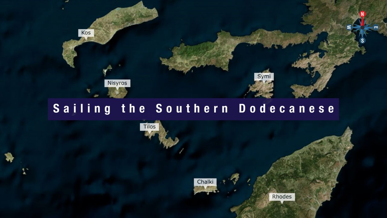
Routes from Symi
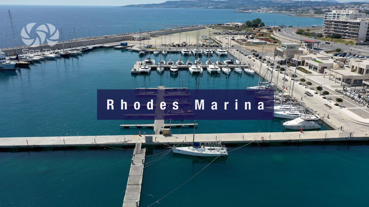
SE to Rhodes: ~25 NM SE. See Rhodes Island · Rhodes Marina.
SW to Tilos: ~20 NM SW. See Tilos Island.
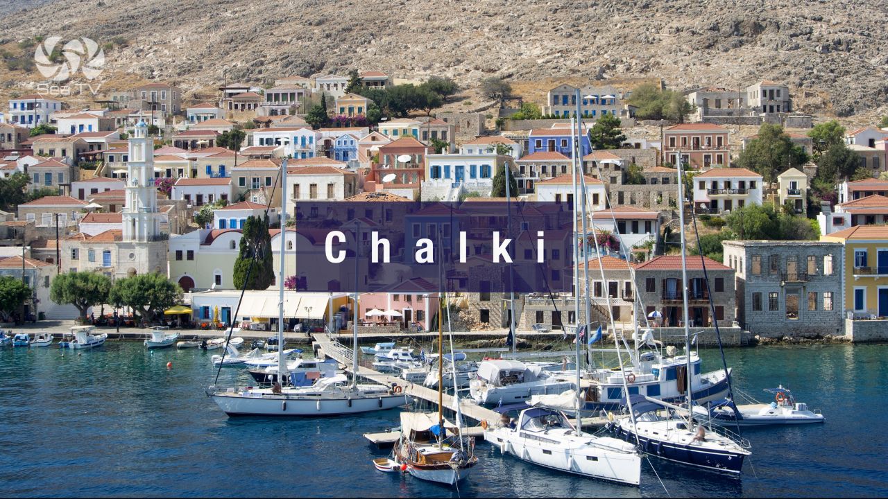
S to Chalki: ~25 NM S. See Chalki Island.
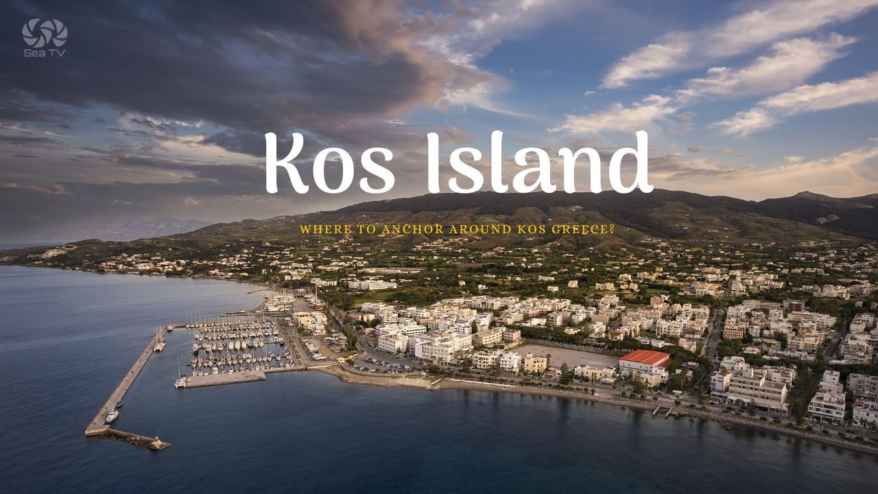
NW to Kos: ~30 NM NW. See Kos Island.
E to Turkish Datça: ~3 NM E (cross-border clearing required).
Dodecanese full route: See Dodecanese — Our Route.
Emergency Numbers — Symi
European Emergency: 112
Greek Coastguard: 108
Coastguard Distress (VHF Ch. 16): Universal
Symi Port Authority: +30 22460 71205
Related SeaTV Pages
Adjacent Islands
Sailing Symi?
Symi Town for the neoclassical postcard · Pedi for the quieter alternative · Panormitis for the SW-corner monastery and the S-wind shelter · move on if S forecast.
“Symi sits at the entrance to the Gulf of Doris between Rhodes and the Turkish Datça peninsula — the deep harbour at the town is ringed with one of the most photographed neoclassical waterfronts in the Aegean, paid for by the eighteenth and nineteenth-century shipbuilding wealth that made Symi captains rich. Anchor in twelve to twenty metres off the N or S quay, brace for ferry wash, watch the holding because the bottom is mud and rock and weak in places, and move to Panormitis on the SW corner if a southerly is forecast because the surge in the town harbour can become dangerous. The monastery anchorage at Panormitis is the all-weather refuge, the over-the-hill bay at Pedi is the quieter alternative, and the trip-boat ferries from Rhodes empty the town between mid-morning and late afternoon — visit either side of those windows for the harbour at its quietest.”
— SeaTV Visual Pilot · Dodecanese Edition