SeaTV · Greece · Dodecanese Islands · Leros Island
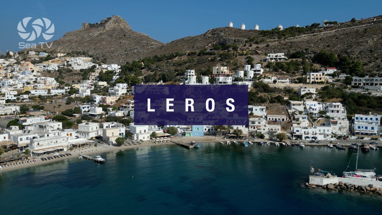
Leros Island — Italian Naval Town, Many Bays & the Greenest Hills in the Dodecanese
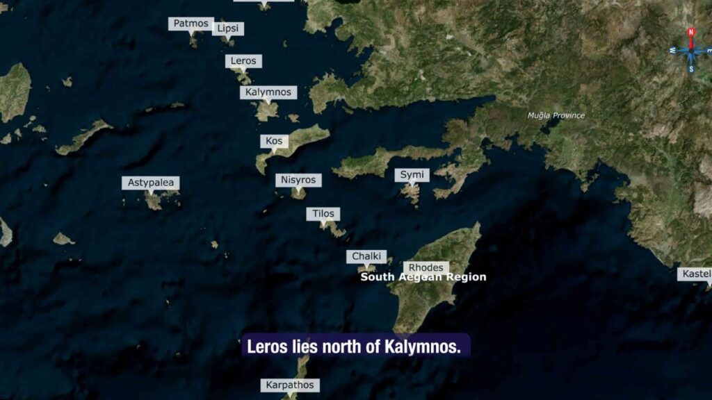
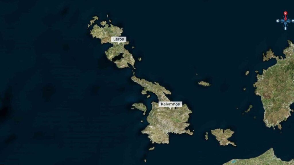
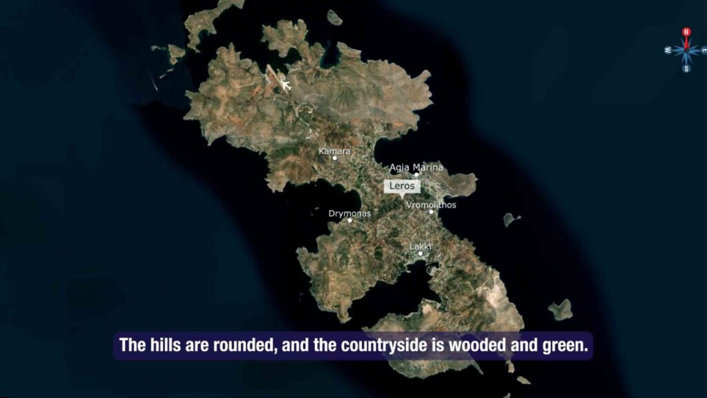
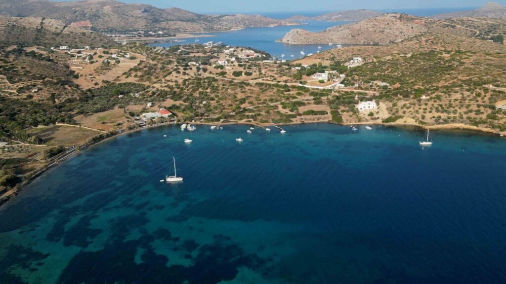
North of Kalymnos · the layered Dodecanese island where Mussolini-era Italian Rationalist architecture survives almost intact at Lakki, the rounded hills around Lakki and Platanos are wooded and green (rare for the Dodecanese), and the irregular coastline forms many bays providing excellent anchorages — Lakki Marinas (S, all-weather shelter, 220 berths), Pandeli (NE, postcard village + castle), Blefouti (N, clear-water swimming), Partheni (N, mud anchorage near boatyard), and Paradisos.
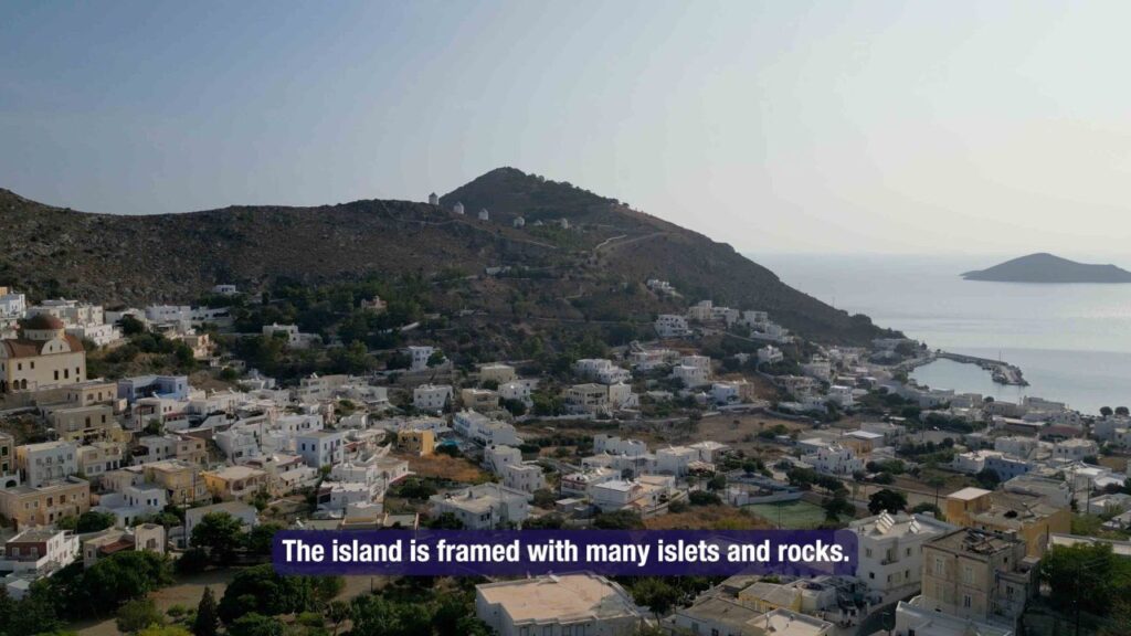
Leros sits north of Kalymnos · the rounded hills are unusually wooded and green for the Dodecanese, particularly around Lakki and Platanos · the shape of the island has formed many bays that make excellent anchorages, and the surrounding waters are framed with islets and rocks. The big-picture story is the Italian colonial period: from 1923 the Italian Royal Navy made Lakki Bay its main Dodecanese base, and in the 1930s Mussolini’s Italy laid out an entire planned model town there in Italian Rationalist (Razionalismo) style — one of the most preserved such ensembles outside Italy itself.
⚠ Reality check:
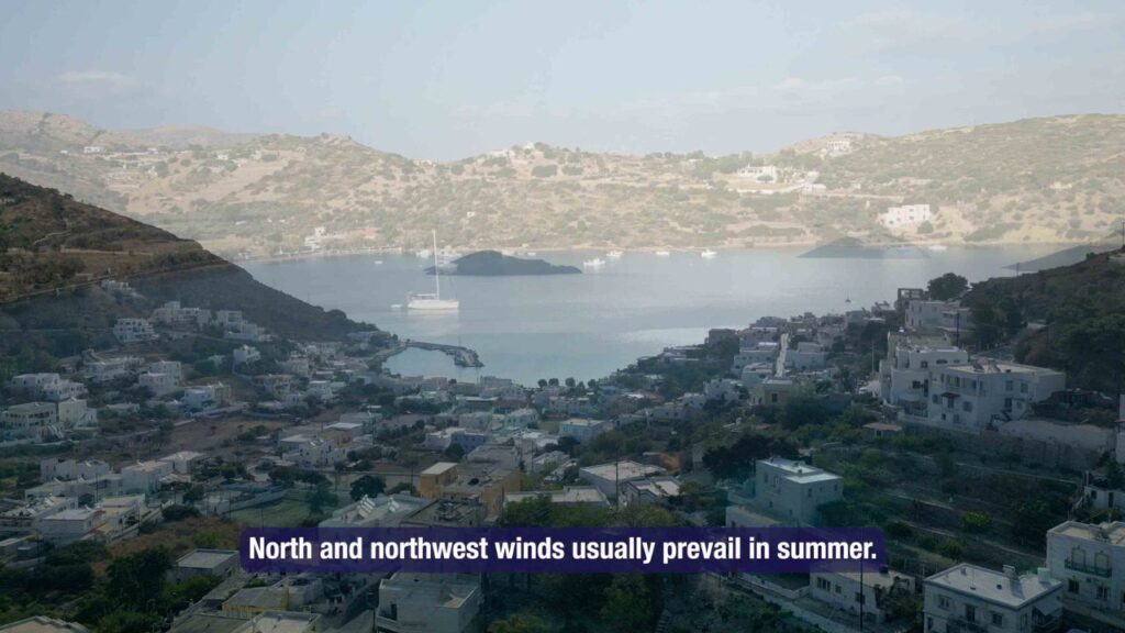
→ N and NW winds prevail in summer (Meltemi)
→ Many islets and rocks framing the island · careful navigation
→ Restricted areas in Lakki Bay · Italian-naval-base legacy · check chart
→ Blefouti open to N-NE · Meltemi exposure on the N coast
→ Pick the bay by wind direction · Lakki for all-weather, Pandeli for NE-facing in S winds
⚓ Leros at a Glance
Position
N of Kalymnos · S of Patmos
Main port
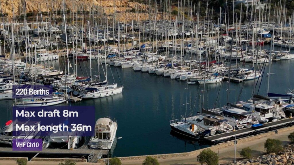
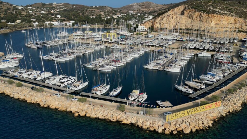
Lakki (S) · Marina Leros 220 berths
Hills
Wooded + green (rare for Dodecanese)
Heritage
Italian Rationalist Lakki + Battle of Leros
Airport
LRS on N coast · daily Athens
Summer wind
N-NW (Meltemi)
⚓ The Sailing Stops Around Leros
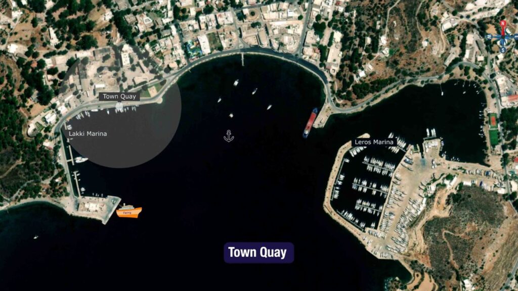
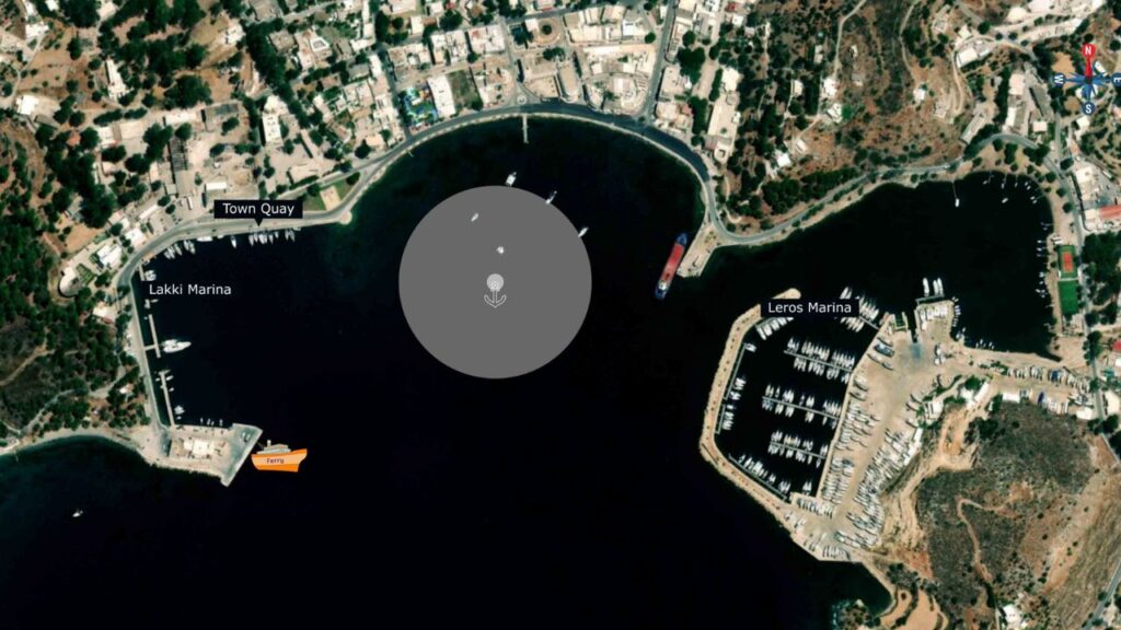
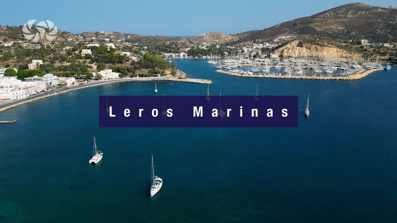
South · Lakki Bay · Italian Naval Town · 220-Berth Marina
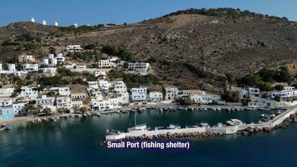
Lakki — The Main Port
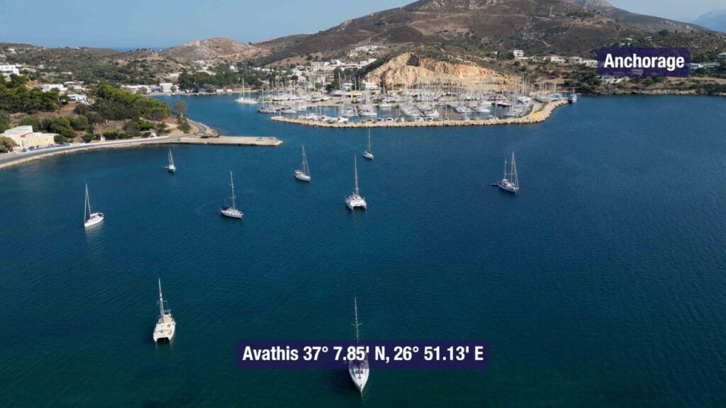
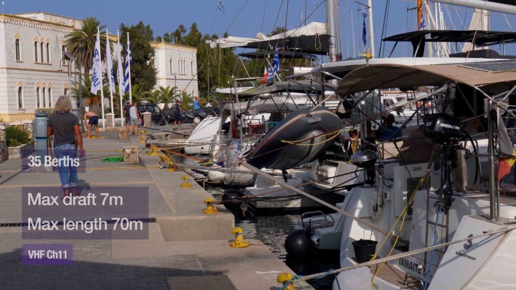
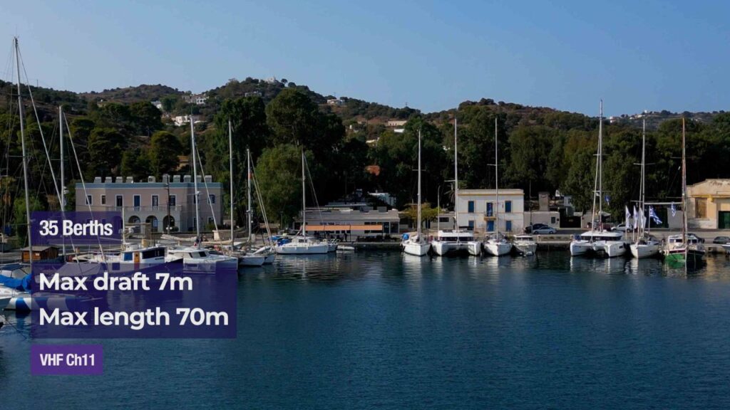
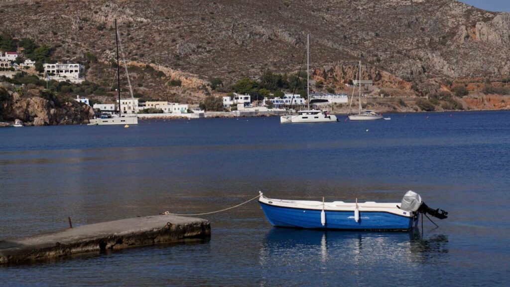
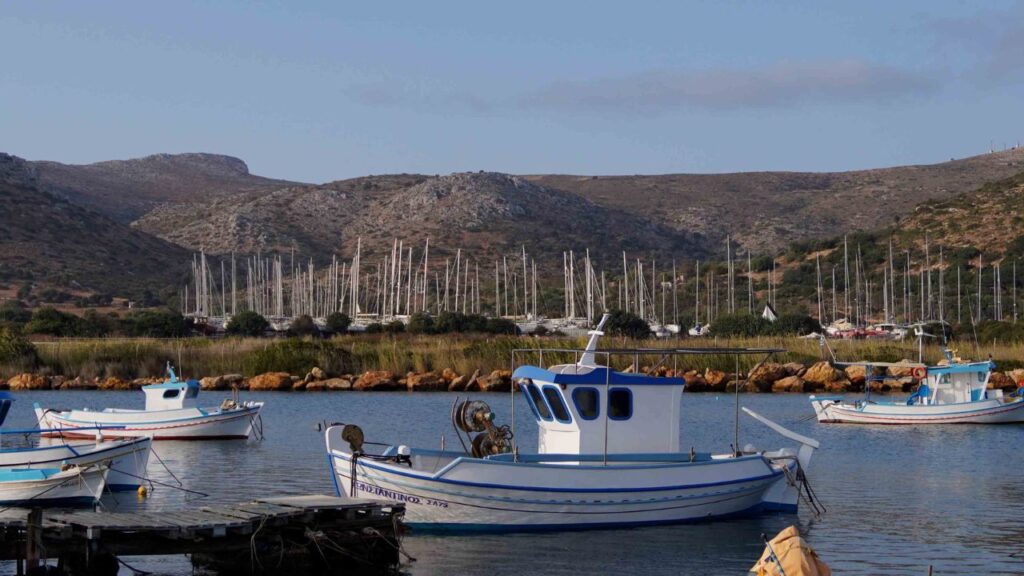
Lakki Bay on the south shore is one of the largest natural deep-water harbours in the Aegean · three mooring options: Marina Leros (E side, 220 berths, all-weather shelter, max LOA 36 m, max draft 8 m, VHF Ch 10), Lakki Marina (W side, 35 berths, max LOA 70 m, max draft 7 m, fuel by mini-tanker), and Avathis Anchorage (sand+mud, good holding, not for swimming).
Cultural: Lakki (formerly “Portolago”) was Italy’s main Royal Navy base in the Dodecanese from 1923 · the 1930s Italian Rationalist civic architecture is one of the most preserved outside Italy itself · the 1943 Battle of Leros and Italian + Commonwealth war cemeteries.
⚠ Watch for: Restricted areas (naval-base legacy) · S winds bring some swell into the bay · ferry traffic.
Full detail: See Leros Marinas.
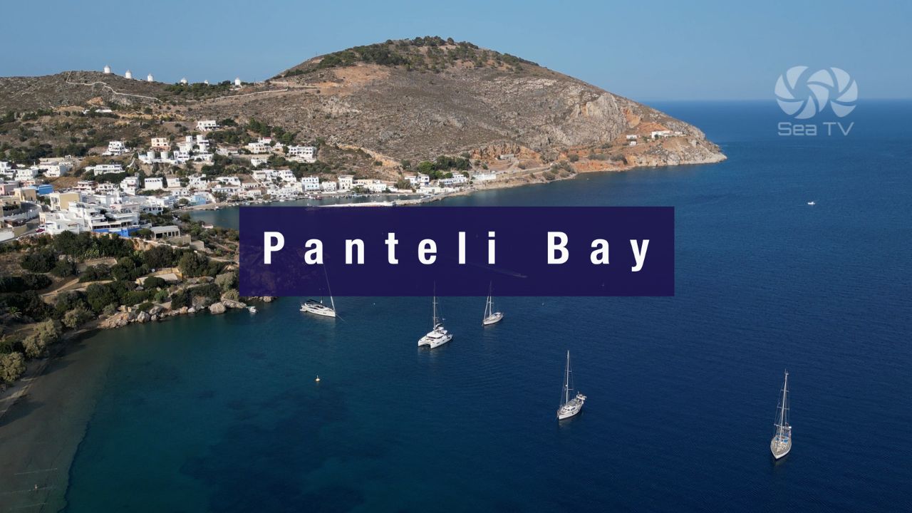
East · Pandeli & Paradisos · Postcard Greek-Island
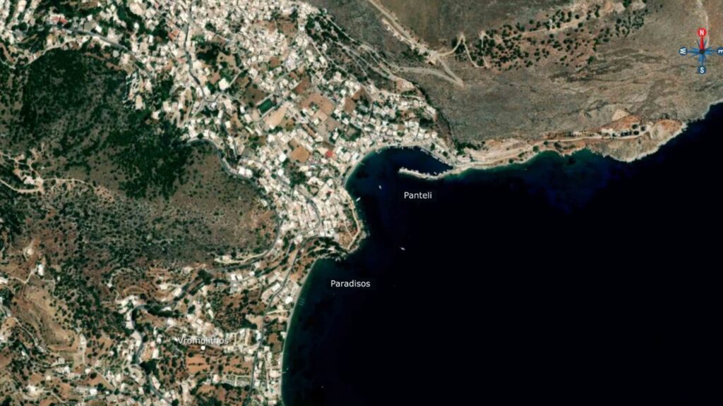
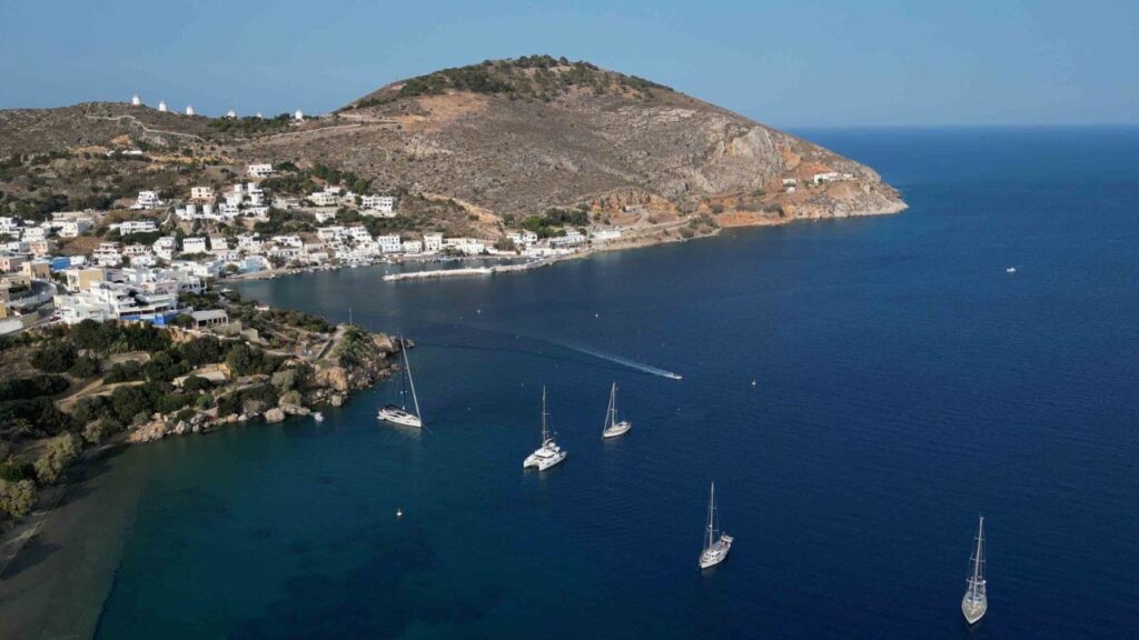
Pandeli Bay (and Paradisos)
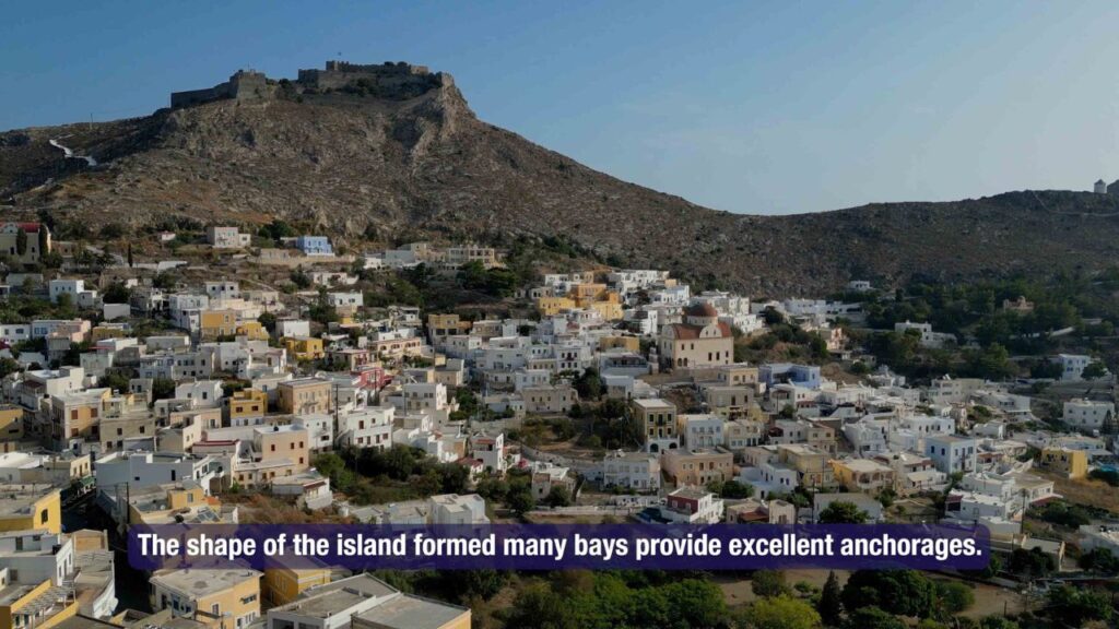
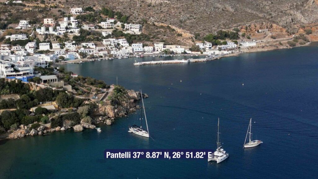
Pandeli (Pantelli) Bay: 37°08′.87N · 26°51′.82E · the picturesque postcard side of Leros · whitewashed village + the Pandeli (Kastro) castle on the hilltop · some mooring buoys available · clear-water swimming.
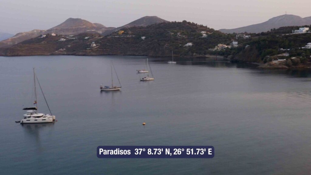
Paradisos: 37°08′.73N · 26°51′.73E · adjacent on the E coast · clear-water bay where you can swim.
Full detail: See Panteli Bay Leros.
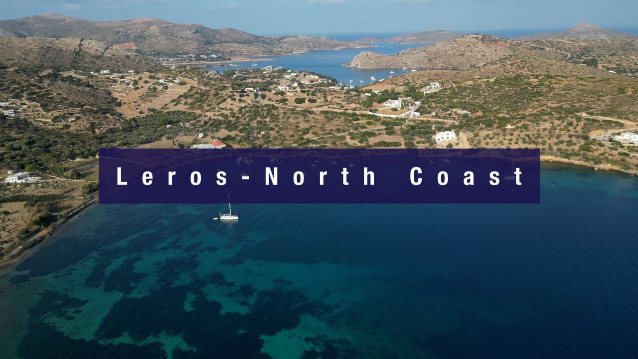
North · Blefouti · Boatyard · Partheni · Airport-Side
North Coast — Three Stops
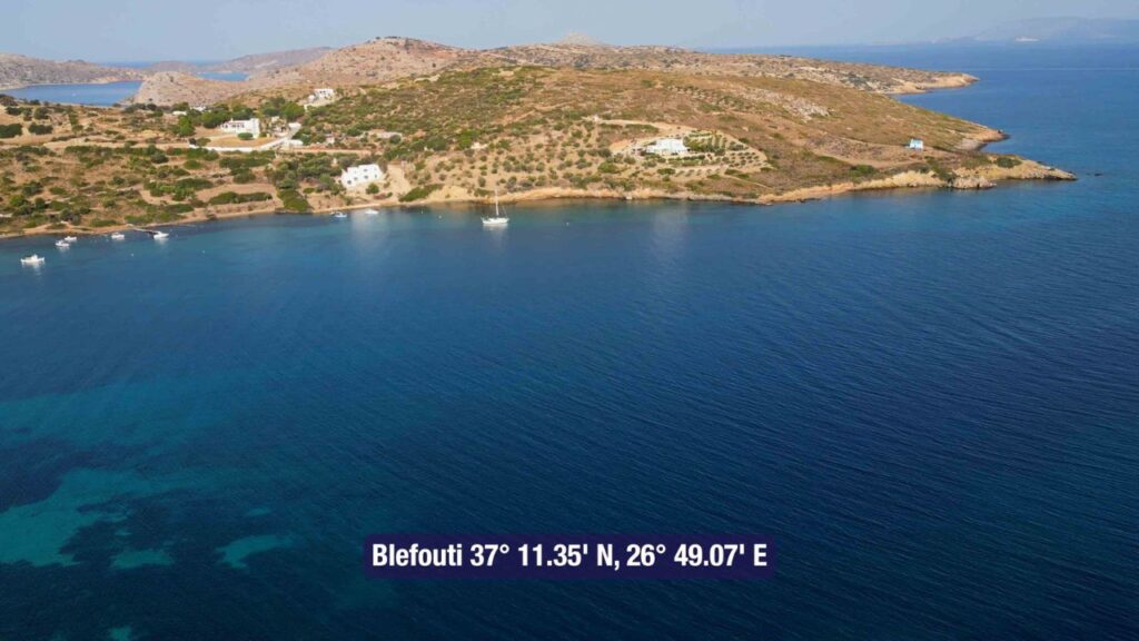
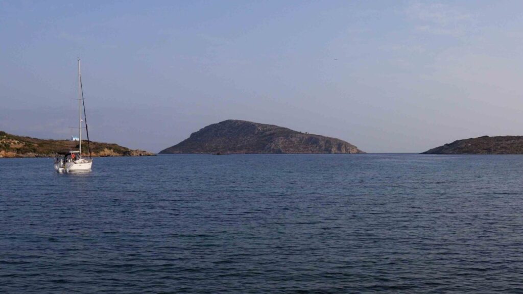
Blefouti Bay: 37°11′.35N · 26°49′.07E · large bay open to N-NE winds, well sheltered from S · transparent waters for swimming · sand+seagrass bottom (don’t anchor on grass) · ⚠ rocks at entrance · old Italian military structure on south shore.
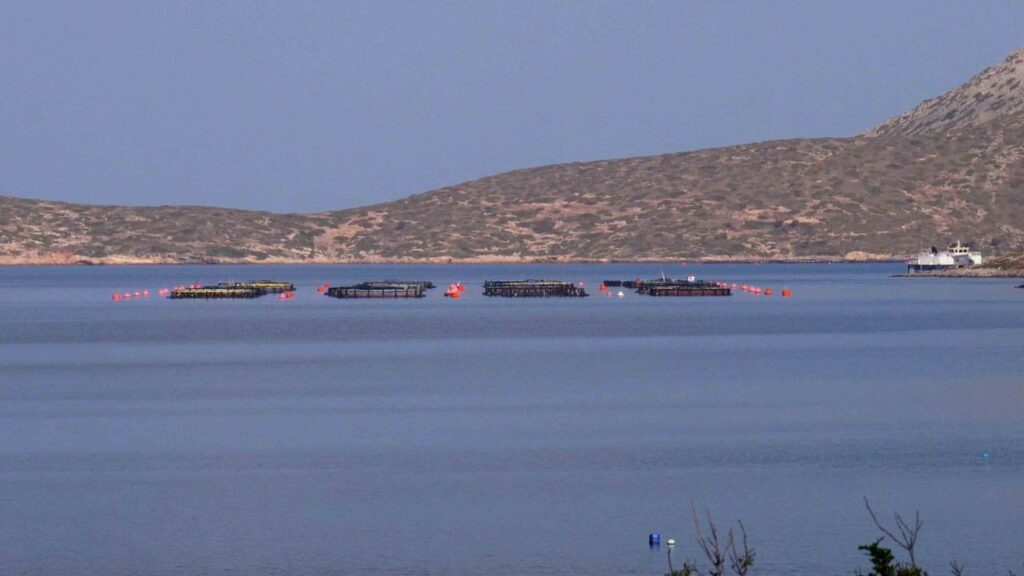
Artemis Leros Boatyard: 37°11′.17N · 26°47′.73E · close to Leros airport for crew rotation + technical refits · “Stand by to lift” mooring buoys · ⚠ fish farms in the area.
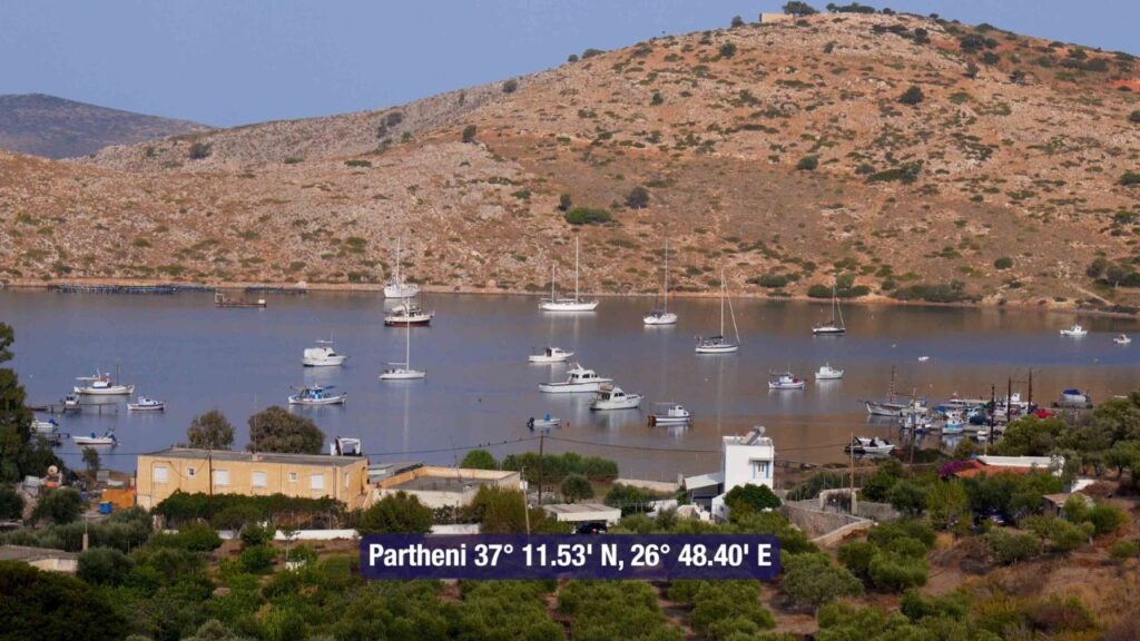
Ormos Partheni: 37°11′.53N · 26°48′.40E · sheltered private moorings on mud bottom (good holding) · no facilities.
Full detail: See North Coast of Leros.
Which Side of Leros?
South (Lakki) — the all-weather default. 220-berth Marina Leros · all-wind shelter · Italian Rationalist town · main provisioning · charter handover. Use this when in doubt.
East (Pandeli) — the postcard side. Whitewashed village + Pandeli Castle · classic Greek-island visual · clear-water swimming · best in N-NW Meltemi (sheltered).
North (Blefouti / Boatyard / Partheni) — practical + clean swimming. The N coast handles charter handover at the airport, refits at the boatyard, and the cleanest swimming on the island. Avoid in N or NE wind.
Leros Heritage
Italian Royal Navy Base · 1923-1947
Lakki Bay’s exceptional natural harbour made Leros the strategic heart of the Italian Dodecanese · submarine pens, fuel depots, and naval workshops were built around the bay starting in 1923 · the entire town of Portolago was laid out in the 1930s as a Mussolini-era planned model town to house Italian naval families. The Italian Rationalist (Razionalismo) architecture is one of the most complete intact ensembles outside Italy itself.
Battle of Leros · November 1943
After Italy’s 1943 armistice with the Allies, Leros became the site of one of the most significant Aegean engagements of WWII · British and Italian forces held the island; German paratroopers and naval forces invaded in November 1943 · after weeks of fighting, the Germans took Leros. Both Italian and Commonwealth war cemeteries on the island commemorate the dead.
Pandeli Castle · Knights of St John
The medieval Pandeli (Kastro) Castle on the hilltop above Pandeli Bay dates from the Byzantine period and was extensively rebuilt by the Knights of St John (1309-1522) · panoramic views over the eastern bays from the ramparts · part of the network of Knights’ fortifications across the Dodecanese.
Routes from Leros
N to Patmos: ~10-12 NM N · UNESCO Apocalypse island · the natural N stop.
S to Kalymnos: ~12 NM S. See Kalymnos Island.
SE to Kos: ~25 NM SE. See Mandraki Kos.
Dodecanese full route: See Dodecanese — Our Route.
Emergency Numbers — Leros
European Emergency: 112
Greek Coastguard: 108
Coastguard Distress (VHF Ch. 16): Universal
Marina Leros (Lakki): +30 22470 24733 · 26600 · 26601 · VHF Ch. 10
Marina Leros website: lerosmarina.gr
Related SeaTV Pages
Leros Detail Pages
Adjacent Islands
Sailing Leros?
Lakki for the Italian Rationalist town and the all-weather marinas · Pandeli for the postcard village + Knights’ castle · the N coast for clean swimming and the airport · wooded green hills throughout.
→ Lakki Marinas · Panteli · North Coast
“Leros is the unusually green and wooded Dodecanese island where the Italian Royal Navy made Lakki Bay its main base from nineteen-twenty-three and Mussolini’s Italy laid out an entire planned model town in Italian Rationalist style — most of which still stands. Pick the south for the all-weather marinas and the architecture, the east for the postcard Pandeli and its hilltop castle, the north for the clean swimming and the airport access, and the bays of Leros open up across an island that pays back the wider sailing detour.”
— SeaTV Visual Pilot · Dodecanese Edition