SeaTV · Greece · Dodecanese Islands · Kastellorizo
Kastellorizo — The Easternmost Greek Island, 1.25 NM Off Turkey & the Blue Cave
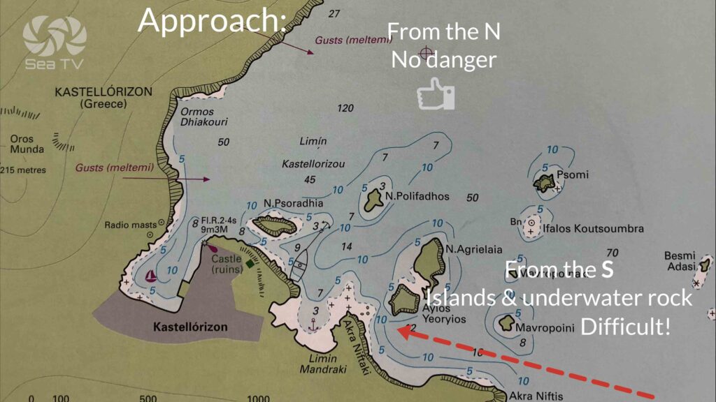
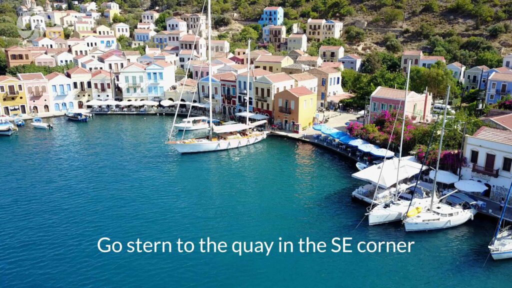
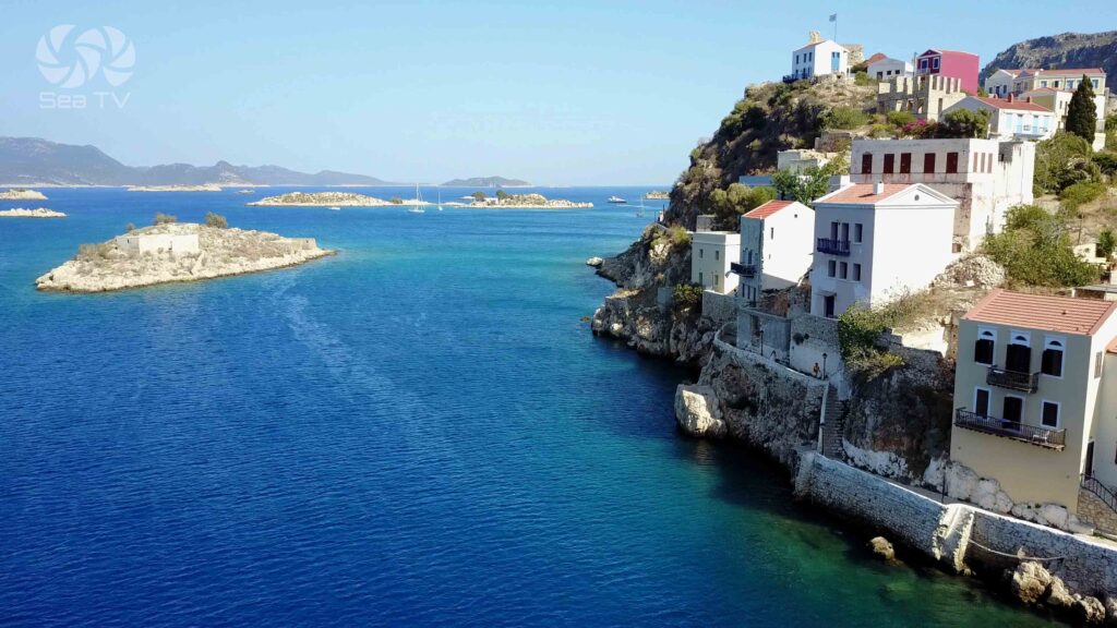
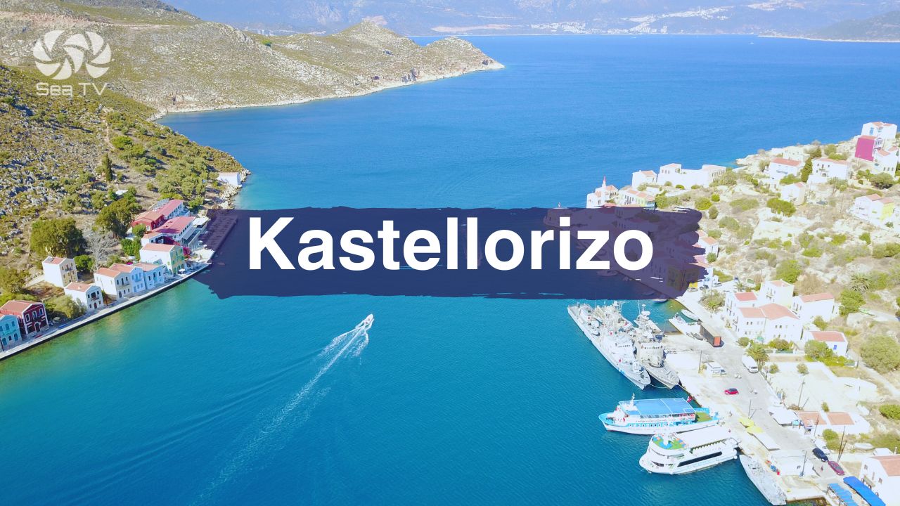
36°09’00.9″N · 29°35’26.6″E · the easternmost Greek island, sitting just 1.25 NM off the Turkish coast (across from Kaş). The bay is on the NE of the island. Stern-to the SE quay (max LOA 55 m, max draft 2.5 m, VHF Ch 35), bottom is mud and rocks, anchorage inside the port is prohibited. ⚠ Rocky reef ~55 m NW of the port light · ⚠ approach from S has islets and underwater rocks. The Blue Cave (Parastas), the cliff-top Castle of the Knights, and the “Mediterraneo” 1991 film legacy define the cultural visit.
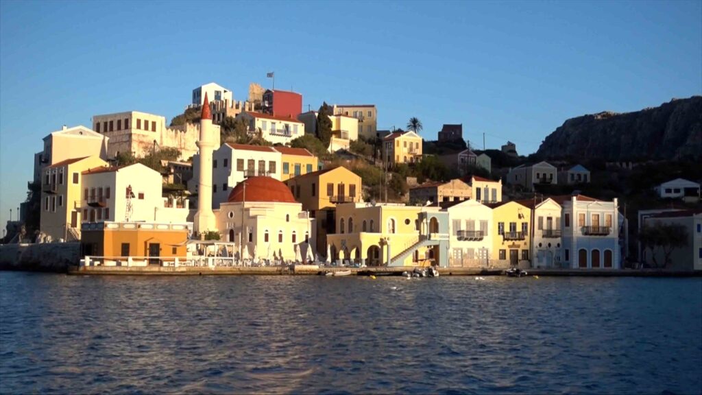
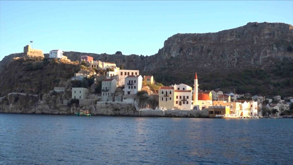
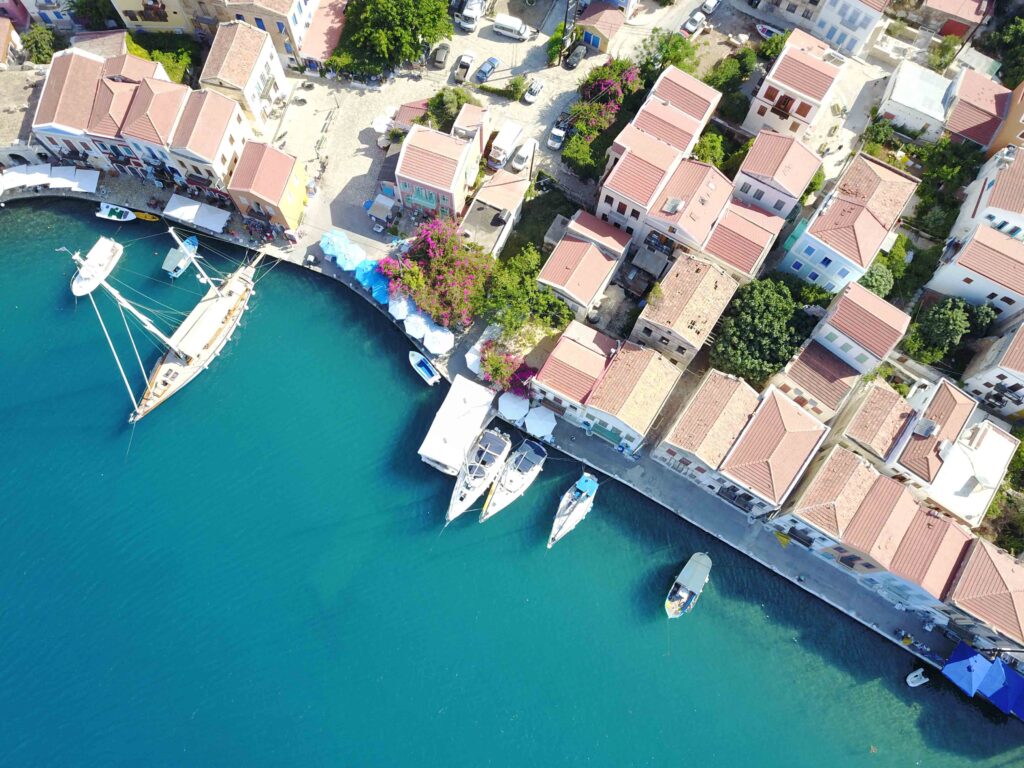
Kastellorizo (also Megisti) is the easternmost Greek island · sitting just 1.25 nautical miles off the Turkish coast (directly across from the Lycian-coast town of Kaş). The bay is at the NE of the island, with the colourful Italian-era waterfront of Kastellorizo Town wrapped around it. The remoteness is the defining characteristic — the next Greek island west is Rhodes (~70 NM), and the political-strategic position close to Turkey gives Kastellorizo an outsized profile in Greek-Turkish relations. The famous Blue Cave (Parastas) on the SE coast is one of the most distinctive sea-cave visits in the Mediterranean and the destination for short boat trips from the harbour.
⚠ Reality check:
→ Rocky reef ~55 m NW of port light · plot before approach
→ Approach from S: islets + underwater rocks · check chart carefully
→ Anchorage inside port prohibited · only stern-to at SE quay
→ Max draft 2.5 m · larger drafts won’t fit
→ Remote position · ~70 NM E of Rhodes · provision before crossing
→ Approach from N is straightforward — prefer this entry
⚓ Kastellorizo at a Glance
Position
36°09’00.9″N · 29°35’26.6″E
Distance from Rhodes
~70 NM E
Distance from Turkey
~1.25 NM W of Kaş
Status
Easternmost Greek island
VHF
Ch 35
Cultural icon
“Mediterraneo” 1991 film
Approach & Navigation
N Approach Straightforward · S Approach Has Islets
Approach from N: Straightforward · the practical entry direction.
⚠ Approach from S: Islets and underwater rocks · check the navigation maps carefully · prefer the N approach.
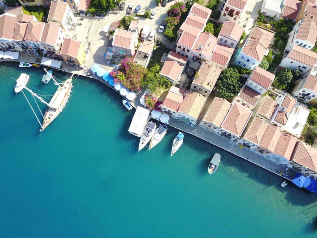
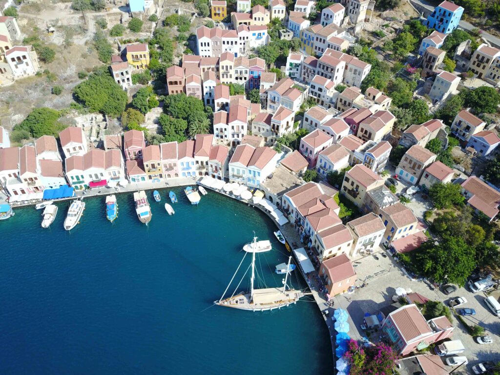
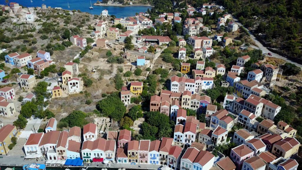
Bay setting: The bay is on the NE of the island · Kastellorizo Town climbs the slopes around the harbour in the colourful Italian-era waterfront houses.
⚓ Kastellorizo Port — Mooring
SE Quay Stern-To · VHF Ch 35 · Max LOA 55 m · Max Draft 2.5 m
Kastellorizo Port
Position: 36°09’00.9″N · 29°35’26.6″E · NE of the island.
VHF: Channel 35 · contact for berth assignment on arrival.
Specs: Max draft 2.5 m · max LOA 55 m.
Mooring: Stern-to the SE quay.
Bottom: Mud and rocks.
⚠ Anchorage inside the port is PROHIBITED · only stern-to at the SE quay.
⚠ Rocky reef ~55 m NW of the port light · plot before approach · don’t sail over it.
⚓ Cove Navlakas — Settled-Weather Alternative
Open SE · 1.3 NM From Cape Megalos Niftis · Inner Depths ~11 m
Cove Navlakas
Position: 1.3 NM from Cape Megalos Niftis.
Depths: ~11 m at the inner part of the cove.
⚠ Open to SE · use only in settled weather · move on if SE wind forecast.
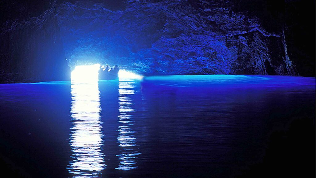
The Blue Cave (Parastas)
One of the Mediterranean’s Most Distinctive Sea Caves
The Blue Cave (Parastas) on the SE coast of Kastellorizo is one of the largest and most-photographed sea caves in the Mediterranean · light entering through the underwater entrance refracts off the chamber walls and creates an unusual blue glow inside · access is by small boat through a low entrance (~1.2 m headroom) which means yacht-tender visits are weather-dependent and the entrance gets impassable in any swell. Local boatmen run dawn trips from the harbour when conditions allow · the visit takes ~15-20 minutes inside the cave.
Kastellorizo Heritage
The Castle of the Knights · Castello Rosso
The Castle of the Knights of St John on the cliff above the harbour gave the island its modern name — Castel Rosso (“Red Castle”) in the Italian medieval forms became Kastellorizo. The Knights held the island as part of their Dodecanese network from the 14th to early 16th centuries · the ruins overlook the harbour and the Turkish coast across the strait. The Greek name Megisti (“the Greatest”) refers to its being the largest of the small surrounding islets.
“Mediterraneo” · 1991 Italian Film & the Tourism Revival
The “Mediterraneo” (1991), an Italian film by Gabriele Salvatores set on Kastellorizo during WWII, won the Academy Award for Best Foreign Language Film · the film essentially put Kastellorizo on the European tourist map for the first time, and the island’s tourism industry rebuilt around the legacy. Visiting the harbour today, much of the colourful waterfront looks as it does in the film.
From 16,000 to 200 · The Population Collapse
In the late 19th century Kastellorizo had a population of around 16,000 · the combination of Italian colonial neglect, WWI and WWII bombings, mass evacuations to British-controlled Cyprus and Egypt, the 1944 fire that destroyed much of the town, and post-war emigration (especially to Australia, where the Kastellorizian community became the largest Greek-Australian sub-group) reduced the resident population to around 200-500 people by the late 20th century. The Australian-Greek “Kazzies” diaspora maintains close cultural ties · Australian English with Kastellorizian accents is heard on the harbour every summer.
Italian Colonial Period · 1923-1943
Kastellorizo passed to Italian rule in 1923 (after a period of French occupation 1915-1921) and remained Italian until the 1943 armistice · the island took heavy bombing in WWII and was evacuated entirely by the British in 1944 · returned to Greece in 1947 with the rest of the Dodecanese. The Italian-era architecture along the waterfront survives in the most-photographed harbour view.
Wind Strategy
N Meltemi: The bay’s NE position gives reasonable shelter from the prevailing summer wind · the high cliffs surrounding the bay break up direct wind effects.
⚠ S and SE winds: Cove Navlakas is open SE and unsuitable in southerlies · the main port handles S winds better but check forecasts before committing.
Best season: May-October · the long crossing from Rhodes (70 NM) means you want settled conditions and a workable forecast window.
Pro Tips for Kastellorizo
Approach from N. The S approach has islets and underwater rocks · use the straightforward N approach.
Plot the NW reef. ~55 m NW of the port light · plot before approach.
Provision in Rhodes before crossing. Limited shopping on Kastellorizo · the resident population is small · stock up before the 70 NM crossing.
Pick a good crossing window. 70 NM crossing each way · go with a settled forecast and a safe return window.
Take the dawn boat to the Blue Cave. Local boatmen run trips when conditions allow · early morning gives the best light inside · the trip is weather-dependent because of the low entrance.
Climb to the Knights’ Castle. Sunset views over the harbour and across to Kaş on the Turkish coast · 30-40 minutes climb on stepped path.
Cross to Kaş if clearing for Turkey. 1.25 NM E · the Lycian-coast town · cross-border clearing required at both ends. Combine Greek-Turkish-Greek charters this way.
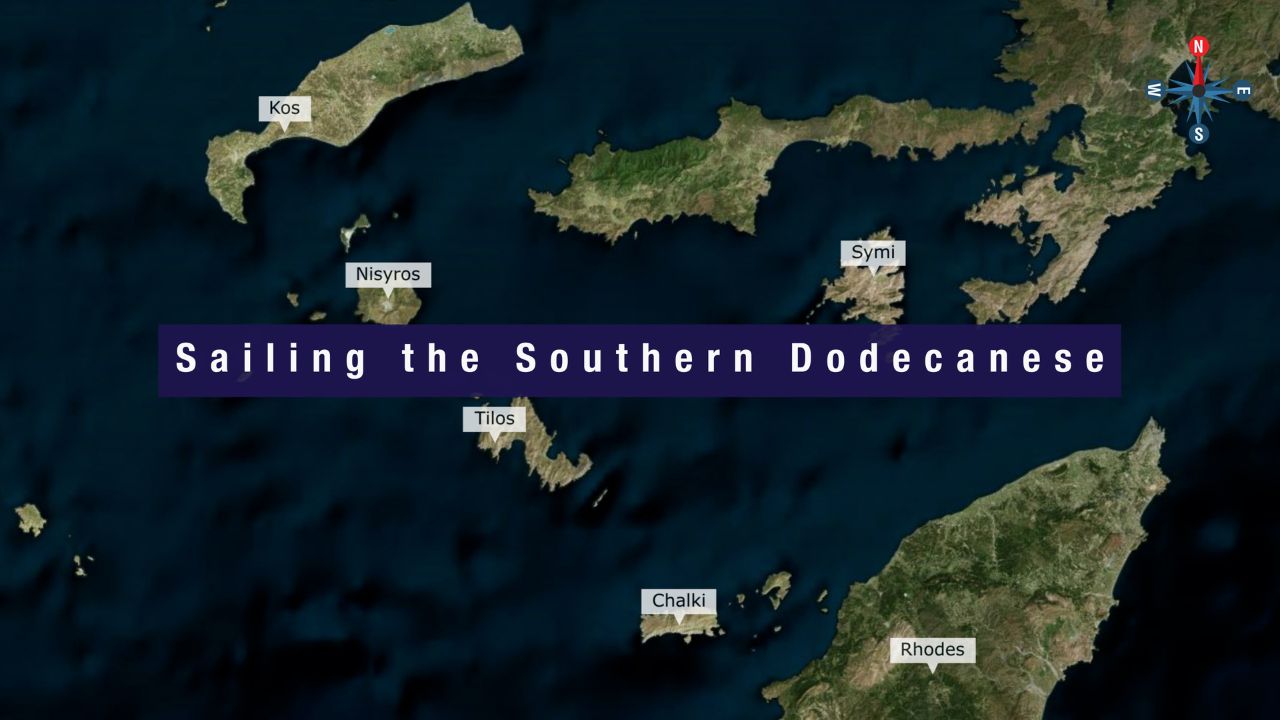
Routes from Kastellorizo
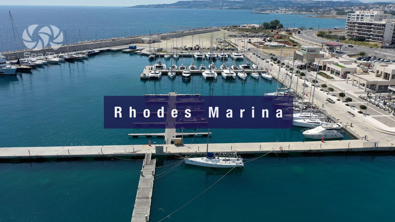
W to Rhodes: ~70 NM W · the long crossing · plan a settled-weather window. See Rhodes · Rhodes Marina.
E to Kaş (Turkey): ~1.25 NM E (cross-border clearing required at both ends) · the Lycian-coast town across the strait.
Dodecanese full route: See Dodecanese — Our Route.
Emergency Numbers — Kastellorizo
European Emergency: 112
Greek Coastguard: 108
Coastguard Distress (VHF Ch. 16): Universal
Kastellorizo Port (VHF): Ch 35
Kastellorizo Port Authority: +30 22460 49270
Related SeaTV Pages
Adjacent Islands & Crossing Hub
Sailing to Kastellorizo?
Easternmost Greek island · 1.25 NM off Turkey · 70 NM E of Rhodes · the Blue Cave + the Knights’ Castle + the “Mediterraneo” 1991 film legacy · Italian-era waterfront · max LOA 55 m, max draft 2.5 m.
“Kastellorizo is the easternmost Greek island, sitting one and a quarter nautical miles off the Turkish coast and seventy nautical miles east of Rhodes — the Italian-era waterfront wraps around the NE bay below the cliff-top Knights’ Castle that gave the island its name (Castel Rosso, the Red Castle), the Blue Cave on the SE coast is the dawn-trip destination, and the nineteen-ninety-one Italian Oscar-winning film ‘Mediterraneo’ rebuilt the modern tourism economy around the harbour. Approach from the north (the south has islets and rocks), plot the reef fifty-five metres northwest of the port light, stern-to the SE quay (anchorage inside is prohibited, max draft two and a half metres, max LOA fifty-five), and the layered remote Aegean stop that the Australian-Greek ‘Kazzies’ diaspora has kept culturally alive opens up — for sailors who pick their crossing window and provision properly before the seventy-mile run from Rhodes.”
— SeaTV Visual Pilot · Dodecanese Edition