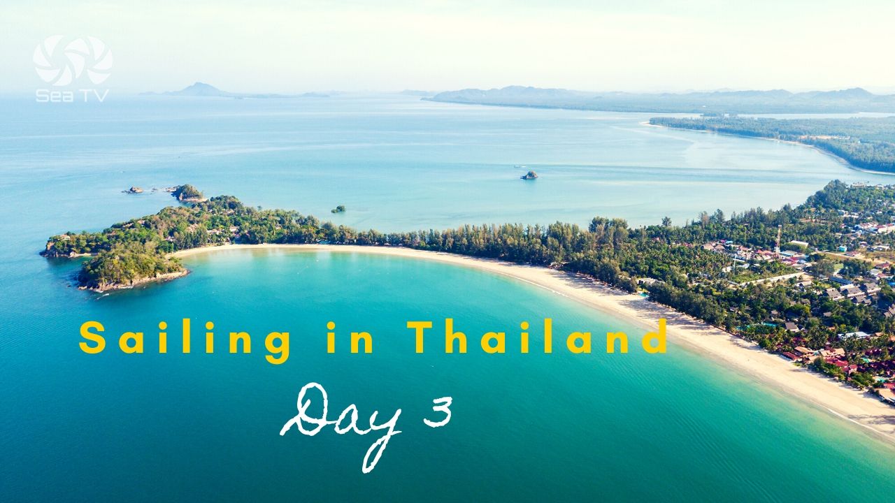
SeaTV · Thailand · Andaman Coast · Phuket Region · Phang Nga Bay
Phang Nga Bay — Ko Phanak, Ko Hong, Ko Roi & Ko Kudu Yai
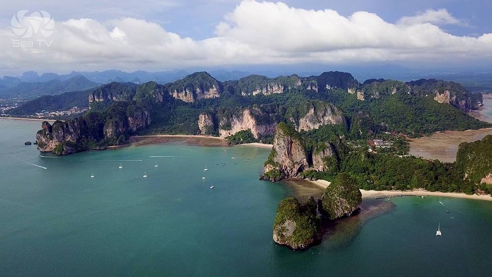
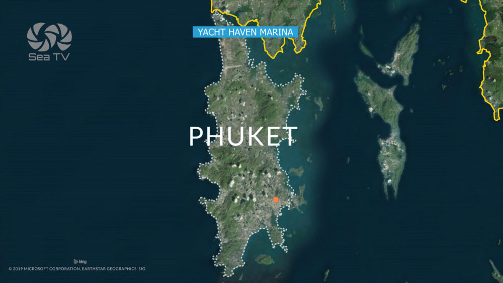
Day 1 of the Phuket charter route · 12-25 NM E from Yacht Haven Marina · the limestone karst archipelago of Ao Phang Nga National Park · home to the famous “hongs” (lagoons hidden inside the islands, accessed by sea-level tunnels) · James Bond Island (Ko Tapu / Khao Phing Kan) · the floating Muslim village at Ko Pan Yi · 400 km² park established 1981 · park fee 300 THB adult / 150 THB child.
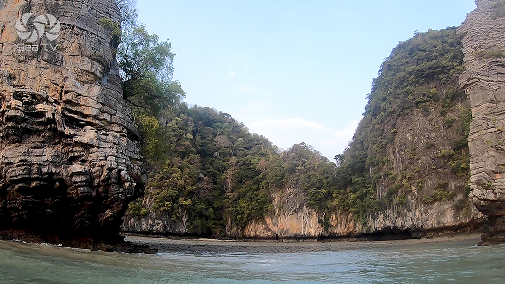
Phang Nga Bay is the most photographed bay in Thailand and the natural Day-1 destination from Yacht Haven Marina. Vertical limestone karsts rise 100-300 m straight from the water · sea-level tunnels lead through the rock walls into hidden inland lagoons known as “hongs” (Thai for “rooms”) · the bay is the largest mangrove ecosystem in Thailand and home to dugongs, finless porpoises, monitor lizards, sea eagles, hornbills, and giant fruit bats. Four islands sit in the natural charter sequence: Ko Phanak (closest, with a famous 50 m bat tunnel) · Ko Hong (the iconic three-island lagoon) · Ko Roi (quieter, foot-access hong) · Ko Kudu Yai (two hongs with eagles, hornbills, and fruit bats). All are inside Ao Phang Nga National Park — note the park fee is 300 THB (different from the 400 THB Mu Ko Phi Phi NP that covers Phi Phi, Krabi, and Lanta). James Bond Island (Khao Phing Kan / Ko Tapu) and the stilted Muslim village of Ko Pan Yi sit further N at the head of the bay.
⚠ Reality check:
→ Ao Phang Nga NP fee: 300 THB adult / 150 THB child · DIFFERENT from Mu Ko Phi Phi NP (400 THB)
→ ⚠ Hong access by tide: sea-level tunnels open only at specific tide states · check Krabi tide tables · entering on a rising tide can trap you
→ ⚠ ENGINES OFF inside hongs. Use paddles only · noise disturbs bats and birds · this is enforced
→ ⚠ Ko Phanak NW hong = bat colony · do NOT enter on rising tide · bring a torch · 50 m tunnel at 1.5-2 m tide
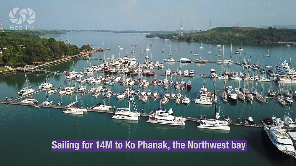
→ Day-trip armada arrives 10:00-15:00 · arrive at hongs by 07:30-08:00 to have them empty
→ Bottom is mostly mud · check anchor set carefully · holding good but bottom is soft
→ ⚠ Ko Kudu Yai rocky reef extends 500 m along the beach in front of the beach resort
⚓ Phang Nga Bay at a Glance
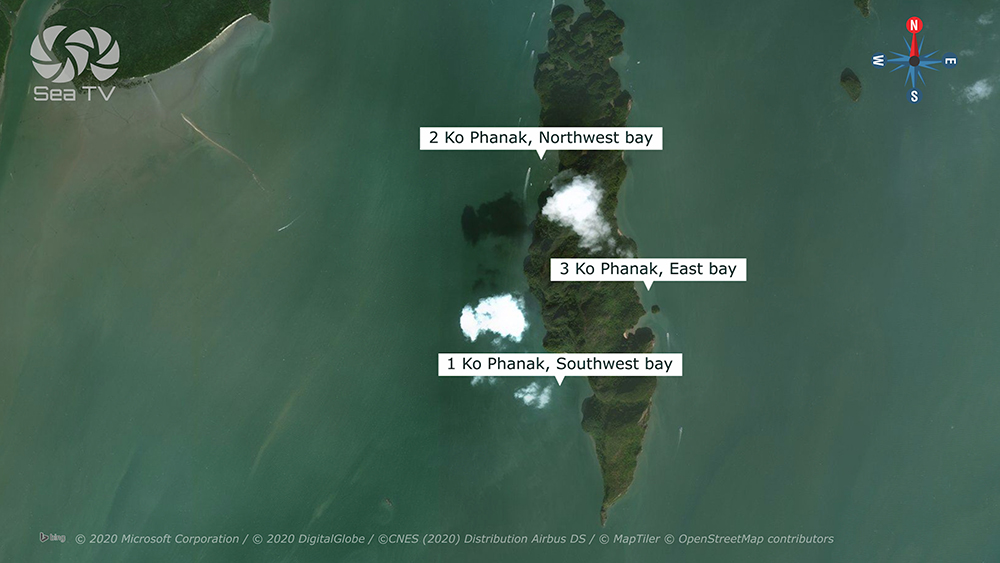
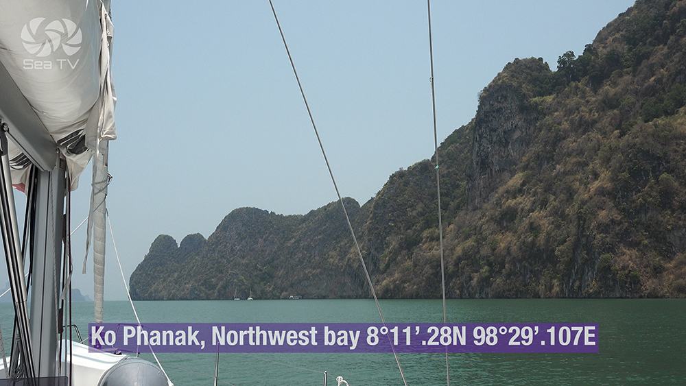
Ko Phanak NW
08°11.28’N · 098°29.107’E
Ko Hong
08°13.518’N · 098°30.098’E
Ko Roi
08°11.540’N · 098°36.639’E
Ko Kudu Yai
08°11.697’N · 098°38.029’E
Park
Ao Phang Nga NP (1981)
Park fee
300 THB / 150 THB child
From Yacht Haven
12-25 NM E
Park area
400 km² · largest mangrove in TH
Best season
Year-round (sheltered bay)
The Four Islands & Their Anchorages
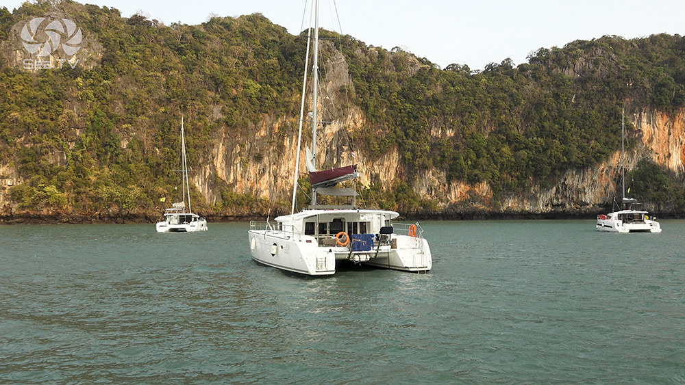
1 · Ko Phanak — The Bat Tunnel Island
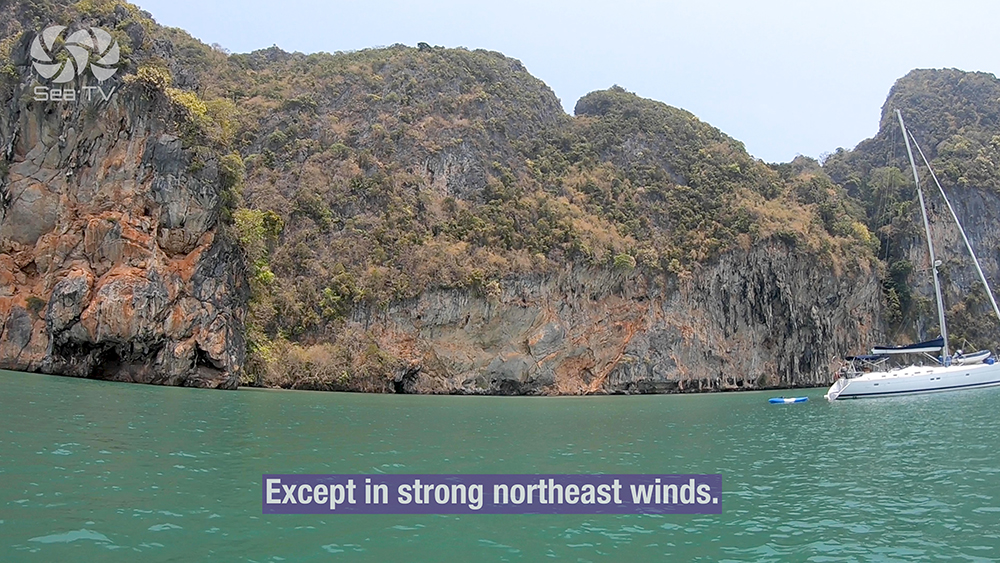
~12-14 NM E of Yacht Haven Marina. The closest of the karst islands · home to the famous 50 m sea-level bat tunnel on the NW side · three distinct anchorages around the island for different wind conditions.
08°11.28’N · 098°29.107’E · 14 NM E from Yacht Haven
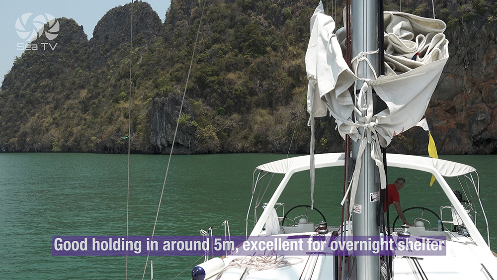
Ko Phanak NW Bay — Bat Tunnel Hong
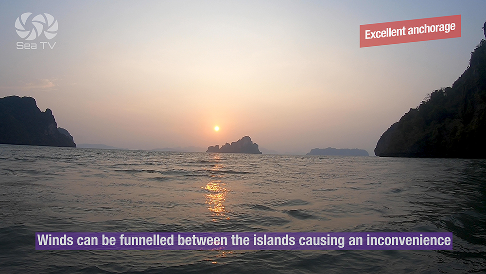
Anchor: good holding in 5 m mud · excellent for overnight shelter · busy with day-trip boats during the day · except in strong NE winds when the anchorage becomes uncomfortable.
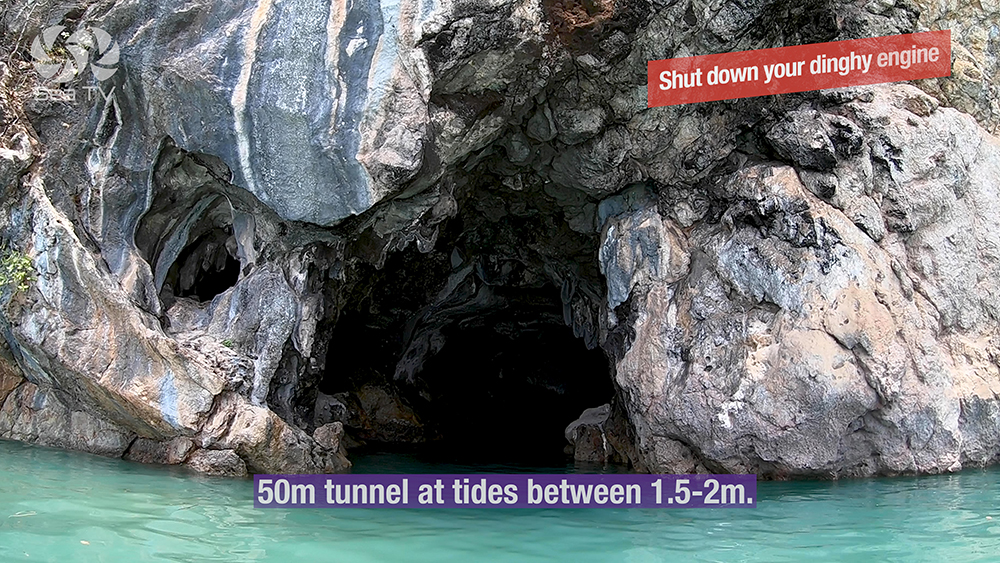
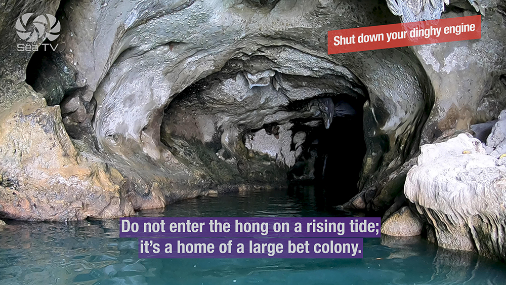
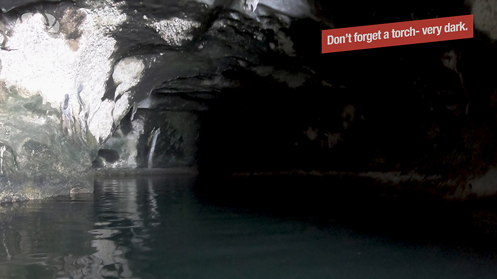
⚠ The famous 50 m tunnel: open at tide level 1.5-2.0 m only · bring a torch · the tunnel leads to a hidden inland hong with a large bat colony.
⚠ DO NOT enter the hong on a rising tide · the tunnel can close behind you and trap you inside · check tide tables before entering.
⚠ ENGINES OFF inside the hong · paddle only · the bats are sensitive to noise and the rangers enforce this.
Use it for: the bat-tunnel experience · NE-monsoon (calm) overnight · day-trip lunch stop.
08°10.487’N · 098°29.230’E · 12 NM E from Yacht Haven
Ko Phanak SW Bay — NE-Wind Shelter
Anchor: 4 m muddy bottom · good holding · excellent shelter in strong NE winds when the NW anchorage becomes choppy. The default fallback anchorage when the wind goes hard NE.
Use it for: NE-wind overnight · sheltered alternative to NW Bay.
08°11.213’N · 098°29.626’E · 14 NM E from Yacht Haven
Ko Phanak East Bay
Approach from the E and anchor in 4 m. Less crowded than the other Ko Phanak anchorages · used as a quiet alternative for SW-wind weather.
Use it for: SW-wind overnight · quieter alternative.
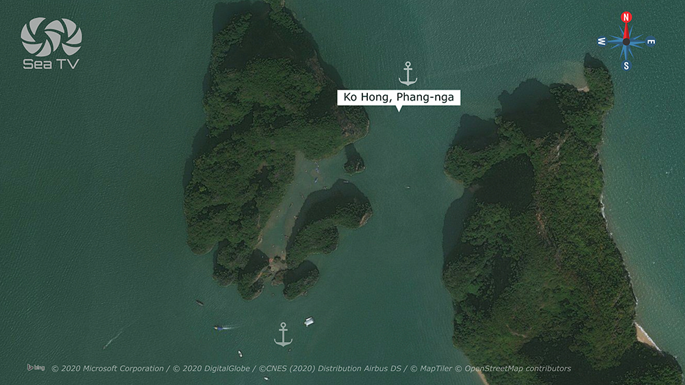
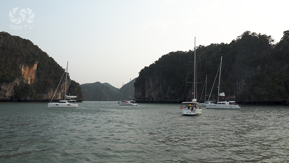
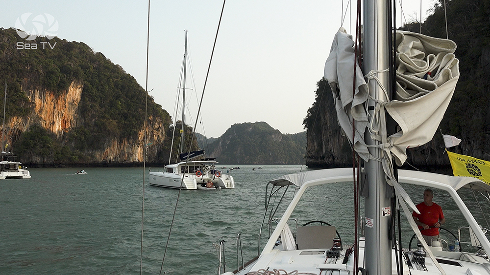
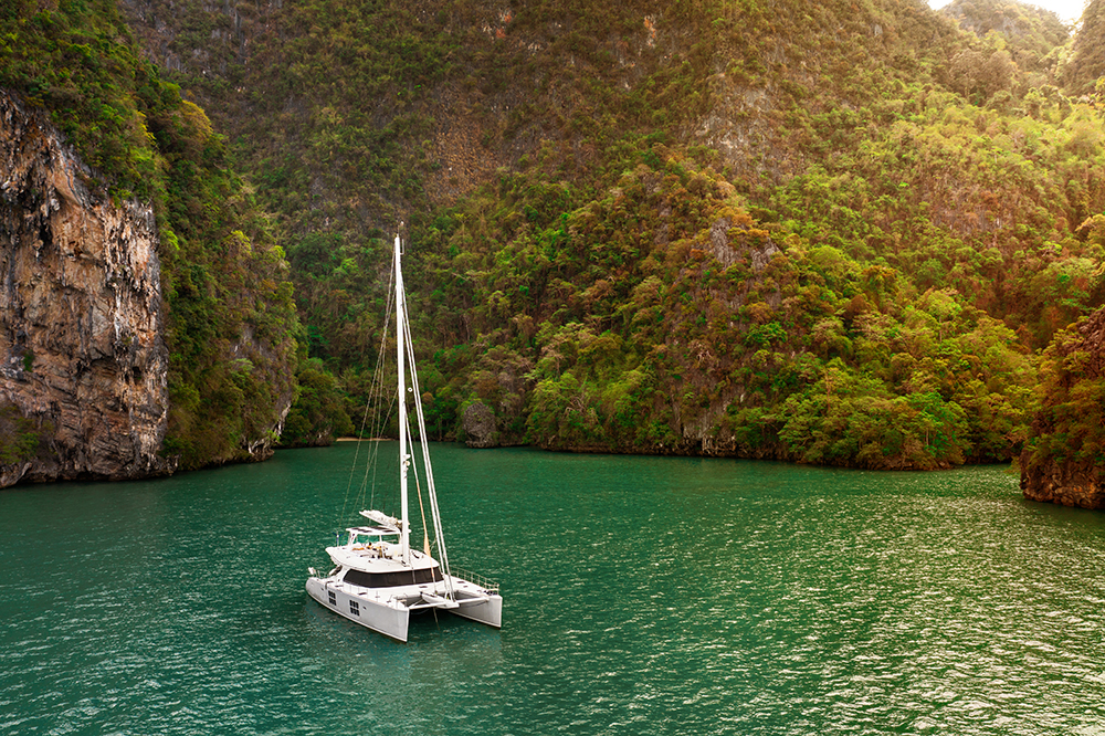
2 · Ko Hong — The Iconic Three-Island Lagoon
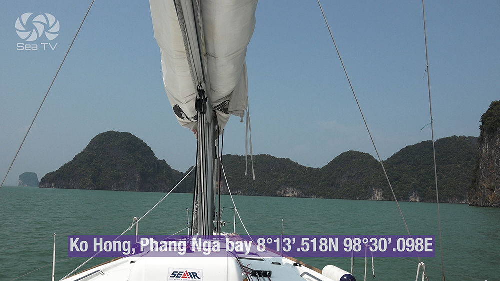
Dock 1 · 08°13.518’N · 098°30.098’E · Dock 2 · 08°13.162’N · 098°30.035’E · 16 NM E from Yacht Haven
Ko Hong (Phang Nga) — The Iconic Three-Island Hong
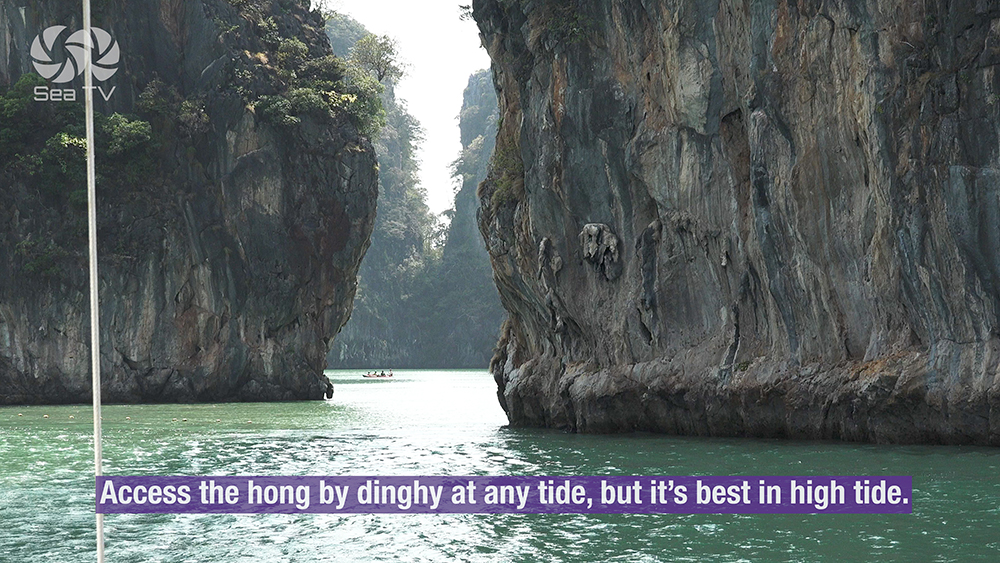
“Ko Hong” literally means “Room Island” — three small limestone islands surround a large enclosed inland lagoon · iconic photograph of Phang Nga Bay · accessible by dinghy through a sea-level passage at any tide (best at high tide for full water cover).
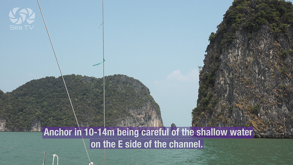
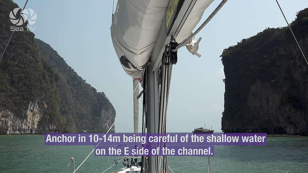
Anchorage A — Between the three islands: 10-14 m mud · good holding · be careful of shallow water on the E side of the channel. Holding in ~12 m on muddy bottom.
Anchorage B — S of Ko Hong: 4-5 m · alternative shallower anchorage.
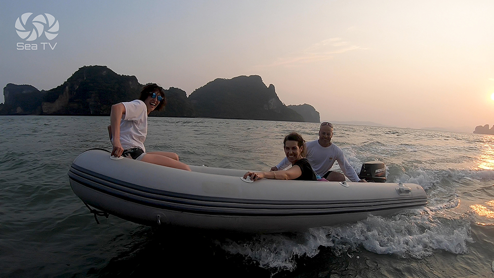
⚠ Bring paddles for the dinghy. Engines must be off inside the hong · use oars only.
⚠ Very busy with tour boats and sea canoes 10:00-15:00 · arrive at 07:30 or after 16:00 for the empty hong.
→ Small tunnel on the W side of the hong accessible only by kayak at mid-tide · explore further inland.
Use it for: the iconic Phang Nga photo · easy hong access for dinghy or kayak · NE-monsoon overnight in the channel.
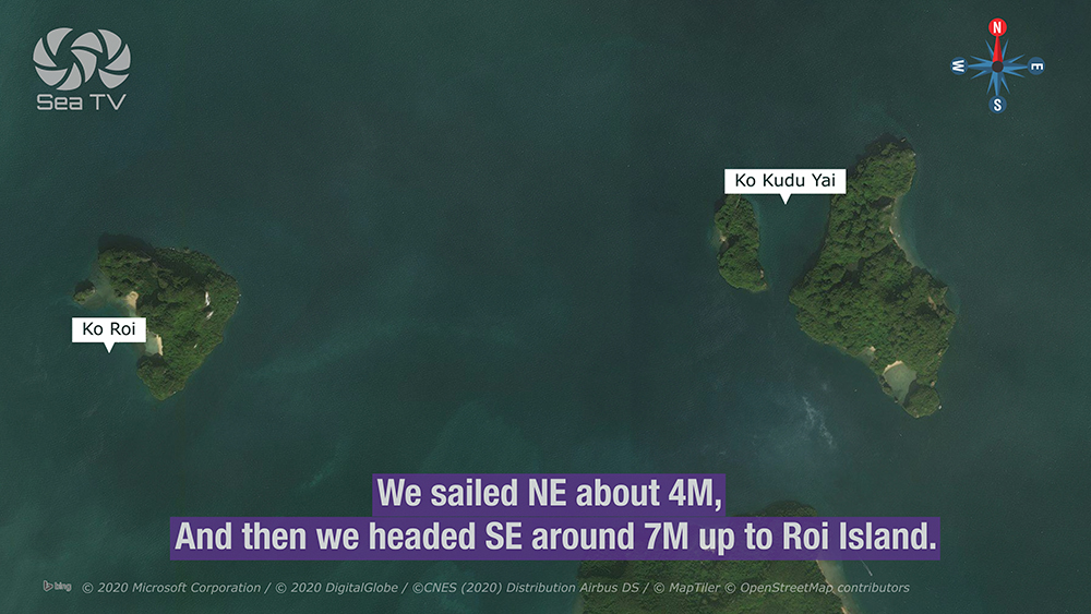
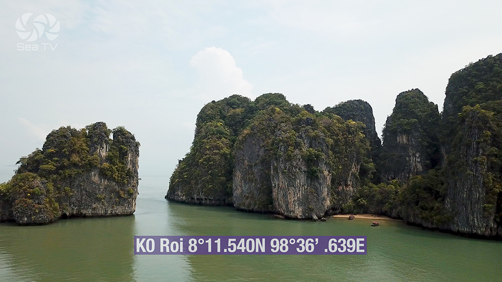
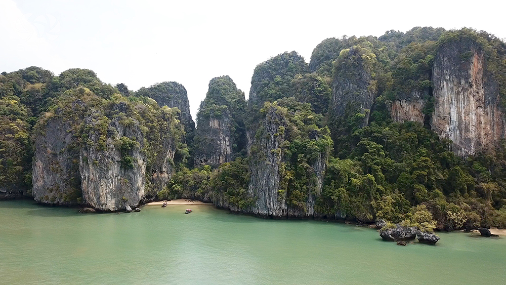
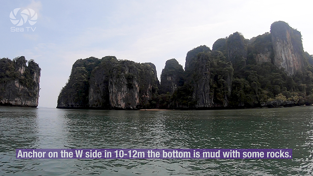
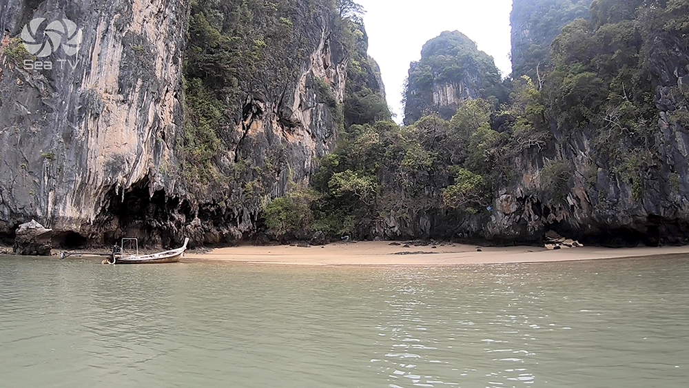
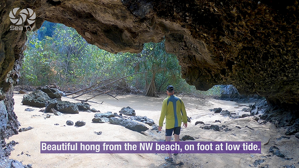
3 · Ko Roi — The Foot-Access Hong
08°11.540’N · 098°36.639’E · ~25 NM E from Yacht Haven
Ko Roi — Quiet Hong, Walk-In at Low Tide
Quieter and further E than Ko Hong · accessed less by day-trip boats · the hong on this island can be reached on FOOT from the NW beach at low tide (rather than only by dinghy).
Anchor: W side in 10-12 m mud with some rocks · do not approach any closer to the shore — the bottom rises sharply.
⚠ Shallow reef extends across the entire E side of Ko Roi · keep clear when approaching · always come in from the W.
Use it for: quieter hong experience · walk-in hong access at low tide · less-crowded alternative to Ko Hong.
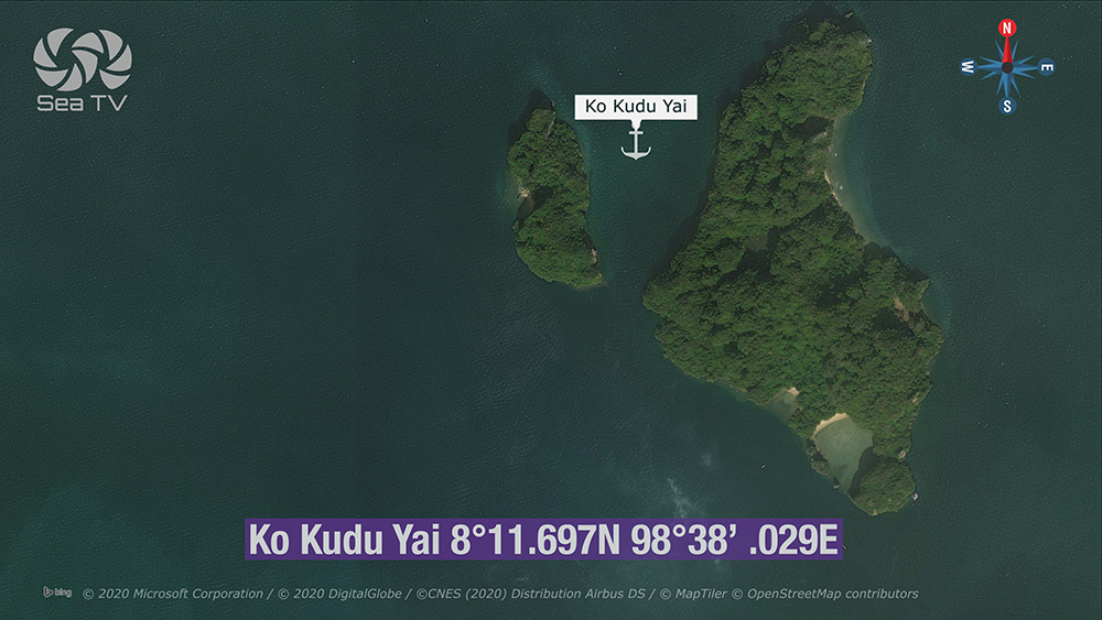
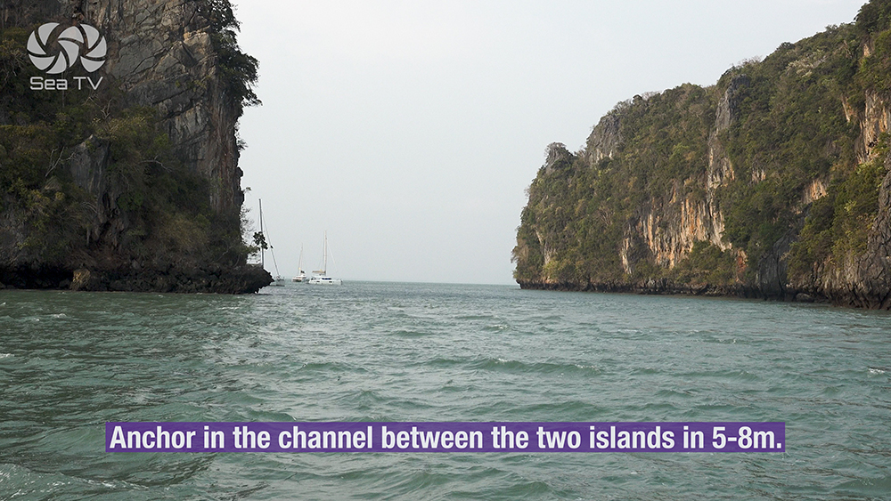
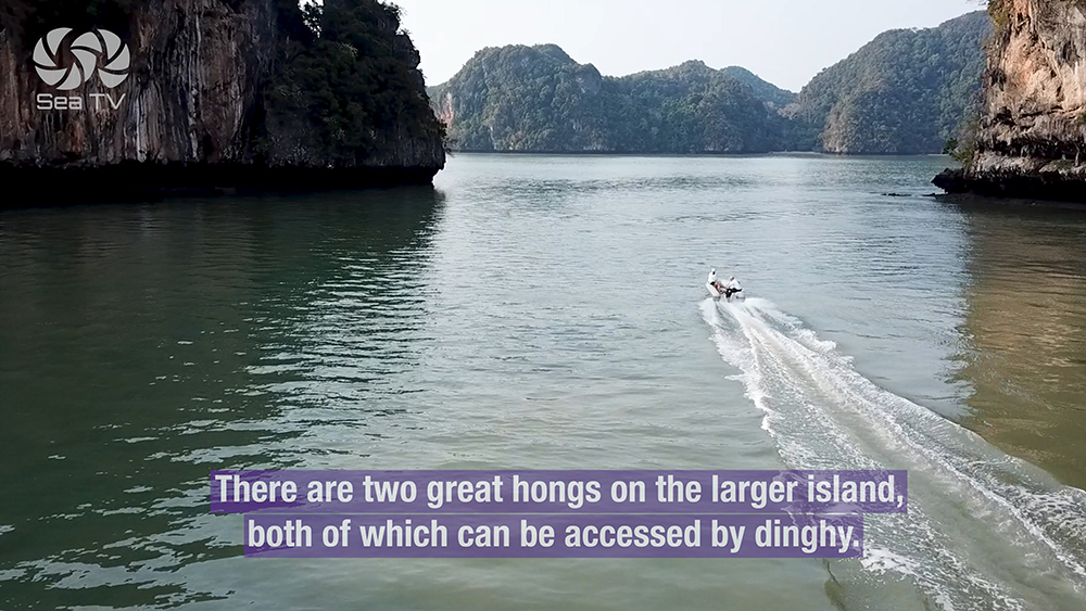
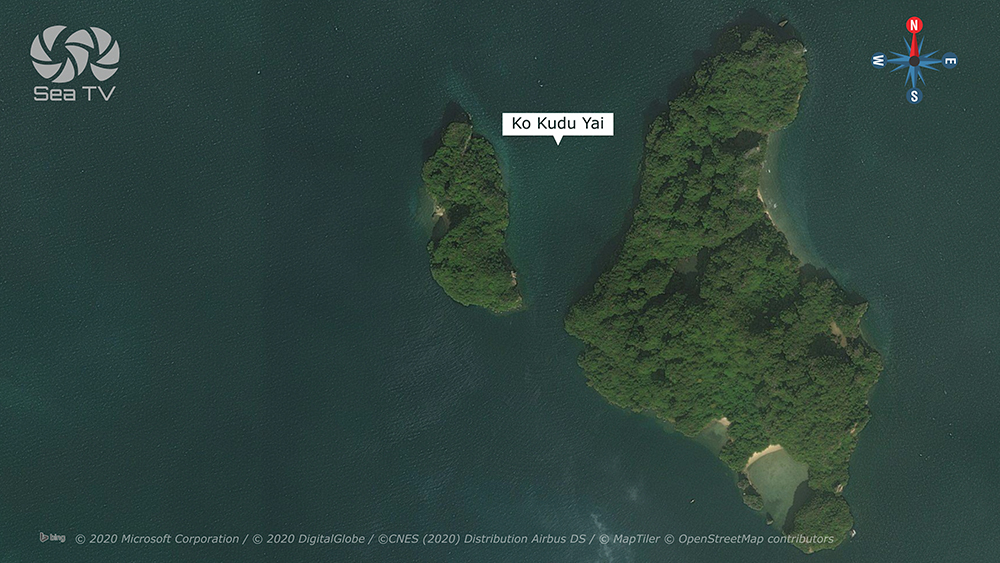
4 · Ko Kudu Yai — Two Hongs & Wildlife Sanctuary
08°11.697’N · 098°38.029’E · ~20 NM E from Yacht Haven
Ko Kudu Yai — Eagles, Hornbills, Fruit Bats
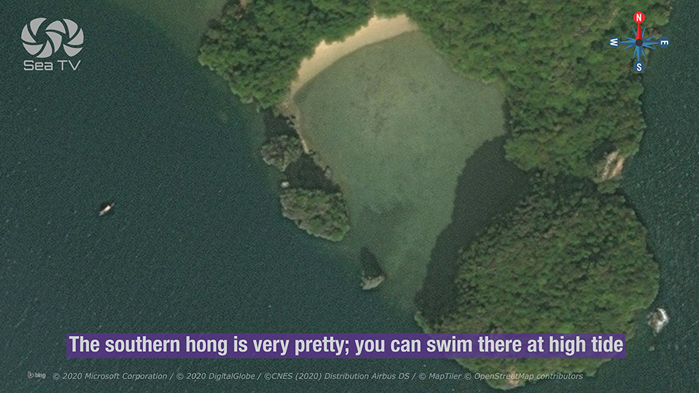
The wildlife island. Two hongs on the larger of the two islands of the group · the E hong is home to giant fruit bats, monkeys, sea eagles, and hornbills · the S hong is the prettier of the two and is swimmable at high tide.
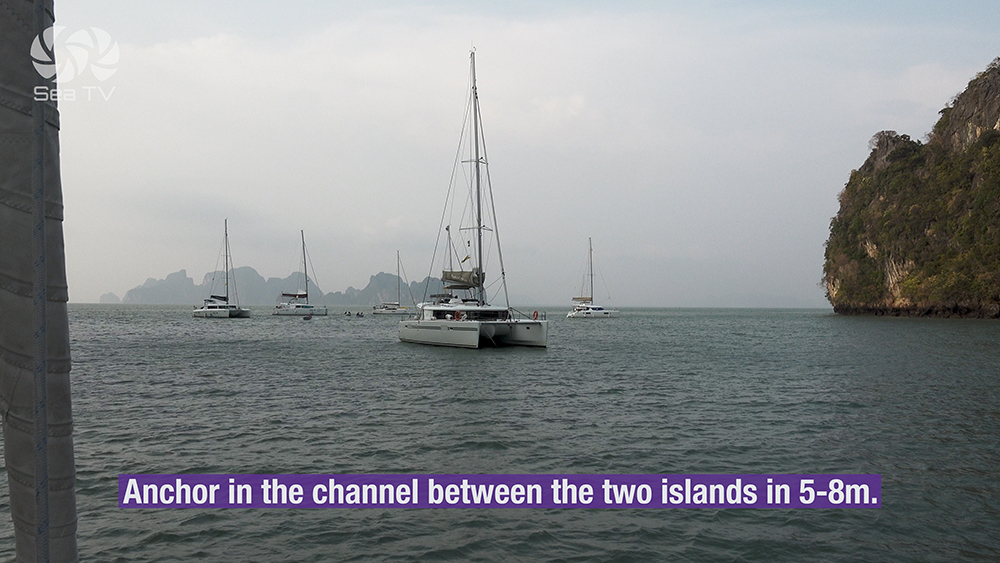
Anchor: in the channel between the two islands in 5-8 m · sheltered between the cliffs.
⚠ Dangerous rocky reef extends up to 500 m along the beach in front of the resort on the W shore · keep well clear · approach only via the channel between the islands.
→ S hong: swimmable at high tide · the prettier hong.
→ E hong: wildlife sanctuary · giant fruit bats, monkeys, eagles, hornbills.
Use it for: wildlife observation · two hongs in one stop · final hong before sailing E to Krabi.
James Bond Island & Ko Pan Yi (Northern Bay)
James Bond Island (Khao Phing Kan / Ko Tapu)
The 20 m vertical limestone spike rising from the water 40 m off the small island of Khao Phing Kan · made famous by the 1974 James Bond film “The Man with the Golden Gun” · also featured in “Tomorrow Never Dies”.
⚠ Park fee 300 THB per person (separate ranger station collects on arrival).
⚠ Extremely crowded 10:00-15:00. Khao Phing Kan is so small it’s overrun · arrive at dawn or after 16:00.
Use it for: photo stop · 30-45 minutes is enough · avoid peak hours.
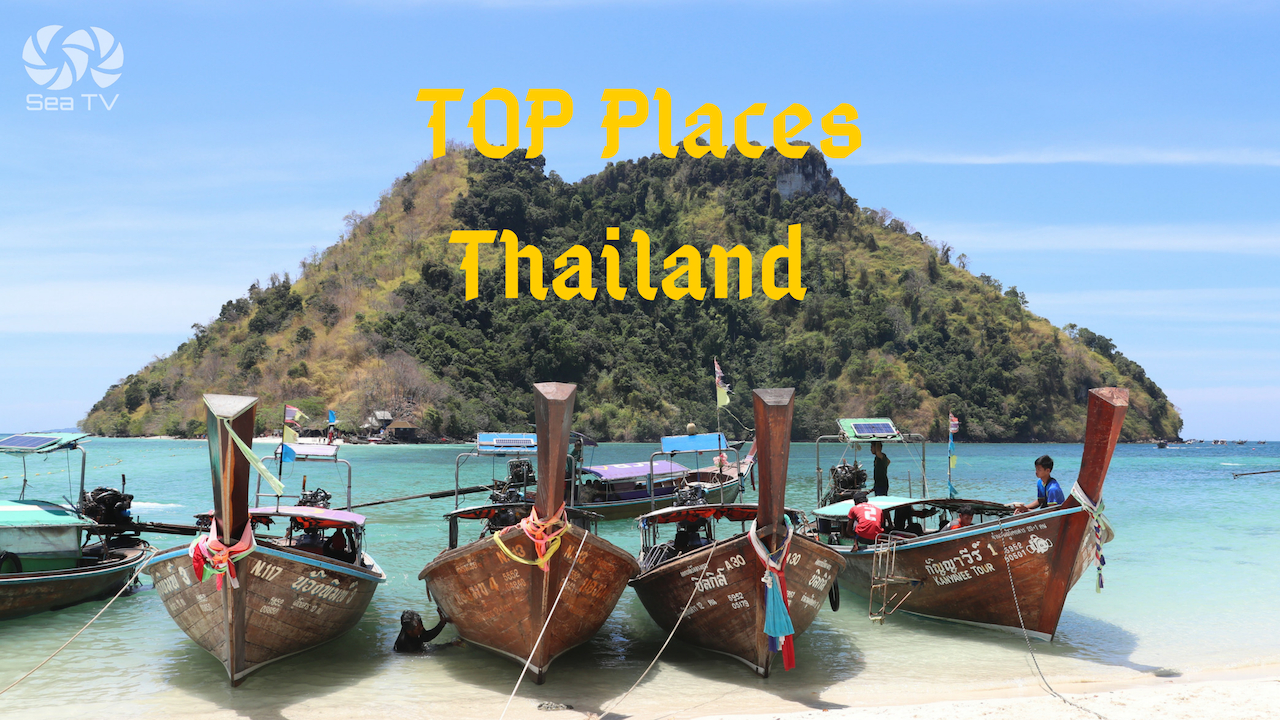
Ko Pan Yi (Floating Muslim Village)
A village built entirely on stilts over the water at the foot of a limestone cliff · ~200 Muslim families · seafood restaurants serve buffet lunch (the standard tour stop) · floating football pitch.
→ Good lunch stop on the way N to James Bond Island · respect Muslim customs (no pork in restaurants, modest dress).
Use it for: cultural lunch stop · authentic Andaman village experience.
The Hong Rules — Sea-Level Tunnel Etiquette
Hongs (literally “rooms”) are inland lagoons enclosed by vertical limestone walls and accessed by sea-level tunnels through the rock. They open and close with the tide. Get the rules wrong and you can be trapped, fined, or kicked out by rangers.
→ 1 · Check the tide BEFORE entering. Tunnels open at specific tide ranges (Ko Phanak NW = 1.5-2.0 m). Wrong tide = no access or trapped.
→ 2 · NEVER enter on a rising tide. The tunnel can close behind you and trap you inside until the next low tide (12+ hours).
→ 3 · Engines off · paddles only. Inside the hong, dinghy engines must be off. Use oars or paddles. Bats and birds are sensitive to noise.
→ 4 · Bring a torch. Tunnels can be dark · stalactites overhead.
→ 5 · Do not disturb wildlife. Bats roost in the tunnels · monkeys and eagles inhabit the hongs · feeding is forbidden.
→ 6 · Pack out all rubbish. The hongs have no bins · bring everything back to the yacht.
Seasonal Strategy
Year-Round Anchorage
Phang Nga Bay is sheltered from both monsoons by the surrounding islands and mainland · workable year-round for most anchorages. NE-wind: use Ko Phanak SW Bay for shelter. SW-wind: use Ko Phanak East Bay for shelter. The hongs themselves are wind-protected by the limestone walls regardless of weather.
Tide-Driven Schedule
Tide is the critical variable. Ko Phanak 50 m tunnel only opens at 1.5-2.0 m tide. Plan the day around the tide table from the Thai Hydrographic Department · check Krabi tide tables for the bay.
Pro Tips for Phang Nga Bay
Sail at dawn from Yacht Haven. 12-25 NM E to the Phang Nga islands · arrive at the hongs by 07:30-08:00 to have them empty. The day-trip armada from Phuket arrives 10:00.
Pre-pay the park fee. 300 THB / 150 THB child via DNP e-ticket OR pay rangers in cash. Note: Ao Phang Nga NP fee is DIFFERENT from the 400 THB Mu Ko Phi Phi NP fee.
Bring a torch and paddles. Hong tunnels are dark · engines must be off inside · paddle access only.
Check Krabi tide tables before any hong attempt. Ko Phanak NW tunnel opens at 1.5-2.0 m only · entering on rising tide can trap you for 12+ hours.
Mud bottom = check anchor set carefully. Most Phang Nga anchorages are mud · holding is good once set but the bottom is soft · watch for drag.
Keep clear of the Ko Kudu Yai 500 m reef in front of the resort on the W shore · approach only through the central channel between the two islands.
Watch wildlife respectfully. Don’t feed monkeys, don’t approach bats, don’t disturb hornbills · the rangers patrol and fines apply.
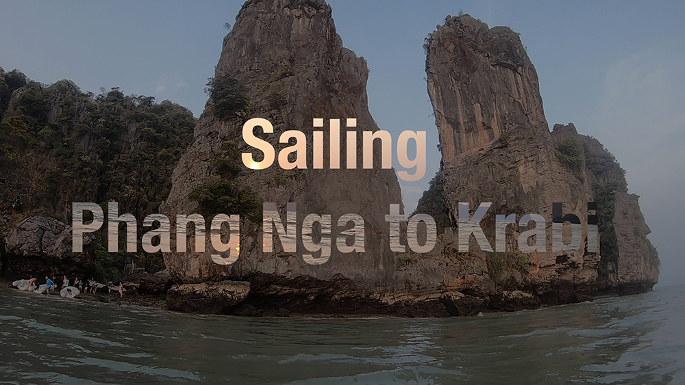
Routes To & From Phang Nga Bay
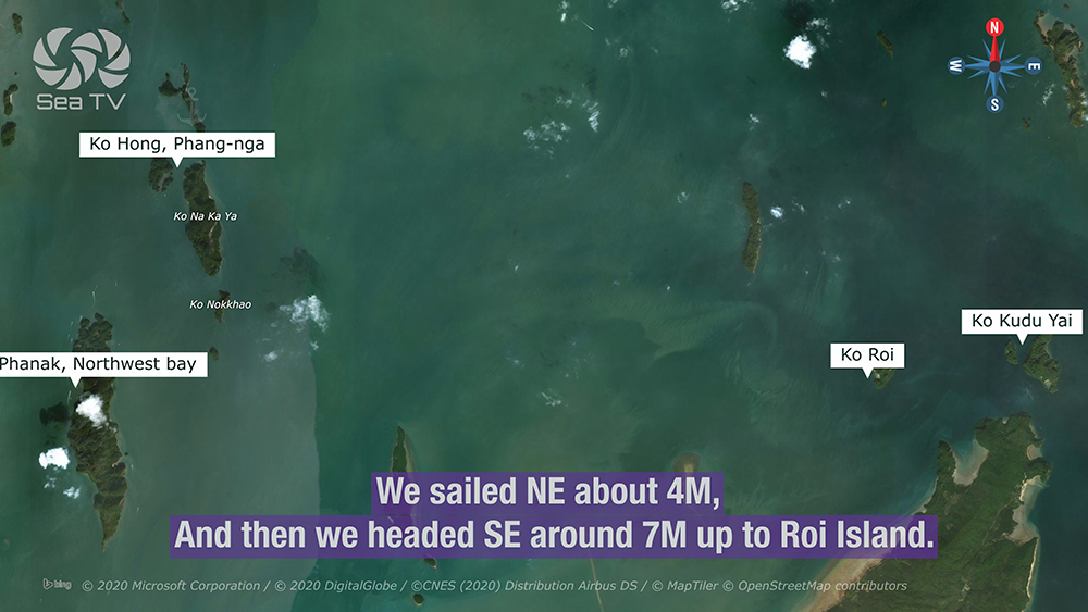
From Yacht Haven Marina (W): 12 NM E to Ko Phanak SW · 14 NM to Ko Phanak NW · 16 NM to Ko Hong · 20-25 NM to Ko Kudu Yai/Ko Roi. See Phuket Yacht Haven Marina.
SE to Krabi: ~25 NM SE from Ko Kudu Yai to Klong Muang Beach. See Krabi Coast · Ao Nang & Railay.
N to James Bond Island & Ko Pan Yi: ~10 NM N from Ko Hong · further N into the head of the bay.
Full route detail: See Sailing Phang Nga to Krabi.
Emergency Numbers — Phang Nga Bay
Tourist Police (24/7, English): 1155
Marine Emergency & SAR: 1196
Coastguard Distress: VHF Ch. 16
Ao Phang Nga National Park HQ: +66 76 481 188
Phang Nga Hospital: +66 76 599 100
Yacht Haven Marina (Ch 68): +66 76 397 908
Useful Links
→ Ao Phang Nga National Park (DNP official)
→ DNP National Park e-Ticket System
Related SeaTV Pages
Phang Nga & Krabi Coast
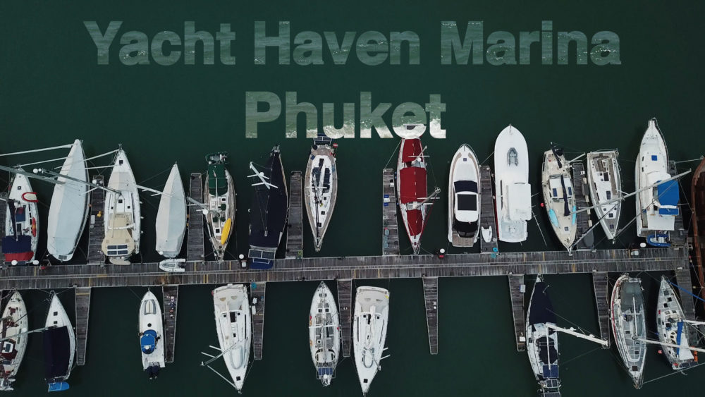
→ Phuket Yacht Haven Marina (charter base)
→ Krabi Coast · Ao Nang & Railay
Hub & Routes
Sailing the Phang Nga Bay Hongs?
Four limestone islands · four anchorages · multiple hongs accessed by sea-level tunnels. Ao Phang Nga NP fee 300 THB · ENGINES OFF inside hongs · NEVER enter on rising tide · check Krabi tide tables before every attempt.
→ Yacht Haven W · Krabi SE · Full Route
“Day one of the Phuket charter circuit · twelve to twenty-five nautical miles east from Yacht Haven into the limestone karst bay where the cliffs rise three hundred metres straight from the water and the hongs hide inside. Ko Phanak fifty metre tunnel at one and a half to two metre tide for the bat colony · Ko Hong three islands around an iconic lagoon · Ko Roi quieter and the hong walked into on foot at low tide · Ko Kudu Yai with eagles and hornbills and giant fruit bats and the rocky reef five hundred metres long that nobody saw coming. Three hundred Thai baht park fee — not the four hundred Thai baht of the Phi Phi park · the difference matters. Engines off inside the hongs · paddles only · never enter on a rising tide because the tunnel will close behind you and the next opening is twelve hours away. James Bond Island for the photo if you must · Ko Pan Yi for the buffet lunch on stilts above the water · the day done by sundown back at Yacht Haven or onward to Krabi.”
— SeaTV Visual Pilot · Andaman Coast Edition