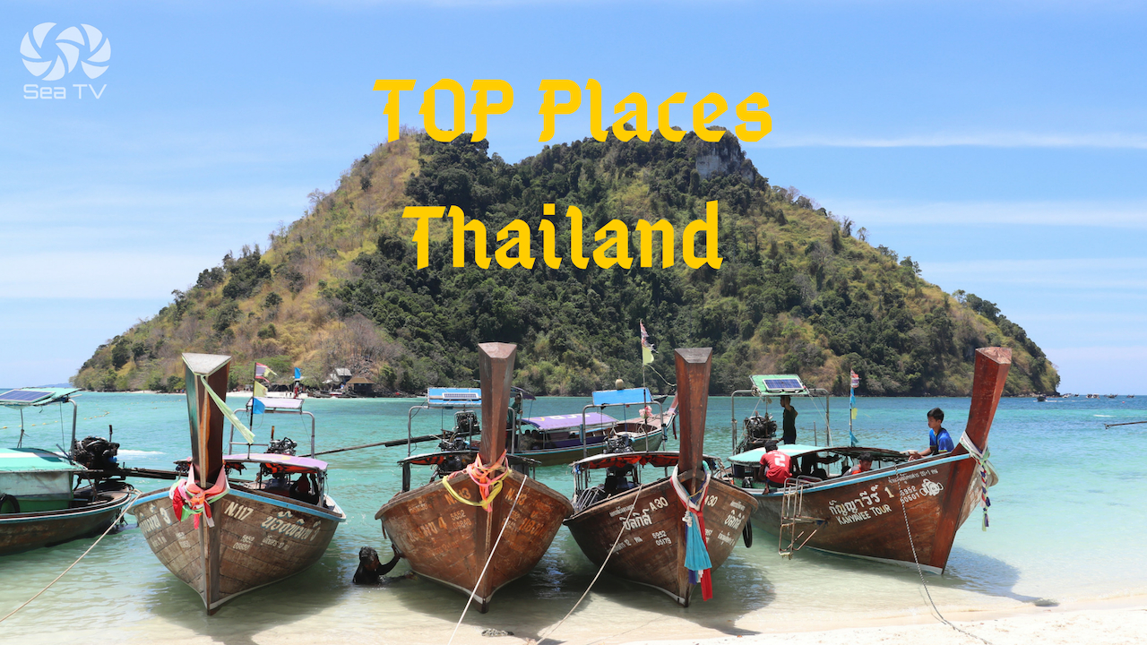
SeaTV · Thailand · Andaman Coast · Phuket Region · Krabi Coast
Krabi Coast — Klong Muang, Ao Nang & Railay Beach
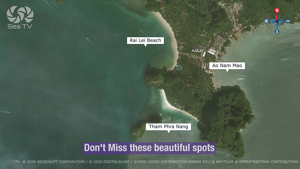
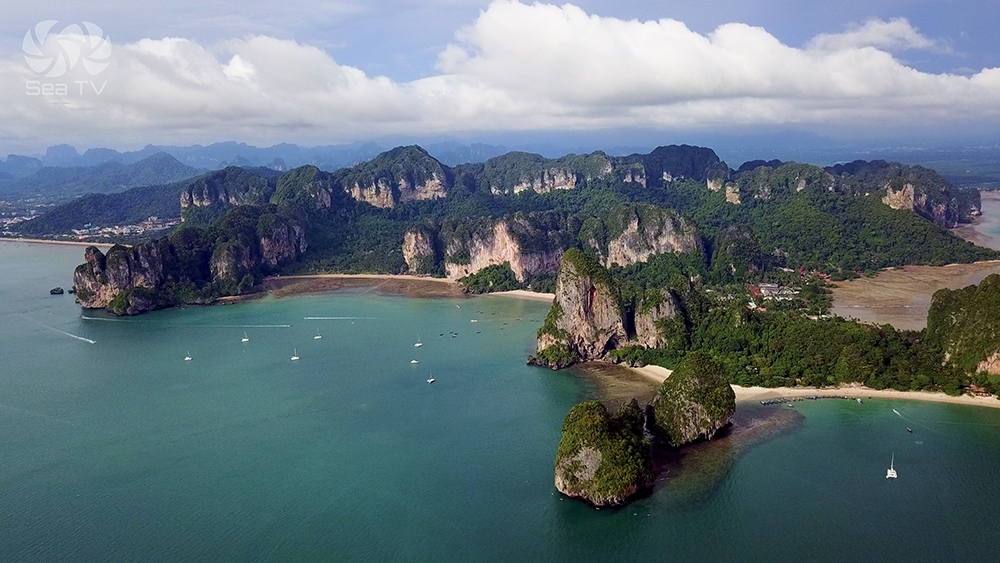
The Krabi mainland anchorages on Day 2 of the charter route · Klong Muang Beach (lunch stop in front of Dusit Thani / Sheraton resort) · Ao Nang (overnight in front of the main town) · Railay Peninsula (the world-class climbing peninsula with four distinct beaches: Railay E, Railay W, Phra Nang, Tonsai) · all accessible only by boat · all within Hat Noppharat Thara – Mu Ko Phi Phi National Park.
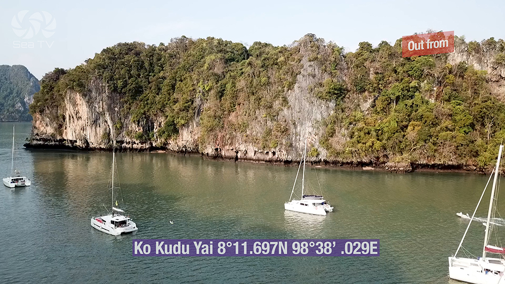
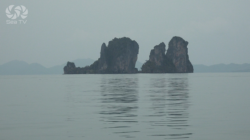
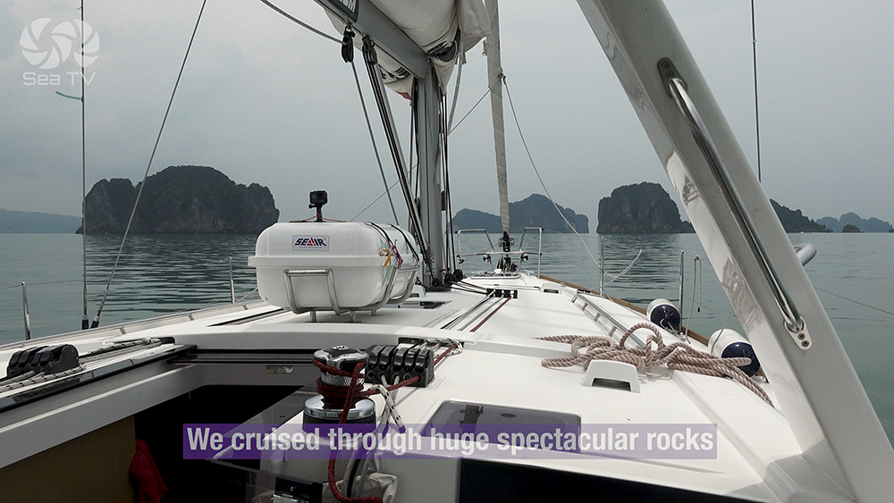
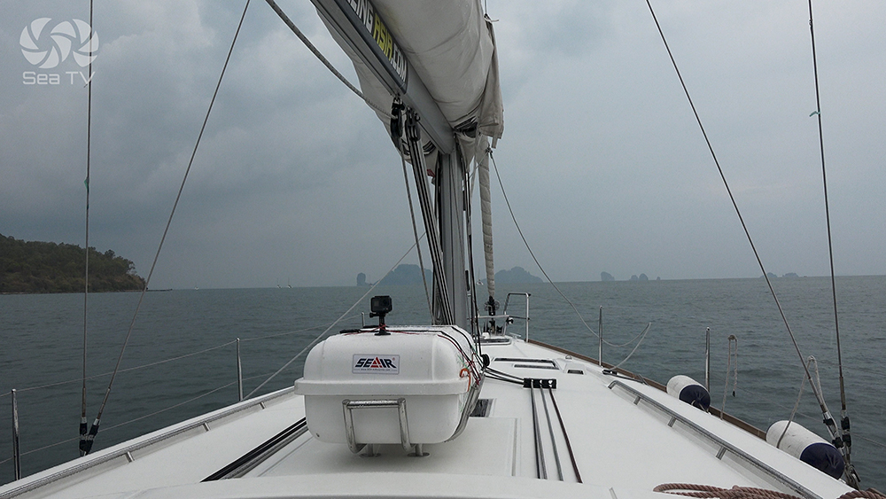
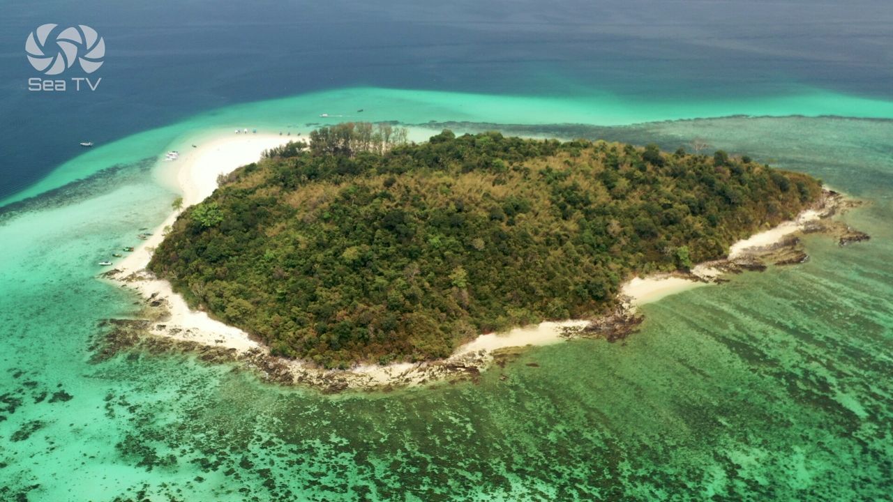
The Krabi mainland coast is the second day on the Phang Nga-to-Phi Phi charter route. Three distinct anchorages cluster along this stretch: Klong Muang Beach (~5 NM W of Ao Nang) in front of the upmarket Dusit Thani Krabi Beach Resort area · Ao Nang as the main mainland tourist hub · and the Railay Peninsula immediately E of Ao Nang — technically attached to the mainland but cut off by sheer limestone cliffs, accessible only by boat. Railay has four named beaches: Railay E (mangrove side, accommodation, longtail dock) · Railay W (main swimming beach, sunset, longtail dock from Ao Nang) · Phra Nang Cave Beach (the star — fine sand, sea-goddess shrine, no boat landing) · Tonsai at the N end (climbers’ beach · NOT to be confused with Tonsai on Phi Phi Don). The whole peninsula is one of the world’s premier climbing destinations with 700+ bolted routes on the limestone walls.
⚠ Reality check:
→ Park fee 400 THB per person · Hat Noppharat Thara – Mu Ko Phi Phi NP applies to all anchorages
→ Ao Nang dries out extensively at low tide · check tide tables before going ashore · prepare to carry the dinghy
→ ⚠ Phra Nang Beach: NO BOAT LANDING · swimming beach only · longtails anchor offshore · access by foot from Railay E/W
→ ⚠ Dangerous reef N of Lo Daeng / Ko Daeng · keep clear when transiting the Klong Muang area
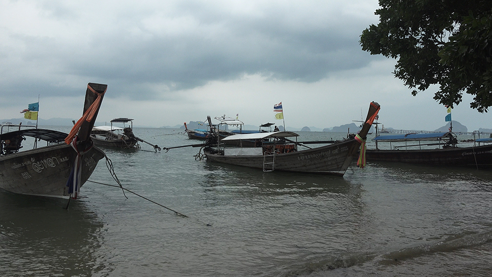
→ Heavy longtail traffic all day · Ao Nang to Railay shuttle runs every 5 minutes 09:00-17:00
→ Significant tidal range · 2 m+ swing daily · plan dinghy run for mid-tide
→ Rayavadee resort dominates Phra Nang · expensive but the only food/drink option on that beach
⚓ Day 2 Anchorages at a Glance
Klong Muang Beach
08°02.955’N · 098°44.830’E
Ao Nang
08°00.637’N · 098°50.094’E
Railay W
08°00.586’N · 098°50.619’E
Phra Nang Beach
08°00.214’N · 098°50.252’E
Park fee
400 THB / 200 THB child
Best season
Nov-Apr (NE monsoon)
Tidal range
~2 m diurnal · plan tender carefully
Climbing routes
700+ bolted routes on Railay
Krabi airport
KBV · ~30 min drive from Ao Nang
The Three Anchorage Areas
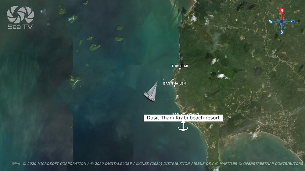
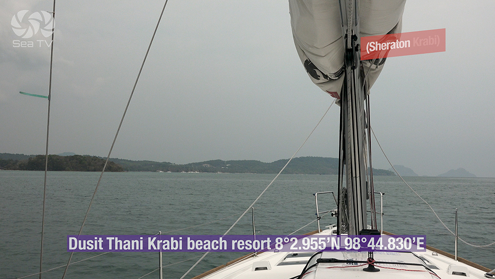
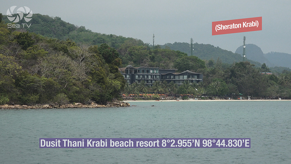
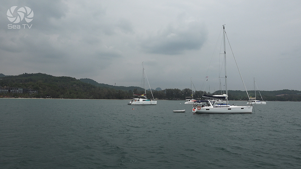
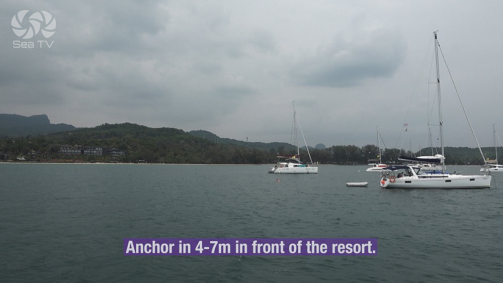
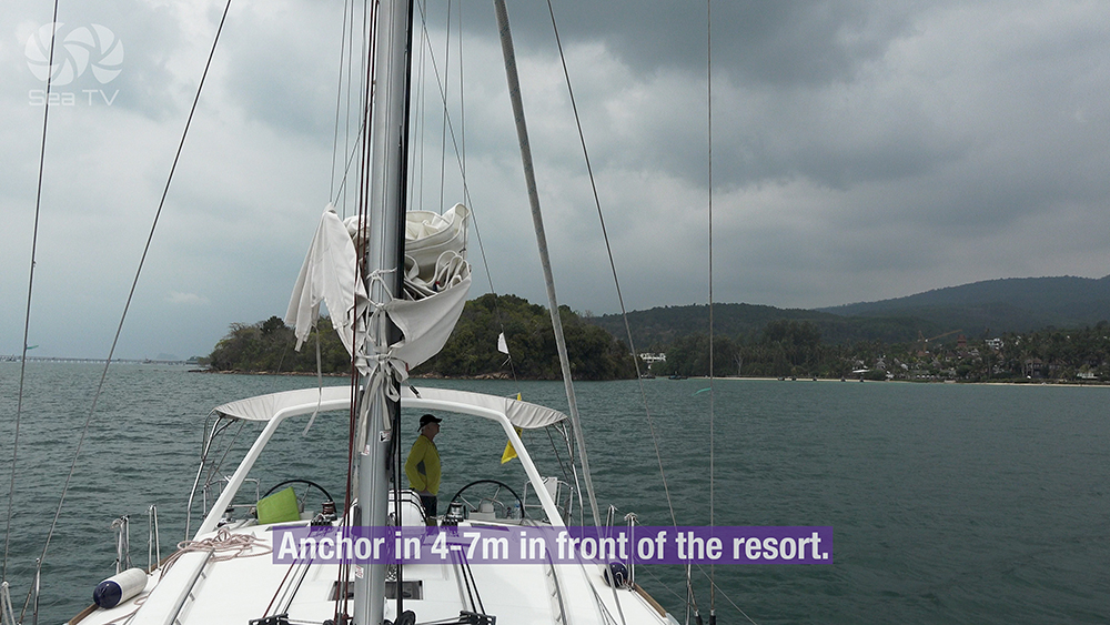
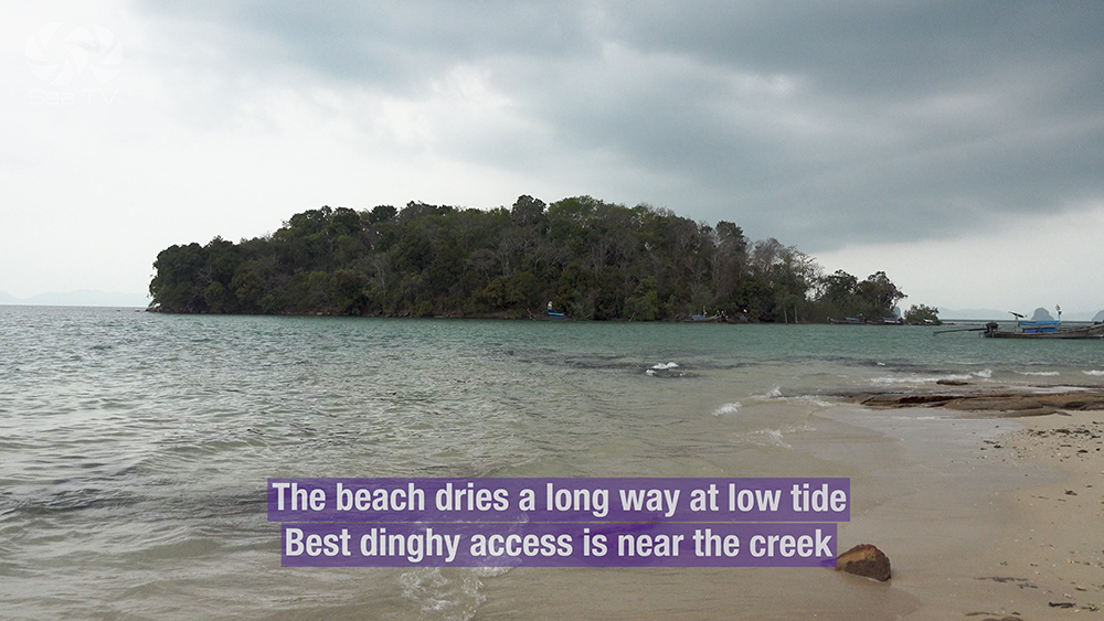
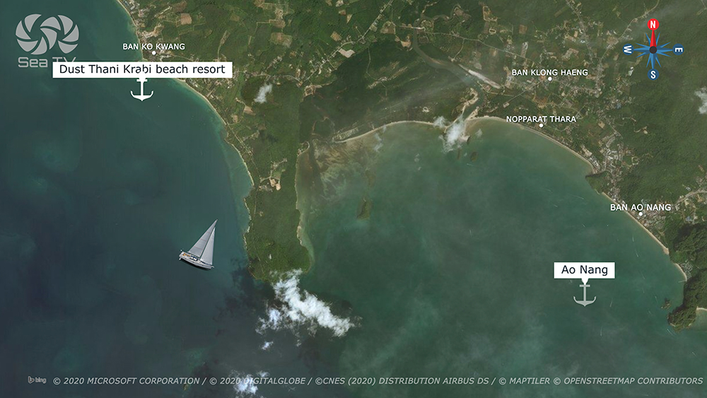
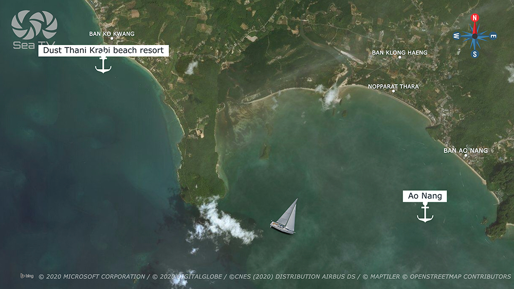
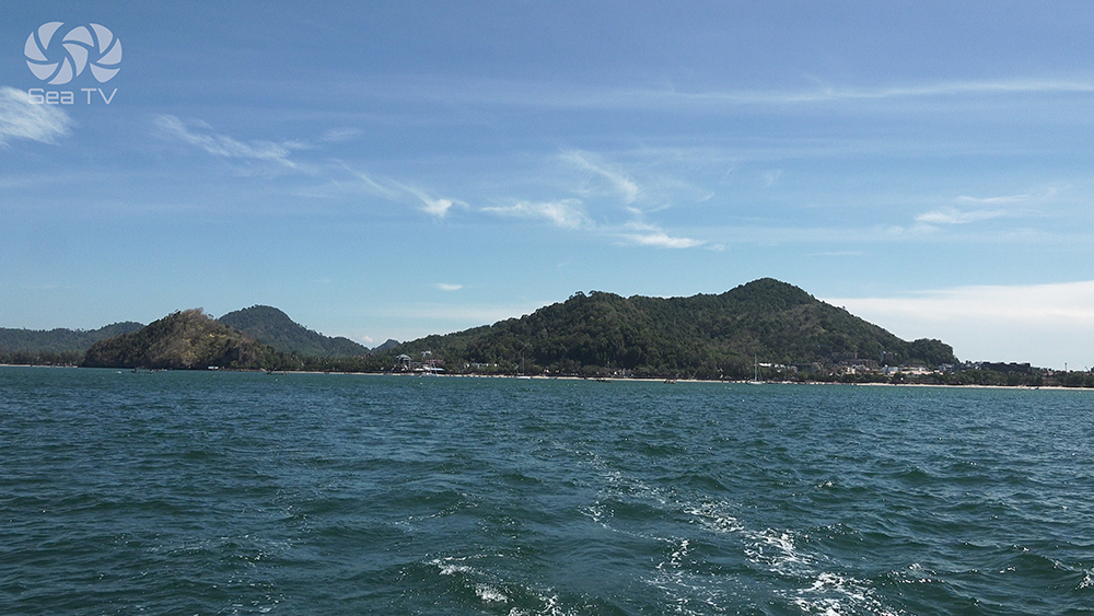
1 · Klong Muang Beach (W of Ao Nang) — Resort Lunch Stop
08°02.955’N · 098°44.830’E
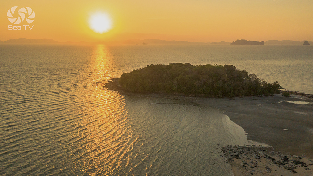
A long sandy beach ~5 NM W of Ao Nang · home to Dusit Thani Krabi Beach Resort, Sheraton Krabi, Tubkaek Sunset Beach Resort, and other upmarket properties · much quieter than Ao Nang itself · the natural lunch stop sailing south from Phang Nga Bay before pushing on to Ao Nang or Railay for the night.
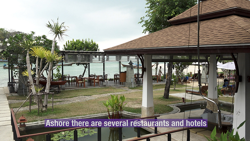
Anchor: 4-7 m sand in front of the resort line · best dinghy access near the central creek at low tide · several restaurants and hotels available ashore.
⚠ Dangerous reef N of Lo Daeng / Ko Daeng · keep clear when transiting · the reef sits offshore between Klong Muang and the Ko Daeng group.
→ Points of interest: King’s summer palace (gold-roofed) on the hill N of Laem Hang Nak (“Naga’s Tail” headland) · excellent snorkelling around Ko Daeng and Ko Samet · Thai massage at the resorts.
Use it for: lunch stop · spa break · upmarket dinner ashore at the Dusit Thani · alternative to crowded Ao Nang.
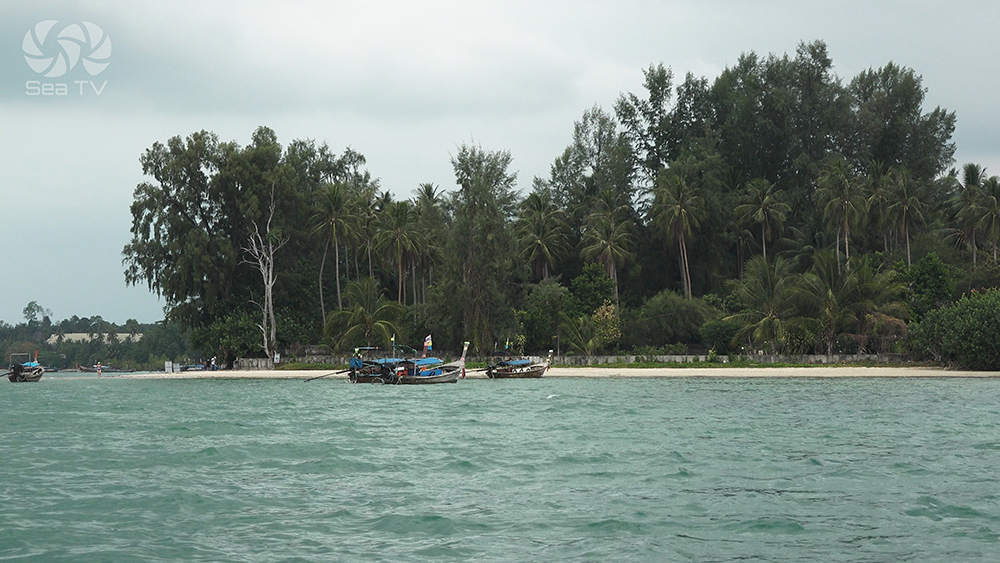
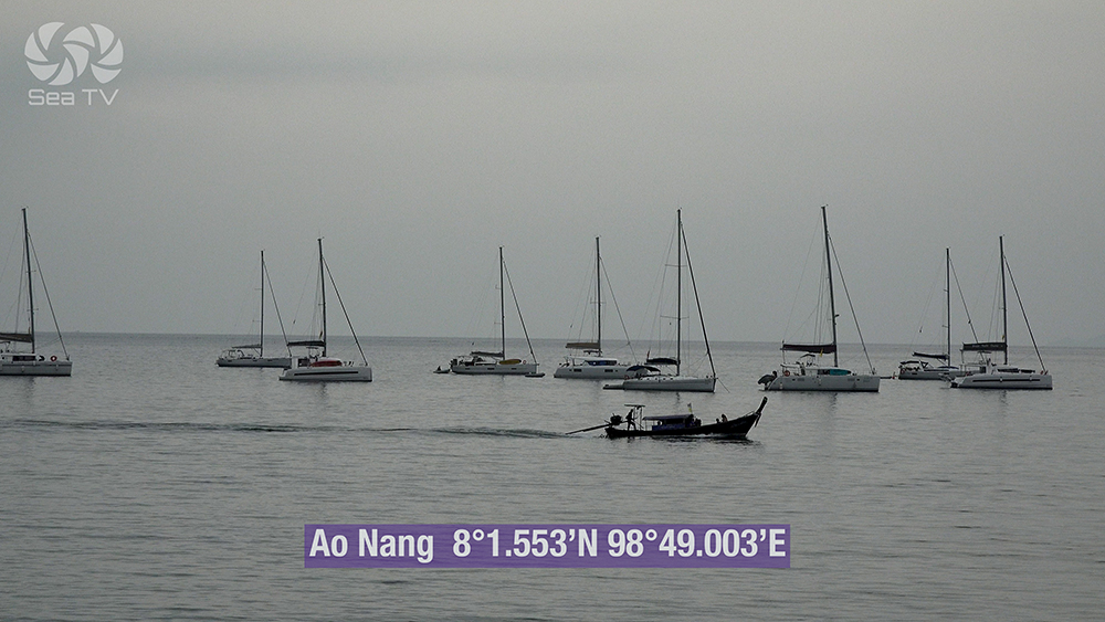
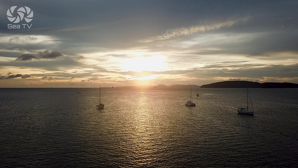
2 · Ao Nang (Mainland Hub) — The Overnight Town
08°00.637’N · 098°50.094’E
The main tourist hub of Krabi province on the mainland. Long sandy beach backed by a busy strip of restaurants, bars, dive shops, ATMs, supermarkets, and hotels · Nopparat Thara Pier handles longtails to Railay, Phi Phi, and the Krabi 4-Island tour group · Krabi airport (KBV) ~30 minutes by taxi.
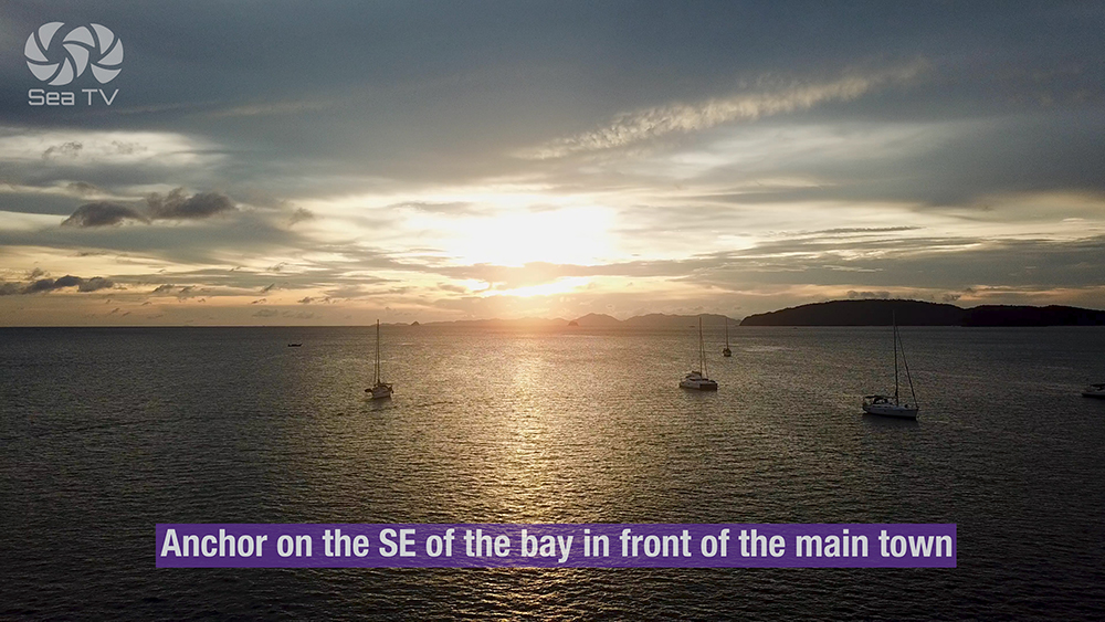
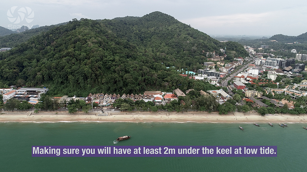
Anchor: SE of the bay in front of the main town · ensure at least 2 m under the keel at low tide · sand bottom · holding good in NE-monsoon weather.
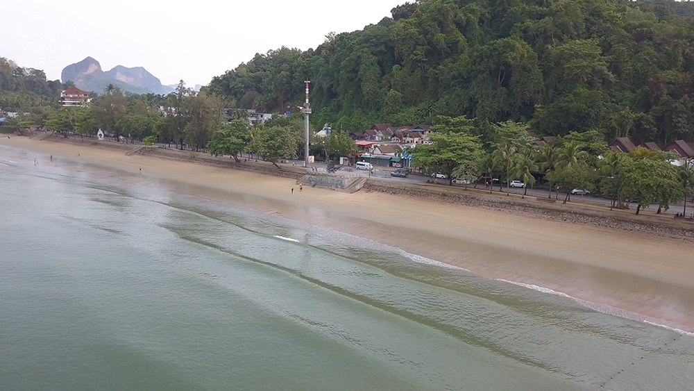
⚠ Significant tidal range · the beach dries out extensively at low tide · the dinghy run can be a long carry across exposed sand · plan timing for mid-tide rising.
⚠ Heavy longtail traffic · Nopparat Thara Pier is busy 09:00-17:00 · keep clear of the ferry approach.
⚠ Exposed to W/SW swell · NE-monsoon only for overnight · move to Lanta Old Town or Krabi Boat Lagoon in SW season.
→ Provisioning: 7-Eleven, Tesco Lotus, Big C all in the town · best fresh-produce market on the Krabi mainland · pharmacies, ATMs, money exchange.
→ Crew handover: Ao Nang is the practical crew rotation point if you can’t reach Phuket · Krabi Airport handles direct international flights.
Use it for: overnight in NE-monsoon · provisioning run · crew rotation via Krabi airport · transition between Phang Nga and Phi Phi.
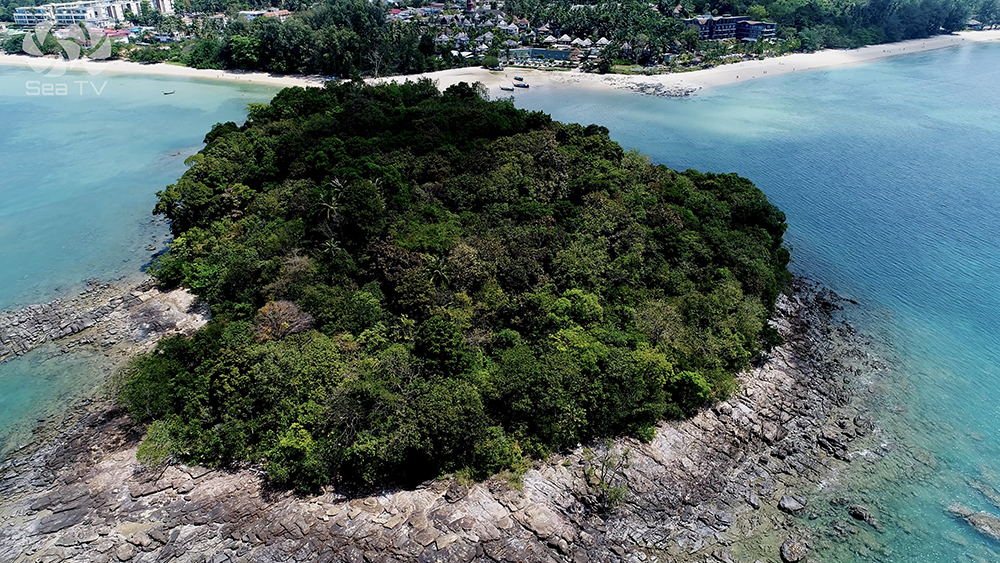
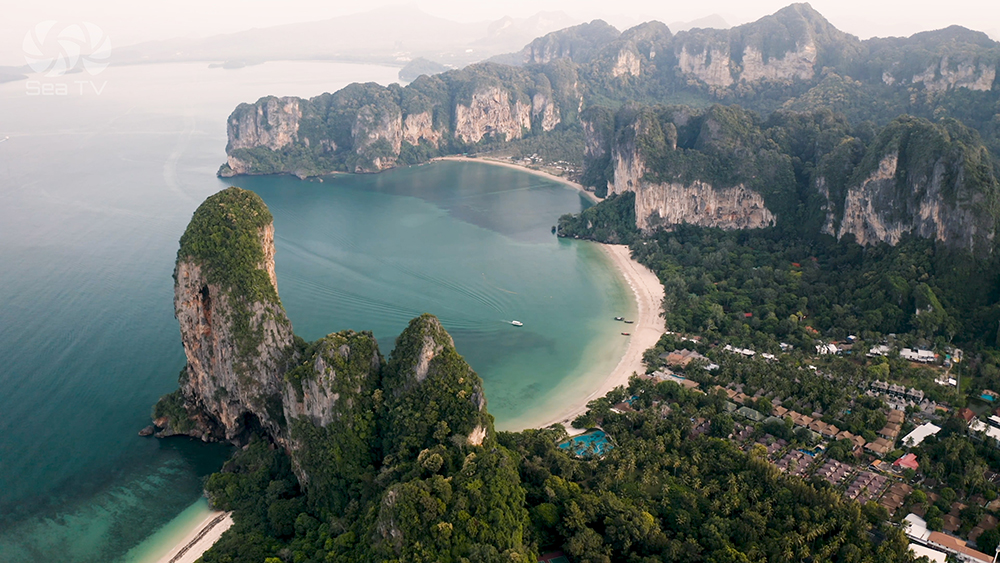
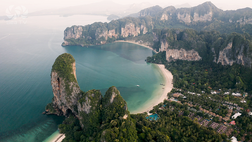
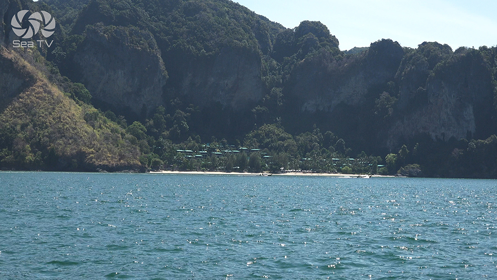
3 · Railay Peninsula — The Climbing Peninsula
Technically a peninsula attached to the mainland but the cliffs are so sheer that road access is impossible · accessible only by longtail boat from Ao Nang (~10 minutes) or Krabi Town (~20-45 minutes via Ao Nam Mao Pier). Four named beaches around the peninsula · all within walking distance of each other across the central isthmus.
08°00.586’N · 098°50.619’E
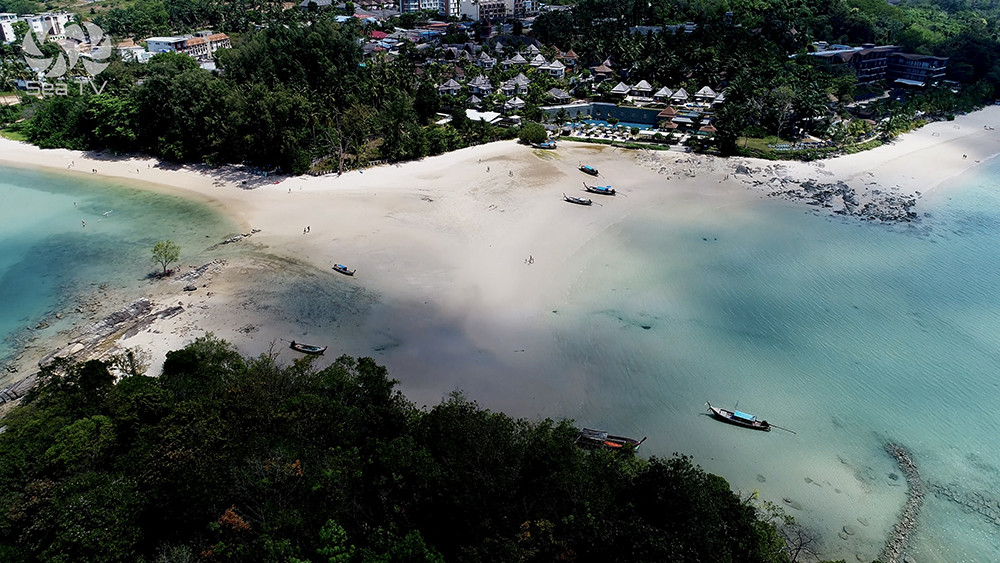
Railay W (Hat Rai Le West)
The main swimming beach of Railay · longtail boats land here from Ao Nang · sunset views over the Andaman Sea · most-developed side with restaurants, beach bars, and resorts. Anchor offshore in 6-10 m sand · tender ashore.
→ Walking street to Railay E: ~5 minutes across the central isthmus.
Use it for: arrival point from yacht · dinner with sunset · main social hub of Railay.
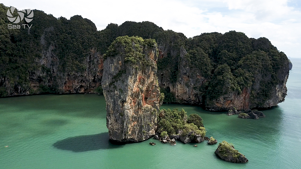
Phra Nang Beach (S tip of peninsula)
Phra Nang (Princess) Cave Beach
Regularly voted one of the world’s best beaches. Powder-fine white sand · towering limestone cliffs on three sides · turquoise water · dense limestone karst islets visible offshore (Koh Mor, Koh Tup). The S tip of the Railay peninsula.
⚠ NO boat landing on Phra Nang. Swimming beach only · longtails anchor offshore · access by foot from Railay E or Railay W (~10-15 min walk through the central path).
→ Princess Cave (Tham Phra Nang Nok): sacred cave with hundreds of wooden phallic carvings (lingams) offered by fishermen · sea-goddess shrine · respect the local custom.
→ Hidden Beach: accessible at low tide via cave at the W end of Phra Nang · small private cove.
→ Climbing routes: “Escher World” wall behind the beach · 1-2-3 Wall above · titanium bolts.
→ Rayavadee Resort dominates the peninsula · only food/drink option on the beach · expensive but the location is unmatched.
Use it for: the iconic Krabi photo · cave shrine · climbing · arrive before 11:00 to beat the day-tripper crowds.
Railay E (Hat Rai Le East)
Railay E — Mangrove Side & Accommodation
A picturesque mangrove-fronted beach on the E side of the peninsula. Most of Railay’s hotels are here · longtail dock for boats from Krabi Town and Ao Nam Mao Pier · the “highlands” / headlands area has budget restaurants, bars, climbing schools, and small shops.
⚠ Mangrove water is murky · not for swimming · the beach is mostly used as a transit point.
→ Diamond Cave (Tham Phra Nang Nai): illuminated show cave with stalactites · short walk from Railay E · separate ticket.
Use it for: evening dinner at the budget restaurant area · climbing school office · access to Diamond Cave.
Tonsai Bay (Krabi · NOT Phi Phi)
Tonsai Beach — The Climbers’ Bay
A palm-lined stretch of sand N of Railay W · favoured by climbers and backpackers · accessible by longtail · the harder-to-reach side of the peninsula. Note: this is Tonsai Krabi · entirely different from Tonsai Bay on Phi Phi Don.
→ Climbing focus: Tonsai is the climbers’ centre of Railay · Deep Water Solo above the sea · 700+ routes between Tonsai and Railay.
Use it for: climbing-focused day · backpacker bars · escape from Railay W crowds.
Climbing Notes
Railay is one of the world’s premier climbing destinations · 700+ bolted routes on limestone walls · grades from beginner (French 4) to extreme (8c) · titanium anchor bolts (rust-resistant in salt air).
→ 1-2-3 Wall above Phra Nang · the iconic warm-up wall.
→ Escher World behind Phra Nang · beginner-intermediate routes.
→ Tonsai bouldering and Deep Water Solo · climbing above the sea, falling into the water.
Operators: several climbing schools at Railay E · half-day intro courses for beginners · rentals available.
Seasonal Strategy
NE Monsoon · Nov-Apr (Charter High Season)
All anchorages workable. Recommended sequence: arrive Klong Muang for lunch · move E to Ao Nang for the afternoon · push to Railay W for the evening · overnight off Railay W or back at Ao Nang. The W-coast position of all three means N or NE wind protection.
SW Monsoon · May-Oct
All three anchorages exposed to SW swell. Most charter operators avoid the Krabi mainland in this period. Limited operators run in calm windows. Krabi Boat Lagoon Marina (E of the city, in the river) is the SW-monsoon shelter for the Krabi area.
Pro Tips for Krabi Coast
Arrive at Phra Nang before 11:00. The day-trip armada from Ao Nang and Krabi pours in 11:00-14:00 · before that the beach is empty.
Don’t try to land at Phra Nang. No boat landing allowed · anchor off Railay W and walk across the peninsula (5-10 min).
Time the Ao Nang dinghy run. The beach dries to bare sand at lowest tide · plan tender access for mid-tide rising · or anchor closer in if your draft allows.
Watch for monkeys on the Phra Nang path. The walking track between Railay E and Phra Nang has aggressive macaques · keep food and bags closed · don’t make eye contact.
Respect the Phra Nang shrine. The wooden phallic carvings are sacred offerings to the sea goddess · photographs are fine, but don’t move or take them.
Climbing schools are at Railay E. Half-day introductory courses ~1,500 THB · book at the climbing offices on the way to Diamond Cave.
Crew rotation via Krabi airport. KBV is ~30 min by taxi from Ao Nang and ~45 min from Klong Muang · easier than going back to Phuket if your charter timing allows.
Routes To & From Krabi Coast
From Phang Nga Bay (NW): ~25 NM SE to Klong Muang. See Phang Nga Bay anchorages.
From Phi Phi Don (W): ~15 NM E to Ao Nang. See Ko Phi Phi Don.
SW to Chicken Islands: ~4 NM SW from Ao Nang. See Ko Dam Khwan · Chicken Island.
S to Ko Lanta: ~30 NM S from Ao Nang to Klong Dao. See Ko Lanta · Klong Dao & Kantiang Bay.
Emergency Numbers — Krabi
Tourist Police (24/7, English): 1155
Marine Emergency & SAR: 1196
Coastguard Distress: VHF Ch. 16
Krabi Hospital: +66 75 611 200
Ao Nang Hospital: +66 75 695 999
National Park Office: +66 75 661 145
Useful Links
→ Hat Noppharat Thara – Mu Ko Phi Phi NP (DNP official)
→ DNP National Park e-Ticket System
Related SeaTV Pages
Krabi & Phang Nga Group
→ Ko Dam Khwan · Chicken Island & Lanta NW
Sailing the Krabi Coast?
Klong Muang for the lunch stop · Ao Nang for the overnight and provisioning · Railay for the climbing and Phra Nang Cave Beach. NO boat landing on Phra Nang · 700+ climbing routes on the limestone walls · Krabi airport for crew rotation.
“Day two on the charter circuit · the Krabi mainland coast where Klong Muang for the lunch stop in front of the upmarket resorts, Ao Nang for the overnight near the longtail pier and the supermarkets and the airport thirty minutes by taxi if you need to swap crew, and the Railay peninsula five nautical miles east where four named beaches sit at the base of vertical limestone walls accessible only by boat. Phra Nang for the postcard photo and the cave with the wooden phalluses offered to the sea goddess · do not try to land your dinghy because no boats are allowed on Phra Nang · walk across from Railay West instead. Seven hundred bolted climbing routes for those who climb · the dinghy run at Ao Nang at low tide for those who do not check the tide tables · the four hundred Thai baht park fee for everyone.”
— SeaTV Visual Pilot · Andaman Coast Edition