SeaTV · Thailand · Andaman Coast · Phuket Region · Ko Dam Khwan
Ko Dam Khwan — Chicken Island, the Krabi Sandbar Group & Lanta NW
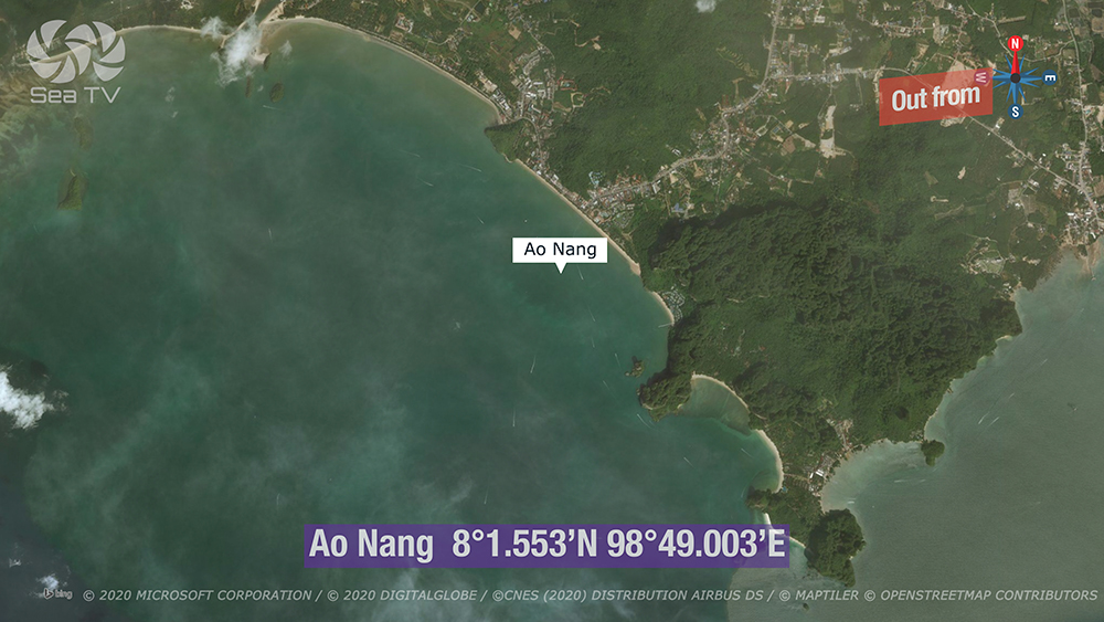
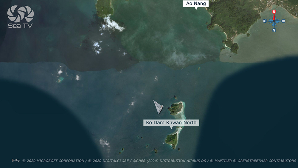
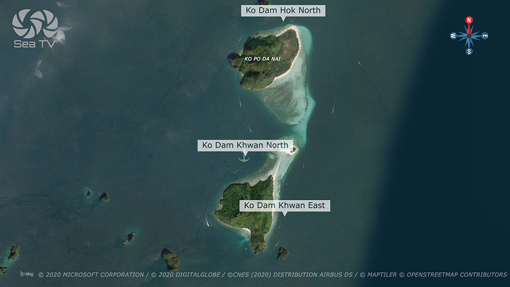
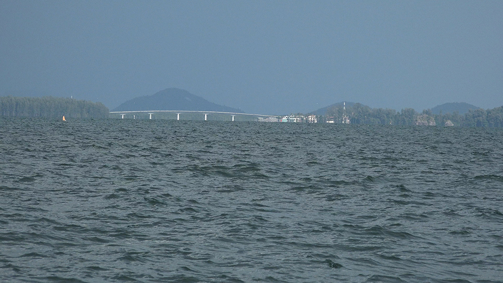
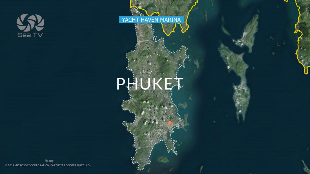
Day-3 charter route from Ao Nang S to Klong Dao Ko Lanta · ~4 NM SW from Ao Nang to Ko Dam Khwan (“Chicken Island”) · part of the Mu Ko Poda group with Ko Dam Hok, Koh Tup, Koh Mor connected by a low-tide sandbar (Talay Waek) · then ~22 NM S to Klong Dao on the NW tip of Ko Lanta · all anchorages within Hat Noppharat Thara – Mu Ko Phi Phi National Park · 400 THB park fee.
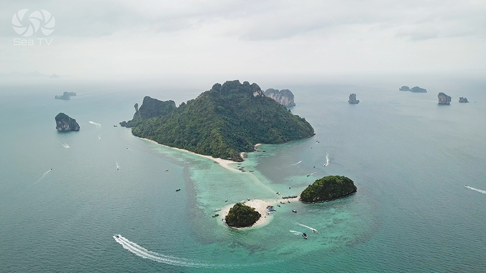
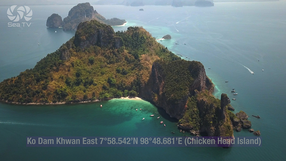
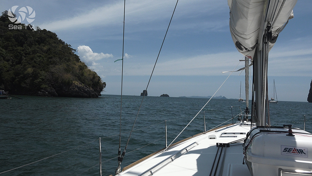
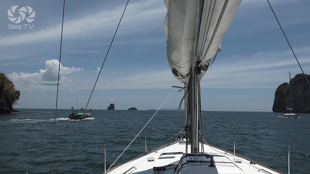
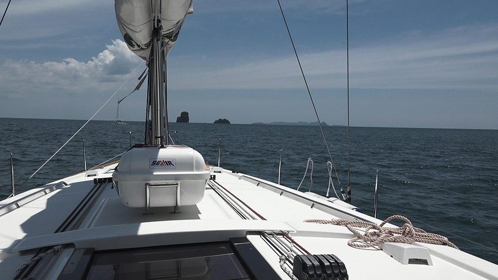
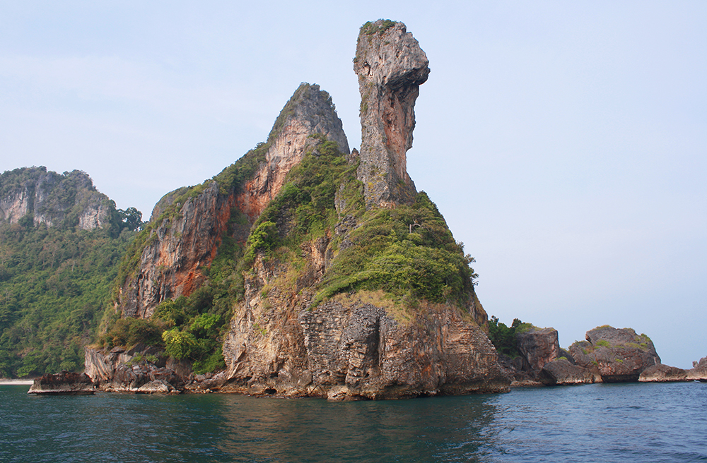
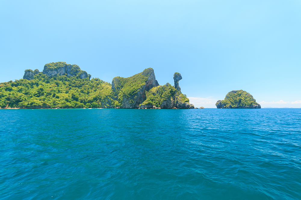
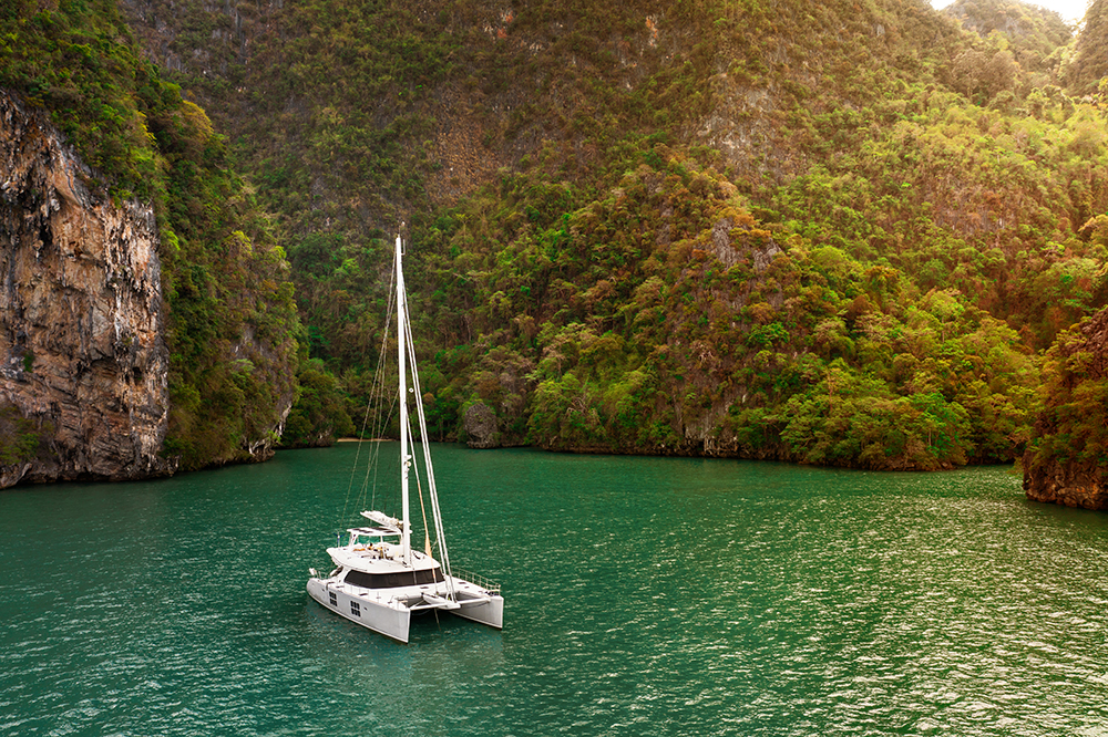
The classic Day-3 sailing route on the Krabi-Lanta charter circuit runs from Ao Nang on the mainland SW to the small “Chicken Islands” group (just south of Poda Island), then S another ~22 NM to Klong Dao on the NW tip of Ko Lanta for the night. The Chicken Islands group is one of the most photographed spots in Krabi province — Ko Dam Khwan (also called Koh Poda Nok / Koh Kai / Koh Gai / Koh Hua Khwan) carries the famous chicken-head limestone rock formation on its E end · Ko Dam Hok (Koh Poda Nai) is its smaller neighbour to the N · they are joined to Koh Tup and Koh Mor by a Y-shaped sandbar that emerges at low tide (“Talay Waek” — the separated sea). All islands are in the National Park · 400 THB park fee per person · rangers actively collecting · the SE side of Ko Dam Khwan offers overnight anchorage in the SW monsoon, while Ko Dam Hok N is sheltered in calm conditions.
⚠ Reality check:
→ DO NOT pass between Ko Dam Hok and Ko Dam Khwan · a coral reef closes the channel · always go around the islands
→ Park fee 400 THB per person · Hat Noppharat Thara – Mu Ko Phi Phi NP · rangers actively collecting · cash on hand
→ ⚠ Coral heads on the bottom at Ko Dam Khwan SE · dive on the anchor after settling to confirm the set
→ Do NOT feed the sergeant major fish · it’s a criminal offence in the National Park
→ Ko Dam Khwan SE = SW-monsoon overnight · Ko Dam Hok N = SW season day-stop · neither is good for NE-monsoon overnight
→ Talay Waek sandbar emerges at lowest tide · plan timing by checking Krabi tide tables
→ Klong Dao Ko Lanta: shallow at low tide · plan dinghy run mid-tide rising · NE-monsoon only
⚓ Day 3 Route at a Glance
Departure: Ao Nang
08°00.637’N · 098°50.094’E
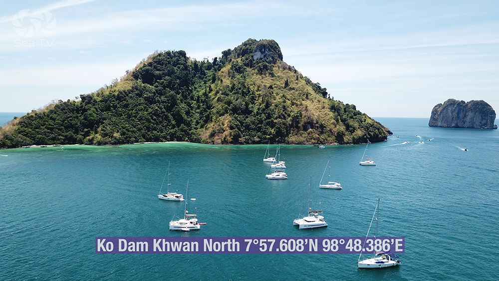
Ko Dam Khwan N
07°57.608’N · 098°48.386’E (~4 NM SW)
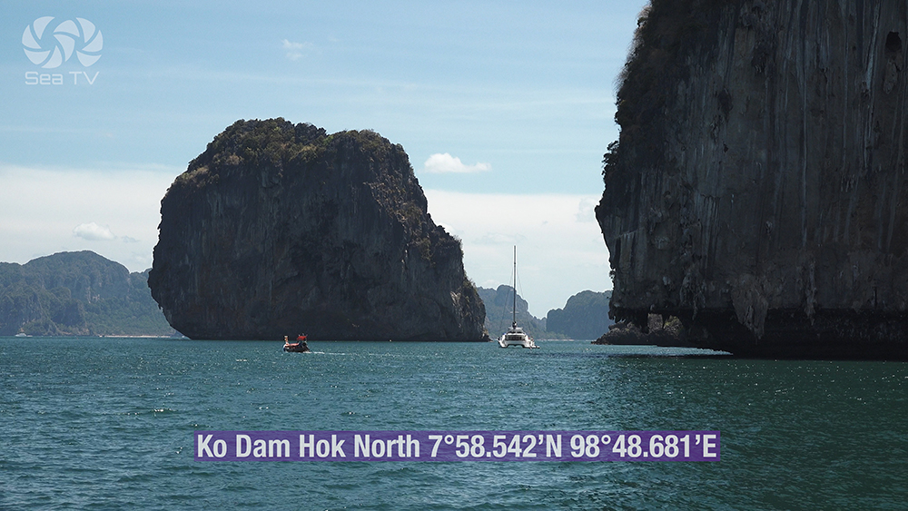
Ko Dam Hok N
07°58.542’N · 098°48.681’E
Klong Dao (overnight)
07°38.322’N · 099°01.299’E (~22 NM S)
Total distance
~26 NM · ~5-6 hours
Park status
Hat Noppharat Thara – Mu Ko Phi Phi NP
Park fee
400 THB per person
Best season
Mixed · Ko Dam SE = SW season
Mooring
Government moorings at Ko Dam Hok N
The Three Key Anchorages
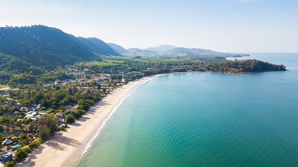
1 · Ao Nang (Departure) — Provisioning & Krabi Mainland
08°00.637’N · 098°50.094’E
The main mainland tourist beach of Krabi province · backed by the town of Ao Nang with restaurants, dive shops, ATMs, and Nopparat Thara Pier serving longtails to the islands. The natural starting point for the Krabi-Lanta day · sail SW from here. See Krabi Coast · Ao Nang & Railay for the full anchoring detail.
Departure timing: aim for 09:00-09:30 to arrive at Ko Dam Khwan around 10:30 · in time for the Talay Waek sandbar at low tide if it falls during the day.
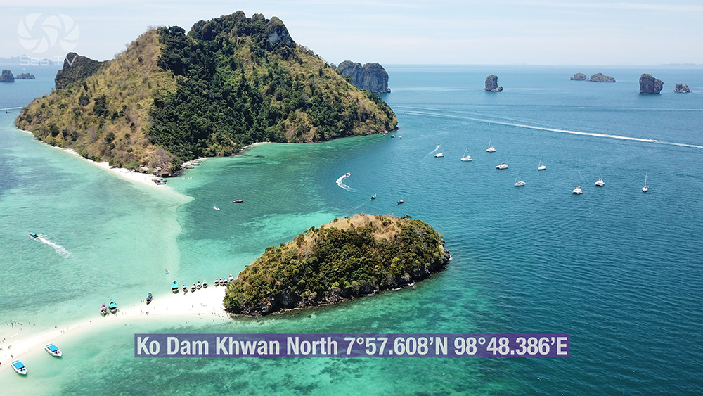
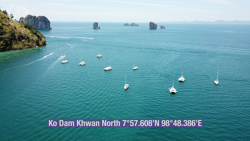
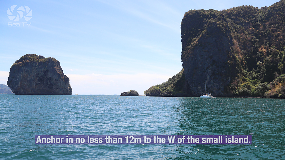
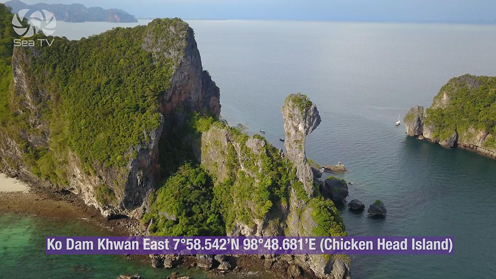
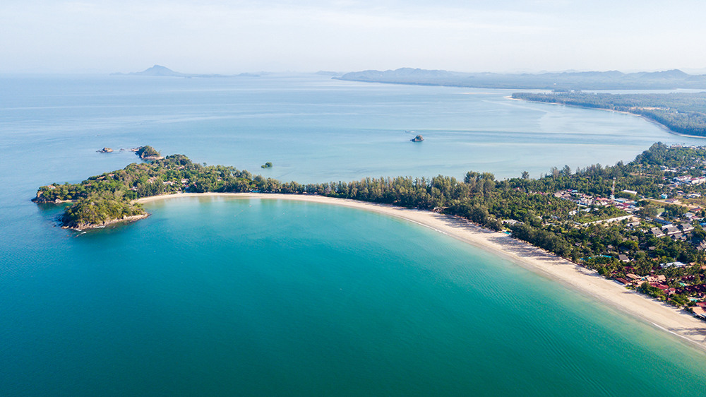
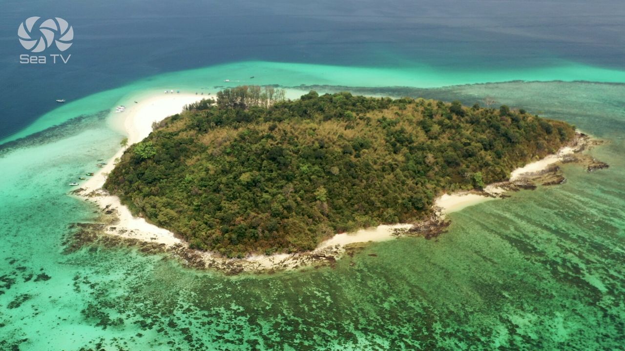
2 · Ko Dam Khwan (Chicken Island) — The Limestone Landmark
Position · 07°57.608’N · 098°48.386’E (Ko Dam Khwan N)
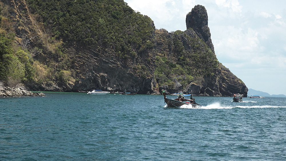
Also known as Koh Poda Nok, Koh Kai, Koh Gai, Koh Hua Khwan — locally known as “Chicken Island” because of the limestone outcrop at its E end that resembles a chicken head and neck. One side of the island is sheer vegetated cliffs · the other is a beautiful white-sand beach. ~4 NM SW from Ao Nang.
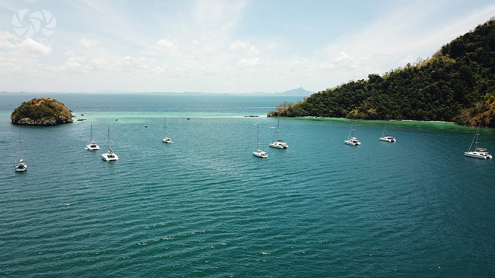
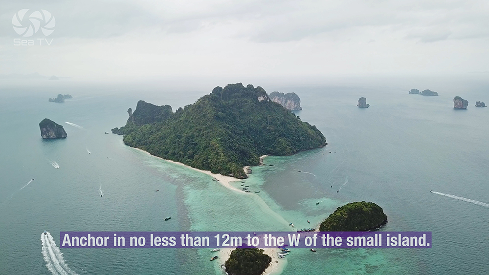
Anchorage A — Ko Dam Khwan SE (the SE corner of the island, just N of the small islet): 11-12 m sand · secure overnight in the SW monsoon · large coral heads on the bottom · dive on the anchor after settling to confirm the set.
Anchorage B — Koh Tup / Koh Mor / Koh Dam Khwan sandbar: anchor offshore in deeper water and tender to the Talay Waek sandbar at low tide for the famous walk between the three islands.
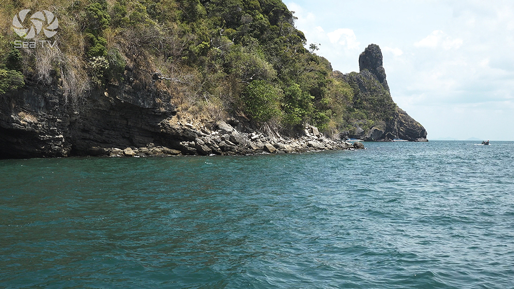
⚠ DO NOT attempt to pass between Ko Dam Hok and Ko Dam Khwan — a coral reef closes the channel. Always go around the outer side of either island.
⚠ Coral heads on the bottom · dive on the anchor after settling to confirm it’s holding in sand and not on coral.
⚠ Do not feed the sergeant major fish · this is a criminal offence in the National Park · fine applies.
→ Snorkelling: the reef closing the passage between Dam Hok and Dam Khwan · dinghy access · clownfish, parrotfish, occasional turtles.
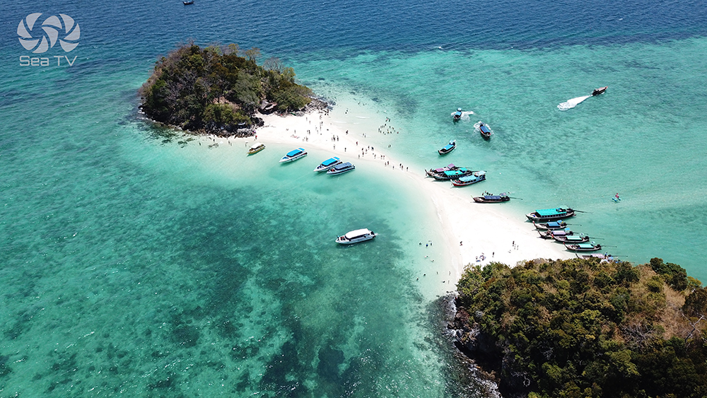
→ Beach: small restaurant, beach bar, toilets · busy with longtail day-trippers from Ao Nang at peak times.
Use it for: photo stop with the chicken-head rock · sandbar walk at low tide · snorkel · SW-monsoon overnight at the SE anchorage.
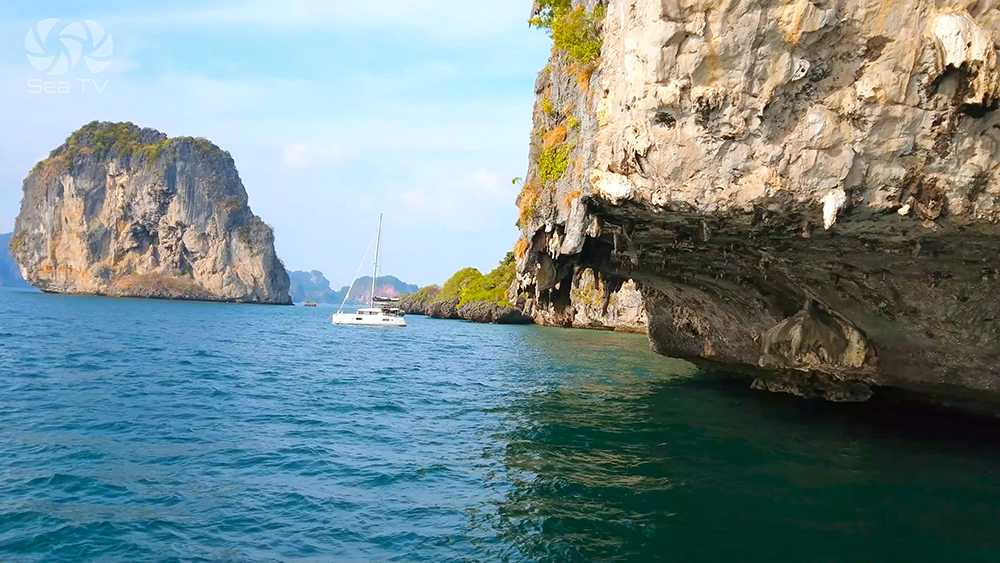
3 · Ko Dam Hok (Koh Poda Nai) — The N Anchorage
07°58.542’N · 098°48.681’E (Ko Dam Hok N)
The smaller N island in the Chicken Islands group. Also known as Koh Poda Nai. Anchor on the N side between the main island and the small islet · government moorings available in 6 m for shallow draft yachts · secure overnight anchorage in 12 m on sand giving way to coral towards the beach.
Anchor: 12 m sand E of the small islet · or use government moorings closer in (6 m).
⚠ NOT suitable for overnight in NE winds · the anchorage is exposed to E/NE swell.
⚠ Reef extending S to Ko Dam Khwan · stay clear of the channel between the islands.
→ Beach: casuarina trees give shade · bungalow resort with restaurant on shore · flat sandy ground for walking.
→ Snorkel: NE end of the beach has shallow coral with reef fish · in calm conditions visibility is excellent.
Use it for: SW-season overnight · government mooring · alternative to the busier Ko Dam Khwan SE.
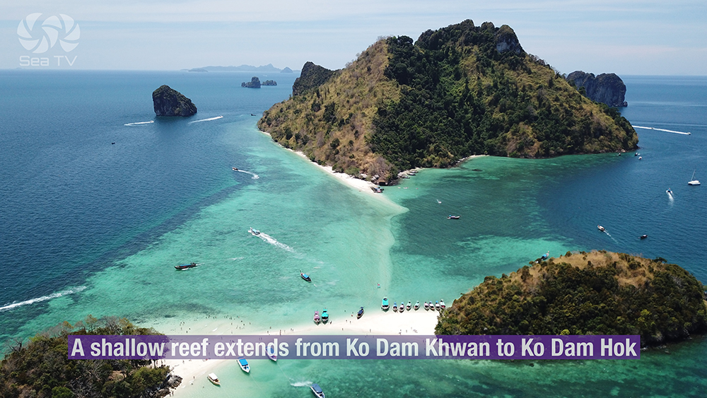
Talay Waek — The Separated Sea Sandbar
Talay Waek (“the separated sea”) is a Y-shaped sandbar that emerges at the lowest daily tide between Ko Dam Khwan, Koh Tup (Tub Island), and Koh Mor. Three islands become connected by a single white-sand walking strip · the phenomenon is unique to this group and is one of the most photographed natural events in Thailand.
Timing: emerges only at the lowest tide · check Krabi tide tables · the window is typically 1-2 hours per day · varies daily.
Practical: anchor offshore on a yacht, take the dinghy to the deeper edge, walk the sandbar between the islands.
Crowds: day-trip longtails from Ao Nang time visits to coincide · expect 50+ people at peak · arrive at the start or end of the window for fewer crowds.
⛵ Onward to Klong Dao Ko Lanta NW
07°38.322’N · 099°01.299’E · ~22 NM S from Ko Dam Khwan
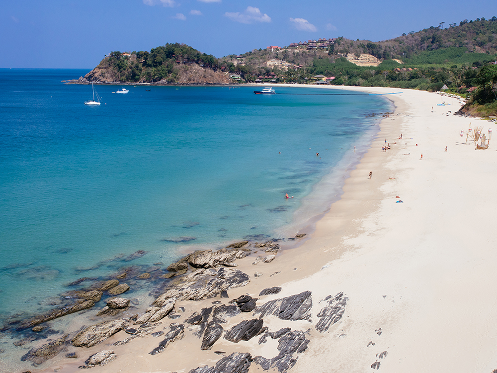
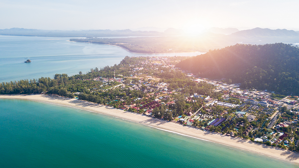
After lunch at the Chicken Islands · sail S ~22 NM to Klong Dao on the NW tip of Ko Lanta. Anchor in the middle of the bay in 4-6 m · holding good in sand. Beware shallow reef and rocks to the S of the bay. NE-monsoon only · in SW-monsoon weather divert to Lanta Old Town on the E coast instead.
→ Saladan town next to Klong Dao for evening dinner ashore · 7-Eleven, restaurants, ATMs.
→ Full Klong Dao detail on the Ko Lanta · Klong Dao & Kantiang Bay page.
Seasonal Strategy
NE Monsoon · Nov-Apr (Charter High Season)
Day-stop at Chicken Islands · overnight at Klong Dao. The Chicken Islands anchorages are exposed in NE-monsoon and not recommended for overnight · use them as photo and snorkel stop for 1-2 hours · then push S to Klong Dao for the night.
SW Monsoon · May-Oct
Ko Dam Khwan SE = secure overnight when Klong Dao is unworkable. Ko Dam Hok N government moorings also available. The position offers protection from SW swell because the islands themselves shelter the SE anchorage from the prevailing wind.
Pro Tips
Time the Talay Waek sandbar. Check Krabi tide tables before departure · plan to be at Ko Dam Khwan during the lowest tide of the day for the sandbar walk.
Pre-pay the park fee. 400 THB per person · pre-register via DNP e-ticket or pay rangers in cash on arrival · keep receipts accessible.
Dive on the anchor at Ko Dam Khwan. Coral heads on the bottom mean the anchor can hook on coral instead of sand · dive after settling and re-set if needed · don’t damage the reef.
Take the outer route around the islands. NEVER pass between Ko Dam Hok and Ko Dam Khwan · a reef closes the channel · always sail around the outer side.
Don’t feed the sergeant majors. Feeding fish in the National Park is a criminal offence · the rangers monitor · fines are issued.
Government moorings at Ko Dam Hok N in 6 m · for shallow-draft yachts · use these instead of dropping anchor on the reef.
Reef-safe sunscreen only. Standard chemical sunscreens are banned in the National Park · zinc-oxide based products only.
Routes To & From Ko Dam Khwan
From Ao Nang/Krabi (NE): ~4 NM SW to Ko Dam Khwan. See Krabi Coast · Ao Nang & Railay.
From Phi Phi Don (W): ~10 NM E to Ko Dam Khwan. See Ko Phi Phi Don.
S to Ko Lanta: ~22 NM S to Klong Dao. See Ko Lanta · Klong Dao & Kantiang Bay.
Full Phang Nga to Krabi route: See Sailing Phang Nga to Krabi.
Emergency Numbers — Krabi/Lanta Region
Tourist Police (24/7, English): 1155
Marine Emergency & SAR: 1196
Coastguard Distress: VHF Ch. 16
National Park Office (Phi Phi): +66 75 661 145
Krabi Hospital: +66 75 611 200
Ko Lanta Hospital (Saladan): +66 75 697 100
Useful Links
→ Hat Noppharat Thara – Mu Ko Phi Phi NP (DNP official)
→ DNP National Park e-Ticket System
Related SeaTV Pages
Sailing the Krabi-Lanta Day?
Ao Nang departure · Ko Dam Khwan / Chicken Island for the limestone rock and Talay Waek sandbar · Klong Dao Ko Lanta NW for the night. Park fee 400 THB · NEVER pass between Dam Hok and Dam Khwan · don’t feed the fish.
“Day three on the Krabi to Lanta charter circuit · Ao Nang on the mainland to Ko Dam Khwan four nautical miles southwest, the Chicken Island where the limestone rock at the eastern end looks exactly like the head and neck of a chicken and the Y-shaped sandbar emerges at the lowest tide each day to walk between three islands. Anchor at the southeast corner in eleven metres on sand · dive on the anchor because the bottom has coral heads · never pass between the two main islands because a reef closes the channel · do not feed the sergeant majors because that is a criminal offence in the National Park · pay the four hundred Thai baht per person to the rangers when they come for it. Then twenty-two nautical miles south to Klong Dao on the northwest tip of Ko Lanta for the night, the bay shallow at low tide, the village of Saladan five minutes away by tender, the supermarket and the seven-eleven and the dinner ashore the reward for getting the route right.”
— SeaTV Visual Pilot · Andaman Coast Edition