SeaTV · Thailand · Andaman Coast · Phuket Region · Ko Lanta
Ko Lanta — Klong Dao to Kantiang Bay (Plus Lanta Old Town)
~25 NM S of Phi Phi Don · ~50 NM SE of Phuket · the largest island in the Mu Ko Lanta archipelago · Klong Dao at the NW tip near Saladan port · Kantiang Bay 10 NM S in the upmarket south · Lanta Old Town on the E coast for shelter in SW monsoon · all anchorages on Ko Lanta Yai (the main island) · the southern tip is Mu Ko Lanta National Park (established 1990).
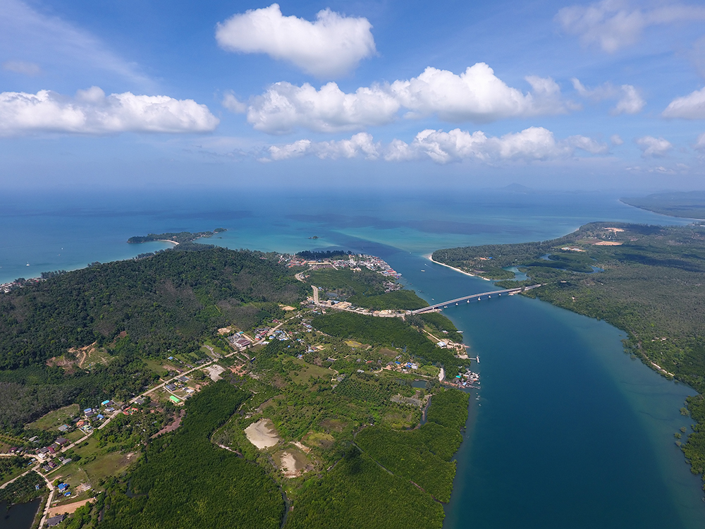
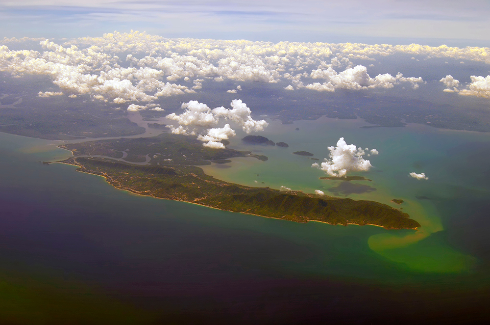
Ko Lanta (officially Ko Lanta Yai · “Yai” = “big”) is the largest of 16 islands in the Mu Ko Lanta archipelago. The W coast holds the developed beaches and tourist infrastructure · the E coast remains relatively quiet with the historic Lanta Old Town (administrative centre and home to the Chao Le sea gypsy community). The W coast charter route runs N-S through five anchorages: Klong Dao (NW tip, near Saladan port and ferry terminal) · Phra Ae / Long Beach · Klong Khong · Klong Nin · Kantiang Bay in the south (the upmarket Pimalai resort bay). The southern tip is Mu Ko Lanta National Park with its lighthouse and three further bays only suitable in NE-monsoon weather. Lanta Old Town on the E coast is the SW-monsoon shelter port.
⚠ Reality check:
→ No marina on Ko Lanta · all stops are anchorages · the only marine services are Lanta Old Town
→ Mu Ko Lanta NP fee: 400 THB foreign adult / 200 THB child for the southern tip (Laem Tanod)
→ Ko Rok and Ko Haa CLOSED 16 May – 31 October · the southern islands are off-limits half the year
→ Klong Dao is shallow at low tide · the beach has a long sand flat · check tide tables before approach
→ Kantiang Bay floating pontoon is private (Pimalai) · do NOT tie your dinghy to it
→ SW-monsoon strategy: move to Lanta Old Town on the E coast · the W beaches are exposed
→ No fuel dock · refill at Yacht Haven Marina or Krabi Boat Lagoon
⚓ Ko Lanta at a Glance
Klong Dao
07°38.322’N · 099°01.299’E (NW)
Kantiang Bay
07°29.635’N · 099°04.368’E (S)
Lanta Old Town
07°32.152’N · 099°06.484’E (E)
Distance
Klong Dao to Kantiang ~10 NM S
From Phi Phi Don
~25 NM S to Klong Dao
Park status
Mu Ko Lanta NP (southern tip)
Park fee
400 THB / 200 THB child
Ferries from
Saladan to Phi Phi, Phuket, Krabi
Best season
Nov-Apr (NE monsoon)
The Five Anchorages of Ko Lanta
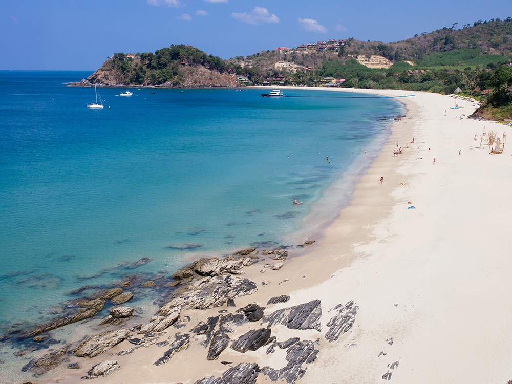
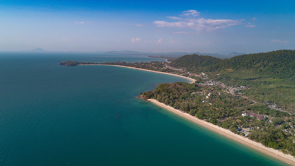
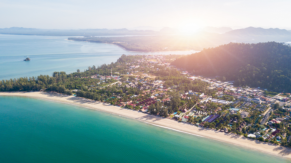
1 · Klong Dao Beach (NW tip) — The Charter Hub
07°38.322’N · 099°01.299’E
A wide ~2 km arc of golden sand on the NW tip of Ko Lanta · adjacent to Saladan, the main port and ferry terminal · backed by restaurants, bars, dive shops, ATMs, and pharmacies. Twin Lotus Resort is the largest property at the N end. The first anchorage you reach sailing S from Phi Phi Don.
Anchor: 8-12 m sand offshore · holding is good · plenty of swing room. The reef is offshore enough that anchoring is straightforward.
⚠ Very shallow at low tide · the beach has a long sand flat · time the dinghy run for mid-tide rising · large yachts may bottom out close to shore.
⚠ Saladan Pier ferry traffic · keep clear of the ferry approach · expect wake from passing speedboats.
⚠ Exposed to W/SW swell · uncomfortable in May-Oct · move to Lanta Old Town in SW-monsoon weather.
Use it for: first stop on the Ko Lanta route · provisioning at Saladan market and 7-Eleven · ferry connections · day-stop or overnight in NE-monsoon calm.
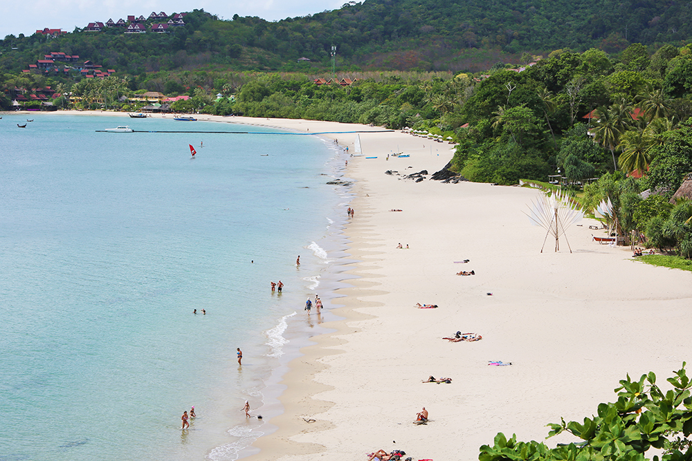
2 · Phra Ae (Long Beach) & Klong Khong (NW-Central) — Day Stops
Two long sandy beaches S of Klong Dao · Phra Ae (also called Long Beach, ~3 km long, with Layana Resort) and Klong Khong (just S of Phra Ae). The W coast natural-shade pine trees line both beaches. Less developed than Klong Dao or Kantiang · good lunch stops or quiet alternative overnights.
Anchor: 8-12 m sand offshore · good holding · enter the bay perpendicular to the beach line.
⚠ Same SW-monsoon exposure · NE-monsoon only · check the swell forecast before stopping.
Use it for: lunch stop · quieter alternative when Klong Dao or Kantiang are busy.
3 · Klong Nin (Mid-W coast) — The Quiet One
A long quieter beach further S · soft sand, calm crystal-clear water, beachfront restaurants, less developed than the N beaches. A good overnight when Klong Dao and Kantiang are full.
Anchor: 8-12 m sand offshore · good holding · note the reef on either side of the bay.
Use it for: quiet overnight in the middle of the Ko Lanta W coast · NE-monsoon only.
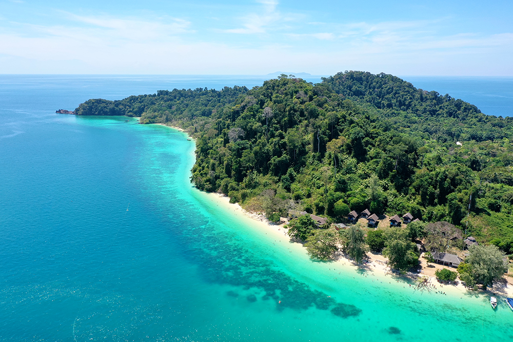
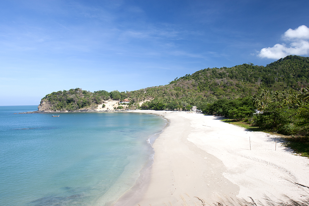
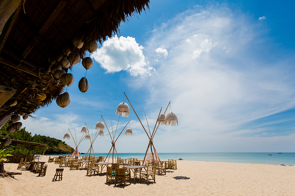
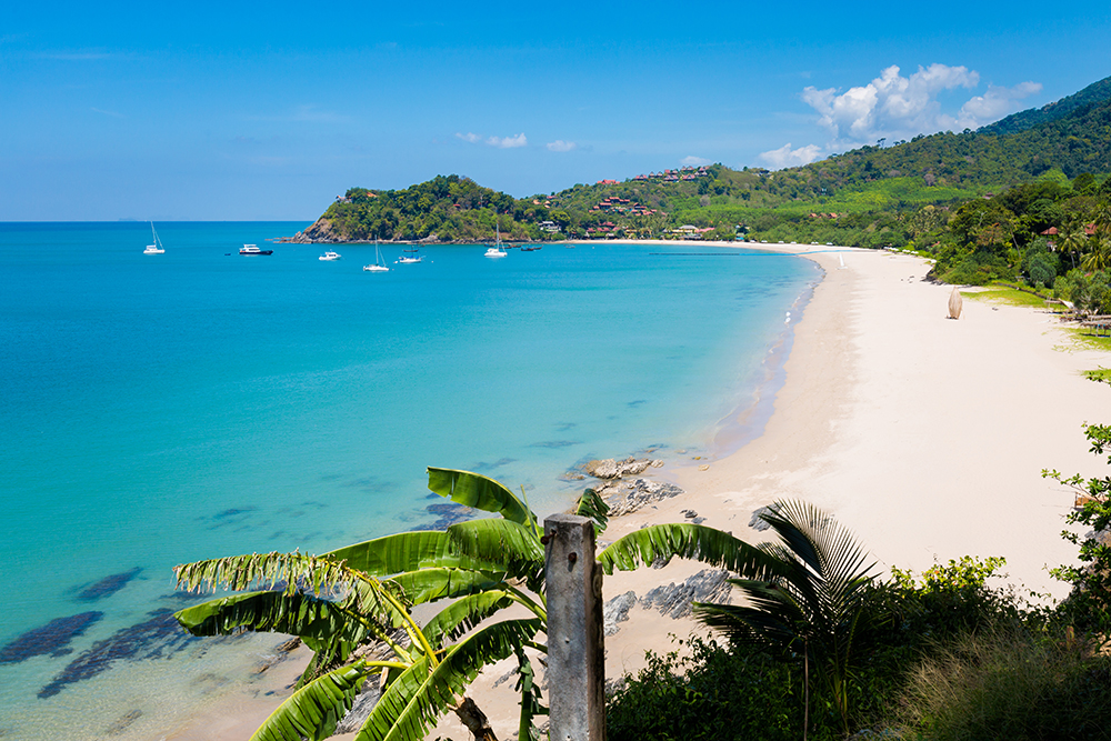
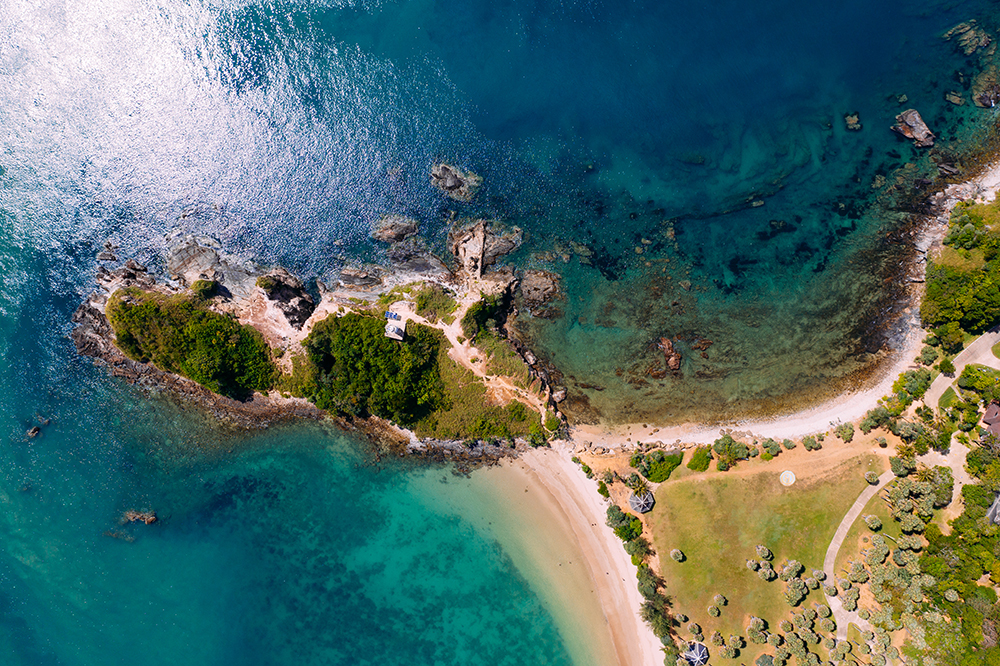
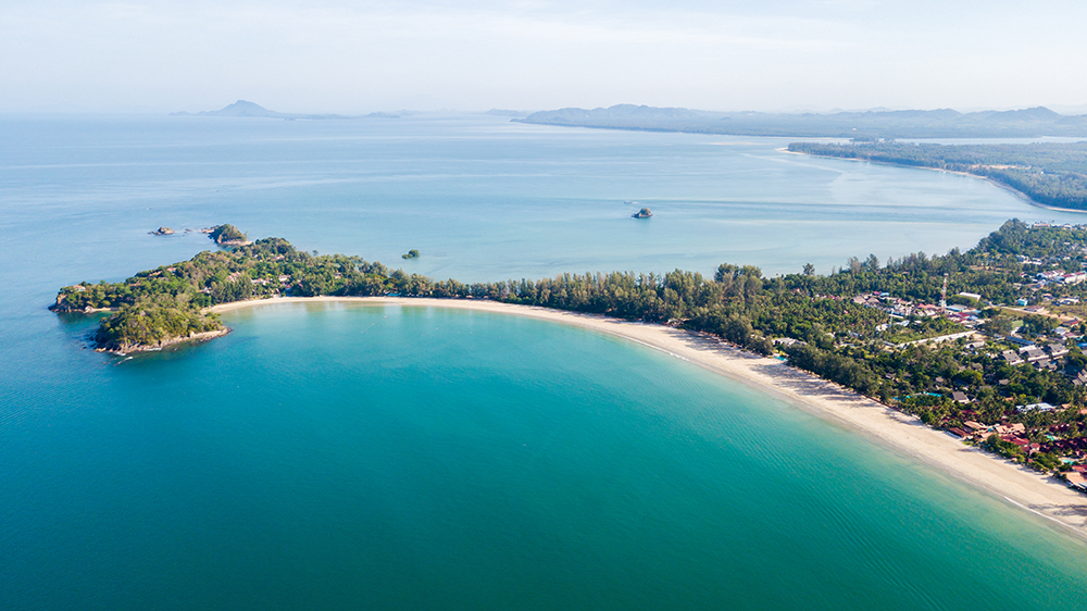
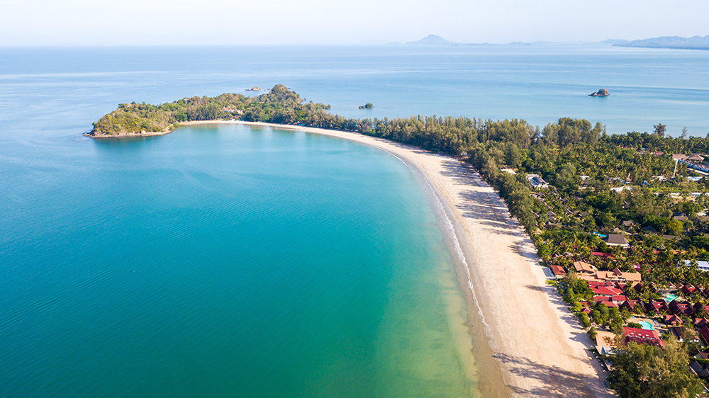
4 · Kantiang Bay (Far S) — The Upmarket Crescent
07°29.635’N · 099°04.368’E
A perfect crescent of soft golden sand stretching ~2 km in the far south of Ko Lanta · ~10 NM S of Klong Dao · 45 minutes by road from Saladan. The upmarket end of the island · home to Pimalai Resort & Spa (Ko Lanta’s original 5-star) · backed by mountains rising directly behind the beach.
Anchor: 6-8 m sand offshore · good holding · shallow water mostly · the bay is well-sheltered from N and E.
⚠ Floating pontoon in the bay belongs to Pimalai · DO NOT tie your dinghy to it. Use the public beach further N or contact Pimalai for guest access.
⚠ N end has shallow rocks · stay 100m+ off the rocks at the N corner of the bay.
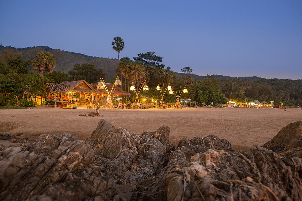
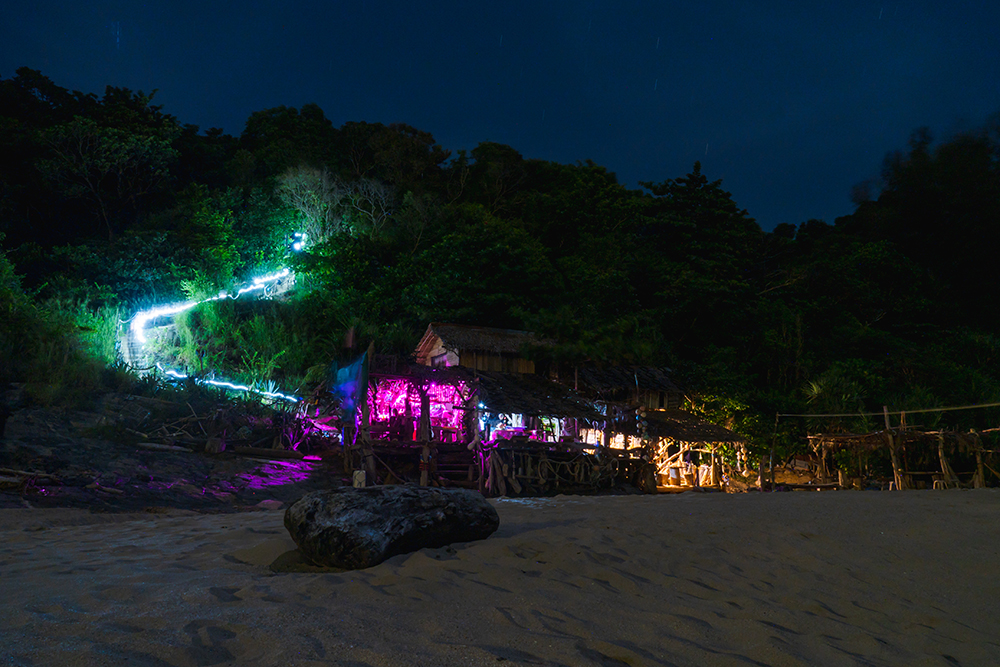
→ N end of beach: Why Not Bar (live music, fire shows), Aqua Bar.
→ Mid-bay: Pimalai Resort · Phra Nang Lanta · Baan Lanta resort.
→ Behind the beach: small village with 7-Eleven, tour agents, cafés.
Use it for: the prettiest overnight on Ko Lanta · upmarket dinner ashore · base for the southern run to Mu Ko Lanta NP and beyond.
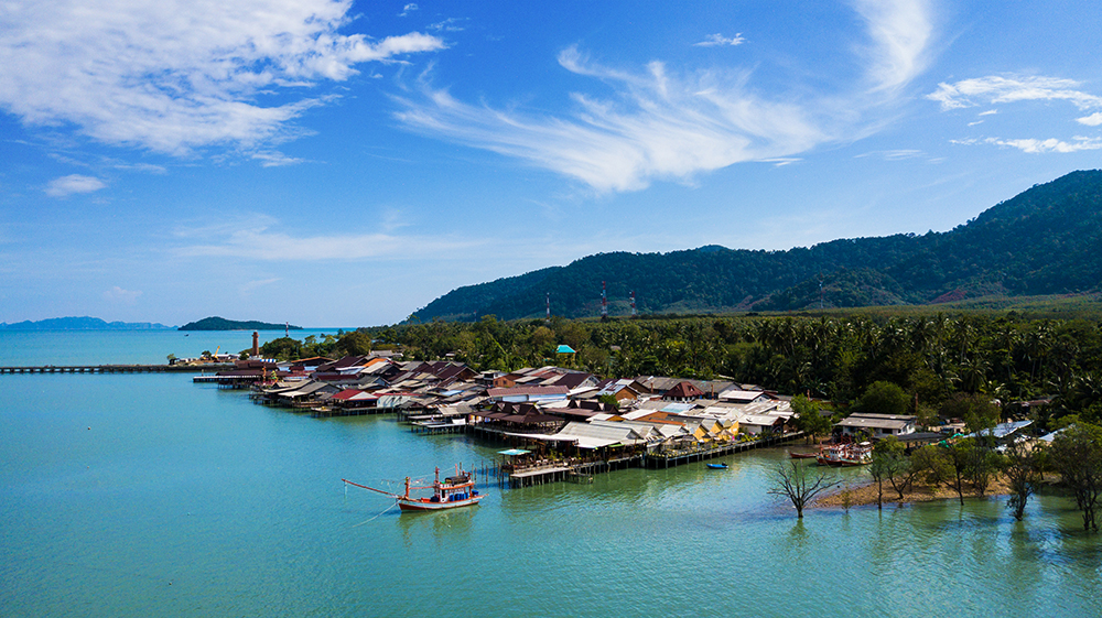
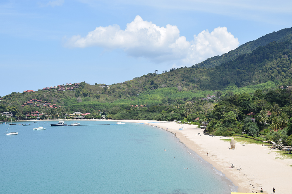
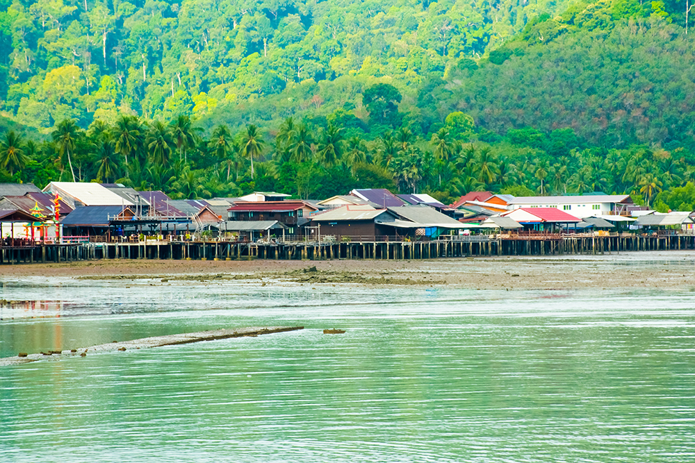
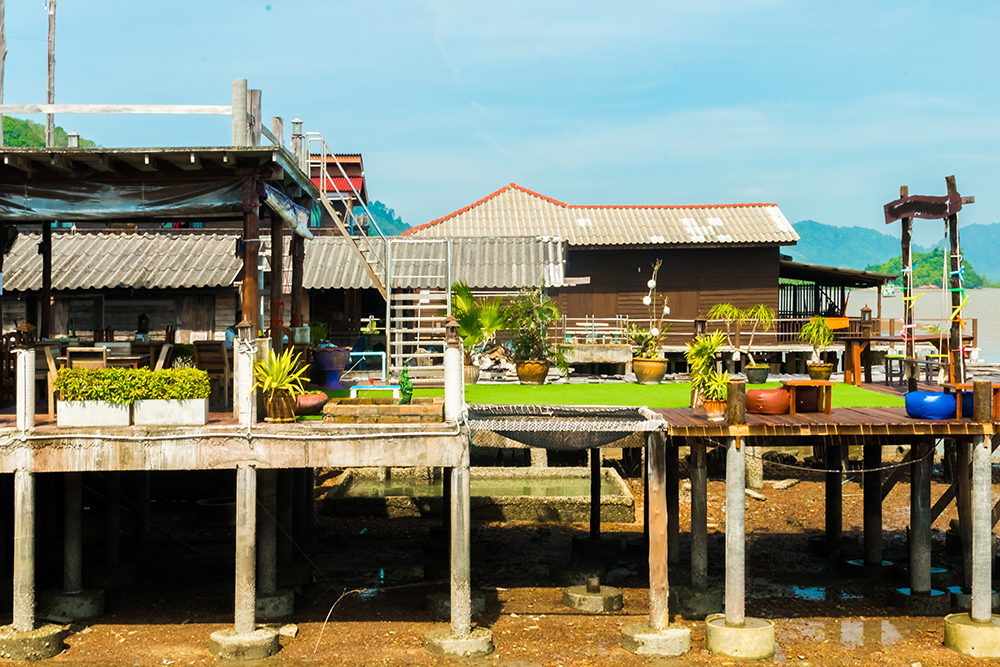
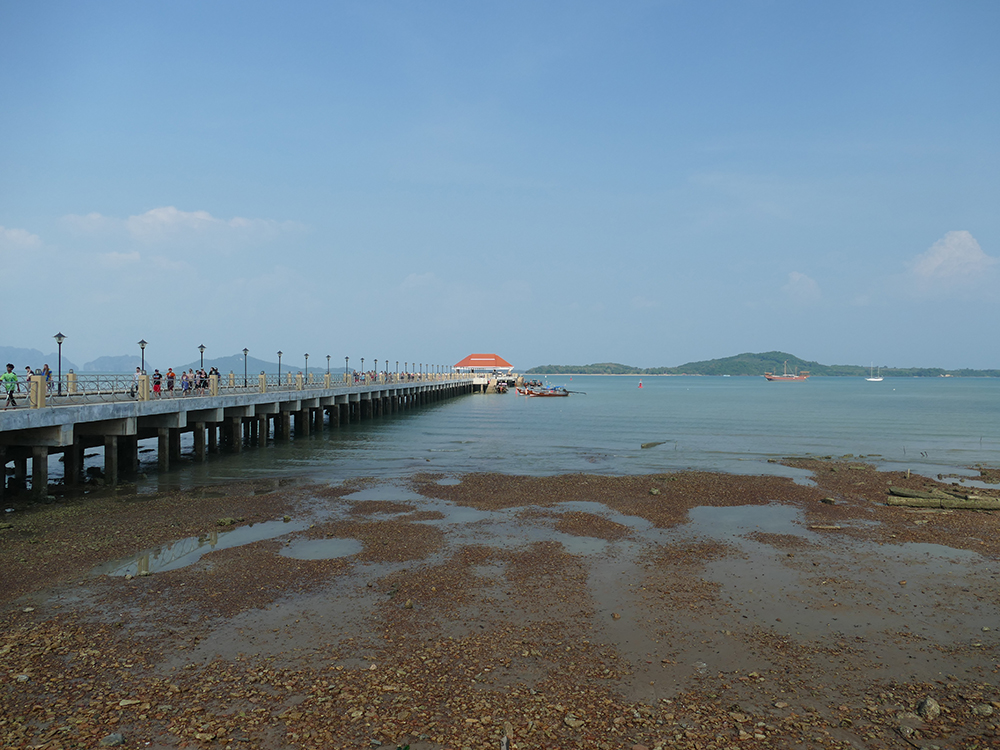
5 · Lanta Old Town (E coast) — The SW-Monsoon Shelter
07°32.152’N · 099°06.484’E
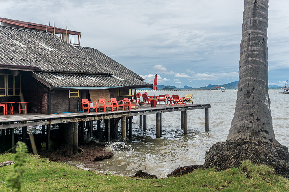
The historic administrative centre on the E coast of Ko Lanta · once the main port of the island before tourism shifted everything to Saladan in the NW. Home to the Chao Le (Sea Gypsy / Urak Lawoi) community · wooden stilt houses, simple seafood restaurants, a long pier. The natural shelter port for SW-monsoon weather.
Anchor: off the pier in 6-10 m mud · holding is good but the bottom is soft · check anchor set carefully.
⚠ NE-monsoon exposure · only suitable in SW-monsoon weather (May-Oct) when the W coast is uncomfortable.
→ Marine services: Steve Lanta Marine Services (mobile +66 84 729 1828) provides emergency repairs and pickup parts from Krabi.
Use it for: shelter when the W coast is unworkable · cultural visit to Sea Gypsy community · marine services pickup.
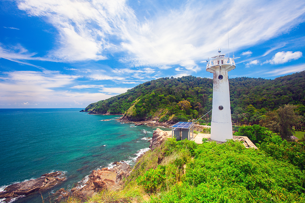
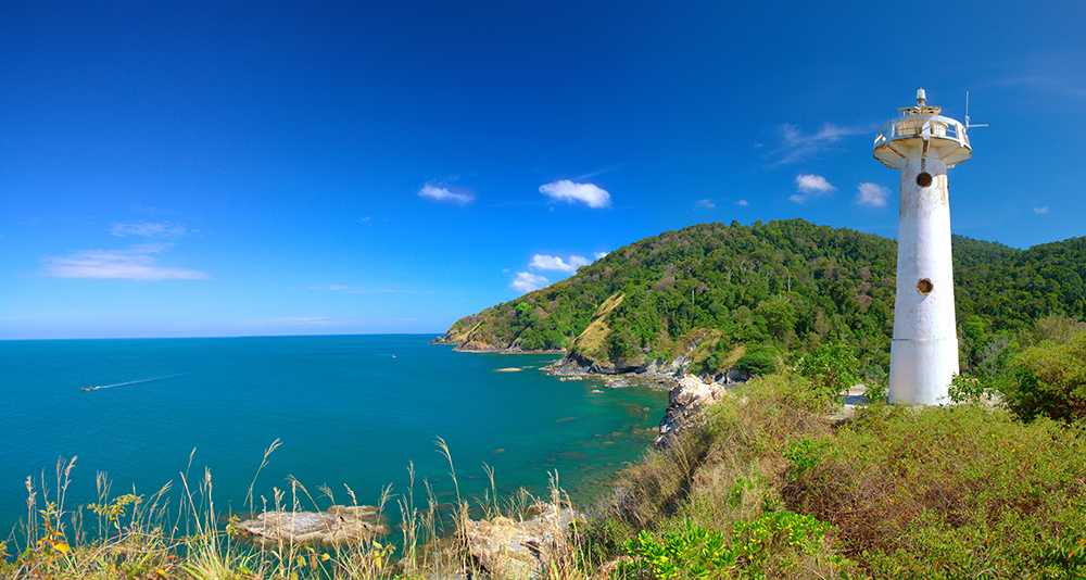
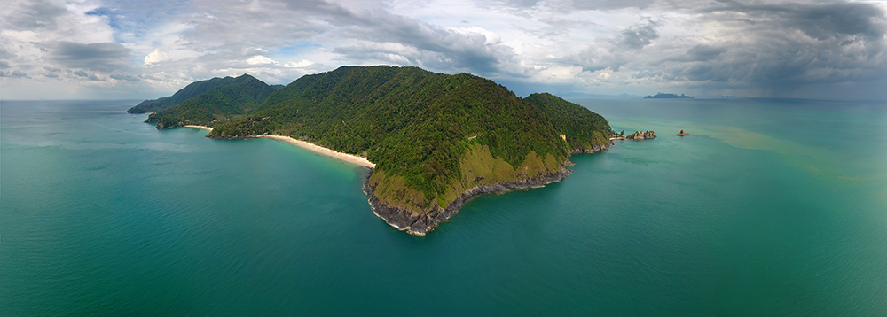
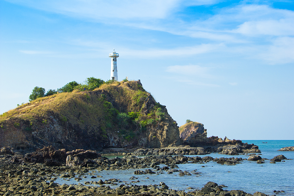
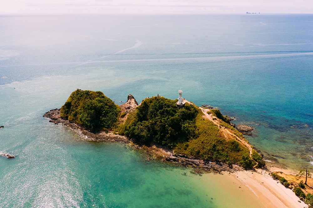
Mu Ko Lanta National Park (S Tip)
The southern tip of Ko Lanta Yai · 134 km² across 16 islands · established 1990 · headquartered at Laem Tanod (07°28.20’N · 099°05.91’E) where a white-rock peninsula is topped by a lighthouse. The park includes Ko Talabeng (limestone caves on the E coast) and the further-south islands of Ko Rok Nai & Ko Rok Nok (~26 km SW), Ko Haa, Ko Ngai, and Ko Kradan.
Park fee: 400 THB foreign adult · 200 THB child · pay at Laem Tanod gate or via DNP e-ticket.
⚠ Ko Rok Nai, Ko Rok Nok, and Ko Haa CLOSED 16 May – 31 October annually for monsoon recovery. Confirm dates with park HQ before sailing south.
→ Three further bays S of Kantiang (between Kantiang and Laem Tanod) are usable in NE-monsoon only.
→ Park HQ phone: +66 75 660 7112 · for camping permits and information.
Use it for: southern day-stop with photo of the lighthouse · gateway S to Ko Rok and the Trang islands.
Seasonal Strategy
NE Monsoon · Nov-Apr (Charter High Season)
All W-coast anchorages usable. Recommended sequence from Phi Phi Don: arrive Klong Dao for provisioning · sail to Klong Nin or Kantiang for overnight · day-stop at Mu Ko Lanta NP lighthouse · push S to Ko Rok if weather allows. Lanta Old Town day-stop only.
SW Monsoon · May-Oct
W-coast anchorages mostly unusable. Move to Lanta Old Town on the E coast for shelter. Ko Rok and Ko Haa CLOSED 16 May – 31 Oct. Most charter operators avoid Ko Lanta in this period · plan Phi Phi Le, Phang Nga Bay, and Krabi instead. Limited operators run in calm windows.
Pro Tips for Ko Lanta
Saladan for provisioning. The town next to Klong Dao has supermarkets, ATMs, dive shops, restaurants, and the ferry terminal. Best provisioning point S of Phuket.
Kantiang for the overnight, not Klong Dao. Klong Dao has ferry traffic and is shallow · Kantiang is sheltered, sandy, and the dining ashore is much better.
Pimalai pontoon is private. The floating pontoon in Kantiang Bay belongs to Pimalai Resort · paid guests only · do not tie your dinghy without permission.
Hike to the Mu Ko Lanta lighthouse for 360° views over the Andaman Sea · 1-hour loop trail · see monkeys, occasional dugongs offshore. Pay the 400 THB park fee at the gate.
Ko Talabeng caves on the E coast are sea-kayak country · arrange a half-day kayak tour from Lanta Old Town · limestone karsts and sea-level caves.
Steve Lanta Marine Services in Lanta Old Town (mobile +66 84 729 1828) handles emergency engine and rigging repairs · can pick up parts from Krabi · only marine professional on the island.
No fuel on Ko Lanta. Refill at Yacht Haven Marina before sailing or at Krabi Boat Lagoon · plan accordingly.
Routes To & From Ko Lanta
From Phi Phi Don (N): ~25 NM S to Klong Dao. See Ko Phi Phi Don.
From Krabi (NE): ~30 NM SE to Klong Dao. See Krabi Coast.
To Ko Dam Khwan (NW): ~5 NM NW for the Chicken Head and Lanta NW route. See Ko Dam Khwan · Chicken Head.
S to Ko Rok and Trang Islands: ~26 km / ~14 NM SW from Mu Ko Lanta NP to Ko Rok (NE-monsoon only · Ko Rok closed May-Oct).
Emergency Numbers — Ko Lanta
Tourist Police (24/7, English): 1155
Marine Emergency & SAR: 1196
Coastguard Distress: VHF Ch. 16
Mu Ko Lanta National Park HQ: +66 75 660 7112
Ko Lanta Hospital (Saladan): +66 75 697 100
Steve Lanta Marine Services: +66 84 729 1828
Useful Links
→ Mu Ko Lanta National Park (DNP official)
→ DNP National Park e-Ticket System
Related SeaTV Pages
Krabi & Phang Nga (NE/E)
→ Ko Dam Khwan · Chicken Head & Lanta NW
→ Krabi · Ao Nang & Railay Beach
Sailing to Ko Lanta?
Klong Dao for provisioning · Kantiang Bay for the overnight · Lanta Old Town for SW-monsoon shelter · Mu Ko Lanta NP for the lighthouse and hike. Park fee 400 THB · Ko Rok & Ko Haa closed 16 May–31 Oct · no fuel on the island. Don’t tie to the Pimalai pontoon.
“Five anchorages strung along the W coast of the largest island in the Mu Ko Lanta archipelago, the historic E-coast Old Town for shelter when the SW swell makes the W coast unworkable, and a National Park lighthouse at the southern tip pointing the way down to Ko Rok and the Trang islands. Klong Dao for the supermarket and the Saladan ferry terminal · Kantiang Bay’s perfect crescent for the night · the Pimalai pontoon for nobody who didn’t pay for it · Lanta Old Town for the Sea Gypsies and Steve who can fix your engine. The southern tip closes its outer islands every May to October when the monsoon takes over · the rest of the year the four hundred Thai baht park fee buys you the lighthouse view and the trail through the jungle, the four hundred Thai baht for the children half that, the dugongs offshore for free if you are lucky.”
— SeaTV Visual Pilot · Andaman Coast Edition