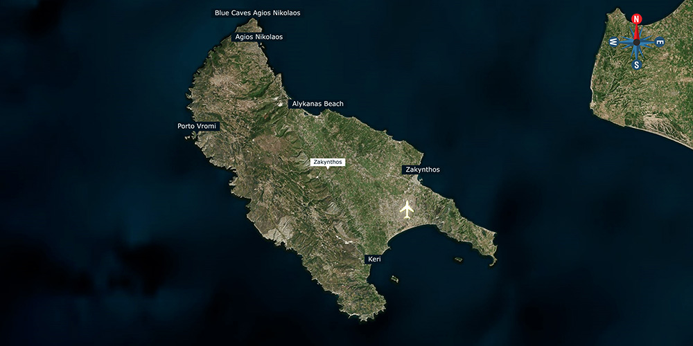
SeaTV · Ionian Islands · Zakynthos
Lagana Bay (Kolpos Lagana) — Marine Park & Anchorage Guide
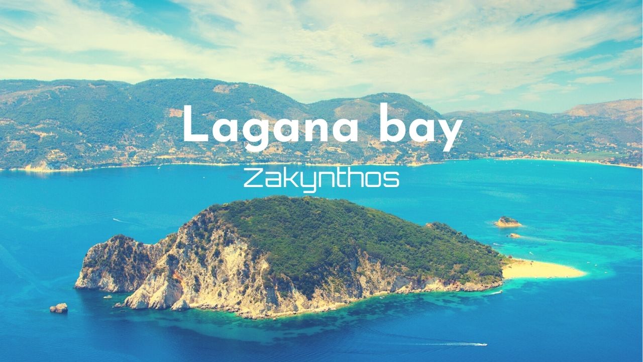
A wide protected bay on the south coast of Zakynthos — the most important loggerhead-turtle nesting site in the Mediterranean, divided into three regulated zones from May to October.
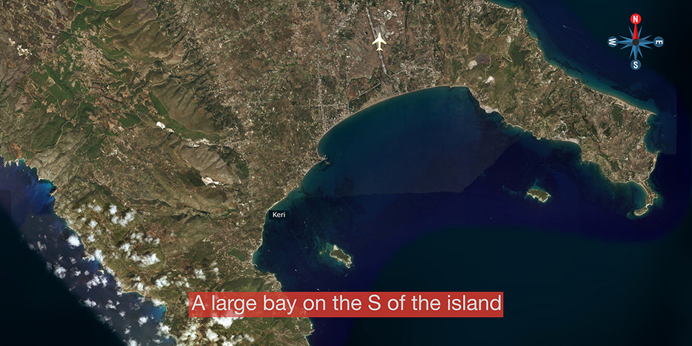
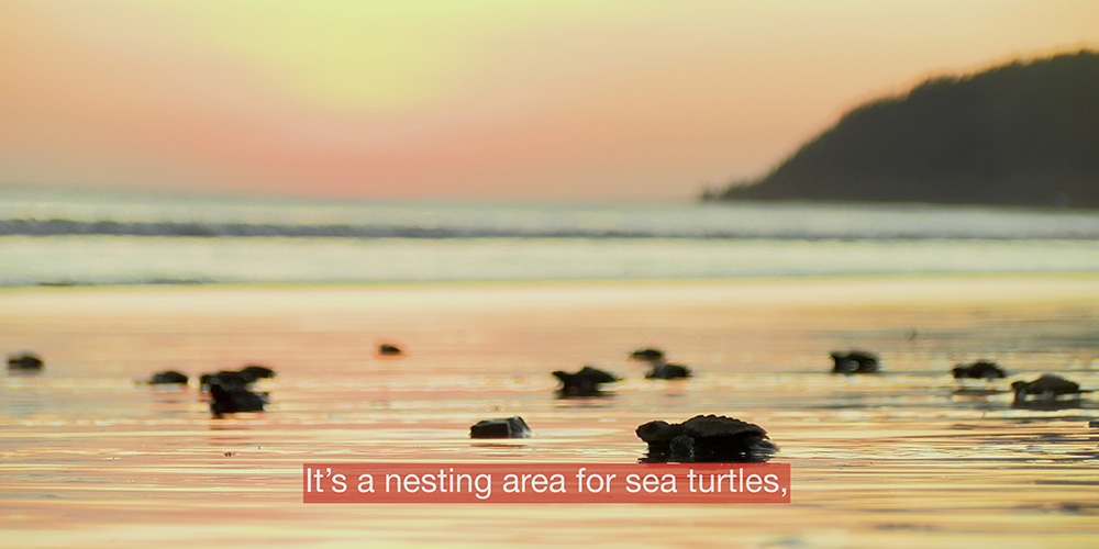
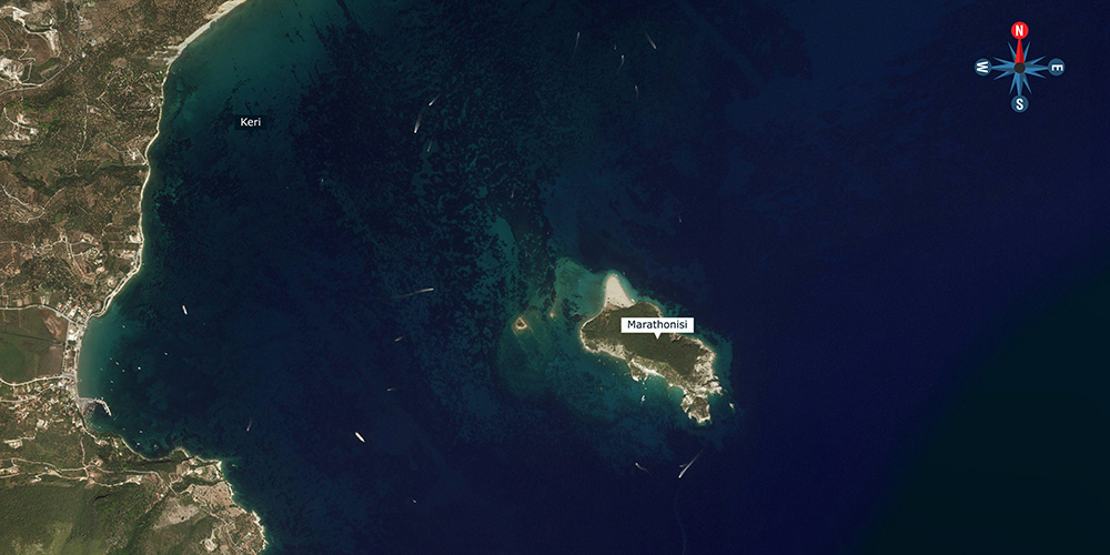
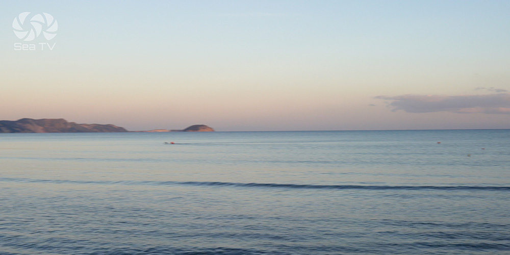
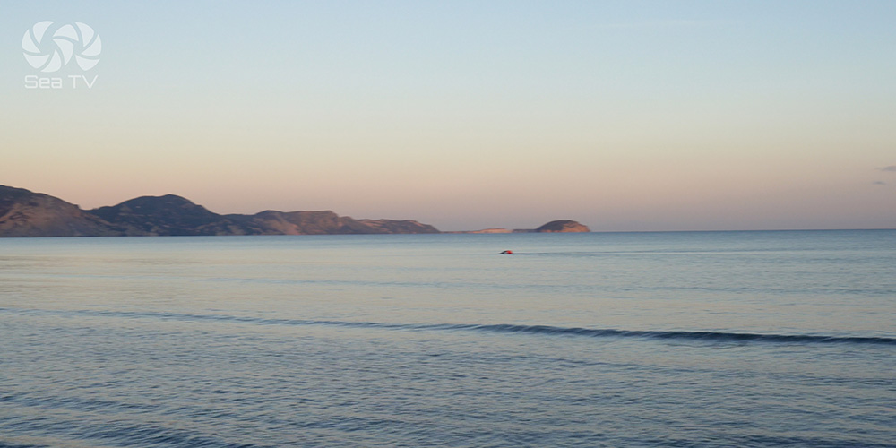
Kolpos Lagana — Lagana Bay — is a wide bay opening south on the underside of Zakynthos, framed between Cape Keri to the west and Cape Marathia to the east. The shallow sandy beaches of this bay are the largest Caretta caretta sea-turtle nesting site in the Mediterranean — and the entire bay is protected as the National Marine Park of Zakynthos.
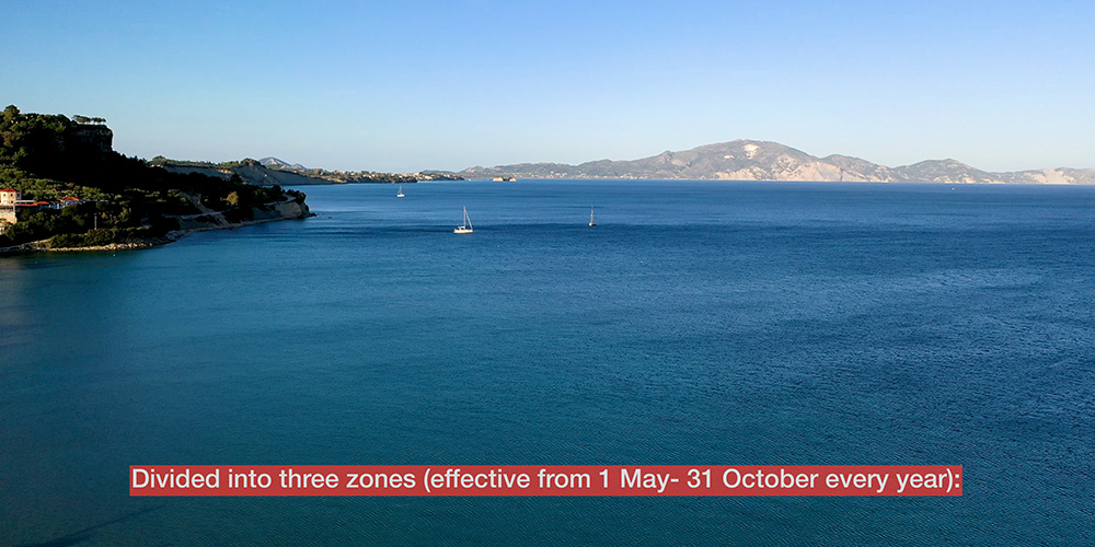
For sailors, this means restrictions matter. From 1 May to 31 October, the bay is divided into three zones with different rules — entry forbidden in some, speed-limited and no-anchoring in others, and a permitted swing area for boats around Marathonisi and Keri. Get the zones right and Lagana is one of the most spectacular anchorages in the Ionian. Get them wrong and you face a heavy fine — or worse, you damage a nesting site.
⚠ Reality check: The marine park is patrolled. Speed cameras and ranger boats enforce the rules. Read the zone restrictions below before you commit to a course — the lines on the chart are not suggestions.
⚓ Quick Facts for Sailors
Bay Coordinates
~37°41’N · 20°51’E (centre)
Restriction Period
1 May – 31 October (turtle season)
Anchoring
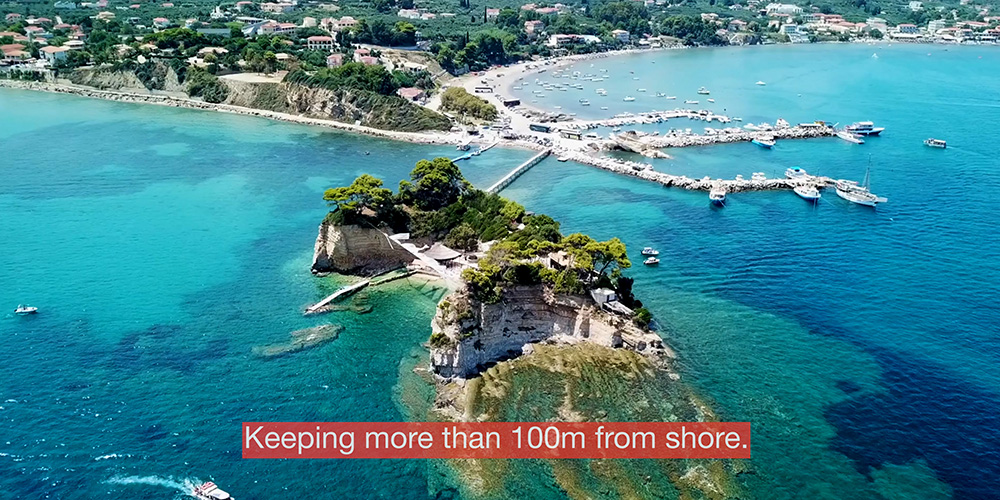
Permitted areas only · > 100 m from shore
Bottom & Holding
Sand, rocks, weed — set carefully
Wind Protection
Good NW–W · Open to S & E
Keri Contact
+30 26950 28117
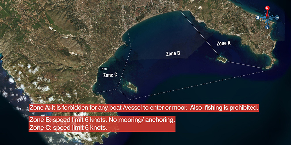
The Three Marine Park Zones
From 1 May to 31 October the bay is divided into three zones with different restrictions. Penalties for violations are significant. For the official map and current rules, see the National Marine Park of Zakynthos website: www.nmp-zak.org/en.
Zone A · Strictest Protection
No Entry · No Mooring · No Fishing
Forbidden for any boat to enter. Fishing is also prohibited. This is the core nesting zone where the turtles come ashore — the strictest level of protection in the park.
⚠ Watch: Routes that look natural on a chart can take you across the line. Plan the approach to keep clear by a wide margin.
Zone B · Transit Only
6 Knot Speed Limit · No Mooring or Anchoring
Transit only at 6 knots maximum. No mooring, no anchoring, no stopping. You may pass through but not pause.
⚠ Watch: 6 knots can feel slow when you’re trying to make a destination. The patrol boats know exactly where the line is — don’t try to push it.
Zone C · Permitted with Limits
6 Knot Speed Limit · Anchoring Permitted
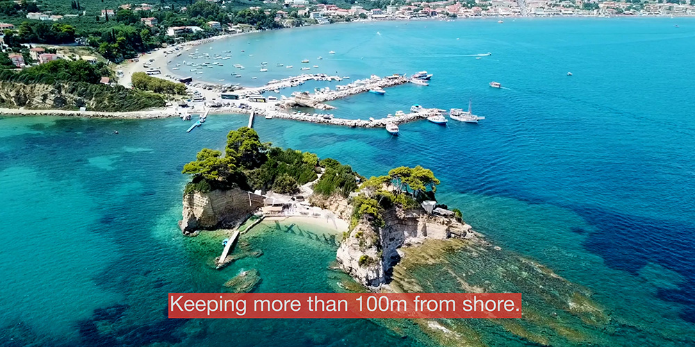
Speed limit 6 knots. This is the zone where anchoring is permitted — at the designated areas around Keri and Marathonisi, more than 100 m from shore.
⚠ Watch: Even in Zone C, the 100-metre offshore rule is enforced. Don’t drift in close to the beach for a swim — use the dinghy.
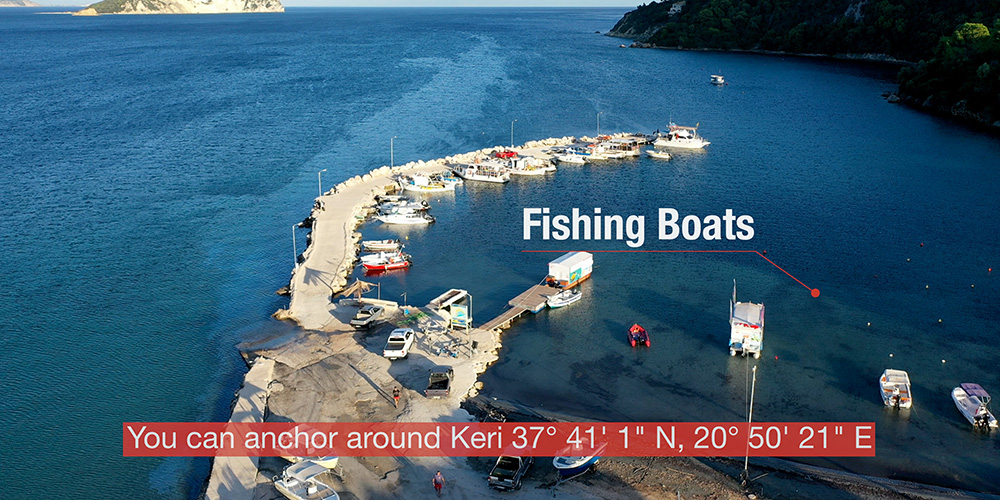
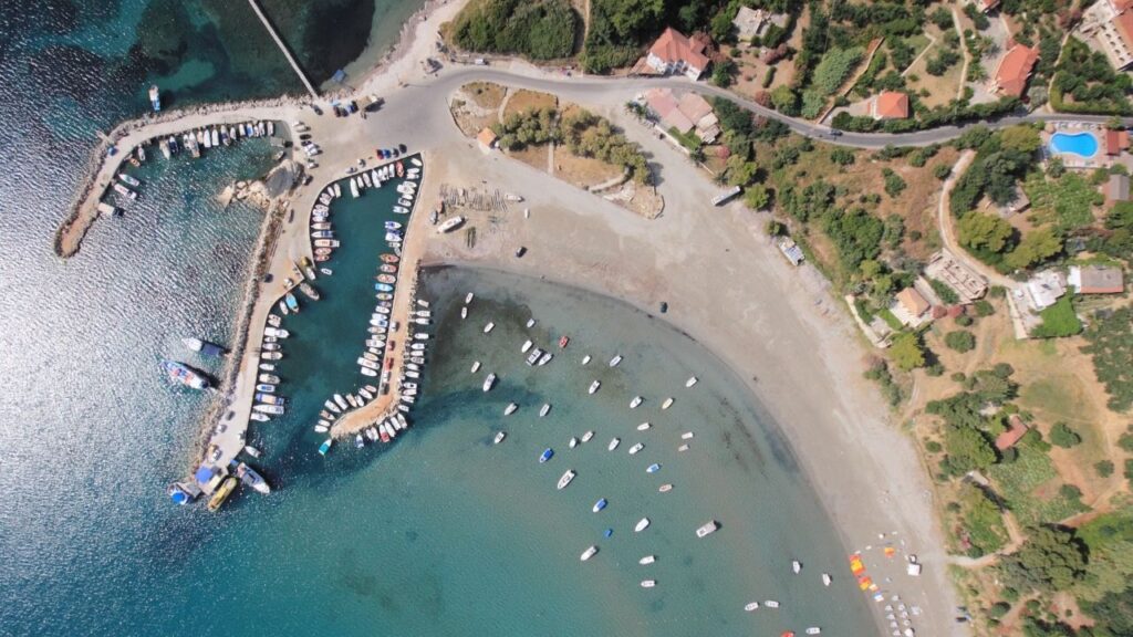
⚓ Permitted Anchoring Spots
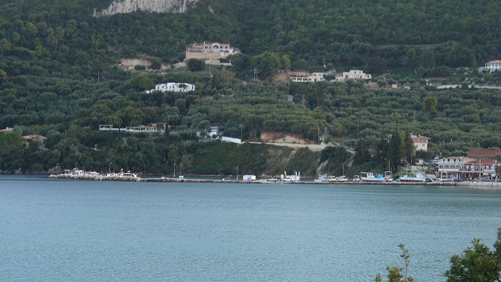
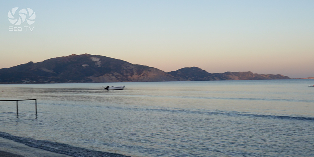
Keri · 37°41.01’N · 20°50.21’E
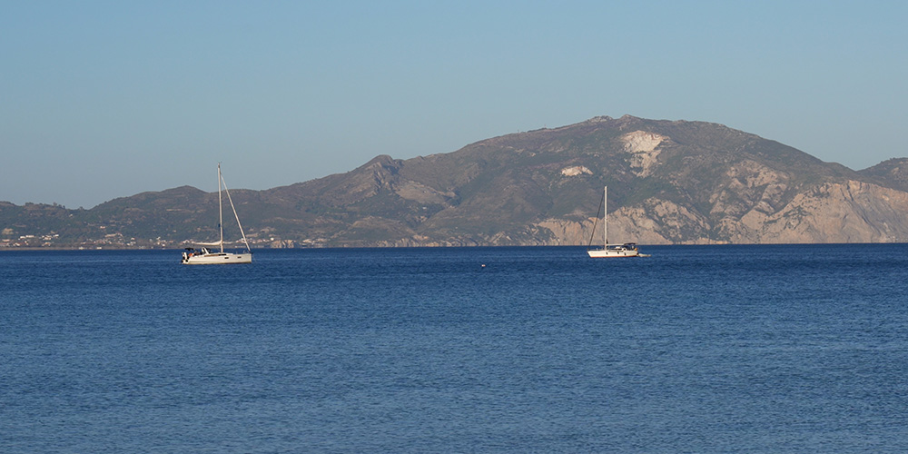
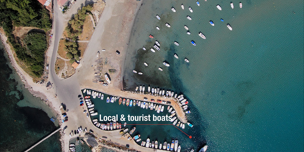
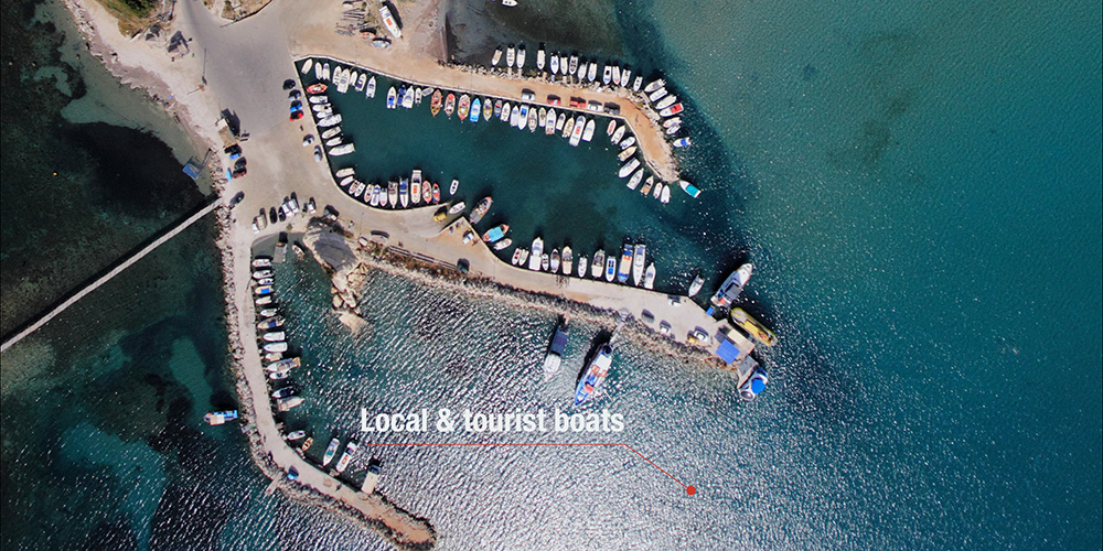
Anchorage off Keri Village
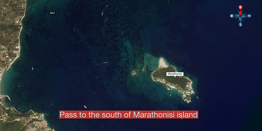
The west-side anchorage of the bay, off the small village of Keri at the foot of the cape. Pass to the south of Marathonisi island when approaching from the east.
Anchoring: Drop more than 100 m from shore. Bottom is sand mixed with rocks and seaweed — set carefully and confirm the bite before settling.
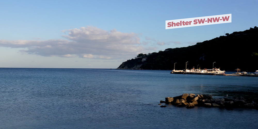
Shelter: Good in the prevailing NW–W winds. Open to S and E — uncomfortable to untenable in any southerly system.
⚠ Watch: Wind shifts to S in late afternoon are the danger here. Have a fallback in mind — there is no proper shelter in this part of the south coast in southerlies.
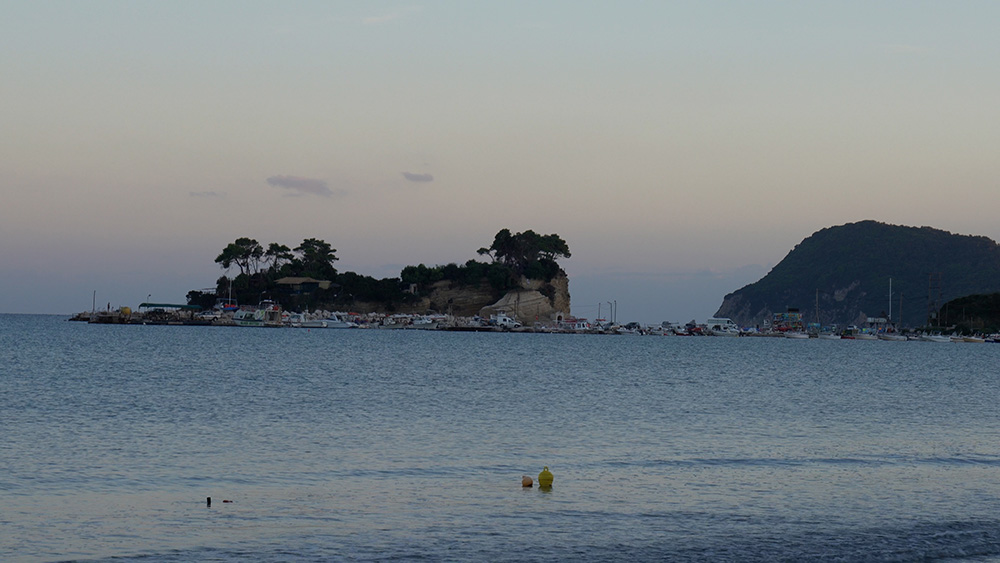
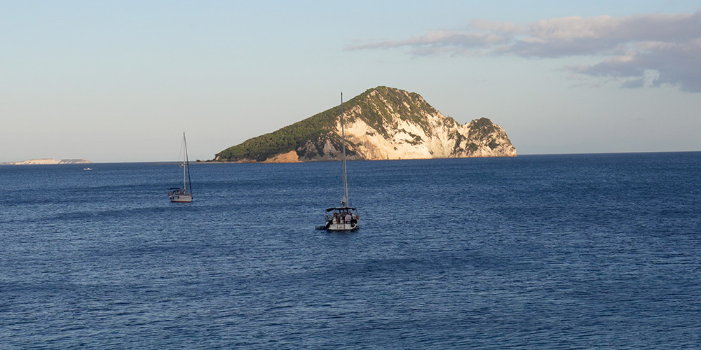
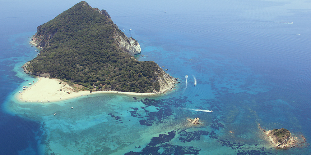
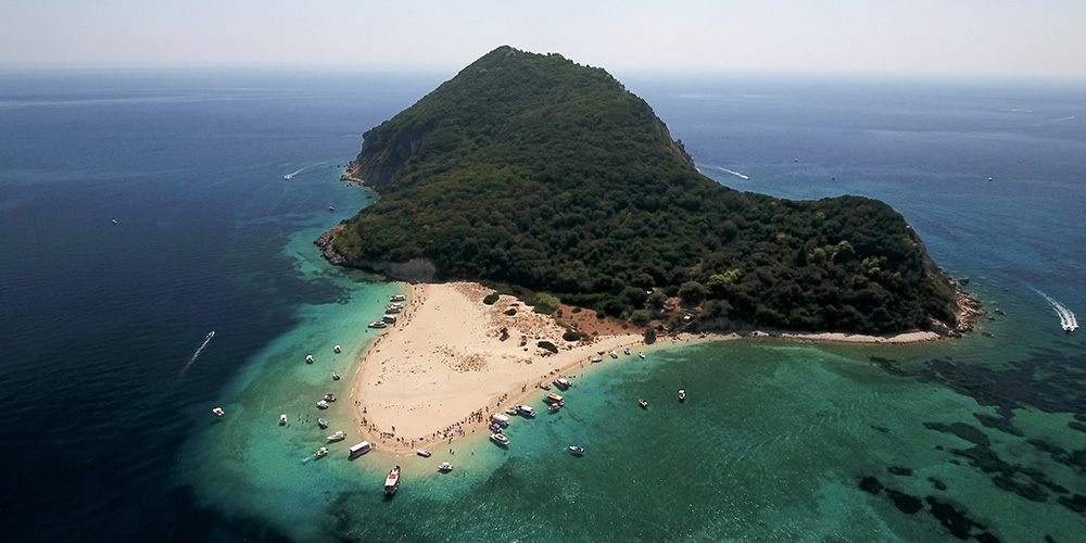
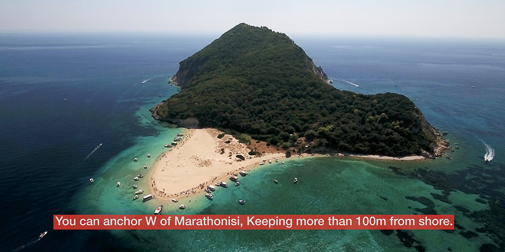
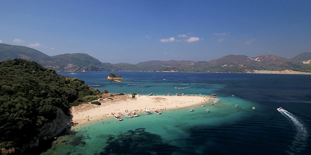
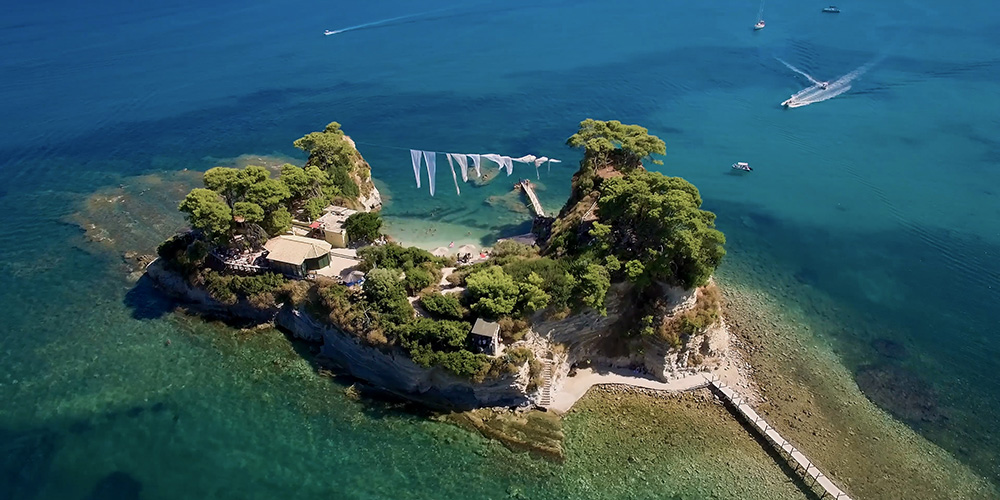
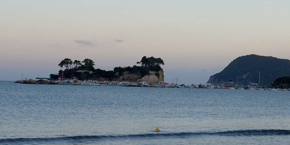
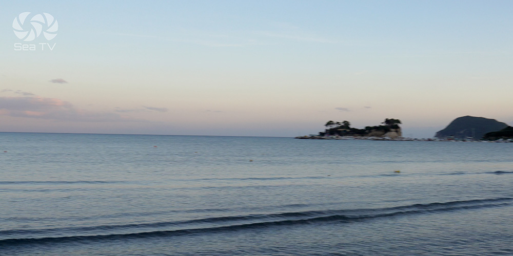
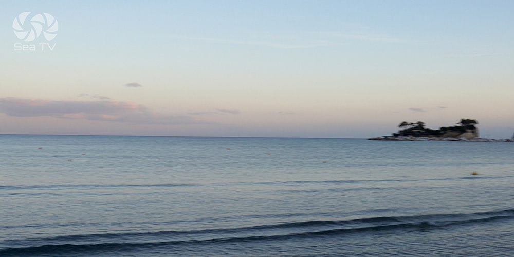
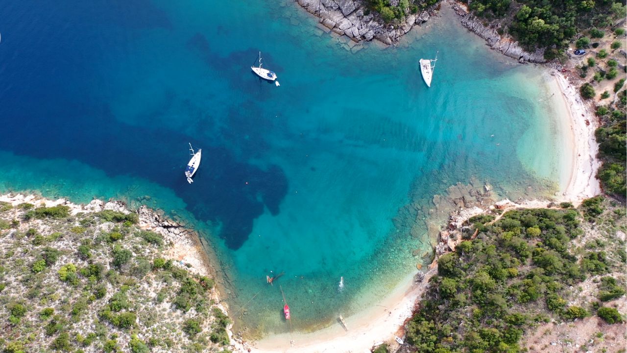
Marathonisi · 37°41.18’N · 20°52.06’E
Marathonisi Island Anchorage
The “turtle island” — small uninhabited islet in the middle of the bay, the most photogenic anchorage on Zakynthos. Anchorage permitted on the west side of Marathonisi, between Cape Marathia (Ak Marathia) and the islet itself.
Anchoring: West of Marathonisi, more than 100 m from shore. East side of Ak Marathia, west of Nisis Marathonisi, also permitted at the same distance rule.
Shelter: Same as Keri — good in NW–W, open to S and E.
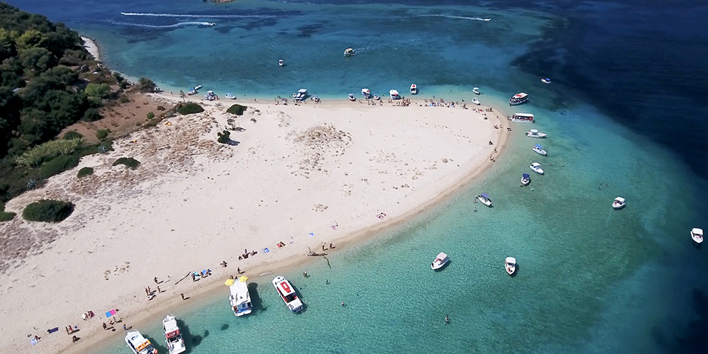
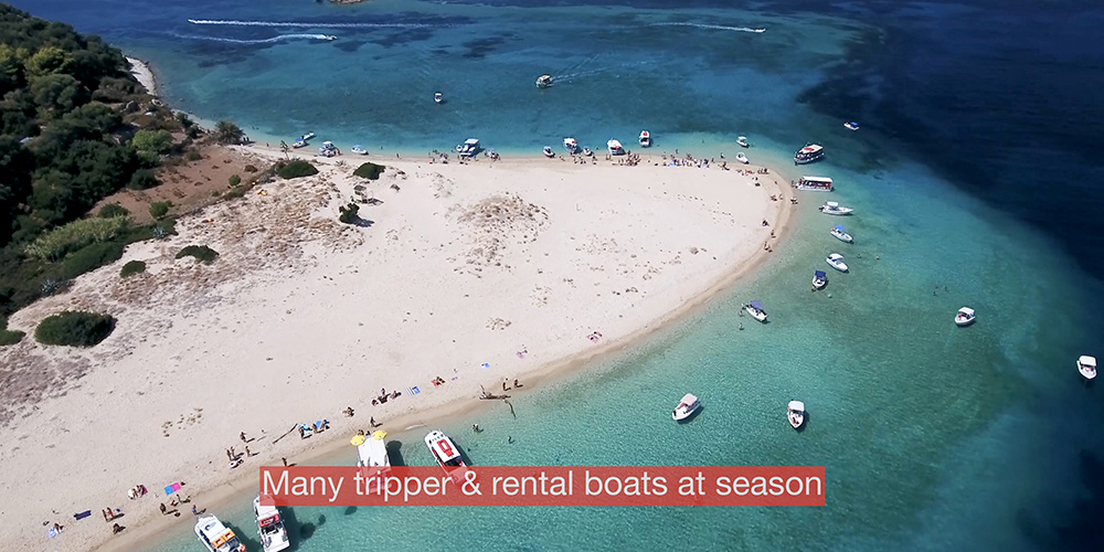
⚠ Watch: The clear shallows around the islet are tempting to drop close to. Don’t — 100 metres minimum, no exceptions. Day-tripper boats from Zakynthos Town visit constantly between 11:00 and 16:00.
Attractions Around the Bay
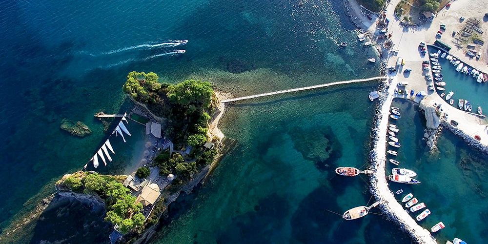
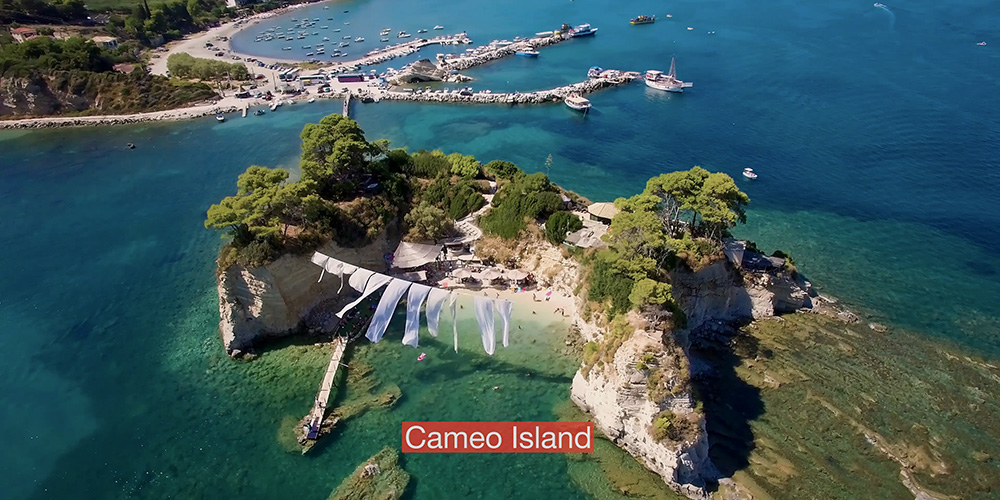
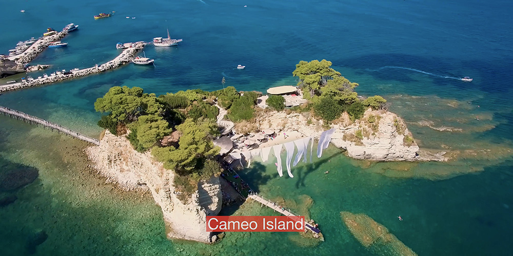
Cameo Island
A small islet at the western edge of the bay, joined to the Zakynthos shore by a wooden footbridge. A popular ashore attraction with a beach club and small chapel — best visited by dinghy from the Keri anchorage. More info: welcometozante.com/en/cameo-island.
Marathonisi turtle viewing
In the morning hours during nesting season, juvenile turtles can sometimes be seen swimming in the clear water around the islet. Stay quiet, no engines close, no swimming chase — the rules exist for a reason.
Keri Caves & Cape Keri
A short distance west of the Keri anchorage, the cape’s limestone cliffs are pierced by sea caves accessible by dinghy in calm weather. Dramatic morning light. Stay outside the marine park boundary and keep clear of swim-tour boats.
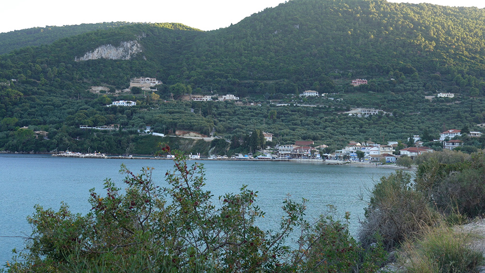
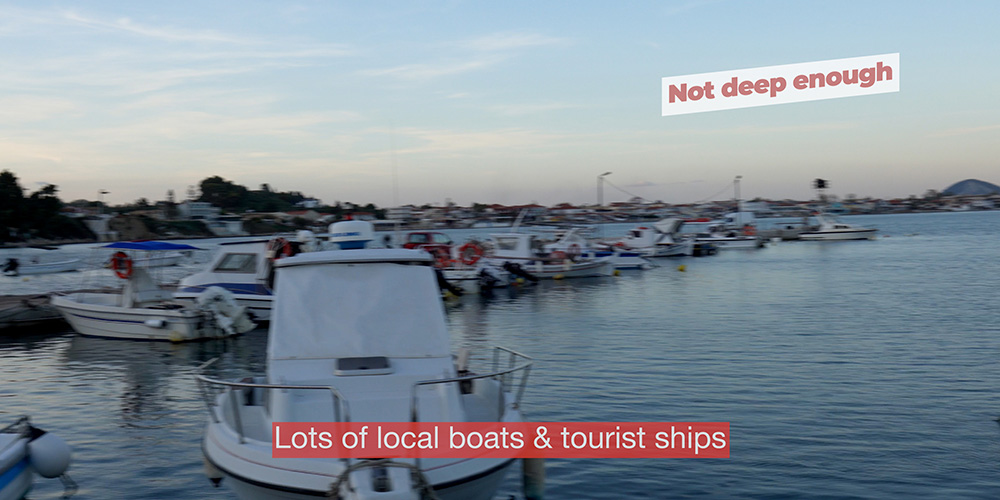
Ashore — Keri Village
Keri is a small fishing village set back from a narrow stone-walled harbour. A handful of waterfront tavernas serve the day-tripper traffic and the occasional cruising yacht. Standards are reasonable; nothing exceptional.
Keri Lake Restaurant
A long-running family taverna near the small wetland behind the village. Greek classics, fresh fish, simple service. €€
Cameo Island beach bar
For an afternoon sunset drink rather than a full dinner — accessible by dinghy or by walking across the bridge. €€
Pro Tips for Lagana Bay
Plot the zones before you arrive. Mark the boundaries on your chartplotter from the official park map. Trying to navigate them visually from the cockpit is unreliable — and expensive when you get it wrong.
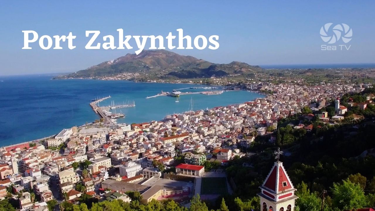
Lunch only, not overnight, if S forecast. A southerly forecast turns Lagana from spectacular to dangerous. Plan to clear out and head for Port Zakynthos before any S component builds.
Morning is calm. Afternoon is busy. Day-tripper traffic from Zakynthos Town peaks 11:00–16:00. For a quiet swim around Marathonisi, drop anchor at 09:00 or after 17:00.
No swimming with engines on. If you’re stopped to swim, kill the engine. The park rules and basic turtle-respect both require it.
Set the anchor on sand, not weed. The bottom in this bay is patchy. Patches of clean sand between weed rocks. Snorkel the bite or use the chartplotter to position over a sandy patch — visibility is excellent in calm conditions.
Suggested Routes from Lagana
East to Port Zakynthos
A 10 NM run east along the south coast to Port Zakynthos — the main town quay with full facilities, fuel, water, supermarkets. The natural overnight after a Lagana lunch.
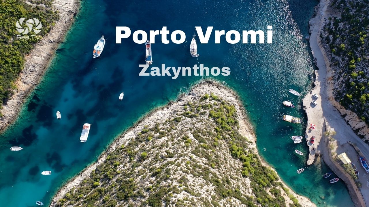
North to Porto Vromi & Shipwreck
Around the western tip of the island to the dramatic NW coast: Porto Vromi and the famous Shipwreck Beach. Roughly 15 NM, calm-day morning passage only — the west coast is exposed.
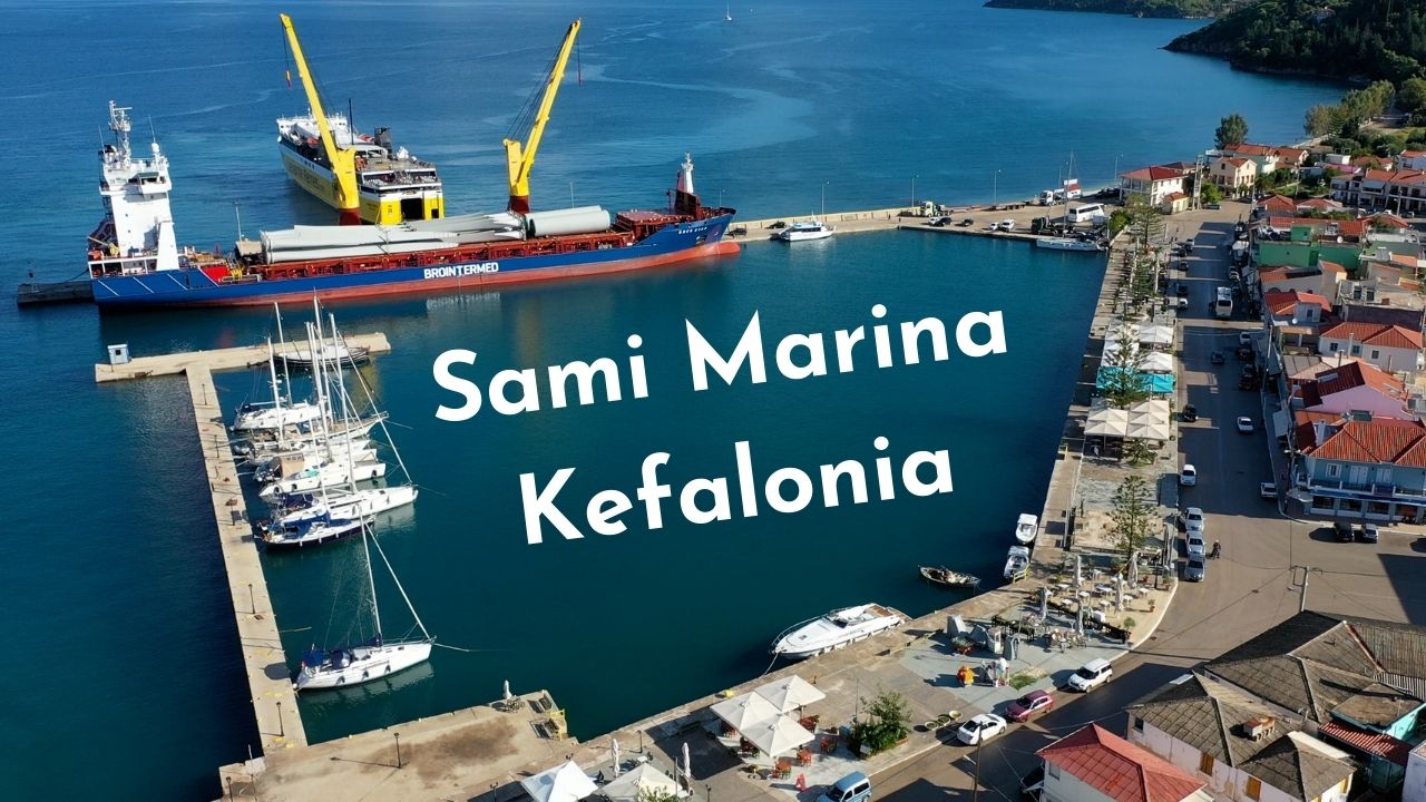
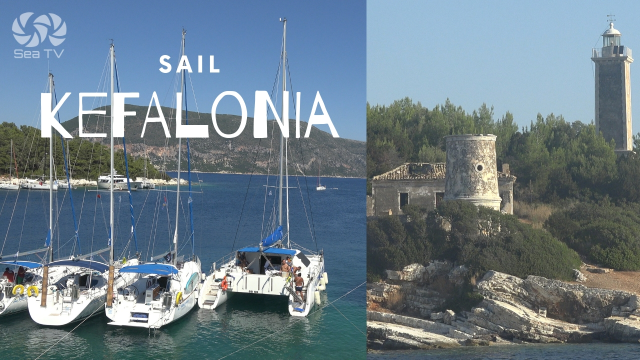
North to Kefalonia
A longer leg of 30+ NM north to Sami Marina on Kefalonia. Plan for an early start — the channel between Zakynthos and Kefalonia can build a strong NW chop by midday.
For full overview of the south Ionian: Sail & Anchor around Zakynthos. For multi-day plans, see our 7-Day Ionian itinerary.
✅ Sailor’s Safety & Compliance Checklist
▢ Park zones plotted on chartplotter from official park map
▢ Speed reduced to 6 knots before crossing Zone B/C boundary
▢ Anchored more than 100 m from any shore
▢ No southerly component in forecast for the planned stay
▢ Fallback identified — Port Zakynthos 10 NM east
▢ VHF on Ch. 16 / Ch. 12
Emergency Numbers — Zakynthos
European Emergency: 112
Coastguard Zakynthos (VHF Ch. 12): +30 26950 28117
Olympia Radio (VHF Ch. 03/86): Greek HF/VHF maritime service
Marine Park Office: www.nmp-zak.org/en
Hospital Zakynthos: +30 26950 59100
Watch the SeaTV Visual Pilot Video
Drone footage of Marathonisi and the Keri cliffs, the approach to the anchorages, and views of the marine park boundaries — Lagana Bay as you’d see it from the cockpit. Free for members.
Related SeaTV Pages
If you’re sailing the south Ionian, here are the related SeaTV pages — organised by area.
Zakynthos · Other Anchorages
→ Sail & Anchor around Zakynthos — full island overview
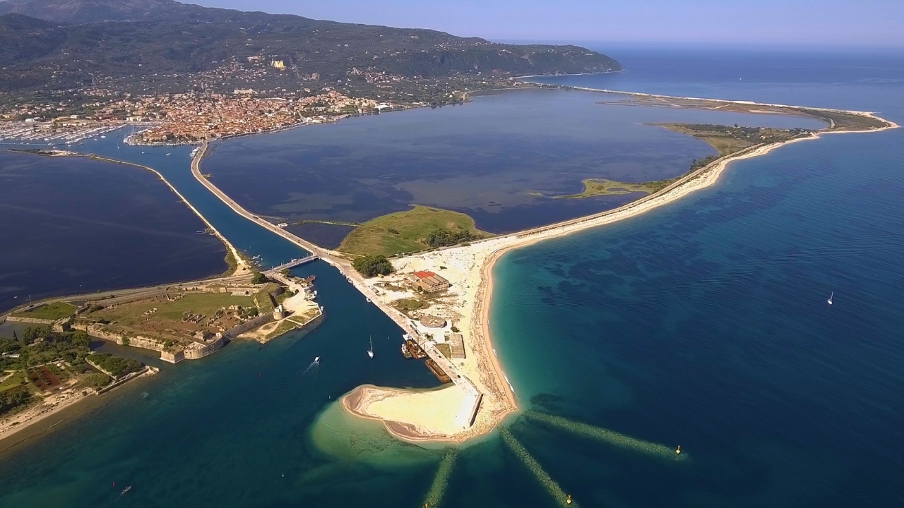
→ Port Zakynthos — main town quay & port of entry
→ Porto Vromi — NW coast cliff cove
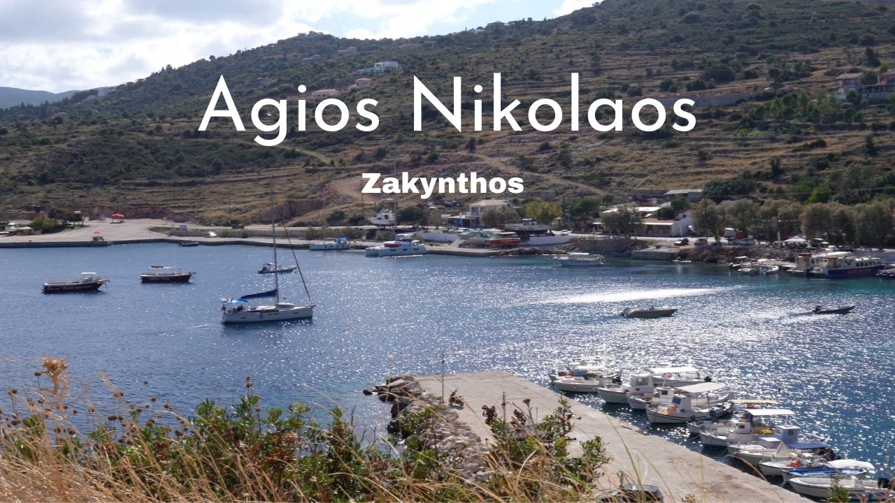
→ Agios Nikolaos & Blue Caves — north tip caves
Kefalonia · 30+ NM North
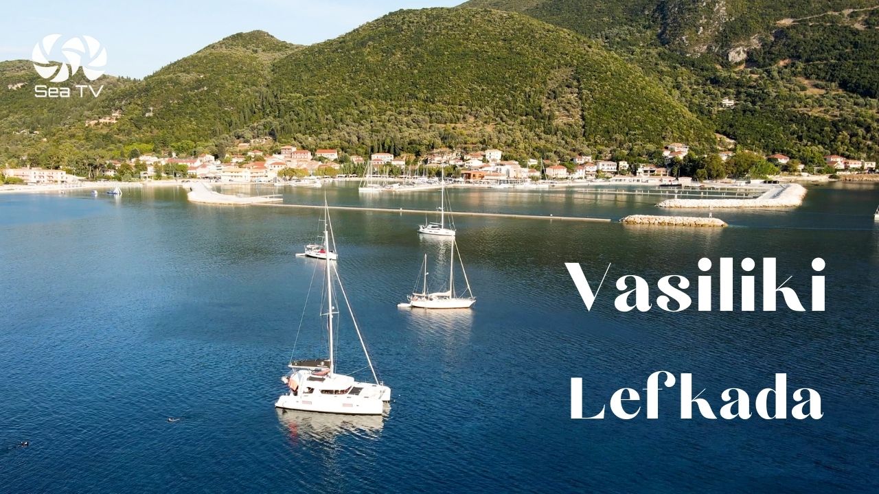
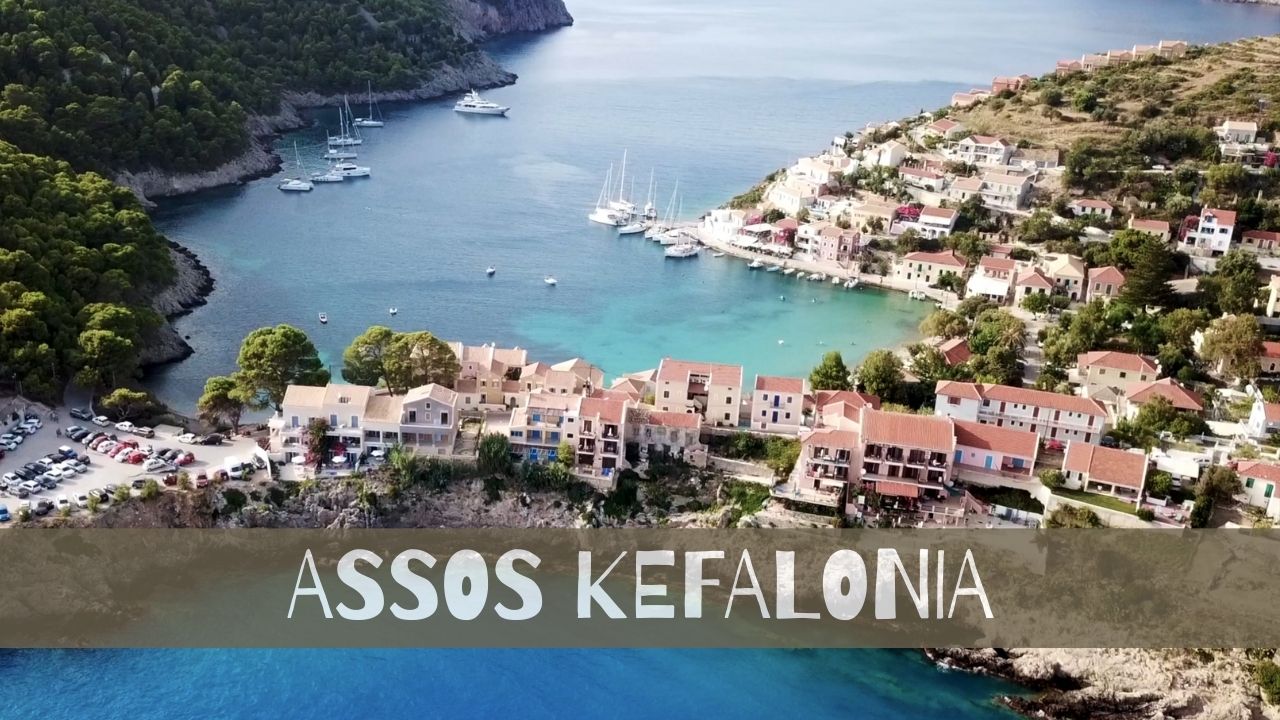
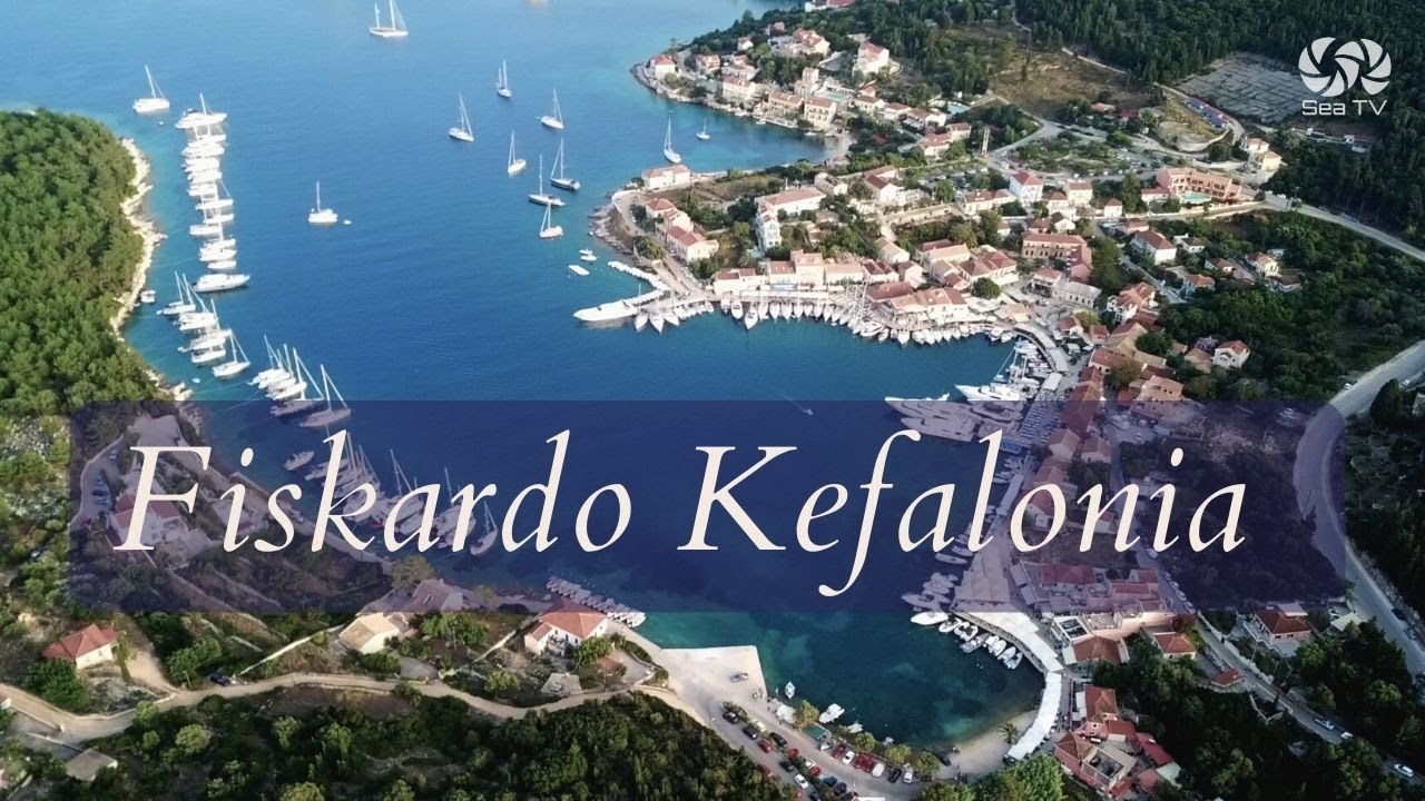
→ Kefalonia overview — Fiskardo, Sami, Assos, Myrtos
→ Sami Marina — east-coast service hub
→ Fiskardo — north-tip pastel village
→ Assos
Northern Ionian (For Longer Charters)
Continue your Zakynthos charter
East to the main port, north to Porto Vromi and Shipwreck Beach, or up to Kefalonia.
→ Ionian Islands hub · Port Zakynthos · Porto Vromi · Sami Marina
“In Lagana, the lines on the chart matter. The turtles got there first.”
— SeaTV Visual Pilot · Zakynthos Edition