SeaTV · Ionian Islands · Zakynthos
Porto Vromi, Zakynthos — Sailing & Anchorage Guide
A spectacular deep cove on the wild NW coast of Zakynthos — a calm-day-only stop, the launchpad for the famous Shipwreck Beach 2 NM north.
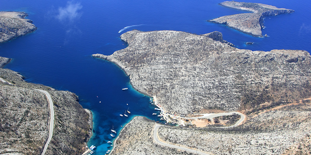
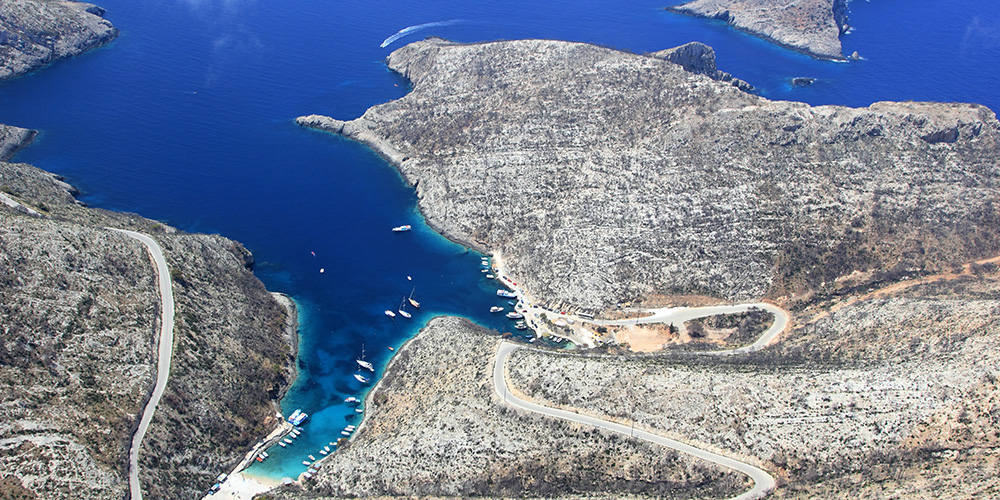
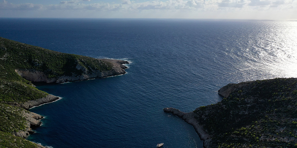
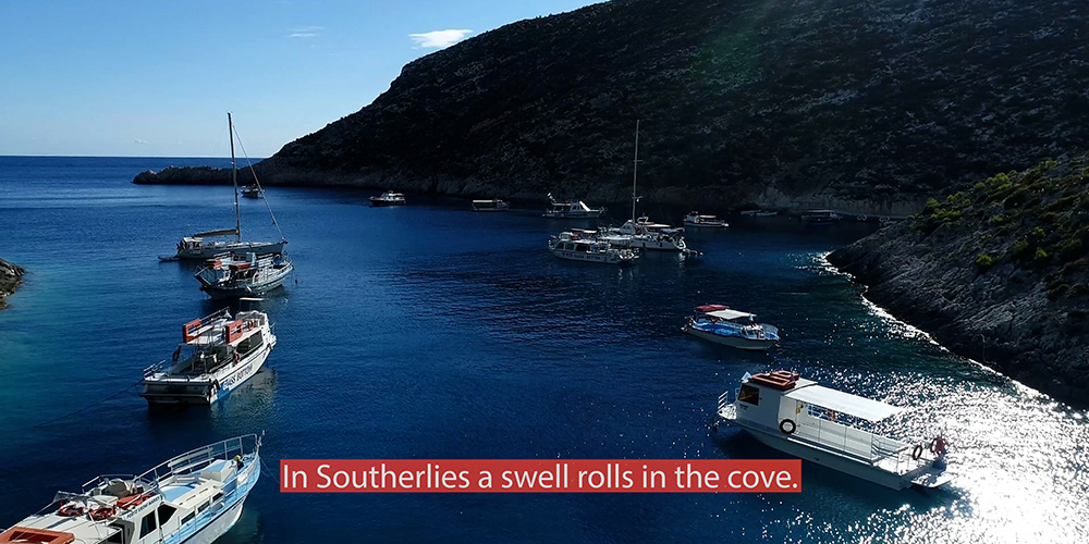
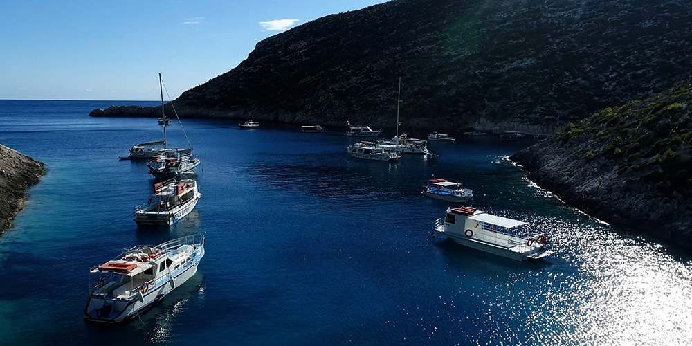
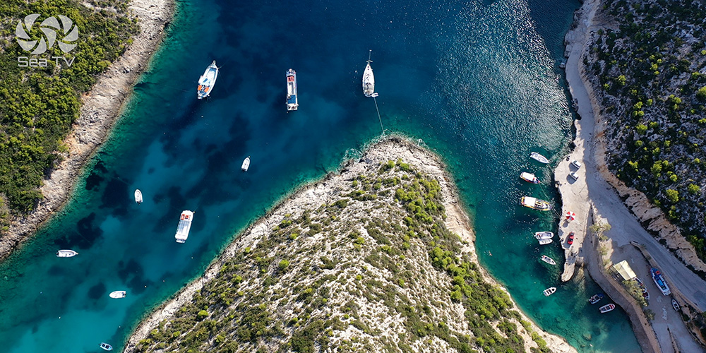
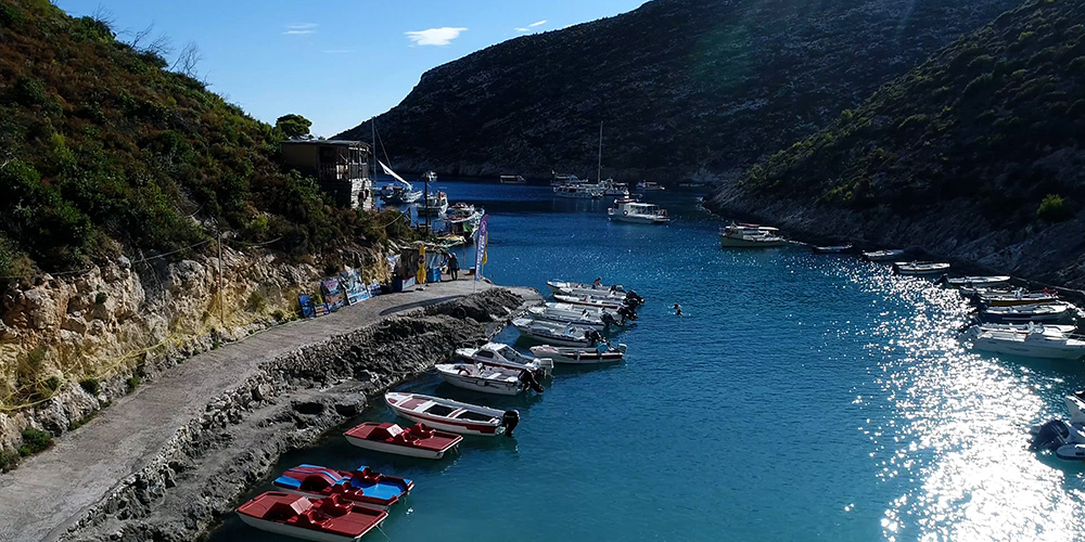
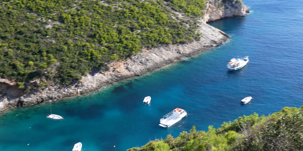
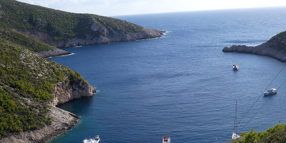
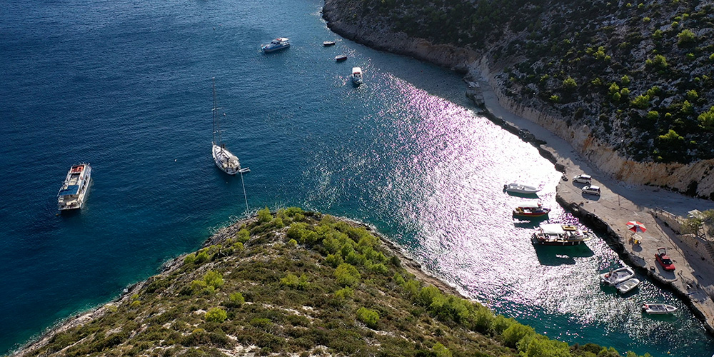
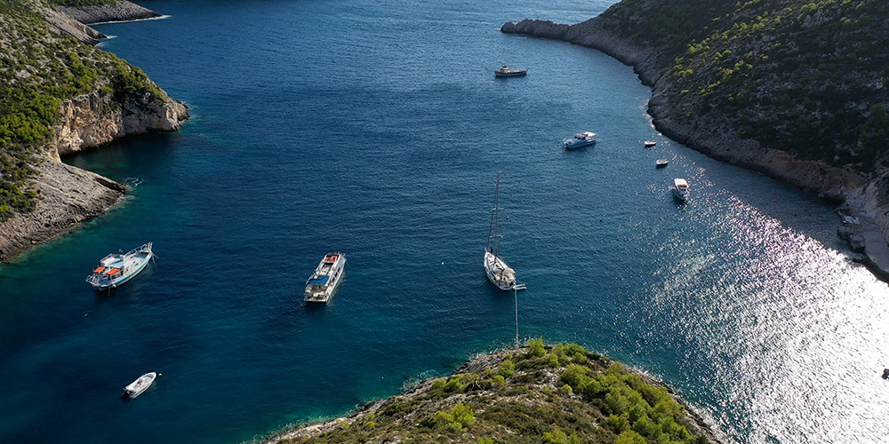
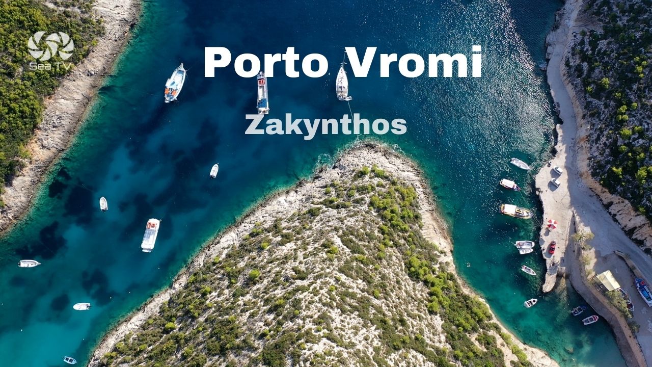
Porto Vromi cuts deep into the white limestone cliffs on the northwest coast of Zakynthos — a narrow cove of clear turquoise water, vertical walls of rock on both sides, and a small pebble beach at the head. The whole NW coast of Zakynthos is dramatic — vertical cliffs falling 200 m into the sea — but Porto Vromi is the only meaningful indentation that gives any kind of shelter and access ashore.
For sailors, Porto Vromi is a calm-weather lunch stop, not a serious overnight. The cove is spectacular but exposed in any southerly system, the bottom is rocks-and-weed with poor holding, and the inside is shared in summer with constant tripper-boat traffic running tourists to Shipwreck Beach (Navagio) just 2 NM further north. Treat it as a destination on a flat-calm day — anchor for a swim, walk ashore, lunch — then move on before the afternoon air builds.
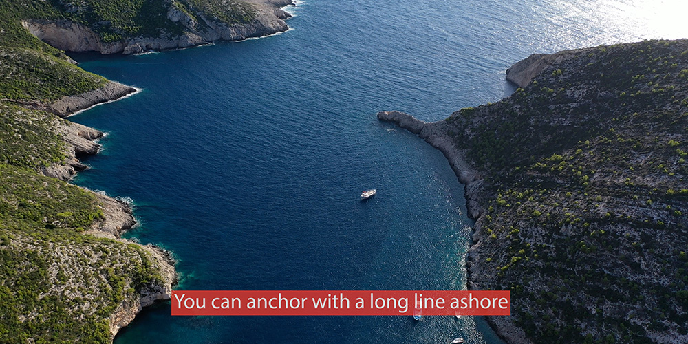
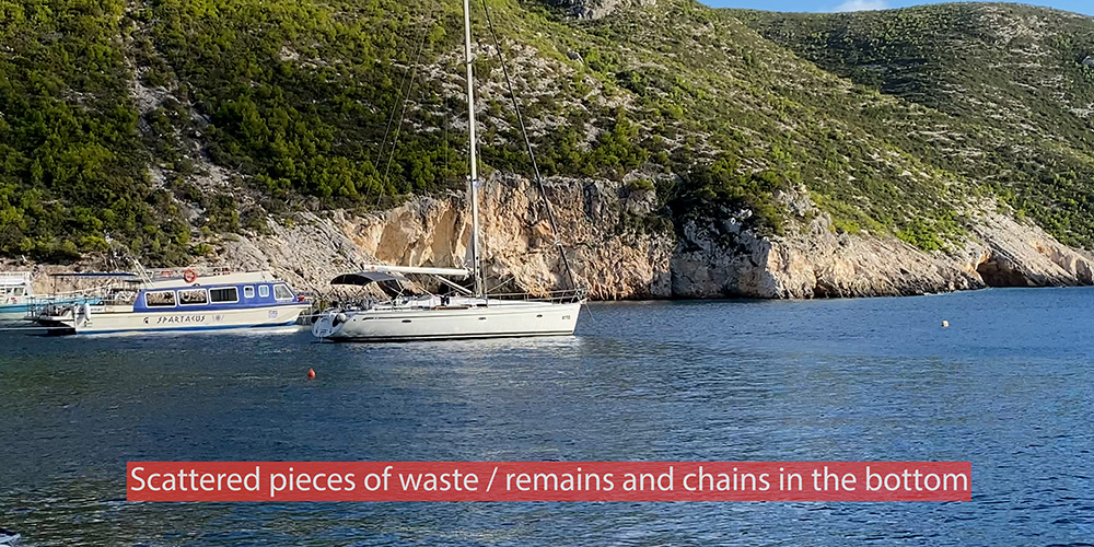
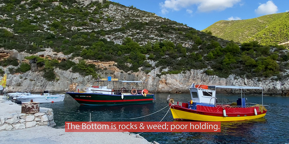
⚠ Reality check: The bottom in Porto Vromi is rocks, weed, and miscellaneous waste — old chains, lost ground tackle, scattered debris. Holding is poor. Use a long line ashore or pick up one of the local moorings (call VHF Ch. 09) — don’t trust your anchor alone.
⚓ Quick Facts for Sailors
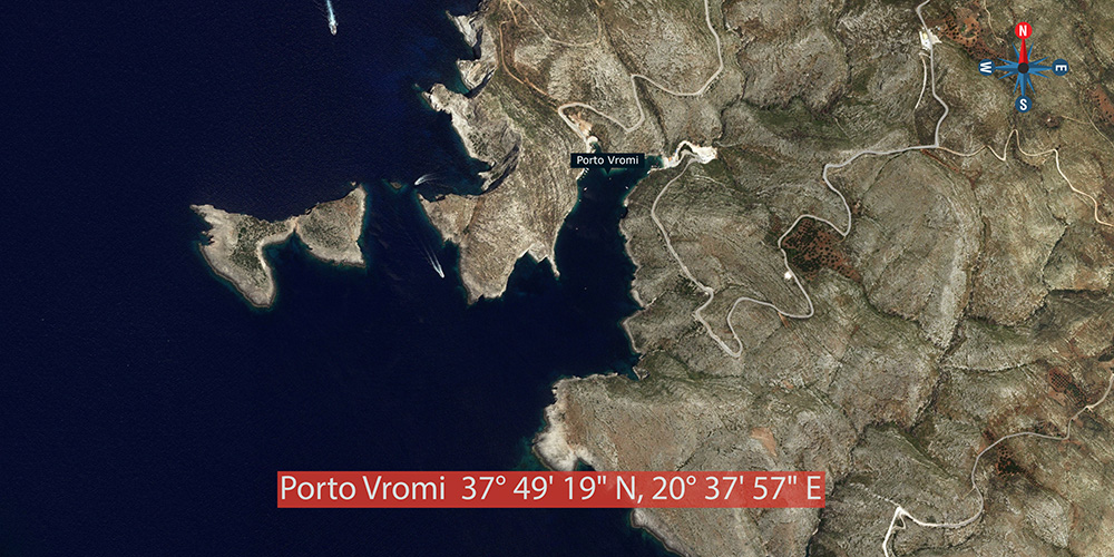
Coordinates
37°49.19’N · 20°37.57’E
VHF Channel
Ch. 09 (local moorings) · Ch. 16 (distress)
Bottom
Rocks & weed — poor holding · debris scattered
Shelter
Moderate · open to S · swell rolls in
Best Use
Lunch stop · calm-day swim · Shipwreck launchpad
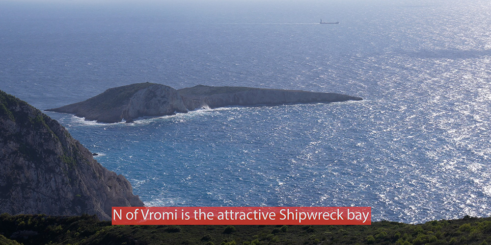
Shipwreck Beach
2 NM north · 37°51.37’N · 20°37.26’E
Wind, Weather & Approach Notes
The NW coast — exposed
The entire west and northwest coast of Zakynthos faces the open Ionian Sea — there is nothing between this coastline and Italy. Any wind with a westerly or southerly component builds swell that runs straight onto the cliffs. The coast looks calm and protected from a chart, but the geography is brutal once weather arrives.
Southerlies = retreat
In any southerly system, swell rolls into the cove and bounces off the back wall — uncomfortable for short stays, dangerous if the wind builds while you’re at anchor. Porto Vromi is moderate shelter at best, never proper protection.
Approach — visible from offshore
The cove is the only obvious indentation in this stretch of cliffs. The opening is narrow but unmistakable from a couple of miles offshore. Approach in the morning when the air is light — by midday the tripper-boat traffic in and out of the cove is constant.
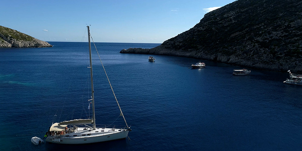
⚓ Mooring Options
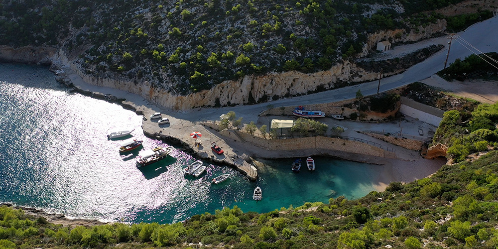
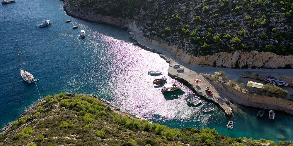
Local Mooring · VHF Ch. 09 · Recommended
Pick Up a Local Mooring Line
The locals offer mooring lines for visiting yachts — call VHF Ch. 09 as you approach and they’ll guide you in. Standard charter-day fee for a few hours’ tie-up.
Why use one: The bottom is unreliable for anchoring, and even with a long line ashore you’re working against poor holding. The local moorings are properly anchored to fixed points. Save your sanity.
⚠ Watch: Moorings are a few-hours arrangement, not a 24-hour stay. Day-tripper traffic uses the same moorings on rotation. Don’t expect to leave the boat unattended for long.
Anchor & Long Line Ashore · Backup
Anchor with Stern Line to Rocks
If no mooring is available, the standard alternative is to anchor with a long line ashore to one of the rocky shores on either side of the cove. The cove is too narrow for a free swing and the holding too poor for unsupported anchoring.
Setup: Drop the anchor in 8–10 m off the rocks, reverse in carefully testing depth, then dinghy a long stern line to a fixed rock or tree. Allow for swell movement.
⚠ Bottom hazards: Scattered chains, lost anchors, and waste from years of charter-boat use. Snorkel before you accept the set — check the anchor isn’t snagged on something you don’t want to leave behind.
⚠ Watch: Don’t leave the boat for long. If the wind shifts S even slightly, the cove starts to roll fast.
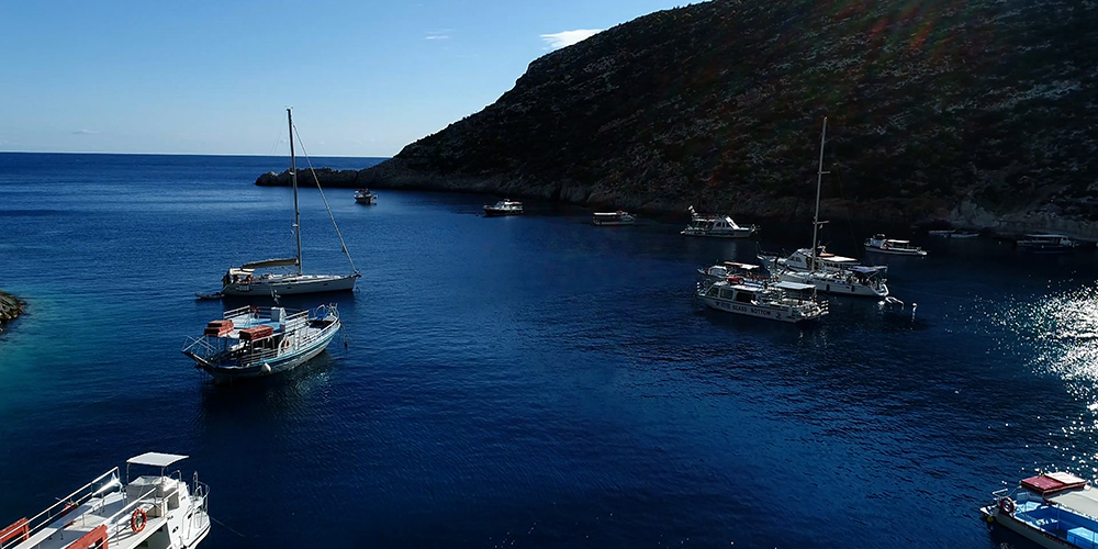
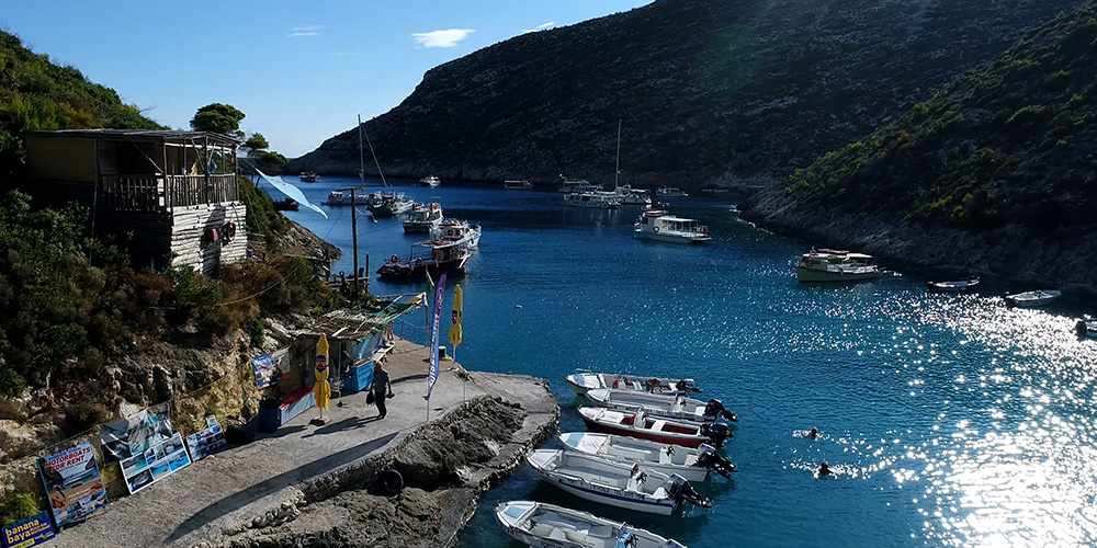
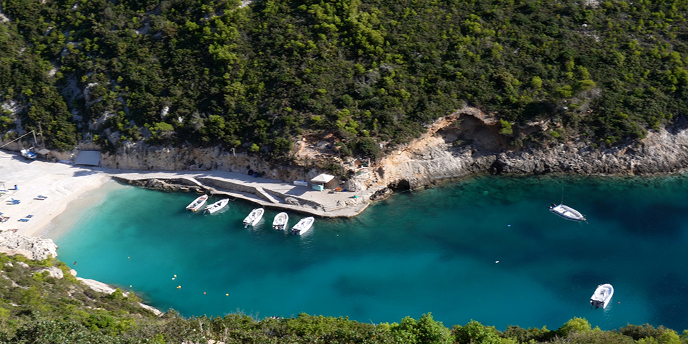
Ashore — What’s There
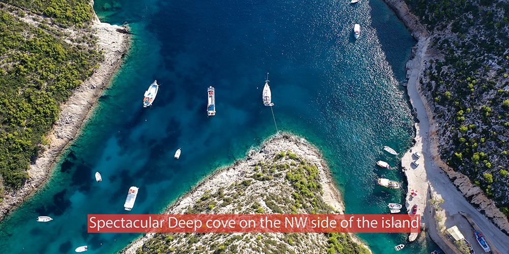
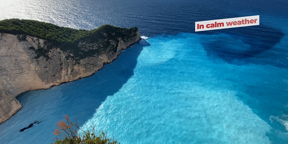
Beach & cove: A small pebble beach at the head of the cove, accessible by dinghy. Clear turquoise water, good for a quick swim, vertical limestone walls on both sides for shade in the afternoon.
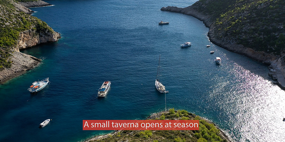
Taverna: A small seasonal taverna operates on the shore in summer — basic Greek menu, simple service, the only food option in the cove. Limited opening hours, closed in shoulder season.
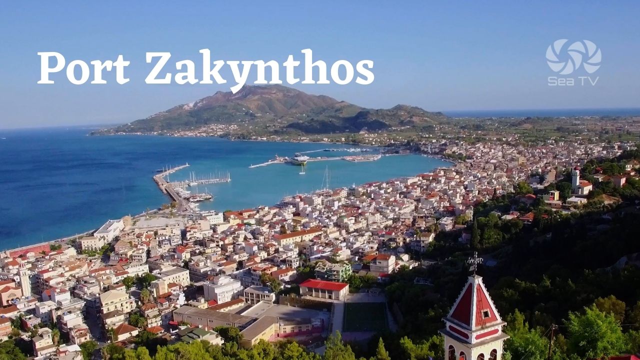
No fuel, no water, no electricity, no provisioning. This is a wild-coast cove, not a working harbour. For services, plan a stop at Port Zakynthos on the south coast.
Boat-trip launchpad: Small tour boats run from Porto Vromi to Shipwreck Beach throughout the day — you’ll see them coming and going constantly in summer. The cove is essentially the operational base for the Navagio tourism operation.
⛵ Shipwreck Beach (Navagio) — The Side Trip
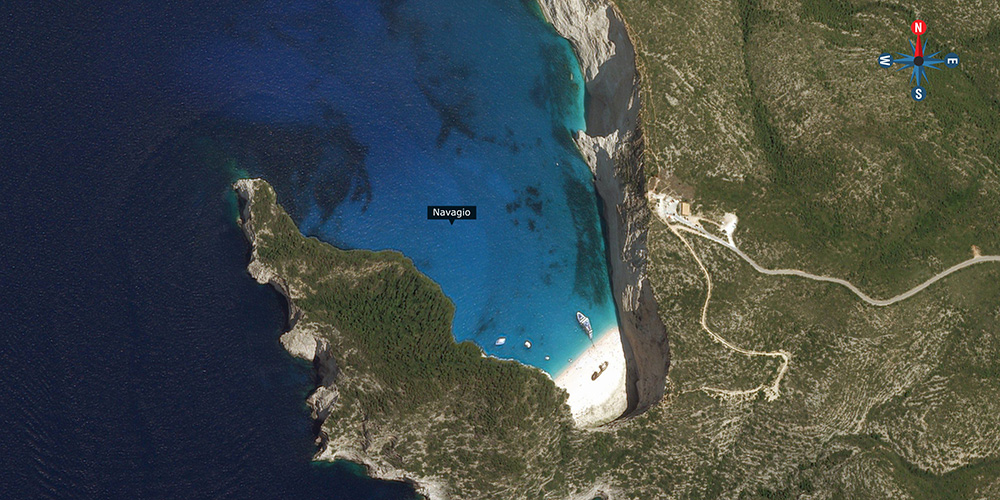
Shipwreck Beach · 37°51.37’N · 20°37.26’E
Navagio (the Shipwreck) — 2 NM North
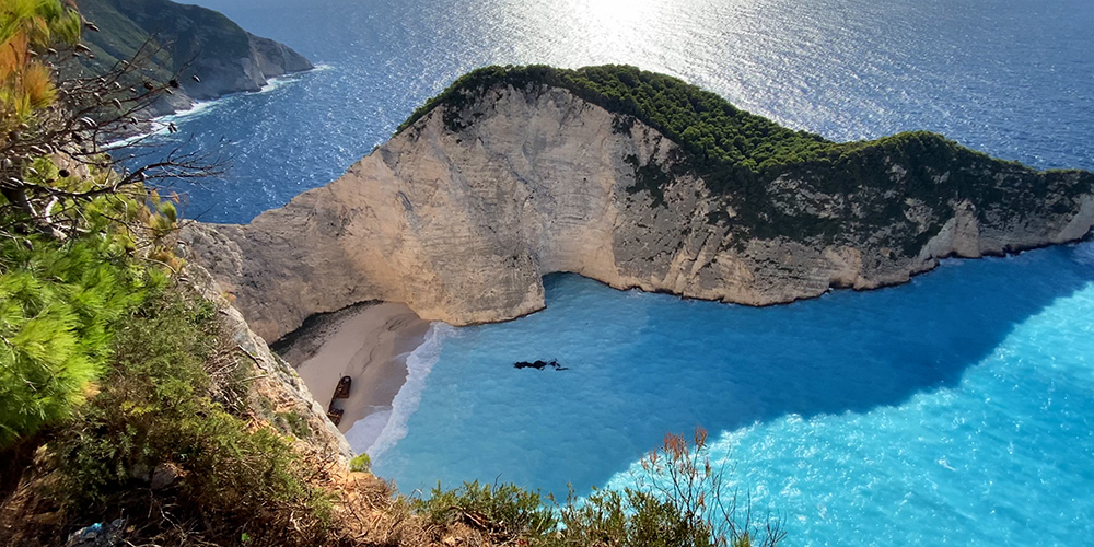
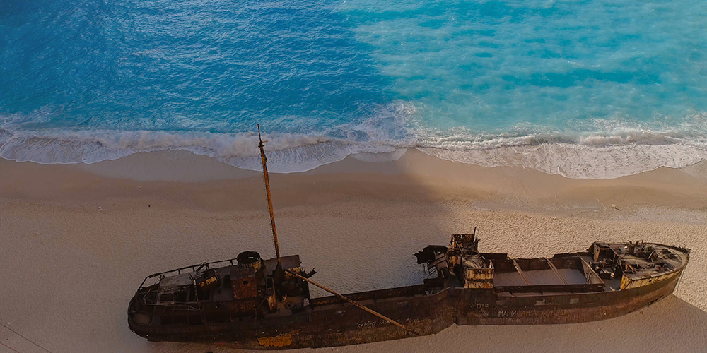
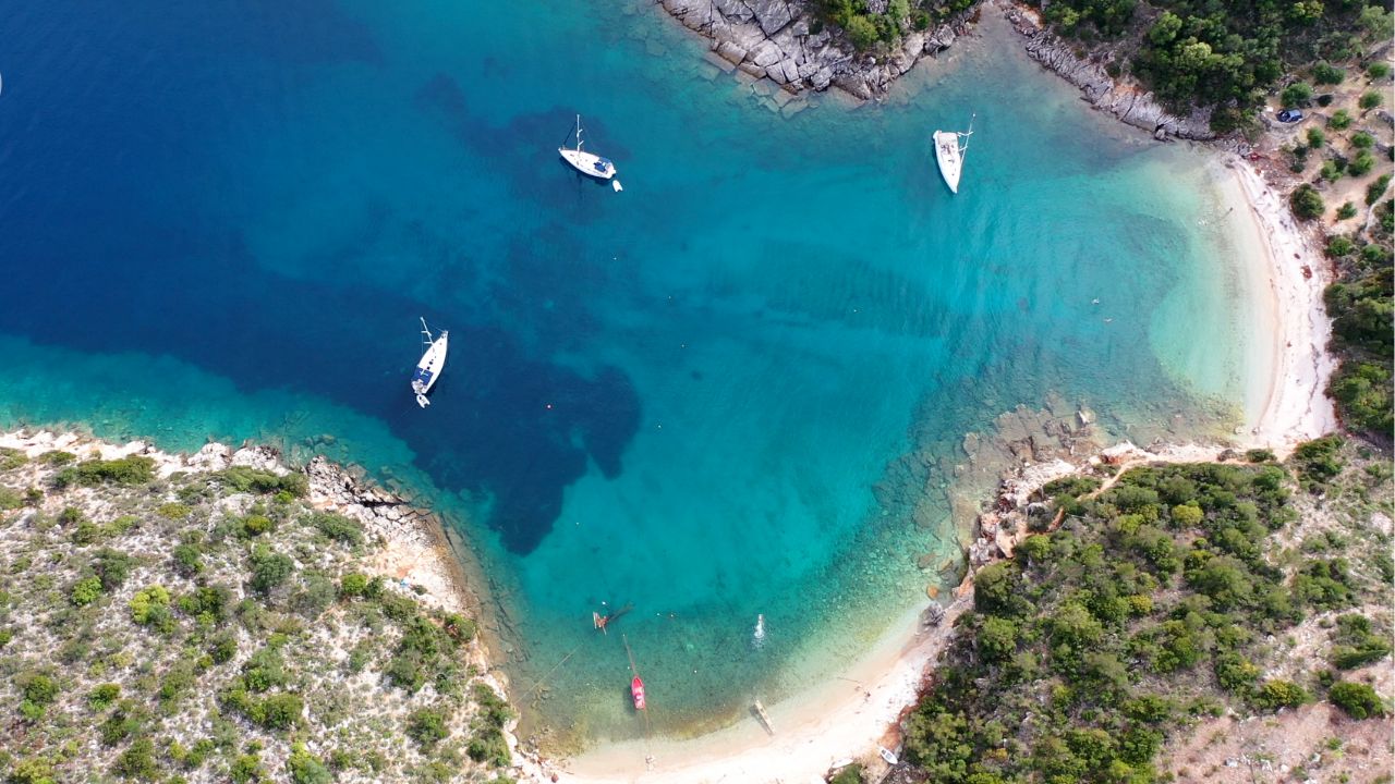
The most photographed beach in Greece — a small white-sand cove backed by 200-metre vertical cliffs, with the rusted hulk of the freighter MV Panagiotis half-buried on the beach. Accessible only from the sea — there is no road down. North of Porto Vromi, around the cape.
Anchoring: Drop in 7–10 m on sand off the beach. Calm weather only — no shelter at all in any wind from the western half of the compass.
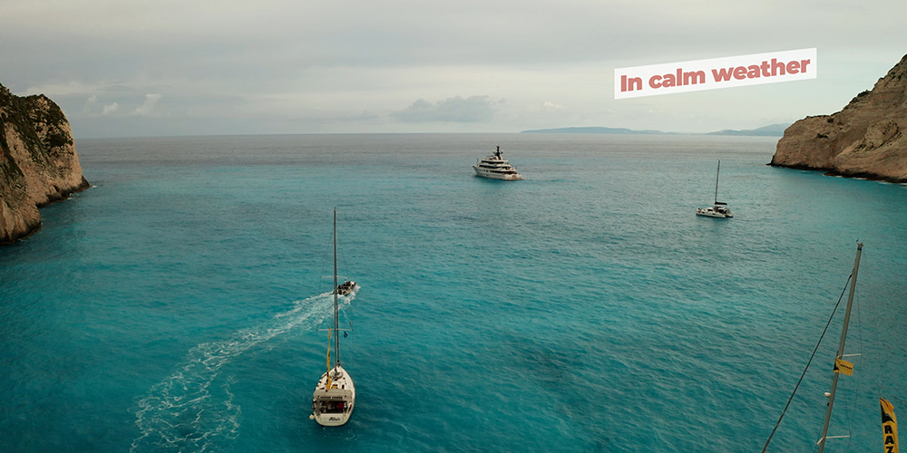
Crowds: 50+ boats can be in the cove at peak times in summer. For a quieter visit, arrive at 09:00 before the day-tripper fleet shows up — or after 17:00 when they leave.
⚠ Watch: The beach is partially closed off due to falling-rock danger from the cliffs above. Stay away from the foot of the cliff and observe any roped-off areas.
Pro Tips for Porto Vromi
Lunch stop, not overnight. Treat Porto Vromi as a calm-day swim and lunch — three or four hours, then move on. Overnight here in any unsettled forecast is asking for trouble.
Pay for a local mooring. The cost is small. The reduction in stress is large. Anchoring on the cove’s bottom is a recipe for dragging or fouling on debris.
Shipwreck early. If you want a Shipwreck Beach photo without a hundred other boats, you need to be at Navagio by 09:00. By 11:00 it’s a parade.
Plan the retreat. Before you commit to the cove, know your fallback. The natural retreat from this part of the coast is back south to Port Zakynthos or north to Agios Nikolaos.
Drone photo from above. The cove and Shipwreck Beach are spectacular from a low drone — but check current Greek drone rules (registration, permits) before flying. Rules change every few seasons.
Suggested Routes from Porto Vromi
North to Shipwreck & Agios Nikolaos
A morning calm-day passage 2 NM north to Shipwreck Beach, then continuing around the north tip to Agios Nikolaos & the Blue Caves — about 8 NM total. From there, into the more sheltered NE coast.
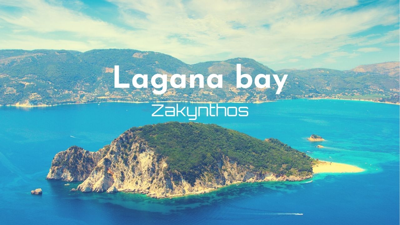
South to Lagana Bay
A long passage of about 15 NM south around the western tip of the island and into Lagana Bay Marine Park. Plan only on a calm-morning forecast — the west tip is fully exposed.
East via Port Zakynthos
Around the north tip of the island and down the east coast to Port Zakynthos — roughly 18 NM, generally a sheltered run on the east side of the island.
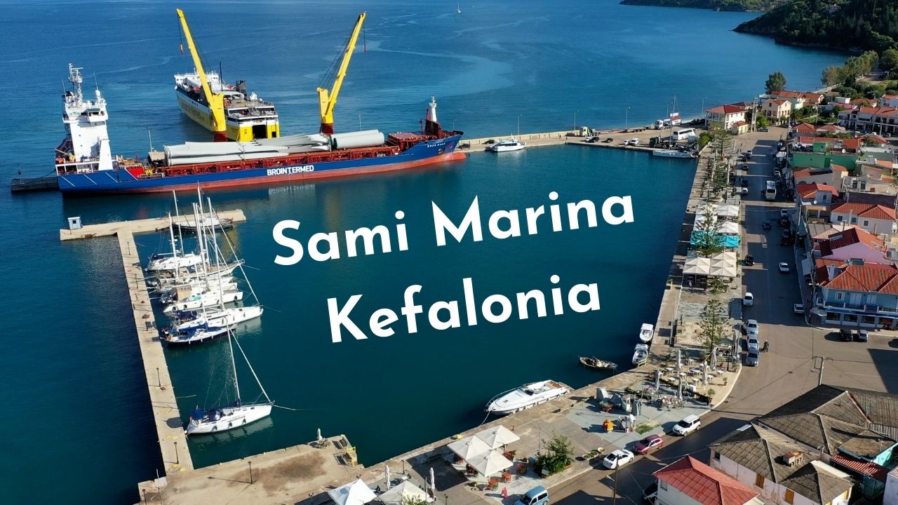
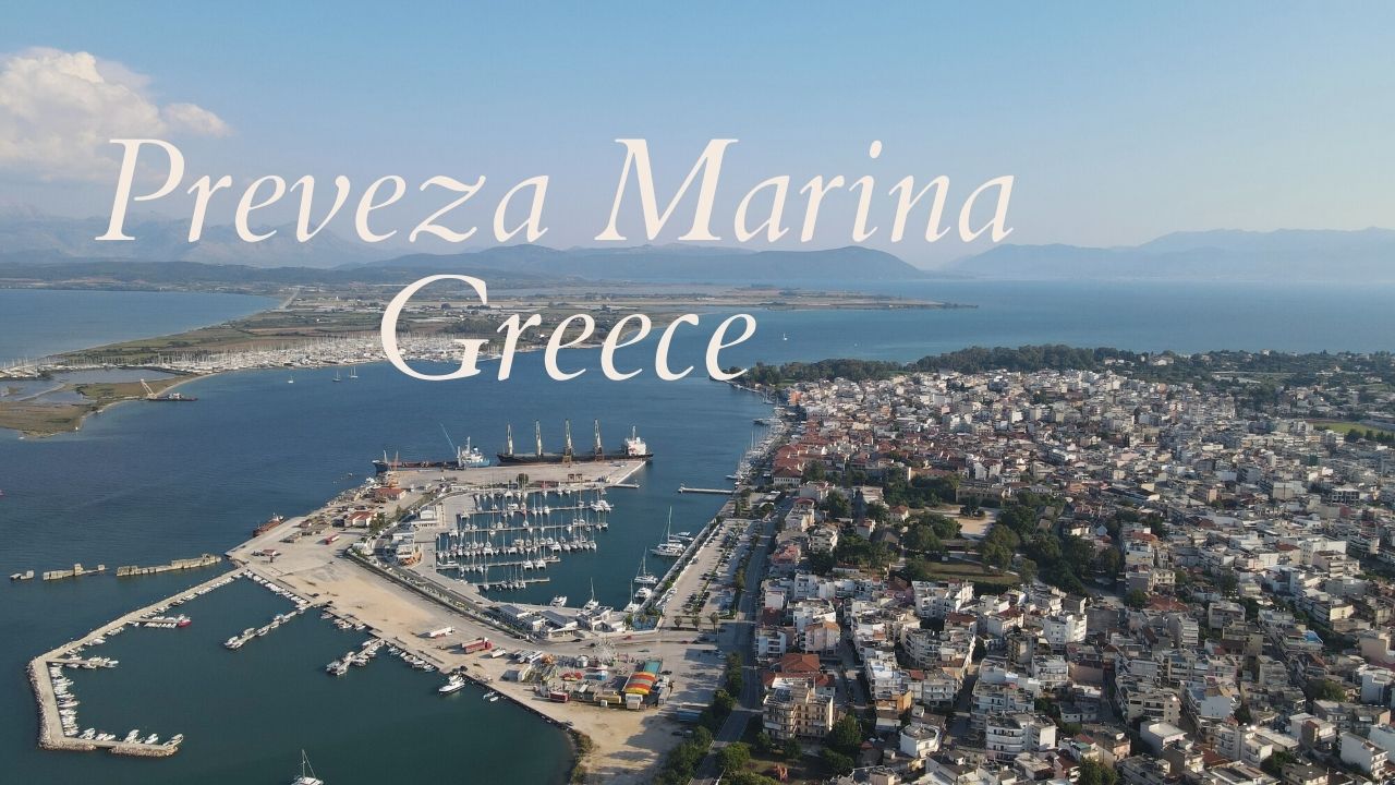
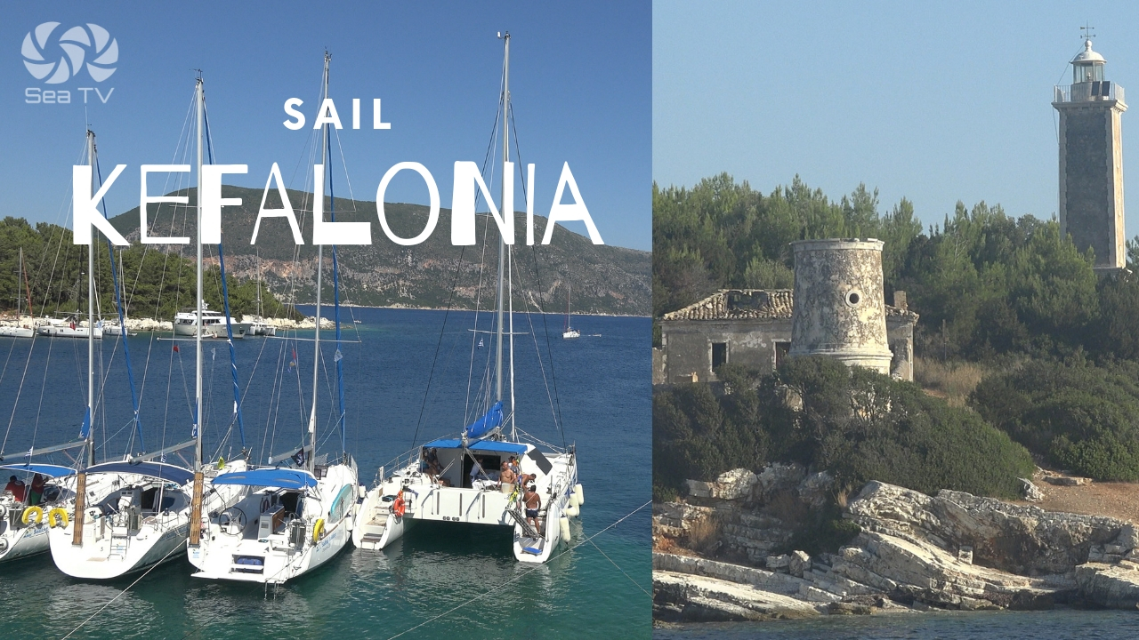
North to Kefalonia
For a longer charter passage: 25 NM north to Sami Marina on Kefalonia. Plan early start — the Zakynthos–Kefalonia channel can build chop quickly in the afternoon thermal.
For a full Zakynthos picture: Sail & Anchor around Zakynthos. For multi-day plans: 7-Day Ionian itinerary.
✅ Sailor’s Safety Checklist
▢ Forecast checked — no S/SW component for the planned stay
▢ Local mooring arranged on Ch. 09 (preferred) or long line ashore plan ready
▢ Snorkelled the bottom — anchor not on debris
▢ Fallback identified (Port Zakynthos / Agios Nikolaos)
▢ Crew briefed: not leaving the boat unattended
▢ VHF on Ch. 16 (Ch. 09 for local moorings)
Emergency Numbers — Zakynthos
European Emergency: 112
Coastguard Zakynthos (VHF Ch. 12): +30 26950 28117
Olympia Radio (VHF Ch. 03/86): Greek HF/VHF maritime service
Hospital Zakynthos: +30 26950 59100
Watch the SeaTV Visual Pilot Video
Drone footage of the cove from above, the cliffs of the NW coast, approach detail, and an overhead pass of Shipwreck Beach — Porto Vromi as you’d see it from the cockpit. Free for members.
Related SeaTV Pages
If you’re sailing the south Ionian, here are the SeaTV pages worth bookmarking — organised by area.
Zakynthos · Other Anchorages
→ Sail & Anchor around Zakynthos — full island overview
→ Port Zakynthos — main town quay & port of entry
→ Lagana Bay Marine Park — south coast turtle sanctuary
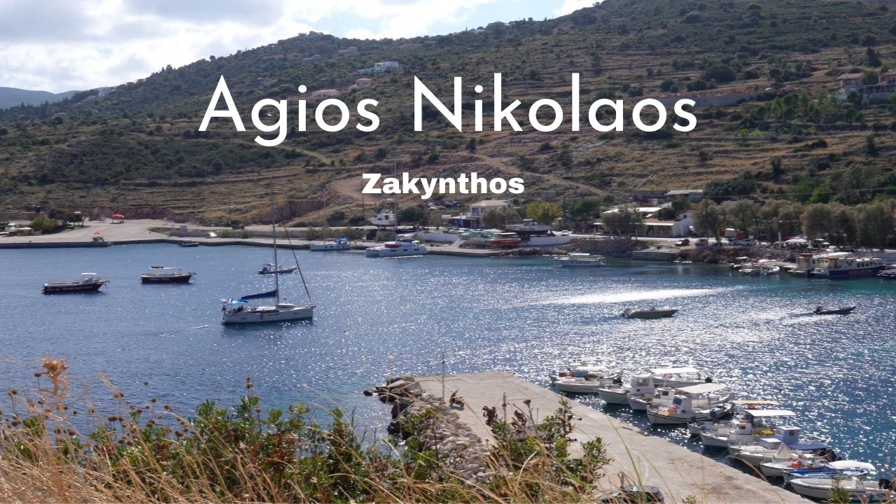
→ Agios Nikolaos & Blue Caves — north tip caves
Kefalonia · 25+ NM North
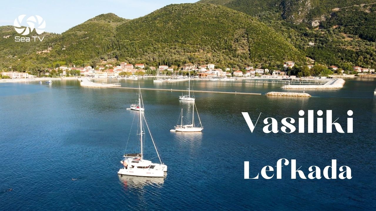
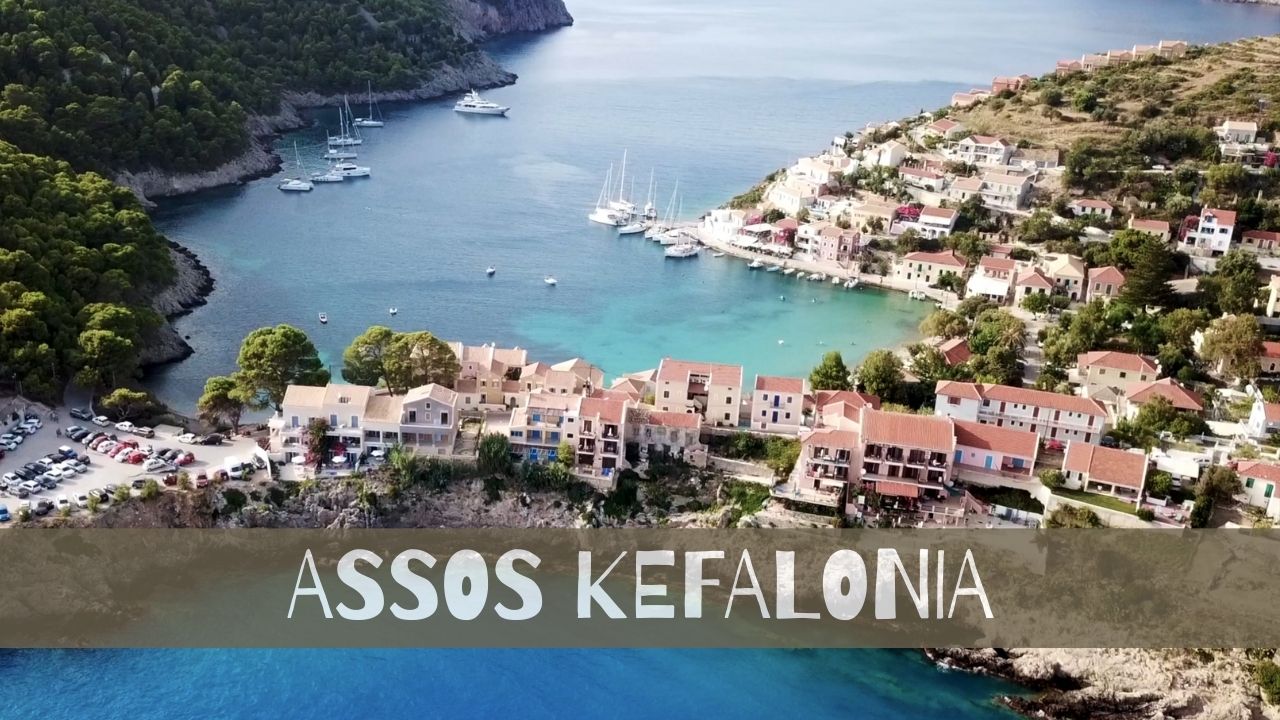
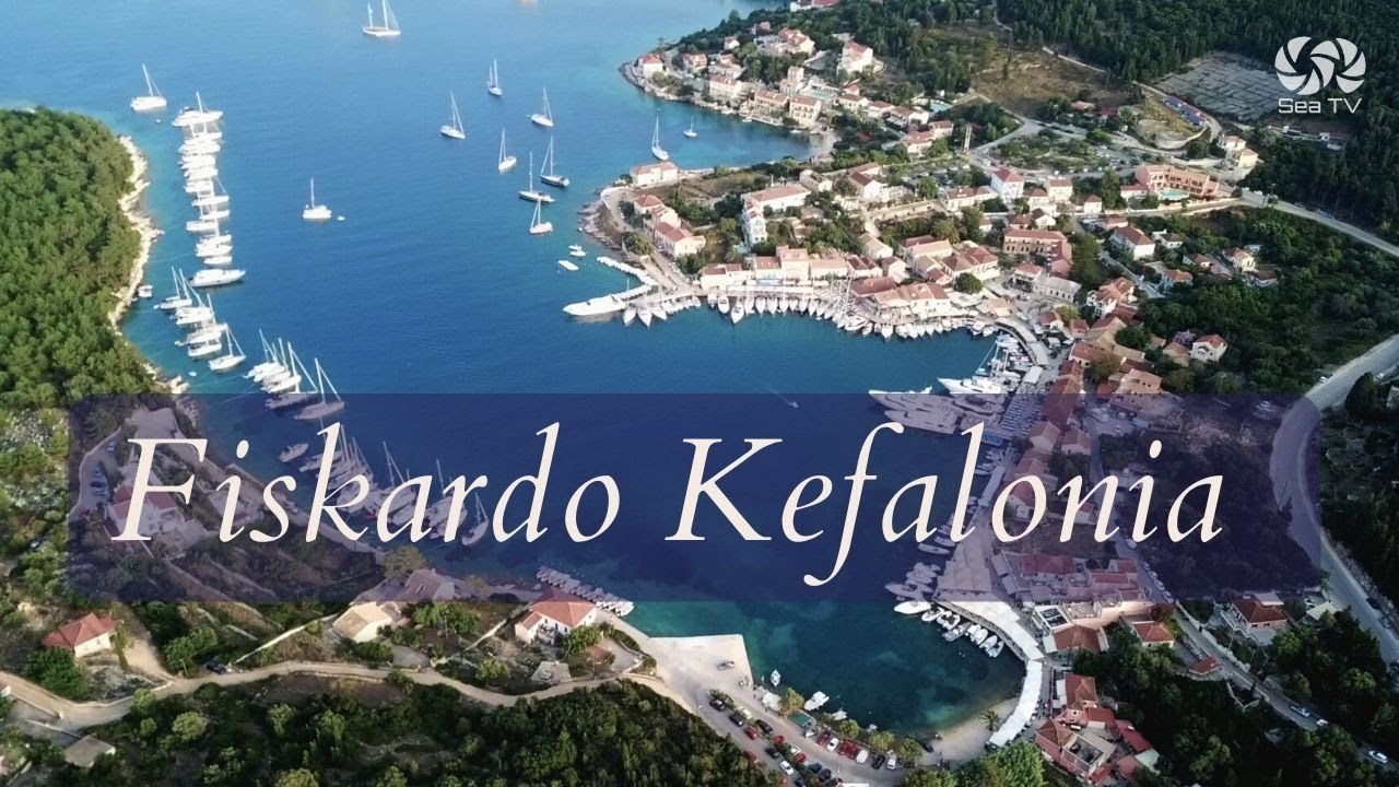
→ Kefalonia overview — Fiskardo, Sami, Assos, Myrtos
→ Sami Marina — east-coast service hub
→ Fiskardo — north-tip pastel village
→ Assos
Northern Ionian (For Longer Charters)
Continue your Zakynthos charter
South to Lagana Bay, east to the main port, or up around the north tip to the Blue Caves.
→ Ionian Islands hub · Blue Caves · Port Zakynthos · Lagana Bay
“Porto Vromi rewards the calm morning. Don’t ask it for more than that.”
— SeaTV Visual Pilot · Zakynthos Edition