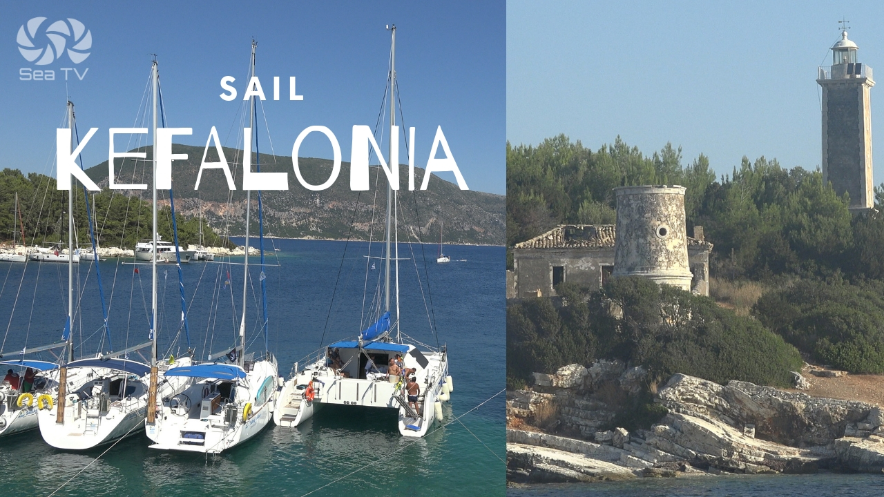
SeaTV · Ionian Islands · Kefalonia
Assos, Kefalonia — Sailing & Mooring Guide
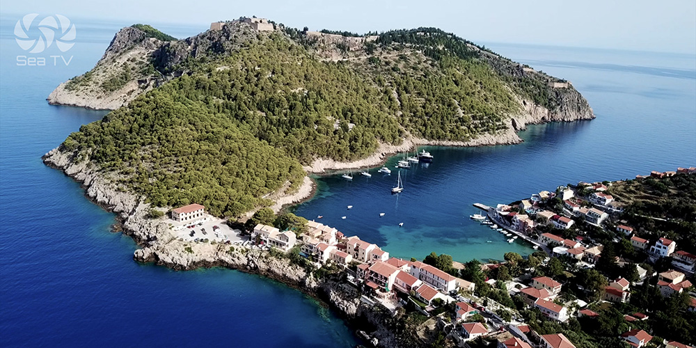
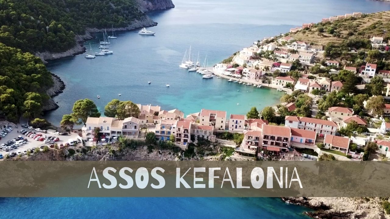
A 16th-century pastel village clinging to a Venetian-fortress peninsula on the west coast of Kefalonia — a daytime visit on calm days, a hard pass when the NW is up.
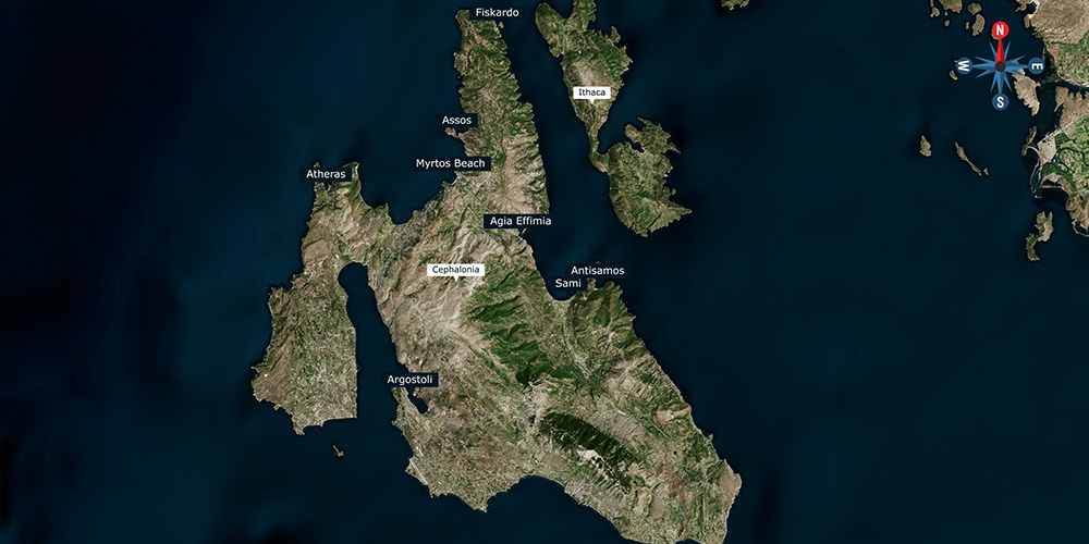
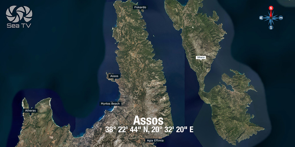
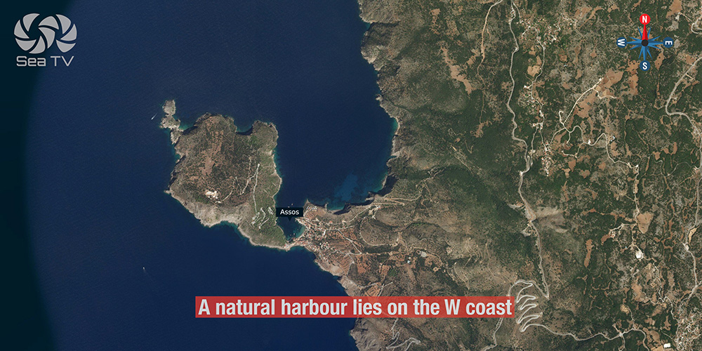
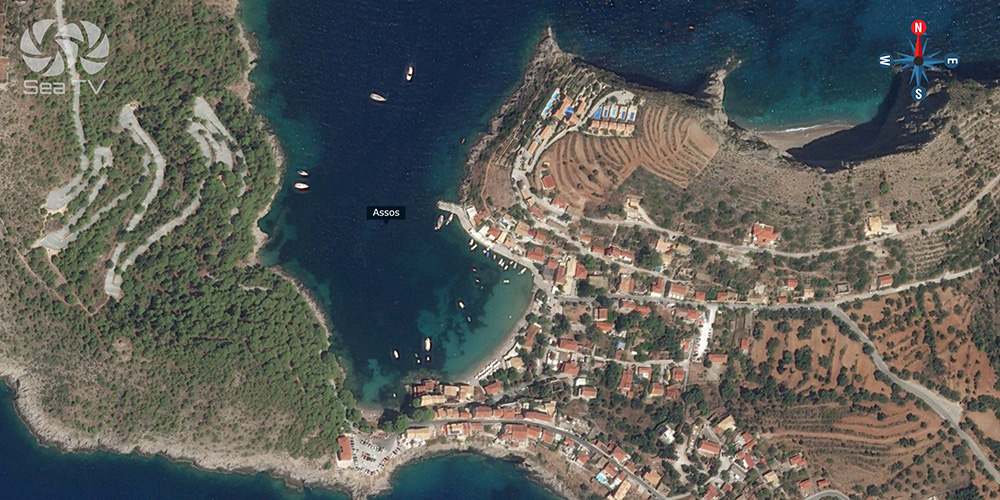
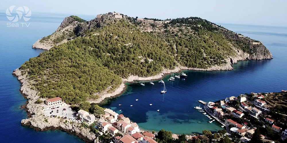
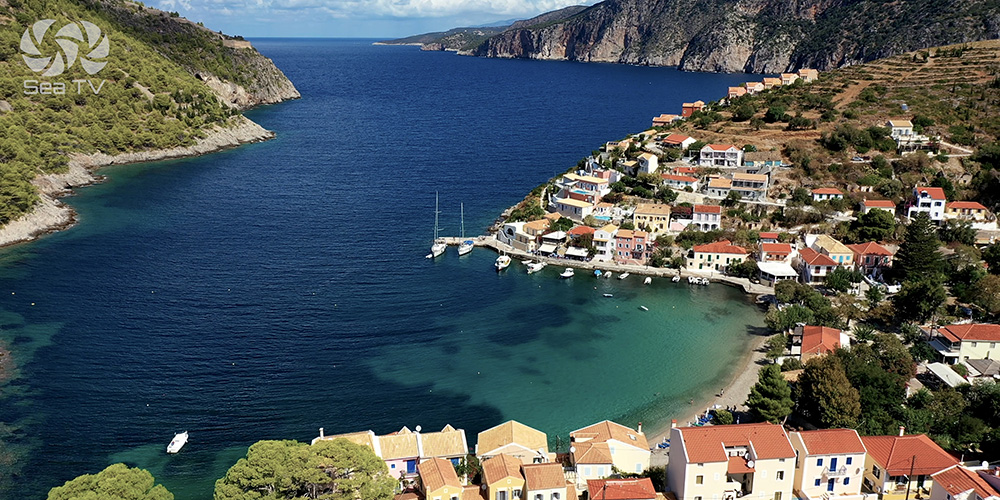
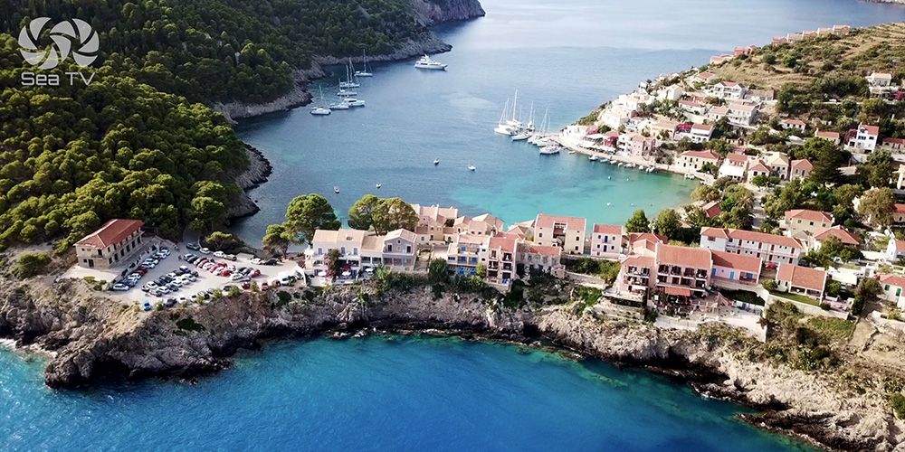
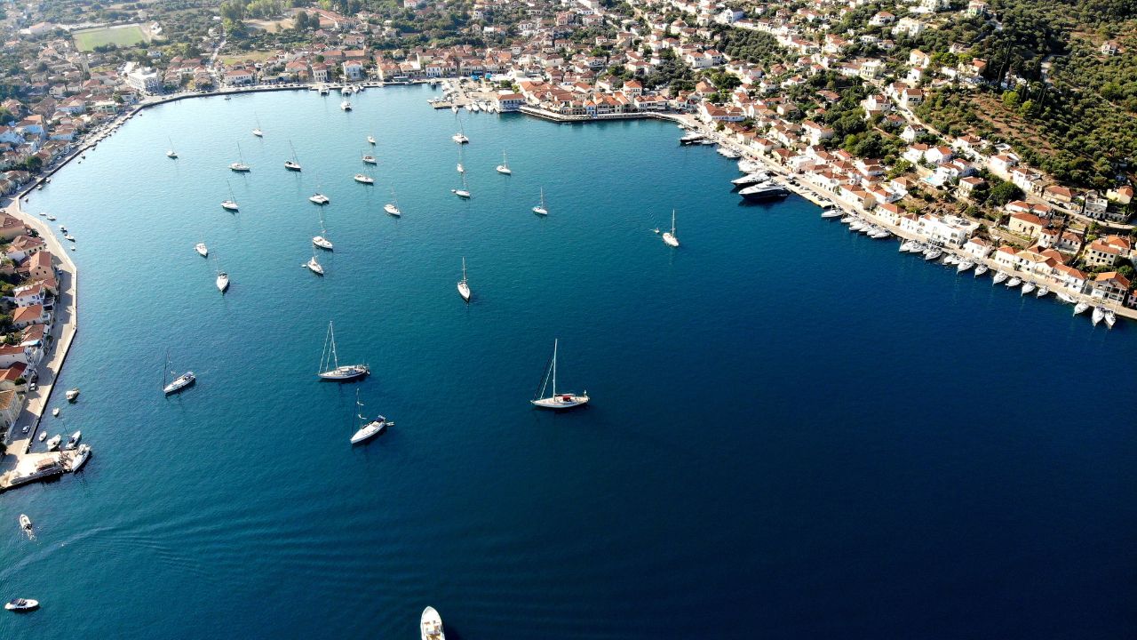
Assos sits on the rugged west coast of Kefalonia, in a small natural harbour formed by a peninsula crowned with the ruins of a 16th-century Venetian fortress. The village itself — a tight cluster of pastel houses around a tiny harbour and pebble beach — is the most photographed spot on Kefalonia after Myrtos Beach. For sailors, it’s a destination with strong limits.
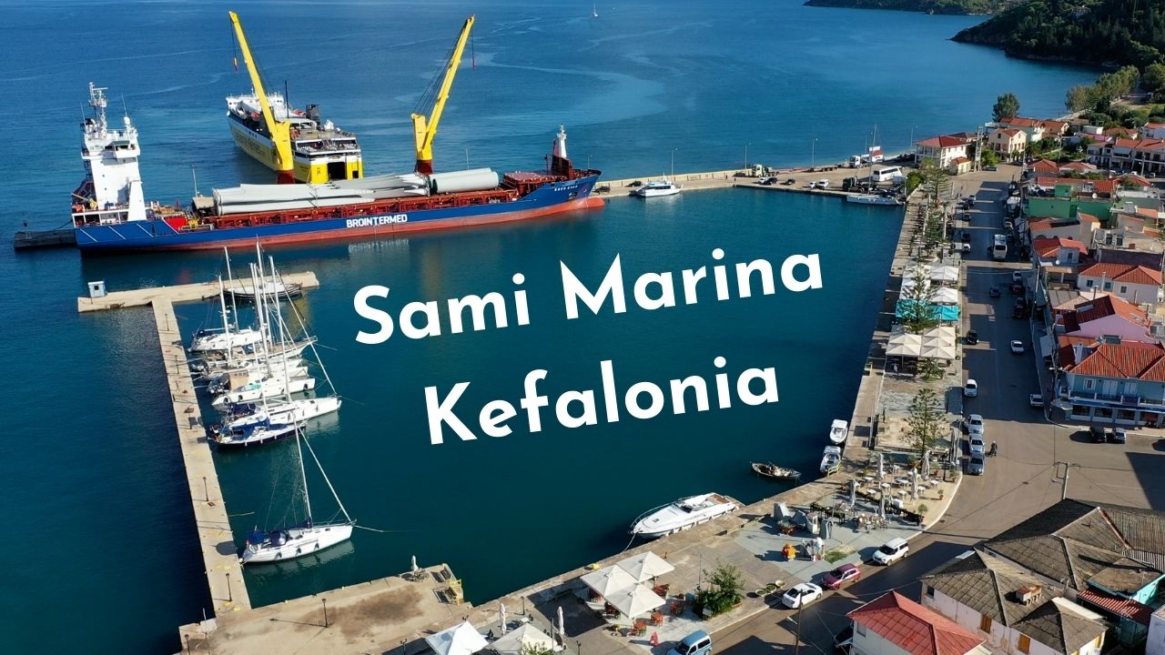
The harbour is small, the village quay tight, and the bay open to the north with no real shelter from the prevailing wind. In settled weather it’s a magnificent calm-day lunch stop or a careful overnight; in any kind of NW or N forecast, it’s uncomfortable, and there’s no nearby alternative on the west coast — the swell wraps around to the south side too. The closest reliable shelter is back across the island at Sami on the east coast.
⚠ Reality check: Assos has no nearby shelter. The bay is open to the north, holding is patchy, and a NW or N blow makes the anchorage untenable. The swell affects the south side too, so you can’t simply “duck round”. Always check the forecast before committing — and have Fiskardo or Sami identified as your bail-out.
⚓ Quick Facts for Sailors
Coordinates
38°22.73’N · 20°32.33’E
Position
West coast Kefalonia · natural harbour
Open To
North · swell also wraps to S side
Bottom & Holding
Mud · sand · weed · patchy
Best For
Calm-day lunch · settled-forecast overnight
Nearest Shelter
Fiskardo (NE) or Sami (SE) — both 12+ NM
Approach & Wind Notes
Visual landmarks
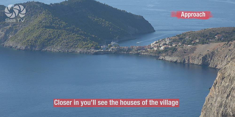
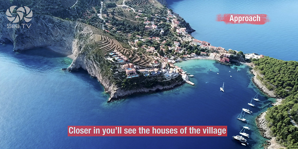
From offshore, the Venetian fortress ruins on top of the peninsula are visible from a long distance — sandstone walls and the silhouette of the fort crown the headland. Closer in, the pastel houses of the village come into view, lining the small bay. The harbour itself is tucked at the head of the cove.
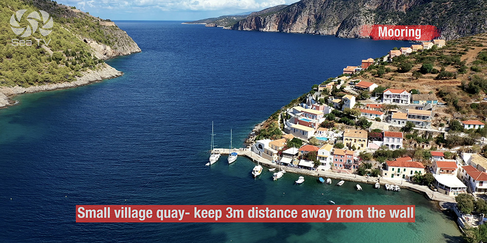
Open to the north
The harbour faces north — straight into the prevailing summer wind. In settled forecasts (light morning, weak afternoon thermal) the bay is workable. In any meaningful NW or N blow, swell rolls in directly and the anchorage becomes uncomfortable to untenable.
Swell on the south side too
Don’t expect to take shelter on the south side of the bay if the wind comes up. The west-coast swell wraps around the headland and affects both sides — there’s no lee corner here.
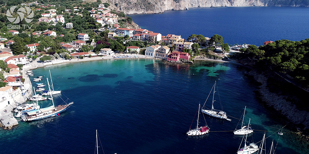
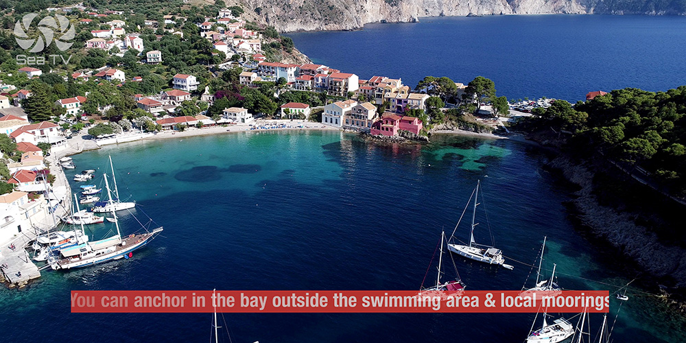
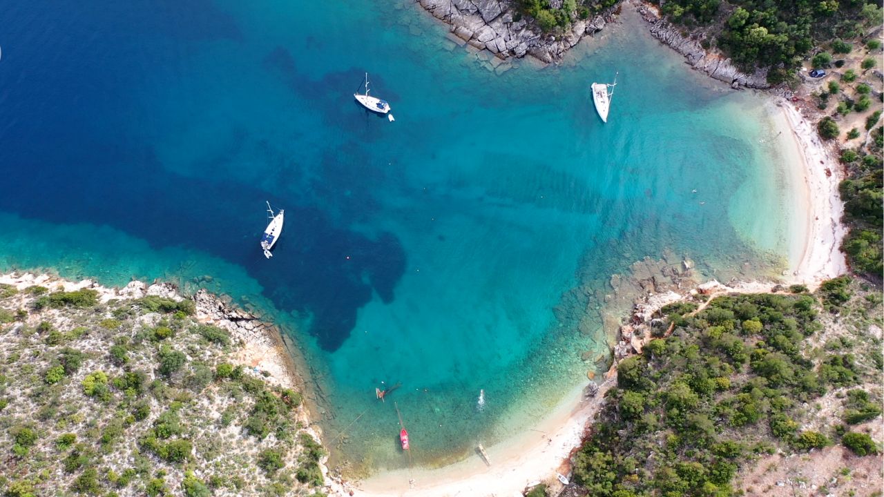
Swimming zone
There’s a marked swimming zone in the bay — refer to your Navionics chart for the boundaries. Anchor outside it. Local moorings sit in the inner part of the bay; anchor outside them as well.
⚓ Mooring Options
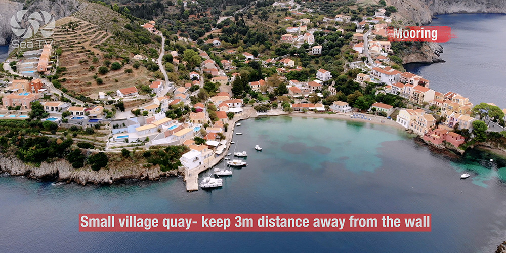
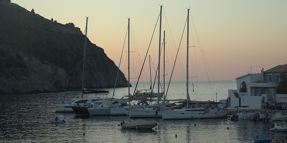
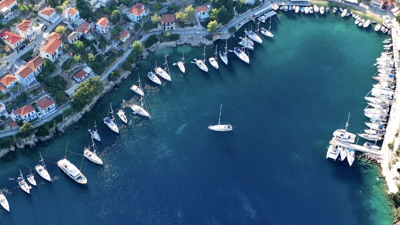
Small Village Quay · Tight Spot
Stern-to the Village Quay
A small stone quay at the head of the village, accommodating a few yachts at most in season. Very limited space — first come, first served.
Berthing: Stern-to with own anchor. Keep the boat 3 m off the wall — there are submerged stones along the quay base that will damage the rudder or transom if you back too close.
Best for: A planned overnight in settled weather to walk up to the fortress at sunset.
⚠ Watch: Stones at the base of the wall — set the stern lines long enough to keep clearance. The quay fills early in season.
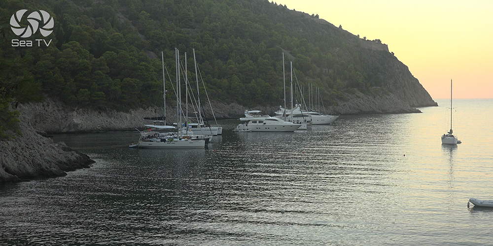
Bay Anchorage · Long Line Ashore
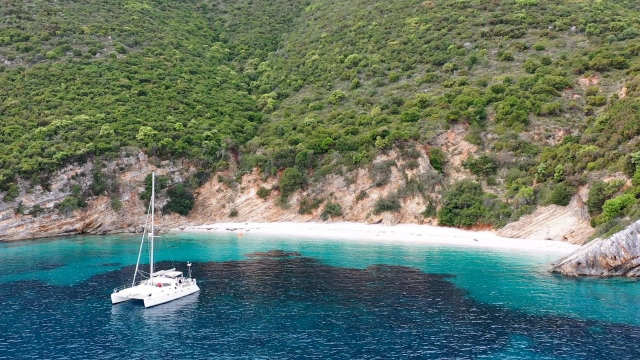
Anchor in the Bay (Outside Swimming Zone)
In the wider bay, outside the marked swimming area and clear of the local moorings, you can anchor with a long line ashore.
Anchoring: Drop in 6–10 m on mud/sand/weed. Take a long line ashore to a fixed rock for a stable position.
Holding: Patchy — not everywhere holds well. Set the anchor properly, snorkel to confirm if you can. Move and reset if the first drop doesn’t bite.
⚠ Watch: Stay outside the swimming zone (Navionics-marked) and the cluster of local moorings. With strong NW the swell makes anchoring uncomfortable; with no near shelter, plan to leave.
Shore & Facilities
Provisioning: Limited — small village shops only, fine for bread, fruit, water, basic supplies. For real provisioning, head to Sami on the east coast.
Water & fuel: No quay services. Top up at Fiskardo or Sami.
Tavernas: A few tavernas along the harbour-front and on the way up to the fortress road — quality is reasonable, prices are tourist-influenced.
Where to Eat — Sailors’ Picks
Assos has only a handful of tavernas, all clustered around the small harbour-front. Standards are decent for a village this size. The setting — eating with the fortress lit above the bay at dusk — is the real draw.
Platanos
A village classic by the small square — Greek menu, fresh fish, traditional stews. Sit outside if you can. [link]
Nefeli’s
A smaller spot up one of the village lanes — family-run, slower service, the kind of evening you wanted. [link]
Pro Tips for Assos
Settled forecast only. Don’t commit to Assos for an overnight unless the forecast is light NW or calm. The cost of misjudging is a 12 NM bash to Fiskardo or Sami in the dark.
Walk up to the fortress. A 25-minute walk from the village brings you to the 16th-century Venetian fortress on top of the peninsula. Sweeping views over the bay and the wild west coast — best at sunset.
Three metres off the wall. The submerged stones at the base of the village quay are real — keep the boat 3 m off when berthing stern-to. Long stern lines, watch the bow swing on the anchor.
Anchor + line ashore. If the village quay is full, the bay anchorage with a long line ashore is the next-best option. A free-swinging anchor in patchy holding here is asking for a 03:00 dragging episode.
Lunch stop, not destination. If the forecast is uncertain, treat Assos as a half-day visit — arrive 11:00, lunch ashore, walk to the fortress, leave at 15:00 for an east-coast overnight at Fiskardo or Sami.
Suggested Routes from Assos
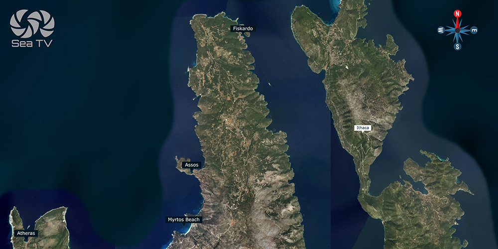
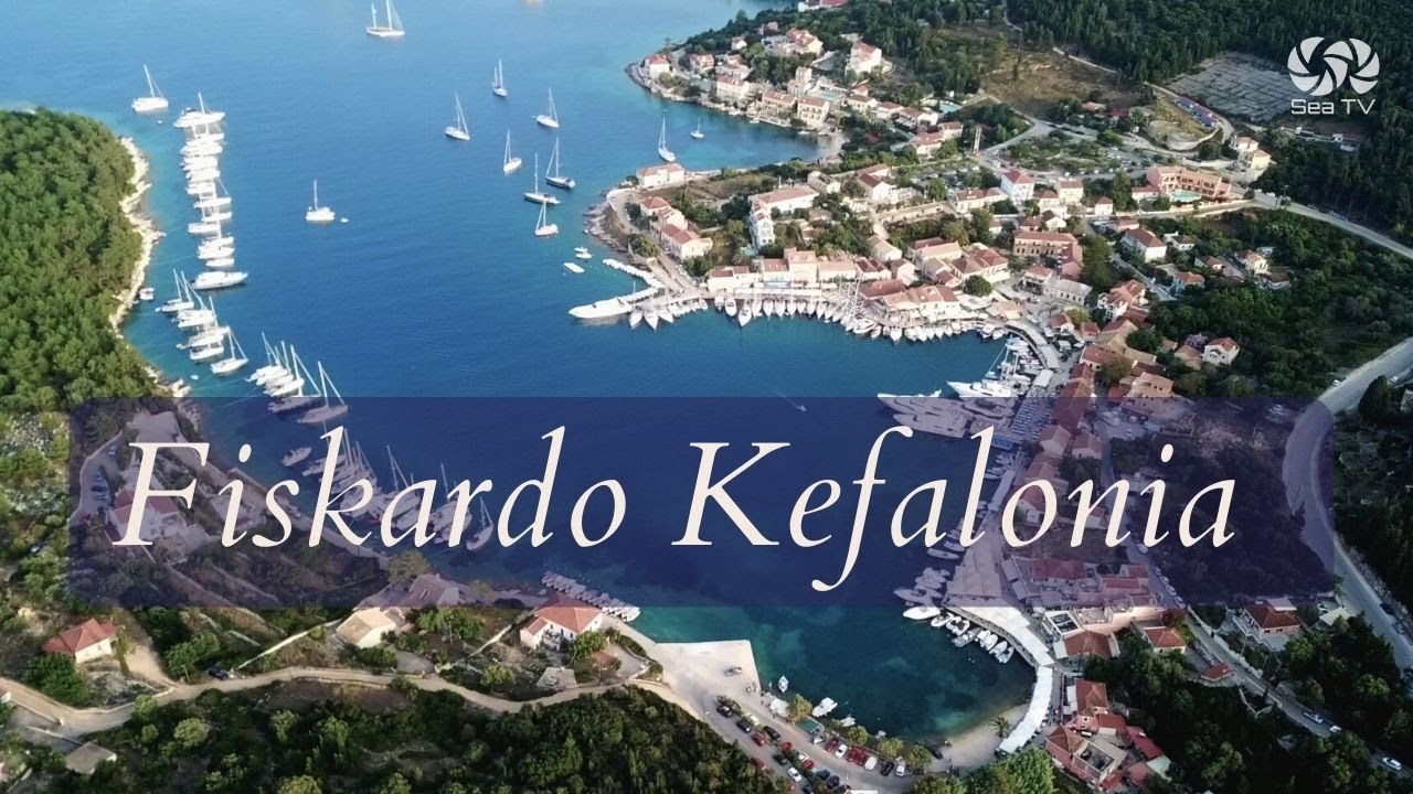
North to Fiskardo (12 NM)
Up the west coast and round the NE tip to Fiskardo — the most photographed harbour in the Ionian and the safest overnight on the north end of Kefalonia.
SE to Sami (15 NM)
Round the NE tip and down the east coast to Sami Marina — the main service port for the island, full provisioning, and the launching point for visits to Melissani Cave.
North to Lefkada
A longer leg north to Vasiliki on the south coast of Lefkada (25 NM), or further to Lefkas Marina via the inner Ionian.
Visit Myrtos Beach by sea
Just 2 NM south of Assos — Myrtos Beach is the iconic Kefalonia photograph. Calm-day lunch anchorage only, never overnight. Drop in 6–10 m on sand a respectful distance off the beach.
For full overview: Kefalonia overview. For multi-day plans: 7-Day Ionian itinerary.
✅ Sailor’s Safety Checklist
▢ Forecast confirmed light NW / calm before committing to overnight
▢ Plan B identified (Fiskardo or Sami)
▢ Swimming zone plotted on chartplotter (Navionics)
▢ 3 m clearance from village quay wall (stones)
▢ Long line ashore prepared if anchoring in bay
▢ Anchor bite confirmed (snorkel if possible — patchy holding)
Emergency Numbers — Kefalonia
European Emergency: 112
Coastguard Sami (VHF Ch. 12): +30 26740 22031
Coastguard Argostoli: +30 26710 22224
Olympia Radio (VHF Ch. 03/86): Greek HF/VHF maritime service
Argostoli Hospital: +30 26713 60100
Watch the SeaTV Visual Pilot Video
Drone passes over the Venetian fortress, approach footage from offshore, the village harbour from above, and the manoeuvre into the small quay — Assos as you’d see it from the cockpit. Free for members.
Related SeaTV Pages
If you’re sailing Kefalonia or planning a southern Ionian charter, here are the related SeaTV pages — organised by area.
Kefalonia · Other Anchorages
→ Fiskardo — most photographed harbour in the Ionian
→ Sami Marina — east-coast service hub
Ithaca · Across the Channel
Continue your Kefalonia charter
North to Fiskardo, SE to Sami, or down to Ithaca — east-coast shelter when the west turns.
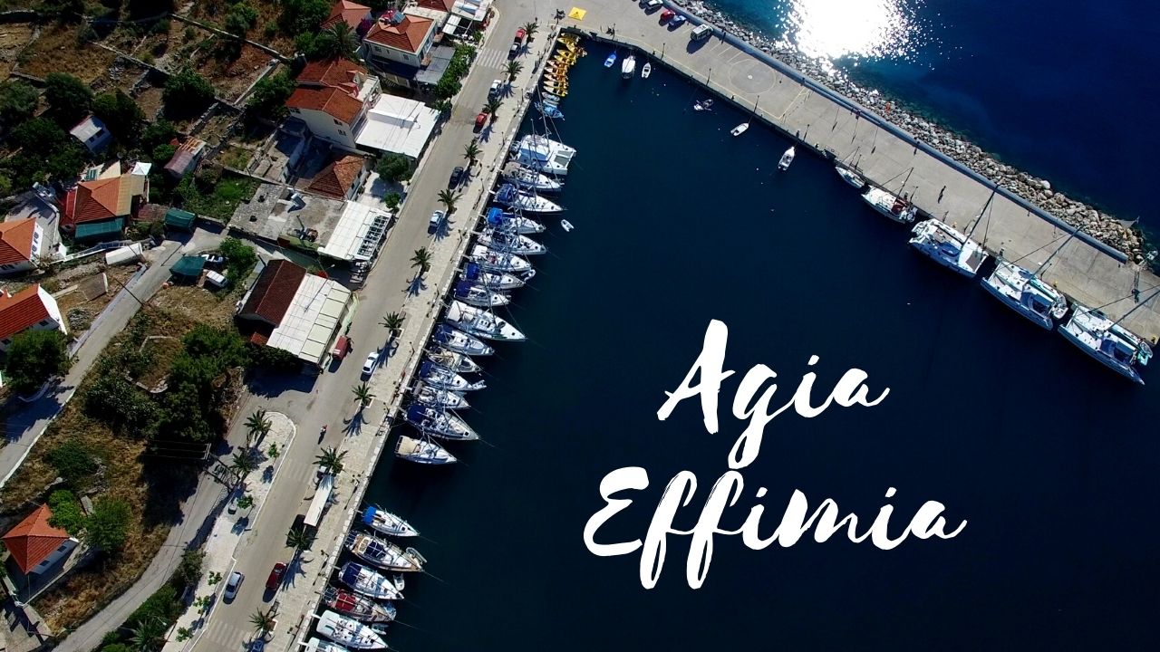
→ Kefalonia overview · Fiskardo · Sami · Agia Effimia
“Assos is for the calm-day picture and the fortress walk. Don’t make it the night plan.”
— SeaTV Visual Pilot · Kefalonia Edition