SeaTV · Greece · Dodecanese Islands · Rhodes Island
Rhodes Island — UNESCO Old Town, Lindos Acropolis & the Largest of the Dodecanese
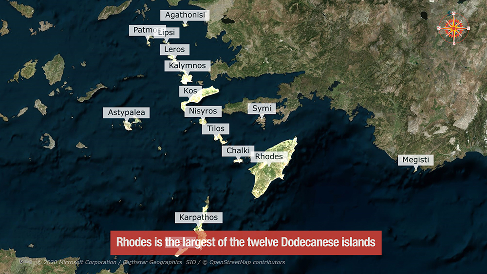
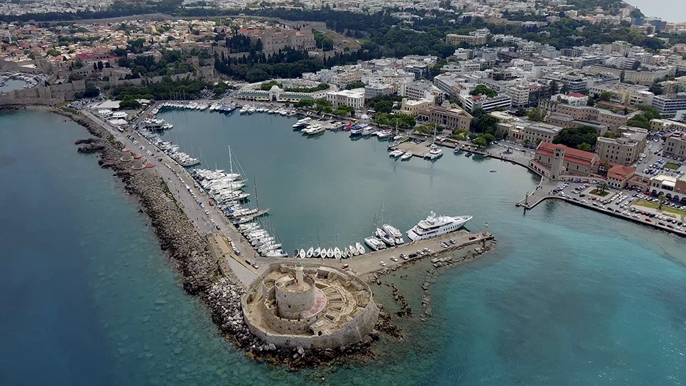
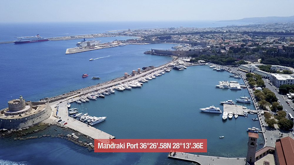
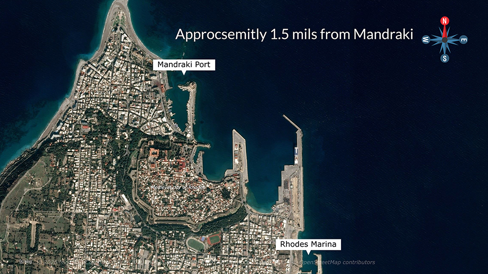
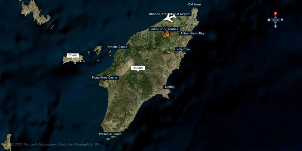
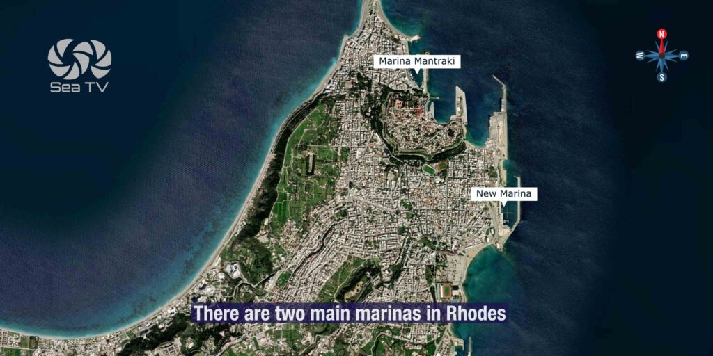
The largest of the twelve Dodecanese islands and the southeastern corner of the Aegean. UNESCO medieval old town from the Knights of St John (1309-1522) · the Lindos cliff-top acropolis 24 NM SE · Italian colonial nineteen-thirties architecture overlaid on the medieval ramparts · turquoise SE-coast bays · the windsurfers’ Prassonisi at the southern tip. Two main mooring options: Mandraki Port (historic, NE tip, 36°26′.58N · 28°13′.36E, VHF Ch 09, max LOA 40 m, max draft 3.5 m, ⚠ shoals + N reef) and Rhodes Marina (modern, 1.5 NM S of Mandraki).
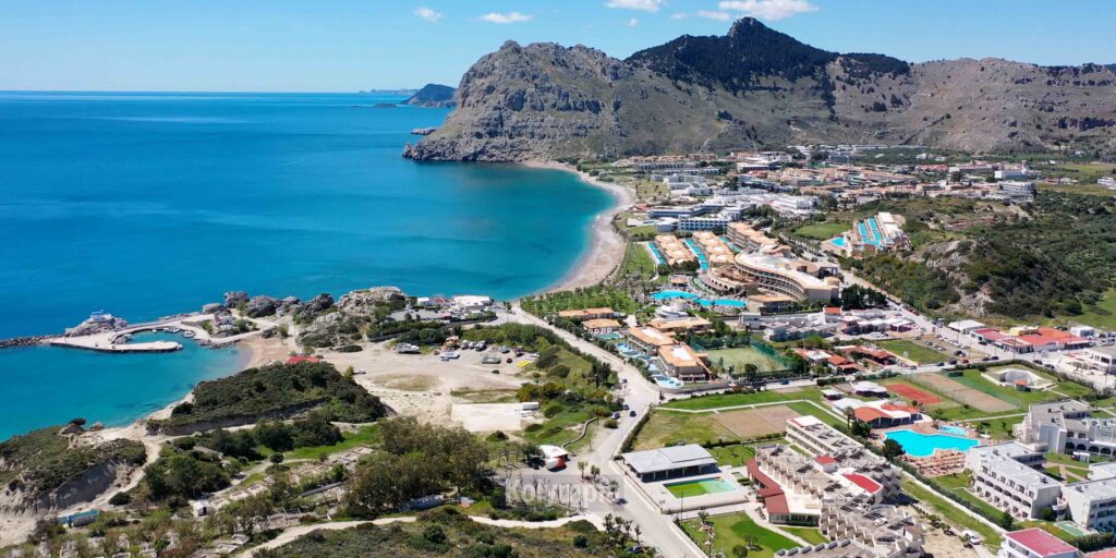
Rhodes is the largest of the twelve Dodecanese islands · the city of Rhodes offers a cluster of pastoral SE-coast bays with strikingly turquoise water, the medieval old town that sits behind UNESCO-listed Knights’ ramparts, and the layered Italian-era architecture overlaid on top. The eastern coastline holds the most-visited bays (Anthony Quinn, Lindos), the southern tip at Prassonisi draws windsurfers and kitesurfers, and the inland sites (Butterflies Valley, Kritinia and Monolithos castles) round out a layered island visit. Two SeaTV-recommended mooring options cover the sailing side: the historic Mandraki Port at the medieval old town and the modern Rhodes Marina 1.5 NM south.
⚠ Reality check:
→ Mandraki: shoal water + reef N of entrance · careful approach
→ Mandraki: very crowded in summer · book in advance · no mooring lines
→ Rhodes Marina: care at entrance in strong winds
→ Pick Mandraki for the historic-old-town walk · Marina for capacity and modern services
⚓ Rhodes at a Glance
Position
SE corner of Aegean · largest Dodecanese island
Mooring options
Mandraki + Rhodes Marina
UNESCO
Old Town (medieval Knights’ city)
Cliff-top site
Lindos Acropolis · 24 NM SE
Surf spot
Prassonisi · southern tip
Cross-border
~25 NM E to Marmaris (Turkey)
⚓ The Two Sailing Bases
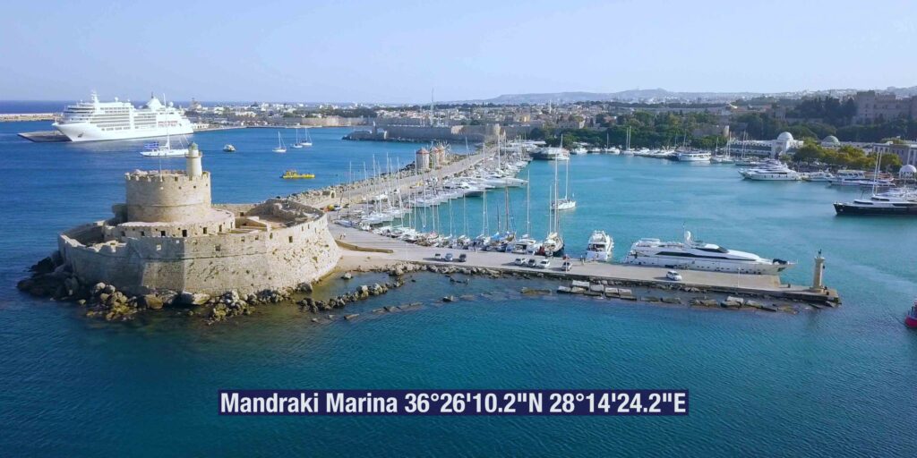
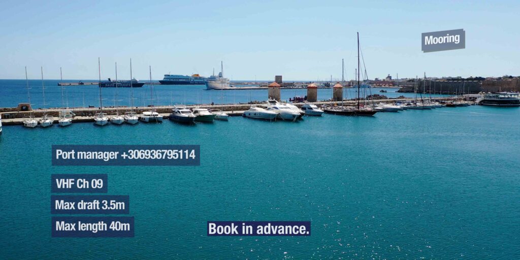
Mandraki Port · 36°26′.58N · 28°13′.36E · VHF Ch 09
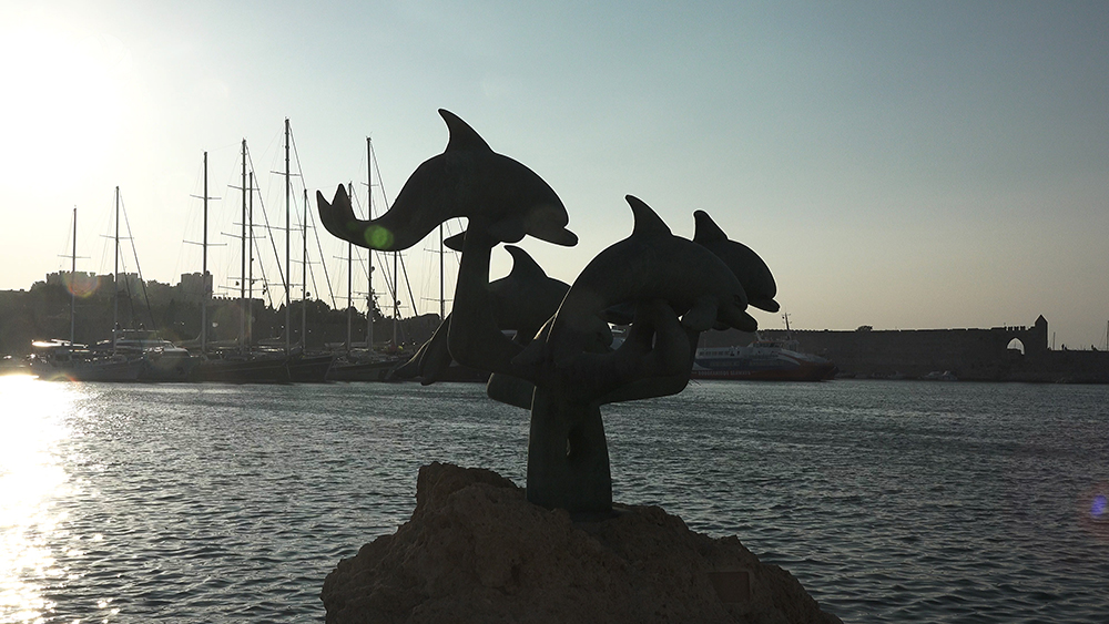
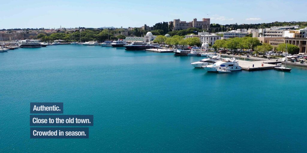
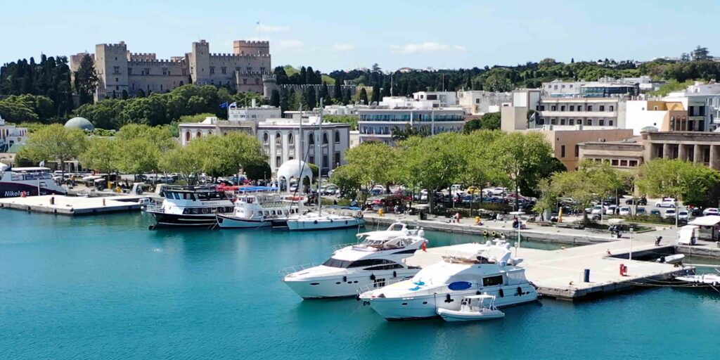
Mandraki Port — Historic Harbour at the Old Town
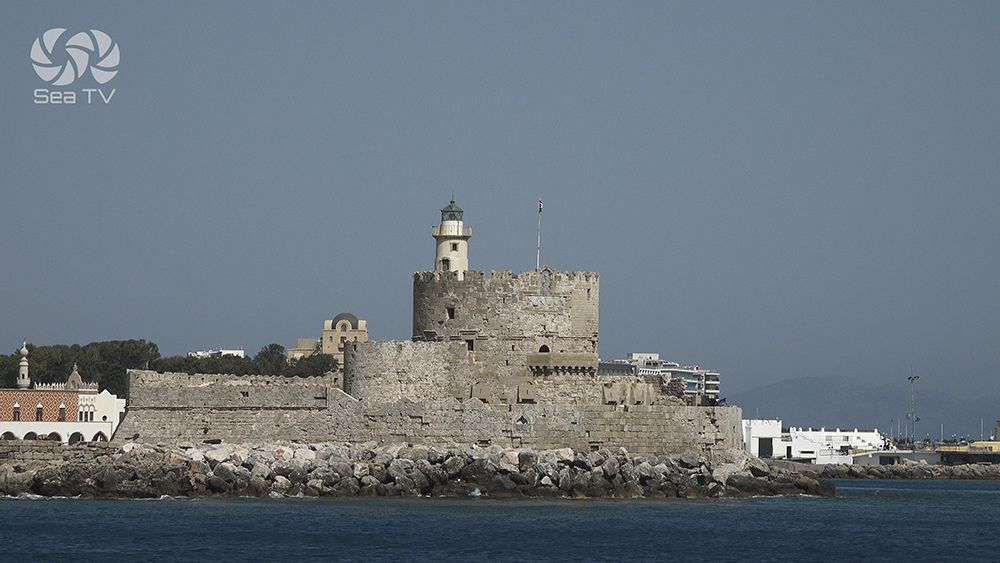
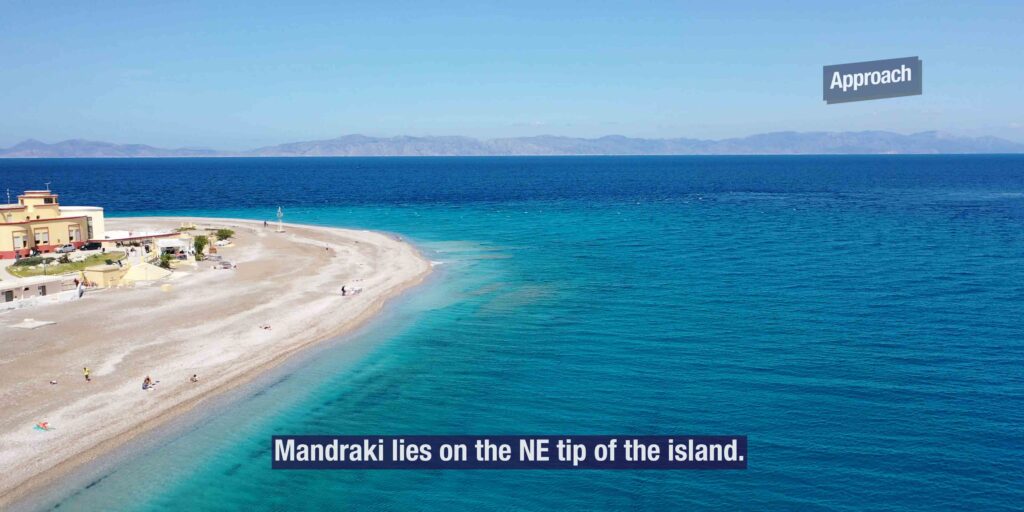
Position: NE tip of the island · directly in front of the medieval Knights’ ramparts and the modern town · 36°26′.58N · 28°13′.36E.
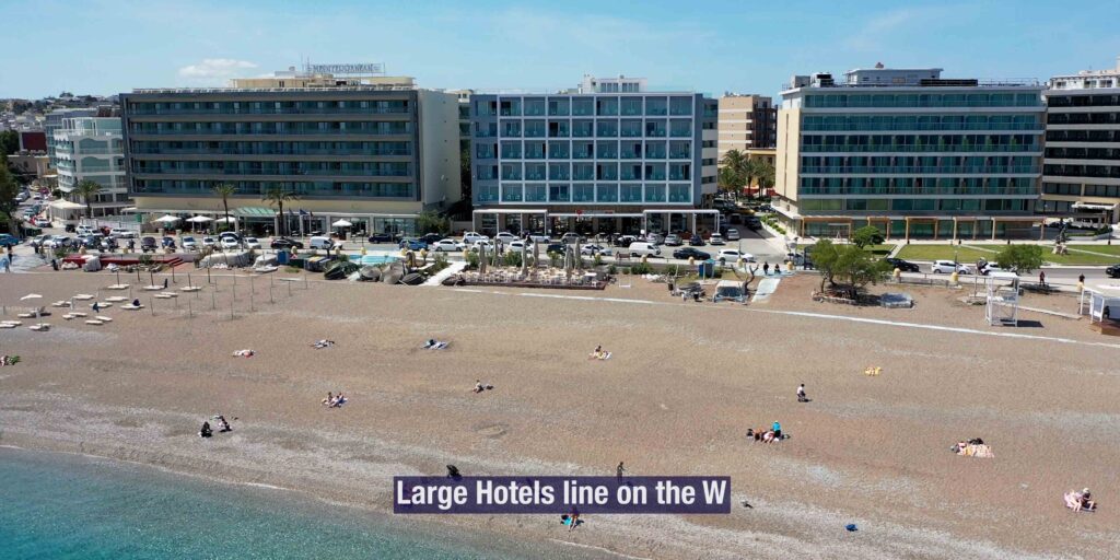
Approach: Large hotels line the W approach.
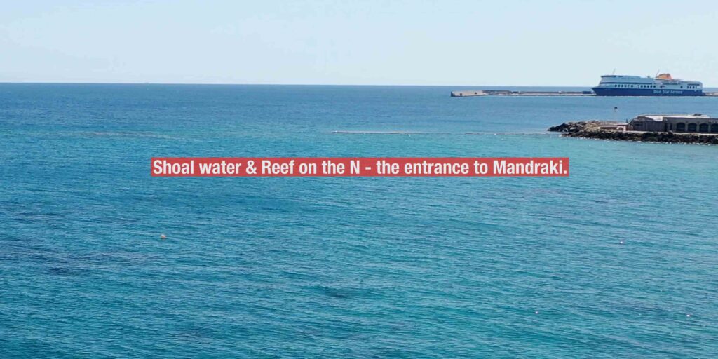
⚠ Care needed: Shoal water + reef on the N · the entrance to Mandraki is the hazard zone · plot before approach.
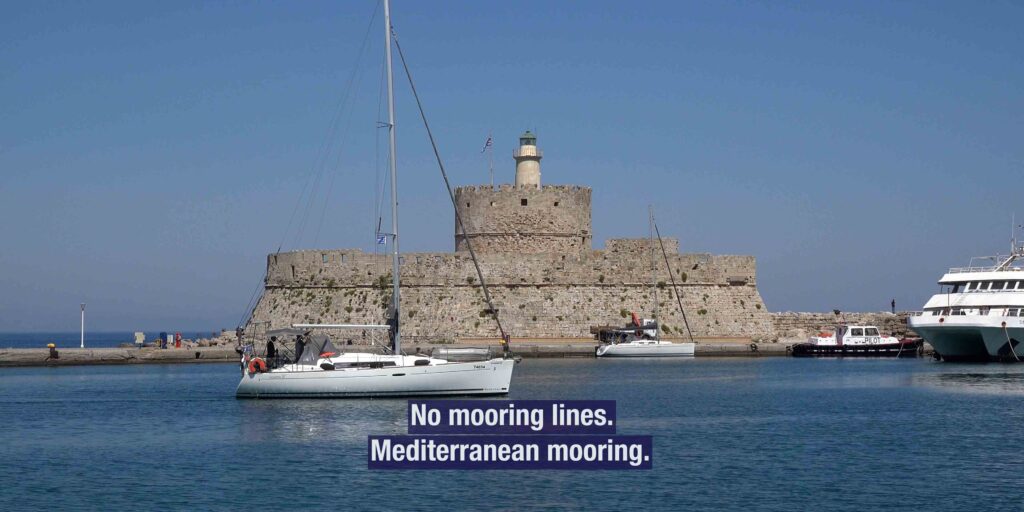
Specs: VHF Ch 09 · max draft 3.5 m · max LOA 40 m · book in advance · no mooring lines.
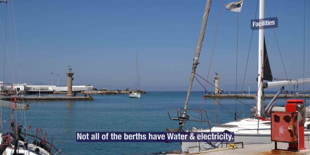
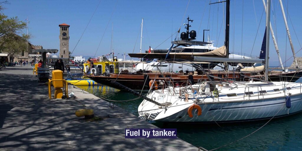
Facilities: Water + electricity on some quays · fuel by tanker.
⚠ Very crowded in summer · advance booking essential.
Why use Mandraki: Walking distance to the UNESCO old town · the Colossus of Rhodes historical entrance with the bronze deer statues · the medieval atmosphere right at the quay.
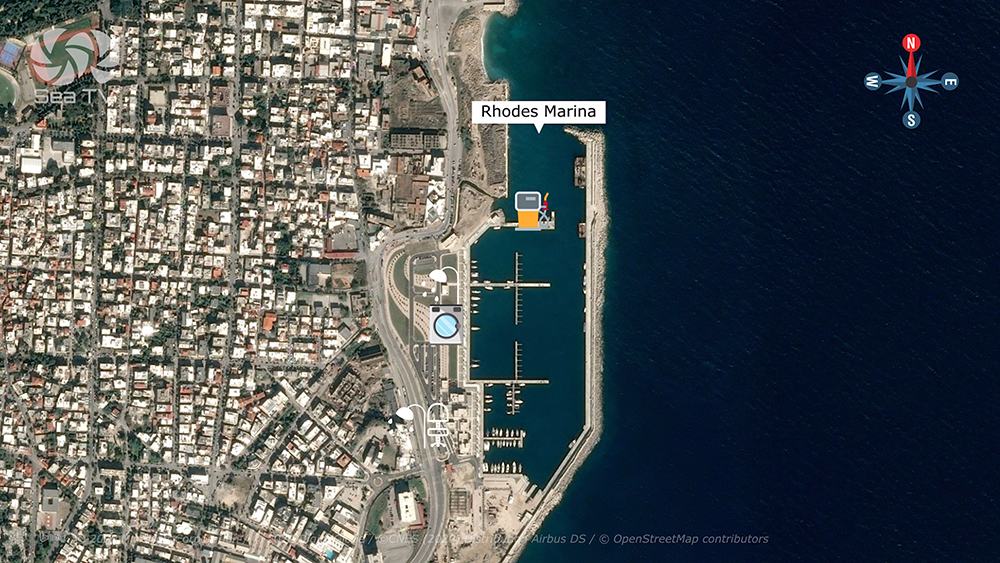
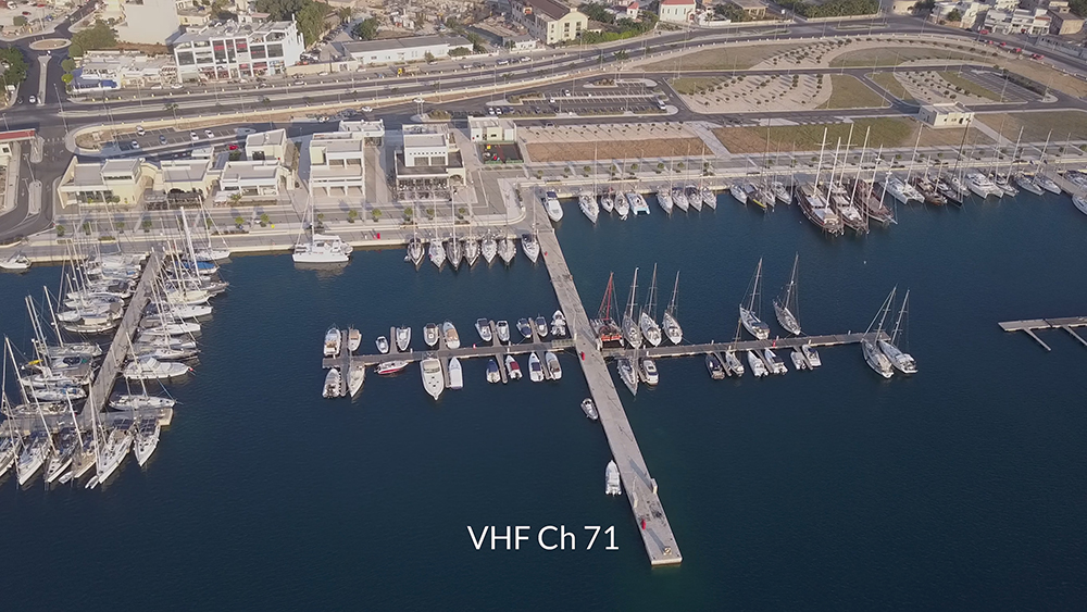
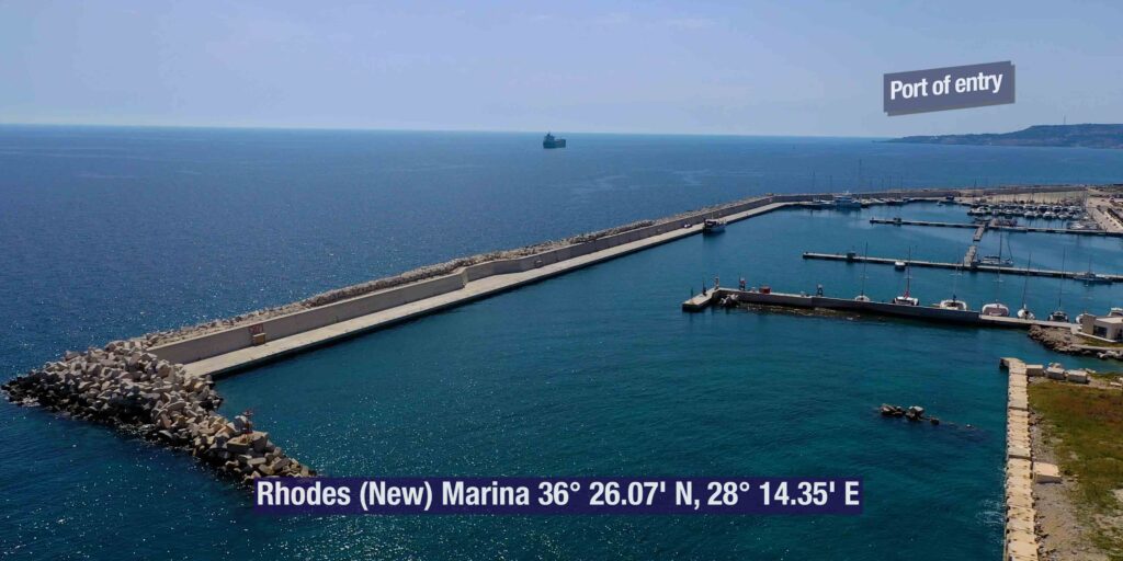
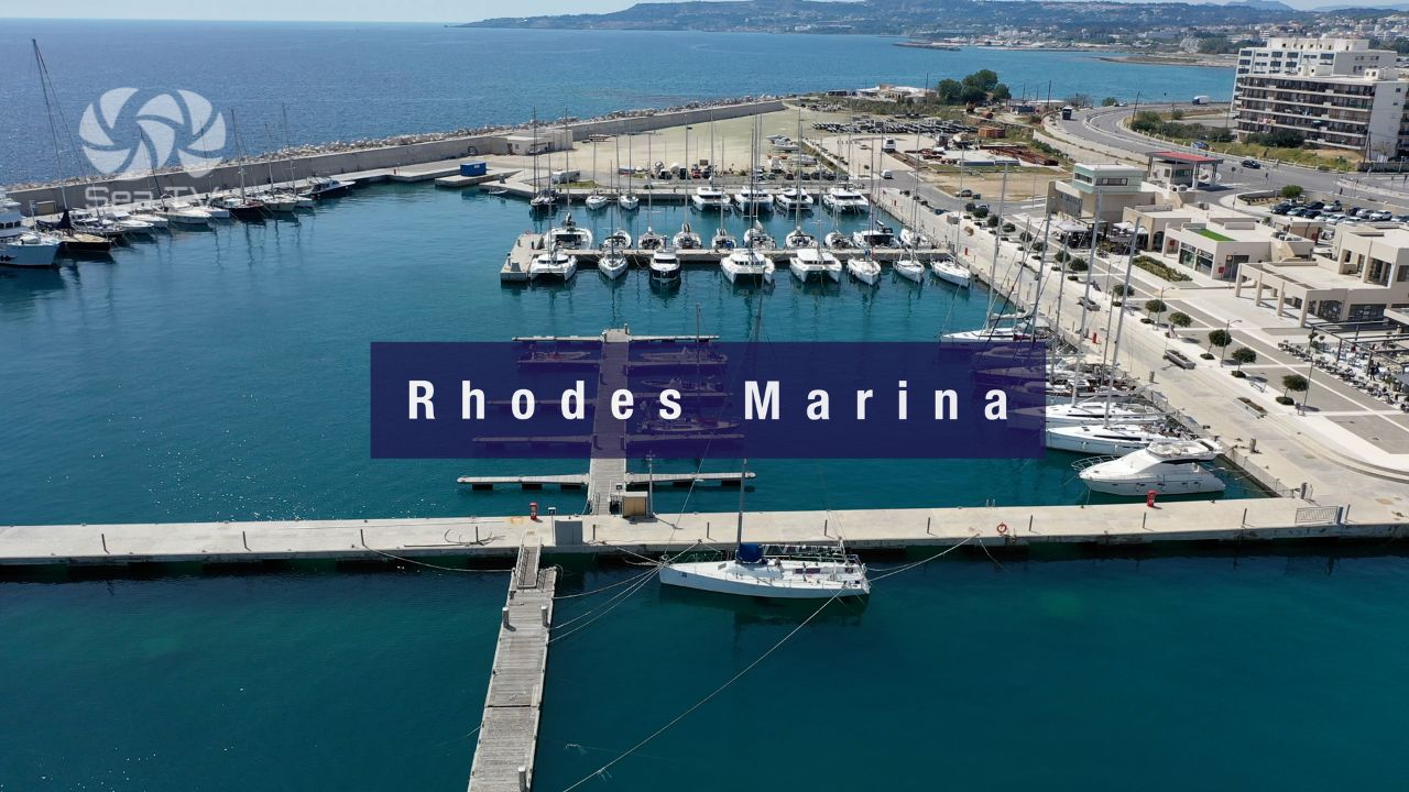
Rhodes Marina · 36°26′.16N · 28°14′.26E · VHF Ch 71
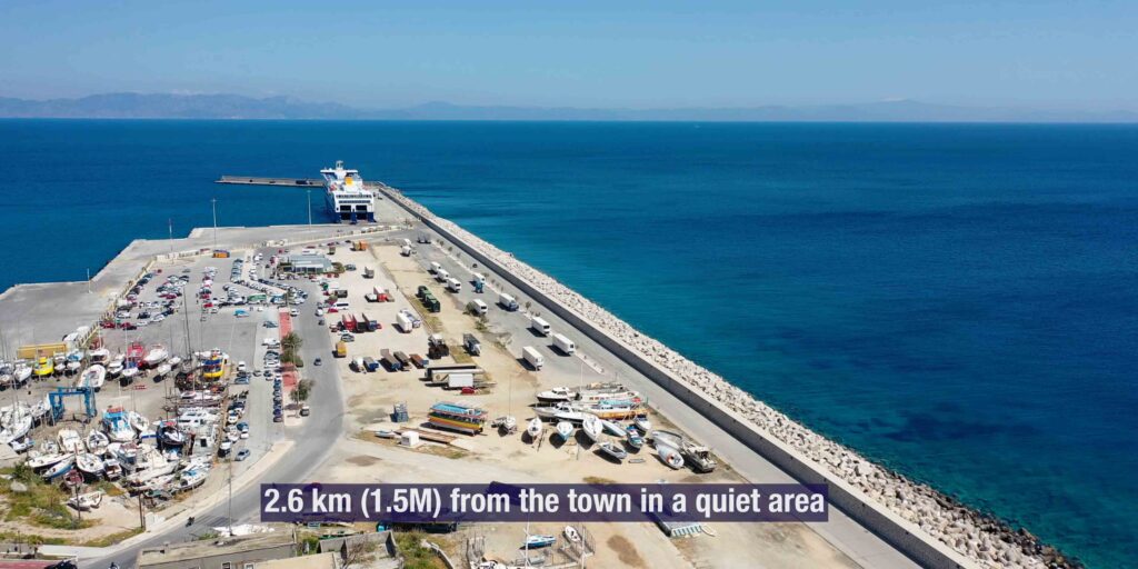
Rhodes Marina — Modern, 1.5 NM S of Mandraki
Position: 1.5 NM S of Mandraki · in a quieter area on the SE side of Rhodes town · 36°26′.16N · 28°14′.26E.
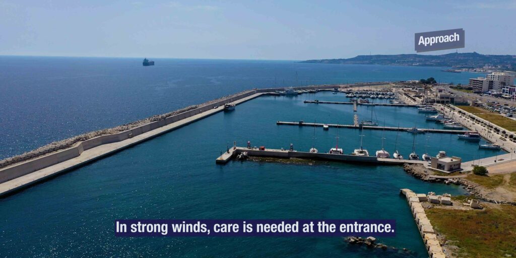
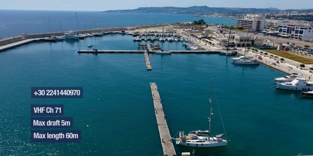
Specs: VHF Ch 71 · phone +30 2241 440970 · max draft 5 m · max LOA 60 m · marina crew assigns berth · water + electricity at quay · fuel at the entrance.
⚠ In strong winds: Care is needed at the entrance.
Full detail: See Rhodes Marina.
Mandraki or Rhodes Marina?
Mandraki Port — for the historic atmosphere and direct walking access to the old town · max LOA 40 m, max draft 3.5 m · advance booking essential. Best for shorter yachts and visitors who want the medieval experience right at the quay.
Rhodes Marina — for capacity, modern facilities, and SE-coast day-sailing access · max LOA 60 m, max draft 5 m · marina crew handles berth assignment · taxi or short hired-car ride into the old town. The default choice for larger yachts and longer stays.
The Old Town & Cultural Visits
The UNESCO Old Town
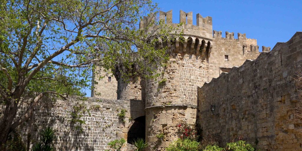
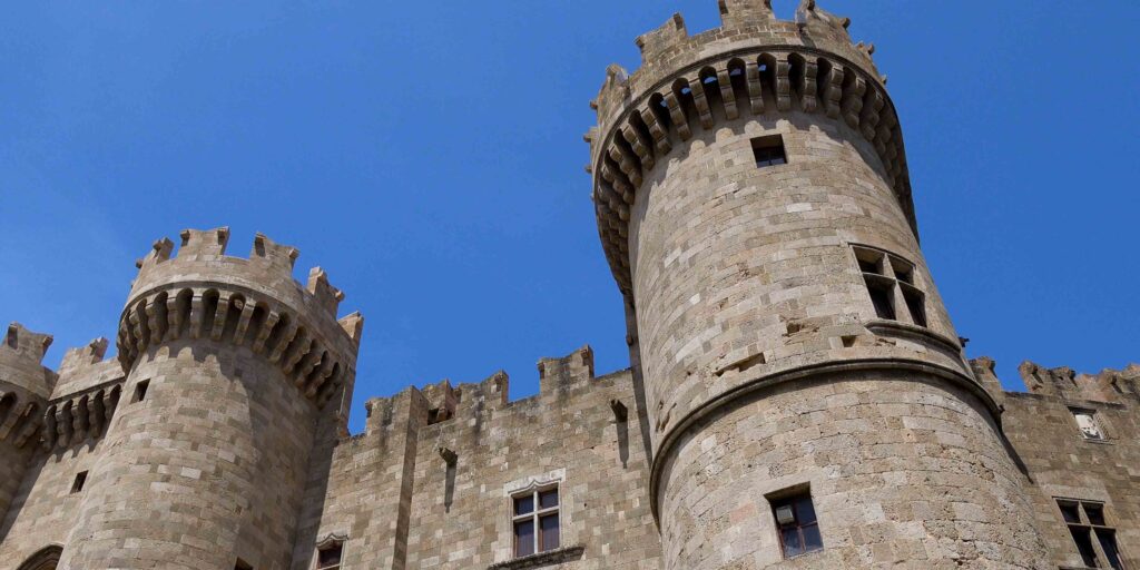
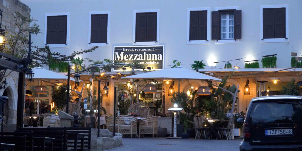
The old town holds a layered medieval atmosphere · the Knights of St John ruled Rhodes from 1309 to 1522 and built one of the largest medieval walled cities in Europe. Walk around in the twilight when the heat eases · the ramparts, the Palace of the Grand Master, the Street of the Knights with the Inns of the Tongues (national chapter houses), and the Hospital of the Knights all survive. Restaurants and shops fill the alleys today, but the medieval shape is intact.
Lindos · ~24 NM SE
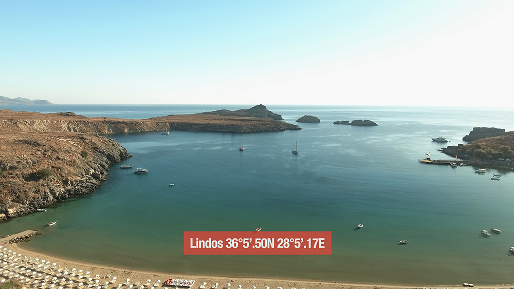
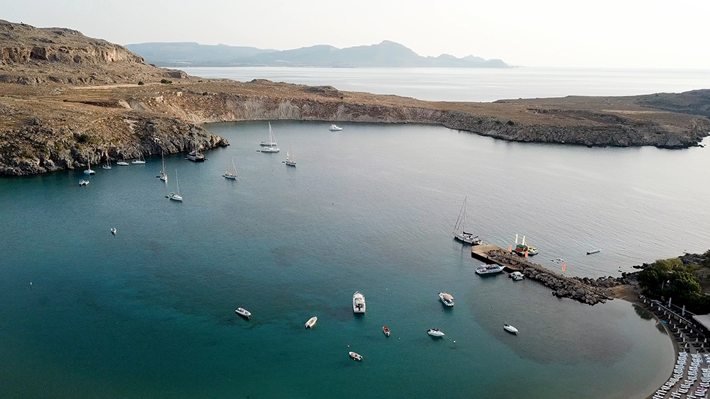
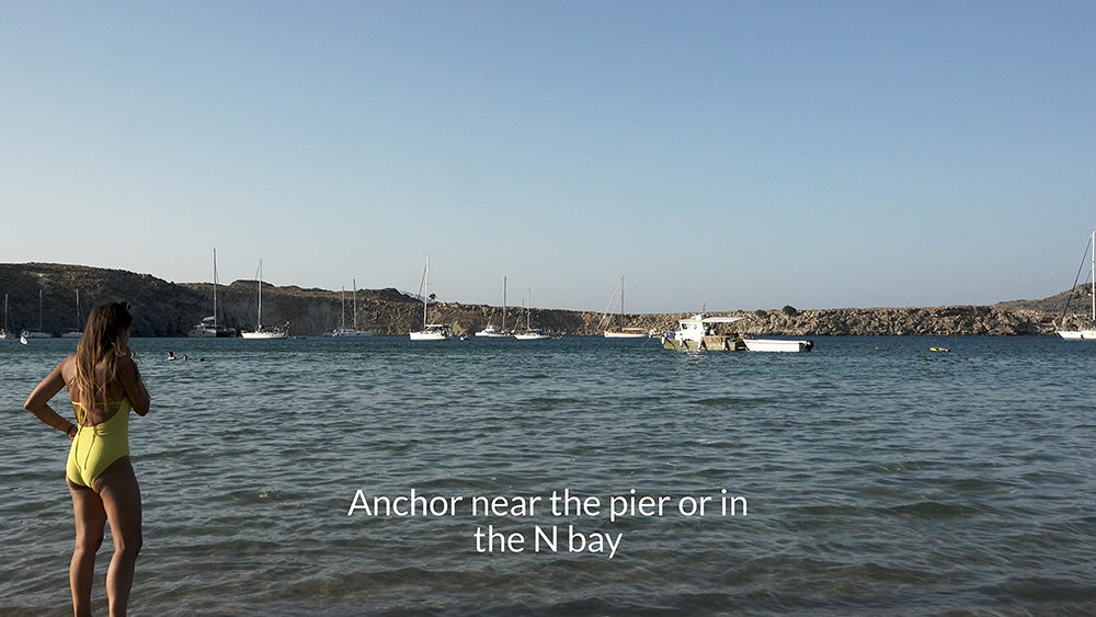
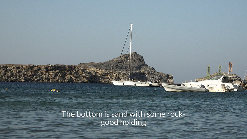
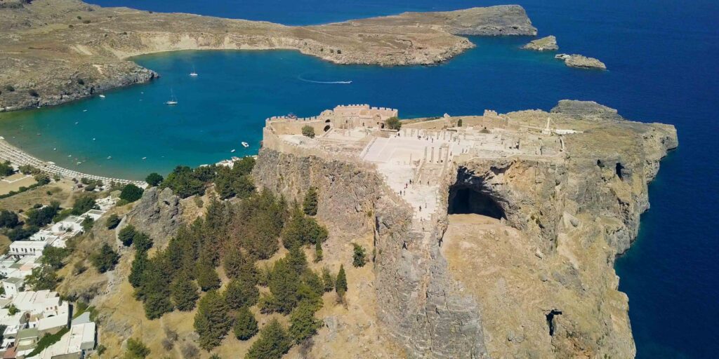
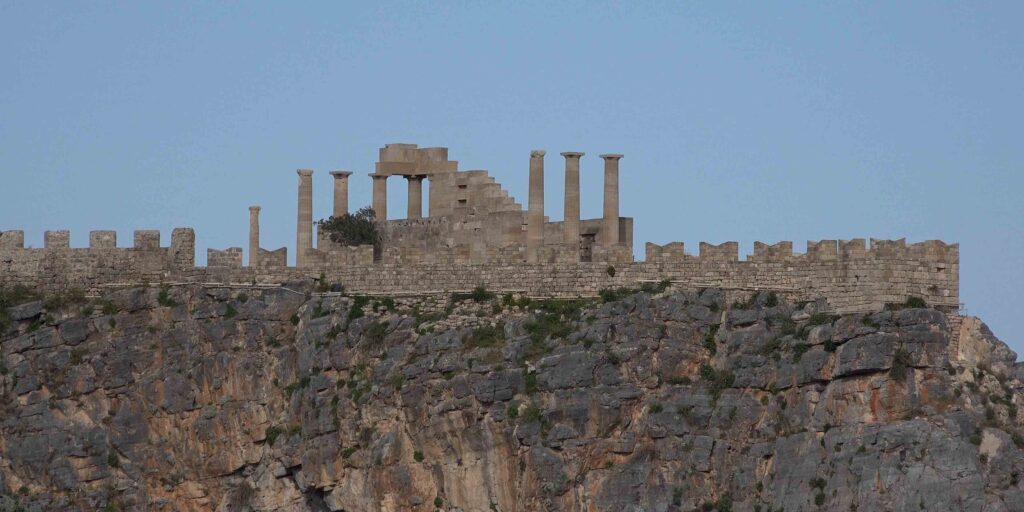
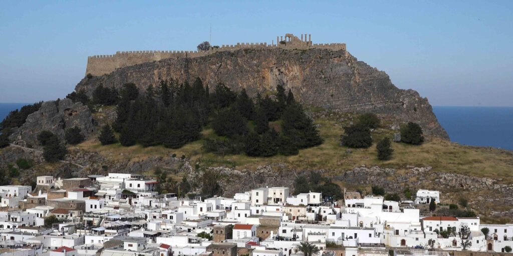
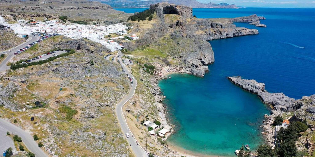
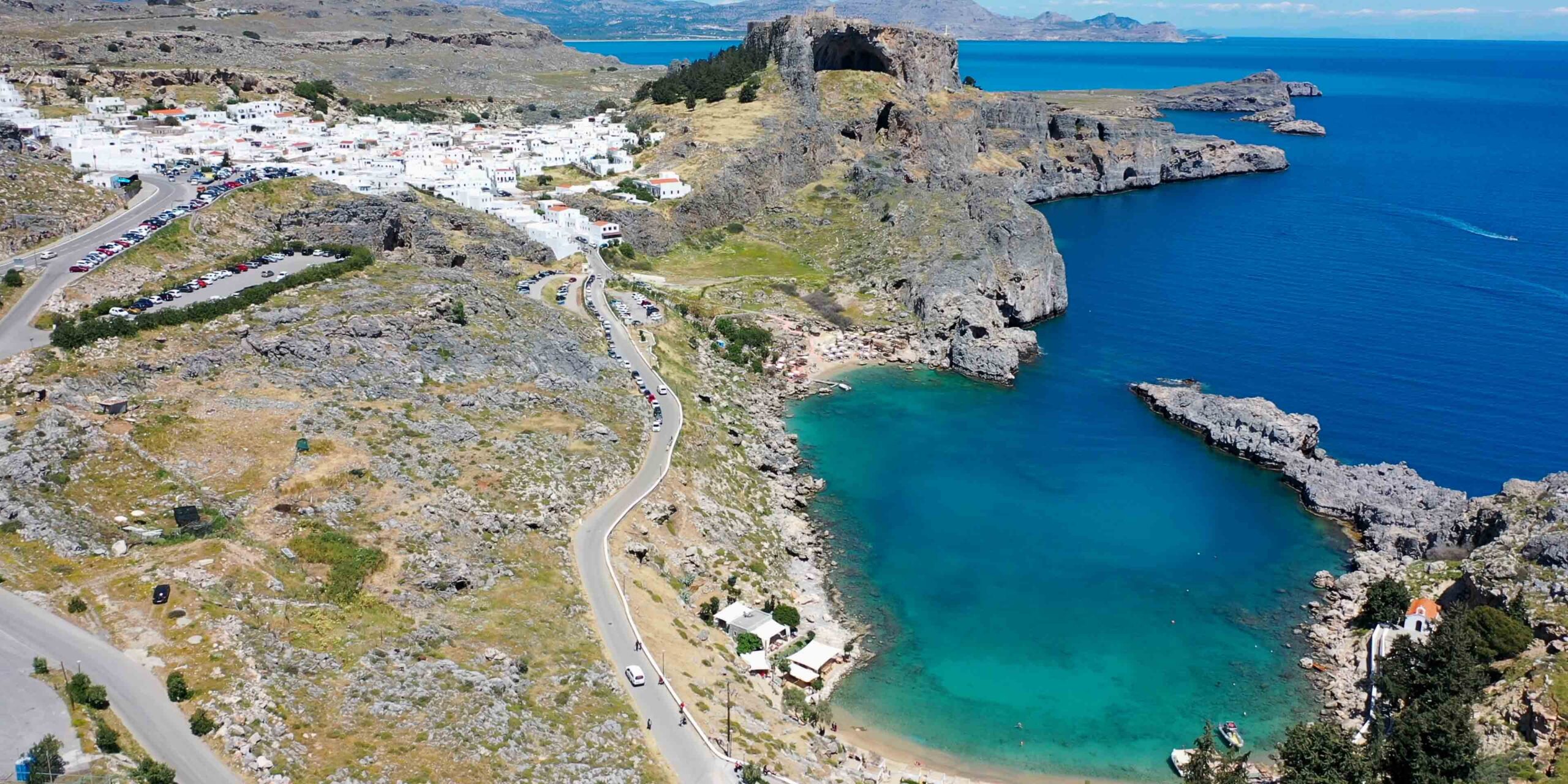
The cliff-top acropolis 24 NM SE of the old town · 4th-c BC Doric Temple of Athena Lindia stacked with Byzantine and Knights’ fortifications on a 116-metre cliff above the natural-port bay · the most distinctive sailing visit on Rhodes. Visit early morning or late afternoon · car-free village · climb on foot or by donkey · ⚠ daytime arrival only (no harbour lights). See Lindos, Rhodes.
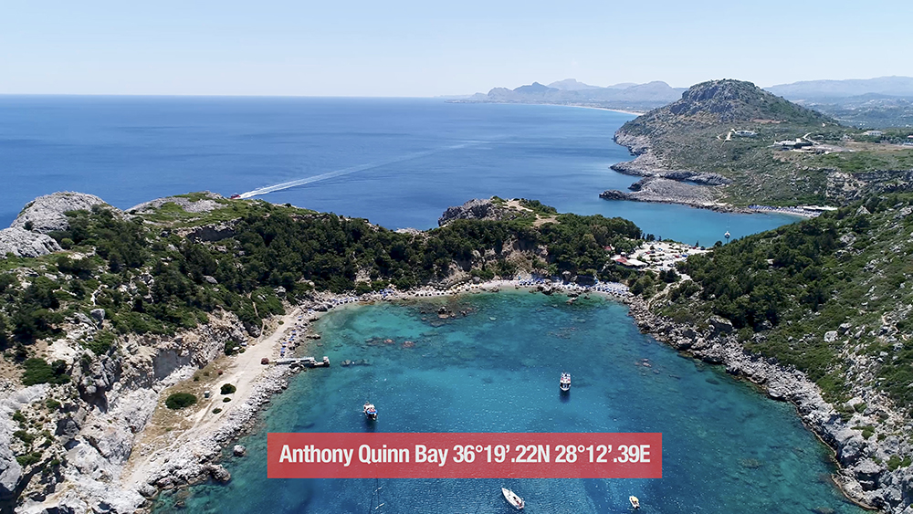
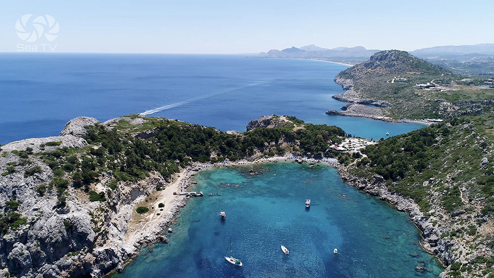
Anthony Quinn Bay · ~7.5 NM SE
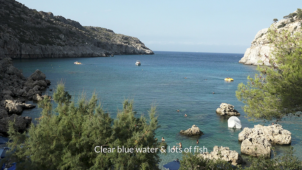
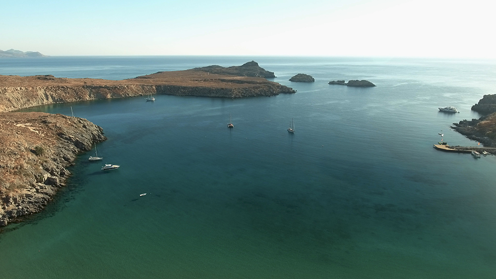
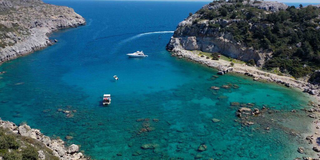
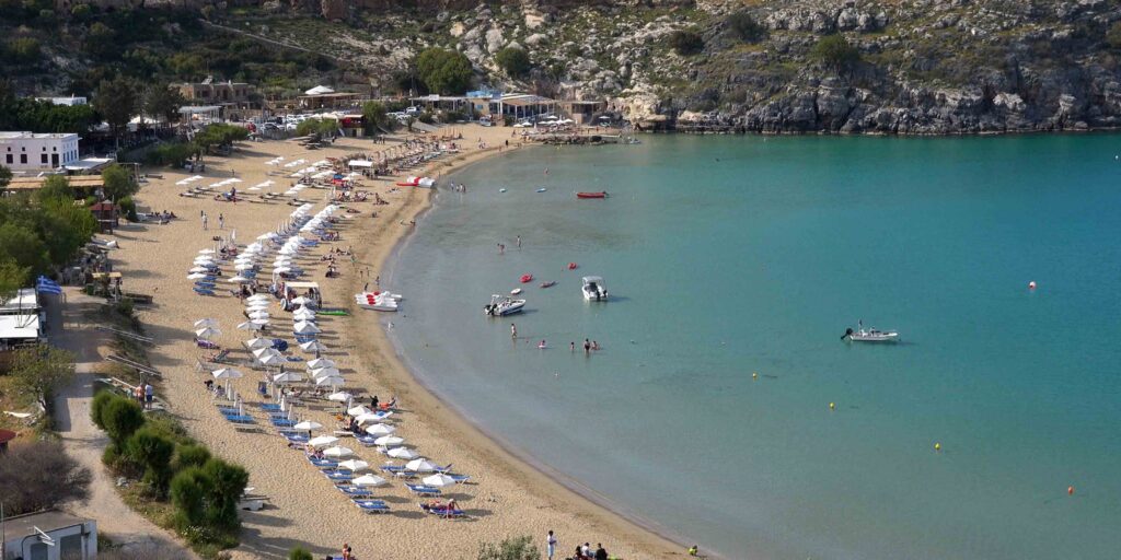
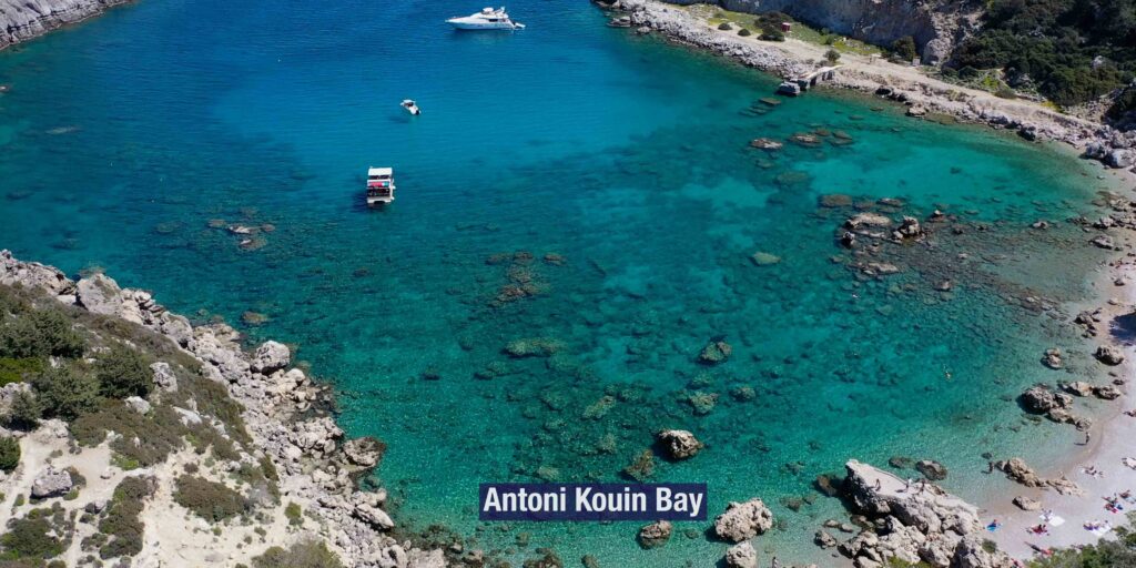
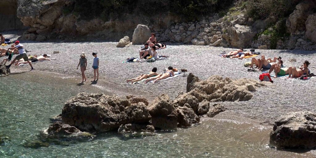
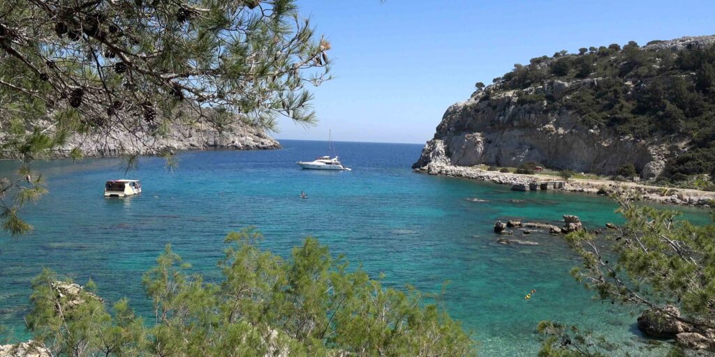
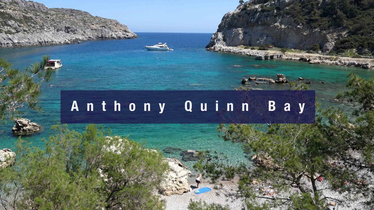
Famous quiet small bay 36°19′.39N · 28°12′.68E · named after the actor who fell in love with it filming “The Guns of Navarone” (1961) · rocky beach, clear water for diving and snorkelling · day-stop only (open to E winds). See Anthony Quinn Bay.
More E-Coast Stops
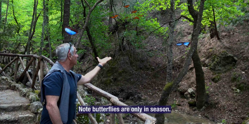
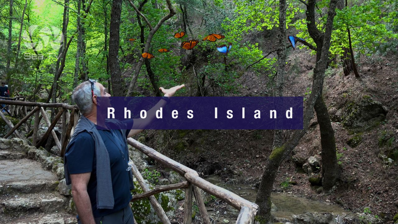
Butterflies Valley: Inland nature park with walking trails and a summer-resident butterfly population · butterflies arrive in summer only (peak July-August).
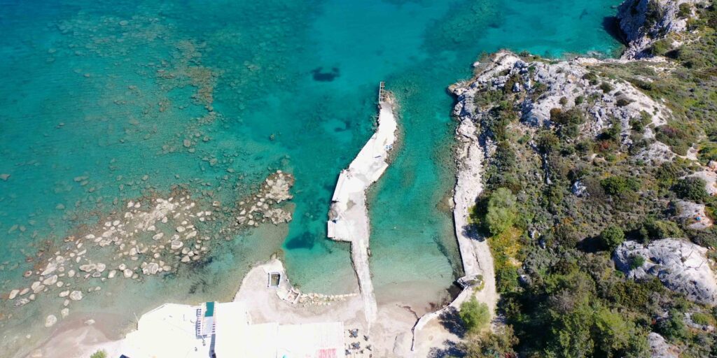
Kolympia: E coast of Rhodes · relatively quiet in season.
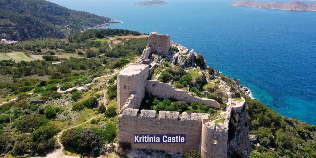
Kritinia Castle & Castle of Monolithos: Two 15th-century Knights’ inland castles · Kritinia (built 1472) on a hilltop · Monolithos perched on a cliff · panoramic views over the Aegean · accessed by hired car.
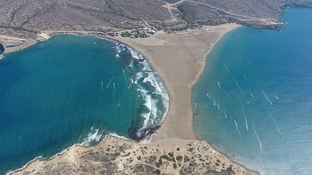
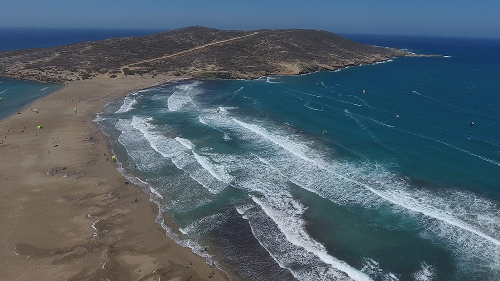
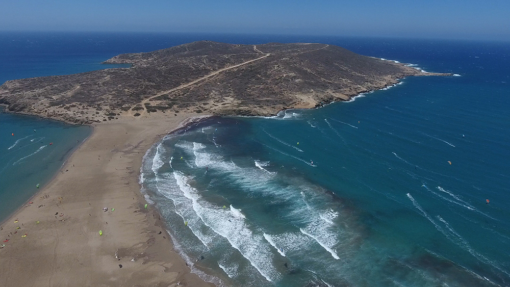
Prassonisi · Southern Tip
Prassonisi · 35°51′.53N · 27°45′.24E
The southern tip of Rhodes · windsurfing and kitesurfing destination · a sandy isthmus connects the mainland to a small islet, and the two beaches catch wind from opposite sides — ideal for surfers because there’s almost always usable wind on one side. Surfing-focused day-stop · check forecast for strong winds.
Rhodes Heritage Layers
Colossus of Rhodes · Ancient Wonder
The ancient Colossus of Rhodes — one of the Seven Wonders of the Ancient World — stood at the entrance to Mandraki harbour around 280 BC · destroyed in an earthquake ~226 BC · the Statue of Liberty in New York Harbor was directly inspired by it. Two bronze deer statues now mark the historical entrance to Mandraki where the Colossus stood.
Knights of St John · 1309-1522
The Knights of St John ruled Rhodes for over two centuries · the medieval old town is their fortified capital, and the network of inland castles (Kritinia, Monolithos, the Lindos castle) extended their control across the island. The Knights surrendered Rhodes to Suleiman the Magnificent in 1522 after a six-month siege and relocated to Malta · the medieval shape of Rhodes Town is essentially unchanged from their period.
Italian Colonial Period · 1912-1947
Italy ruled the Dodecanese including Rhodes from 1912 to 1947 · Rhodes was the administrative capital · the Italian period left significant Art Deco and Italian Rationalist architecture in the modern town outside the medieval walls · the New Market (Mandraki Mercato) is one of the most distinctive examples · the Italian period also conducted major archaeological restoration work on the medieval old town.
Pro Tips for Rhodes
Book Mandraki ahead. Very crowded in summer · advance booking essential · max LOA 40 m means many superyachts can’t fit anyway.
Plot the N reef before approaching Mandraki. Shoal water + reef on the N side · approach with care.
Walk the old town in the twilight. Cooler · the medieval atmosphere comes through · plan dinner inside the walls.
Day-sail SE for the best beaches and Lindos. Anthony Quinn (~7.5 NM SE) for the swim · Lindos (~24 NM SE) for the cliff-top acropolis · combine in one long day with daytime arrival at Lindos.
Rent a car for inland castles. Kritinia and Monolithos are inland on the W coast · accessed only by road · half-day to full-day excursion.
Visit Butterflies Valley in summer only. The butterflies are summer residents · peak July-August · winter and spring visits give an empty park.
Routes from Rhodes
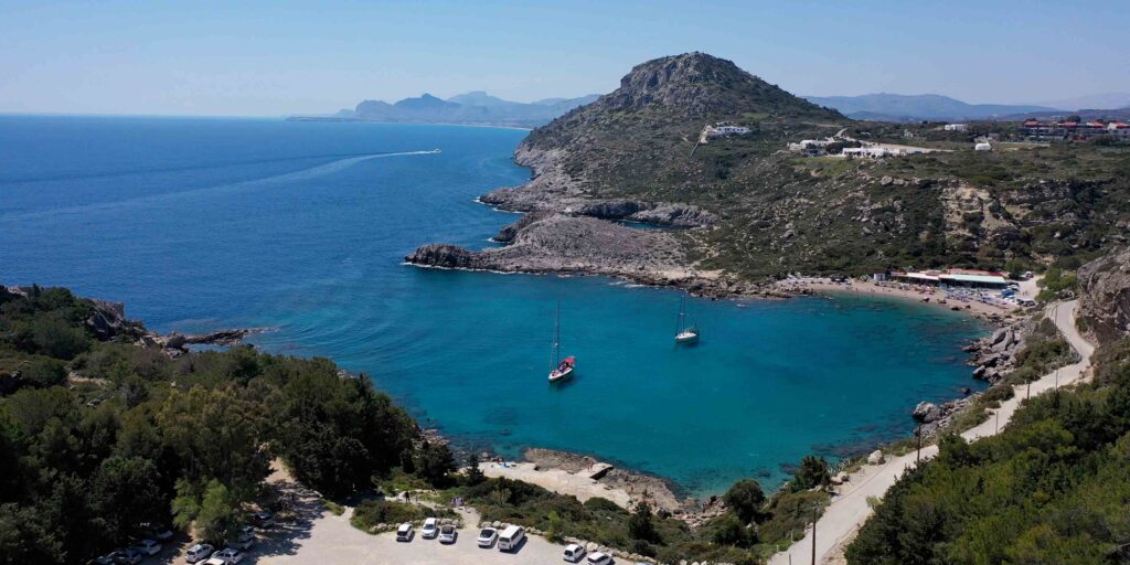
SE coast Rhodes: Anthony Quinn Bay (~7.5 NM SE) · Lindos (~24 NM SE) · Prassonisi (~50 NM SW around the southern tip).
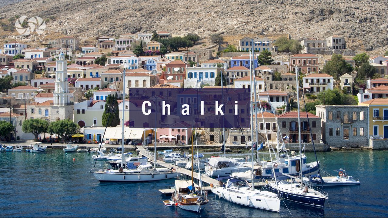
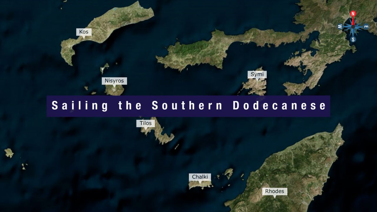
W to Chalki: ~30 NM W. See Chalki Island.
NW to Symi: ~25 NM NW. See Symi Island.
SE far to Kastellorizo: ~70 NM E (the easternmost Greek island, on the Turkish coast). See Kastellorizo.
N via Tilos / Nisyros to Kos: See Tilos · Nisyros · Kos.
E to Turkish coast: Marmaris ~25 NM E (cross-border clearing required).
Dodecanese full route: See Dodecanese — Our Route.
Emergency Numbers — Rhodes
European Emergency: 112
Greek Coastguard: 108
Coastguard Distress (VHF Ch. 16): Universal
Mandraki Port (VHF): Ch 09
Rhodes Marina (Ch 71): +30 2241 440970
Related SeaTV Pages
Adjacent Islands
Sailing Rhodes?
Largest of the twelve Dodecanese islands · UNESCO medieval old town · cliff-top Lindos acropolis · turquoise SE-coast bays · Italian colonial Art Deco · the surfers’ Prassonisi at the southern tip · Mandraki Port for the historic atmosphere or Rhodes Marina for capacity.
→ Rhodes Marina · Lindos SE · Symi NW
“Rhodes is the largest of the twelve Dodecanese islands and the southeastern corner of the Aegean — UNESCO medieval old town from the Knights of St John, the cliff-top Lindos acropolis twenty-four nautical miles southeast, Italian colonial nineteen-thirties Art Deco overlaid on the medieval ramparts, the turquoise-water bays of the southeast coast, and the kitesurfers’ Prassonisi at the southern tip. Pick Mandraki Port for the historic atmosphere right at the medieval ramparts or Rhodes Marina for capacity and modern services, plot the north reef before entering Mandraki, walk the old town in the twilight when the heat eases, and the layered Aegean island that anchored the Knights’ Mediterranean for over two centuries opens up.”
— SeaTV Visual Pilot · Dodecanese Edition