SeaTV · Cyclades Islands · Milos Port
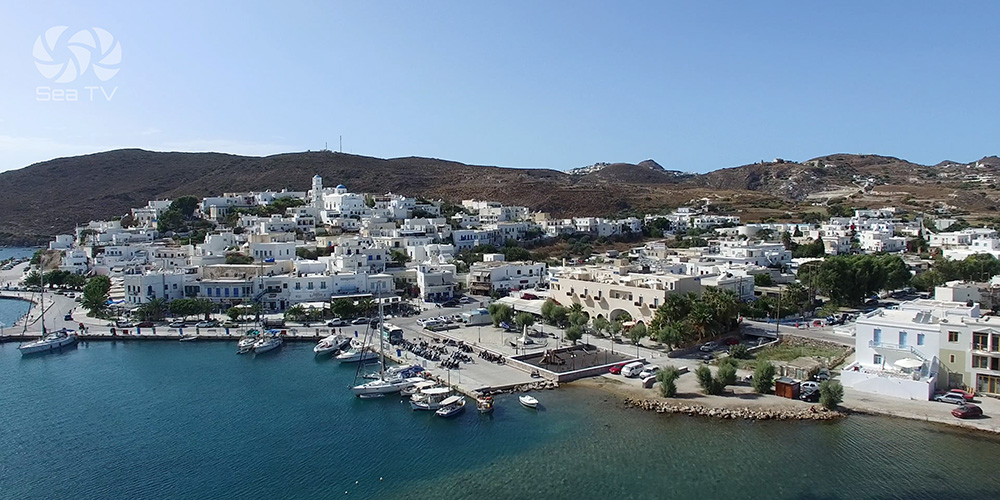
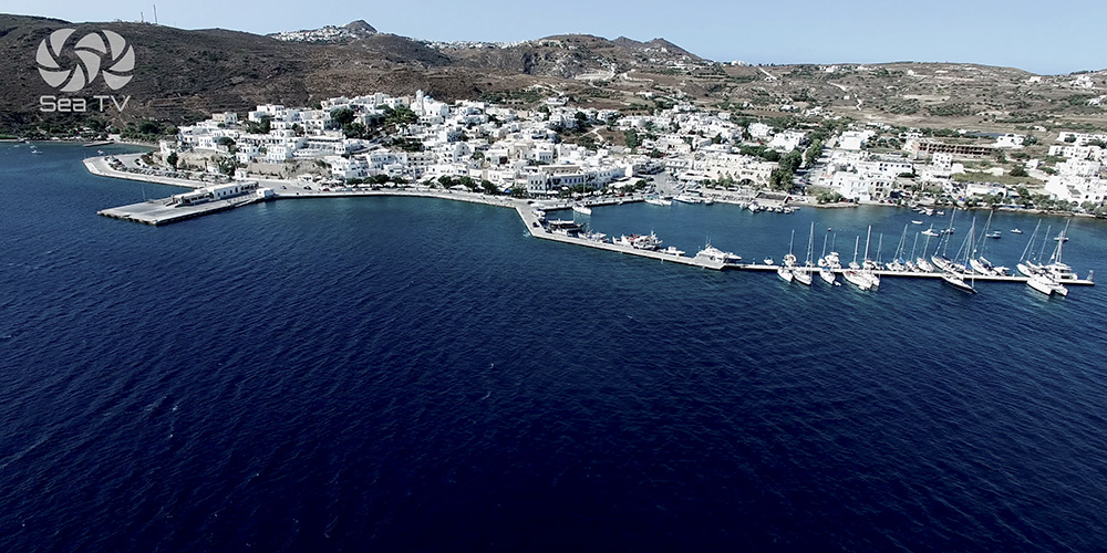
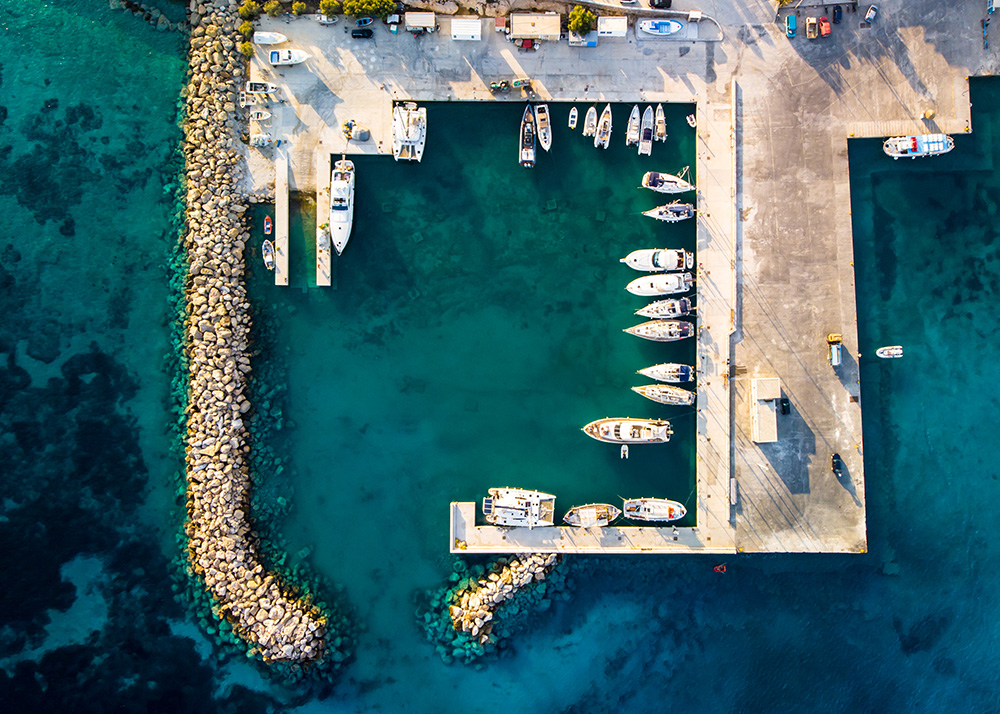
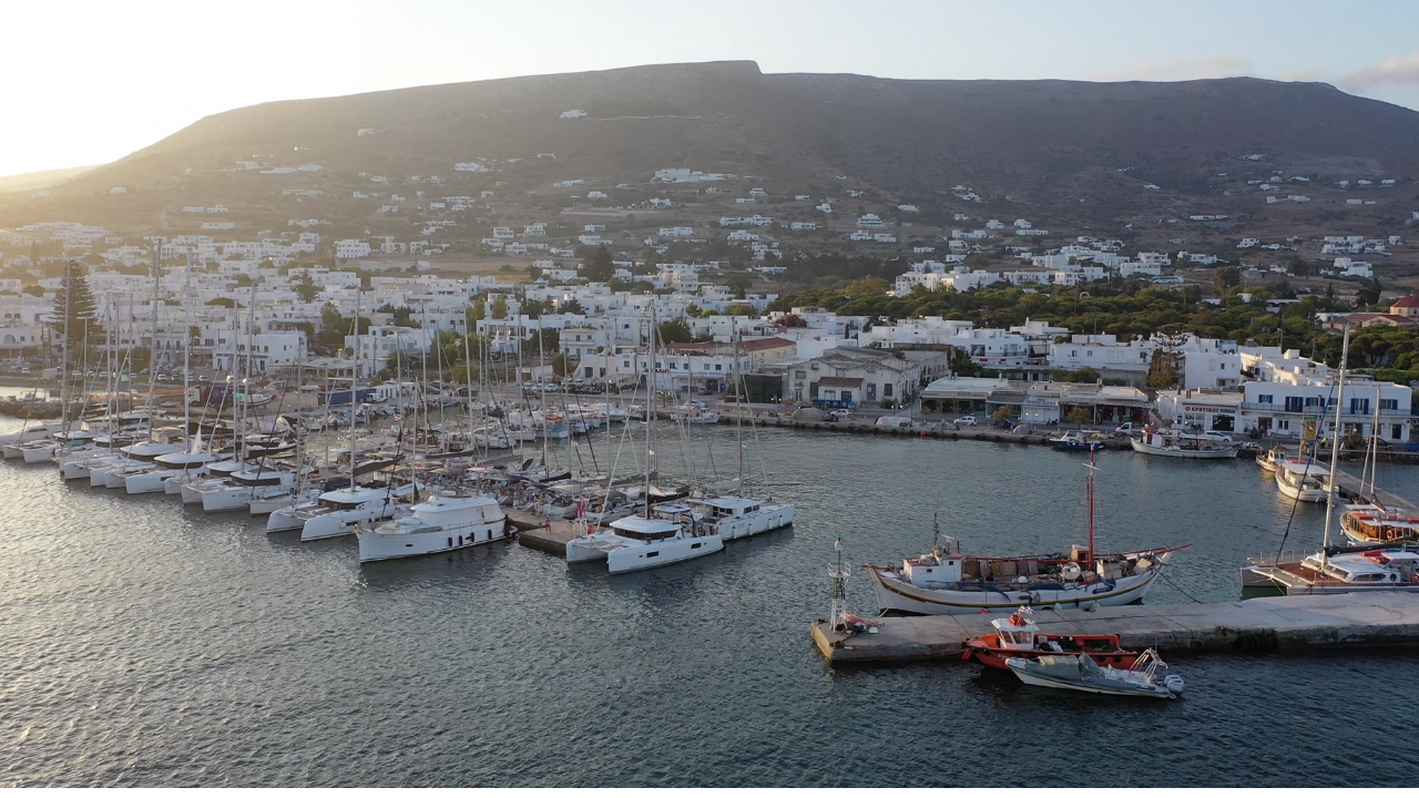
Milos Port — Adamantas Harbour
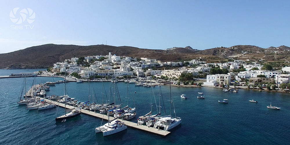
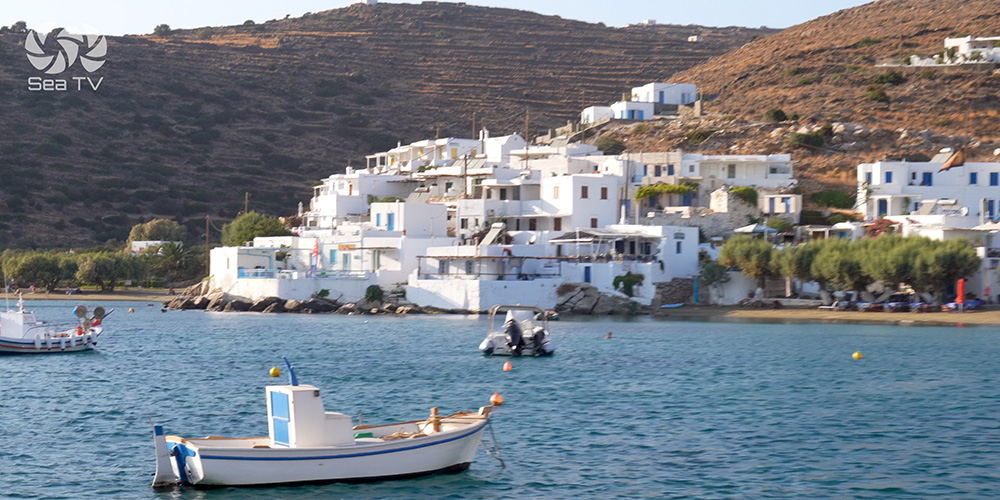
Inside the natural caldera bay on the north side of Milos. Greece’s most monumental natural harbour after Santorini, a working port with full authority presence, and the practical base for every Milos charter week.
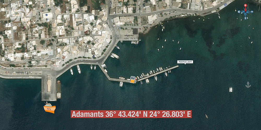
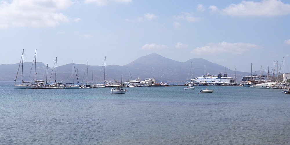
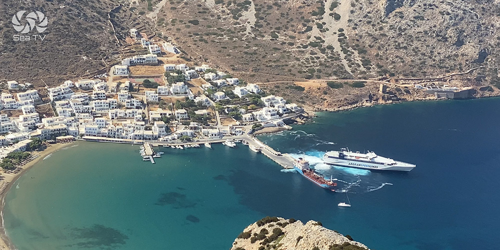
Adamantas is the main port of Milos — sitting inside the protected caldera bay that forms the island’s natural harbour. The port has full government presence (Port Police, Customs, and a Harbour Master) which makes it a clearance point for crews moving between Greek waters. For sailors, this is where Milos charter weeks begin and end, where you take on fuel and provisions, and where the day-tour boats depart for Kleftiko.
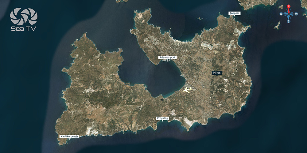
For full Milos coverage including the six other island anchorages (Pollonia, Kleftiko, Provatas, Klima, Papafragkas, plus the Sykia Cave and other alternates), see the Milos Island anchorages page.
⚠ Reality check:
→ Rough seas off the entrance with Meltemi · plan arrival timing
→ Ferries make significant wake in the harbour basin · anchor inner side of pontoon if possible
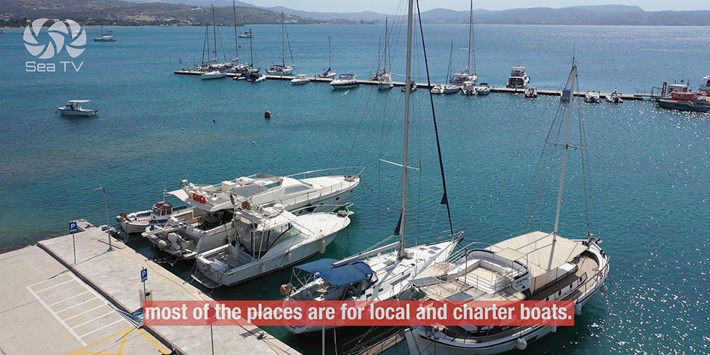
→ Most berths reserved for local and charter boats
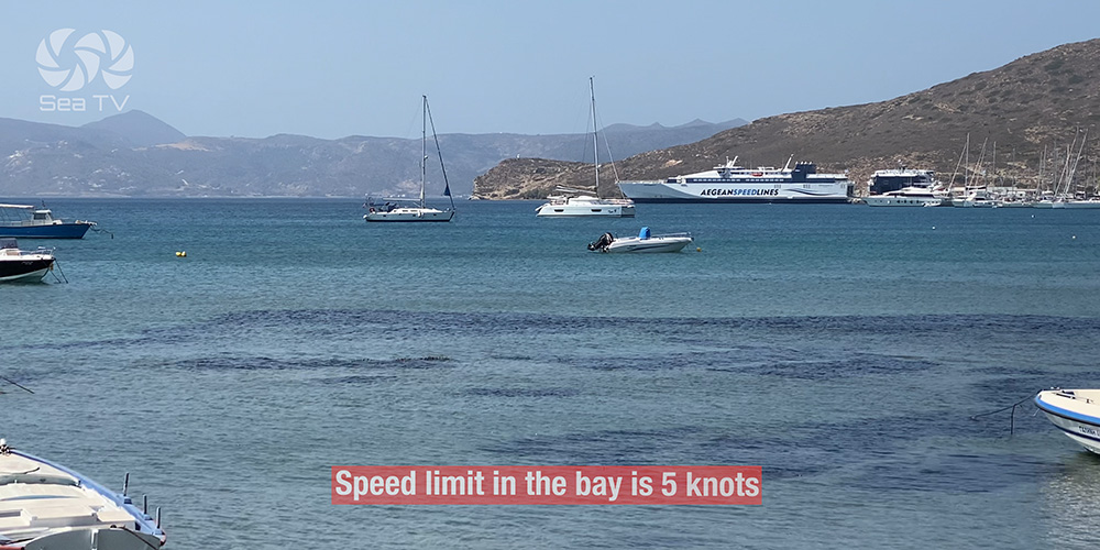
→ 5-knot speed limit in the bay
⚓ Quick Facts for Sailors
Position
Inside Milos caldera bay · north side of island
Calm-weather anchor
36.723796 · 24.451074
Speed limit
5 knots in the bay
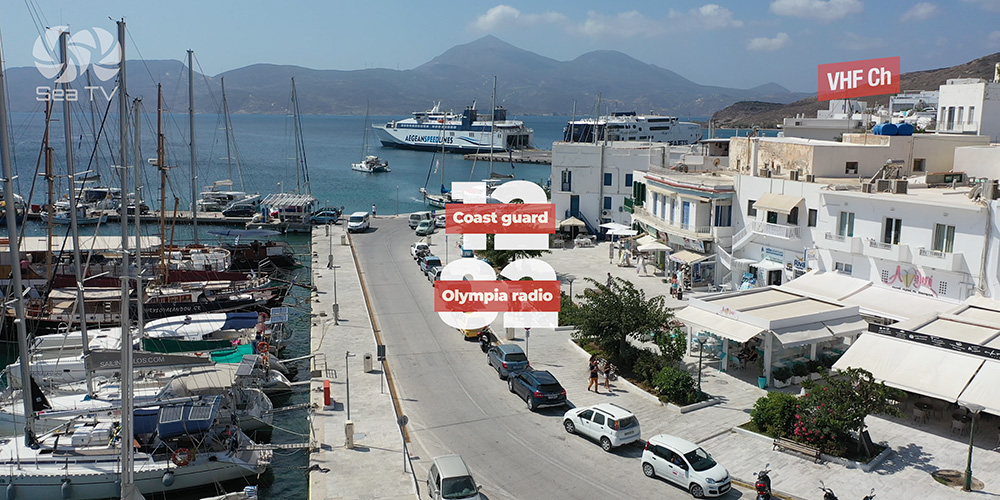
Authorities
Port Police · Customs · Harbour Master
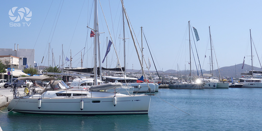
Mooring style
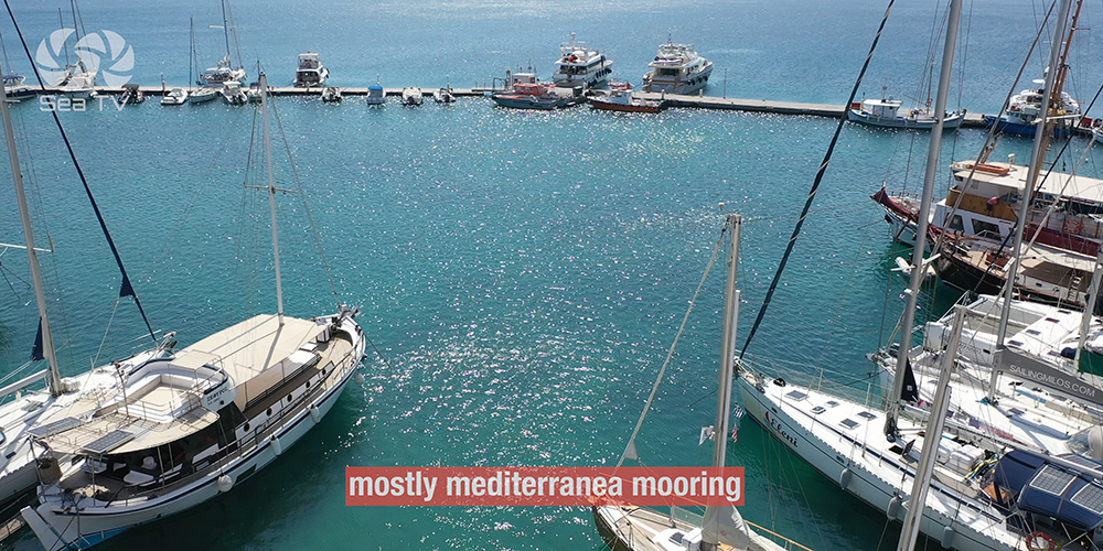
Mediterranean stern-to · pontoon · town quay
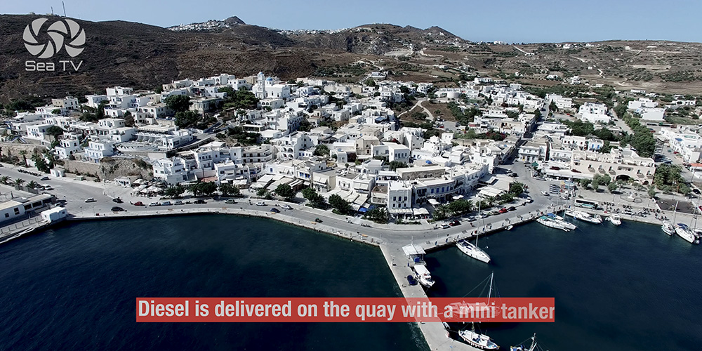
Fuel
Diesel by mini-tanker on the quay
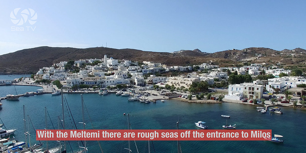
Approach
⚠ With the Meltemi, there are rough seas off the entrance to Milos. Plan your arrival timing — early morning before the wind builds gives you the smoothest approach. Once inside the caldera bay, conditions calm dramatically.
The natural caldera bay is the headline feature of the approach — Milos is the open caldera of a Pliocene-period volcano, and the bay you sail into is what’s left when the sea broke through the crater wall on the north-west side. The port itself sits well inside this protected basin, so even when the entrance is uncomfortable, the basin is workable.
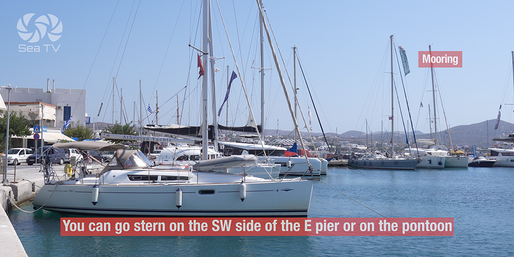
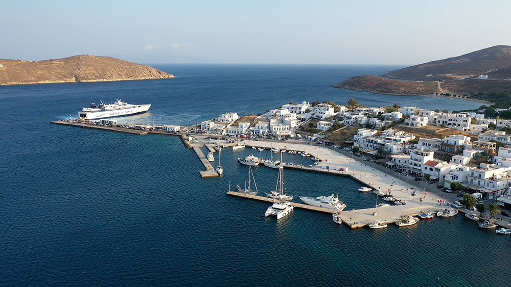
⚓ Mooring at Adamantas
Three Options · Pick By Wave-Exposure
Where to Tie Up
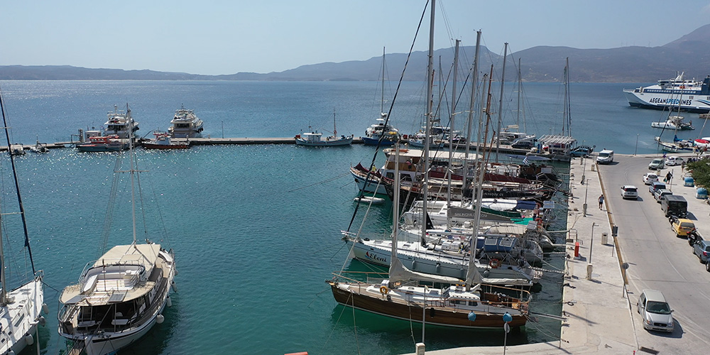
Option 1 — SW side of the E pier: Stern-to.
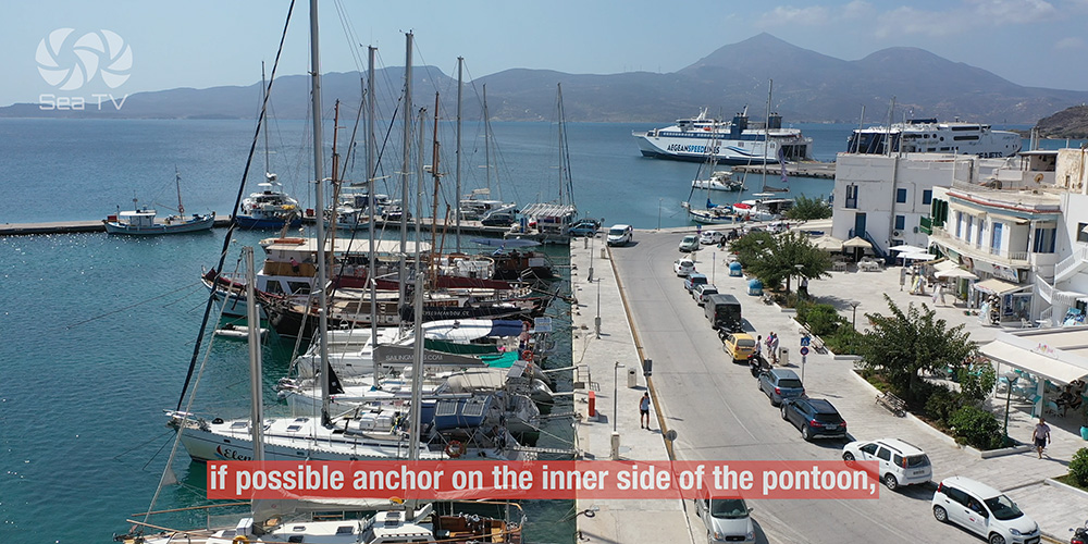
Option 2 — Pontoon: Stern-to. If possible, anchor on the inner side of the pontoon to reduce ferry-wake effect.
Option 3 — Town quay: Stern-to alongside the town front.
Method: Mediterranean mooring — drop anchor, reverse in, secure stern lines.
⚠ Ferry wake: Adamantas is a working ferry port — ferries arriving and departing throw significant waves into the basin. The classic mistake is mooring on the outer side of the pontoon and getting hammered by ferry wake all afternoon. Anchor inner side wherever the layout permits.
⚠ Berth availability: Most places are reserved for local boats and charter fleets. Visiting yacht slots are limited — call ahead in season or arrive early.
Floating pontoons: Equipped with mooring hangers — but not at all locations. If your assigned spot doesn’t have a hanger, drop your own anchor.
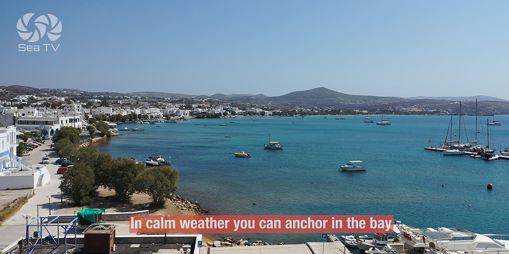
Calm-weather anchor option
In calm weather, you can anchor in the bay at 36.723796 · 24.451074 rather than going on the wall — useful when the basin is busy or you want a quieter night. Confirm the depth and bottom before setting hard.
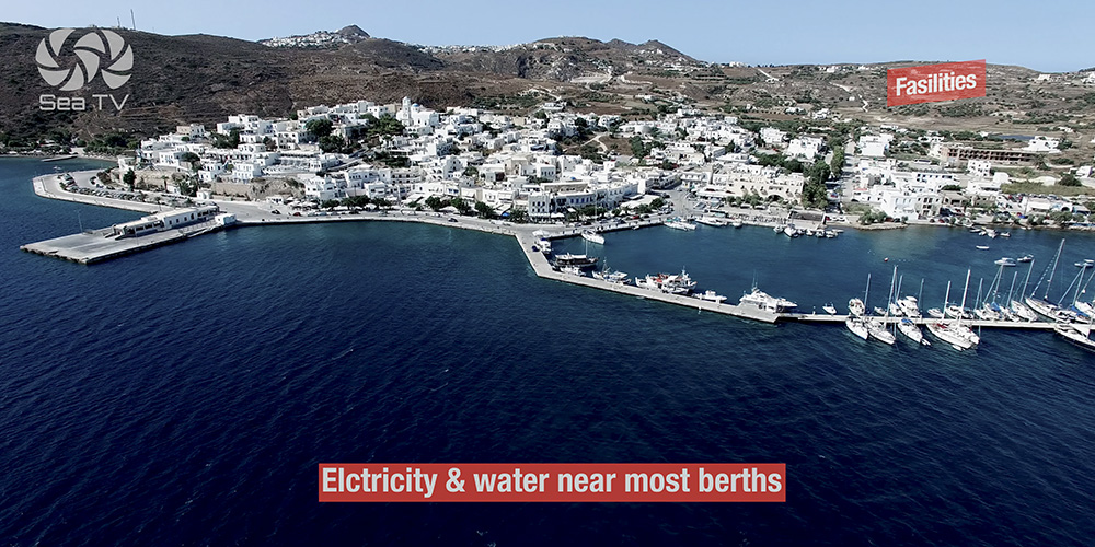
Facilities & Services
Fuel: Diesel delivered on the quay by mini-tanker. Call ahead to arrange — easier than queuing.
Authorities on site: Port Police, Customs, and a Harbour Master — useful for any clearance requirements or paperwork.
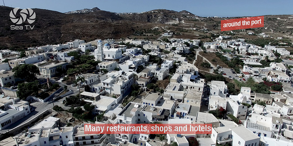
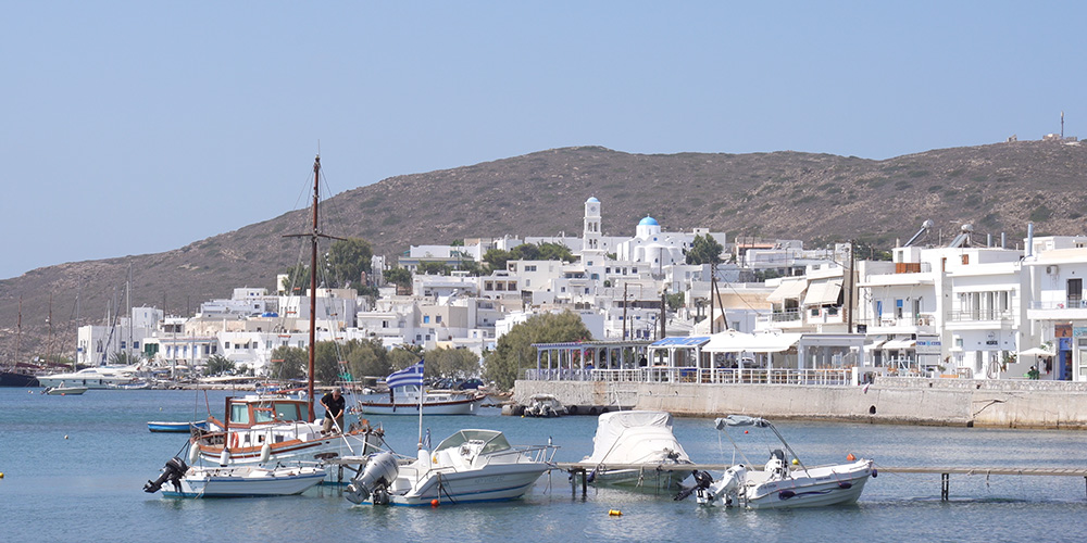
Provisioning: The town of Adamantas has a working waterfront with supermarkets, bakeries, fresh produce, and the practical supplies a charter week needs. Stock up here before heading to the outer Milos anchorages — Kleftiko, Klima, and Papafragkas have nothing.
Restaurants & cafés: The Adamantas waterfront has a substantial selection — walk the front and pick what looks good. Local Cycladic cooking, fresh fish, the standard Greek-port dining range.
Boat-tour operators: Multiple companies operate from Adamantas to Kleftiko, Sykia Cave, and the southern coast. Useful if you want to visit Kleftiko but don’t want to take your own yacht into the shifting-wind cove.
Weather Forecast Info — Local VHF Practice
Daily forecast: Issued after 08:00 each morning.
VHF Channel 8: Used by fishermen.
VHF Channel 10: Used by other crafts.
Shore Excursions from Adamantas
Plaka (capital): 5 km north — the Cycladic whitewashed traditional capital with a Venetian Kastro and panoramic views over the caldera. Taxi or bus from Adamantas.
Trypiti & the Catacombs: 30-minute walk or short taxi from Adamantas — site of the early-Christian catacombs (one of the three most important early-Christian burial sites in the world) and the ancient theatre where the Venus de Milo was discovered in 1820.
Sarakiniko: The famous lunar-landscape beach — white volcanic rock formations sculpted by the sea. 10-minute taxi from Adamantas.
Klima & Skinopi: The painted fishermen’s villages with houses built on the water. Walkable from Plaka or accessible by taxi.
Pro Tips for Adamantas
Anchor inner side of the pontoon. The ferry wake is the headline annoyance in Adamantas. Inner-side moorings dramatically improve overnight comfort. Worth working harder on the manoeuvre.
Catch the 08:00 forecast. The local weather forecast is broadcast after 08:00 daily. VHF Ch. 10 for non-fishing yacht use. Build it into the morning routine — Milos’s exit can be rough in Meltemi conditions.
Time the entrance for early morning in Meltemi. Rough seas off the entrance ease before noon when the wind is just building. Arriving at 06:00 makes a significantly easier approach than 14:00.
Use Adamantas as the Kleftiko base. Day-tour boats run from here. If your own yacht doesn’t suit a Kleftiko overnight (shifting winds), take the day tour and come back to Adamantas at evening.
Stock here for the outer anchorages. The supermarkets and provisioning in Adamantas are the last full options before the outer Milos coast. Top up water, food, fresh produce before you leave for Kleftiko or Pollonia.
Walk to where Venus de Milo was found. 30 minutes from Adamantas to Trypiti, the ancient theatre, and the niche where Yorgos Kentrotas dug up the statue in 1820. The catacombs are next door. Cultural payoff for a low-effort shore day.
✅ Sailor’s Checklist for Adamantas
▢ Berth confirmed before arrival (visiting yacht slots are limited)
▢ Approach timed for early morning if Meltemi forecast
▢ 5-knot speed limit observed in the bay
▢ Inner-side pontoon mooring preferred where possible
▢ Diesel mini-tanker arranged in advance
▢ 08:00 forecast catch on VHF Ch. 10
▢ Provisioning completed before heading to outer Milos coast
▢ VHF on Ch. 16 throughout
Emergency & Service Numbers — Adamantas
European Emergency: 112
Coastguard Distress (VHF Ch. 16): Universal
Coastguard Working (VHF Ch. 12): Per region
Local fishing fleet: VHF Ch. 8
Other crafts & weather forecast: VHF Ch. 10 (after 08:00)
Milos Port Authority: VHF Ch. 12 / 16
Olympia Radio (VHF Ch. 03/86): Greek HF/VHF maritime service
Watch the SeaTV Visual Pilot Video
Drone passes over the caldera bay approach, the manoeuvre into the basin, the pontoon and town quay layout, the ferries arriving and departing, and a walk through the Adamantas waterfront. Free for members.
Related SeaTV Pages
Milos · Other Pages
→ Milos Island — 6 Anchorages Around the Coast · Pollonia, Kleftiko, Provatas, Klima, Papafragkas + alternates
Arriving at Milos?
Anchor inner side of the pontoon, catch the 08:00 forecast, walk to where the Venus was found.
“Adamantas is the practical heart of Milos sailing — Port Police on the dock, ferries throwing wake every hour, and the caldera you sailed into still holding everything together. Anchor inner-side, top up the tanks, then head out to the rest of the island.”
— SeaTV Visual Pilot · Cyclades Edition