SeaTV · Cyclades Islands · Iraklia
Iraklia Island — Quiet Anchorages South of Naxos
A small Cycladic island in the Lesser Cyclades chain, south of Naxos. Three anchorages, a modest harbour, and one of the most unusual snorkel attractions in the Aegean — a plane wreck in 8 m of water at Alimias Beach.
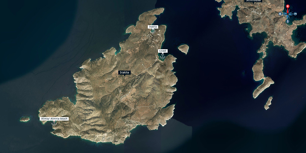
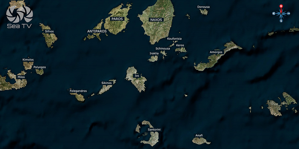
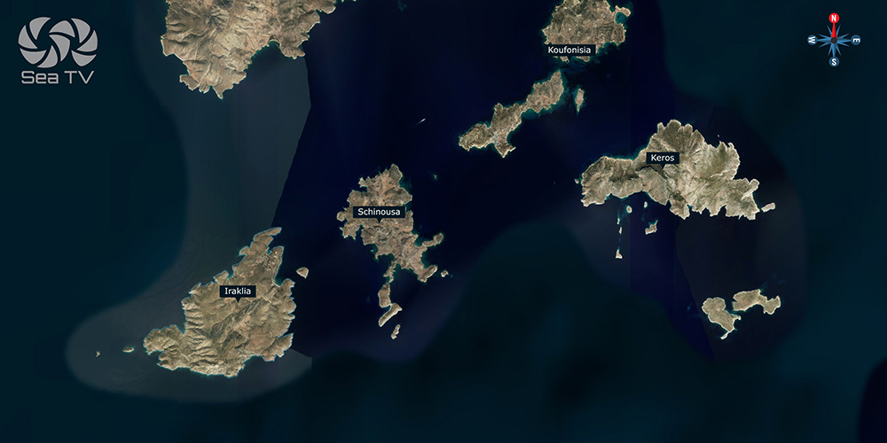
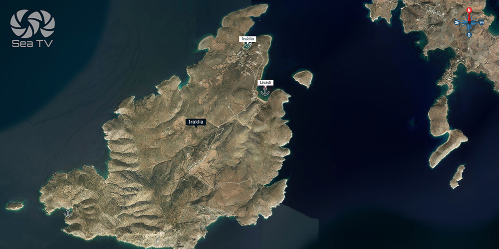
Iraklia sits south of Naxos in the Lesser Cyclades — a small group of islands (Iraklia, Schinoussa, Koufonisia, Donousa) that get a fraction of the visitors of their bigger neighbours. The island has a deep inlet on the NE tip with the small port at the head, plus two further anchorages to the west and south. Calm-weather sailing here is quiet and uncrowded; in Meltemi conditions, the options narrow significantly.
⚠ Reality check:
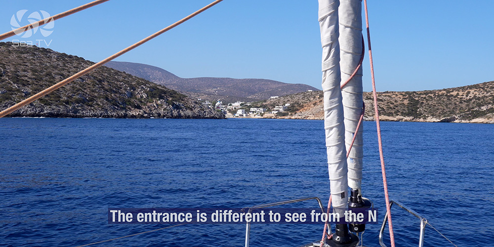
→ Iraklia Key entrance is difficult to see from the north
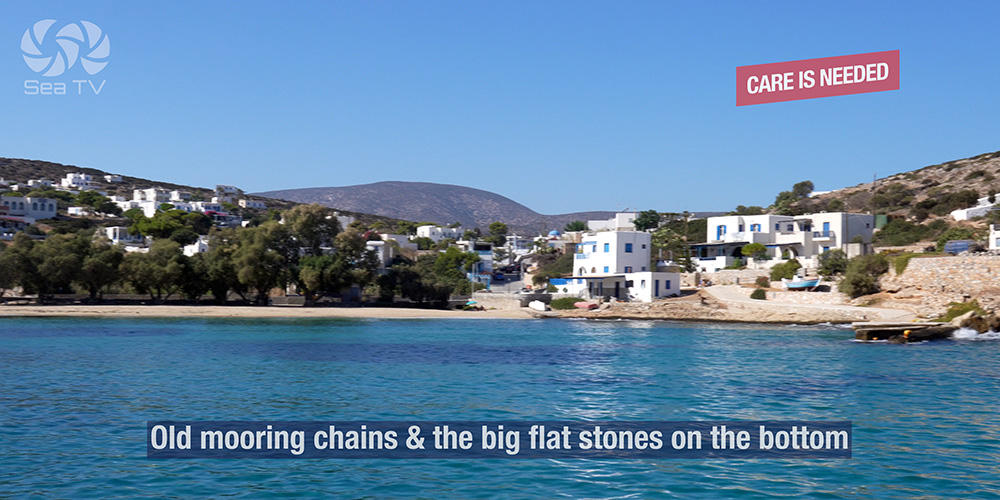
→ Old mooring chains + big flat stones on the bottom at the harbour
→ Livadi Bay has underwater pipes — care required
→ Livadi Bay does NOT shelter from Meltemi (only W/S/E)
→ Big ferries and water ship in the harbour — moor only on inside pier
⚓ Quick Facts
Position
South of Naxos · Lesser Cyclades
3 anchorages
Iraklia Key · Livadi Bay · Alimias Beach
Main harbour
NE tip · deep inlet · short mole
Special feature
Plane wreck in 8 m at Alimias Beach
Meltemi shelter
Limited — Livadi exposed to Meltemi
Atmosphere
Quiet · uncrowded · undeveloped
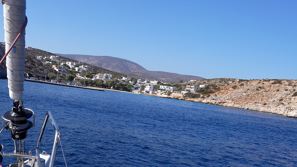
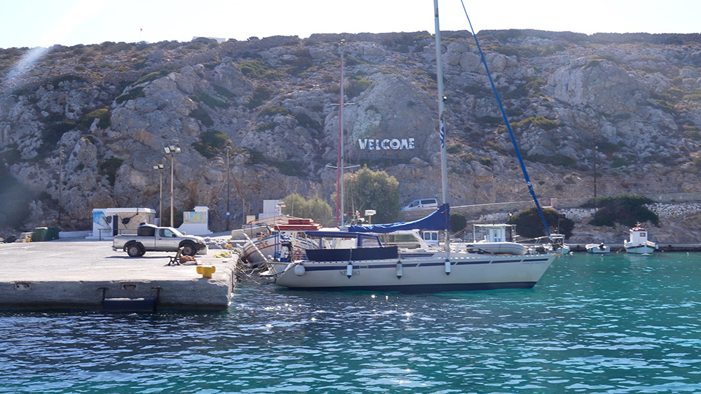
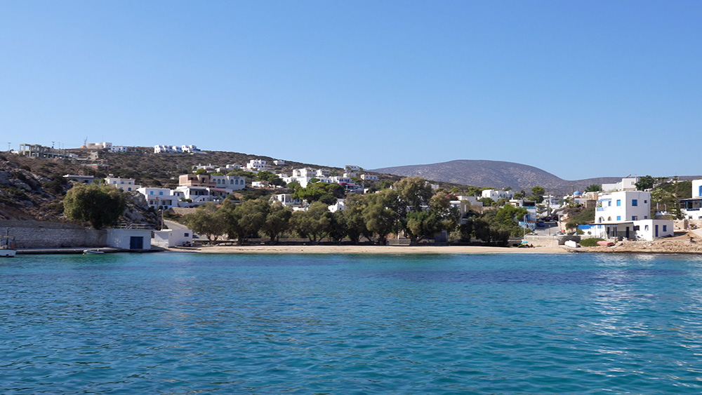
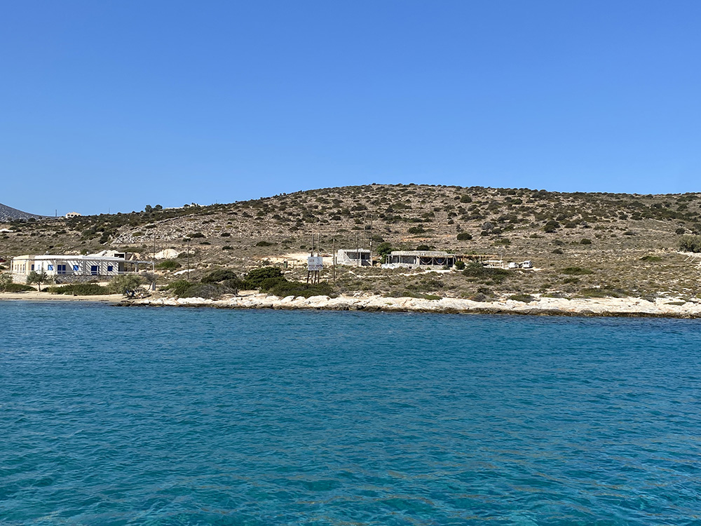
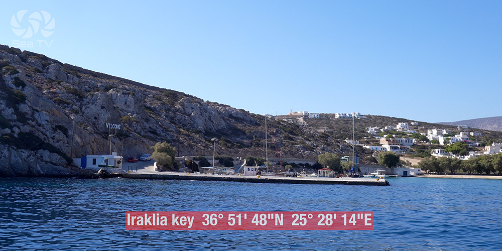
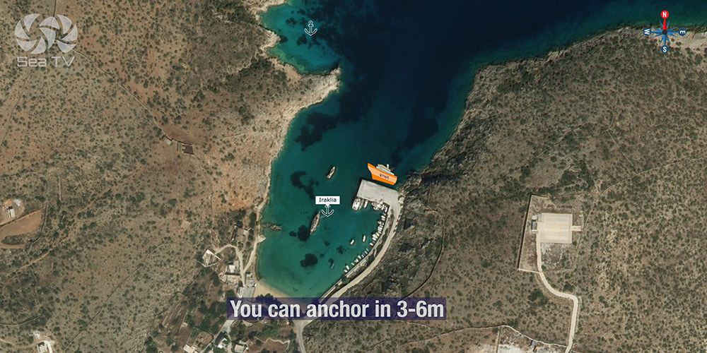
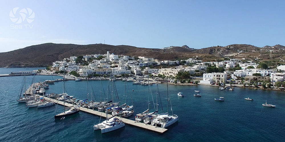
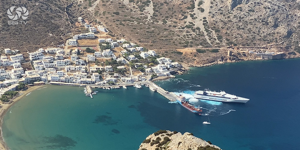
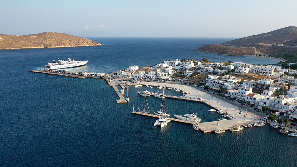
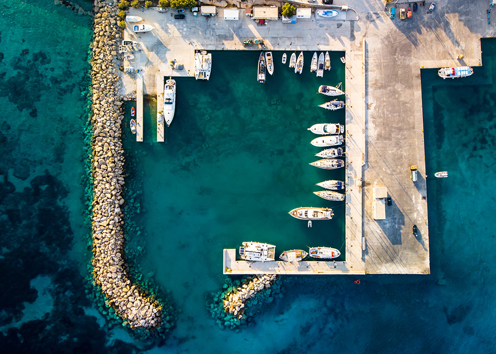
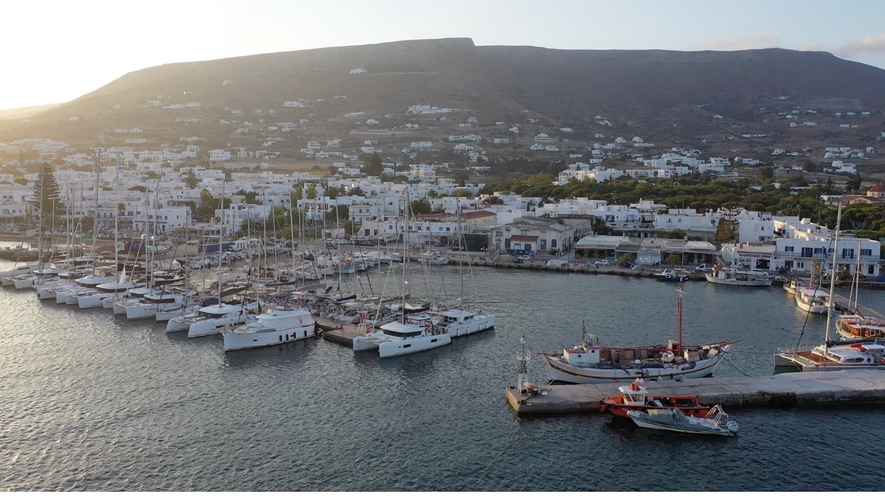
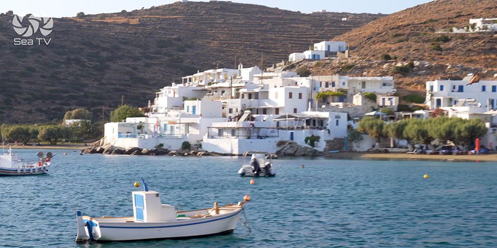
1. Iraklia Key (NE Harbour)
Position · 36°51’48″N · 25°28’14″E · Main Harbour
Iraklia Key — Deep Inlet Harbour
Position: Deep inlet on the NE tip of the island.
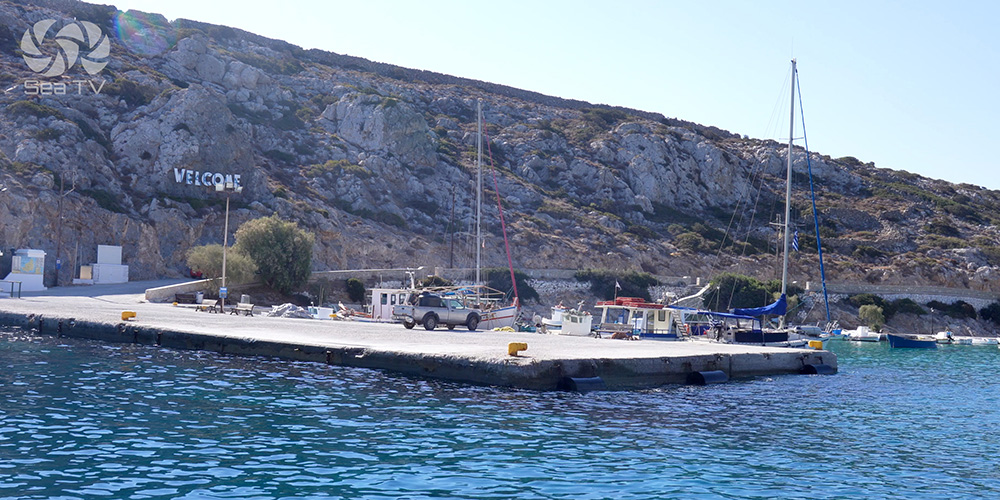
Mooring: Moor only on the inside pier · short mole with room for a few yachts.
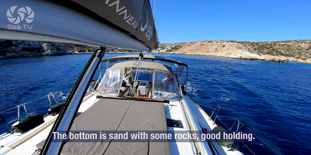
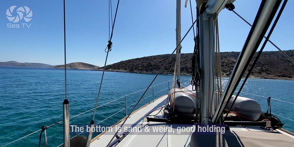
Anchoring: 3–6 m · sand with some rocks · good holding.
⚠ Be aware of big ferries and the water ship coming in — they create wake and need clear access.
⚠ Hazard #1 — Hidden entrance: The harbour entrance is difficult to see from the north. Plot the entry on the chartplotter and approach with care if coming down from Naxos.
⚠ Hazard #2 — Bottom obstructions: Old mooring chains and big flat stones on the bottom — set the anchor with care, snorkel down to verify if visibility allows.
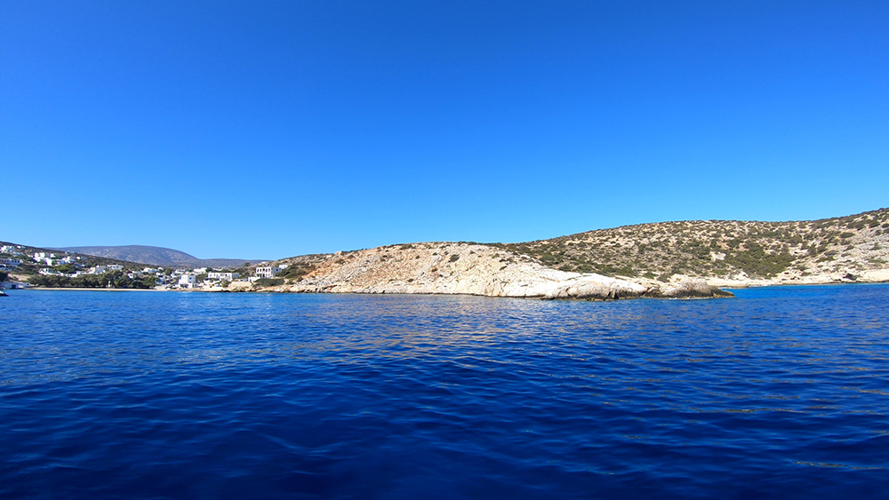
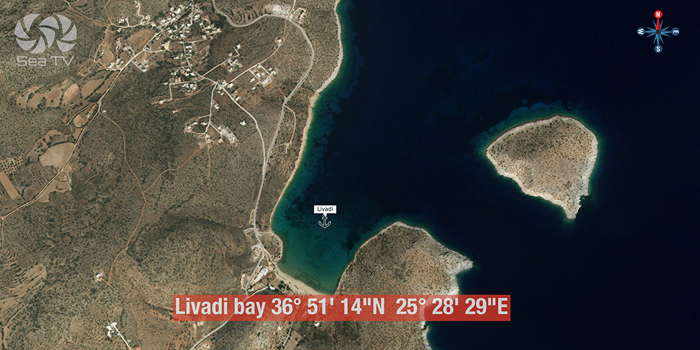
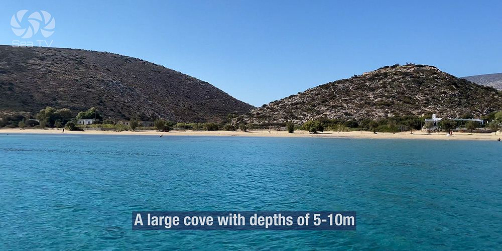
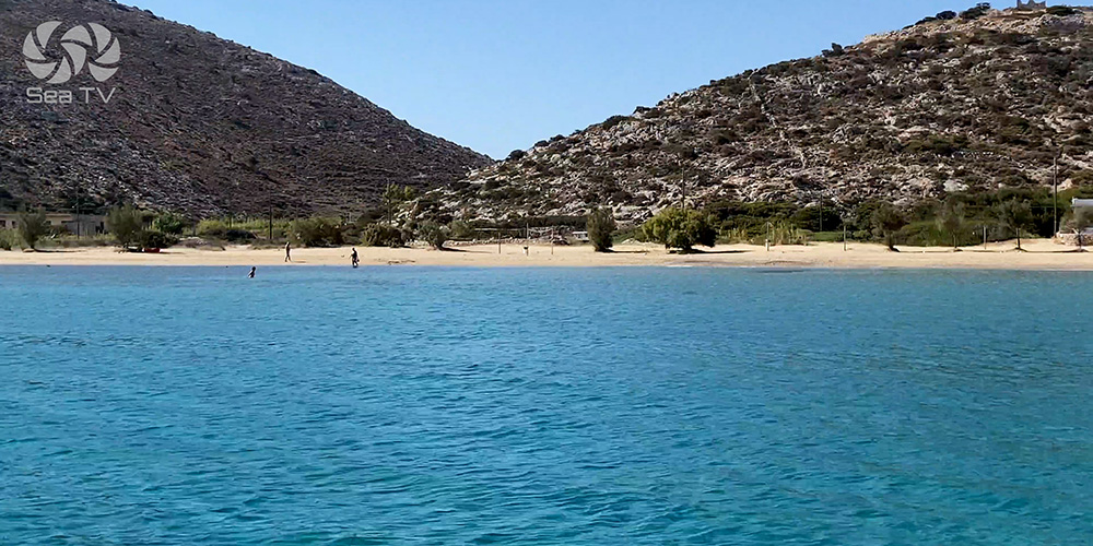
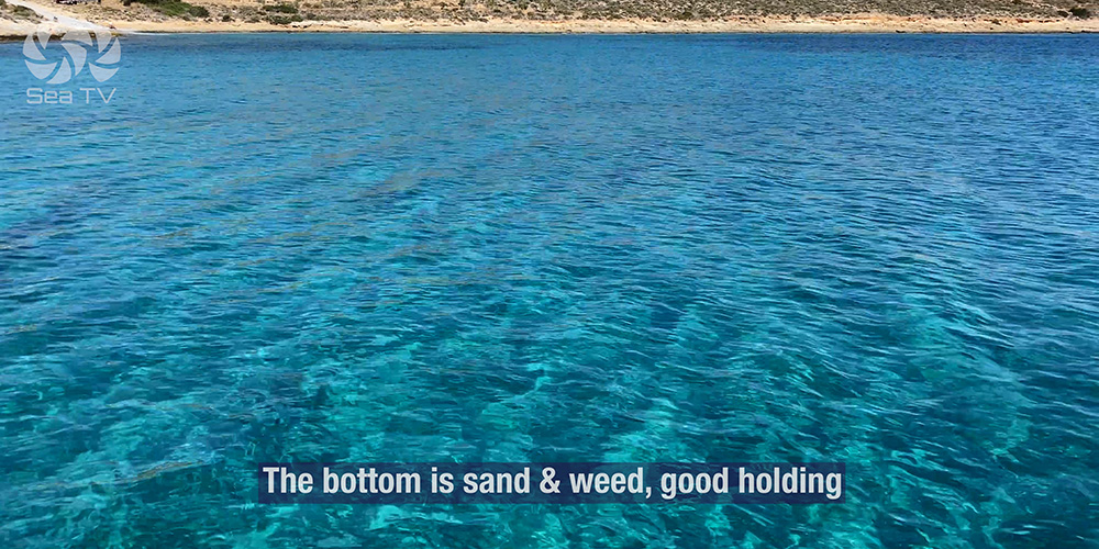
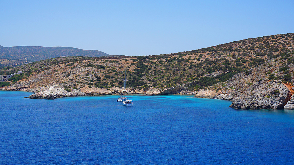
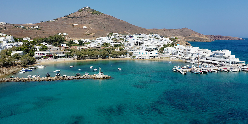
2. Livadi Bay
Position · 36°51’14″N · 25°28’29″E · Large Cove
Livadi Bay — Large Cove with Underwater-Pipe Hazard
Position: Large cove · plenty of room for yachts.
Anchoring: 5–10 m · sand and algae · good holding.
Shelter: Protection from W, S, and E winds — but NOT in a Meltemi. Don’t plan to use this in heavy NE conditions.
⚠ Hazard: Underwater pipes — care needed when setting the anchor. Plot if charted; eyeball the bottom on the way in.
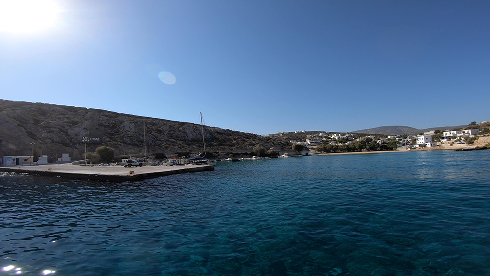
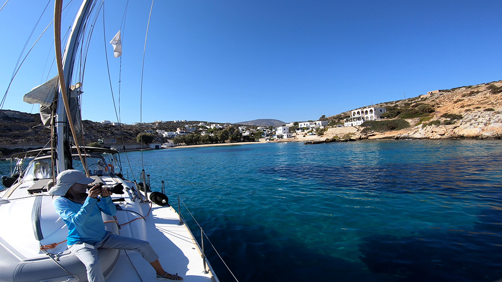
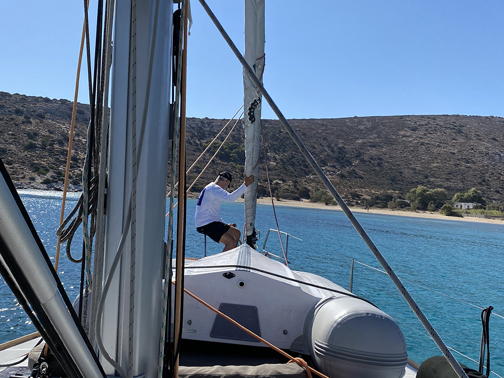
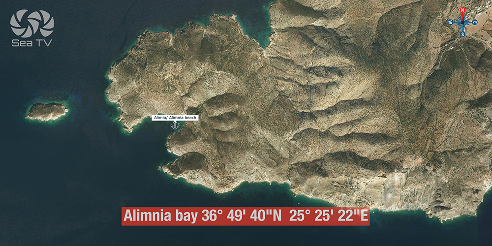
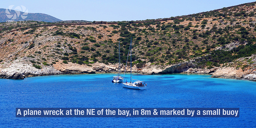
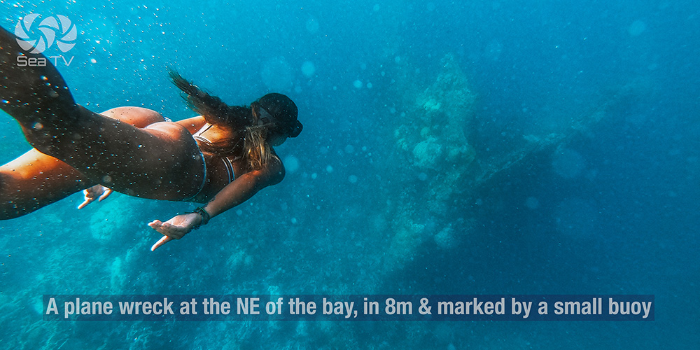
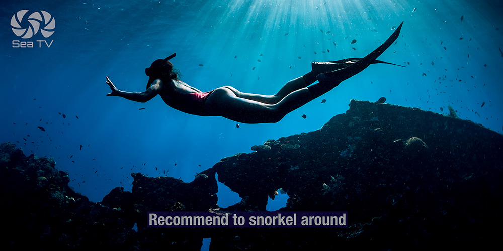
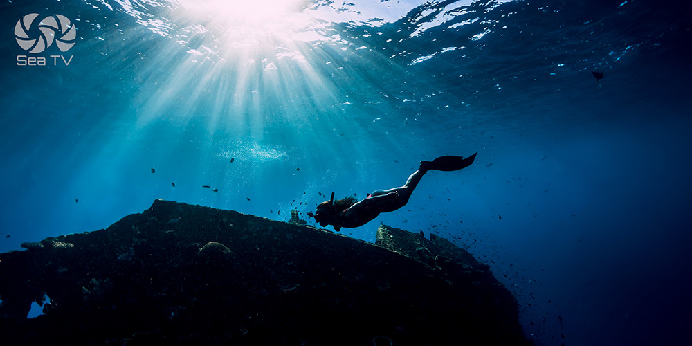
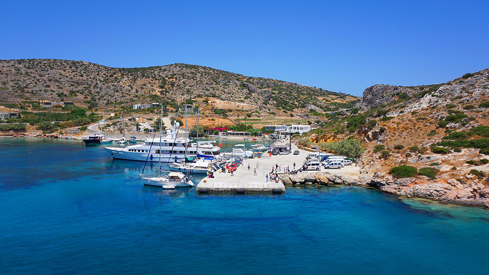
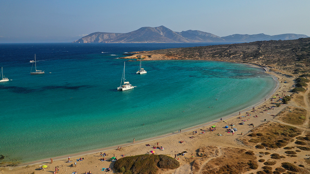
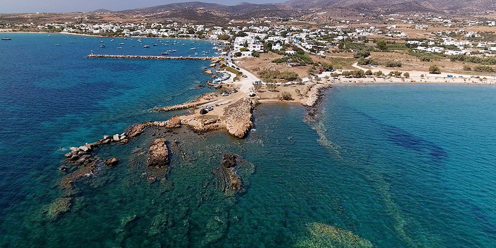
3. Alimias Beach (Plane Wreck Snorkel)
Position · 36°49’40″N · 25°25’22″E · Narrow Bay
Alimias Beach — Narrow Bay with a Sunken Plane
Position: SW corner of the island · narrow bay.
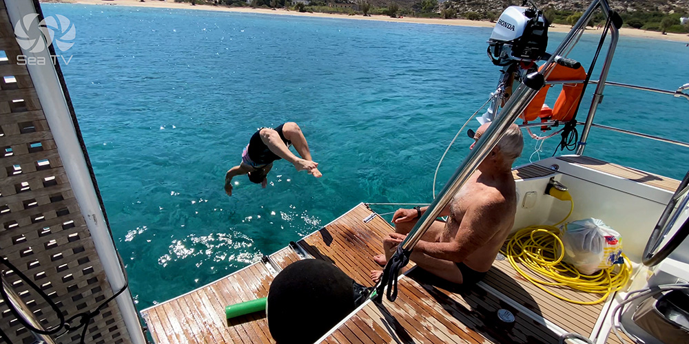
Special feature: A plane wreck in 8 m of water at the NE end of the bay, marked by a small buoy. Snorkelling around the wreck is recommended — one of the most unusual underwater attractions in the Cyclades, and easily accessible from a yacht anchored in the bay.
Best use: Day-anchor for the snorkelling. Calm-weather visit. The narrow shape limits options if conditions deteriorate, so plan around a settled forecast.
Wind Strategy on Iraklia
Calm to moderate weather: All three anchorages workable. Livadi Bay gives you the most space; Iraklia Key the most shelter; Alimias the snorkelling.
W / S / E winds: Livadi Bay is the right call — protection from these three sectors.
Strong Meltemi (NE): Livadi Bay is exposed. Move to Iraklia Key inside the deep NE inlet, or consider crossing to neighbouring Schinoussa or Koufonisia for more options.
Pro Tips for Iraklia
Approach Iraklia Key with the chartplotter on. The entrance from the north is hard to spot visually. Plot the entry waypoint and follow it in.
Snorkel down to verify the harbour anchor. Old mooring chains and big flat stones — both can foul. The water at Iraklia Key is usually clear enough to verify the set visually.
Don’t trust Livadi Bay in Meltemi. The bay protects from W/S/E but not from NE. If a Meltemi is forecast, move to Iraklia Key inside the NE inlet, or sail across to Koufonisia or Schinoussa.
Visit Alimias for the plane wreck. One of the most unusual snorkelling experiences in the Cyclades — the wreck sits in 8 m, marked by a buoy at the NE end of the bay. Bring fins and a mask. Calm weather only.
Eyeball the Livadi Bay underwater pipes. Set the anchor with the bottom in mind. The water is usually clear enough to see what’s down there.
Combine with neighbouring Lesser Cyclades. Iraklia + Schinoussa + Koufonisia work well as a 3-island Lesser Cyclades sub-loop within a longer Cyclades charter — all within 5–10 NM of each other, all quieter than the bigger islands.
Suggested Routes from Iraklia
East to Schinoussa: Short hop · the next Lesser Cyclades island. See Schinoussa Island.
East to Koufonisia: ~10 NM · third Lesser Cyclades stop. See Koufonisia Island and Koufinisi Marina.
North to Naxos: ~20 NM · the larger island to the north.
SW to Ios: ~25 NM · onward to Santorini direction. See Ios Island.
Full Cyclades route: See the SeaTV 8-Day Cyclades Route — Iraklia features in the eastern Lesser Cyclades section.
✅ Sailor’s Checklist for Iraklia
▢ Iraklia Key entrance plotted on chartplotter (hard to see from N)
▢ Old mooring chains + flat stones in harbour bottom understood
▢ Livadi Bay underwater pipes plotted
▢ Meltemi backup plan ready (Iraklia Key or cross to Schinoussa/Koufonisia)
▢ Snorkel gear ready for Alimias plane wreck
▢ Inside-pier-only mooring at the harbour confirmed
▢ VHF on Ch. 16 throughout
Emergency & Service Numbers — Iraklia
European Emergency: 112
Coastguard Distress (VHF Ch. 16): Universal
Coastguard Working (VHF Ch. 12): Per region
Naxos Port Authority: Closest active port · VHF Ch. 12 / 16
Olympia Radio (VHF Ch. 03/86): Greek HF/VHF maritime service
Watch the SeaTV Visual Pilot Video
Drone passes over the deep NE inlet at Iraklia Key, the open Livadi Bay, the narrow approach to Alimias, and underwater views of the plane wreck snorkel site. Free for members.
Related SeaTV Pages
South of Iraklia
→ Ios Island · onward to Santorini direction
Cyclades Routes & Region
Sailing Iraklia?
Three quiet anchorages, a hidden harbour entrance, and a sunken plane in 8 m at Alimias.
“Iraklia rewards the sailor who reads the chart carefully — entrance hidden from the north, mooring chains and flat stones on the bottom, underwater pipes in Livadi, and a plane wreck waiting at Alimias. Quieter than the bigger Cyclades, smaller than its reputation, with the Aegean’s most unusual snorkel.”
— SeaTV Visual Pilot · Cyclades Edition