SeaTV · Cyclades Islands · Milos
Milos Island — The Volcanic Caldera of the Western Cyclades
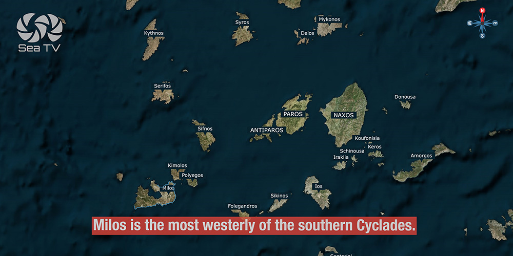
The most westerly of the southern Cyclades and one of the most monumental natural harbours in the Mediterranean. Six anchorages around a Pliocene caldera, the original home of the Venus de Milo, and the dramatic Kleftiko sea-caves on the south coast — the iconic Pirate Bay of the Aegean.
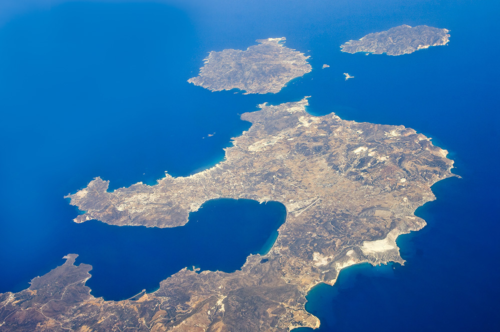
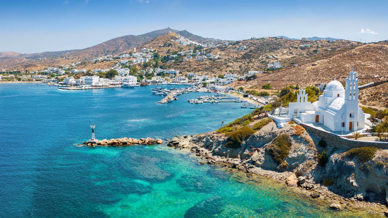
Milos is the most westerly of the larger southern Cyclades. The island owes its distinctive horseshoe shape and dramatic geology to its origin as the caldera of a Pliocene-period volcano — when the sea broke through a gap in the crater’s north-west side, it created what’s still considered one of the most monumental natural harbours in the Mediterranean, much like Santorini.
For sailors, this geology is everything. Adamantas sits inside the protected caldera bay — see the dedicated Milos Port (Adamantas) page for full mooring detail. Around the rest of the coast, six other anchorages each offer their own version of Milos’s drama: white volcanic cliffs at Kleftiko, painted fishermen’s houses on the water at Klima, white limestone canyons at Papafragkas, a mooring-chain trap at Pollonia. The mountain rises to 752 m at Profitis Ilias, sulphur hot springs still bubble in the north-east and south-east, and the seabed is volcanic enough that it can heat seawater and throw your depth sounder readings.
⚠ Reality check before sailing Milos:
→ Pollonia mooring chains running all over the bay — the headline hazard
→ Volcanic seabed can heat seawater · depth sounder readings may fluctuate
→ Kleftiko has shifting winds · crowded with day-tripper boats midday
→ Strong NW–NE Meltemi requires leaving Pollonia for safer alternatives
→ Klima, Provatas, Papafragkas are calm-weather only
⚓ Quick Facts for Sailors
Position
Most westerly · southern Cyclades
Geology
Pliocene volcanic caldera · 752 m peak
Main port
Adamantas (caldera-protected)
6 main anchorages
Adamantas, Pollonia, Provatas, Kleftiko, Klima, Papafragkas
Famous for
Venus de Milo · Kleftiko caves · Sarakiniko
Volcanic warnings
Heated seabed · sulphur springs NE/SE
Wind Strategy on Milos
The horseshoe shape of Milos creates very different shelter on different sides — choosing the right anchorage by wind direction is essential. The main caldera bay (Adamantas) is well sheltered, but the outer-coast anchorages each have specific wind exposure:
Strong NW–NE Meltemi: Leave Pollonia. Best alternatives are the protected Adamantas caldera, the East Cape Pilonisi anchorage, or — if conditions are extreme — the industrial bay of Voudia in the north-east, which is ugly but safe.
East winds: Pollonia (open to E), Papafragkas, Klima all become uncomfortable. Move to south-coast anchorages.
South winds: Provatas and Kleftiko become exposed. Move to Adamantas or Pollonia.
NE–SE winds: The east-coast bay of Agios Ioannis (sandy beach, monastery of St John Siderianos) becomes a workable alternative — uncharted but solid holding in sand with weed patches.
⚓ Six Anchorages Around Milos
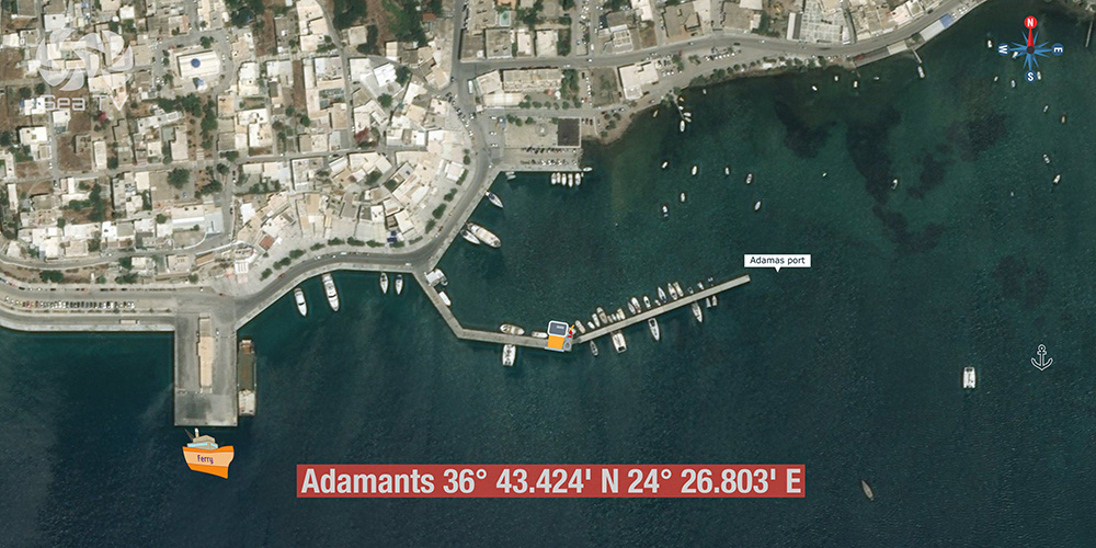
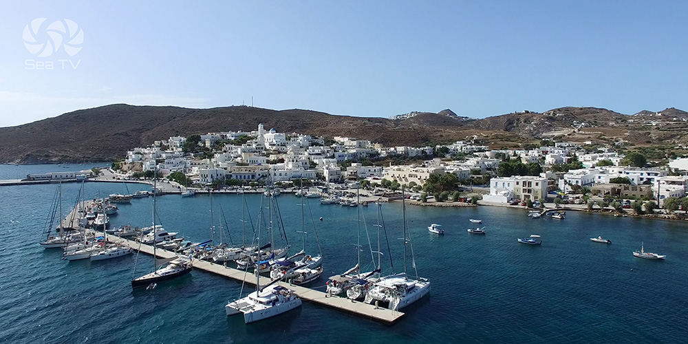
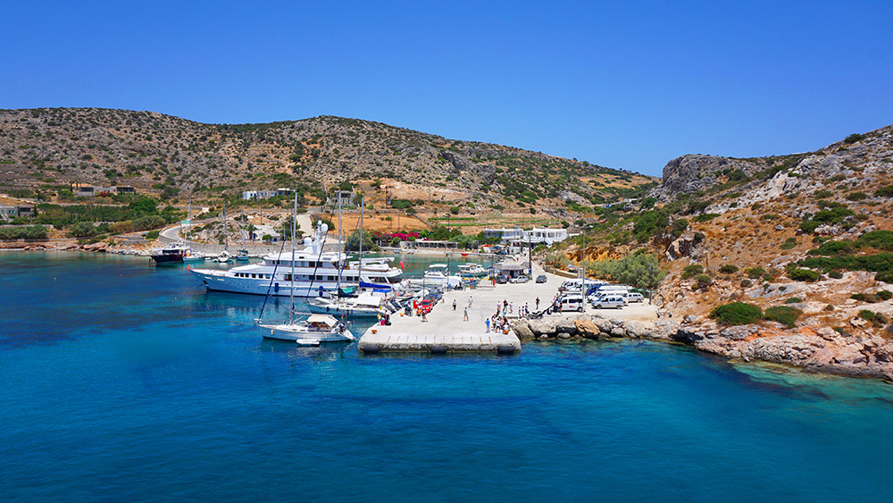
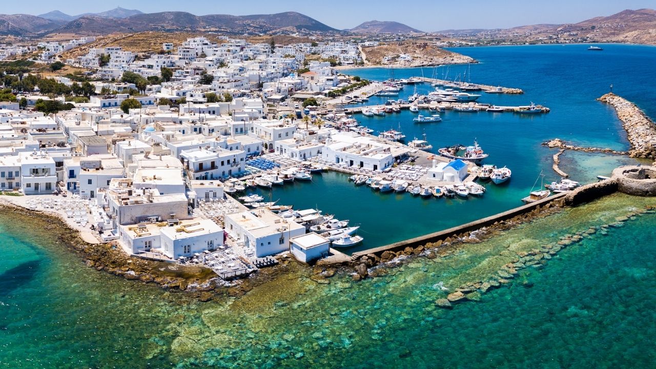
1. Adamantas · 36°43.424’N · 24°26.803’E · Main Port
Adamantas — Inside the Caldera
Position: Inside the natural caldera bay on the north side of Milos · the main working port and ferry hub.
Shelter: Excellent — the caldera bay is one of the best-protected harbours in the Aegean, comparable to Santorini’s protected anchorages.
Use: Charter check-in, full provisioning, ferry connections, base for boat-tour operators heading to Kleftiko, taxi to Plaka (capital, 5 km north) and Sarakiniko.
→ Full mooring detail: Milos Port (Adamantas) page
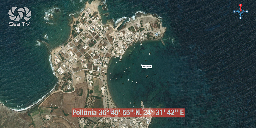
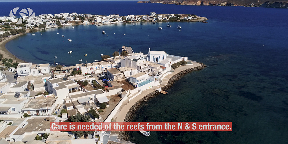
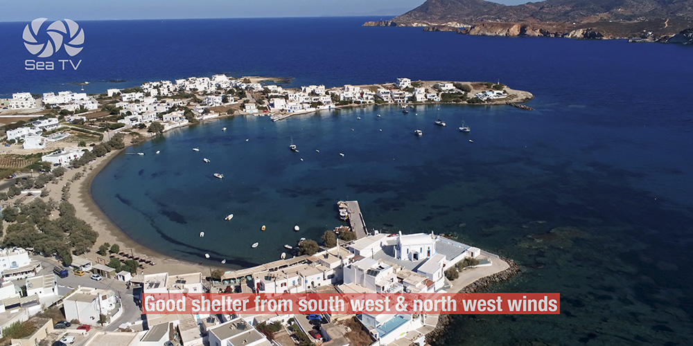
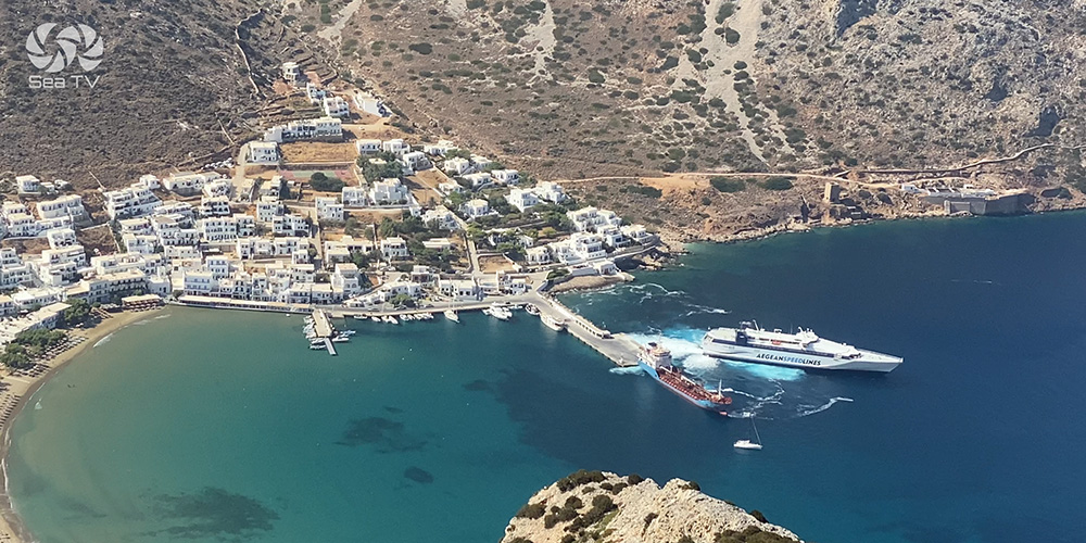
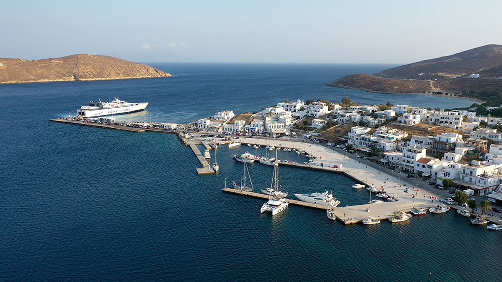
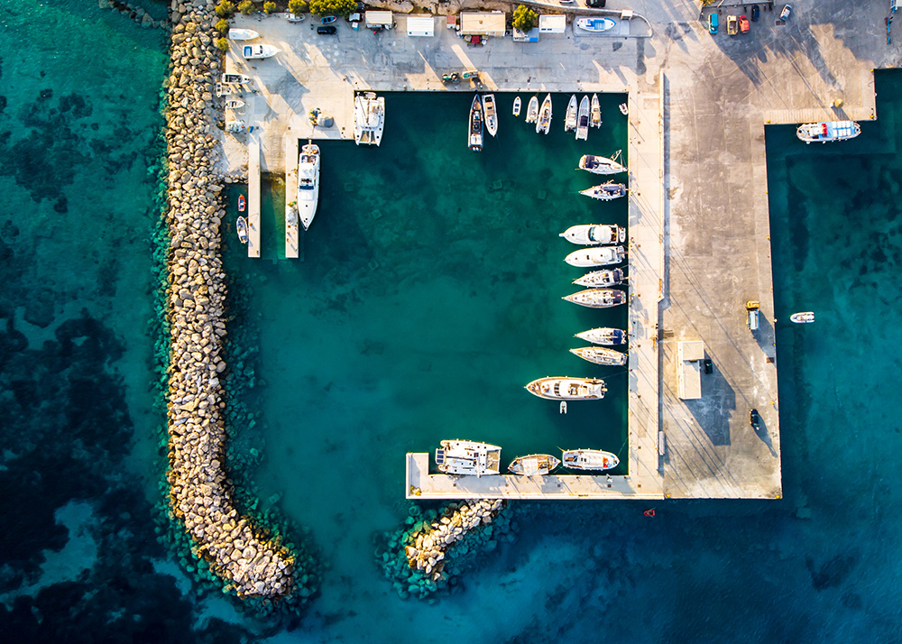
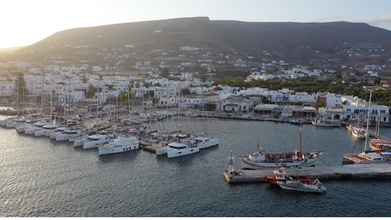
2. Pollonia · 36°45’55″N · 24°31’42″E · NE Coast
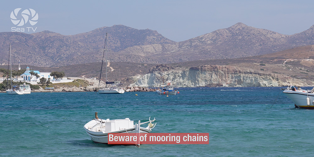
Pollonia — Mooring-Chain Trap
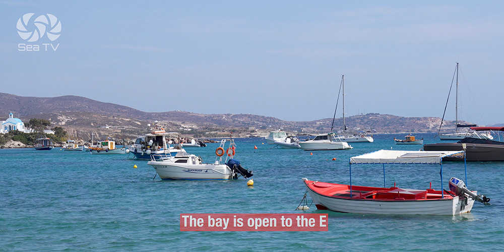
Position: NE side of Milos, on the channel between Milos and Kimolos. Working port with ferry quay, dive centre, tavernas, mini-markets.
⚠ Critical hazard #1: Mooring chains running all over the bay. The single biggest snag-trap on Milos. Drop anchor with extreme care; expect to foul someone else’s chain if you’re not paying attention.
⚠ Critical hazard #2: Reefs from both N and S entrance — plot them on the chartplotter before approaching.
Exposure: The bay is open to the E — uncomfortable in any easterly weight.
Best for: Calm settled weather only, with the Kimolos crossing nearby. Leave in strong NW–NE Meltemi for Voudia or East Cape Pilonisi.
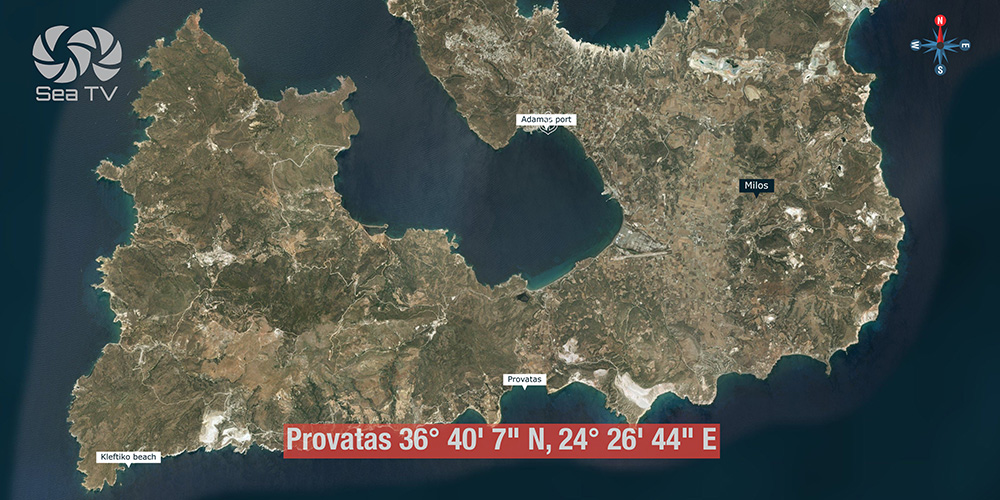
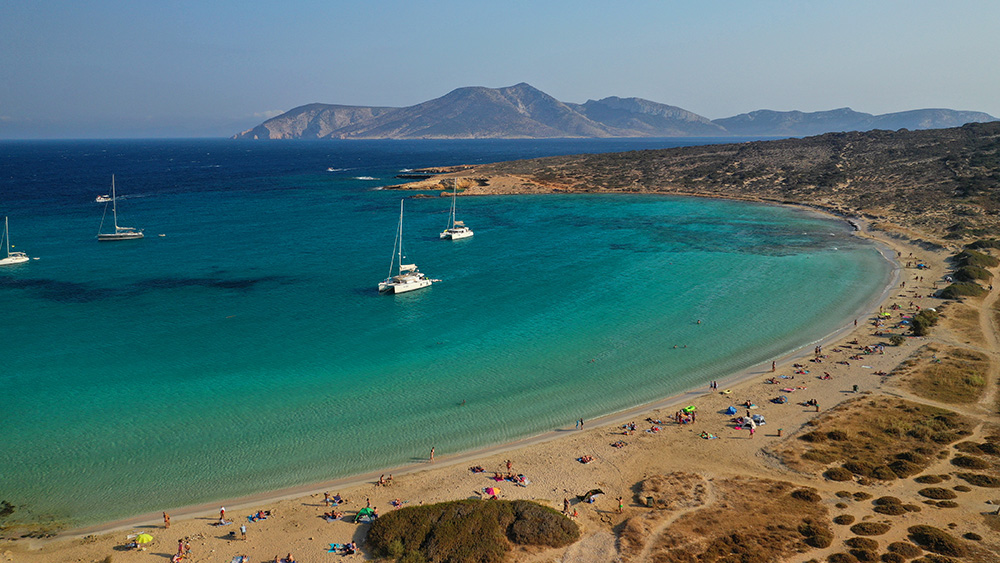
3. Provatas · 36°40’7″N · 24°26’44″E · S Coast · Calm Weather
Provatas — Two-Headed South Coast Bay
Position: South side of Milos · large two-headed bay with turquoise shallow waters and sand beaches.
Bottom: Sand · clear water · good visibility for set-and-check.
Best for: Calm weather day-anchor and overnight. The shape gives you two distinct heads to choose between based on wind angle. Tavernas ashore — walk the front and pick what looks good.
⚠ Limit: South-coast — exposed to any S weight. Calm weather only.
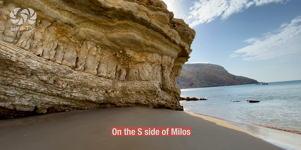
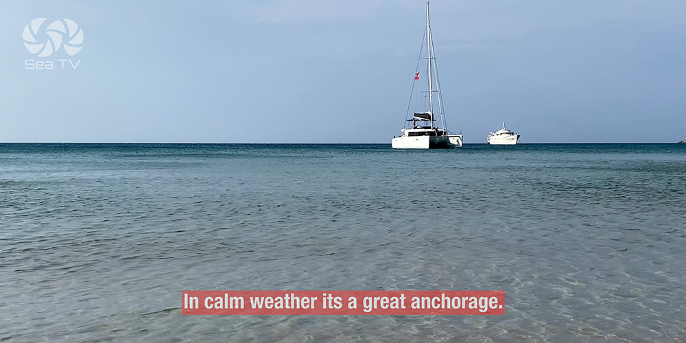
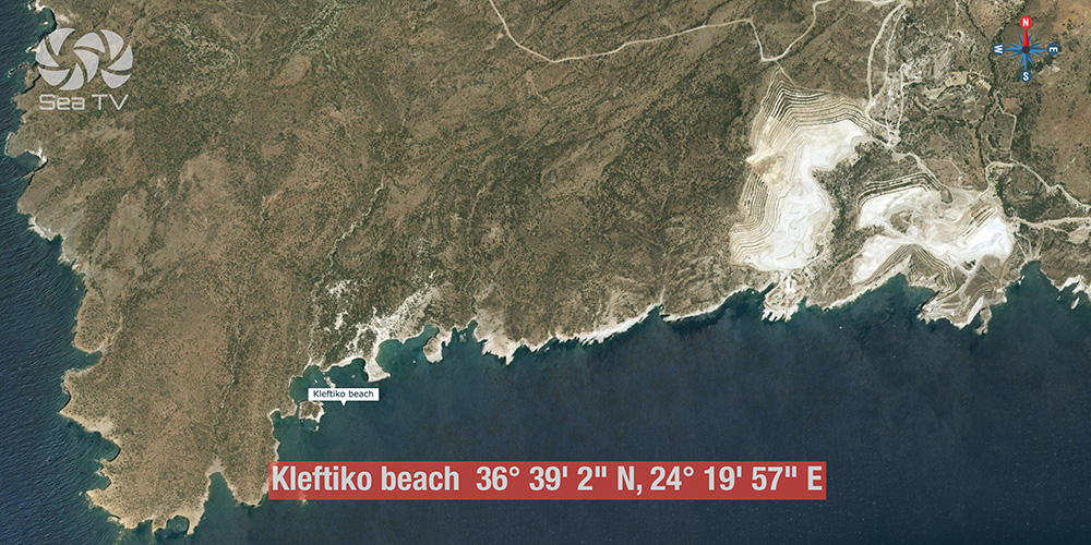
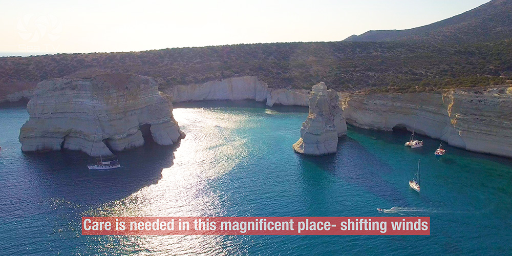
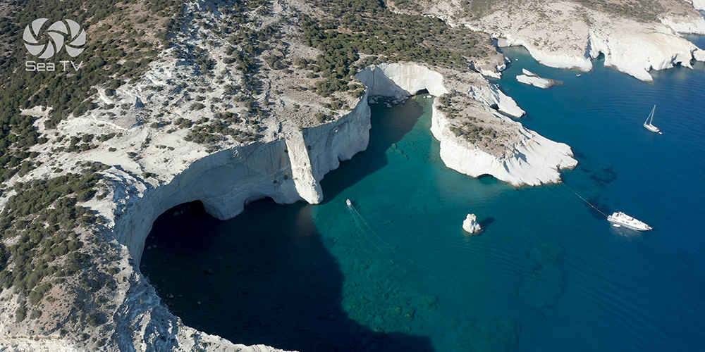
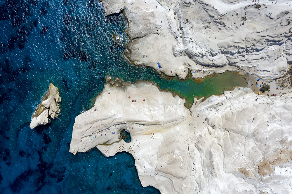
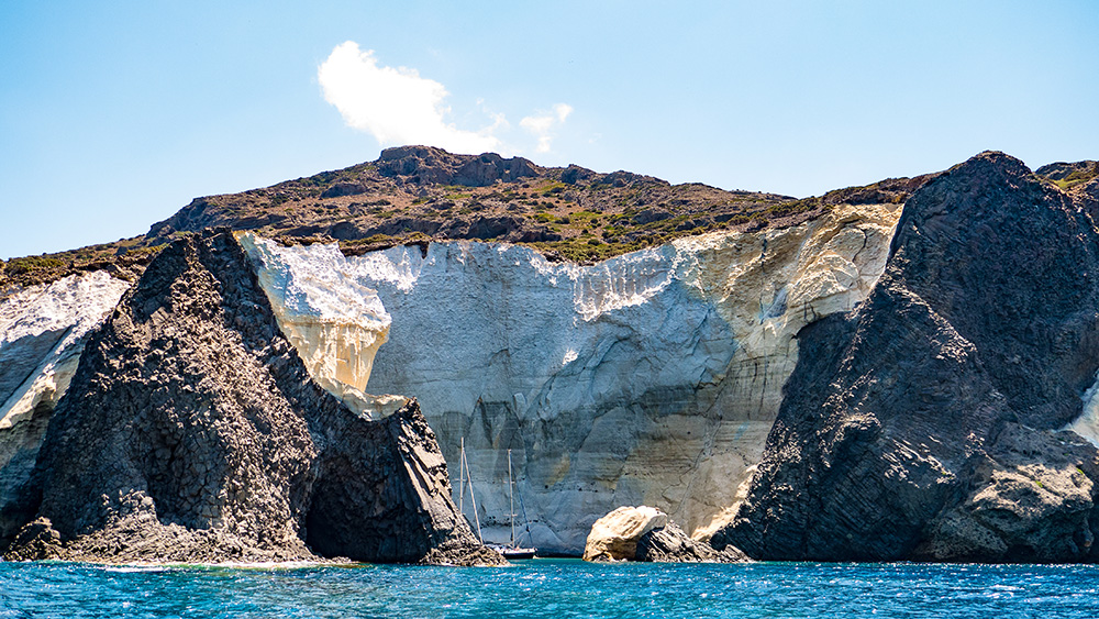
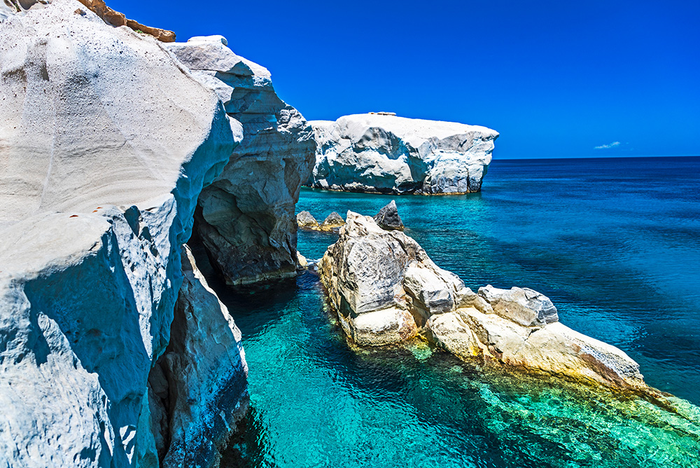
4. Kleftiko · 36°39’2″N · 24°19’57″E · SW Coast · Pirate Bay
Kleftiko — The “Sea Meteoras” of Milos
Position: Far south-western corner of Milos, remote and accessible only by sea. Towering white volcanic cliffs, sea caves, natural arches, tunnels carved by wind and waves over millennia. Greeks call it “Thalassina Meteora” — the Sea Meteoras.
History: The name comes from the Greek kleftis (thief). The 19th-century “thieves” weren’t pirates in the romantic sense — they were Greek partisans who lived in mountains and remote places, fighting against the Ottoman occupation. The hidden coves were perfect refuges.
⚠ Hazard #1: Shifting winds — the cove geometry funnels gusts unpredictably. Anchor with extra scope.
⚠ Hazard #2: Crowded daytime — multiple tour boats from Adamantas arrive daily 10:00–16:00. The bay can hold 20+ boats at peak.
Best for: Stay overnight — the day-tripper boats leave by 17:00 and you have one of the most photographed coastlines in the Aegean to yourself. Crystal-clear water for snorkelling. Calm weather only.
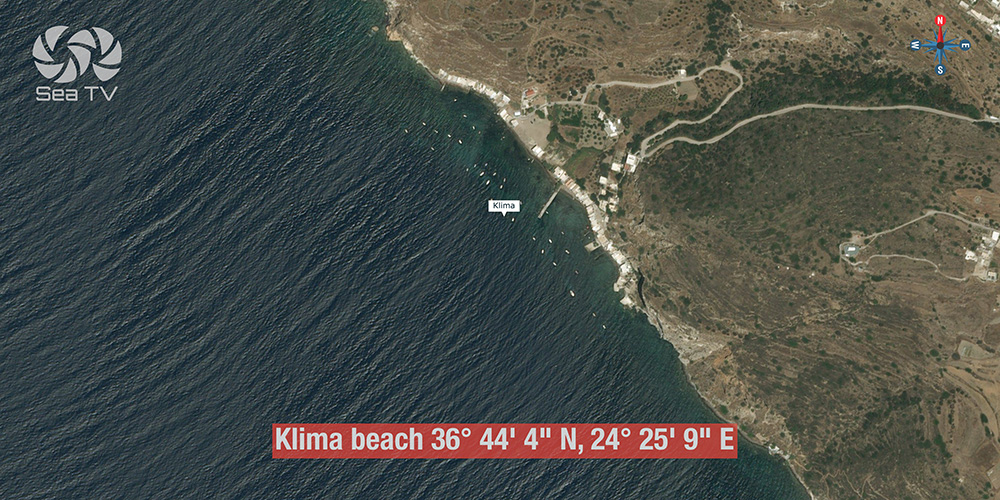
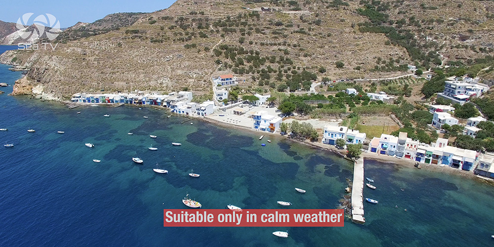
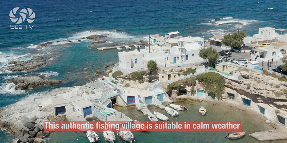
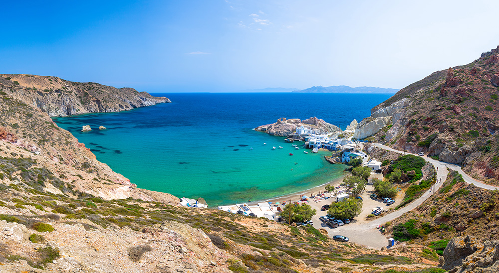
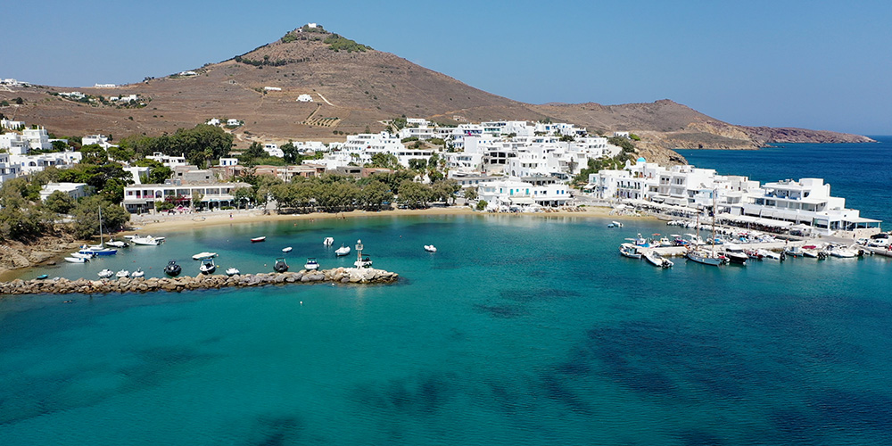
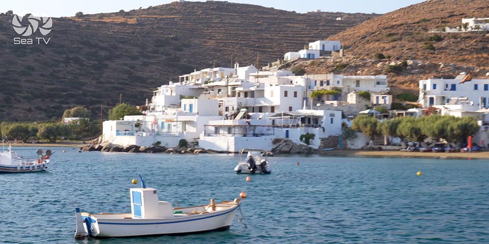
5. Klima · 36°44’4″N · 24°25’9″E · NW Coast · Calm Weather
Klima — Painted Houses on the Water
Position: NW coast of Milos, just outside the caldera mouth.
Character: The famous Syrmata — fishermen’s houses with brightly painted doors built directly on the water at the cliff base, with boats stored on the ground floor and living quarters above. One of the most photographed Greek-island scenes.
Best for: Day stop in calm weather, swim, photographs, walking ashore through the painted village. Tavernas ashore in the small harbour.
⚠ Limit: Calm weather only. Not an overnight choice — go back to Adamantas before evening.
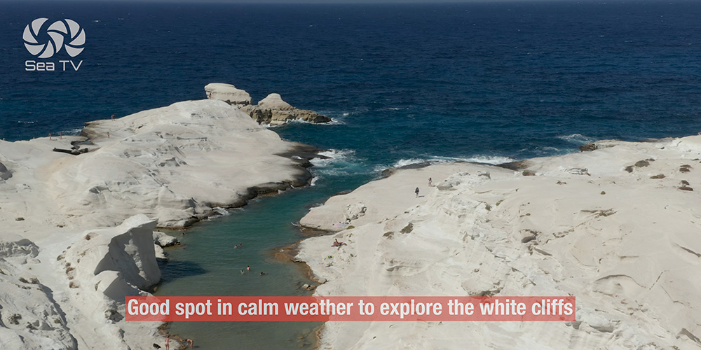
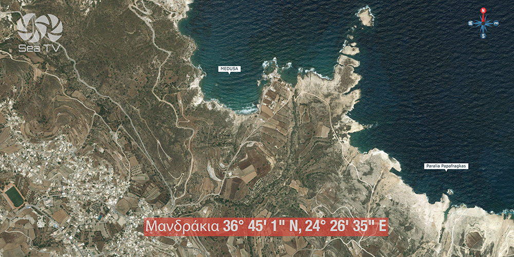
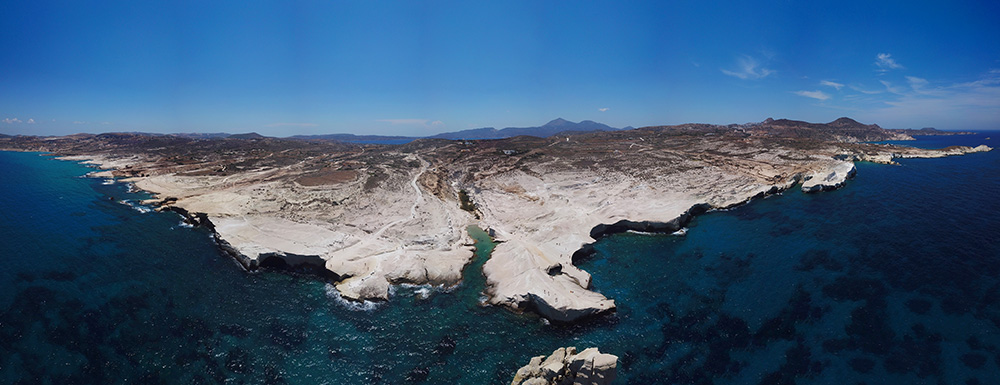
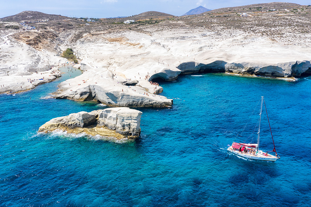
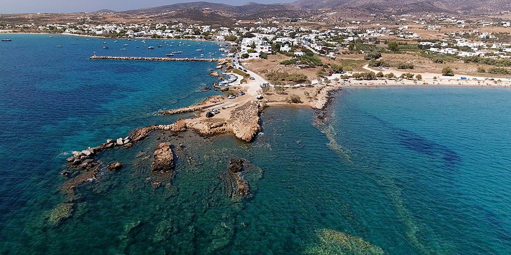
6. Paralia Papafragkas · 36°45’16″N · 24°30’5″E · N Coast · Calm Weather
Paralia Papafragkas — White Cliff Canyon
Position: North coast of Milos, near Pollonia.
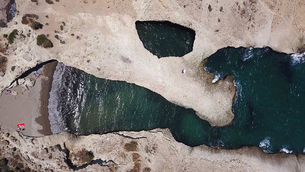
Character: Dramatic narrow canyon between white limestone cliffs, opening to a small turquoise beach. One of the most distinctive geological features on Milos.
Best for: Day stop and swim through the canyon entrance. Anchor in the wider water outside the canyon and dinghy/swim in.
⚠ Limit: Calm weather only · open north → exposed to the Meltemi.
⚓ Additional Milos Anchorages Worth Knowing
Beyond the six headline stops, several other locations on Milos are worth the chart plot — especially as Meltemi alternatives:
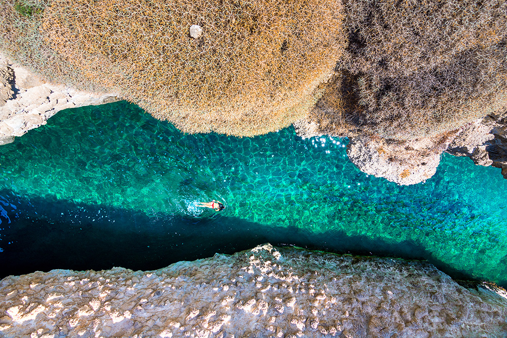
Sykia Cave (south coast): 0.8 NM south of Agios Ioannis bay. A roofless sea cave with a collapsed ceiling — sail through the visible arch on the coast and emerge in a hidden basin open to the sky. The largest cave on Milos. Day-trip stop only, calm conditions.
Tsigrado (south coast): Three coves around Cape Zefyros — aim for the easternmost cove with the beach. Good holding in sand. Land access via a ladder in the cliff. ⚠ Watch the Zefyros reef offshore the cape itself.
Voudia (NE industrial bay): Ugly working bay near the manganese export port — but offers real shelter in strong NW–NE Meltemi when other Milos anchorages become uncomfortable. Pragmatic, not pretty.
Agios Ioannis (east coast): Lovely remote sandy beach. Suitable in NE–SE winds. Solid holding in sand with weed patches. Short walk inland to the historic Monastery of St John Siderianos. Uncharted; eyeball the depths.
⚠ The Volcanic-Seabed Quirk
Milos is geologically active. The volcanic seabed in some areas can heat the seawater above it, causing depth sounder readings to fluctuate or seem unreliable. This is most pronounced near sulphur springs in the NE and SE of the island.
What to do: Cross-check with the chartplotter, observe the water colour, and don’t blindly trust a single sounder reading near suspected hot-spring areas. The Zefyros reef offshore Cape Zefyros is a particular case — there, your sounder is reliable, so trust it.
Bonus: The geology that creates the issue is also why Milos has the distinctive coloured cliffs, the catacombs, the manganese mines at Cape Vani, and the sulphur springs. The same volcanism that built the island still shapes the cruising experience.
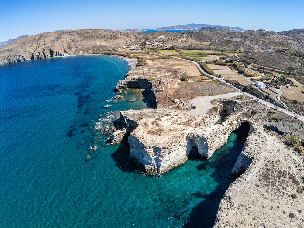
Cultural Context — Venus de Milo & Beyond
Venus de Milo — Discovered 8 April 1820
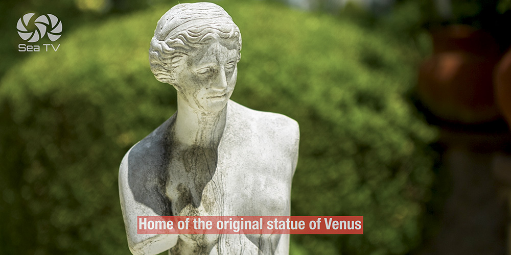
The single most famous artwork ever found on a Greek island was discovered on Milos. On 8 April 1820, a local farmer named Yorgos Kentrotas was clearing stones near the ruins of the ancient theatre at the village of Trypiti when he uncovered a marble figure in a wall niche. A French naval ensign, Olivier Voutier, helped excavate the rest. What emerged was a Hellenistic statue of a goddess — over 2 metres tall, in Parian marble, missing both arms — created around 150–100 BCE, attributed to the sculptor Alexandros of Antioch.
The statue was acquired by France within months and presented to King Louis XVIII, who donated it to the Louvre Museum in 1821. Now known as the Venus de Milo (Aphrodite of Milos), it is one of the three most famous works in the Louvre, alongside the Mona Lisa and the Winged Victory of Samothrace. The discovery site at Trypiti is walkable from Adamantas — a 30-minute walk or short taxi.
The Catacombs of Milos
Below Trypiti, the early-Christian Catacombs of Milos are one of the three most important early-Christian burial sites in the world (alongside Rome and the Holy Land). Used 1st–5th centuries AD, with some 290 burial niches in a network of tunnels. Visitable, atmospheric, and unique to Milos.
Plaka — The Capital
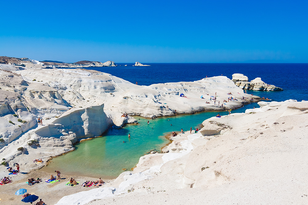
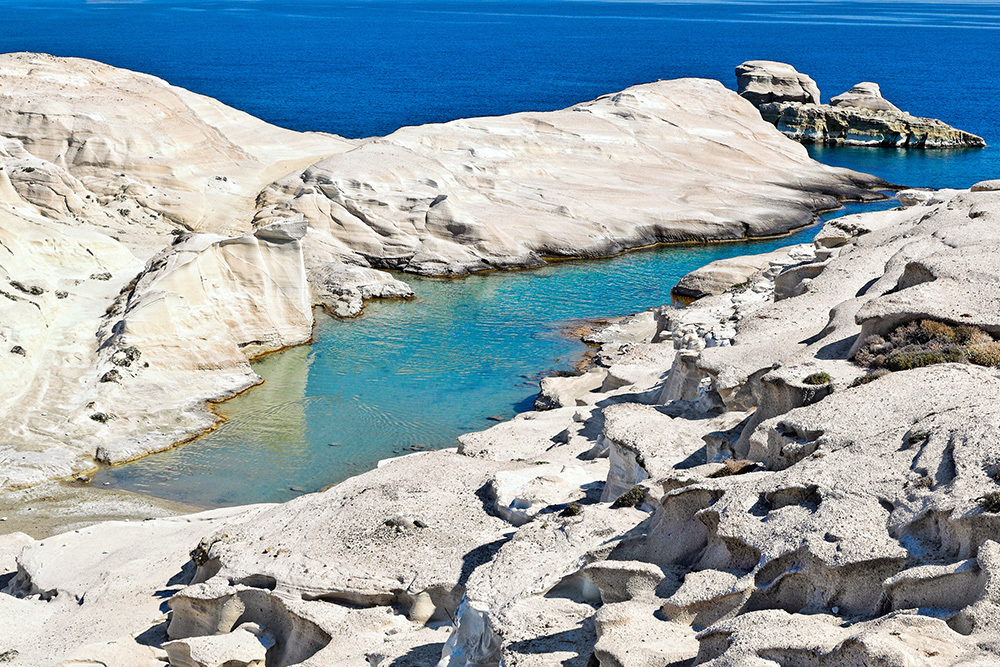
5 km north of Adamantas, Plaka is the traditional capital of Milos — a small whitewashed Cycladic town with a Venetian castle (Kastro) at the top, panoramic views across the caldera bay, and a sunset reputation. Worth a half-day from the boat. Sarakiniko — the iconic lunar-landscape beach made of white volcanic rock — is a 10-minute taxi from Plaka.
Cape Vani & the Manganese Mines
On the western tip of the island, Cape Vani hosts the abandoned manganese mine — colourful mineral cliffs, industrial ruins, and one of the most striking hike destinations on Milos. Accessible by sea (anchor in calm weather) or by 4×4 from Plaka.
Pro Tips for Sailing Milos
Sleep at Kleftiko, not visit. The day-tripper boats leave by 17:00. Stay overnight on a calm-weather day and you have one of the most photographed coastlines in the Aegean entirely to yourself for sunset, swim, and the Aegean dawn. Just verify the forecast — shifting winds at night demand a settled outlook.
Plot Pollonia chains carefully. The mooring chains are the headline Milos hazard. If you must anchor in Pollonia, drop short, set conservatively, and snorkel down to check before leaving the boat unattended. Ask the dive centre staff — they know exactly where the chains run.
Cross-check the depth sounder. Volcanic seabed near sulphur springs can give fluctuating readings. Eyeball the water colour and chartplotter contours alongside the sounder, especially in the NE and SE.
Voudia is your Meltemi insurance. Industrial, ugly, working manganese export bay — but it’s the safest harbour on Milos in heavy NW–NE winds when Pollonia is impossible and Adamantas might be busy. Save the position.
Walk to Trypiti and the catacombs. 30 minutes from Adamantas to where the Venus de Milo was found. The ancient theatre, the catacombs, and the discovery niche are all within walking distance. Cultural payoff for a low-effort shore day.
Sarakiniko by taxi from Adamantas. The famous lunar-landscape beach — white volcanic rock formations sculpted by waves — is a 10-minute drive from the port. Worth the half-hour trip ashore. Best at golden hour.
Use Milos as a Cyclades alternative. If Santorini’s deep-water mooring complications worry you, Milos offers equally dramatic volcanic landscapes (caldera bay, Kleftiko caves, Sarakiniko) with much easier mooring at Adamantas. Often the right call for a Cyclades week.
Suggested Routes from Milos
North to Sifnos and Serifos: The natural Cyclades-return chain. Adamantas → Kamares (Sifnos) is ~22 NM north. See the Sifnos Island page and Kamares Port.
East to Santorini: Cross the open Aegean ~50 NM. Demanding leg in Meltemi, manageable in calm. See Santorini (Thira).
North-East to Paros: ~35 NM via Sifnos channel. See Paros Island Anchorages.
North to Kimolos: The neighbouring volcanic island, ~3 NM from Pollonia. Quieter than Milos.
Full Cyclades route: See the SeaTV 8-Day Cyclades Route for full multi-island planning.
✅ Sailor’s Checklist for Milos
▢ Pollonia mooring chains understood · approach with extreme care
▢ Pollonia N & S entrance reefs plotted on chartplotter
▢ Voudia position saved as Meltemi-shelter backup
▢ Volcanic-seabed depth-sounder fluctuation expected near hot-spring areas
▢ Zefyros reef plotted offshore Cape Zefyros
▢ Kleftiko overnight planned for after 17:00 (day-trippers leave)
▢ Provatas / Klima / Papafragkas confirmed calm-weather only
▢ Cultural day planned (Trypiti / catacombs / Sarakiniko)
▢ VHF on Ch. 16 throughout
Emergency & Service Numbers — Milos
European Emergency: 112
Coastguard Distress (VHF Ch. 16): Universal
Coastguard Working (VHF Ch. 12): Per region
Milos Port Authority (Adamantas): VHF Ch. 12 / 16
Pollonia Port Authority: VHF Ch. 12 / 16
Olympia Radio (VHF Ch. 03/86): Greek HF/VHF maritime service
Watch the SeaTV Visual Pilot Video
Drone passes over the white cliffs of Kleftiko, approach into the Adamantas caldera, the mooring-chain field at Pollonia, the volcanic colours of the Sarakiniko coastline, and the painted houses at Klima — Milos seen from the cockpit and the air. Free for members.
Related SeaTV Pages
Milos · Other Pages
→ Milos Port (Adamantas) Harbour · the main port detail page
Greater Region
→ Athens charter bases (where Cyclades weeks begin)
Sailing to Milos?
Volcanic caldera, painted houses, the Pirate Bay sea-caves — the Cyclades’s most distinctive island.
“Milos is the Cyclades you came for — a Pliocene caldera you sail into, the painted houses of Klima, the white cliffs of Kleftiko after the day-trippers leave. Watch the Pollonia chains, trust the chartplotter over the sounder near the hot springs, and stay overnight at the Pirate Bay. The Venus came from here for a reason.”
— SeaTV Visual Pilot · Cyclades Edition