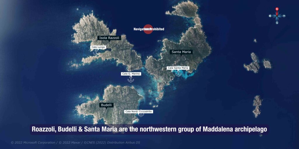
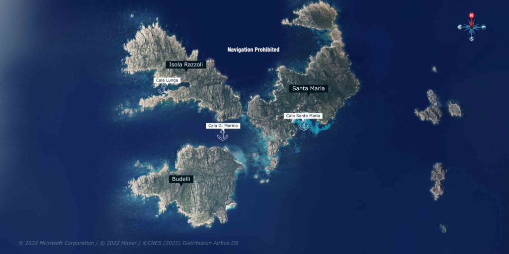
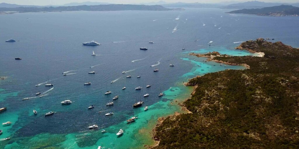
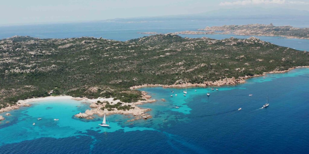
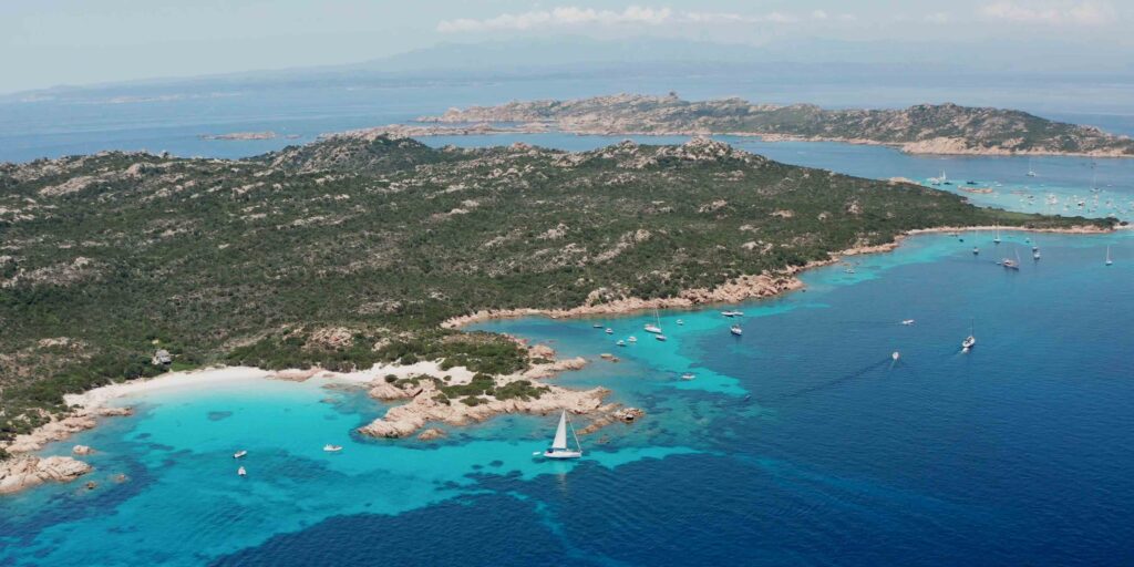
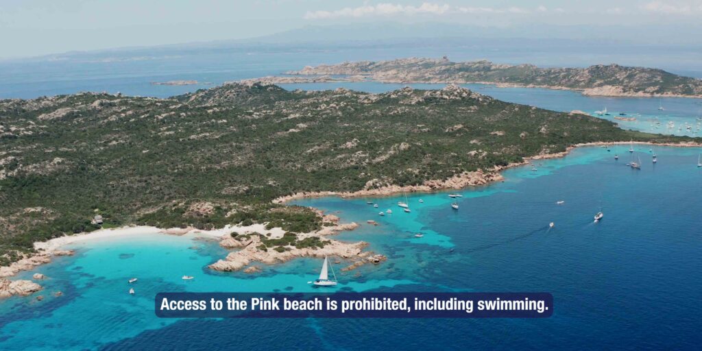
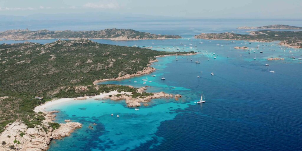
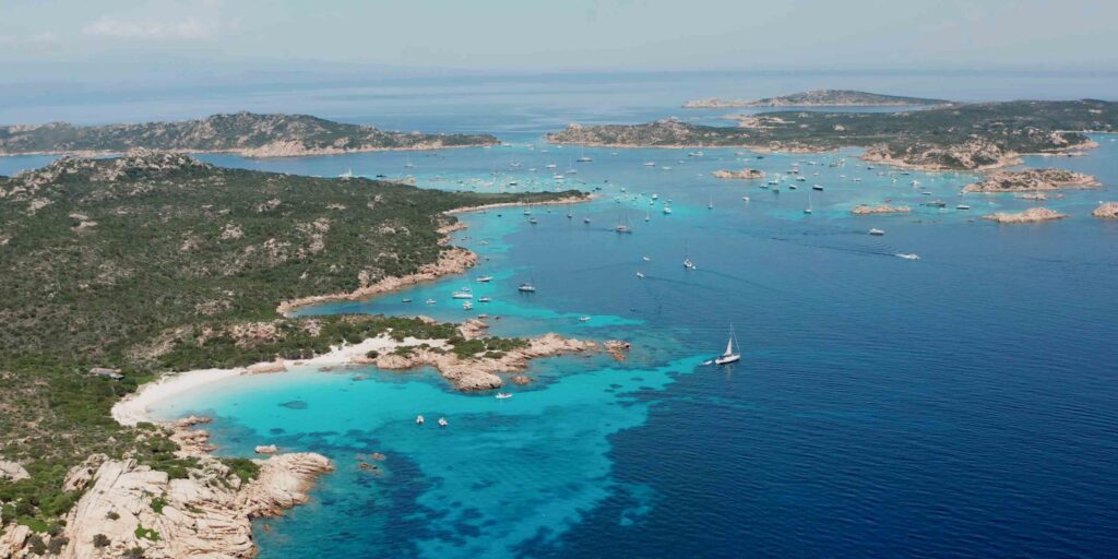
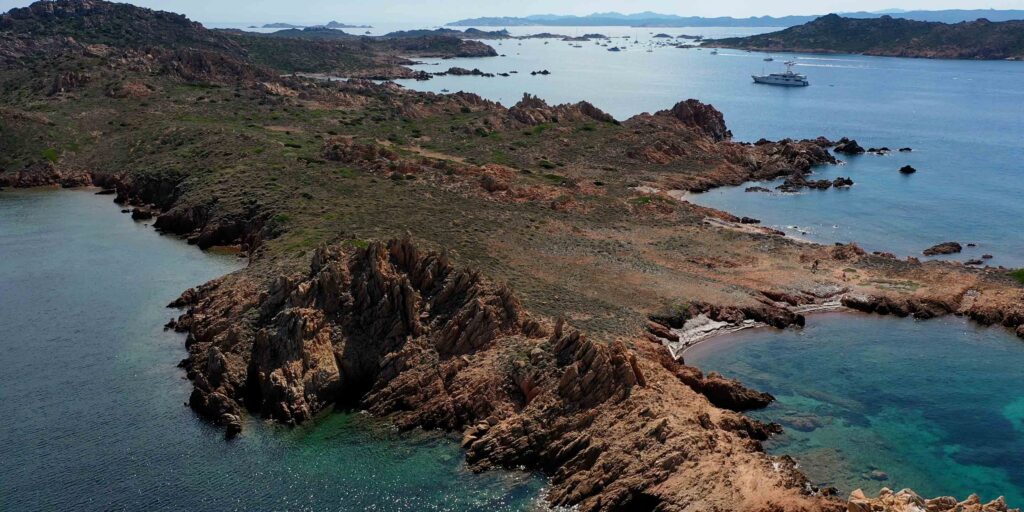
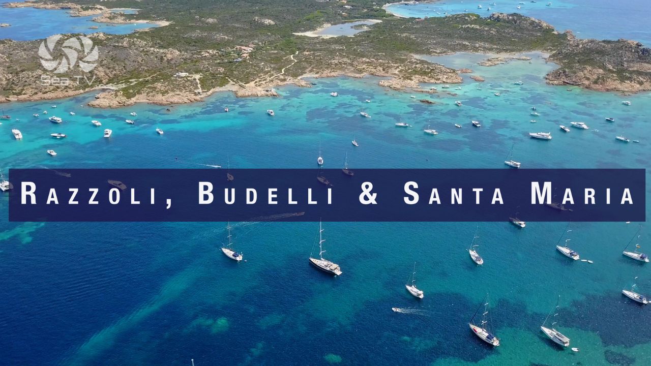
Razzoli, Budelli, and Santa Maria form the northwestern group of the La Maddalena Archipelago — the wildest, most remote, and most beautiful corner of the national park. Between them lies one of the most extraordinary stretches of water in the Mediterranean: Porto della Madonna (Spiaggia del Cavaliere), where the channel between the three islands creates a natural saltwater pool of impossible blue. This is also where you find the legendary Spiaggia Rosa (Pink Beach) on Budelli — currently designated Zone A of the national park, meaning access, anchoring, swimming and navigation within 70 metres is prohibited.
⚠ National Park Permit Required: All vessels must obtain a permit before entering park waters. Apply at autorizzazioni.lamaddalenapark.it. Fines are significant. Night anchoring (21:00–08:00) only on park-authorised buoys. No Posidonia anchoring throughout.
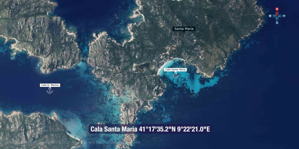
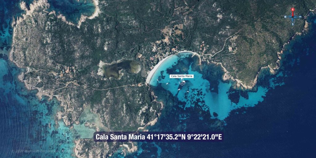
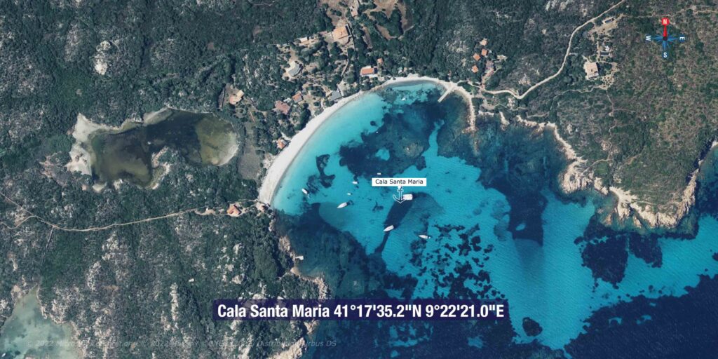
⚓ Anchorage 1 — Cala Santa Maria
| Coordinates | 41°17’35.2″N / 9°22’21.0″E |
| Island | Santa Maria (E side, near Faro di Punta Filetto lighthouse) |
| Depth | 5–6m, sand |
| Shelter | Open to S and E — good protection from W |
| Character | Spacious, good holding, nice beach ashore. Gets very busy during the day but calmer in morning and evening. |
Cala Santa Maria is the largest and most comfortable anchorage in the northern islands — good depth, sand bottom, space for many boats, and a beautiful beach accessible from the dinghy. The Faro di Punta Filetto lighthouse at the eastern tip of Santa Maria is a visible approach landmark. Busy by mid-morning in high season, but mornings and evenings are calm. Best overnight option when westerly winds prevent using Cala Lunga on Razzoli.
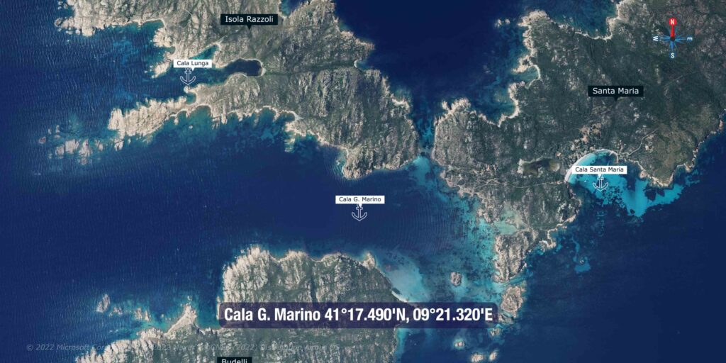
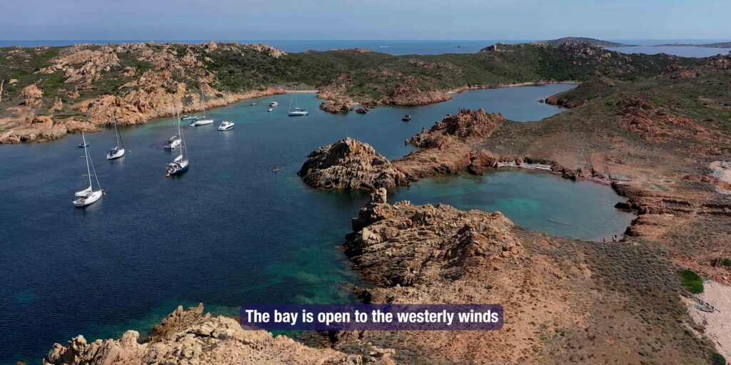
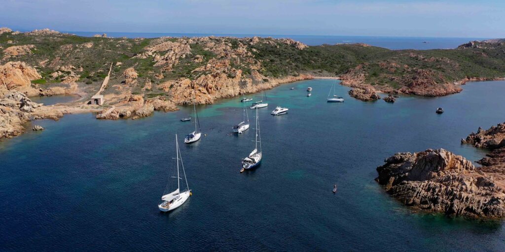
⚓ Anchorage 2 — Cala G. Marino (Porto della Madonna)
| Coordinates | 41°17.490’N / 9°21.320’E |
| Location | Between Razzoli, Budelli and Santa Maria |
| Depth | 3–5m, sand and rock |
| Mooring | Pick up a mooring buoy or anchor off southern shore |
| Shelter | Relatively sheltered from most winds by the surrounding islands |
The channel between the three islands creates a naturally protected basin — the locals call it Porto della Madonna or Manto della Madonna, referring to the extraordinary blue of the deeper water. Anchor or pick up a mooring off the southern shore of Razzoli in 3–5m. This is the anchorage closest to Spiaggia del Cavaliere and gives you the best position for an early morning visit before the crowds arrive. Best in settled conditions — if westerlies build, the protection from the surrounding islands is better than open water but it can still become uncomfortable.
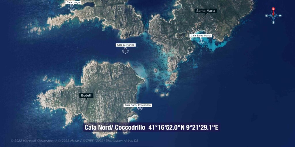
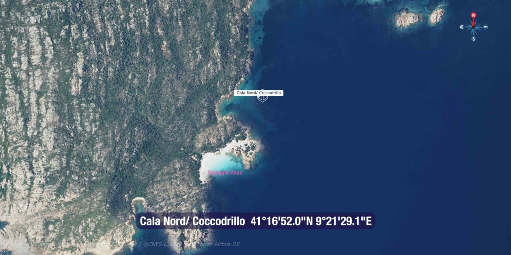
⚓ Anchorage 3 — Spiaggia del Cavaliere
| Location | N coast of Budelli, between Budelli and Santa Maria |
| Depth | Shallow — anchor in designated delimited zone only |
| Shelter | Good from all winds except E |
| Character | The finest water in the archipelago. Anchoring in park-delimited zone only. Extremely crowded July–August. |
Spiaggia del Cavaliere is what sailors call “the swimming pool” — a shallow, wind-cleaned stretch of water between Budelli and Santa Maria with water transparency that defies description. Fine white sand, turquoise water, pink granite rocks. Continuously cleaned by wind and currents. Anchoring is permitted only within the park-delimited zone (marked by buoys). Do not anchor outside this zone.
Important: Boats are not permitted to approach Spiaggia del Cavaliere beach itself — anchoring is in the delimited zone offshore. From the anchorage, a wooden walkway leads to Spiaggia Rosa (Pink Beach, Cala di Roto). You can walk to the pink beach via this walkway — but you may not step on the beach itself, swim near it, or navigate within 70 metres of the Spiaggia Rosa shore. Fines for violations are enforced.
Spiaggia Rosa (Pink Beach) — What You Need to Know
The Pink Beach (Cala di Roto, SE side of Budelli) is one of the most famous beaches in the Mediterranean — its pink colour comes from fragments of a tiny microorganism (Miniacina miniacea) that lives in the Posidonia meadows. The colour is unique and has been photographed worldwide since Michelangelo Antonioni filmed here in 1964.
Today it is designated Zone A (Integral Protection) of the national park:
- No anchoring within 70 metres of the beach
- No navigation closer than 70 metres
- No swimming in the bay
- No landing on the beach
- Viewing from the wooden walkway via Spiaggia del Cavaliere is the only authorised access
The caretaker (Mauro Morandi, who lived on the island for 25 years) has now left. Park rangers and surveillance cameras monitor the beach. Violations result in significant fines.
⚠️ Chiesa di Morto Channel
Shallow water — navigate with extreme care: The channel between Santa Maria and Budelli (Chiesa di Morto / Passo degli Asinelli) is very shallow in places — as little as 1 metre in spots. Do not attempt in a keelboat without precise local knowledge and a rising tide. Use the chart at maximum zoom, proceed slowly, and have crew watching the water. Many boats have grounded here. If in any doubt, go around the outside.
️ Anchorage Summary
| Anchorage | Best wind | Best for |
| Cala Santa Maria | Any except SE | Overnight, families, good holding. Spacious. |
| Cala G. Marino / Porto della Madonna | Most directions | Access to Cavaliere and Pink Beach walkway. Day/overnight. |
| Spiaggia del Cavaliere | All except E | Swimming, snorkelling. Arrive before 09:00 in season. |
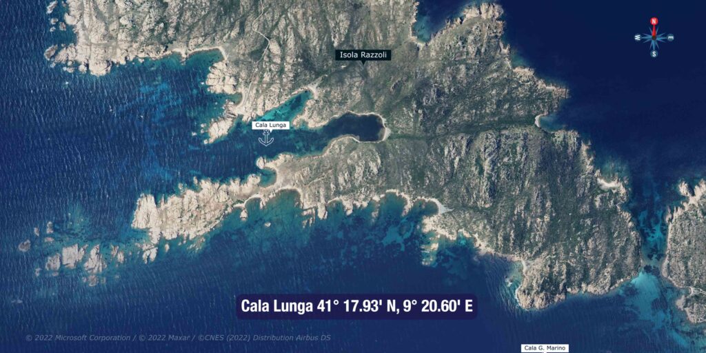
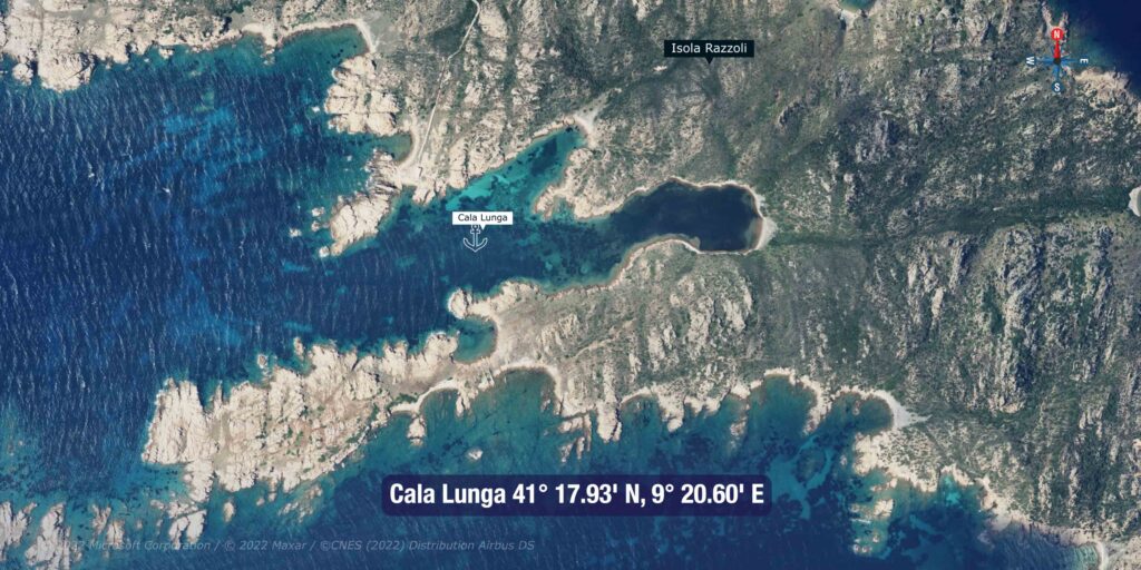
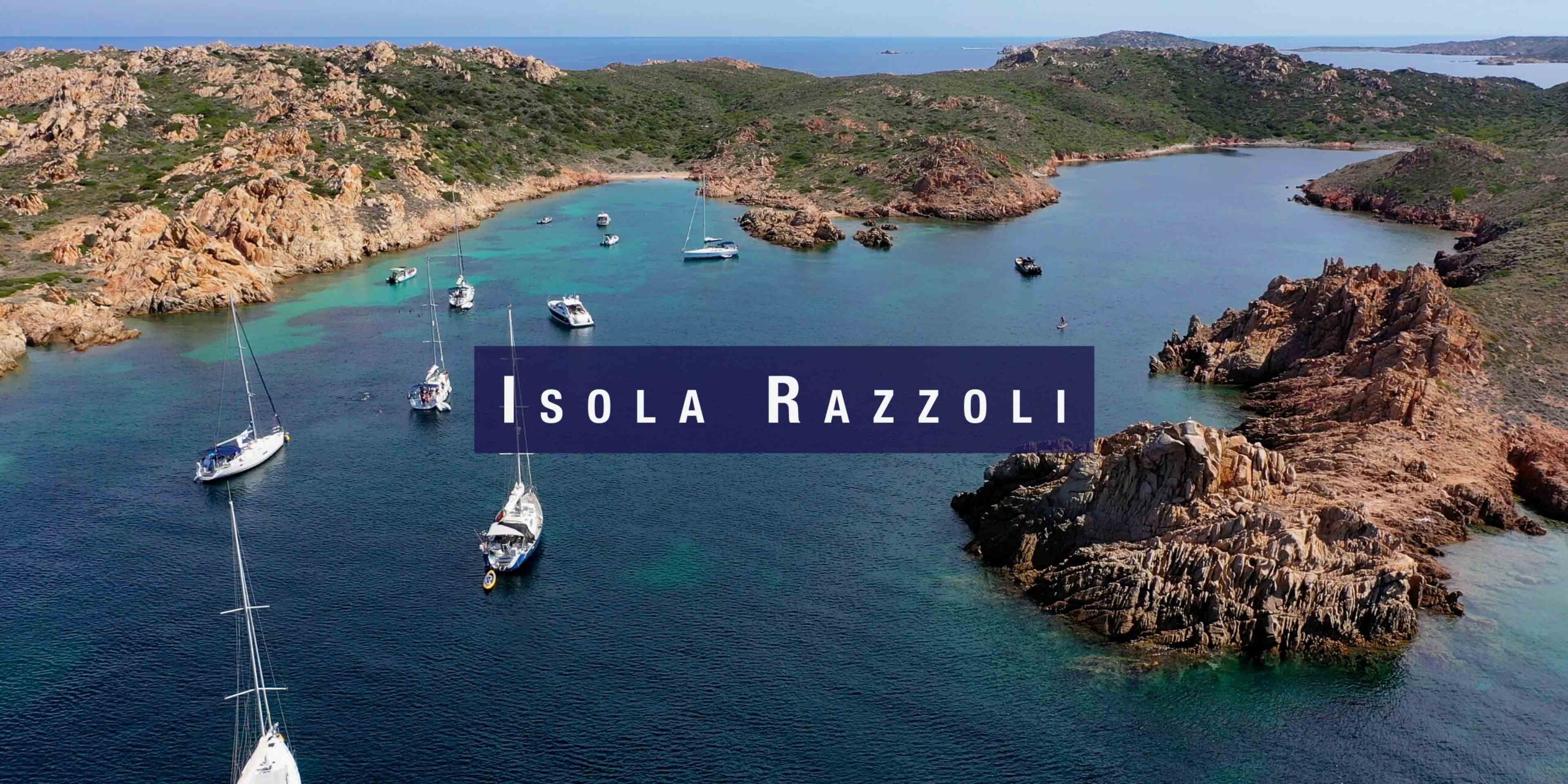
| Cala Lunga, Razzoli | N and SW | Sheltered, remote, granite setting. Rocks at entrance — approach carefully. |
Sailor’s tip: The northern islands are best in June and September. July and August see hundreds of excursion boats from La Maddalena and Palau arriving daily from 09:00. Arrive before 08:30 for Spiaggia del Cavaliere and you’ll have it almost to yourself. By 10:00 in August, the zone is packed. The same applies to Cala Santa Maria. For overnight peace, Cala Lunga on Razzoli is the most remote and least crowded.
✅ Safety Checklist
- Park permit obtained before entering park waters
- Night anchoring on park buoys only (21:00–08:00)
- Spiaggia Rosa — Zone A: no approach within 70m, no swimming, no landing
- Spiaggia del Cavaliere — anchor in delimited zone only
- Chiesa di Morto channel — extremely shallow, avoid in keelboats
- No Posidonia anchoring throughout the park
- NW wind in Bocche di Bonifacio accelerates rapidly — monitor forecast, ready to escape south to Cala Gavetta
Nearby Destinations
| Destination | Distance | Notes |
| Cala Lunga, Razzoli | 1.5 nm W | Remote, sheltered, granite anchorage. |
| Cala Gavetta, La Maddalena | 10 nm S | Full marina, fuel, provisioning, chandlery. |
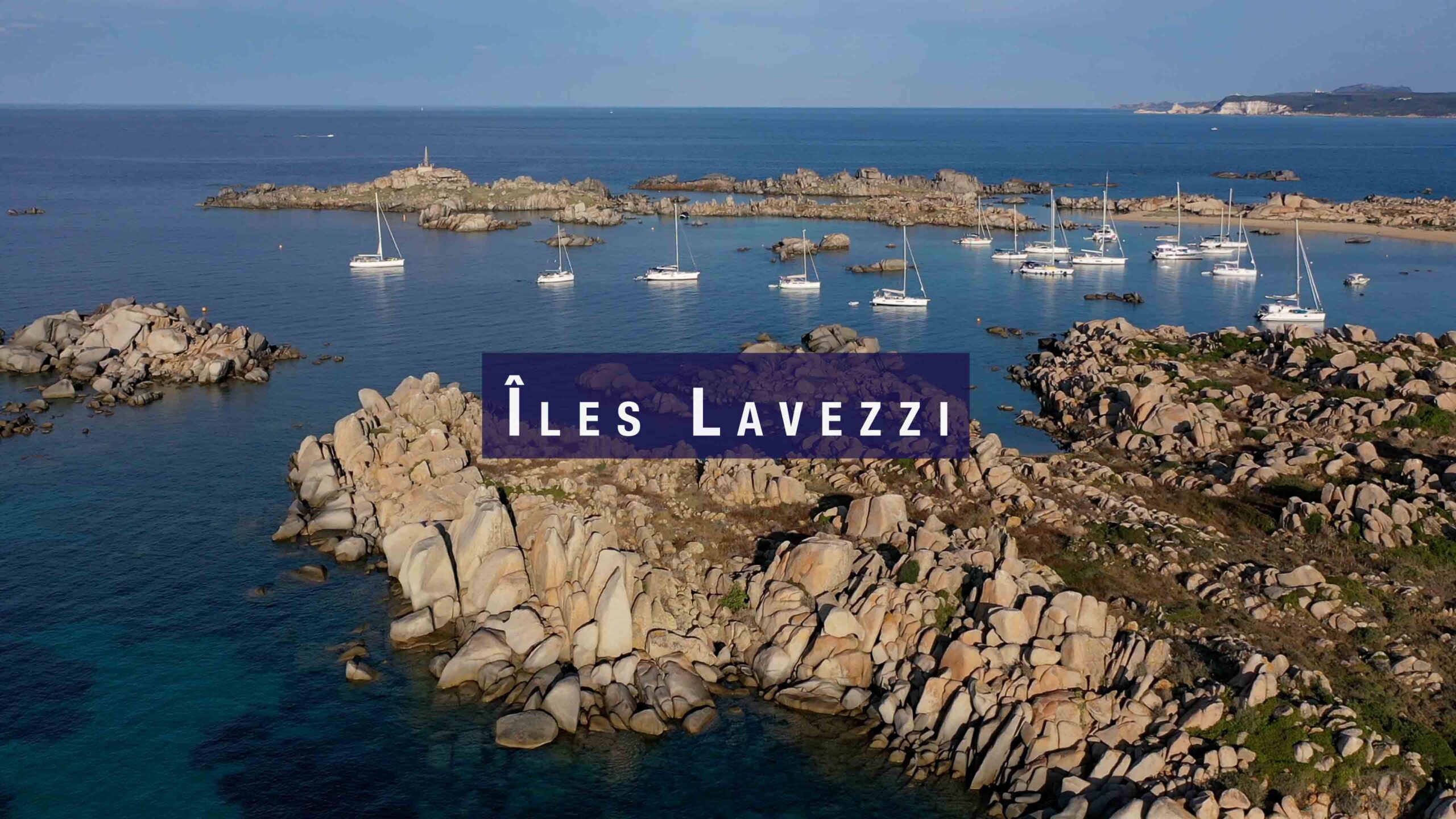
| Îles Lavezzi | 15 nm W | Corsican nature reserve. Daylight approach only. |
| Santa Teresa Gallura | 17 nm SW | Full marina. Ferry to Bonifacio. |