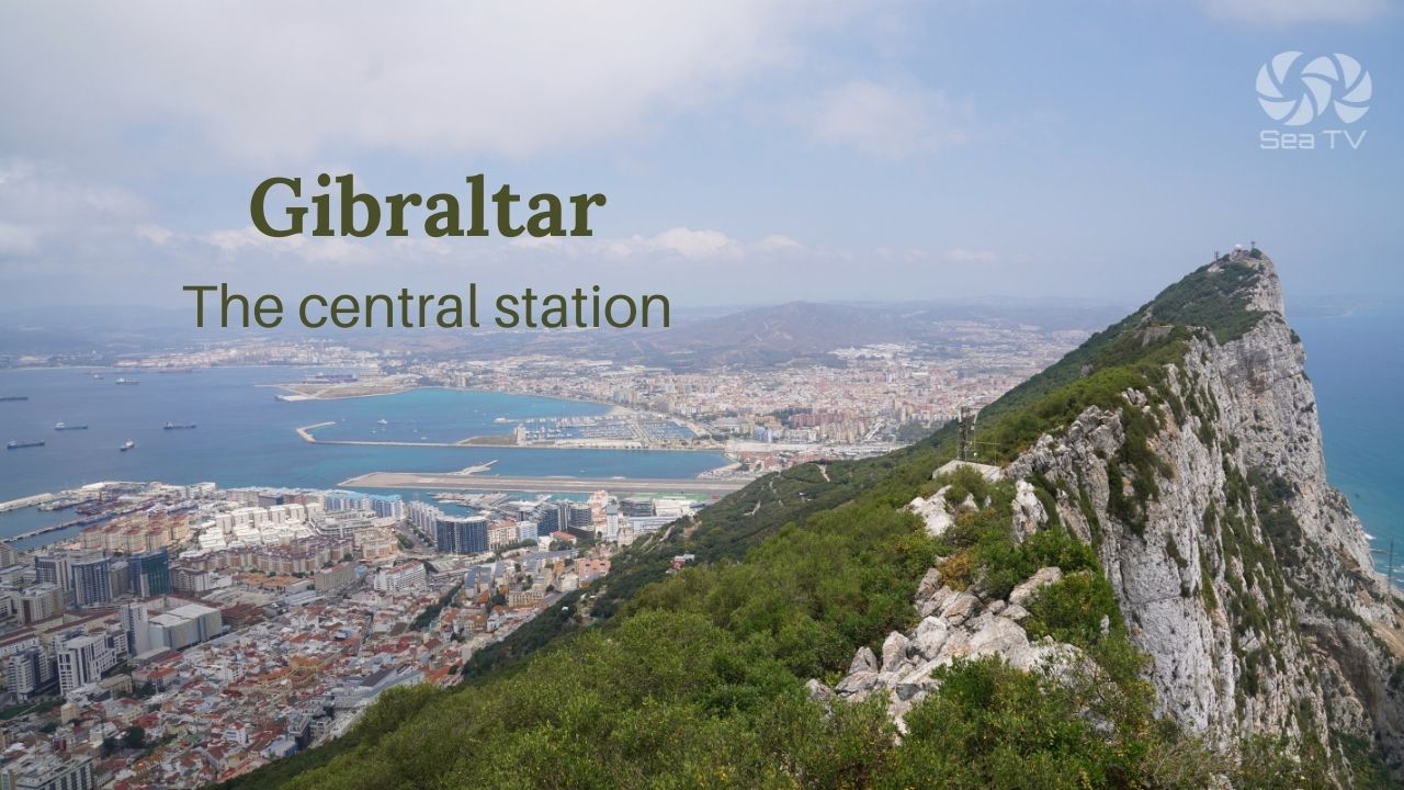
SeaTV · Spain · Andalusia · Puerto de Barbate
Puerto de Barbate — The Last Atlantic Shelter Before the Strait of Gibraltar
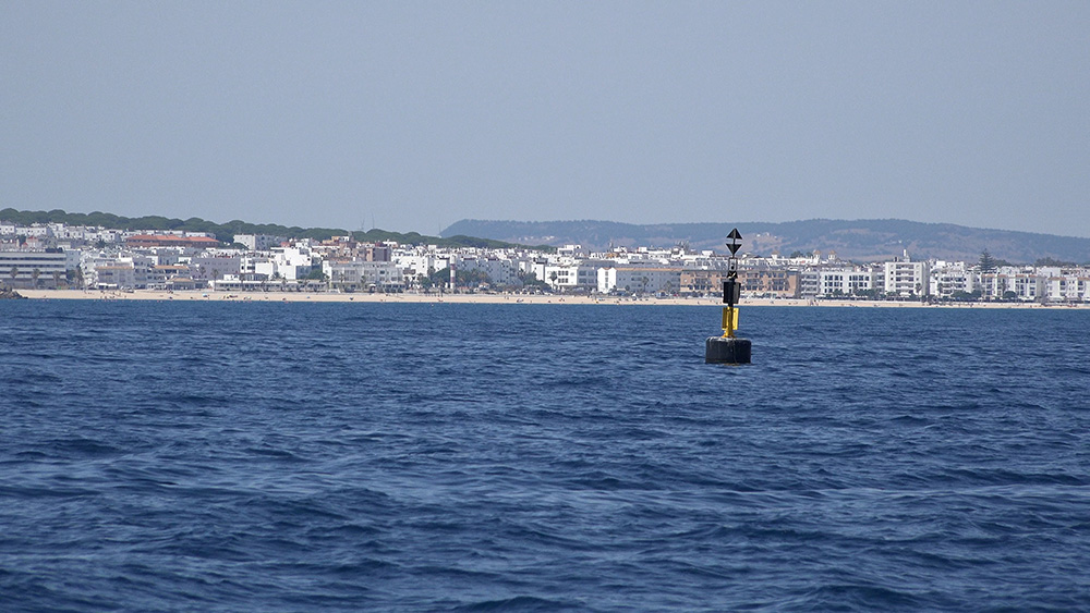
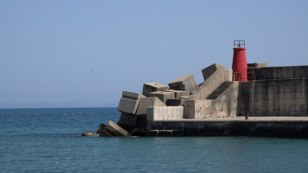
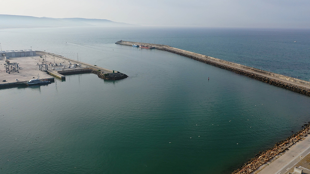
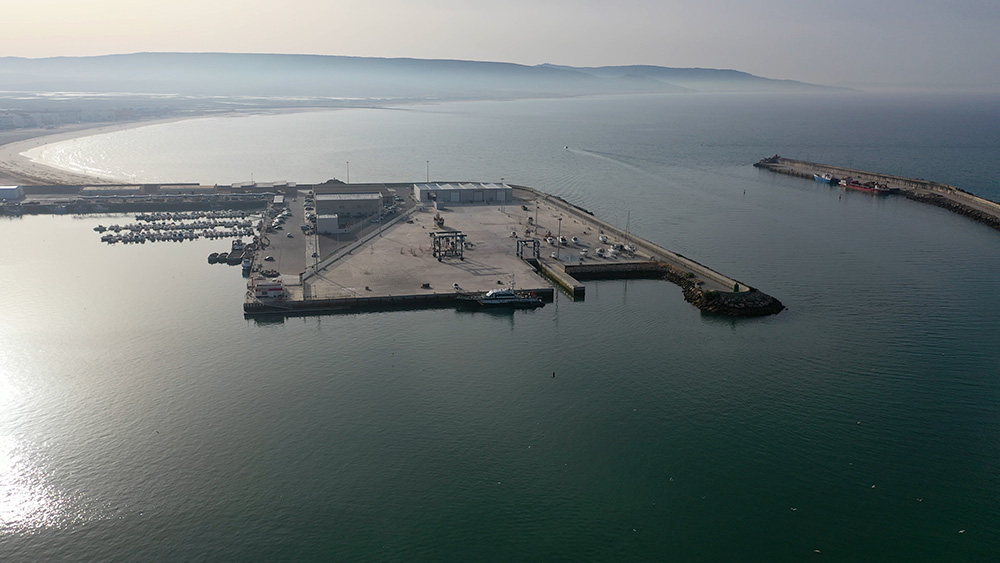
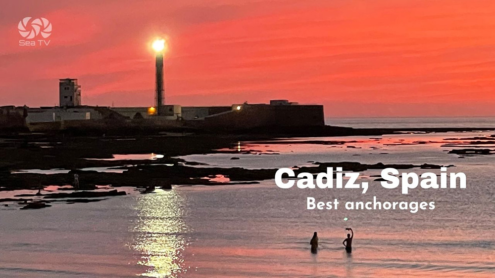
36°10’46.28″N · 5°55’31.14″W · Puerto de Barbate · municipality of Barbate · Cádiz province · Andalusia · Costa de la Luz (Atlantic) · ~100 mooring points · max LOA ~30 m · entrance beacon: red light · Nautical Chart 4411 · 1,300 m Poniente breakwater · adjacent to Parque Natural de La Breña y las Marismas de Barbate · the closest marina W of the Strait of Gibraltar · sheltered from Levante storms · the bluefin-tuna almadraba capital of Spain.
VHF Ch 9 · approach W from Faro de Trafalgar · approach E from Faro de Camarinal · narrow entrance · ⚠ tuna nets in season (May-June) · the practical staging port for Strait crossings
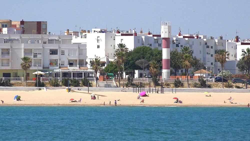
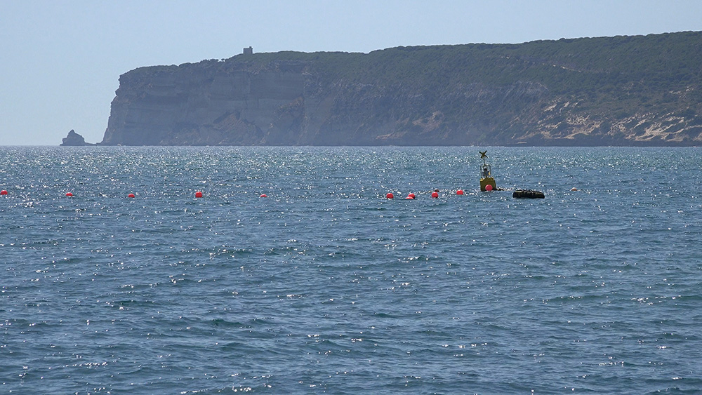
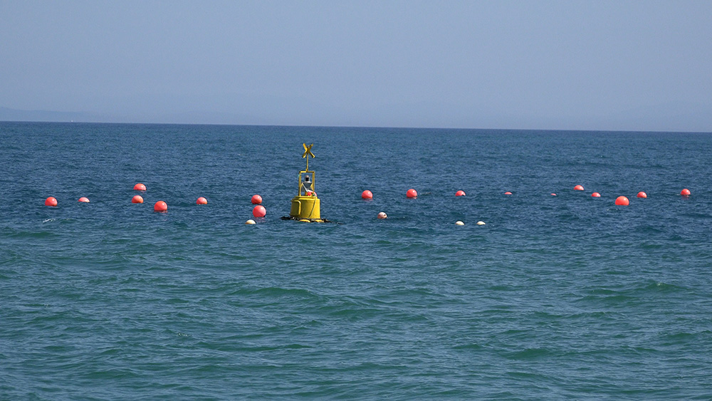
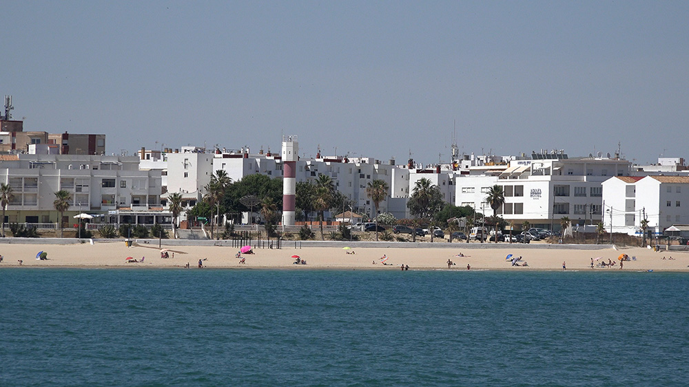
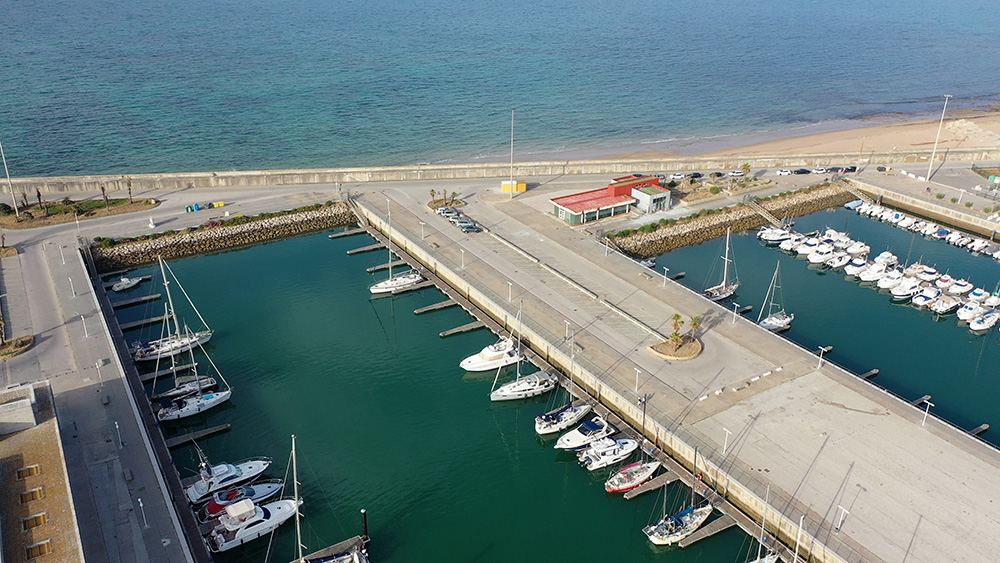
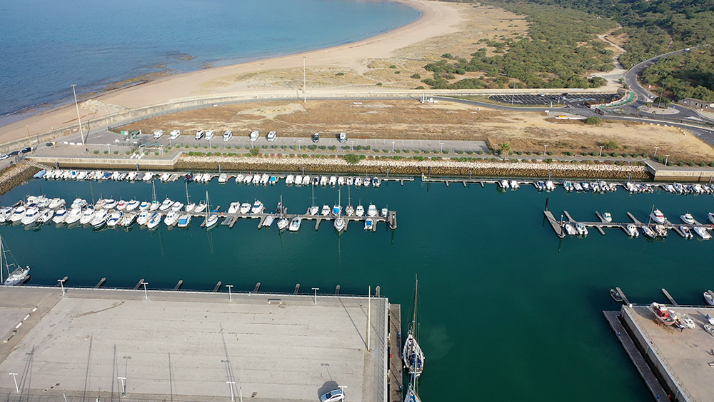
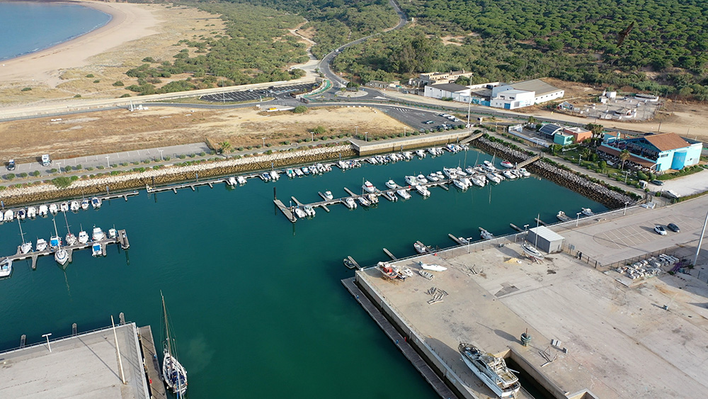
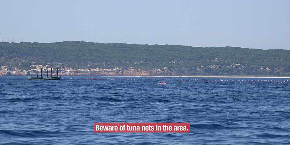
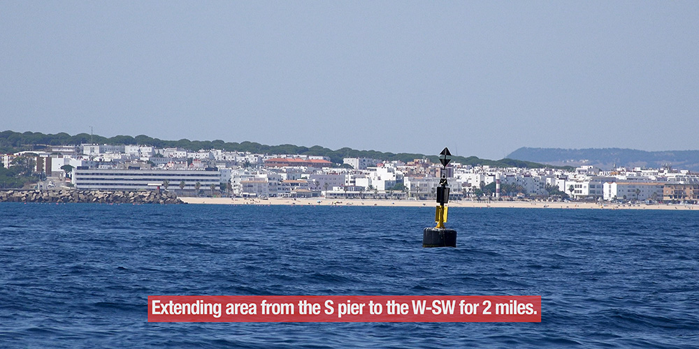
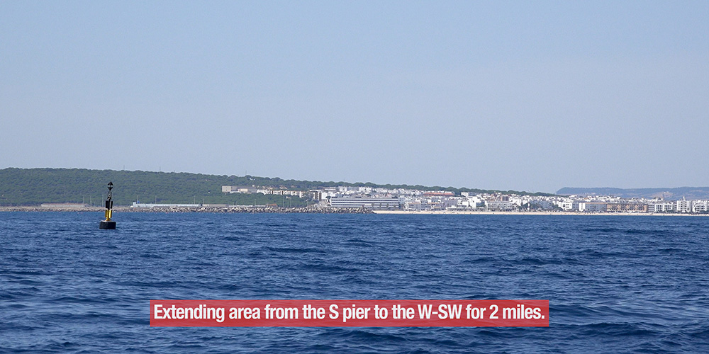
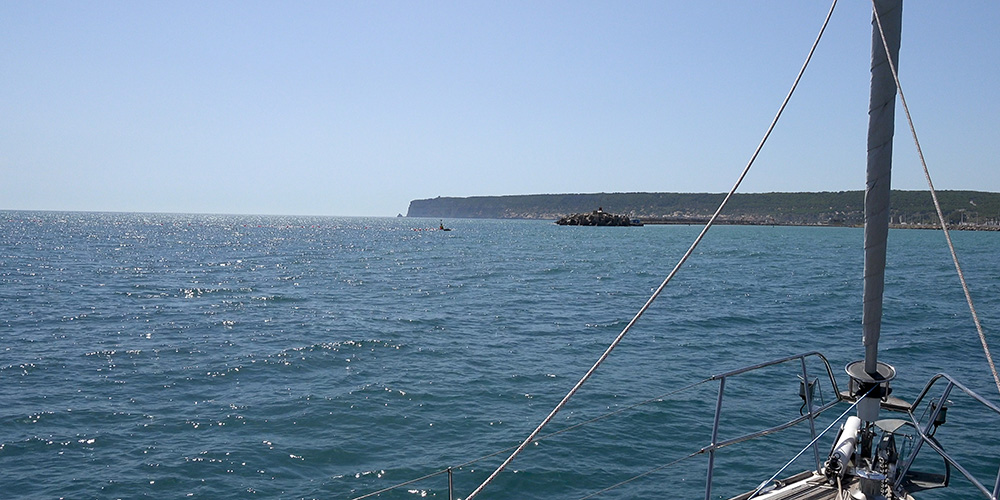
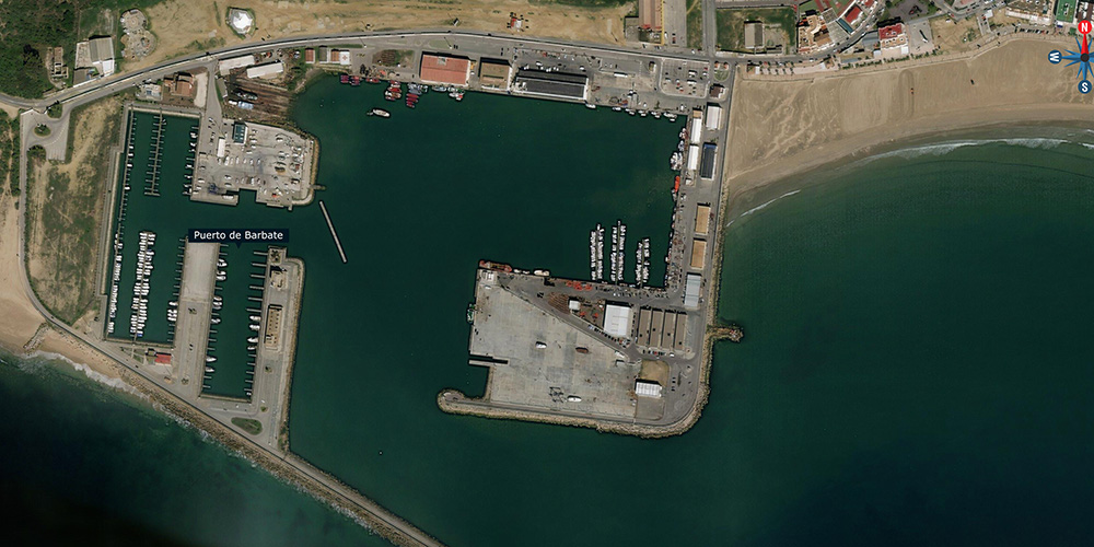
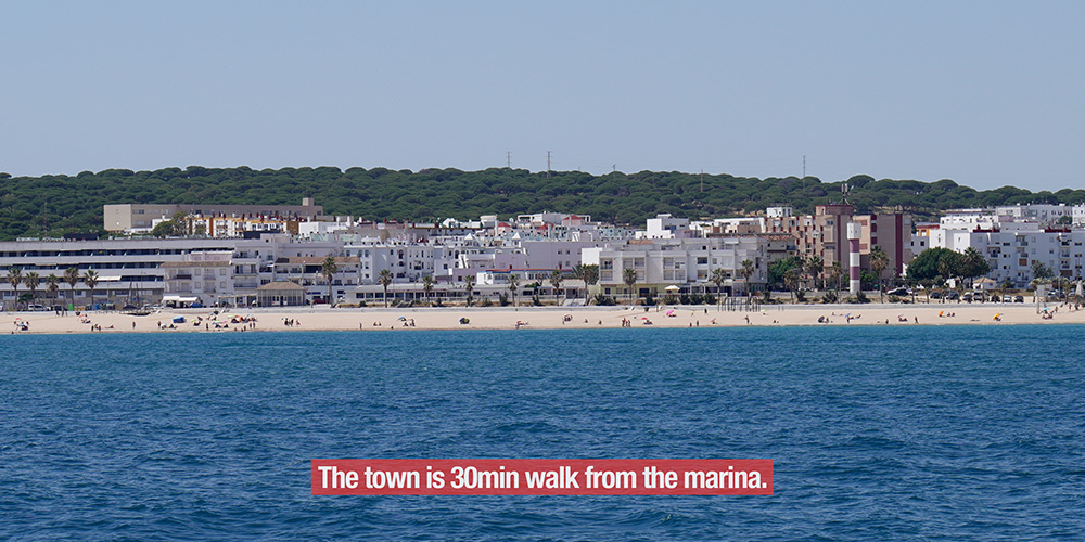
Puerto de Barbate is the most strategically important small marina in the W Andalusian coast — and most cruisers underestimate it. Located in the fishing village of Barbate (Cádiz province), the port sits at 36°10’46″N · 5°55’31″W — the last sheltered harbour on the Atlantic side before the Strait of Gibraltar opens up. For yachts heading E (Atlantic to Mediterranean), Barbate is the staging port to wait for favourable currents + winds before tackling the Strait. For yachts heading W (Mediterranean to Atlantic), it’s the first sheltered Atlantic-coast option after exiting the Strait westbound. The marina has ~100 mooring points, accommodates vessels up to ~30 m, and is sheltered by a ~1,300 m Poniente breakwater from Levante storms — the very wind system that makes the Strait dangerous. The setting is special: Barbate sits adjacent to the Parque Natural de La Breña y las Marismas de Barbate, with cliff-top pine forests, white-sand beaches, and the historic Cabo de Trafalgar lighthouse 8 km W (off the headland where Lord Nelson defeated the Franco-Spanish fleet on October 21, 1805 — the most important naval battle of the Napoleonic Wars). ⚠ Critical sailor’s note: Barbate is famous for the almadraba — the Phoenician-era bluefin tuna trap-net technique still practiced annually in May/June. The tuna nets stretch from the south pier WSW for ~2 NM during the season — a major navigation hazard. Plan around them, never through them.
⚠ Reality check before you arrive:
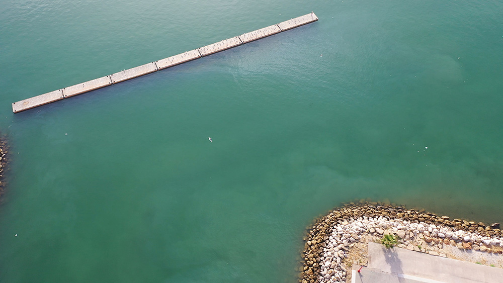
→ ⚠ Almadraba tuna nets May-June · stretch from S pier WSW for ~2 NM · large restricted area · plan around them, never through them
→ ⚠ Narrow entrance · depths <2-5 m · approach in calm-to-moderate conditions · avoid heavy SW swell
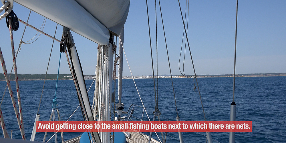
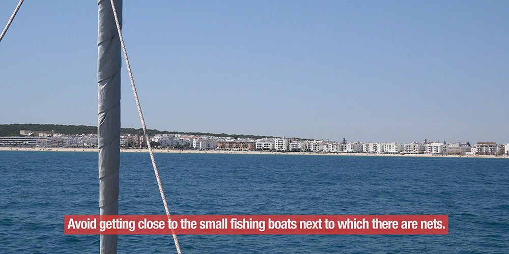
→ ⚠ Small fishing boats with nets at night · keep clear · maintain proper lookout
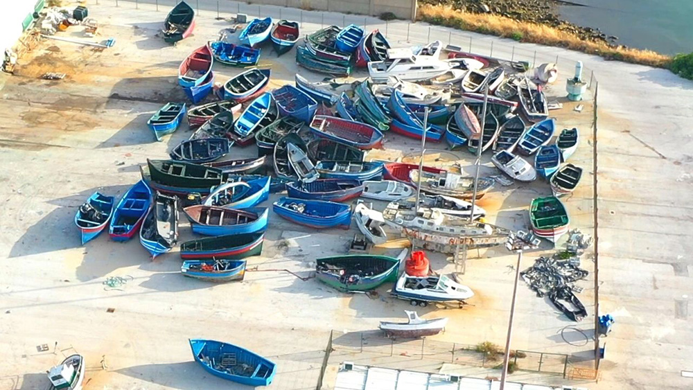
→ ⚠ Yacht berthing on W side · fishing fleet is on E side · respect the layout
→ ⚠ Pontoon A is the recommended pontoon · other piers are very shallow
→ ⚠ External commercial dock · 160 m docking line · 6 m draft · for larger commercial traffic
→ Atlantic tides 2-3 m · plan approach around HW
⚓ Puerto de Barbate at a Glance
Coordinates
36°10’46.28″N · 5°55’31.14″W
Berths
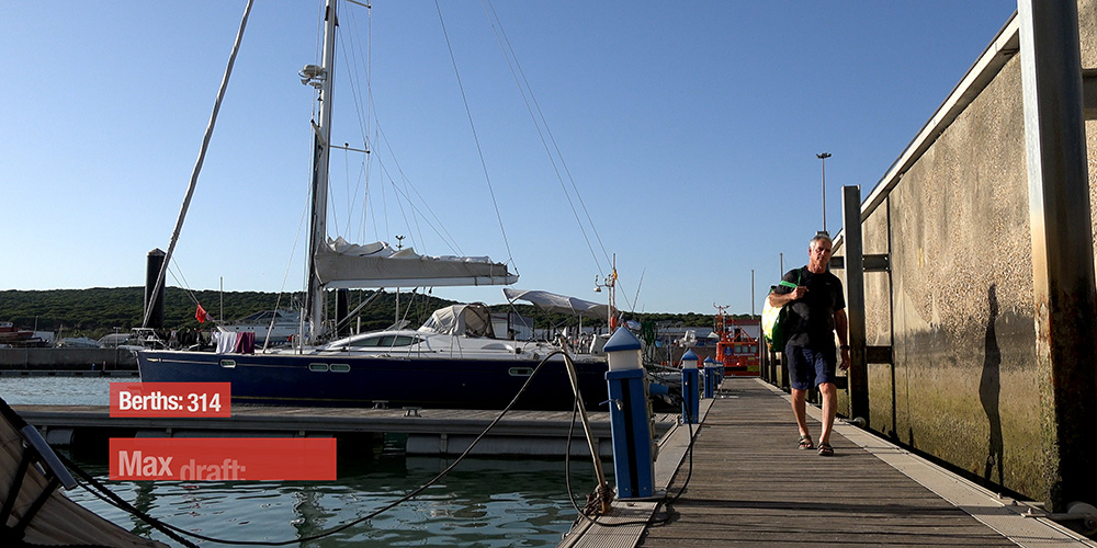
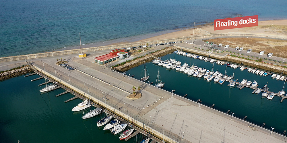
~100
Max LOA
~30 m
VHF
Ch 9 (working) · Ch 16 (distress)
Entrance beacon
Red light
Nautical Chart
Spanish IHM Chart 4411
Breakwater
Poniente · ~1,300 m long
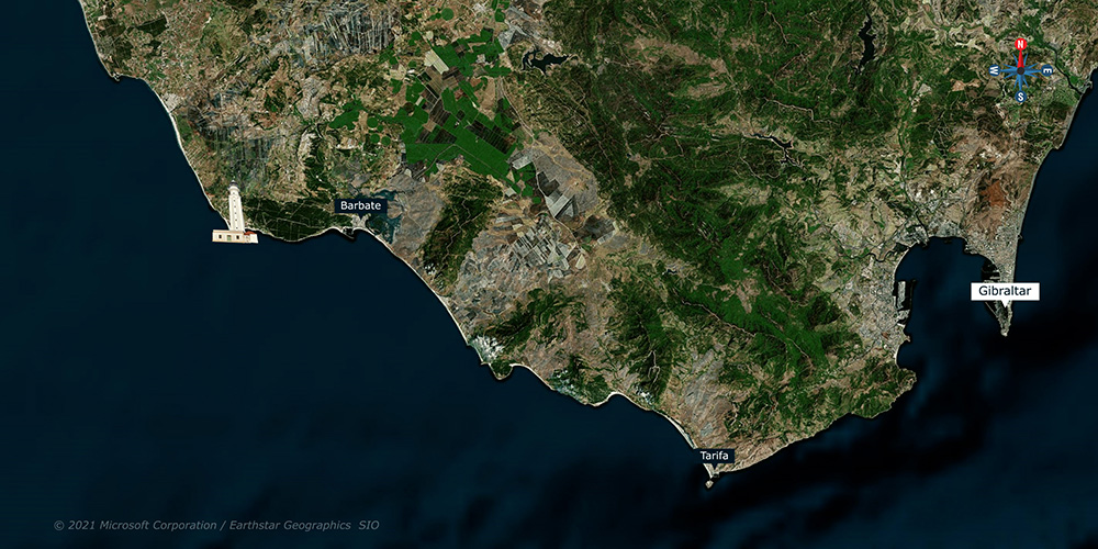
Distance · Cádiz
~30 NM NW
Distance · Tarifa
~20 NM E
Distance · Cabo de Trafalgar
~8 km W (1805 battle site)
Adjacent natural park
La Breña y las Marismas de Barbate
Best for
Strait staging · tuna season · Levante shelter
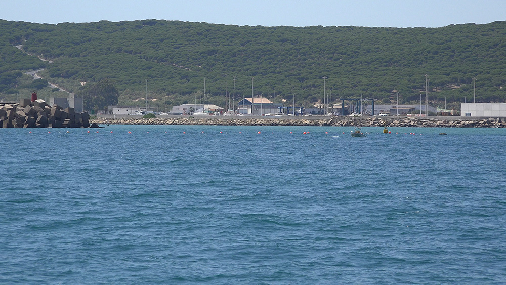
Approach & Entry
Identifying the harbour
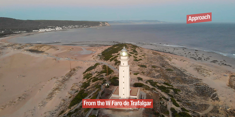
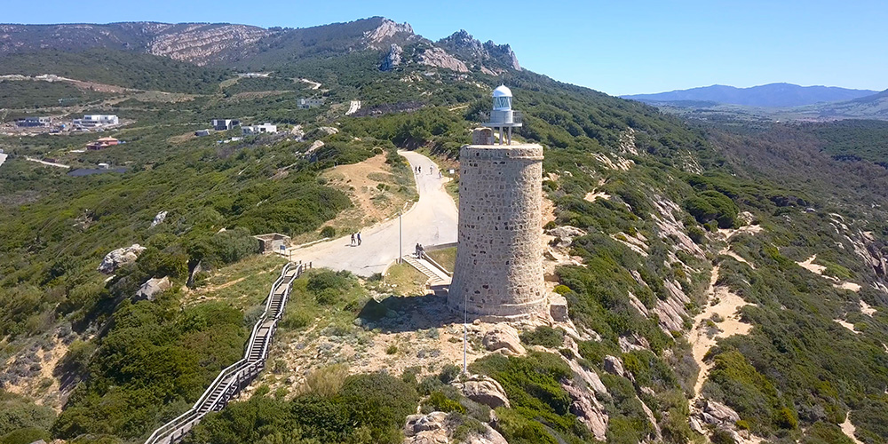
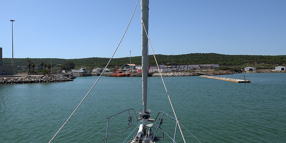
→ From the W (Cádiz): identify by the Faro de Trafalgar · 34 m white tower on Cabo de Trafalgar · 8 km W of Barbate
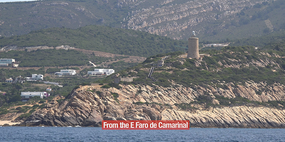
→ From the E (Strait): identify by the Faro de Camarinal
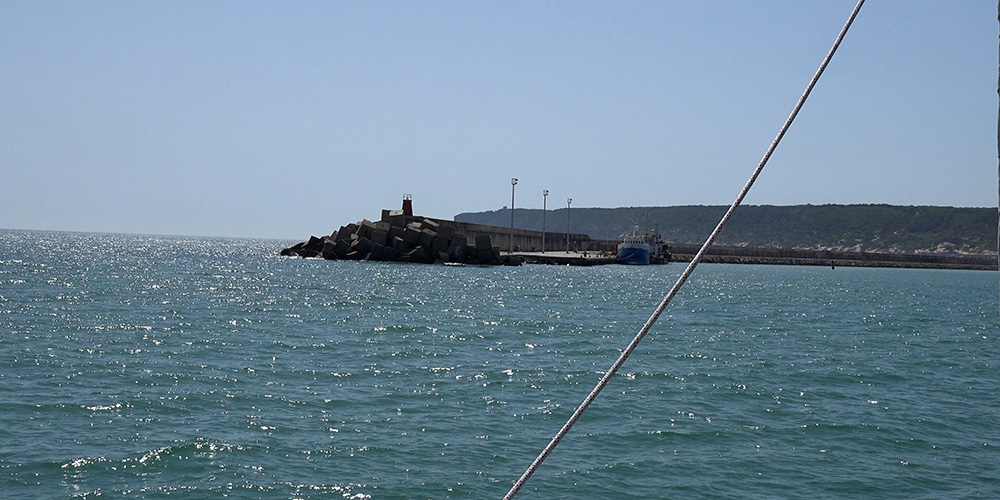
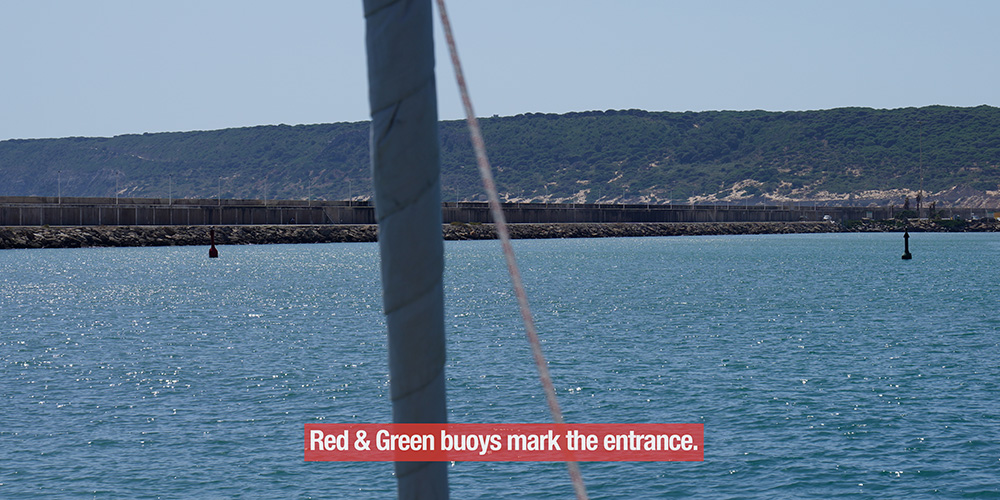
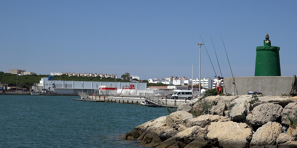
→ Entrance: beacon with red light · narrow · keep central
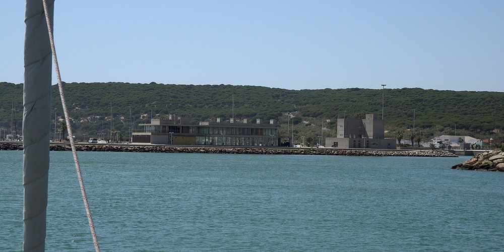
→ Breakwater: the Poniente extends S, then curves W-SW · provides Levante shelter
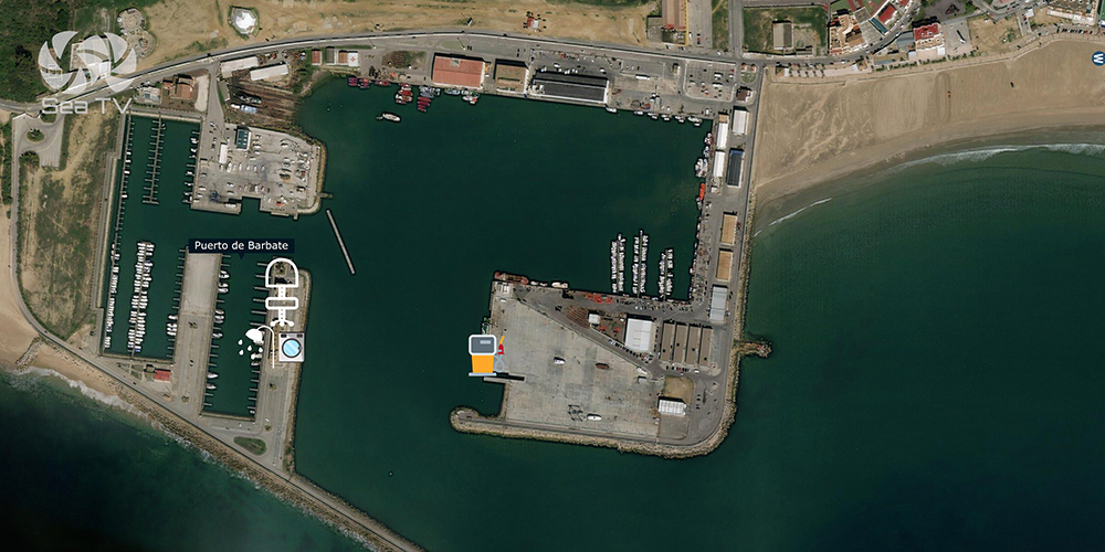
Entry procedure + mooring
→ Call Puerto Barbate on VHF Ch 9 when 1 NM out · request berth assignment
→ Reception pier on the port hand · under the office building
→ Yacht berthing W of the port · fishing boats E of the port
→ Pontoon A is recommended for transient yachts · other piers are very shallow
→ External commercial dock · 160 m line · 6 m draft · for commercial traffic
The Almadraba — Phoenician Tuna Tradition
3,000 years of bluefin tuna
→ The Phoenicians invented the almadraba here ~3,000 years ago — a labyrinth of nets that traps bluefin tuna during their annual May/June migration from the cold Atlantic to the warmer Mediterranean spawning grounds
→ The same net technique still practiced today by 4 Andalusian almadraba towns: Barbate, Conil, Tarifa, and Zahara de los Atunes
→ Annual “levantá” (the lifting) in May — the moment when tuna are brought up · the catch is processed within hours · much of it goes to Japan (the highest-priced bluefin in the global market)
→ The annual catch is strictly quota-controlled (~3,000 tonnes EU-wide) to maintain Atlantic bluefin populations
→ Atún rojo de almadraba is the supreme tuna of Andalusia · tasted in dishes like Mojama (salt-cured tuna), Tarantelo (the loin cut), and the prized Ventresca (the belly)
→ ⚠ For sailors: the nets stretch from the S pier of Barbate WSW for ~2 NM during May-June · plan W-bound passage to give wide berth
⚓ The Battle of Trafalgar — 8 km from Your Berth
→ 21 October 1805 · the most important naval battle of the Napoleonic Wars · Lord Nelson’s Royal Navy defeated the combined Franco-Spanish fleet off Cabo de Trafalgar (8 km W of Barbate)
→ Nelson was killed in the battle · his body returned to England preserved in a cask of brandy
→ The battle established British naval supremacy for over a century
→ Faro de Trafalgar · the 1862 lighthouse marks the cape · 34 m tall · visible from sea 22 NM out · still operational
→ Hike or drive 8 km W from Barbate to walk the cape · the Caños de Meca cliffs · the Playa de Trafalgar beach below
Parque Natural de La Breña y las Marismas de Barbate
→ 5,077 hectares of protected coast · cliff-top pine forest + saltmarsh + dune system
→ Acantilado de Barbate · 100 m sea-cliffs · the highest in Andalusia · stork colonies + peregrine falcons
→ Camino Acantilado del Faro · 7 km clifftop hiking trail · Barbate to Caños de Meca to Faro de Trafalgar
→ Playa de Caños de Meca · 3 km natural sand · clothing-optional · the Atlantic surfer beach
→ Zahara de los Atunes · neighbouring fishing village · the white-sand beach SE of Barbate · UNESCO Biosphere Reserve
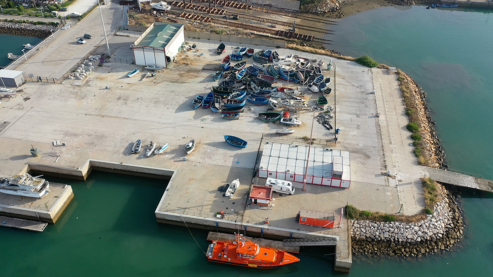
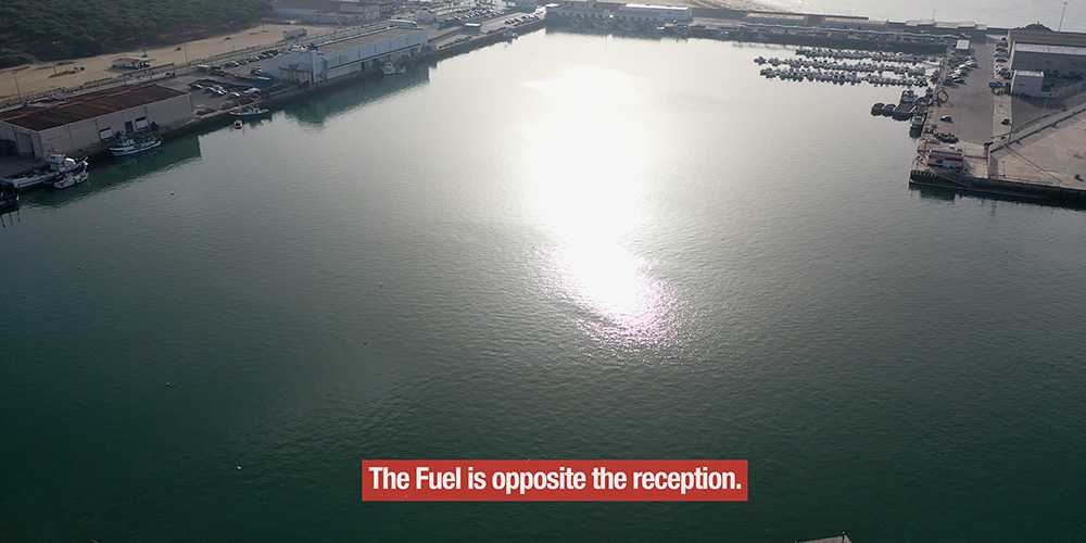
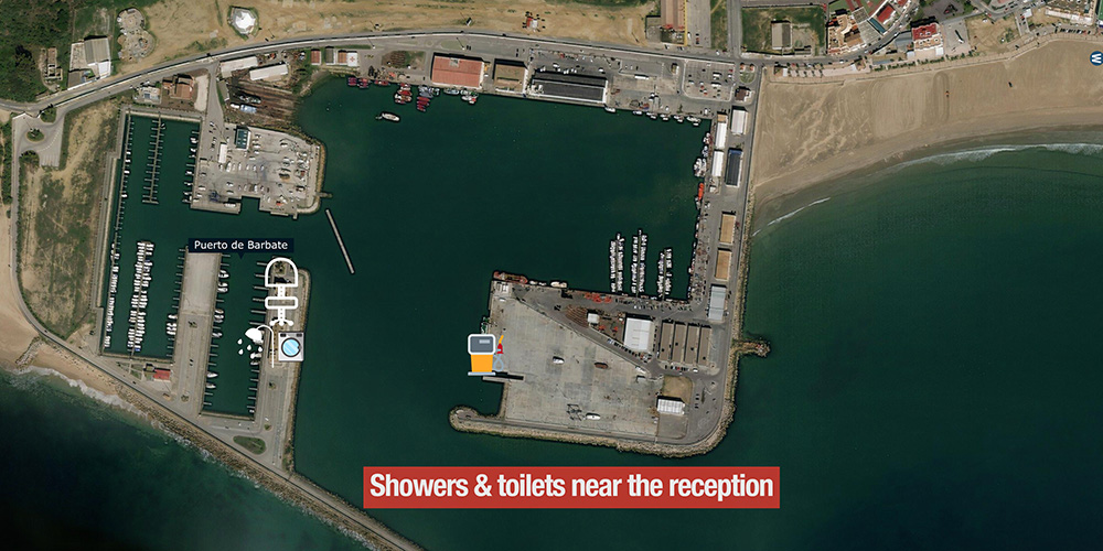
Marina Services
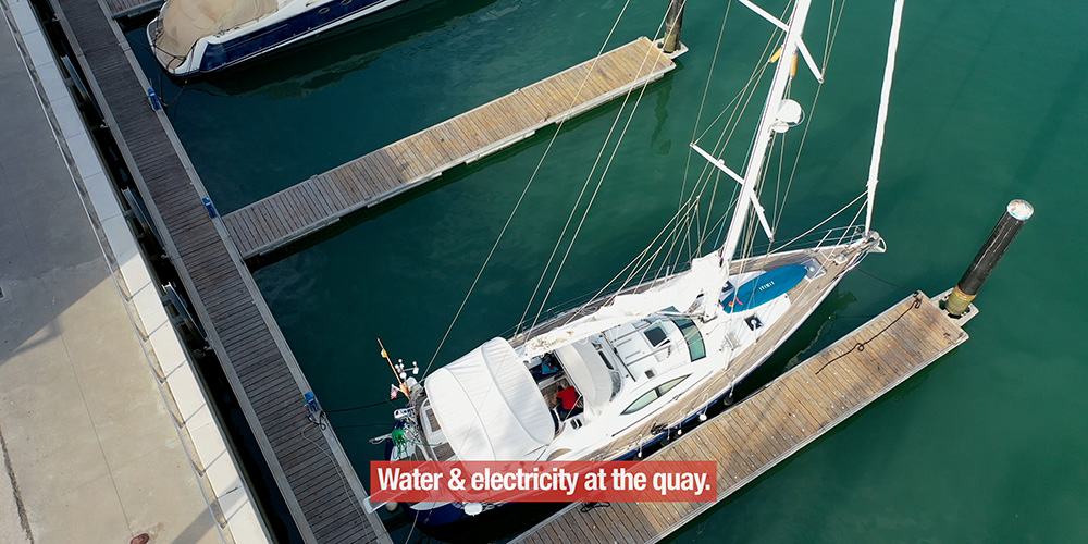
→ Fuel station · electricity + water at every berth
→ Showers + restrooms · Wi-Fi
→ Boat ramp + lifting crane
→ Dry marina
→ Restaurant + yacht club
→ Disabled access
→ 24h video surveillance + night watchman
Local Food & Drink
Barbate is the bluefin tuna capital of Spain — eat what’s local:
→ Atún rojo de almadraba · order whatever cut your kitchen recommends — Tarantelo (loin), Mormo (cheek), Galete (collar), Ventresca (belly)
→ Mojama · salt-cured + air-dried tuna loin · the local jamón of the sea · Phoenician origin
→ Tortillitas de camarones · the tiny shrimp fritters of the Costa de la Luz
→ Ortiguillas fritas · battered + fried sea anemones · authentic local oddity
→ Sherry from Jerez (40 km N) · Manzanilla pairs especially well with the seafood
→ Plus the seafood-restaurant cluster around the marina + the village
⛵ Day Sails & Cruising from Barbate
W-bound (toward Cádiz + Algarve):
→ Conil de la Frontera · ~12 NM W · small fishing village marina
→ Sancti Petri · ~25 NM NW · S of Cádiz
→ Cádiz · Marina Puerto América · ~30 NM NW · UNESCO city + designated port of entry
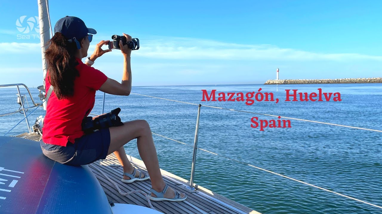
→ Mazagón (Huelva) · ~100 NM NW · Doñana + Algarve gateway
E-bound (the Strait crossing):
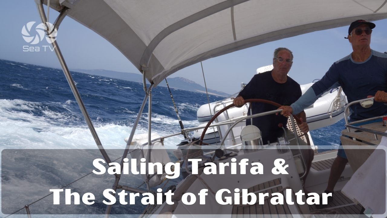
→ Tarifa · ~20 NM E · the Strait of Gibraltar (small boats only · weather-dependent)
→ Gibraltar / La Línea (Alcaidesa) · ~40 NM E · Mediterranean entry
→ Strait crossing strategy: wait at Barbate for favourable wind/current · best is W wind to push you E + slack water at Tarifa Point
Contact & Emergency
Operator: Agencia Pública de Puertos de Andalucía · puertosdeandalucia.es
VHF: Ch 9 (working) · Ch 16 (distress)
Emergency: 112 · Maritime SAR (Salvamento Marítimo): 900 202 202 · the Tarifa SAR centre is the closest
Tide tables: AEMET (aemet.es) · Predictwind
Weather + currents for Strait planning: Predictwind + the official Tarifa SAR meteo
Closest airport: Jerez (XRY) ~70 km · Gibraltar (GIB) ~50 km · Sevilla (SVQ) ~150 km
⛵ Continue Exploring Andalusia
SeaTV Andalusia docking pages:
→ Cádiz · Marina Puerto América — ~30 NM NW · UNESCO city
→ Mazagón (Huelva) — ~100 NM NW · Doñana + Columbus
→ Tarifa & the Strait of Gibraltar — ~20 NM E
→ Gibraltar / La Línea Marinas — ~40 NM E · Mediterranean entry
Cluster hub:
→ Andalusia hub — full Andalusian coverage
“Puerto de Barbate is the most strategically important small marina in the western Andalusian coast and most cruisers underestimate it · located in the fishing village of Barbate in Cádiz province the port sits at thirty six ten forty six north five fifty five thirty one west which is the last sheltered harbour on the Atlantic side before the Strait of Gibraltar opens up · for yachts heading east from Atlantic to Mediterranean Barbate is the staging port to wait for favourable currents and winds before tackling the Strait · for yachts heading west from Mediterranean to Atlantic it’s the first sheltered Atlantic coast option after exiting the Strait westbound · the marina has approximately one hundred mooring points accommodates vessels up to about thirty meters and is sheltered by a thirteen hundred meter Poniente breakwater from Levante storms the very wind system that makes the Strait dangerous · the setting is special Barbate sits adjacent to the Parque Natural de La Breña y las Marismas de Barbate with cliff top pine forests and white sand beaches and the historic Cabo de Trafalgar lighthouse eight kilometers west off the headland where Lord Nelson defeated the Franco Spanish fleet on October twenty first eighteen oh five the most important naval battle of the Napoleonic Wars · Barbate is famous for the almadraba the Phoenician era bluefin tuna trap net technique still practiced annually in May and June so the tuna nets stretch from the south pier west southwest for two nautical miles during the season · plan around them never through them · order atún rojo de almadraba whatever cut your kitchen recommends Tarantelo or Mormo or Galete or Ventresca and Mojama the salt cured tuna loin with Phoenician origin and ortiguillas fritas the battered fried sea anemones and a glass of Manzanilla from Sanlúcar · this is where the Atlantic Ocean meets the Mediterranean and where you wait for the wind to be right · sail accordingly.”
— SeaTV · Andalusia · Puerto de Barbate · The Last Atlantic Shelter Before the Strait