SeaTV · Cyclades Islands · Ios
Ios Island — Halfway Between Paros and Santorini
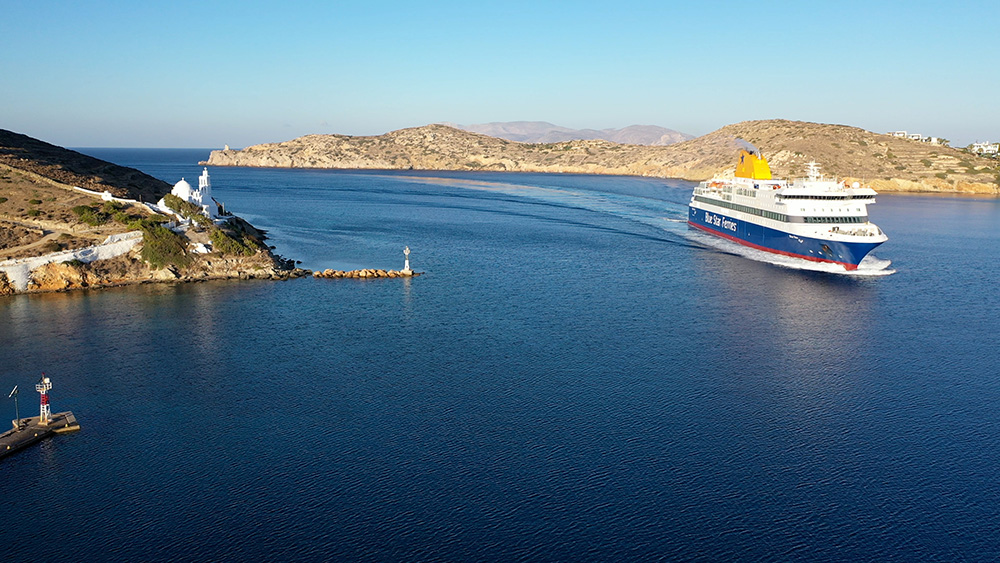
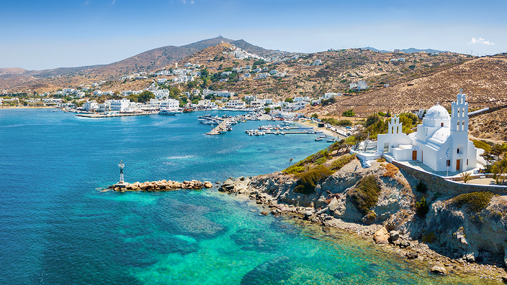
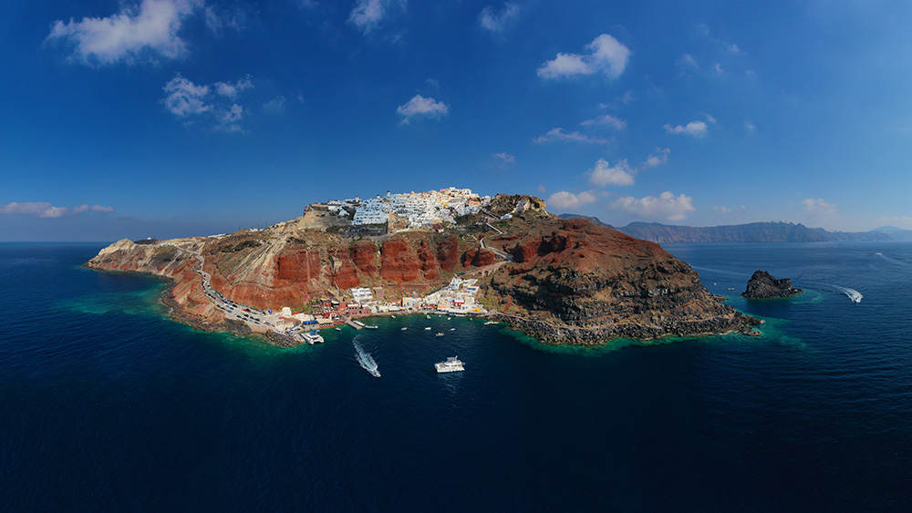
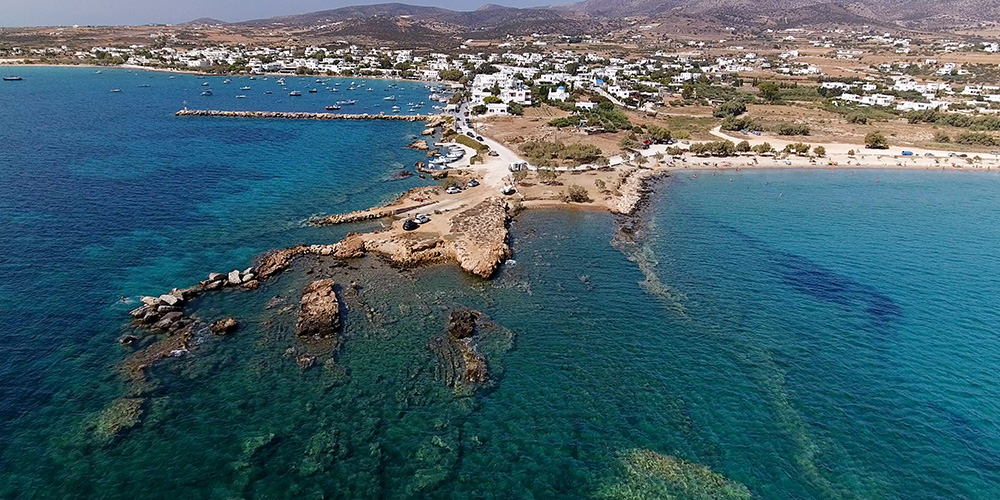
Southern Cyclades, 30 NM S of Paroikia, with the white Chora and two windmills above the harbour. Famous for the village, the beaches, and the nightlife — crowded in summer, lively but pleasant out of season. Anchoring in the bay is prohibited because of the fast-ferry traffic, so plan for the quay.
Ios sits halfway between Paros and Santorini in the southern Cyclades, about 30 NM south of Paroikia marina. The island is known for three things: the traditional Cycladic Chora on the hilltop above the port, a series of strong beaches around the coast, and a nightlife scene that’s earned Ios its reputation as the central-Cyclades party island. Crowded in summer, much more pleasant out of season. The sailing reality is dominated by the fast-ferry traffic into Ios port: anchoring in the bay is prohibited, the surges are heavy, and Meltemi gusts blow straight into the harbour.
⚠ Reality check at Ios Port:
→ Anchoring in the harbour bay is PROHIBITED — fast ferries serve the island
→ Heavy ferry surges — use plenty of fenders, pull the boat well off the quay
→ Strong Meltemi gusts blow straight into the bay
→ High-speed ferries on approach — eyes up, VHF on Ch. 16
→ Magganari rocky islet in NE corner of the bay
⚓ Quick Facts
Position
Southern Cyclades · halfway Paros ↔ Santorini
Distance from Paroikia
~30 NM south
Port position
36°42.82’N · 25°15.72’E · west coast
Visual landmark
White Chora on hilltop · 2 windmills below
4 anchorages
Koubara · Mylopotas · Magganari · Tris Klises
Fuel service
+30 22860 92009 · mobile +30 6974 501 155
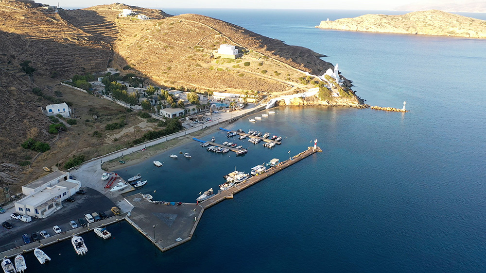
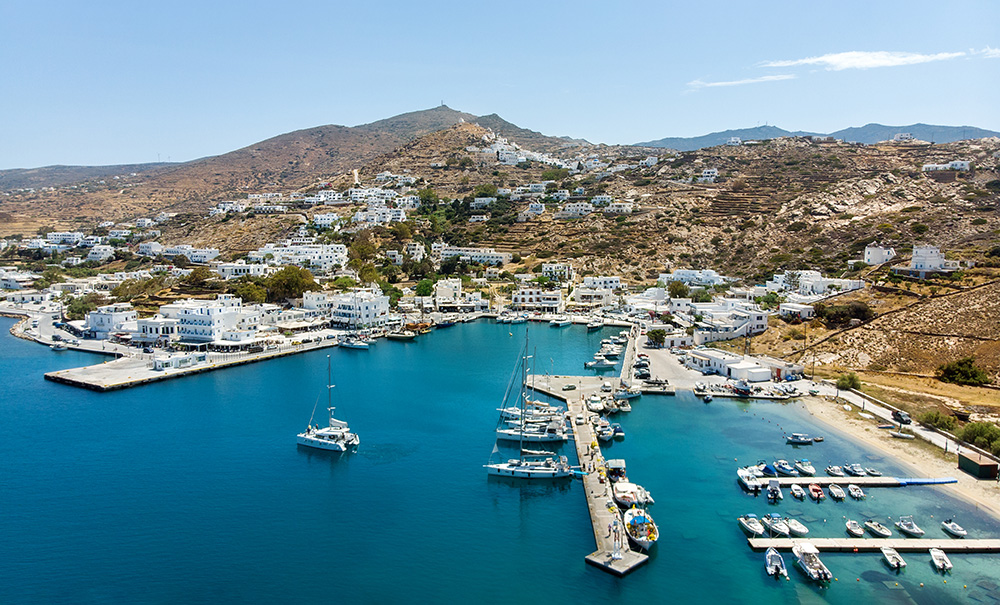
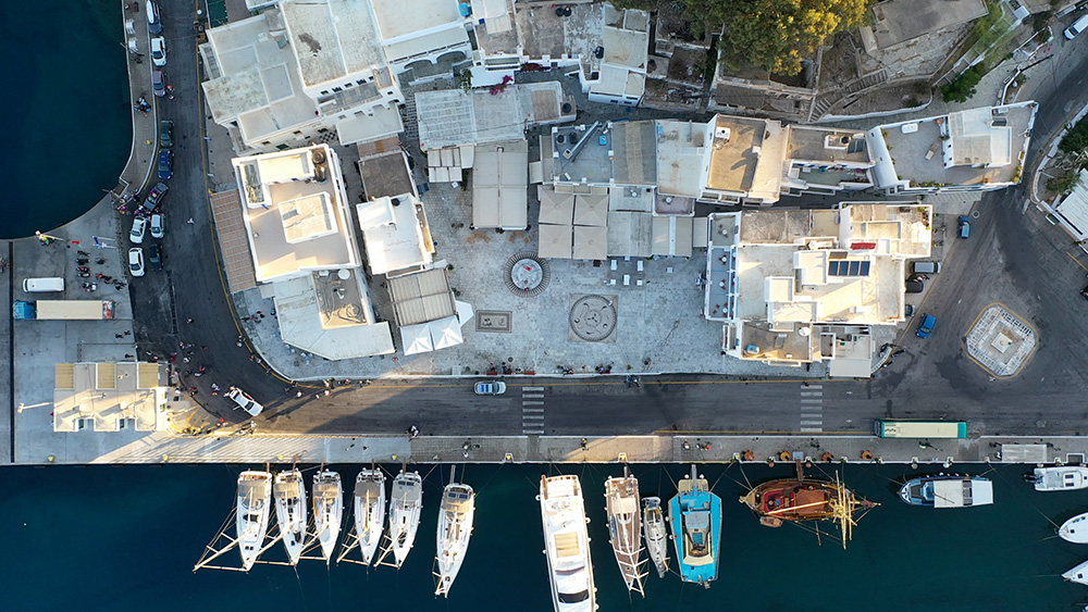
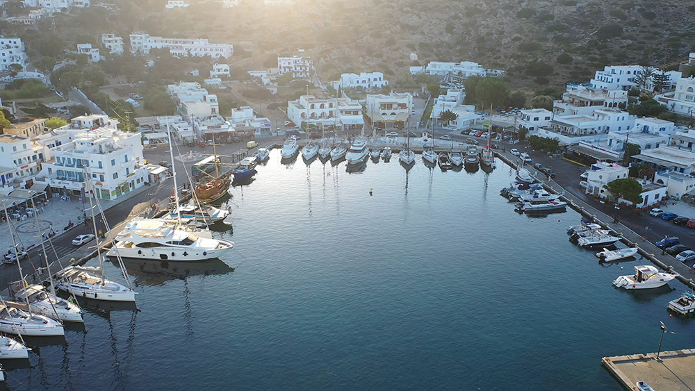
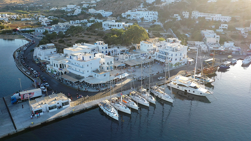
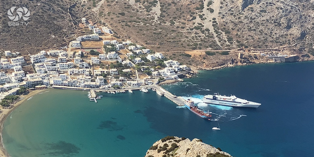
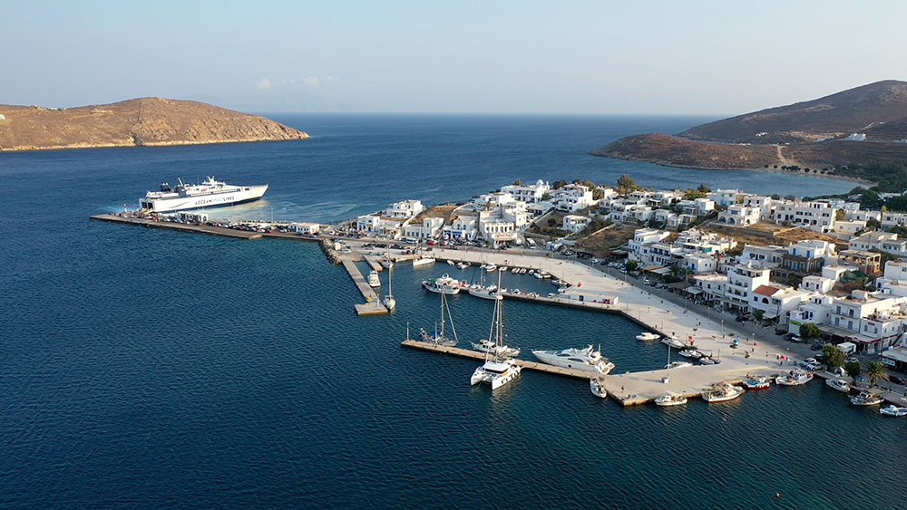
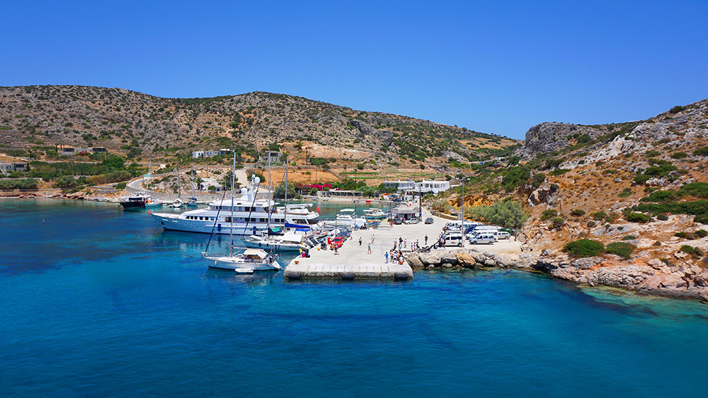
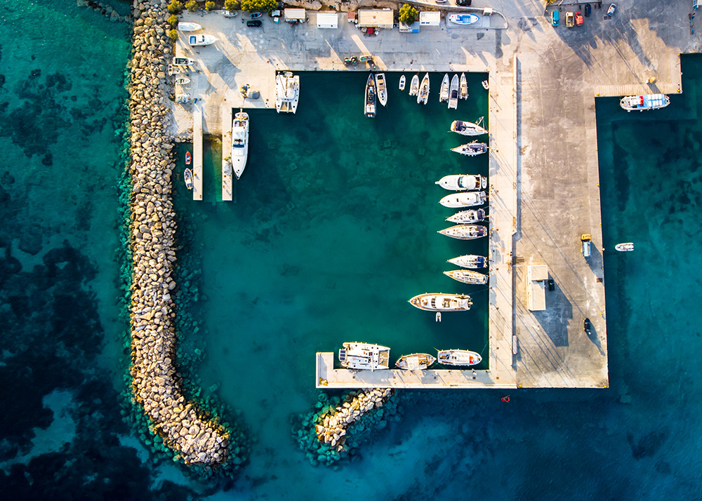
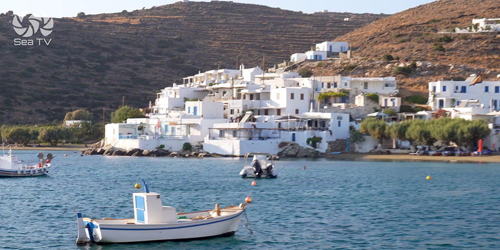
1. Port of Ios (Main Harbour)
Position · 36°42.82’N · 25°15.72’E · West Coast
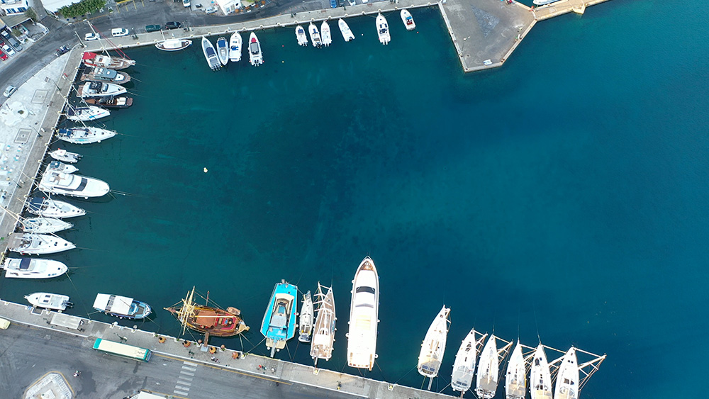
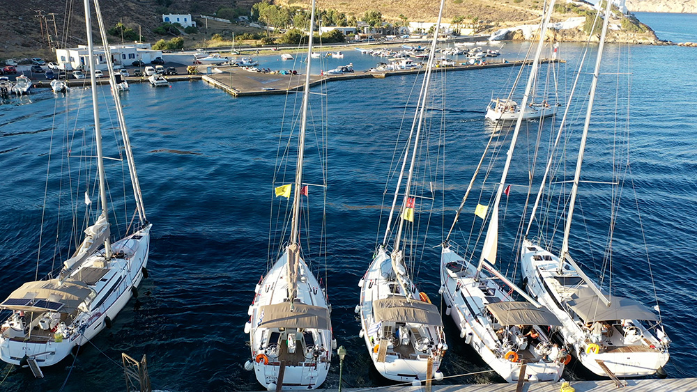
Ios Port — Quay-Only Mooring
Position: West coast of Ios, opposite the northern end of Sikinos island, 3.5 NM away across the channel.
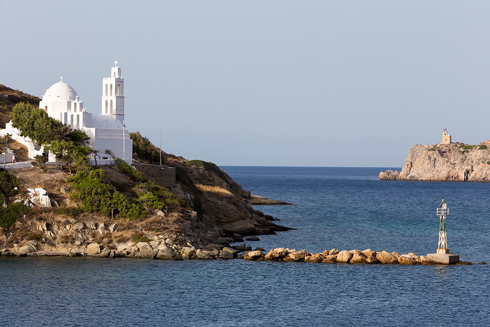
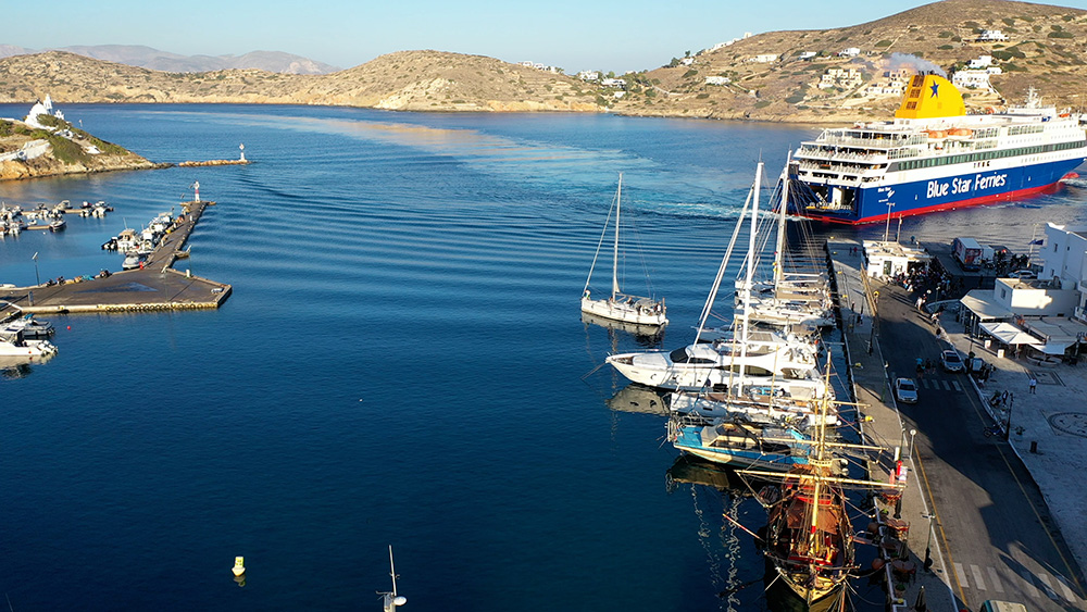
Visual approach: Easily spotted by the white Chora on top of the hill and two windmills below. Clean visual reference from a distance.
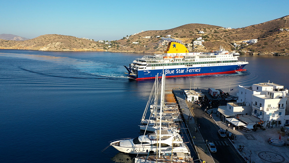
Mooring options: Yachts can moor to the East and North quay.
Eastern quay specifics: Laid moorings · the mooring chain runs north to south, marked by buoys.
Holding: Good in mud (relevant if forced to anchor as backup outside designated areas).
Services: Standard quay facilities · buy a ticket opposite the quay for electricity and water · the town behind the harbour has everything you need for provisioning.
⚠ Critical hazard #1 — Anchoring prohibited: Anchoring in the bay is prohibited due to the many fast ferries serving the island. This is a hard rule, not a guideline. Plan to take a quay berth.
⚠ Critical hazard #2 — Ferry surges: Ferries arrive at speed and create a lot of surges. Use plenty of fenders · pull the boat well off the quay · expect heavy snatching on lines through the day and into evening.
⚠ Critical hazard #3 — High-speed ferry traffic: On approach, take care with the high-speed ferries rushing back and forth. Stay clear of the ferry lanes, monitor VHF Ch. 16, and time your final approach carefully.
⚠ Critical hazard #4 — Meltemi into the bay: Strong Meltemi gusts blow directly into the harbour. The bay’s geometry doesn’t shelter you from N–NE wind — fenders and lines must hold against both wind and surge simultaneously.
Fuel service (advance order required):
→ Land line: +30 22860 92009
→ Mobile: +30 6974 501 155
→ Booking: Call two hours in advance for a truck with diesel or petrol.
2. Koubara Bay
Position · 36°43’29″N · 25°15’21″E · West of Ios Port · Party Beach
Koubara — The Party Bay
Position: The bay lies west of Ios port — short hop round the headland.
Character: The party beach of Ios — beach clubs and music venues line the shore. Good day-anchorage for the daytime club scene; less suitable as a quiet overnight in season.
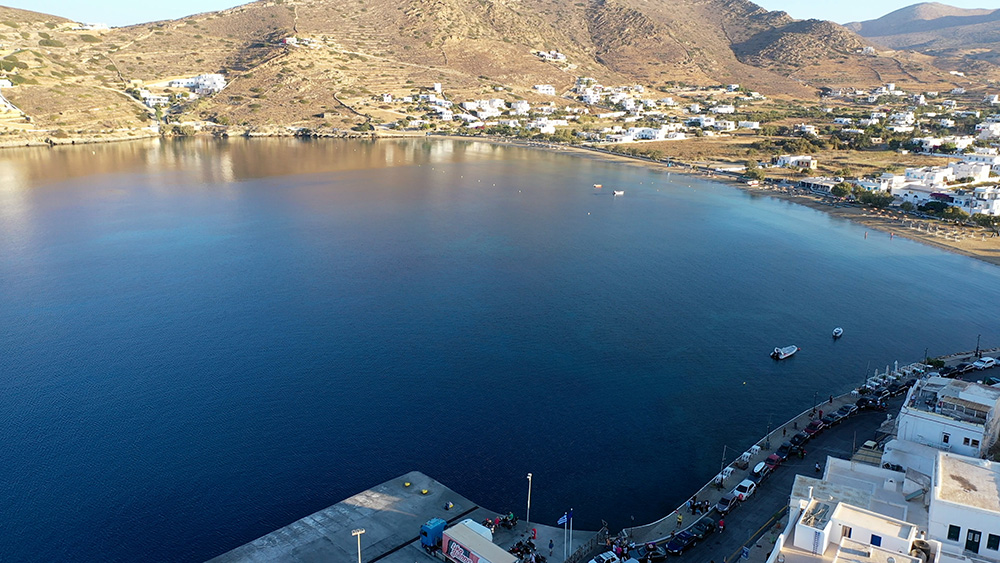
3. Mylopotas Bay
Position · 36°42’44″N · 25°17’32″E · South of Ios Port
Mylopotas — Large Bay with Restaurants Ashore
Position: Lies south of Ios port.
Character: A large bay — anchor where convenient depending on conditions and how busy the bay is.
Ashore: Many tavernas line the beach — walk the front and pick what looks good for dining.
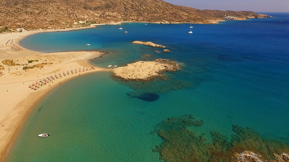
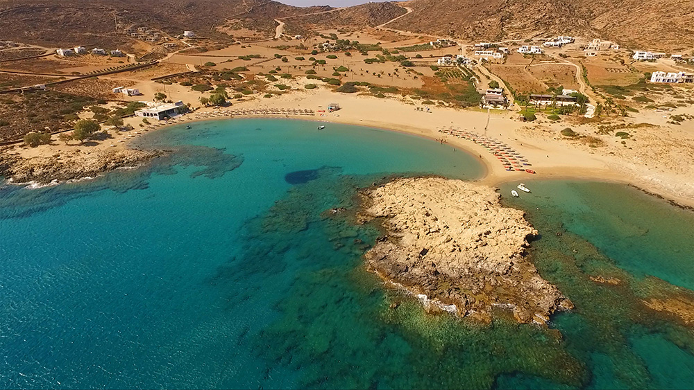
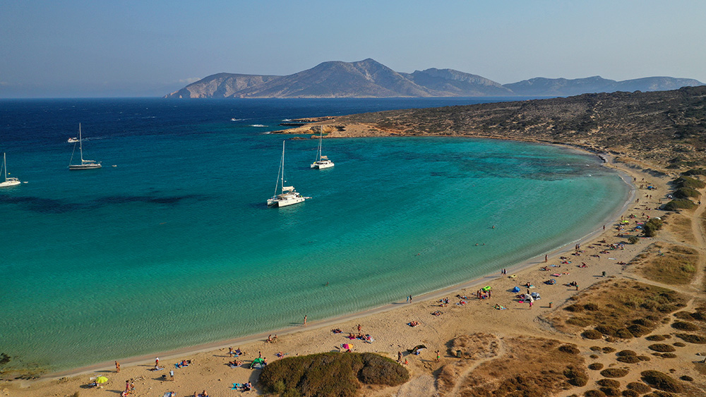
4. Magganari Bay (Recommended)
Position · 36°39’29″N · 25°22’8″E · South Coast · Transparent Water
Magganari — Best Swim & Lunch Anchorage
Position: A large bay on the south coast of Ios.
Water: Incredibly transparent water — exceptional even by Cyclades standards.
Bottom: Sand · excellent holding.
Best use: Swim, breakfast, lunch · the recommended day-anchor on Ios.
⚠ Hazard: In the NE corner of the bay there is a rocky islet. Plot it on the chartplotter, eyeball it on approach, and don’t cut close to that corner of the bay.
5. Tris Klises (Calm Weather Only)
Position · 36°40’15″N · 25°23’7″E · Calm Weather Only
Tris Klises — Quiet Calm-Weather Bay
Best use: Nice bay in calm weather only — not a Meltemi-shelter option. When conditions are settled, an alternative to the busier Magganari for a quiet stop.
Wind Strategy on Ios
Strong Meltemi (NE) — port reality: The Meltemi blows straight into Ios harbour. Heavy fenders, well-pulled lines, expect snatching all day and night. Magganari on the south coast becomes the day-shelter alternative.
Moderate weather: All four anchorages workable. Magganari is the recommended call for a quiet day or overnight.
Calm: Tris Klises opens up · Mylopotas is a large lazy bay with restaurants ashore.
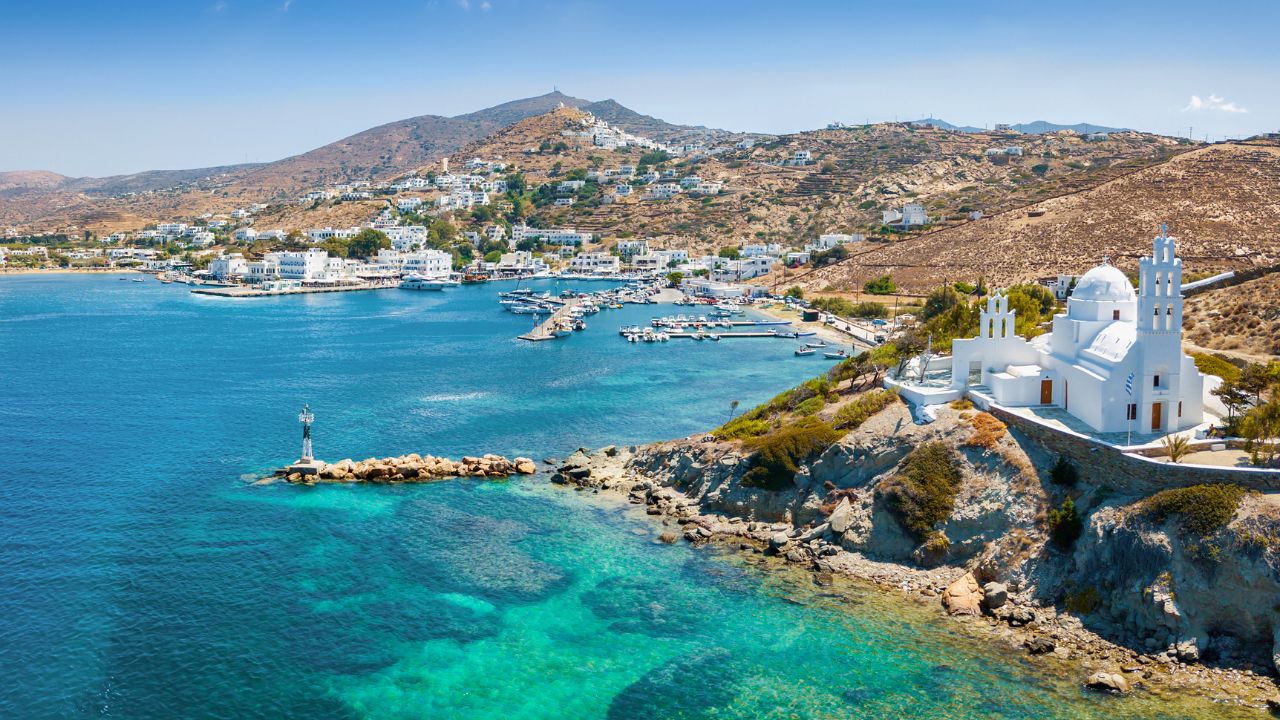
The Chora & Nightlife
The Chora: Walk up from the port to the white-cubed village above — the visual landmark you used on approach is also the social heart of the island. Narrow whitewashed alleys, traditional architecture, churches, and views over the harbour and the channel to Sikinos.
Nightlife: Ios has built one of the central Cyclades’s most concentrated party scenes — the Chora bars, the Koubara beach clubs, and venues at Mylopotas. Crowded in summer (July–August), much more pleasant before/after the peak season.
Pro Tips for Ios
Plan for the quay, not the anchor. Anchoring in Ios bay is prohibited. Aim straight for the East or North quay — laid moorings on the East quay, mooring chain marked by buoys.
Order fuel two hours ahead. The fuel-truck service requires advance booking — call +30 22860 92009 (land) or +30 6974 501 155 (mobile) two hours before you want delivery. Don’t expect walk-up service.
Heavy fenders & long lines. The ferry surge is constant. Fenders thick, lines pulled long so the boat doesn’t snatch up against the quay. Check tension regularly through the day.
Magganari is the day-anchor. South-coast bay, transparent water, sand bottom with excellent holding. Plot the NE-corner rocky islet on the chartplotter and you have a great swim/lunch stop.
Consider Koubara only for daytime. Beach-club party bay west of the port. Good day-trip for the scene, but in summer the music goes late and the bay isn’t a quiet overnight.
Walk up to Chora at sunset. The white-cubed village above the port is the cultural core of the island. Walk up in the late afternoon, eat in the village, descend after.
Time-shift the season if possible. June or September give you the same island, the same Chora, much less crowding. July–August is busy.
Suggested Routes from Ios
South to Santorini: Short hop · the natural southbound continuation. See Santorini (Thira).
North to Paros: ~30 NM. See Paroikia Marina or Piso Livadi.
East to Lesser Cyclades: Iraklia, Schinoussa, Koufonisia. See Koufonisia.
West to Sikinos / Folegandros: Quieter southern Cyclades neighbours · 3.5 NM to the N tip of Sikinos.
Full Cyclades route: See the SeaTV 8-Day Cyclades Route.
✅ Sailor’s Checklist for Ios
▢ Quay berth planned (NOT anchoring — prohibited)
▢ East/North quay choice based on wind
▢ Heavy fenders set · long lines for ferry-surge tolerance
▢ Fuel ordered 2 hours in advance if needed (+30 22860 92009)
▢ Magganari NE-corner rocky islet plotted
▢ High-speed ferry traffic anticipated on approach
▢ Tris Klises confirmed as calm-only
▢ VHF on Ch. 16 throughout
Emergency & Service Numbers — Ios
European Emergency: 112
Coastguard Distress (VHF Ch. 16): Universal
Coastguard Working (VHF Ch. 12): Per region
Ios Port Authority: VHF Ch. 12 / 16
Ios Fuel Service: +30 22860 92009 · mobile +30 6974 501 155 · 2 hrs advance
Olympia Radio (VHF Ch. 03/86): Greek HF/VHF maritime service
Watch the SeaTV Visual Pilot Video
Drone passes over the Ios harbour with the white Chora and two windmills above, the East-quay laid mooring layout, the south-coast Magganari Bay with the NE-corner rocky islet, and Mylopotas’s beach-front. Free for members.
Related SeaTV Pages
Cyclades Neighbours
→ Santorini (Thira) · south neighbour
→ Paroikia Marina, Paros · north (~30 NM)
→ Piso Livadi, Paros · NE alternative
→ Koufonisia Island · east Lesser Cyclades
Cyclades Routes & Region
Sailing into Ios?
Quay-only mooring · order fuel ahead · use Magganari for the swim · time-shift the season for less crowd.
“Ios is a quay-only stop with the white Chora visible from miles out — anchoring prohibited because of the ferries, surge constant, but the Chora and Magganari’s transparent water make the technical demands worth it. Heavy fenders, advance fuel order, eyes on the high-speed traffic, and the southern Cyclades opens up below you.”
— SeaTV Visual Pilot · Cyclades Edition