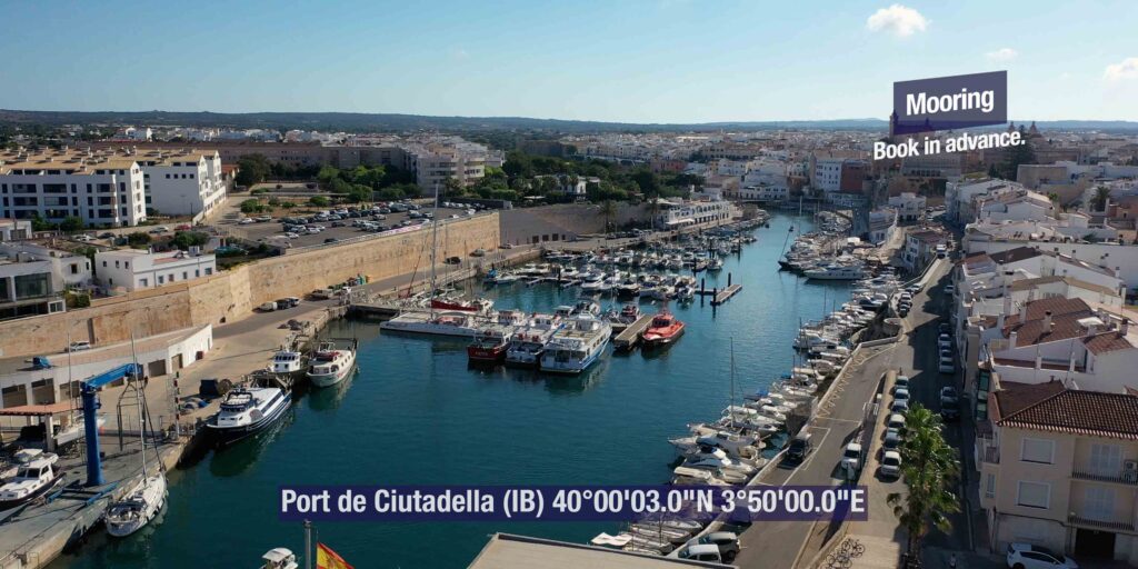
SeaTV · Spain · Balearic Islands · Menorca · Port de Ciutadella · Ports IB
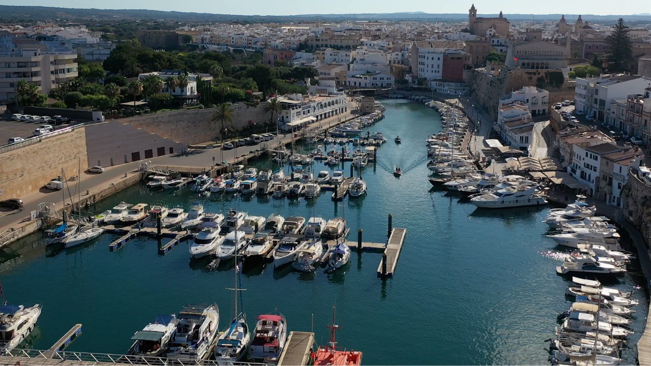
Port de Ciutadella — The 1,170 m Natural Inlet on the W Coast of Menorca
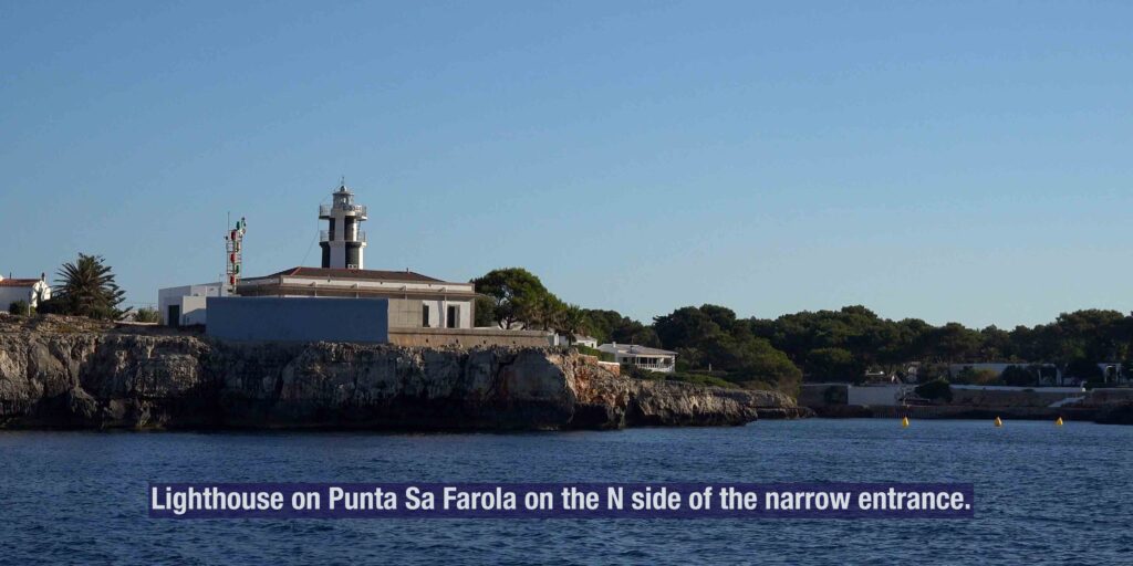
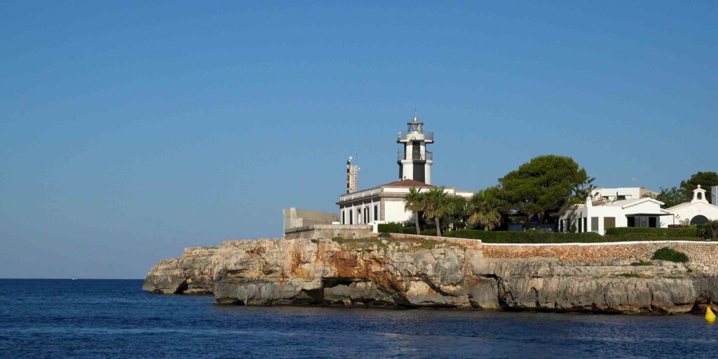
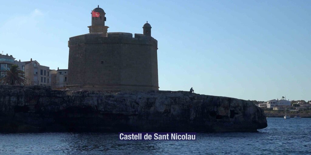
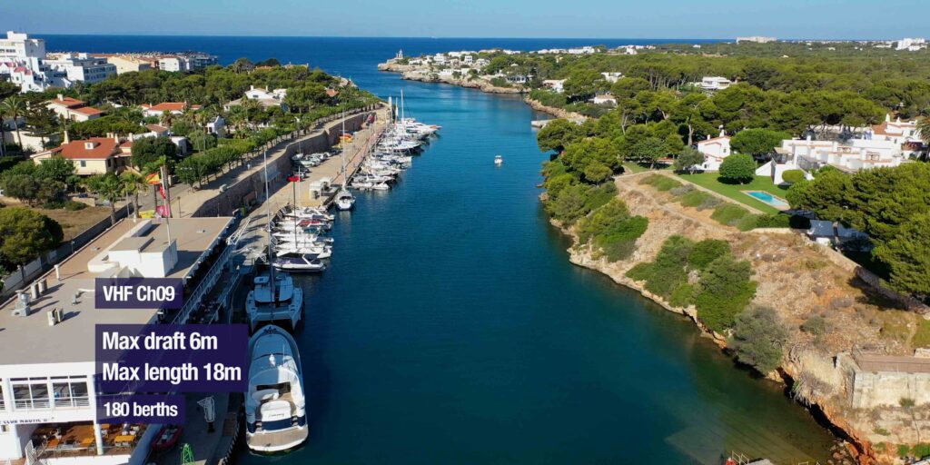
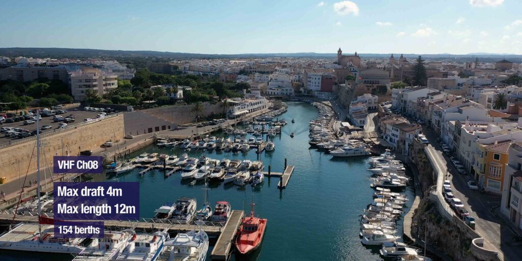
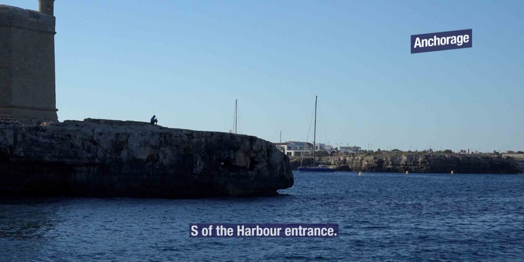
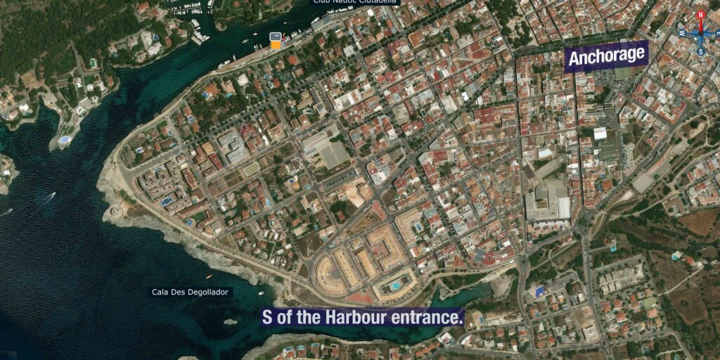
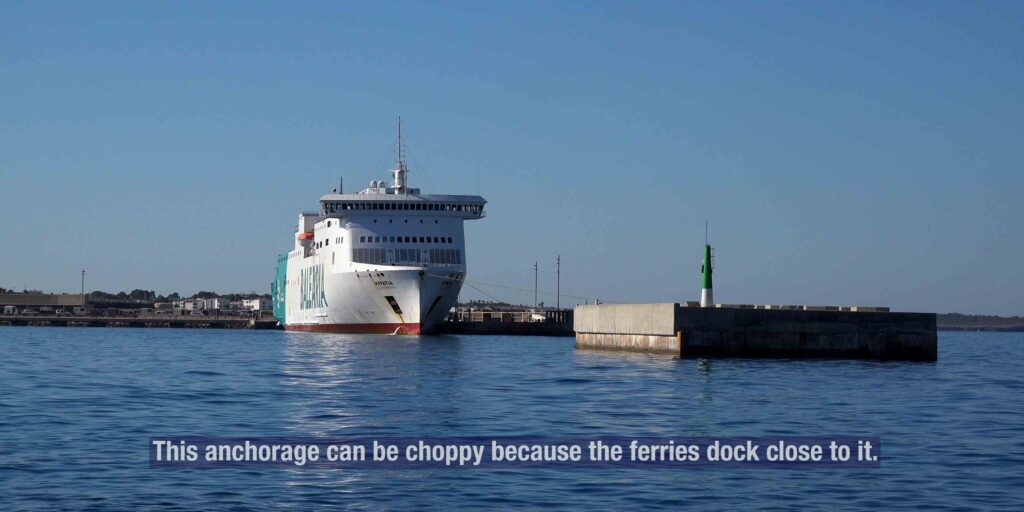
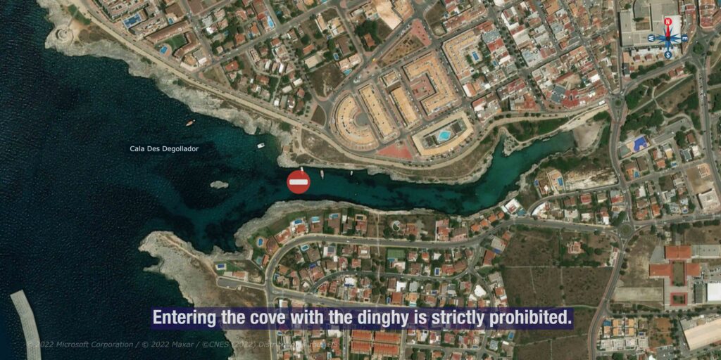
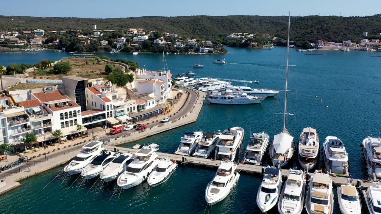
39°59.7’N · 3°49.4’E · 1,170 m natural inlet · width 110 m at entrance narrowing to 15 m at the inner basin · ~5 m depth throughout · managed by Ports de les Illes Balears (Ports IB) · ~175 vessels total capacity across 4 port functions: fishing port + recreational marina + commercial port + passenger ferry terminal · ferries to Alcúdia (Mallorca) and Barcelona · Sa Farola lighthouse (1855) marks the W entrance · Castell de Sant Nicolau (17C hexagonal watchtower) guards the harbour from a small island at the mouth · ⚠ subject to RISSAGA meteotsunami — sea-level oscillations up to 4-5 m occurring April-September. VHF Ch. 9.
22 NM NE of Port de Pollença (Mallorca) · ~45 km from Maó (Menorca capital) · former capital of Menorca until British conquest 1708 · UNESCO Biosphere Reserve since 1993 (whole island)
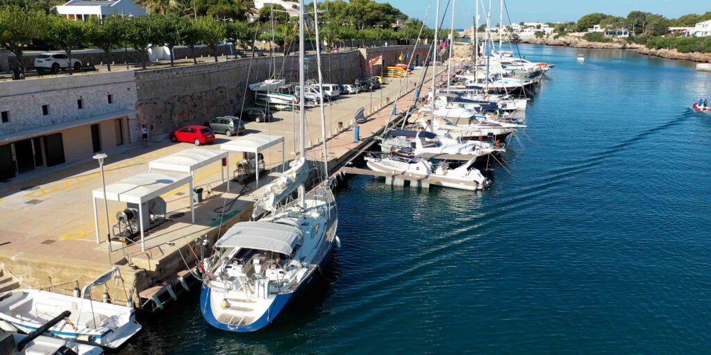
Port de Ciutadella is the natural inlet that gave the city its name and made it the capital of Menorca for 800 years. A long, narrow, deep cala carved into the W coast of the island, ~1.17 km long and never wider than 110 m, sheltered behind the Sa Farola headland and the small fortified island of Castell de Sant Nicolau. The Carthaginians founded the original settlement here under the name Jamma; the Romans renamed it Lammona; the Muslims (903-1287 AD) made it the only city on Menorca and called it Medina Menurqa; the Aragonese reconquest of 1287 turned it into the Christian capital “Ciutadella”; and the British conquest of 1708 moved the capital to Maó on the E coast — but Ciutadella remained the religious + commercial heart of the island. Today the port operates under four functions managed by Ports de les Illes Balears (Ports IB): the fishing fleet still works the harbour daily, the recreational marina holds visiting yachts (managed by Club Nàutic Ciutadella, see our dedicated marina page), the commercial port handles cargo, and the passenger terminal runs Balearia + Iscomar ferries to Alcúdia (Mallorca, ~30 NM SW) and Barcelona (~120 NM N).
⚠ Reality check — the Rissaga + the narrow inlet:
→ ⚠ RISSAGA — meteotsunami unique to Ciutadella · sea-level oscillations of 1.5-4 m occurring in 10.5-min cycles · primarily April-September · the 2006 rissaga destroyed ~100 boats in the harbour · the 1984 rissaga (4+ m) damaged 300 boats · monitor AEMET forecast + Ports IB rissaga alerts
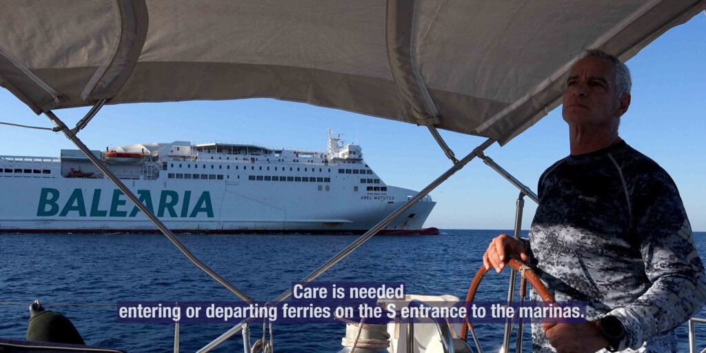
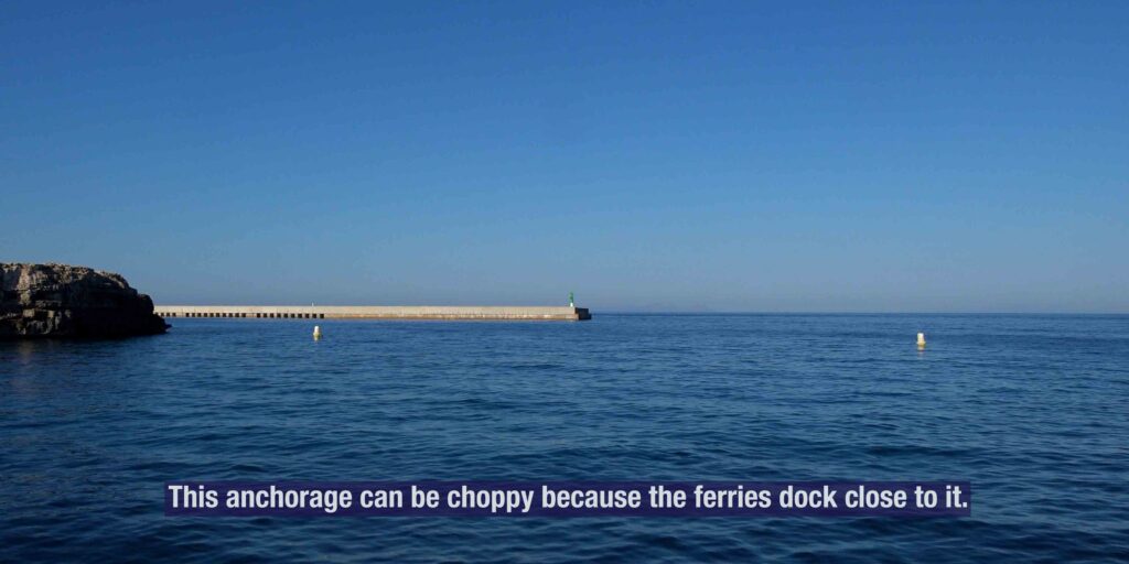
→ ⚠ Narrow inlet entrance · 110 m wide at mouth narrowing to 15 m at the inner basin · ferries + commercial vessels operate · maneuvering room is tight
→ ⚠ Small entrance rocks · approach hazard noted in pilot guides · day-only entry recommended for first-time visitors · night entry technically possible but tricky
→ ⚠ Limited visitor berths · the harbour holds ~175 vessels total but visitor capacity is small · book in advance via portsib.es or Club Nàutic Ciutadella
→ ⚠ Strong S/SW winds can build a working swell into the inlet · combined with rissaga risk = avoid in unsettled weather
→ Schengen status: Spain · clear in/out at Palma if from outside EU (Ciutadella is not a designated port of entry)
⚓ Port de Ciutadella at a Glance
Coordinates
~39°59.7’N · 3°49.4’E
Inlet length
1,170 m
Inlet width
110 m at entrance → 15 m inner basin
Average depth
~5 m throughout
Port operator
Ports de les Illes Balears (Ports IB)
Total capacity
~175 vessels (all 4 functions)
VHF
Ch. 9 working · Ch. 16 distress
Lighthouses
Sa Farola (1855) · Punta Nati (1913) on coast
Defense tower
Castell de Sant Nicolau (17C, hexagonal)
Distance · Mallorca
22 NM NE from Port de Pollença · ~30 NM SW from Alcúdia (ferry route)
Distance · Maó
~45 km by road · ~50 NM by sea (around N coast)
Distance · Menorca Airport
~45 km · 45 min by road
Heritage
Spanish Historical-Artistic Site (1964) · UNESCO Biosphere (whole island, 1993)
Underwater archaeology
Designated archaeological site · 5+ shipwrecks dating Roman-medieval-modern
The Rissaga — Why You Need to Know
⚠ Meteotsunami unique to Ciutadella
The Rissaga (Catalan for “drying event”) is a meteotsunami phenomenon that affects Ciutadella harbour several times a year, primarily during April-September. Despite the Mediterranean’s normal tidal range of just ~20 cm, rissaga events produce sea-level oscillations of 1.5-4 metres in cycles of about 10.5 minutes — sometimes draining the harbour completely, then returning the water with destructive force.
The mechanism
→ Atmospheric gravity waves form upstream of the Balearics travelling SW→NE
→ The pressure fluctuations excite long oceanic waves in the Menorca Channel (Proudman resonance) at the 80 m depth zone
→ As the waves cross from 80 m depth to the 5 m harbour depth, Green’s Law amplifies them by ~2x (shelf amplification)
→ The narrow Ciutadella inlet adds harbour resonance at its natural 10.5-min period · the result is the rissaga
Historical events
→ 21 June 1984: 4+ m wave damaged 300 boats in the harbour
→ 15 June 2006: 4-5 m oscillations destroyed ~100 boats · 30+ sunk completely · happened around the Sant Joan festival (“Marea del Pino”)
→ Smaller events: 70 cm-1 m rissagas occur multiple times each summer · documented daily by Ports IB
For visiting yachts
→ Check rissaga forecast via AEMET before approach (Spanish meteorological agency monitors specifically for Ciutadella)
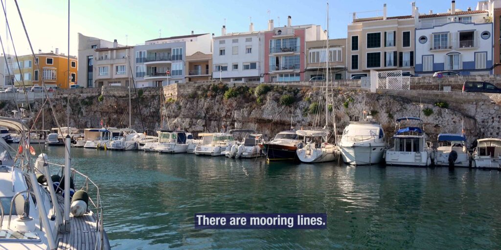
→ Use double the normal mooring lines when berthed · spring lines essential
→ If alert issued: some sailors choose to leave the harbour and anchor in nearby Cala en Blanes / Cala Santandría · others stay with extra lines
→ Rissaga underwater archaeology: the constant water movement has uncovered 5+ shipwrecks in Cala en Busquets (Roman to 18C), making the harbour an active archaeological excavation site
Approach & Entry
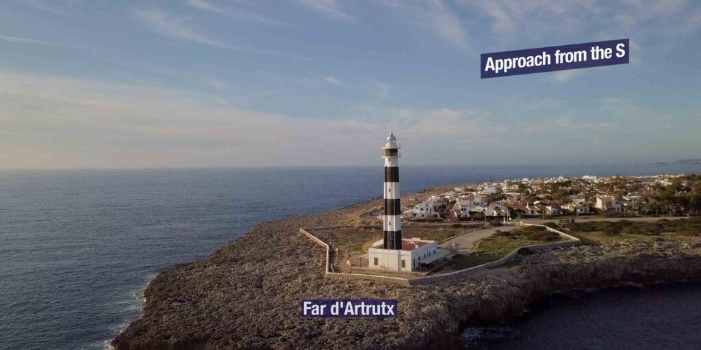
Approach from Mallorca (SW · ~22 NM from Pollença)
→ The crossing from Port de Pollença or Cala Murta heads NE across the Menorca Channel.
→ ⚠ Channel can be lumpy in N-quadrant winds · the depth drop at the SW edge of Menorca focuses any swell.
→ Identify the entrance by Sa Farola lighthouse (white tower, 11 m, 1855) on the W headland.
→ Castell de Sant Nicolau (17C hexagonal stone tower) on the small island at the harbour mouth is the second visual reference.
Approach from N Menorca coast
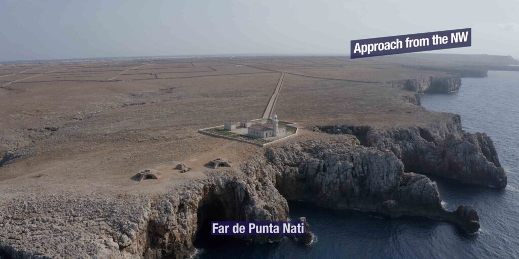
→ Coming S from Cala Morell or Punta Nati (the NW corner of Menorca) · the Punta Nati lighthouse (1913) marks the corner.
→ Punta Nati was built in response to the General Chanzy disaster of 9 February 1910 — a French steamship sank with the loss of all but one of 170 passengers · the lighthouse was the official response.
→ Continue S along the W coast · the approach is straightforward in calm weather.
Inside the inlet — the four functions
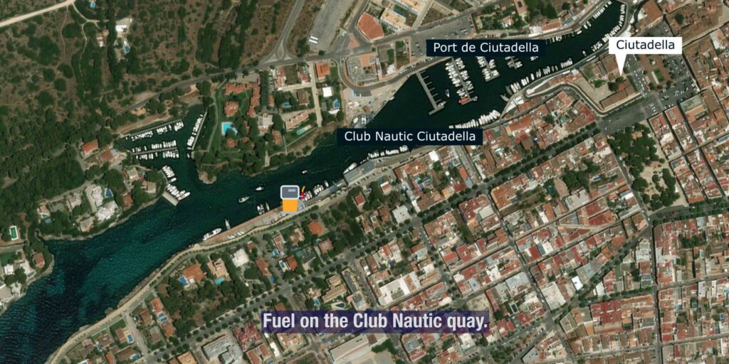
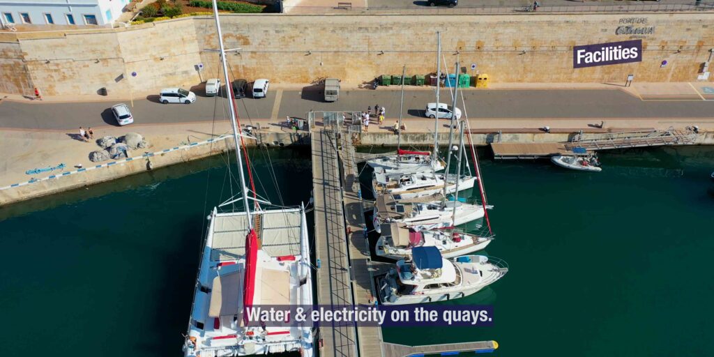
→ Outer harbour (W end · near Sant Nicolau): commercial port + passenger ferry terminal · Balearia + Iscomar to Alcúdia (Mallorca) and Barcelona
→ Mid-harbour (S side · Pasarela): Club Nàutic Ciutadella visitor pontoons · the busy yacht zone
→ N side: traditional fishing fleet quays · still active daily
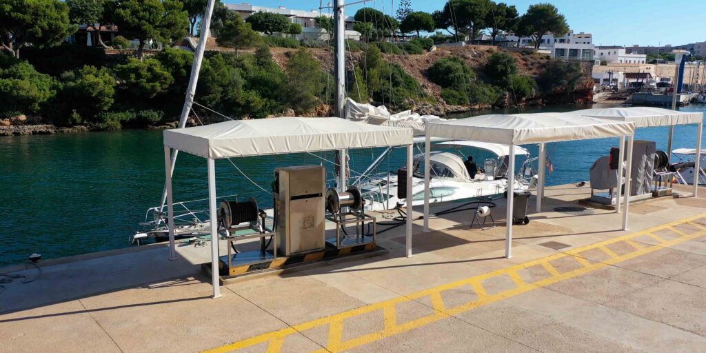
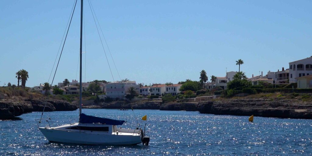
→ Inner basin (E end · Cala en Busquets): 116 base berths managed by Club Nàutic · the inner branch of the inlet · also the underwater archaeological site
→ Moll de Sa Trona: the public visitor quay · summer transit berths only · operated directly by Ports IB · book through portsib.es
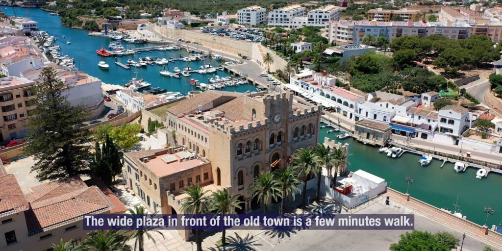
Above the Harbour — Old Town & Defenses
The harbour is the front door of Ciutadella’s old town. Two stepped streets descend from Plaça des Born (the central square) directly to the quays:
→ Carrer del Pere Capllonch (the “Firac” stairs) from Plaça des Born · the path used for the daily walk down to the boats since the city was founded
→ Carrer Sant Crist from Can Faustino · the second access route
The defensive walls (16C): James II of Majorca built the original walls in 1303; they were expanded in the 16C after the Turkish sack of 1558 (still remembered annually as “Any de sa Desgràcia”) and demolished from 1868 · the surviving fragment is the Bastió de Sa Font bastion overlooking the harbour, plus the remaining 5 bastions around the city.
Castell de Sant Nicolau (17C): hexagonal watchtower on the small island at the harbour mouth · built to defend against pirate raids · today houses a small museum on the Menorcan Biosphere Reserve · floodlit at night.
Sa Farola lighthouse (1855): on the W headland · 11 m tower · still operational · 150+ years of service · the visual reference every approaching yacht uses.
Ciutadella Old Town — A Walk From the Quays
From the harbour quays, the historic centre is a 5-min walk uphill:
→ Catedral de Santa Maria (13C-14C Catalan Gothic) · built on the site of the former mosque · entrance at the highest point of the city
→ Plaça des Born · the central square · former Moorish parade ground · ringed with palaces (Palau Salort, Palau Torre-Saura, Palau Vivó), the Town Hall (with date palms in front), and the obelisk commemorating the 1558 Turkish sack
→ Diocesan Museum · housed in the former 17C Augustinian friary · Baroque cloisters · adjoining Església des Socors
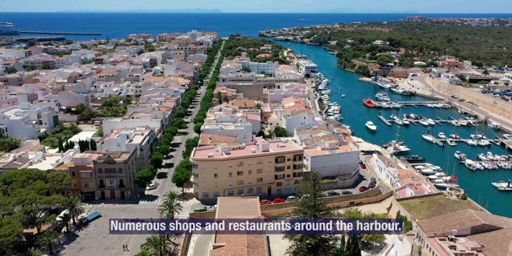
→ Ses Voltes (Carrer Josep Maria Quadrado) · the arched shopping street · the busiest in the old town
→ Mercat des Peix (fish market) · daily morning · fresh local catch
Markets: Plaça des Born hosts a general market Friday + Saturday 8:00-14:30 · summer evening craft markets in the same square + along Carrer del Pere Capllonch.
Cuisine: the Menorcan classics — caldereta de langosta (spiny lobster stew, the regional dish), oliagua amb figues (cold tomato soup with figs), Mahón cheese (the island’s protected cheese), pomada (the local gin + lemonade), ensaïmada (the spiral pastry, also Mallorcan).
Festes de Sant Joan (23-24 June): the most important festival on Menorca · medieval-origin horse parade (“jaleo”) through the streets · costume + horse-rider tradition centred on the harbour and the Bastió de Sa Font · the boats in the harbour become spectator boxes · also the period when “Marea del Pino” rissagas have historically occurred.
⛵ Day Sails — The W & S Coasts of Menorca
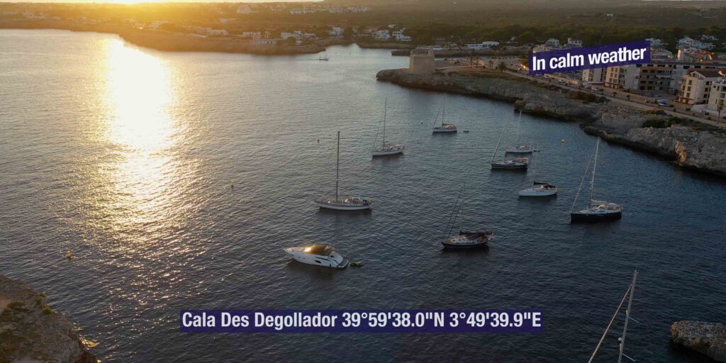
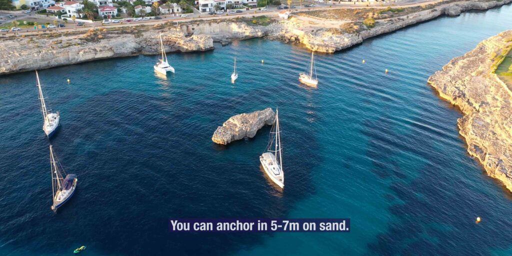
Day-trip anchorages within 10 NM of Ciutadella:
→ Cala en Brut + Cala Forcat (~3 NM N) · turquoise pools · cliff-jumping spot · daytime only
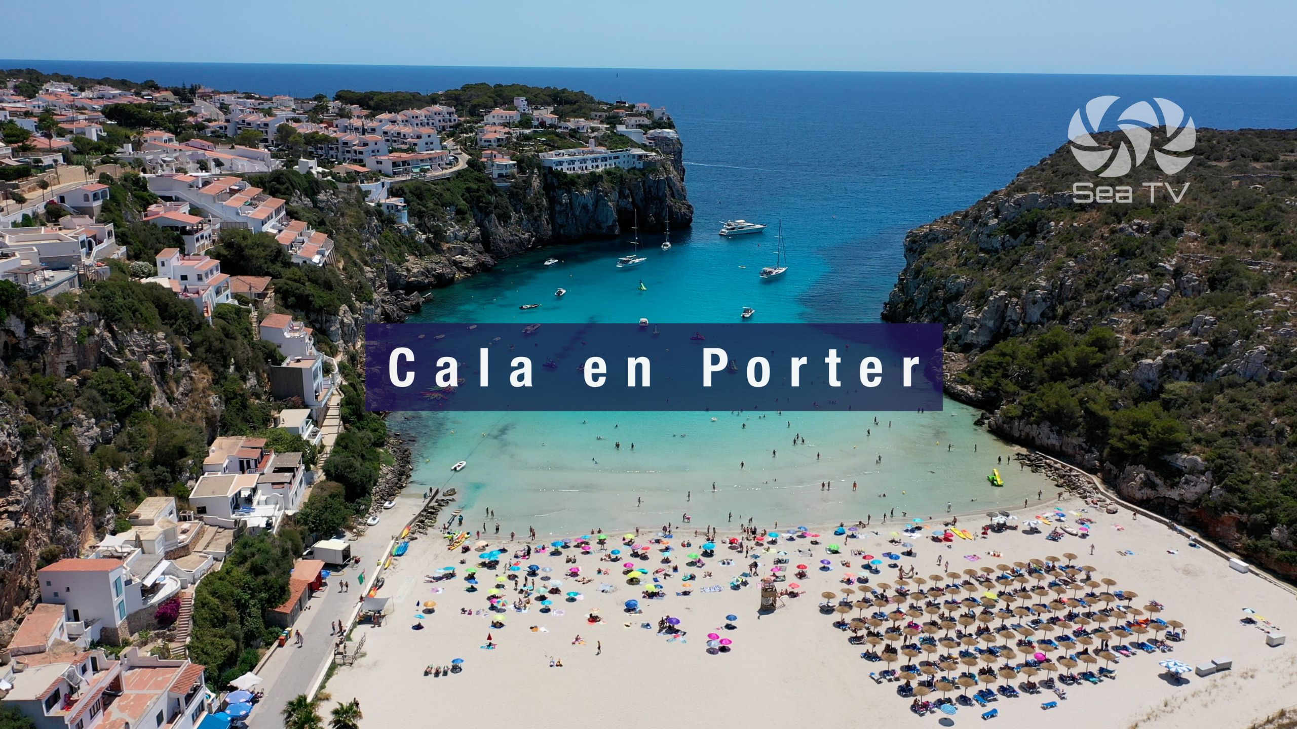
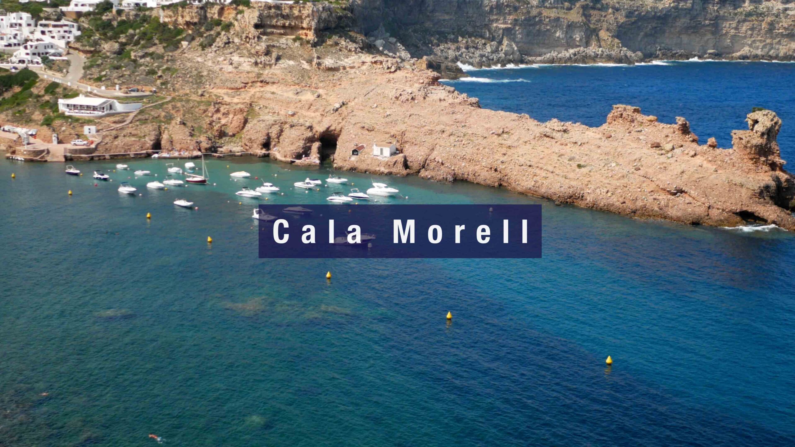
→ Cala Morell (~6 NM N) · wild N-coast cala · prehistoric burial caves in the cliffs (~2000 BC)
→ Cala Pilar + Algaiarens (~10 NM N) · undeveloped sandy bays · hike-only land access
→ Cala Santandría + Cala Blanca (~2 NM S) · family beaches · easy bus access from town
→ Son Saura · Cala des Talaier · Cala Turqueta (~5-7 NM SE) · the famous Menorcan turquoise beaches · sand bottoms 5-8 m · pine-fringed coves
→ Cala Macarella + Cala Macarelleta (~8 NM SE) · the most photographed beaches on Menorca · busy in season
Longer passages:
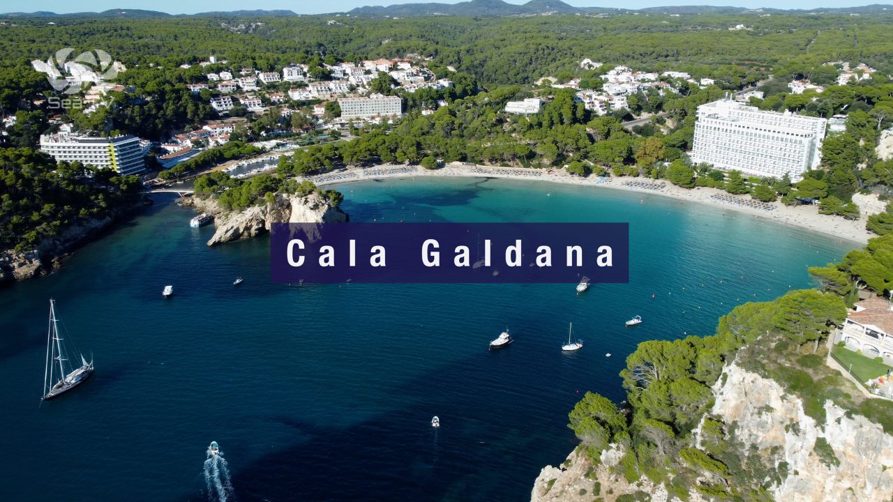
→ Cala Galdana (~12 NM SE) · the major resort + sheltered bay on the S coast
→ Maó (Mahón) natural harbour: ~50 NM around the N coast (one of the world’s finest natural harbours)
→ Fornells (~30 NM around N coast) · the windsurfing bay
→ Crossing back to Mallorca: Port de Pollença ~22 NM SW · Alcudiamar ~30 NM SW
Emergency & Practical Contacts
Ports IB (port operator): portsib.es · Ciutadella office
Club Nàutic Ciutadella (visitor berths): +34 971 383 918 · cnciutadella.com
VHF: Ch. 9 working · Ch. 16 distress
Emergency: 112 (national)
Maritime SAR (Salvamento Marítimo): 900 202 202
Hospital Mateu Orfila (Maó): +34 971 487 000 (45 km · the only public hospital on Menorca)
Rissaga forecast: AEMET maritime forecasts (aemet.es) + Ports IB tide gauge data
Ferry operators: Balearia (balearia.com) · Iscomar (iscomar.com)
Guardia Civil Ciutadella: +34 971 380 787
⛵ Continue Exploring Menorca + the Balearics
→ Ciutadella Harbour Marina (Club Nàutic) — the visitor pontoons + berthing details inside the same inlet
→ Cala Murta · Formentor (Mallorca) — 22 NM SW · the closest Mallorcan anchorage
→ Port d’Alcúdia · Alcudiamar (Mallorca) — 30 NM SW · the regular Balearia ferry destination
“Port de Ciutadella is the natural inlet that gave the city its name and made it the capital of Menorca for eight hundred years · one thousand one hundred seventy meters long and never wider than one hundred ten meters narrowing to fifteen at the inner basin · five meters depth throughout · managed by Ports de les Illes Balears · four functions in the same inlet the fishing port the recreational marina the commercial port and the passenger ferry terminal · approximately one hundred seventy five vessels total capacity · the Carthaginians founded it as Jamma the Romans renamed it Lammona the Muslims made it Medina Menurqa for nearly four hundred years and the Aragonese reconquered it as Ciutadella in twelve eighty seven · the British moved the capital to Maó in seventeen oh eight but Ciutadella remained the religious and commercial heart · approach from Mallorca twenty two miles southwest from Port de Pollença across the Menorca Channel · identify the entrance by the eighteen fifty five Sa Farola lighthouse on the west headland and the seventeenth century Castell de Sant Nicolau hexagonal stone tower on the small island at the harbour mouth · the Punta Nati lighthouse from nineteen thirteen on the northwest corner of the island was built in response to the General Chanzy disaster of February ninth nineteen ten when a French steamship sank with the loss of all but one of one hundred seventy passengers · the rissaga is the meteotsunami unique to Ciutadella sea level oscillations of one point five to four meters in ten point five minute cycles primarily April to September the eighty four event was four meters and damaged three hundred boats and the two thousand six event was four to five meters and destroyed about a hundred boats and sank thirty completely · the mechanism is atmospheric gravity waves traveling southwest to northeast over the Menorca Channel exciting Proudman resonance at the eighty meter depth zone then Greens law amplification as the waves cross to the five meter harbour depth then resonance within the inlet at the natural ten point five minute period · check AEMET forecasts and Ports IB tide gauge data before approach use double mooring lines when berthed · the harbour is also a designated underwater archaeological site with five plus shipwrecks dating Roman to medieval to eighteenth century being excavated · two stepped streets descend from Plaça des Born to the quays the historic Firac and Carrer Sant Crist · the Festes de Sant Joan on June twenty third and twenty fourth is the most important festival on Menorca the medieval horse parade through the streets the boats become spectator boxes also the period when the marea del pino rissagas have historically occurred · day sail from here to Cala Macarella and Cala Turqueta southeast or up the west coast to Cala Morell and the prehistoric burial caves · this is the harbour you visit because it is one of the great natural inlets of the Mediterranean and because the geology of the place produces a meteotsunami that no other harbour in the world experiences in quite the same way.”
— SeaTV · Menorca · Port de Ciutadella · Ports IB · The Natural Inlet