SeaTV · Thailand · Eastern Gulf · Trat Province · Koh Kut
Sailing Koh Chang to Koh Kut — Captain Hook’s Bay, Klong Chao Waterfall & the 9 Anchorages
Nine anchorages around Koh Kut — Thailand’s eastern frontier · the southernmost cruising stop · A26 Ko Maisi Lek (King Rama V era artefacts), A27 Soneva Kiri (6-star reef), A28 Captain Hook’s Bay (Sigal’s #1 favourite), A29 Klong Chao Waterfall (Tarzan rope, fish that nibble), A30 Ao Bang Bao (sheltered hideaway), A31a-c Hat Thakian North & South + Ao Phrao (the river trip), A32 Ao Yai fishing village, A33 Ao Yai Koet (rainbow resort), A34 Ao Salat (“Pirate Bay”). Outside Marine Park · no park fee · 1 ATM at the hospital that’s topped up once a week — bring cash.
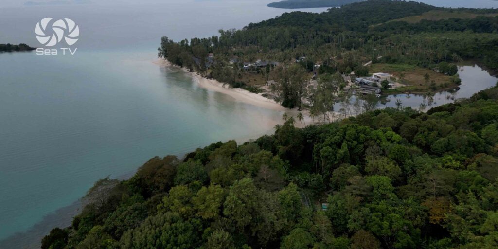
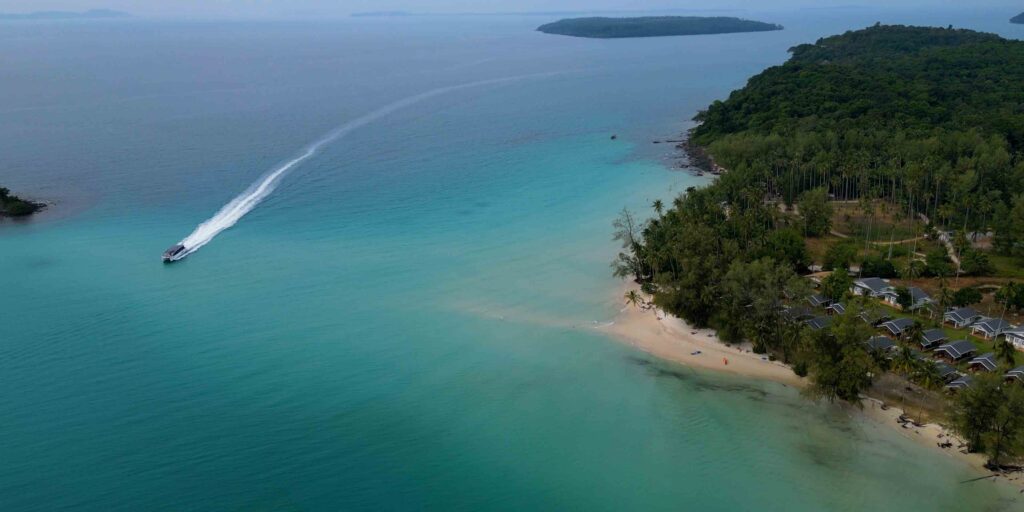
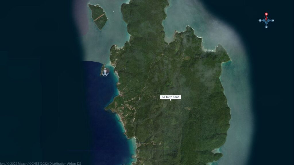
Koh Kut is a special place. The southernmost point of eastern Thailand · so many things come together here: beautiful bays and beaches, waterfalls, charming Thai-style resorts, over-the-water fishing villages, and an island-wide relaxed feeling. Largely isolated, has not really made it high on the backpacker or mainstream tourist trail · long since been a relatively upscale retreat for local people and remains beautifully Thai. Resorts with food and hospitality that are pristine. Rivers to explore, waterfalls to visit, night walks, cocktail bars, palm-tree-lined white sandy beaches accessible from very protected anchorages. Main tourism is local — don’t expect as many people to speak English. Access is by ferry from Laem Sok in Trat or speedboat from Koh Chang. Outside the Mu Ko Chang Marine Park · no park fee · ⚠ One ATM on the island, at the hospital, topped up once a week — bring plenty of cash or pay hotel forex rates. Sail E from Koh Mak on Days 3-4 to reach this group · plan two nights here.
️ Interactive Map — Eastern Gulf Anchorages
→ Full interactive map of the SeaTV Eastern Gulf anchorages · use the layer toggles to filter by category · pinch to zoom on mobile · charts 120 (Koh Chang) + 151 (S to Koh Kut)
⚠ Reality check for Koh Kut:
→ ⚠ Captain Hook’s: approach from S of Ko Raet ONLY · NOT the N channel · sand bar across the entire N channel
→ ⚠ Soneva Kiri: long dark shallow reef outside resort · go well N to clear when heading to beach
→ ⚠ Klong Chao swell into NE · day anchorage · only Feb-Mar OK overnight
→ ⚠ Bang Bao Bay entrance smaller than it looks · stay in 15 m off N point until full visibility · enter centre between heads
→ ⚠ Ao Yai: rock awash N headland · only seen at lowest tide · NOT marked on chart
→ ⚠ Ao Yai bay shallows fast past fishing village pier · fish pens (sticks) at low tide
→ ⚠ Hat Thakian South: rocky outcrops both sides of bay · stay centre · plenty of water at the points
→ ⚠ Ao Salat submarine cable + reefs to W · stay off the yellow buoy line
→ Dress code at fishing villages — NOT bikini / swim shorts · cover up when going ashore
⚓ Koh Kut at a Glance
Anchorages
9 (A26 + A27 + A28 + A29 + A29-S + A30 + A31a-c + A32 + A33 + A34)
Park status
Outside Marine Park (no fee)
Days needed
2 nights minimum
Best NE anchorages
A28 Captain Hook’s · A30 Bang Bao · A31a-c
ATM
1 only · at hospital · topped up weekly
Languages
Mostly Thai · less English than Koh Mak
Highlights
Captain Hook’s, Klong Chao waterfall, Ao Phrao river trip
Distance from Koh Mak
~10 NM SE
⛵ The Nine Anchorages — Going S Around the Island
A26 · Ko Maisi Lek — King Rama V Plantation House
7-10 m sand · NE side · history stop
Ko Maisi Lek is a nondescript island that was once home to one of the royal-appointed Officers of Chinese Affairs · the old dilapidated plantation-style house remains, with mosaic floors dating back to the King Rama V era. Caretakers are generally OK with a walk around · anyone educated in Asian history will be astounded by the abundance of artefacts left lying around. Used to be a pearl farm — perhaps a record-breaking pearl was left behind in a forgotten shell.
Anchorage:
→ Anchor 7-10 m on sand · NE side of island near visible infrastructure on shore.
→ ⚠ Watch the rock E of the channel · channel is smaller than it looks · take care manoeuvring.
Use it as: funky history stop and change of pace.
A27 · Soneva Kiri — 6-Star Resort & the Long Reef
5-7 m sand · ⚠ shallow reef · luxury stop
Soneva Kiri is a 6-star resort catering to those who can afford it. Treepod dining, pool-side restaurant, units with private butler, buggy, and beach. Although the resort is private, the reef they built outside is not.
Anchorage:
→ Anchor 5-7 m sand bottom · away from the long dark reef visible underwater · W or NE of the reef.
→ Beach on the western shore is private · you’re not always welcome ashore but it’s mostly empty.
→ ⚠ BEWARE OF THE LARGE LONG SHALLOW REEF · go well N to clear it if heading to the beach.
→ For a meal at one of the Soneva Kiri’s 5 restaurants you must call ahead · soneva.com
→ N of the resort: two sandy beaches you can anchor off for good NE protection · the northern one is best.
Use it as: high-roller dinner ashore (call ahead) · or NE-protection stop at the N beaches.
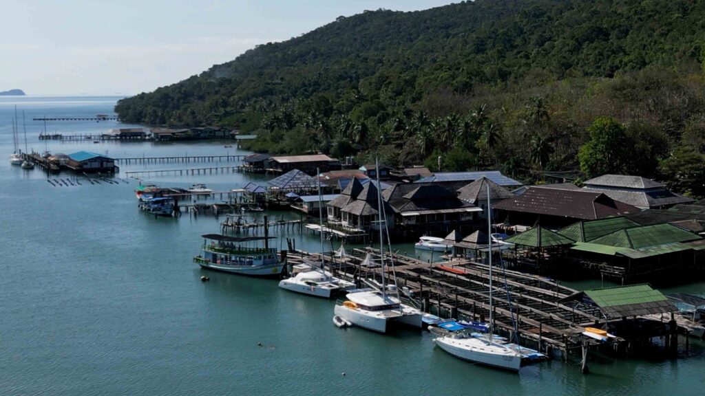
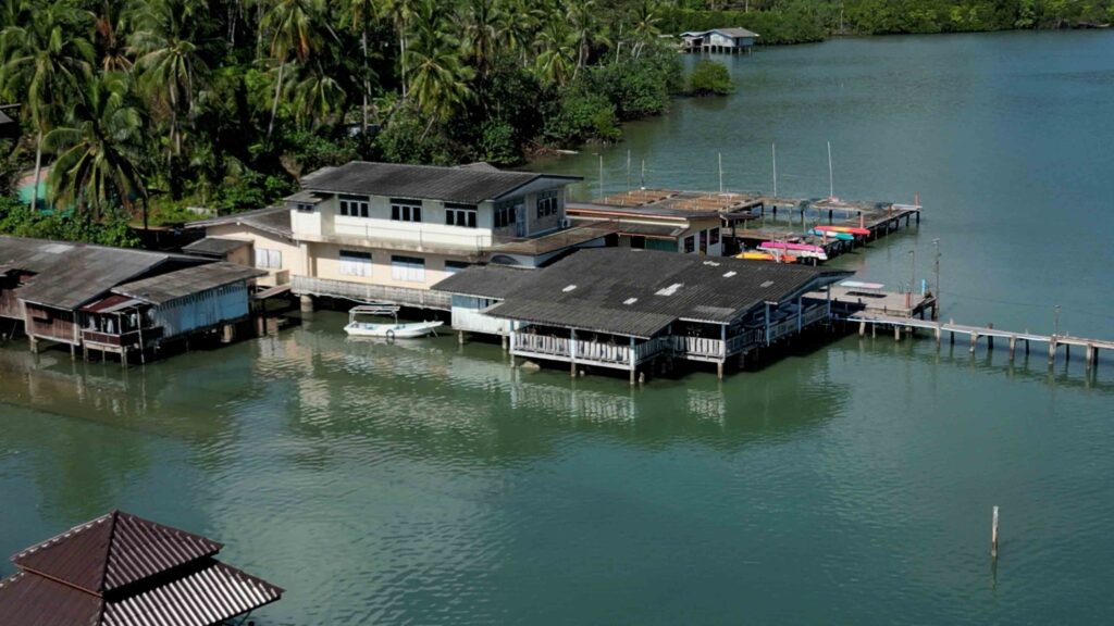
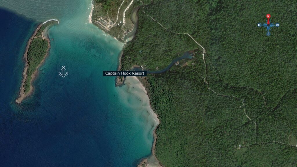
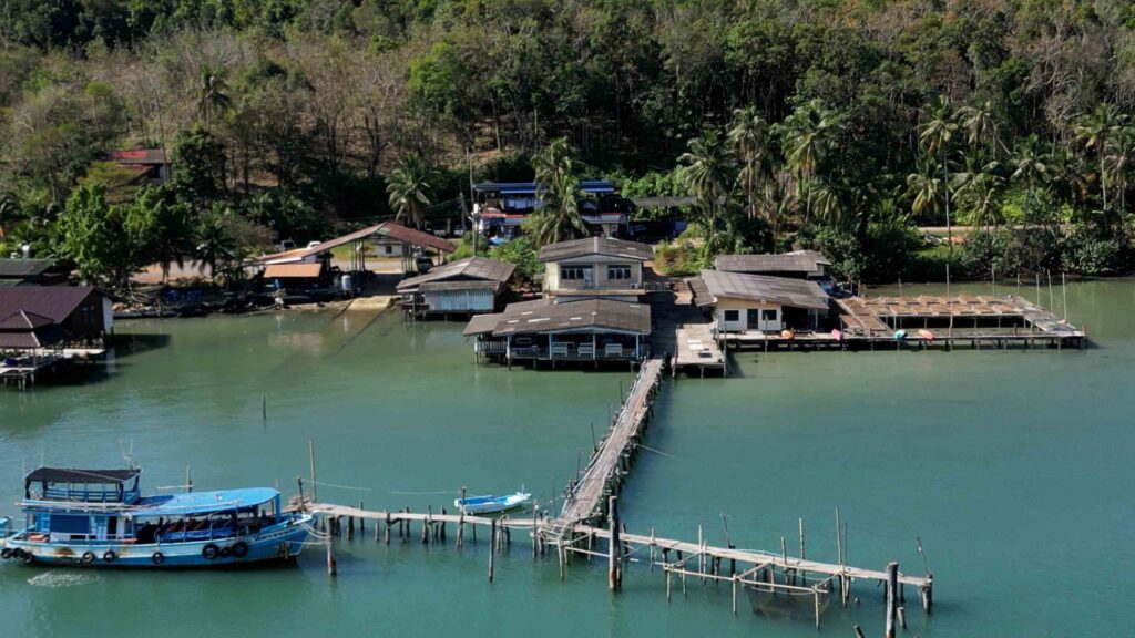
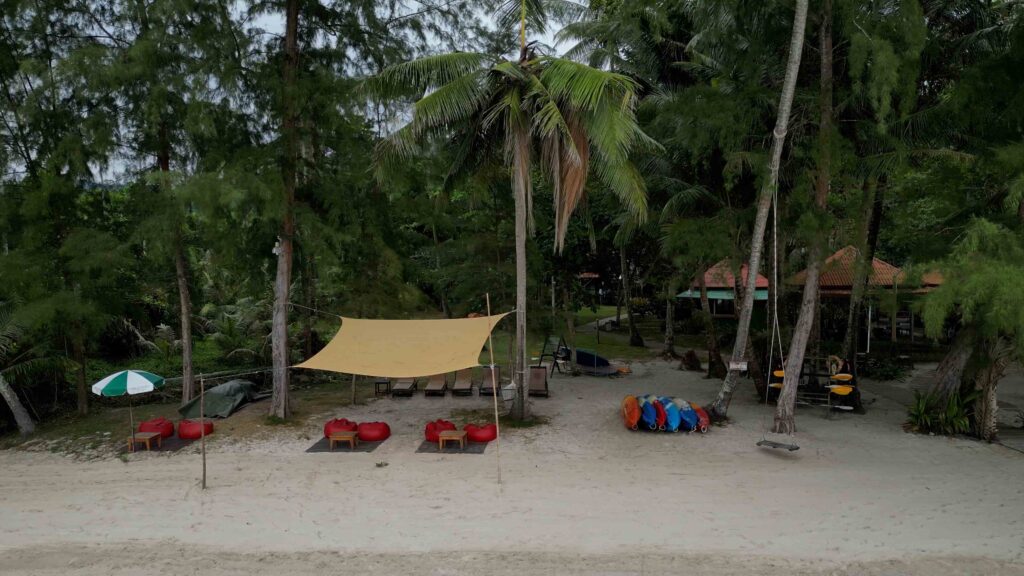
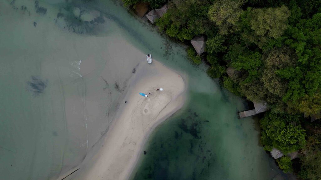
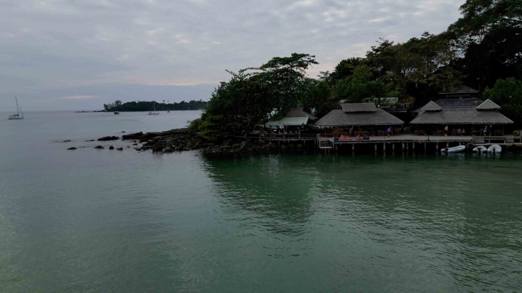
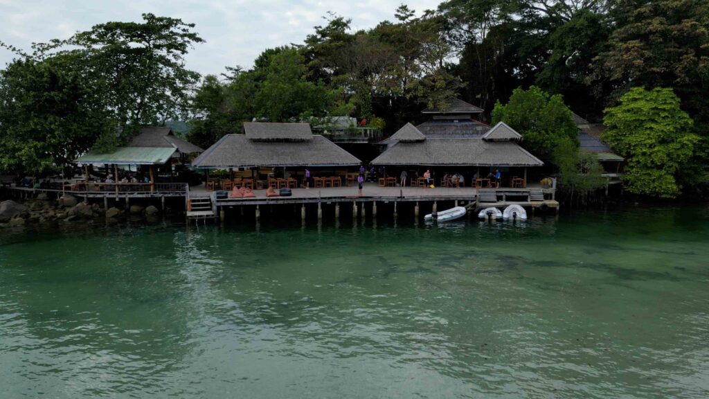
A28 · Ao Check Ki / Captain Hook’s Bay — Sigal’s #1 Favourite
4-7 m sand · approach S of Ko Raet ONLY · the headline anchorage
Ao Check Ki — Captain Hook’s Bay · the headline anchorage of the entire Eastern Gulf charter. Coconut-tree-lined long white sandy beach, crystal clear water, protected anchorage, and Captain Hook’s Resort tucked into the corner. The bay itself is the photograph that ends up on every charter flyer.
⚠ Approach — critical:
→ Approach from the S of Ko Raet ONLY.
→ Do NOT pass through the north channel — there is a sand bar across the entire channel.
Anchorage:
→ Anchor anywhere in the bay on sand 4-7 m.
→ In-between the rocky headland and Ko Raet is best.
→ You’ll be the focus of sunset photographs taken from the sunset viewing platform of Captain Hook’s Resort.
→ Stay well off shore for a mosquito-less evening · tempting to get close but don’t.
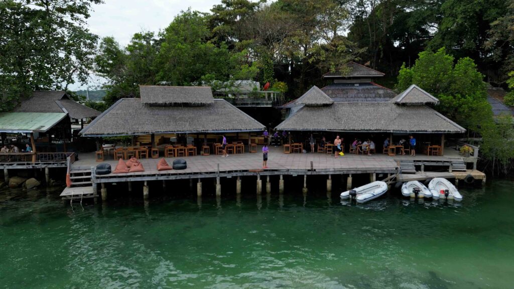
Captain Hook’s Resort:
→ Take the dinghy to the small stream around the point · their pier · take whichever spot is best for the tide.
→ ⚠ Take care navigating the river · best to take a flashlight · go slowly · watch for nets in the river and shallow sections around the bends.
→ Sprawling space: restaurant, cocktail bar, relaxation areas, massage salas, swimming pool with shower next to it.
→ Lychee Rose cocktail recommended on a hot day.
→ Order bags of ice at the bar.
Up the river — Bann Makok Resort:
→ Quaint resort with relaxed atmosphere, fruit shakes, food in a tranquil setting on the river.
→ At night: well-coordinated fireflies blinking on the edges of the stream.
→ Ask staff how to get to the Kai Yee waterfall · ~20 min walk · ask if it’s flowing first.
Snorkelling:
→ Snorkel SE side of Ko Raet for sunken temple statues near the marked mooring ball.
A29 · Ao Klong Chao — The Waterfall Stop
7-10 m sand · day anchorage · only Feb-Mar overnight OK
Ao Klong Chao is the waterfall stop · really only good for a day anchorage due to swell well into the NE. February and March can generally stay overnight.
Anchorage:
→ Anchor 7-10 m in sand · well away from the beach and large coral heads that line the shore.
The waterfall trip:
→ Pack water, snacks, and the spare fuel tank.
→ Take the dinghy to the small estuary in the northern corner of the bay.
→ At low tide you may need to get out and go by foot for a short period.
→ At the mouth of the estuary on the N shore: Away Resort — lunch spot with toilets and showers.
→ Paddle / dinghy along the river staying in the centre for ~3/4 NM · houses and dive resorts on the first part · past the bridge: vegetation only.
→ No crocodiles here despite the appearance.
→ Tie the dinghy to the old pier or a tree at the obvious end · follow the track to the road and turn left · ~15-20 min walk.
→ ⚠ The track is a subsidiary that joins the road · leave a trail of breadcrumbs at the junction · easy to miss on the return.
At the waterfall:
→ Tarzan rope for swinging.
→ Small fish that nibble (don’t bite, just nibble — tickles).
→ Best Nov-Jan but flows all year · pools below the falls for a water massage.
River bars on the way back:
→ Sunset Bar just inside the river · good music · Pad Thai · bring dinghy to the ladder · climb up for a cold drink.
→ Tawan Eco Bar across the street · if you can play an instrument, you can be the entertainment · drinks on the honour system.
A29-S · South Klong Chao — A-Na-Lay SW Shelter
7-10 m sand · SW swell shelter · A-Na-Lay Resort dock
South Klong Chao just SW outside the bay off the A-Na-Lay Resort · use it to get out of a SW swell.
Anchorage:
→ Anchor 7-10 m sand bottom just off shore and away from the reef.
→ A-Na-Lay Resort has a nice dock for the dinghy · good cheap Thai food with a nice view.
→ ⚠ Don’t go into the bay with the yacht · shallows quickly.
→ Bay just to N has palm-lined beach · dinghy only · watch the rocks and reef off the points and in the bay.
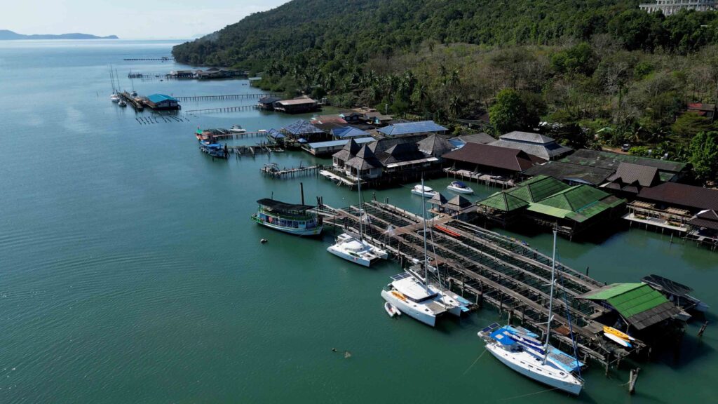
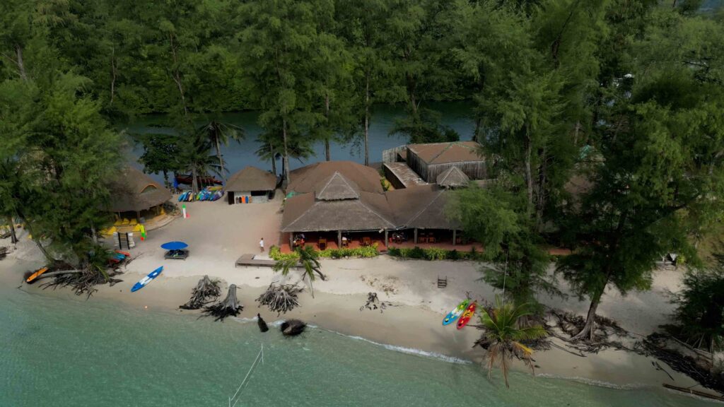
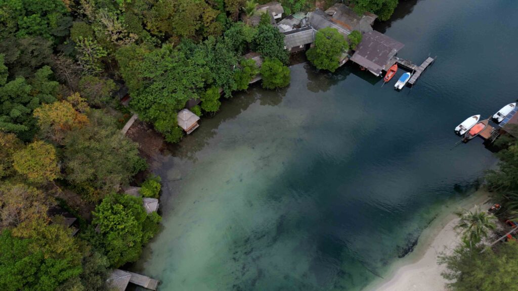
A30 · Ao Bang Bao — Sheltered Hideaway (Sigal’s Pick #2)
7-10 m sand · ⚠ tight entrance · best overnight after waterfall day
Ao Bang Bao is another favourite hideaway · a delightful sandy-bottom bay offering excellent protection · the best place to anchor at night having just spent the day at the waterfall or exploring the island.
⚠ Approach — be careful:
→ The approach can be daunting · the entrance is smaller than you might think.
→ Stay in 15 m of water off the northern point until you can see the entrance in full.
→ Then enter in the centre between the two heads.
Anchorage:
→ Anchor in the middle of the bay 7-10 m.
→ Take the time to bed your anchor properly.
Ashore:
→ The Beach Nature Resort — Island Spirit’s pick of the bunch · super-friendly owner · clean toilets and showers · excellent restaurant with rooftop bar · best massage on the island.
→ To The Sea — terrace bar with a perfect photo spot of the yacht framed between two palm trees.
→ South corner at the estuary mouth: good Thai food · wooden bridge for dangling feet · cheapest beer in the bay.
→ BB Divers base for scuba.
→ Restock ice from the resorts.
A31a · Hat Thakian North — Cham’s House
5-7 m sand · long white beach · sunset stop
Hat Thakian North just around Lam Bang Bao · a long white sandy beach. Only Cham’s House Resort on the beach · beautiful grounds, casual dining, sunset views.
Anchorage:
→ Approach on the outside of the rock Hin Bang Bao · give it plenty of clearance.
→ Anchor anywhere along the beach 5-7 m sand bottom.
A31b · Hat Thakian South — More Sheltered
5-7 m sand · basic bungalows · fishermen shelter
Hat Thakian South just around Lam Ton Son · another long white sandy beach · a little more protected with basic bungalows. Favourite of fishermen — sometimes crowded in heavy weather.
⚠ Approach:
→ Give plenty of water to the point · stay in the centre of the bay.
→ ⚠ Both sides of the bay have rocky outcrops extending quite far out.
Anchorage:
→ Anchor 5-7 m in sand.
→ At the N end of the bay there are remnants of what was planned to be a marina · little of interest now · channel not navigable.
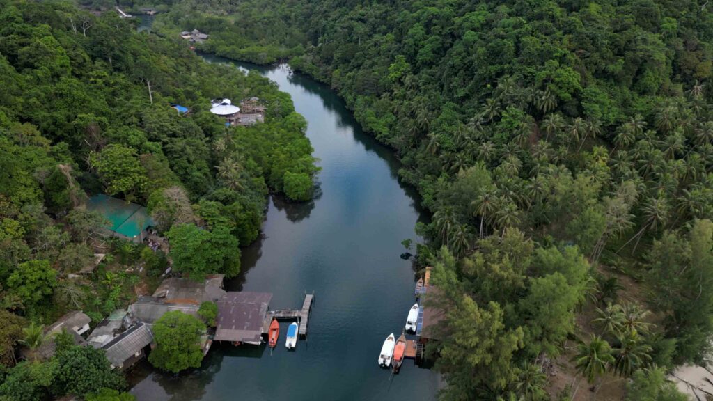
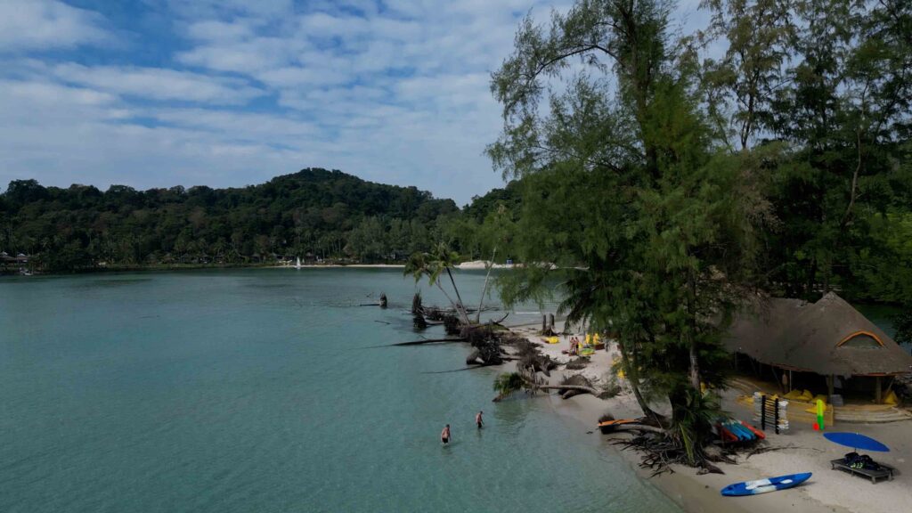
A31c · Ao Phrao — The River Trip (Must-Do)
5-7 m sand · the river trip · don’t miss this
Ao Phrao is the bay you don’t skip. The beach is exquisite · resorts are more basic but offer good local food and very friendly service. Mainly it’s the river trip that gets all the raves. Popular shelter for fishing boats but the bay is huge — plenty of room. Trade your “extra” beer for fresh catch off the local fishing and squid boats.
Anchorage:
→ Approach in the centre of the bay.
→ Anchor 5-7 m on sand between the middle and the W end of the beach · gives dinghy access to resorts and estuary.
The river trip:
→ Provision the dinghy with water and snacks · or shop at the little place inside the river mouth.
→ ⚠ Enter the estuary carefully · may need to walk the first section over the shallow sandbar.
→ Motor along the river as far as you like · be careful of obstructions under the surface.
→ National Geographic-like journey — water village, monastery, life-sustaining river · cultural delight.
Ashore:
→ Rest Sea Resort at river entrance N side · real coffee, juicy western burger, top-notch Thai food · hammocks floating over the sea · contemporary space on a pretty beach.
→ Gumm Lonely Club further up & inside the river · laid-back, smooth jazzy tunes.
→ Working temple at the end of the river · dress appropriately — covered knees and shoulders for both men and women.
A32 · Ao Yai — The Fishing Village (Lunch Stop Only)
5-7 m mud · NOT NE overnight · fresh seafood + Noochy
Ao Yai fishing village · in NE winds doesn’t provide enough protection for overnight · great lunch spot or provisioning trip for fresh seafood.
⚠ Approach:
→ Heading due W in the centre of the bay to avoid the rock at the N headland.
→ ⚠ This rock is only awash at the lowest of tides · generally cannot be seen · NOT marked.
→ Take a path in the middle of the two hazards on the chart.
Anchorage:
→ Anchor on mud bottom 5-7 m just beyond the large concrete pier and off the fishing village pier · don’t impede fishing boat access.
→ ⚠ Bay gets very shallow past the end of the fishing village pier · don’t venture beyond.
→ ⚠ Fish pens (sticks in water) beyond pier · 1 m at low tide · stuck-in-mud territory.
Going ashore:
→ Dinghy to the S corner of the pier — precarious floating bamboo dock.
→ Or tie to a ladder on the pier.
→ Or come alongside a fishing boat, climb over, tie to the pier (NOT the fishing boat — it might leave!).
→ First place at the corner is most yacht-friendly · cruising rally party location · sailors known & helpful.
Dress code:
→ ⚠ NOT bikini / swim shorts to a fishing pier · cover up · this is an authentic working community.
Dinner: Noochy Seafood further down the pier · fresh seafood extravaganza · don’t be afraid to try something unfamiliar.
A33 · Ao Yai Koet — Rainbow Resort Bay
4-6 m sand · NOT NE overnight · lunch stop
Ao Yai Koet is a small bay made distinct by a low-key Thai resort with a rainbow colour scheme that’s unfortunately falling apart. Beach only at low tide · in the NW corner a little dinghy channel.
Anchorage:
→ Approach in the centre of the bay.
→ Anchor 4-6 m sandy bottom.
→ ⚠ Bay gets very shallow · don’t go past the main resort building.
→ NOT overnight in NE winds.
Use it as: lunch stop · resort worth a look · if the cook is in residence they’ll happily whip up a meal.
A34 · Ao Salat — Pirate Bay
7-9 m mud · ⚠ submarine cable + reefs · ferry to Trat available
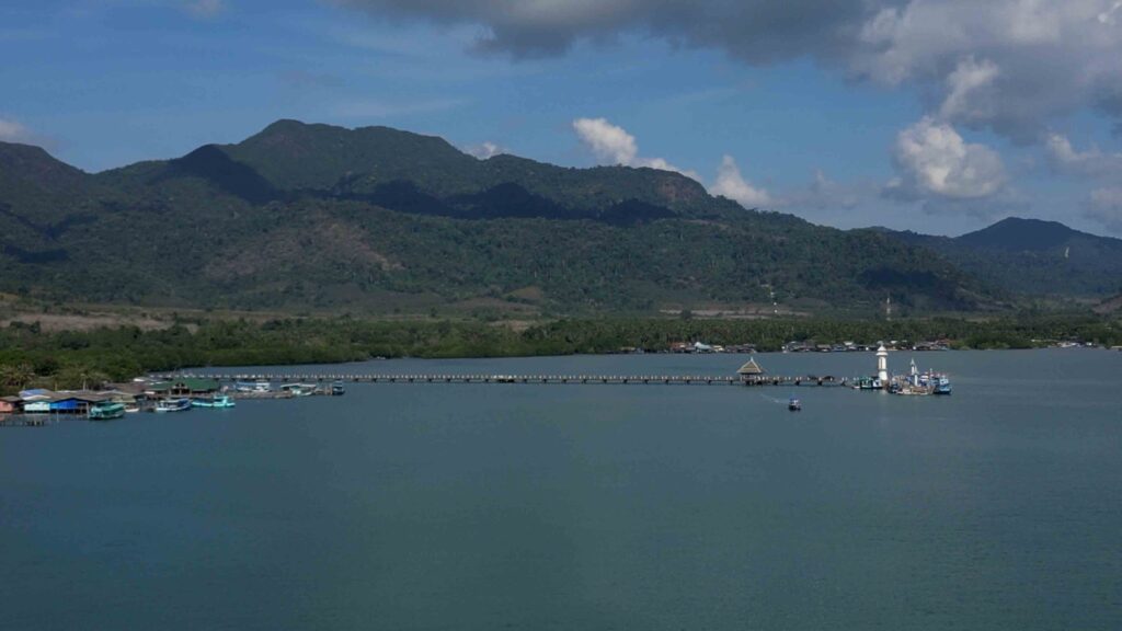
“Salat” is Thai for pirate — Pirate Bay. The pirates are long since gone but it’s not hard to see why this was a good place to call home — you can imagine them disappearing into this small protected bay with their booty from the trading ships passing just below Koh Kut on their way to Bangkok.
⚠ Approach:
→ Approach in the centre of the bay · anchor well off the pier (don’t impede other boat access).
→ ⚠ Stay off the line of yellow buoys that mark the submarine cable and some reefs to the W toward shore.
Anchorage:
→ Anchor on either side of the yellow buoy line 7-9 m mud.
Going ashore:
→ Head into the bay a little · look for a ladder · one outside a little mini-mart is convenient.
→ Or pull up to a fishing boat, climb over, tie to the pier (NOT the fishing boat).
Ashore:
→ Serviced by one of the island’s paved roads · more used to seeing tourists than Ao Yai · less hospitality, more ambiance.
→ Beautiful golden Buddha and the preserved monk inside the temple.
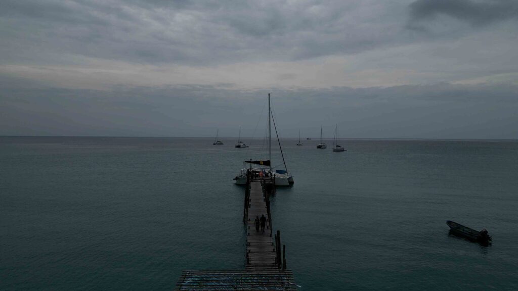
→ Ferry to Laem Sok, Trat · use this for crew arrangements / changeover.
→ Weather hideout option: 20-min taxi to Bann Makok for lunch / drink, then water taxi to Captain Hook’s for cocktails.
Emergency & Contacts
Island Spirit — Phil: +66 81 813 8023 (24hr WhatsApp)
Island Spirit — Kim: +66 93 131 0844 (24hr WhatsApp)
Tourist Police: 1157 or 039 557 287
Bangkok Koh Chang Hospital (W side): 039 532 735
Koh Chang International Hospital (E · Dan Mai): 1719
Marine Emergency & SAR: 1196
VHF Distress: Ch. 16
Continue the Eastern Gulf Charter
→ 1. Charter Base · Island Spirit Yacht Charter
→ 2. Salak Phet & Koh Chang East
→ 3. Koh Chang Outer Islands & Koh Wai
→ 5. Koh Kut (this page)
“Koh Kut is special and the people are part of why · the southernmost cruising point of eastern Thailand and the least documented · A26 Ko Maisi Lek with the King Rama V plantation house and the mosaic floors and the artifacts left lying around like nobody noticed · A27 Soneva Kiri the six star resort with the long dark reef outside that you go well north to clear · A28 Captain Hook’s Bay where you approach from south of Ko Raet only because the north channel has a sand bar across the entire channel · the river around the point and the firefly light show at Bann Makok in the evening · A29 Klong Chao for the waterfall trip with the Tarzan rope and the small fish that nibble and the breadcrumb trail at the road junction so you can find your way back · A30 Ao Bang Bao the sheltered hideaway where you stay fifteen meters off the north point until you see the entrance in full · A31a-c Hat Thakian and Ao Phrao with the river trip that gets all the raves and the working temple at the end of the river where you cover knees and shoulders · A32 Ao Yai the fishing village with the rock at the north headland that the chart does not mark and the dress code that says no bikinis on the pier · A33 Ao Yai Koet the rainbow resort bay falling apart in the most beautiful way · A34 Ao Salat the Pirate Bay with the submarine cable and the yellow buoy line and the ferry to Laem Sok Trat for crew changes · two nights minimum · the most peaceful sailing in Thailand.”
— SeaTV · Eastern Gulf Edition · Koh Kut