SeaTV · Portugal · Azores Islands · Praia da Vitória Marina · Terceira
Praia da Vitória Marina, Terceira — Berthing Beside the Largest Sandy Beach in the Azores
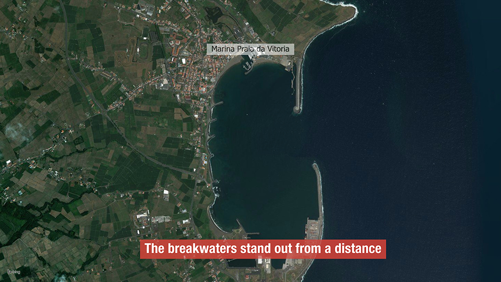
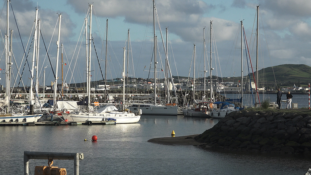
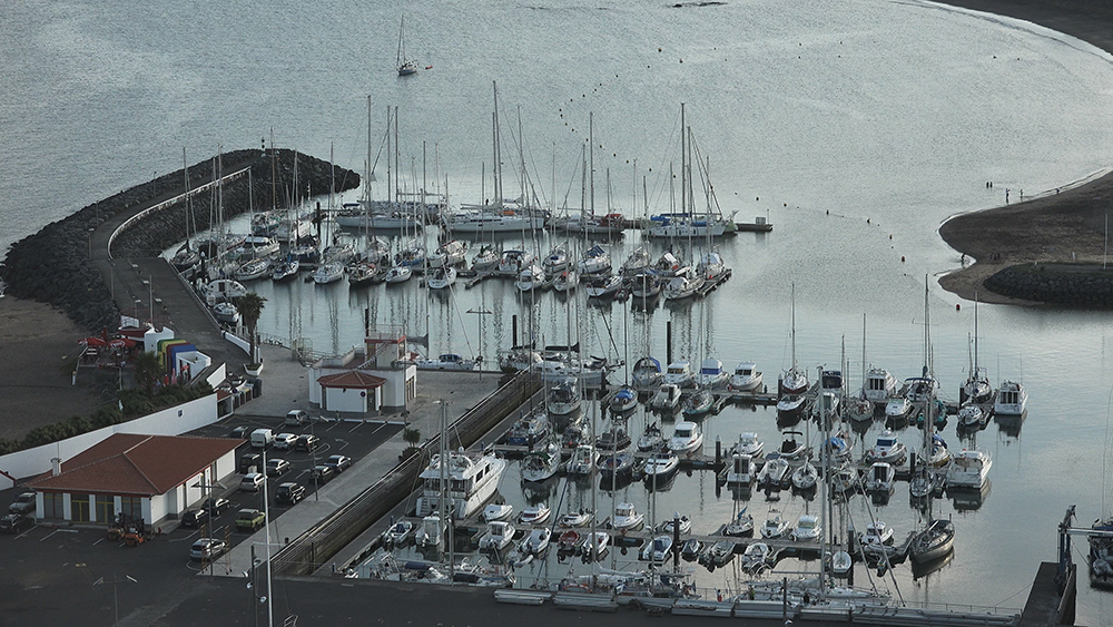
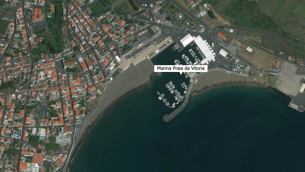
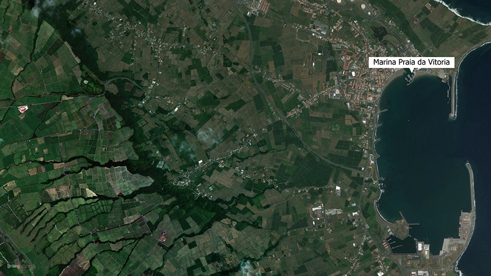
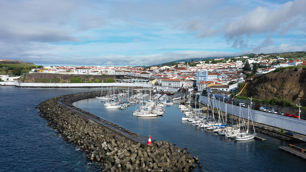
A wide, well-protected bay on the east coast of Terceira · the marina sits in the NW corner between the beaches Prainha and Praia Grande along Beira-Mar Avenue · operated by Câmara Municipal de Praia da Vitória (NOT Portos dos Açores) · floating pontoons, 2.5 m berth depth, dredging ongoing · 7 km from Lajes Airport (and the joint US Air Force base) · 24 km from Angra do Heroísmo by road. Port of entry status · clear in here if arriving from outside the EU · marked with yellow buoys at the shallow entrance. Coordinates: 38°42’41″N · 27°03’08″W. VHF Ch. 9 · Ch. 16 distress.
Marina office: +351 295 540 219 · Mobile: +351 917 869 072 · [email protected]
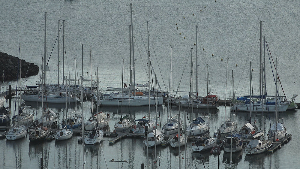
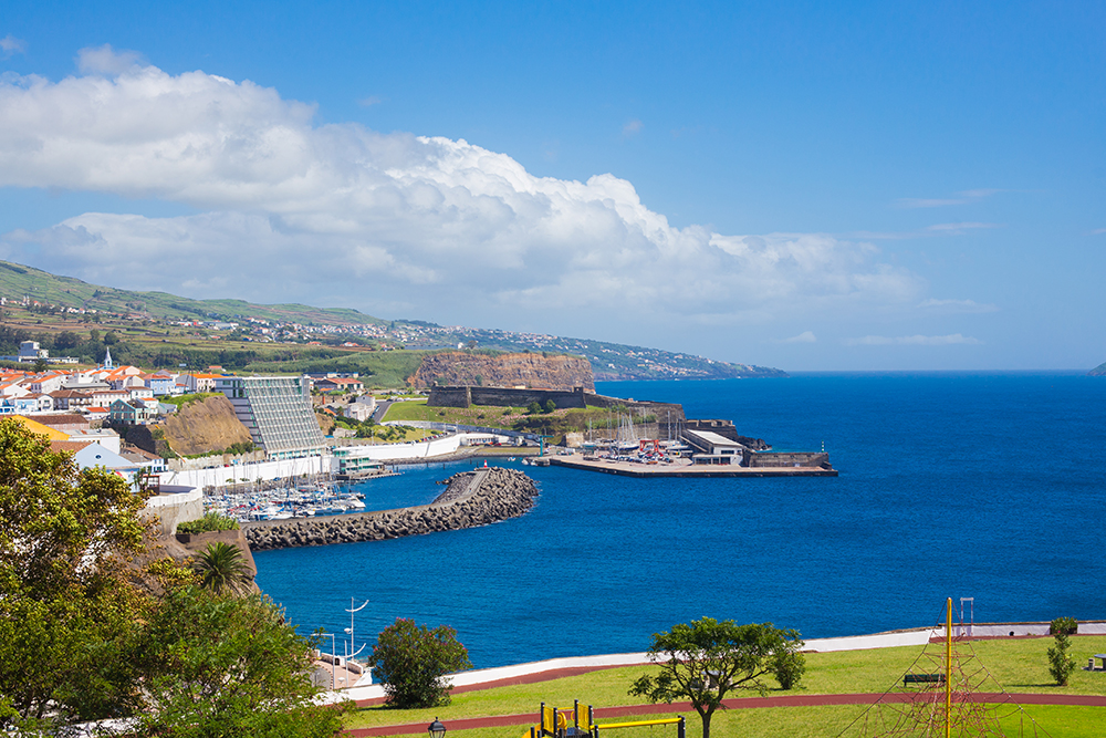
Praia da Vitória is the second port of Terceira — the working counterpart to the UNESCO heritage marina at Angra do Heroísmo on the south coast. The two are on opposite sides of the same island, 24 km apart by road but a complete world apart in feel. Where Angra is historic, Renaissance-walled, and tightly packed with cobbled streets, Praia da Vitória is a wide bay with the longest sandy beach in the Azores, a working commercial port handling cargo and cruise ships, and the joint Portugal-USA Lajes Air Base just 3 km north of the marina. The marina sits in the NW corner of the bay, sheltered by both north and south jetties — but the entrance is shallow (2.5 m at berths), the sand drifts, and dredging continues to be ongoing. Boats drawing more than 2 m should not attempt entry at low tide. Marina is not staffed at weekends. A solid stop for sailors with shallow draft, those needing to wait for weather, or anyone arriving via Lajes airport.
⚠ Reality check before you arrive:
→ ⚠ Marina entrance is shallow · 2.5 m at berths · do NOT enter at low tide if drawing 2 m+ · sand bottom (soft, not rocks)
→ ⚠ Dredging ongoing — depths shift · check current state with marina office before planning approach
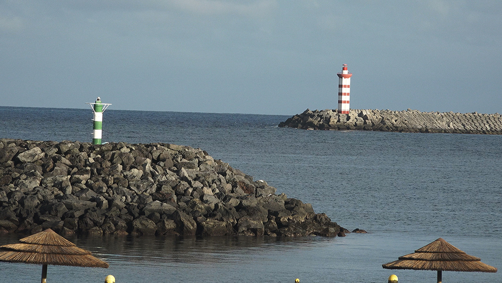
→ ⚠ Yellow buoys mark the shallow zone outside marina entrance — stay on the channel side
→ ⚠ Marina is NOT staffed on weekends · VHF Ch. 9 + 16 may go unanswered Sat-Sun · plan a weekday arrival
→ ⚠ DO NOT enter at night · the green lights on breakwater + outer pontoon help, but the shallow channel and shifting sand make it a daytime-only approach
→ Port of entry · clear in with the immigration/police officer on duty if from outside the EU · weekend arrivals: officer present even when marina office is closed, but no payment possible until Monday
→ ⚠ Distinct from Angra · Angra is on the south coast, this is on the east · 24 km road, 15 NM by water round the south of Terceira
⚓ Praia da Vitória Marina at a Glance
Coordinates
38°42’41″N · 27°03’08″W
Berth depth
2.5 m · ⚠ shallow entrance
Pontoon type
Floating pontoons
Operator
Câmara Municipal de Praia da Vitória (NOT Portos dos Açores)
VHF
Ch. 9 working · Ch. 16 distress
Phone
+351 295 540 219 · Mobile +351 917 869 072
Address
Av. Álvaro Martins Homem, 9760-512 Praia da Vitória
Hours · high season
08:00-20:00 (Mon-Fri only)
Hours · low season
08:00-17:00 (Mon-Fri only)
Distance · Lajes Airport
7 km · 10-min taxi
Distance · city centre
3 km
Distance · Angra
24 km road · 15 NM round the south
Schengen
Yes · port of entry · clear in here
Approach & Entry
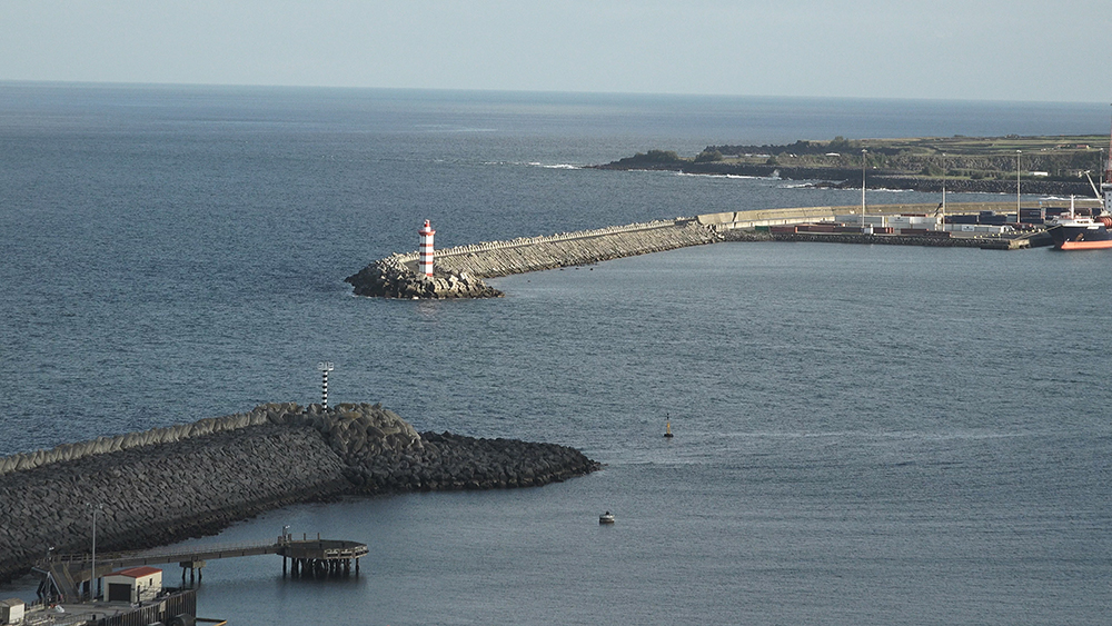
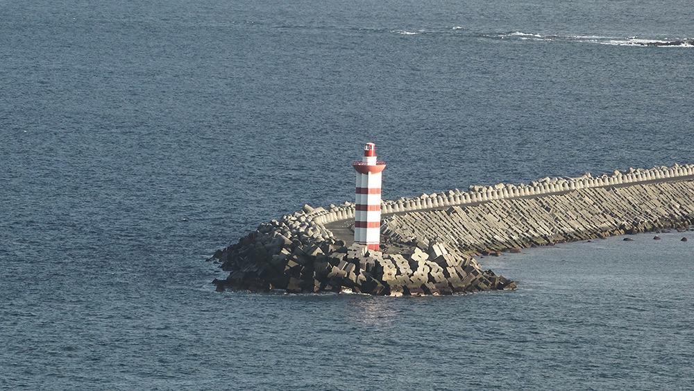
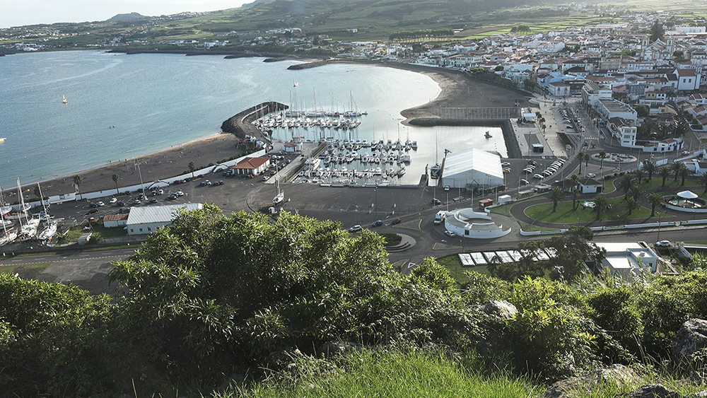
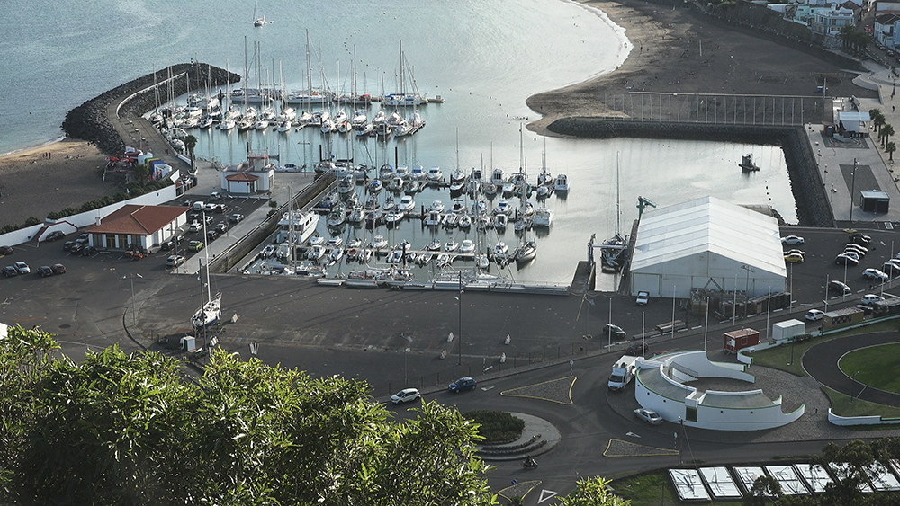
The bay at Praia da Vitória is wide, open, and well-marked from offshore. Both north and south jetties are clearly visible from a distance, the city skyline rises behind, and the long sandy beach makes the bay obvious from far out. The trick is the marina entrance itself — shallow, narrow, with shifting sand and yellow buoys marking the limit of the dredged area.
Approach sequence
→ Identify the bay between Ponta da Má Merenda (N) and Ponta do Baixio (S).
→ Enter past the breakwaters (north + south jetties) — the long sandy beach is on your left as you head W toward the marina.
→ The marina is in the NW corner of the bay · between Prainha and Praia Grande beaches.
→ ⚠ Watch the yellow buoys marking the shallow zone outside the marina entrance.
→ Marina breakwater is marked with a green light · another green light on the outer pontoon · radio the marina before passing the breakwater.
Anchorage outside the marina
→ North anchorage: safe, depths 12-35 m.
→ South anchorage: safe, similar depths.
→ Tides: flood NE, ebb SW.
→ If you arrive after hours and the marina is closed, anchoring outside is acceptable for the night · just check the wind forecast for E-S directions which build a chop.
Wind & tide notes
→ Bay generally well-protected by the jetties and the curve of the coast.
→ Wind generally from the sea — from the east quadrant.
→ More protection from S quadrant than Angra — Praia is the alternative if Angra is rolling on a southerly.
→ Visibility good year-round (no fog issues like further N in the Atlantic).
Praia da Vitória Beyond the Marina
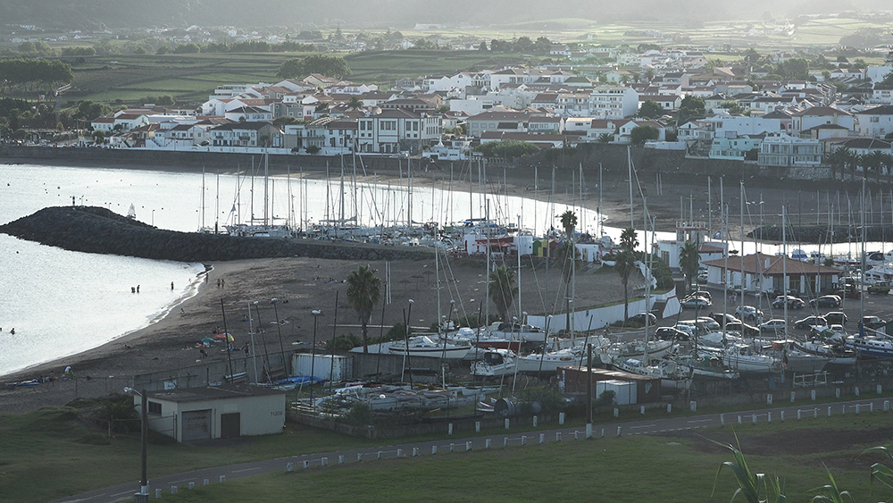
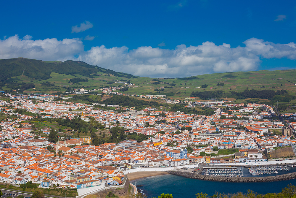
Praia da Vitória means “Beach of Victory” — the city was renamed in 1837 to commemorate the same Liberal Wars victory that earned Angra its “Heroísmo” title. Today it’s a working coastal city of around 21,000 people, less famous than Angra but a strong base for a few days ashore. The beach is the headline — the longest sandy stretch in the entire Azores archipelago.
The beach — Praia Grande + Prainha
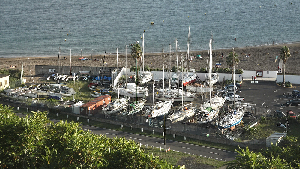
The natural harbour around the marina is bookended by two beaches — Praia Grande (the long stretch to the north) and Prainha (the smaller beach to the south). Together they form the largest sand beach in the Azores · a rare feature in an archipelago where most coastlines are cliffs and volcanic rock. Swimming, windsurfing, water-skiing, kayaking, sea fishing, scuba diving, whale watching all on the doorstep.
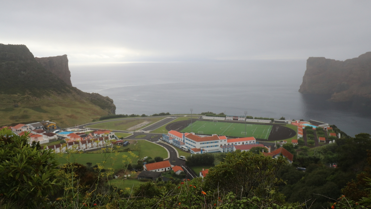
Lajes Air Base
The joint Portugal-USA Lajes Air Base sits 3 km north of the city · a US-NATO airfield used continuously since World War II as a transatlantic refuelling point. It still hosts US Air Force personnel · their off-duty presence in the city’s clubs and restaurants gives Praia a different cultural mix from anywhere else in the Azores. American imported groceries are sometimes available at the local supermarkets.
Easy access to Angra (UNESCO)
Angra do Heroísmo is 24 km by road · the cross-island drive takes 30-40 minutes and passes the central volcanic plateau. If you berth at Praia and want UNESCO heritage on the same charter, hire a car from the marina · also gives you access to Algar do Carvão volcanic chimney and Furnas do Enxofre sulphur fumaroles in the centre of Terceira.
Hydrangeas & the cross-island drive
From late spring through summer (May-August), the country roads on Terceira are lined with hydrangeas — the signature flower of the Azores. Driving from Praia to Angra during this season is one of the highlights of any Azores visit · stop at the rim of Serra do Cume viewpoint for the patchwork of green pastures separated by black volcanic-stone walls.
⛵ Inter-Island Sailing — Distances
Praia is on the E coast of Terceira — closer to São Miguel than the W coast marinas, slightly further from the central triangle:
→ Angra do Heroísmo (same island, S coast): ~15 NM by water · 24 km by road
→ Velas (São Jorge): ~55 NM W
→ Horta (Faial): ~85 NM W
→ Ponta Delgada (São Miguel): ~85 NM E (Praia is the closest Azorean port to PDL)
→ Santa Cruz (Graciosa): ~30 NM N
Tip: if you’re doing the W-to-E Azores crossing (Faial → Horta → São Jorge → Terceira → São Miguel), Praia is the natural hop-off point before the long leg E to Ponta Delgada.
✈️ Getting to Praia da Vitória
Lajes Airport (TER): 7 km · 10-minute taxi · the same Lajes Field used by the US Air Force.
Flight options:
→ From Lisbon: ~2h 20 min · Azores Airlines · multiple daily
→ From Boston (BOS): seasonal direct flights · Azores Airlines · the only Azores airport with regular US connections beyond charter
→ From Ponta Delgada (PDL): ~30-40 min · SATA Air Açores
→ From Horta, São Jorge, Pico, Flores: SATA Air Açores connections
Inter-island ferries:
→ Atlanticoline: Praia da Vitória is the main Terceira terminal for ferries to Faial, Pico, São Jorge · seasonal operation, typically May-October
Emergency & Practical Contacts
Marina Office (Câmara Municipal): +351 295 540 219
Marina Mobile: +351 917 869 072
Marina Email: [email protected]
VHF working channel: Ch. 9
VHF distress: Ch. 16
Emergency (police / fire / ambulance): 112
Maritime SAR (MRCC Lisbon): +351 214 401 919
Hospital de Santo Espírito (Angra · 24 km): +351 295 403 200
⛵ Continue Exploring the Azores
→ Angra do Heroísmo Marina · Terceira S coast — same island, opposite coast, UNESCO World Heritage city
→ Horta Marina · Faial — 85 NM W · the world’s most famous transatlantic stopover
→ Velas Marina · São Jorge — 55 NM W · the quiet centre of the triangle
→ Ponta Delgada Marina · São Miguel — 85 NM E · capital city, full provisioning, 640 berths
“Praia da Vitória is the working east coast counterpart to Angra · longest sandy beach in the Azores between Prainha and Praia Grande and the marina sits in the northwest corner between them · operated by the city council not by Portos dos Açores so the contact and email are different · two and a half meters berth depth so boats drawing more than two meters do not enter at low tide · dredging is ongoing forever · yellow buoys mark the shallow zone outside the entrance · green lights on the breakwater and the outer pontoon for the channel · do not enter at night and do not arrive on a weekend if you can avoid it because the marina is not staffed Saturday Sunday · port of entry so clear in here from outside the EU but the immigration officer is on duty even when the marina office is closed · seven kilometers from Lajes airport and the joint Portugal USA air base · twenty four kilometers by road to Angra do Heroísmo and the UNESCO heritage and the Algar do Carvão volcanic chimney and the Furnas do Enxofre sulphur fumaroles in the centre of the island · this is the marina you choose for shallow draft and the long sandy beach and the cross-island drive through the hydrangeas in summer.”
— SeaTV · Azores · Praia da Vitória Marina · Terceira