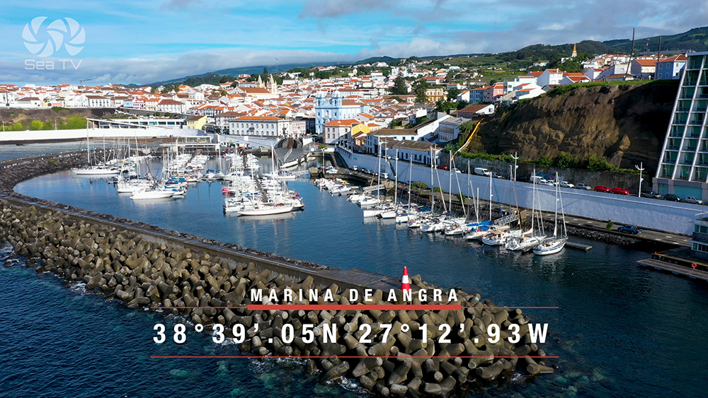
SeaTV · Portugal · Azores Islands · Angra do Heroísmo Marina · Terceira
Angra do Heroísmo Marina, Terceira — Berthing in a UNESCO World Heritage Bay
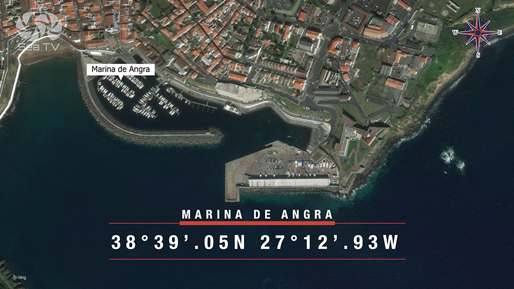
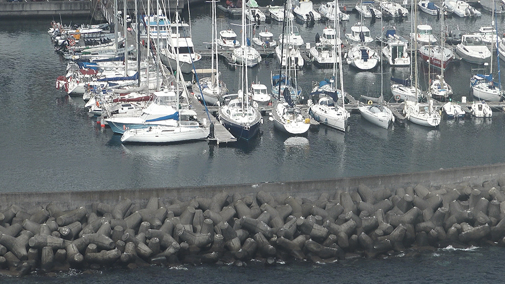
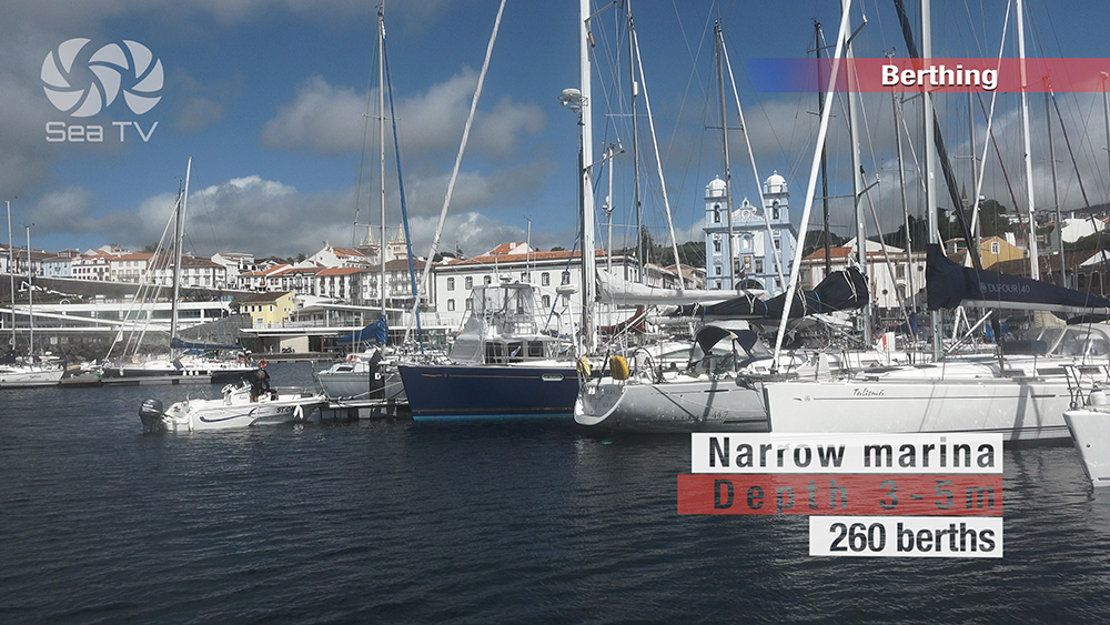
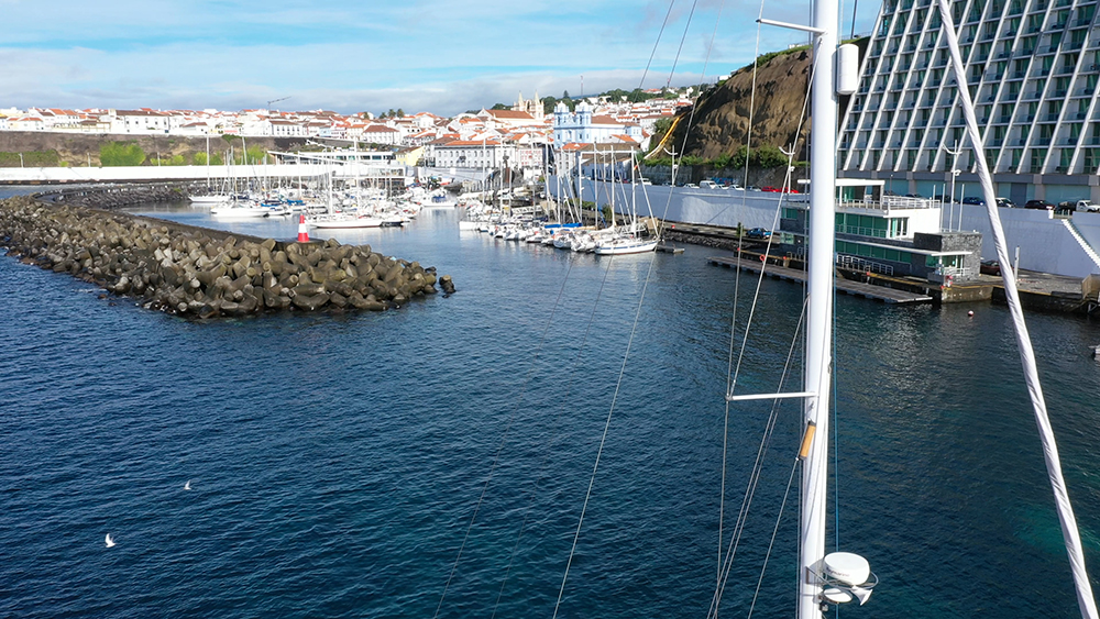
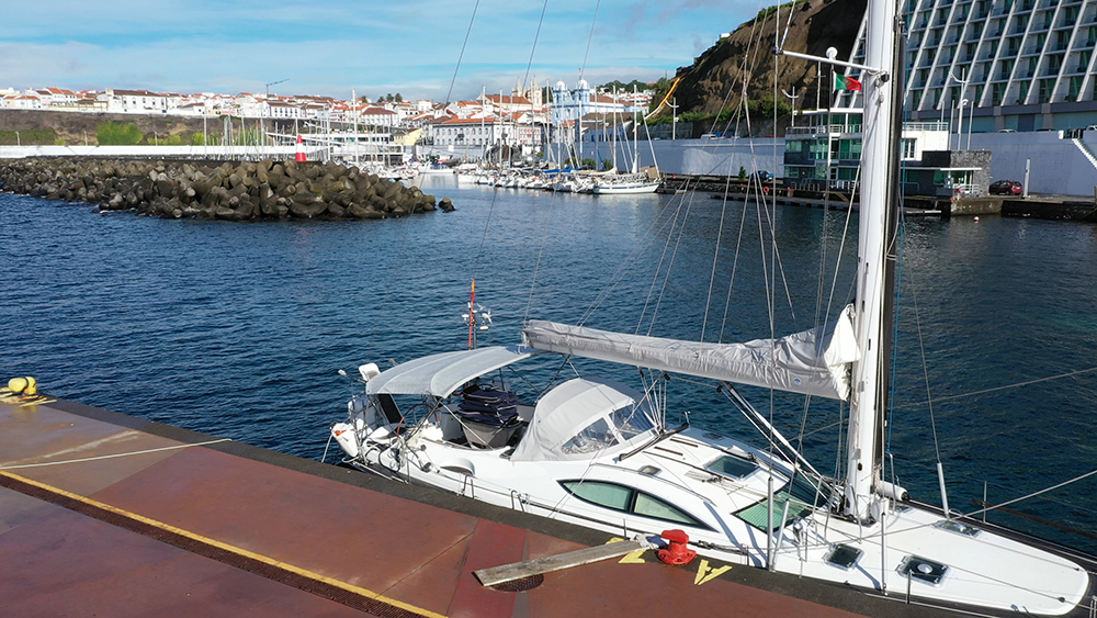
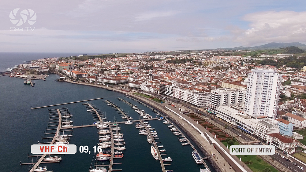
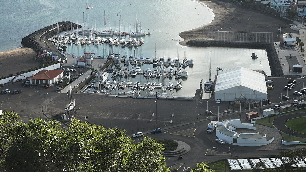
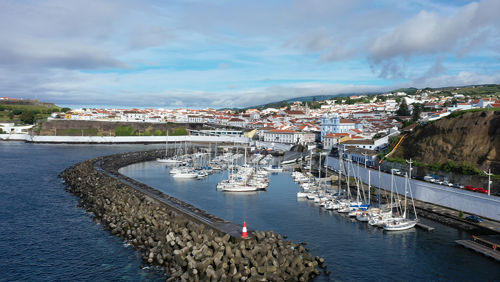
260 berths inside a natural bay sheltered by Monte Brasil · 50 m from a UNESCO World Heritage city centre (since 1983) · the obligatory Atlantic stopover for fleets between the 15th and 19th centuries · operated by Portos dos Açores · EEC Blue Flag since 2006. Underwater archaeological park with 74 historical wrecks, including the 19th-century Lidador and the Anchor Cemetery, all reachable by snorkel or dive from the marina. Approximate coordinates: 38°39’N · 27°13’W. VHF Ch. 9 · Ch. 16 distress.
Capitania do Porto: +351 295 204 400 · [email protected]
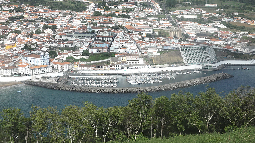
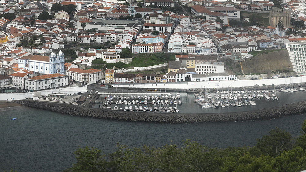
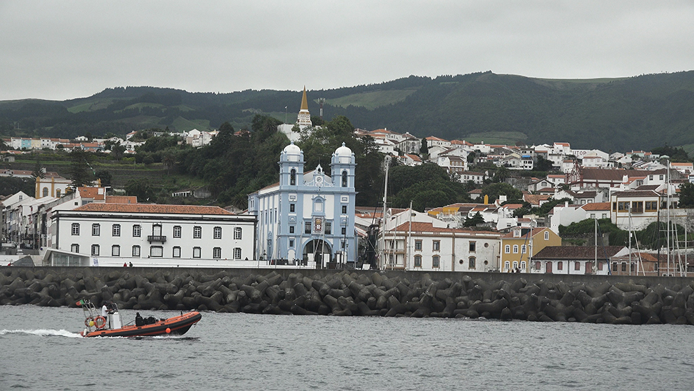
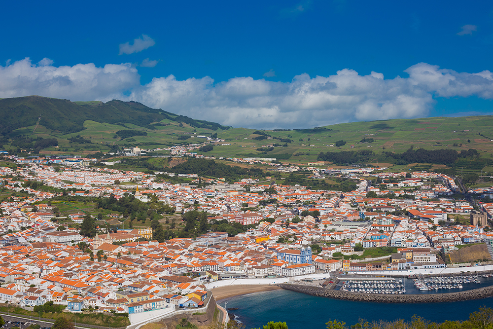
Angra do Heroísmo is the heritage capital of the Azores. Founded in 1478, the city was the obligatory port of call for Portuguese, Spanish, Dutch, English, and French fleets sailing between Europe and the New World — the spot where every fleet refilled water, traded news, and waited out the weather. The defensive star-fortress of São João Baptista on the Monte Brasil promontory is one of the best-preserved examples of Renaissance military architecture anywhere in the Atlantic. The historic centre was named a UNESCO World Heritage Site in 1983 — three years after a magnitude 7.2 earthquake destroyed much of the city, with the Terceirenses rebuilding within four years. The marina sits 50 m from the cathedral steps, sheltered by Monte Brasil to the W, and surrounded by 600 years of maritime history below the surface. Smaller, quieter, and more historically loaded than Horta or Ponta Delgada.
⚠ Reality check before you arrive:
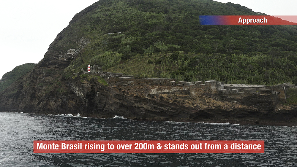
→ ⚠ Approach reference: Monte Brasil · the prominent extinct volcanic cone on the W side of the bay · visible from miles out · daytime approach is straightforward
→ ⚠ Bay subject to swell from the SE-S quadrant · NE protection is excellent (Monte Brasil) but a fresh southerly will roll the marina · check forecast
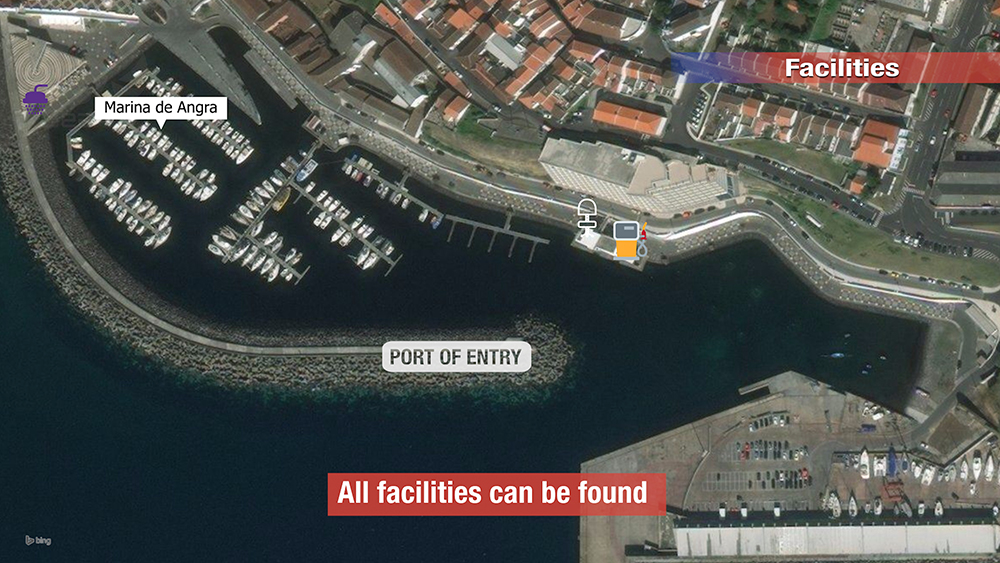
→ ⚠ Customs & immigration: all yachts arriving from outside the EU must clear in via the Capitania do Porto · paperwork at Rua Direita, 9700-066 Angra do Heroísmo
→ ⚠ The bay is an underwater archaeological park · 74 documented wrecks since 1552 · do NOT anchor anywhere outside the marked recreational area · damage to artefacts is a criminal offence
→ ⚠ Schengen rules apply · check visa days carefully if crossing in from outside Europe
→ Distinct from Praia da Vitória on the same island (E coast) · Angra is the capital, Praia is the secondary port — the two are 20 km apart by road
⚓ Angra Marina at a Glance
Coordinates
~38°39’N · 27°13’W
Berths
260
Max LOA
25 m
Max draft
3.5 m
Operator
Portos dos Açores
Blue Flag
EEC Blue Flag since 2006
VHF
Ch. 9 working · Ch. 16 distress & pilotage
Capitania
+351 295 204 400
Capitania email
Capitania address
Rua Direita, 9700-066 Angra do Heroísmo
UNESCO status
World Heritage Site since 1983
Schengen
Yes · clear in at Capitania if from outside EU
Approach & Entry
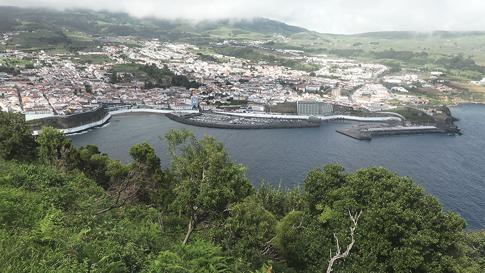
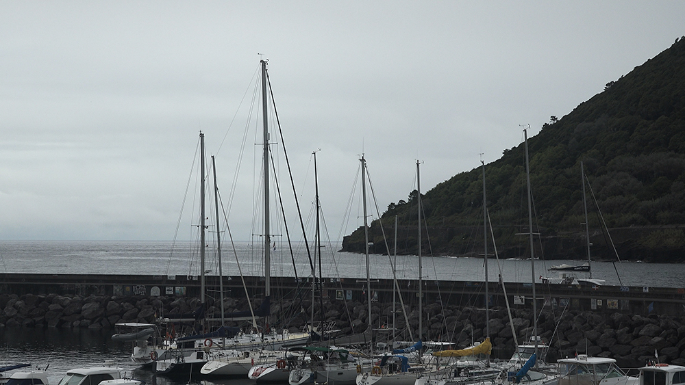
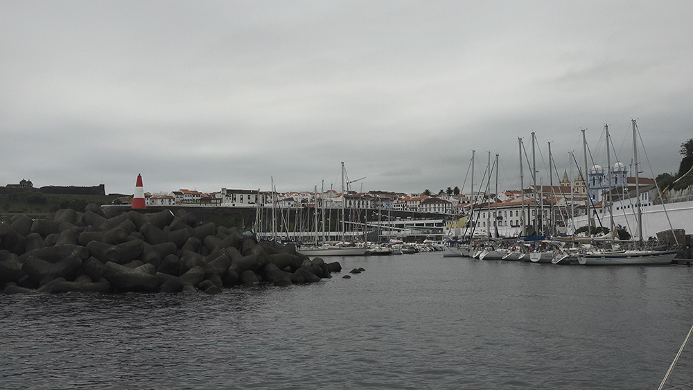
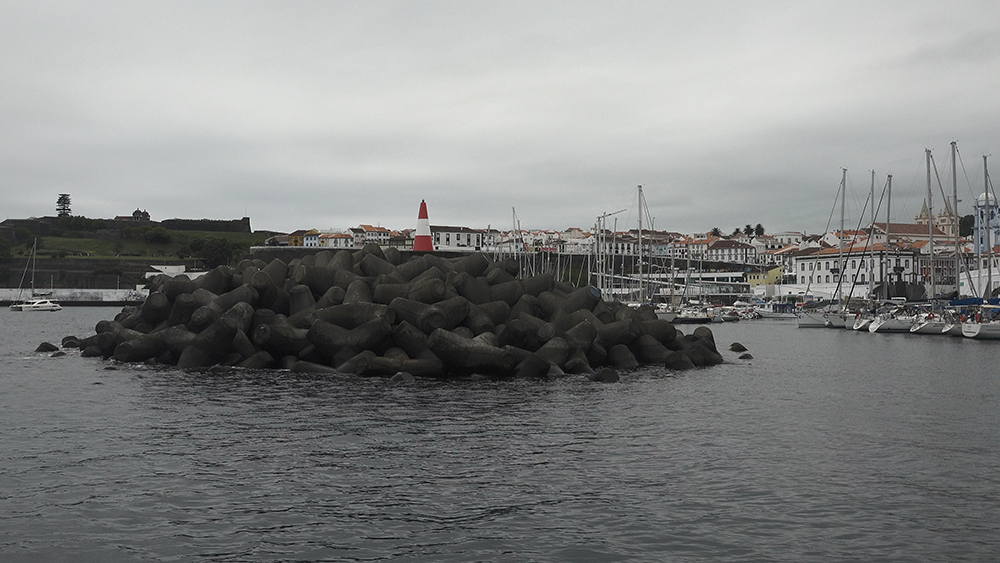
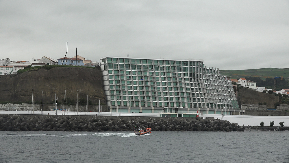
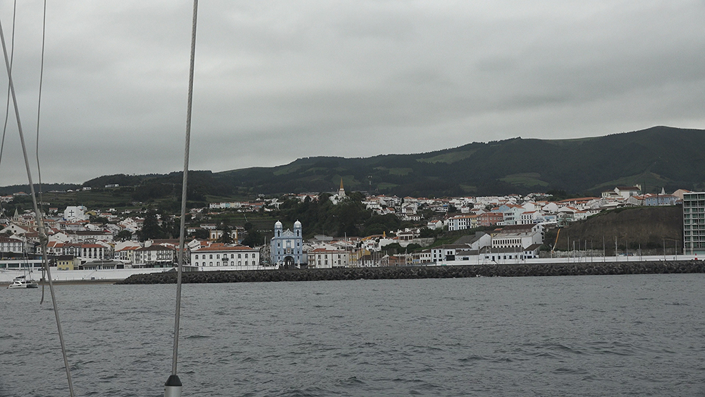
Angra Bay is the most distinctive natural anchorage on Terceira. Two basins protected by Monte Brasil to the W and SW — an extinct volcanic cone that rises 205 m off the sea, joined to the main island by a low isthmus. From offshore, Monte Brasil is visible long before the city itself: a forested green dome shaped like a thumb pointing into the ocean.
Daytime approach
→ Monte Brasil is the prime visual reference · the green volcanic dome on the W side of the bay.
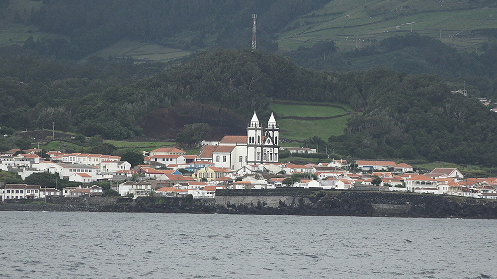
→ The city skyline appears as you come round the cone · the cathedral and the colourful waterfront are visible from a few miles out.
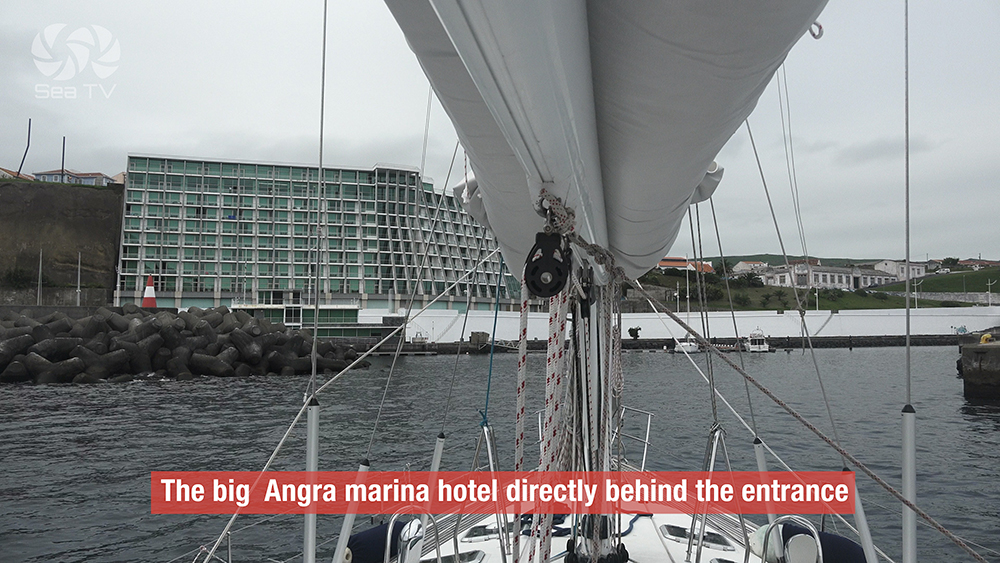
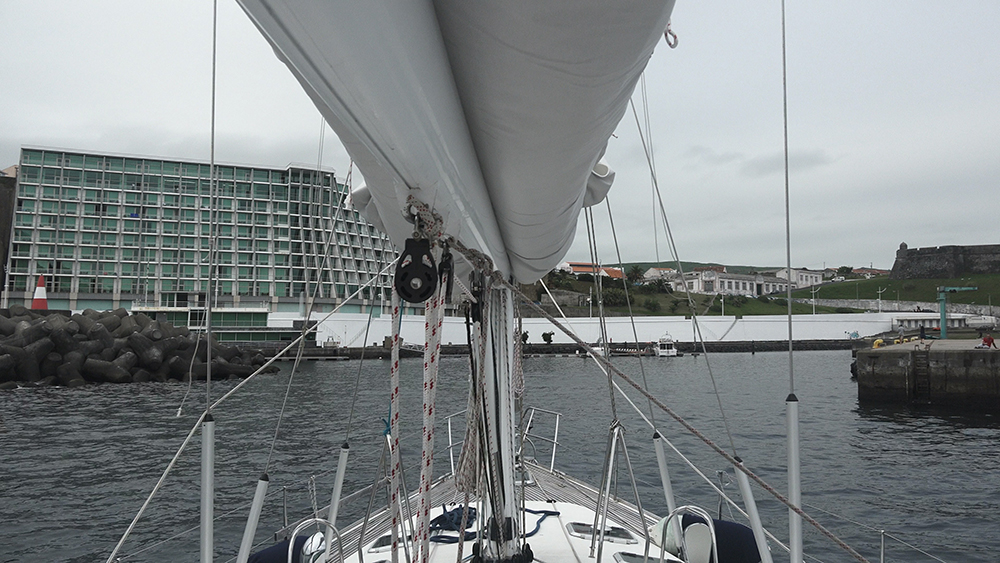
→ The marina is on the E side of the bay · the breakwater protects from the SE.
→ Approach the reception quay at the inside of the marina · do not pick up a vacant berth before checking in.
Wind & swell
→ Excellent shelter from N, NE, and W — Monte Brasil + the high ground W of the city.
→ ⚠ Exposed to SE-S swell · fresh southerlies build a roll inside the marina · less protected than Horta.
→ Praia da Vitória on the E coast of the same island offers better protection from S quadrant · 20 km drive between the two if you need to relocate.
→ Local pilotage is mandatory for commercial vessels · pleasure yachts handle their own approach but call the marina on Ch. 9 to confirm berth assignment.
The UNESCO City — 50 Metres from the Berth
Angra do Heroísmo was the most important city in the Azores for nearly four centuries. Founded 1478. Episcopal seat from 1534. Briefly the capital of Portugal during the Liberal Wars (1828-1832), when the legitimist royal court relocated to Terceira during the civil war on the mainland. The “Heroísmo” in the name was awarded by Queen Maria II in 1837 to commemorate the city’s resistance against the Miguelist forces. The historic centre — the grid of streets that walks straight up from the marina — was named a UNESCO World Heritage Site in 1983.
Sé Cathedral (Igreja do Santíssimo Salvador da Sé)
16th-century cathedral · Gothic + Manueline architecture · detailed azulejo tiles and intricate woodwork inside · damaged in the 1980 earthquake but carefully restored.
Fortaleza de São João Baptista (Monte Brasil)
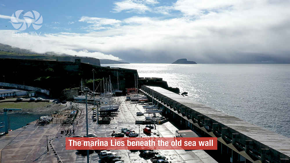
A massive star-shaped fortress built between the 16th and 17th centuries on top of the Monte Brasil volcanic cone · one of the best-preserved examples of Renaissance military architecture in the Atlantic · designed to defend the bay from pirates and rival European powers.
Walk to the top: 30-40 min uphill from the marina · panoramic views across the bay, the city, and the Atlantic from Pico das Cruzinhas viewpoint.
Forte de São Sebastião
The other 16th-century fortification flanking the bay · less famous than São João Baptista but still standing · the harbour was historically defended by both forts in a crossfire arrangement that made the bay almost impossible to attack.
Praça Velha & Duke of Terceira Garden
The historic main square · the 31,600 m² Duke of Terceira Garden built on terraces with basalt-stone paths · the best way to descend from Alto da Memória back to the city centre.
The Underwater Archaeological Park
The bay at Angra has eaten ships for nearly five centuries. 74 historical wrecks have been documented since 1552 — Portuguese galleons, Spanish carracks, English and Dutch warships, 19th-century steam ships. Most went down in the same kind of southerly storm that still rolls the marina occasionally. In recent years the wrecks have been turned into a recreational diving and snorkelling circuit — a unique underwater museum, only metres from the marina pontoons.
The Lidador
A 19th-century Portuguese ship returning from Brazil · sank in a storm in 1787 · the wreck lies at 7 metres depth · accessible by snorkel as well as scuba · the most-visited wreck in the bay.
The hull timbers and some metal fittings are still in situ · marine life has built reef structures on top of the remains.
The Anchor Cemetery
More than 40 historical anchors lying in formation on the seabed · centuries of accumulated lost anchors from ships that had to cut and run during southerly storms · deeper than the Lidador · scuba diving recommended · a marine playground that doubles as historical record.
⚠ Practical: dive operators in Angra run guided trips to both sites · do NOT free-dive on artefacts unsupervised · Portuguese law protects underwater archaeological remains and damage is a criminal offence. Check with the Capitania for current rules before going overboard with a camera.
Terceira Beyond the Marina
Algar do Carvão
A 90 m deep volcanic chimney accessible by a staircase down through the cone · ends at an underground freshwater lagoon · one of the few places in the world you can walk straight down inside a volcano · 30 min drive N from Angra.
Furnas do Enxofre
Active sulphur fumaroles in the centre of the island · steaming volcanic vents · short walk on a wooden boardwalk above the active ground · 25 min drive N from Angra.
Festas de São João da Vila
The big June festival in Angra · processions, bullfights (“touradas à corda” — non-lethal street running with rope-tethered bulls, distinctive to Terceira), street food, traditional music · runs around June 24.
Local cuisine
→ Alcatra: slow-cooked beef rump in red wine, in a clay pot · the signature dish of Terceira
→ Donas Amélias: sweet cinnamon-spiced cakes · local pastry
→ Verdelho wine: the volcanic-soil wine of the Azores · Pico is more famous but Terceira has its own producers
→ Polvo guisado: octopus stew · a Portuguese classic done well across the Azores
⛵ Inter-Island Sailing — Distances
Angra is the eastern hub of the central Azores group. Sail-able distances:
→ Praia da Vitória (same island, E coast): ~15 NM · either by water or 20 km by road
→ Velas (São Jorge): ~50 NM W
→ Horta (Faial): ~80 NM W
→ Ponta Delgada (São Miguel): ~90 NM E
→ Santa Cruz (Graciosa): ~30 NM N
Tip: if you’re sailing W to E across the Azores, Angra is the natural mid-point between the central triangle (Faial-Pico-São Jorge) and São Miguel.
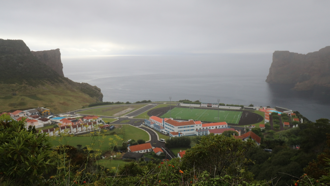
✈️ Getting to Terceira
Lajes Airport (TER): at the NE corner of the island · ~22 km from Angra · taxi 25-30 minutes · also a major US Air Force base (Lajes Field).
Flight options:
→ From Lisbon (LIS): ~2h 20 min · Azores Airlines · multiple daily
→ From Ponta Delgada (PDL): ~30-40 min · SATA Air Açores · daily
→ From Boston (BOS): seasonal direct flights · Azores Airlines
→ From other Azores islands: SATA Air Açores connects to Faial, São Jorge, Pico, Flores
Inter-island ferries:
→ Atlanticoline: from Praia da Vitória (Terceira’s E coast port) to Faial, Pico, São Jorge · seasonal — typically May-October
Emergency & Practical Contacts
Capitania do Porto de Angra: +351 295 204 400
Capitania email: [email protected]
Capitania address: Rua Direita, 9700-066 Angra do Heroísmo
VHF working channel: Ch. 9
VHF distress & pilotage: Ch. 16
Emergency (police / fire / ambulance): 112
Maritime SAR (MRCC Lisbon): +351 214 401 919
Hospital de Santo Espírito (Angra): +351 295 403 200
⛵ Continue Exploring the Azores
→ Praia da Vitória Marina · Terceira E coast — same island, opposite coast, longest beach in the Azores
→ Horta Marina · Faial — 80 NM W · the world’s most famous transatlantic stopover
→ Velas Marina · São Jorge — 50 NM W · the quiet centre of the triangle
→ Ponta Delgada Marina · São Miguel — 90 NM E · capital city, full provisioning
“Angra do Heroísmo is the marina you choose when you want UNESCO heritage at the gangway · founded fourteen seventy eight on the south coast of Terceira sheltered by Monte Brasil the extinct volcanic cone that turns the harbour into a natural fortress · two hundred sixty berths inside a bay that has been an obligatory port of call for fleets between Europe and the New World since the fifteenth century · maximum length twenty five meters maximum draft three and a half · approach with Monte Brasil as your visual reference and the cathedral skyline appearing as you come round the cone · excellent shelter from north northeast and west but exposed to fresh southerlies and that is when boats roll · clear in at the Capitania at Rua Direita if you arrive from outside the EU · the bay is also an underwater archaeological park with seventy four documented wrecks since fifteen fifty two including the Lidador at seven meters and the anchor cemetery deeper down so do not anchor outside the recreational area because damage to artefacts is a criminal offence · ashore the cathedral and the Fortaleza de São João Baptista on top of Monte Brasil one of the best preserved Renaissance fortresses in the Atlantic and Praça Velha and the Duke of Terceira garden and the Algar do Carvão volcanic chimney inland and the Festas de São João every June with the rope-tethered bulls running through the streets · alcatra in the clay pot and Verdelho wine and Donas Amélias for dessert · this is the marina with six hundred years of history below the surface and fifty meters from the cathedral steps.”
— SeaTV · Azores · Angra do Heroísmo Marina · Terceira