Best Bays & Anchorages in Skopelos
Skopelos is a standout stop in the Northern Sporades for sailors who love clear water, green coastline,
and practical anchorages. This page lists four key Skopelos bays and anchorages—Amarandos, Agnontas,
Limnonari, and Panormos—with coordinates, anchoring depths (where provided),
and navigation hazards exactly as recorded in the source notes.
Amarandos Cove
Port Agnontas
Limnonari Beach
Panormos Bay
On this page
Skopelos Anchorages
Sporades Sailing
Coordinates
Hazards
operational notes can change over time, and conditions vary with wind and swell.
Amarandos Cove (Amarandos Beach)
Position
39° 4′ 29″ N — 23° 42′ 29″ E
Why stop here
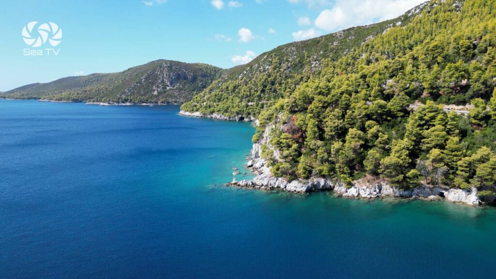
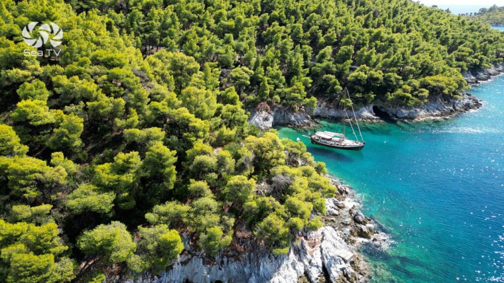
Amarandos Cove is a small rocky inlet along the southern coast of Skopelos, known for its dramatic coastline and
crystal-clear water. The area features small caves carved into the rocky shoreline and is noted as a popular
stop for swimming, cliff jumping, and freediving.
Best use
Due to the rocky surroundings, treat Amarandos as a short daytime anchorage / swim stop rather than a primary
overnight anchorage. Its main appeal is the scenery and exceptionally clear water.
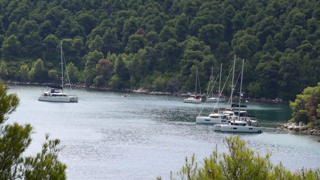
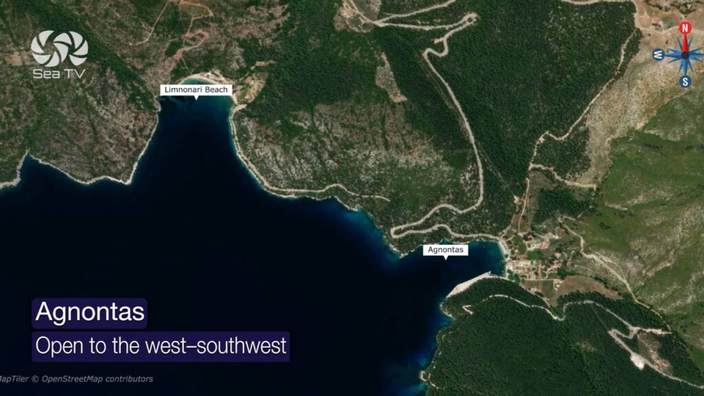
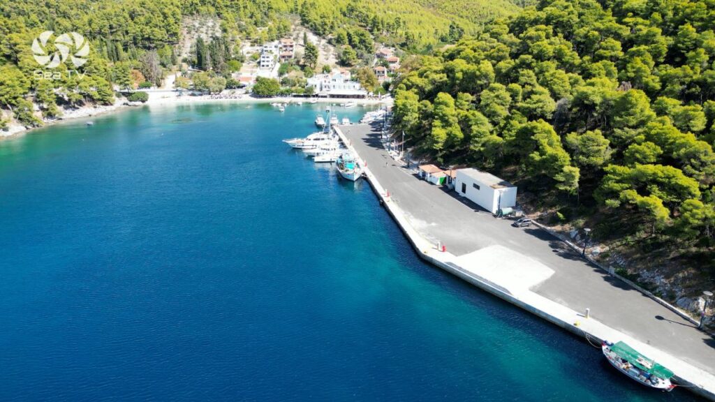
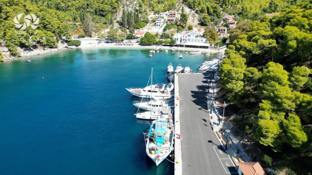
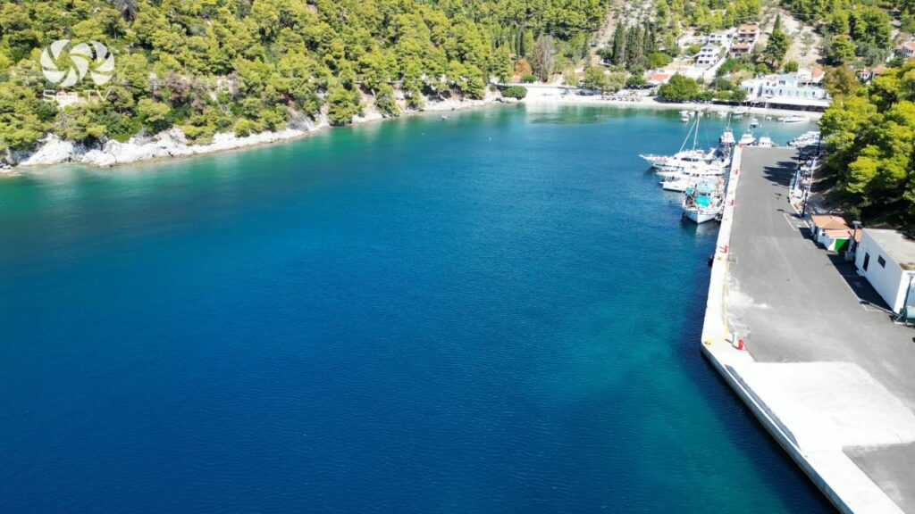
Port Agnontas (Bay of Agnontas)
Position
39° 4′ 59″ N — 23° 42′ 38″ E
(also referenced as 39° 05′,1 N — 023° 42′,5 E)
Overview
Agnontas is described as the best anchorage within Bay Agnontas. The bay lies 0.6 nautical miles north of
Cape Amarandos and opens toward the west–southwest. It extends inward approximately 0.2 miles and is about
200 meters wide.
Anchoring
- Small craft can anchor in the inner part in 5–10 meters.
- Seabed: sandy with good holding.
Quay
- Curved quay along the southern shore, about 190 meters long, oriented toward the southwest.
- A ramp used by local ferries is located along the quay.
- Depths alongside the quay: 3.4 to 5.5 meters.
Important operational note (ferry swell)
When strong winds prevent ferries from using Skopelos Port, ferry traffic may divert to Agnontas.
High-speed ferries and fast vessels can create significant swell, which may damage boats moored along the quay.
Navigation hazard
A dangerous rocky reef lies:
- 300 meters southwest of the green entrance light
- 100 meters offshore
The reef has a depth of 2.6 meters over it and must be avoided.
Entrance lights
- Green light on the starboard side
- Red light on the port side
- (for vessels entering the harbor)
Services
- Water
- Limited provisions
- Fuel supplied by truck
- Minor repair facilities
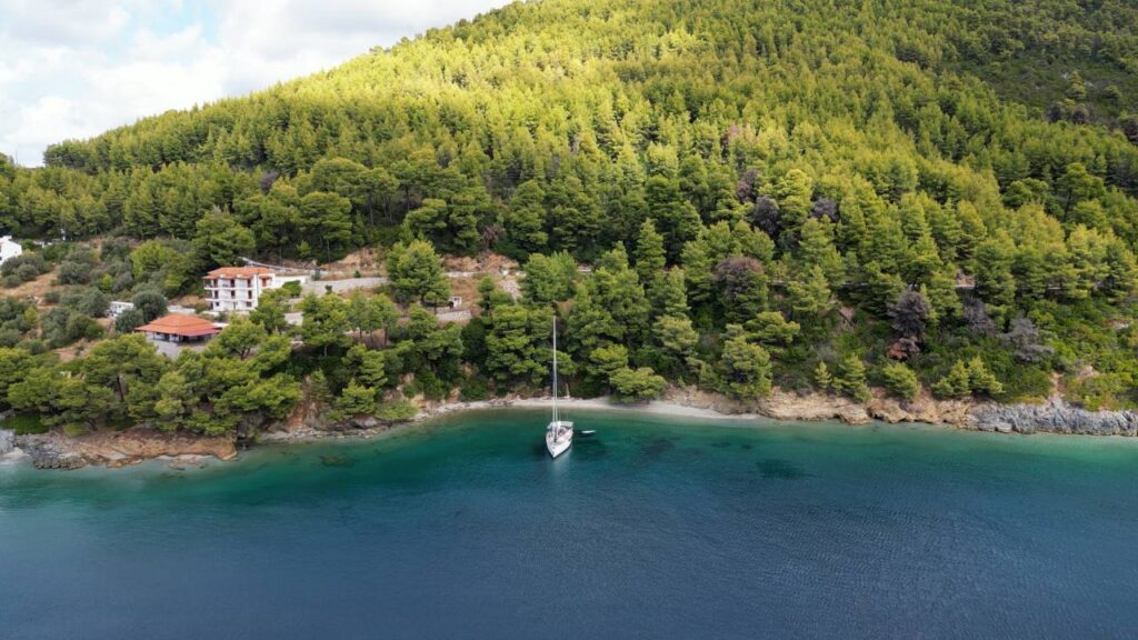
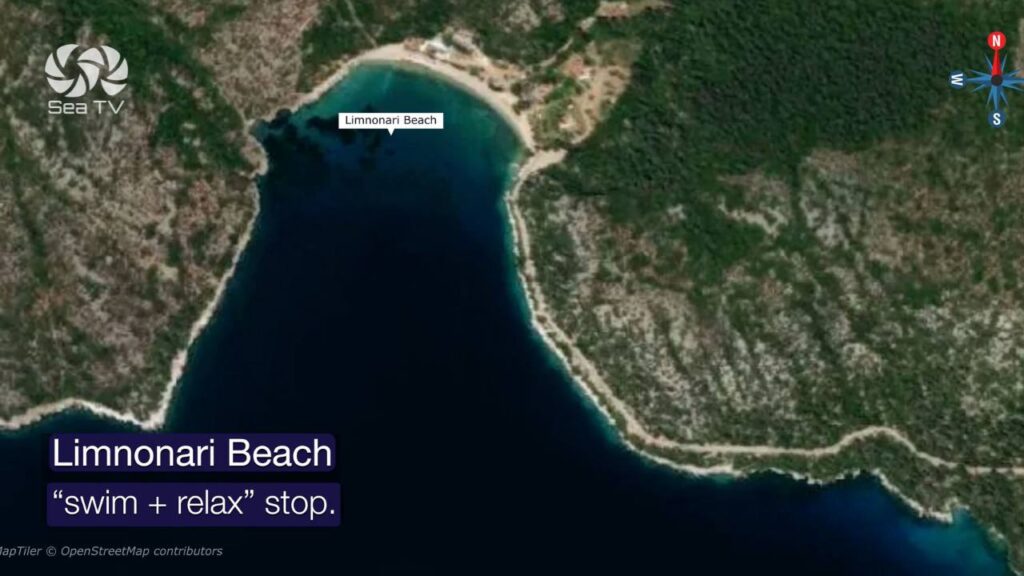
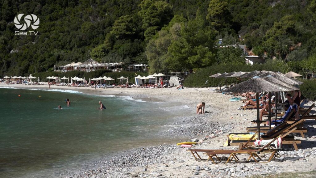
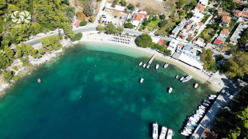
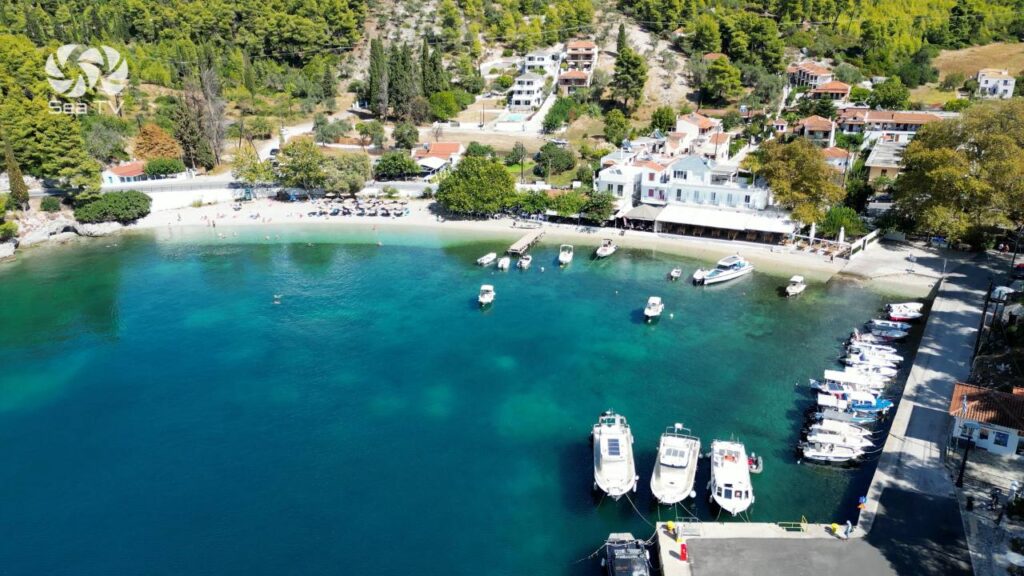
Limnonari Beach
Position
39° 5′ 22″ N — 23° 41′ 53″ E
Overview
Limnonari Beach lies approximately 9.5 km from Skopelos Town, just north of Agnontas. It is described as a beautiful bay
with crystal-clear water, surrounded by pine-covered slopes that reach down to the shore.
Beach character
- Shore: small pebbles
- Water: calm and very clear
Facilities ashore
- A sun bar
- Umbrellas
- Trees providing natural shade
Limnonari is therefore a convenient stop for swimming and relaxing ashore.
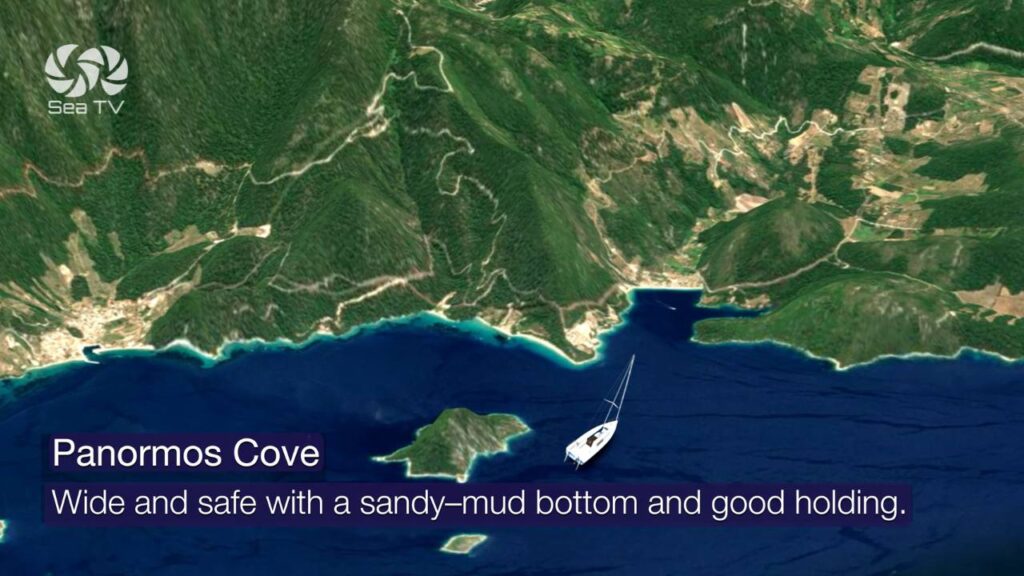
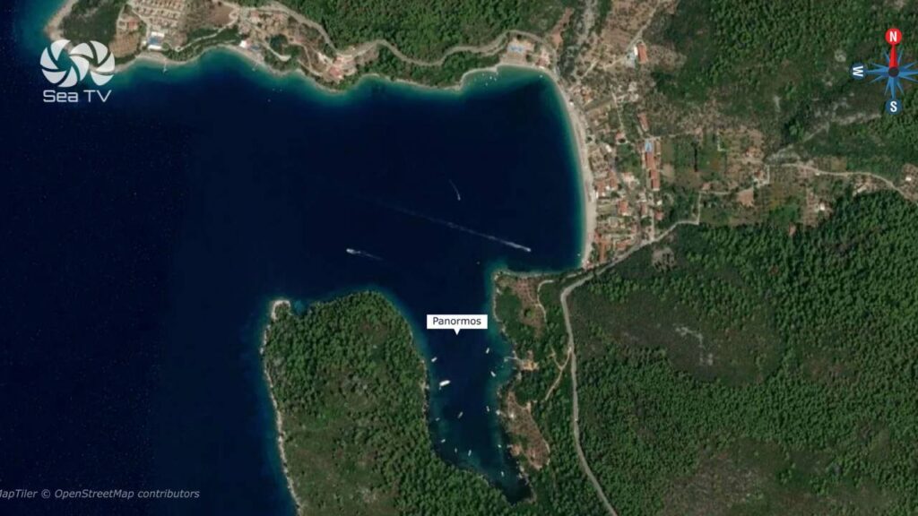
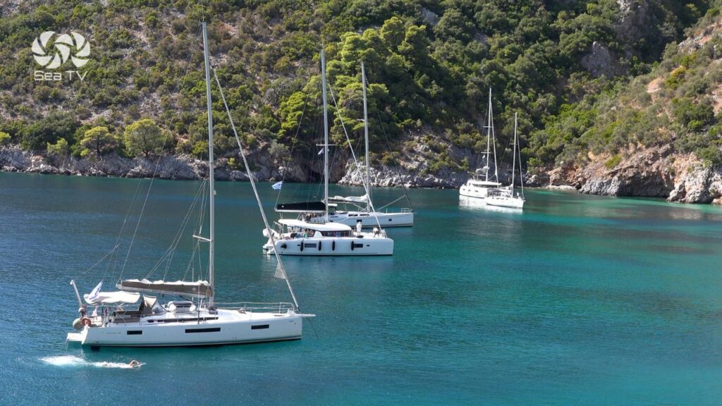
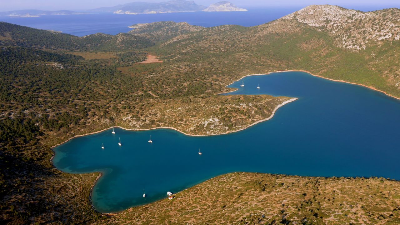
Panormos Bay (Natural Port of Panormos) + Panormos Beach
Panormos Bay / Natural Port of Panormos — Position
39° 06′ 7″ N — 23° 39′ 7″ E
Overview & shelter
Panormos Bay is described as a narrow bay opening toward the west. Near the head of the bay lies the natural port of
Panormos, which provides protection from north and northeast winds.
Access and layout
- The port is described as easy to enter.
- Approximately 400 meters of quays.
Anchoring
- Small vessels can anchor near the northeastern corner of the bay.
- Depths: approximately 10–15 meters.
Navigation hazards (wrecks)
- One wreck located 120 meters north of the eastern end of Panormos Port.
- A second wreck located 70 meters east of the northeastern end of the port.
Shelter statement
- The bay is safe from north and southeast winds.
- The port itself is safe in all weather conditions.
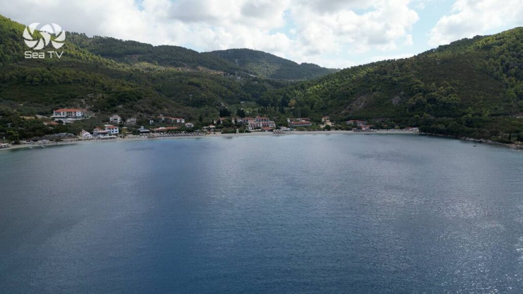
Panormos Beach — Position
39° 6′ 40″ N — 23° 39′ 47″ E
Beach character
Panormos Beach is one of the most popular beaches on the west coast of Skopelos. The shoreline is described as
white sand mixed with pebbles, and the water is noted for its exceptional clarity.
Skipper Notes & Planning Takeaways
How to use this page
- Amarandos: prioritize it as a scenic swim stop; treat with caution as a rocky cove.
- Agnontas: excellent anchorage option in the bay (5–10 m sand), but be wake-aware near the quay.
- Limnonari: a straightforward “swim + relax” stop with shore facilities and shade.
- Panormos: one of the larger bay options, with anchoring guidance (10–15 m NE corner) and wreck hazards to avoid.
Safety reminders
- Verify hazards (reefs/wrecks) on current charts and maintain a proper lookout.
- Account for ferry and fast-boat wake—especially at Agnontas when ferries divert.
- Depths and conditions vary; always evaluate wind, swell, and holding before committing to an overnight stay.
More Skopelos Sailing Guides on SeaTV.world
Want more Skopelos anchorages, route ideas, and visual pilot-style guidance across the Northern Sporades?
Visit SeaTV.world for additional sailing guides and updates.
If you have questions about a specific bay or want help planning a safe day-by-day route around Skopelos, leave a note
and we’ll help you refine it.