SeaTV · Saronic Gulf & Eastern Peloponnese · Hydra
Hydra Island — Anchorages & Sailing Guide
A car-free island of stone mansions and thousands of white steps — and one of the most demanding harbours in Greece for the sailors who choose to call there. Arrive by 11:00 or anchor at Mandraki and take a water taxi.
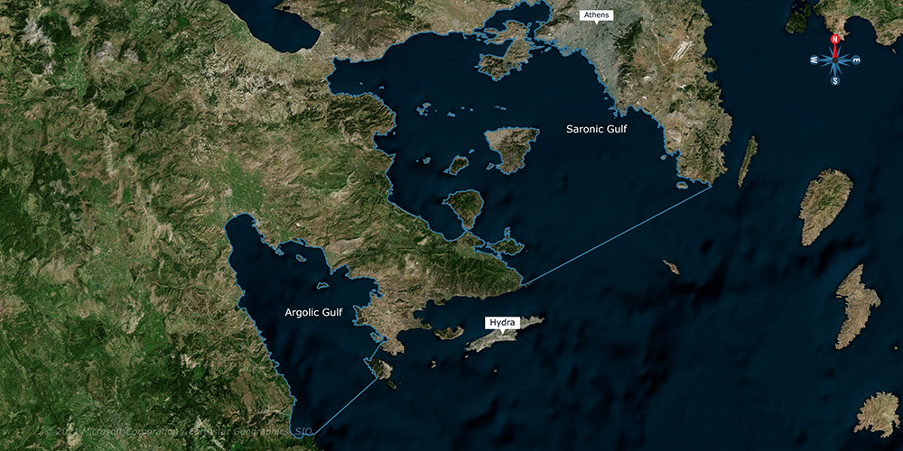
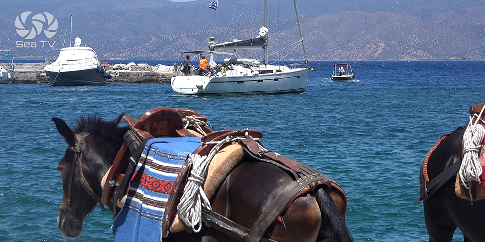
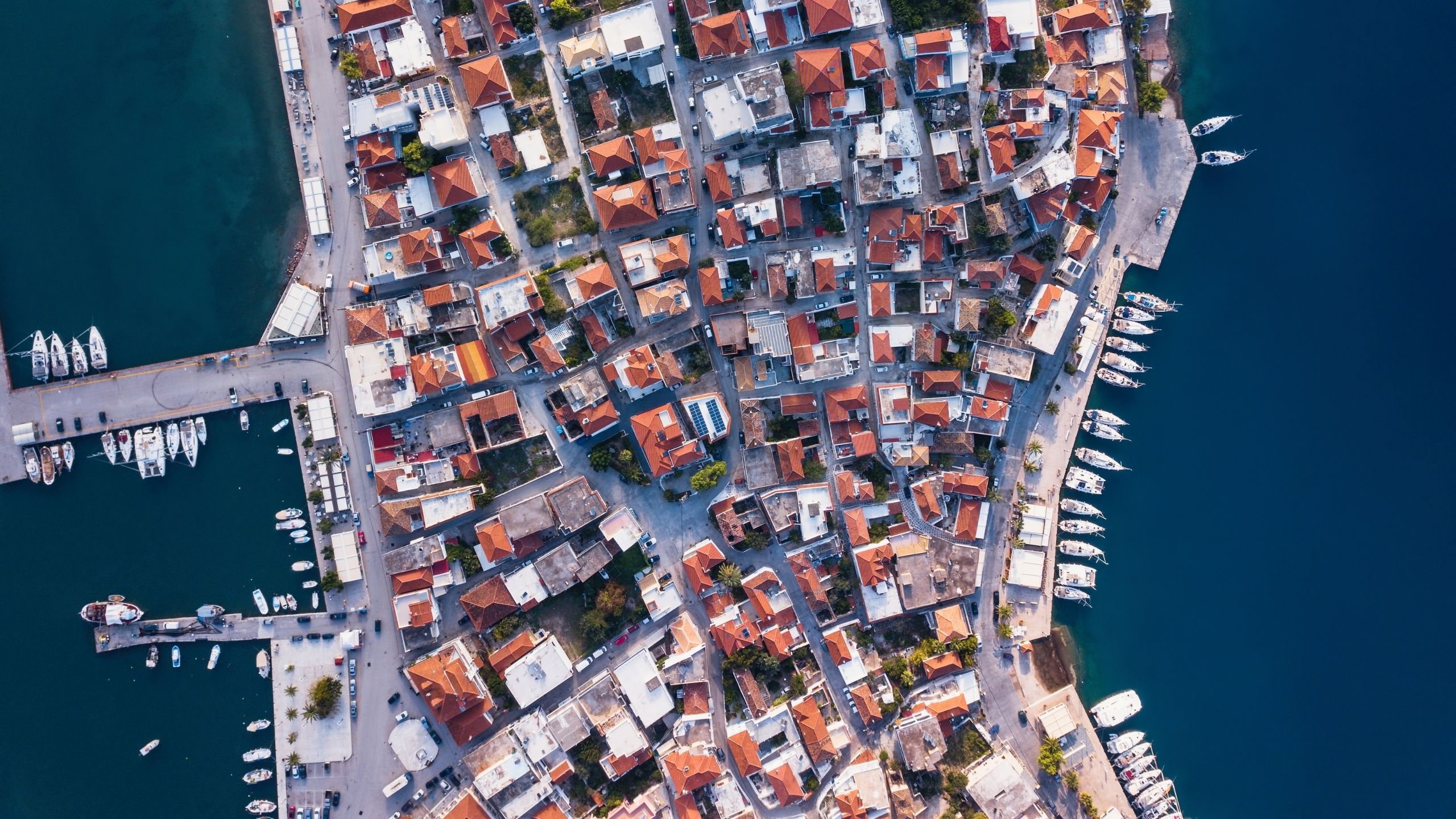
Hydra Island sits between the Saronic Gulf and the Argolic Gulf — a rocky, tall island whose deep natural bays are protected by mountains. There is no natural water on the island; all fresh water is delivered by ship. To preserve the character, cars, motorcycles, and even bicycles are banned. The only motorised vehicle on the whole island is the rubbish cart. Transport for everyone else: donkeys, water taxis, and your own legs up the thousands of white steps that make up the town.
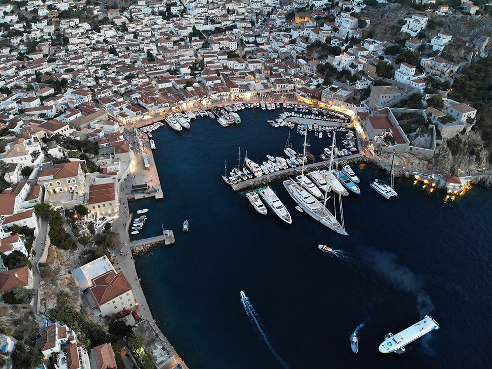
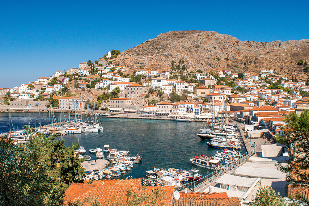
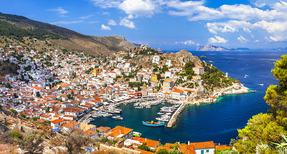
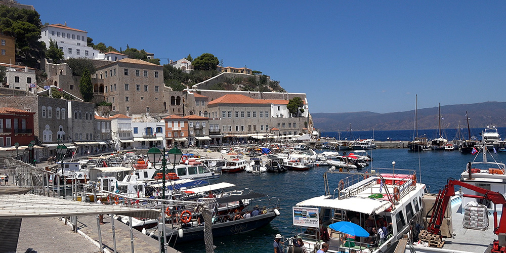
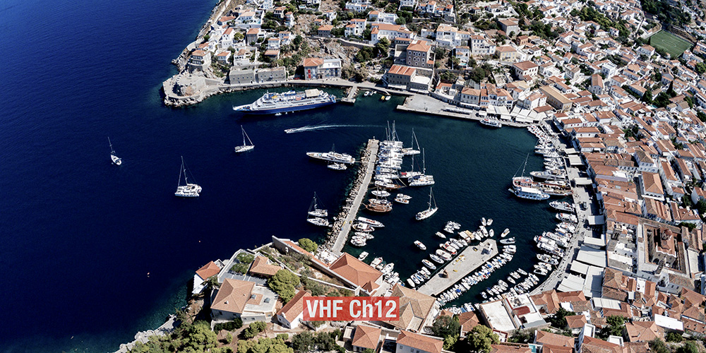
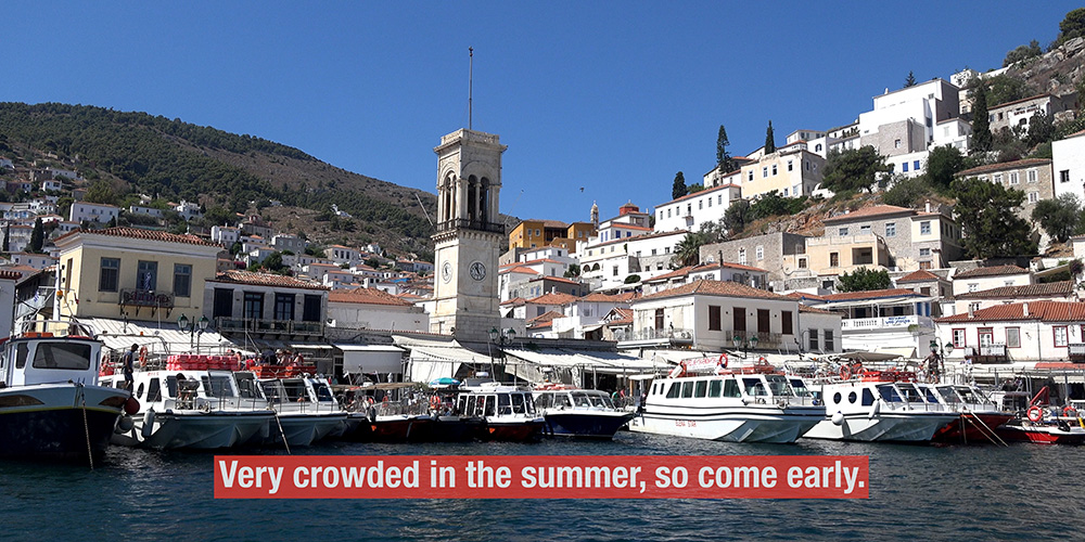
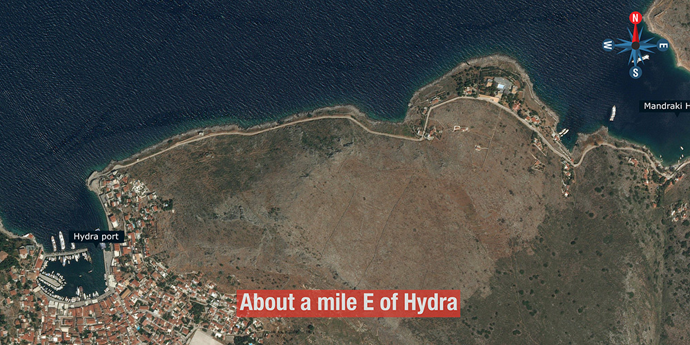
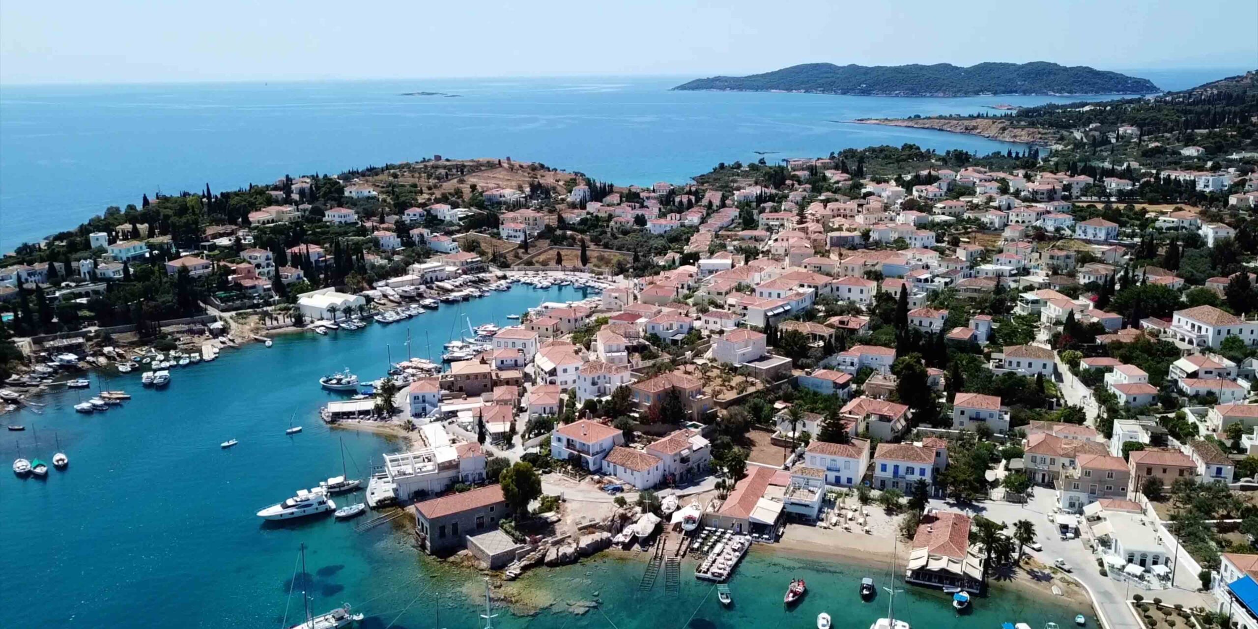
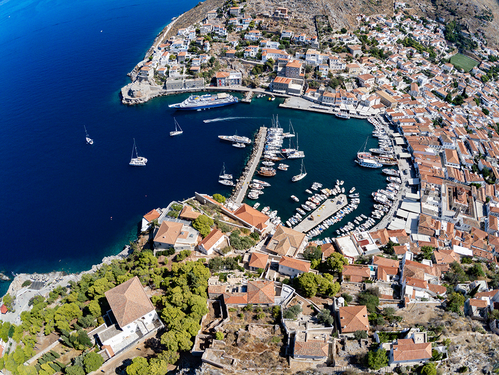
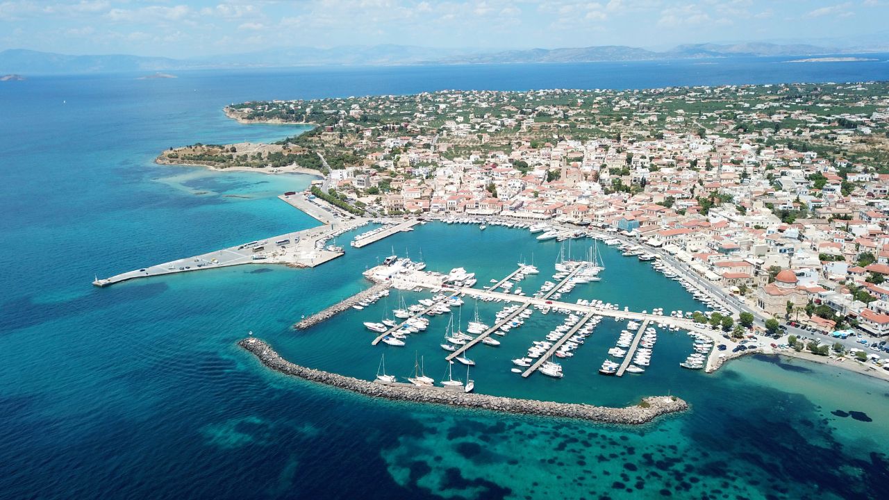
For sailors, Hydra is the most-photographed harbour in the Saronic — and the most demanding to dock in. Hydra Port is one of the most crowded harbours in all of Greece, with a strict daily rhythm: morning yachts leave by 11:00, the harbour fills again, and by 14:00 you’re looking at the third or fourth row of a Med-mooring raft. There’s a backup option at Mandraki Bay, one mile east — water taxi or a 30-minute walk into town. Plan accordingly.
⚠ Reality check — Hydra is unlike anywhere else:
→ Arrive by 11:00 for any chance of a reasonable berth
→ Crossed anchors are normal, not exceptional
→ Don’t dive to clear your own anchor — you’ll get a fine. Use the local divers
→ Stay on board until sunset to coordinate the morning raft departure with neighbours
→ When in doubt, go to Mandraki Bay instead
Why Sailors Still Come to Hydra
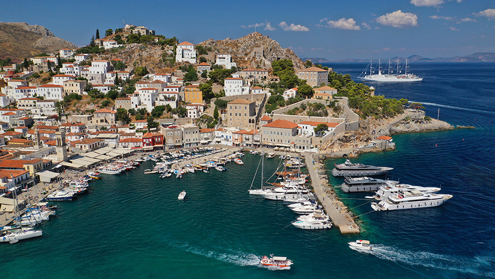
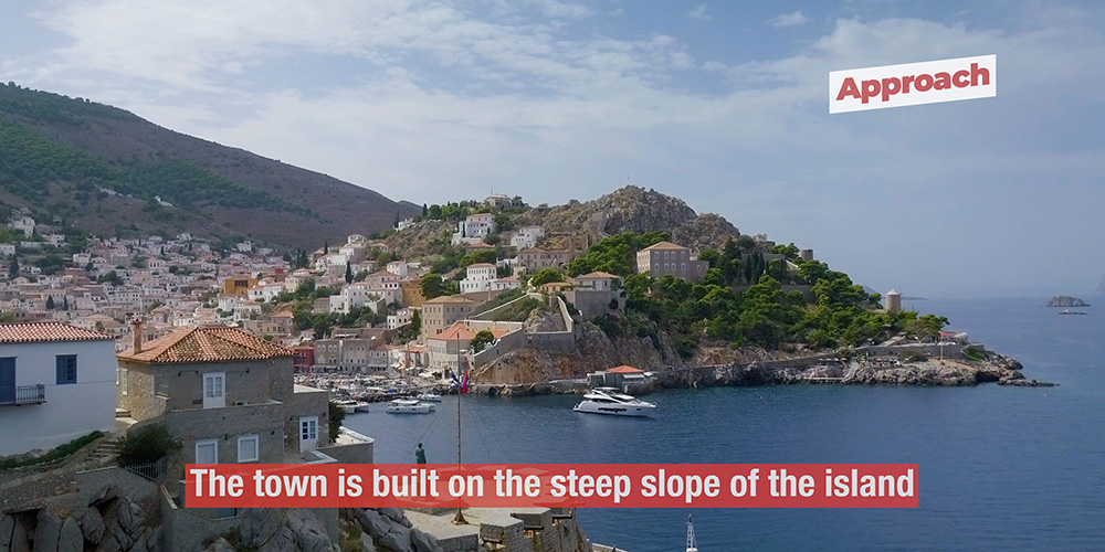
Despite the docking difficulty, Hydra is a stop most sailors prioritise at least once. The town is built on the steep amphitheatre of the harbour slopes — narrow stepped streets, white limestone houses, the tavernas tucked between them, the sound of donkey bells echoing where car horns would be elsewhere. When evening falls and the sky goes red, the harbour quietens, the music starts, and the ouzo arrives. Most crews leave promising to come back.
If a Hydra Port slot isn’t workable, the strategy is simple: anchor at Mandraki, take the water taxi (or walk) into town for the evening, sleep at the quieter anchorage, and skip the morning raft-disentangling drama.
⚓ Quick Facts for Sailors
Position
Between Saronic & Argolic Gulfs
Two Options
Hydra Port · Mandraki Bay (1 NM E)
Hydra Port Cut-off
Arrive by 11:00 · full by 14:00
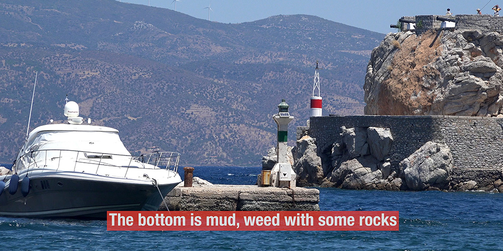
Bottom (Port)
Mud, weed, some rocks
Transport
Donkeys · water taxis · feet only
Visual Landmark
White monastery on hill above port
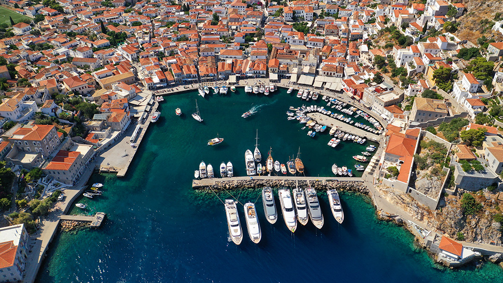
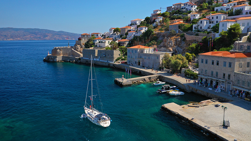
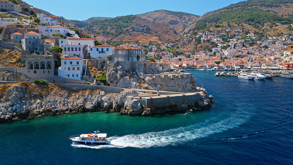
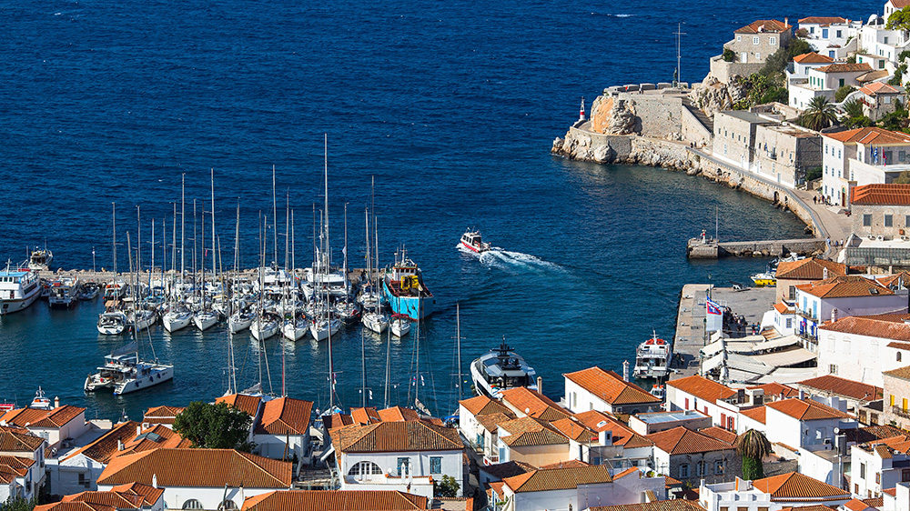
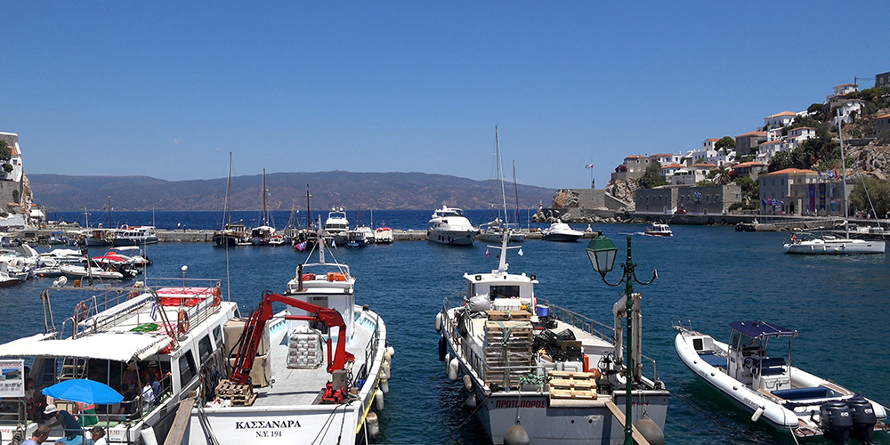
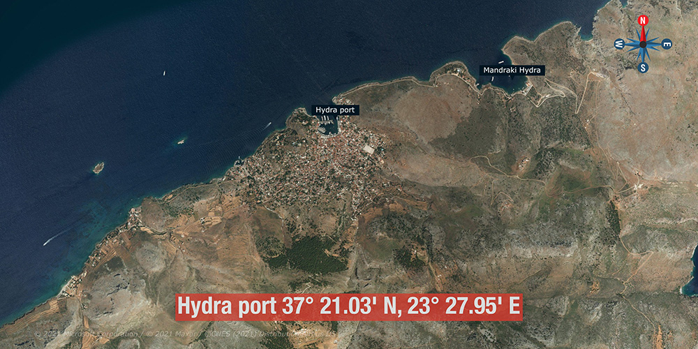
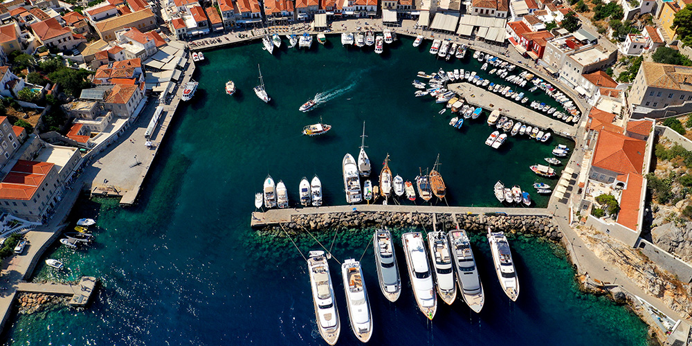
⚓ Hydra Port — 37°21.03’N · 23°27.95’E
The historic main harbour of Hydra Town, set into the steep amphitheatre of the slope. The white monastery on the hill above the port is the long-distance visual landmark — visible from offshore well before the harbour itself.
For sailors, this is a harbour with its own rules and rhythms. Understand them, time the arrival right, and you can get a good slot. Get them wrong and you’re rafted three deep with a complicated departure ahead.
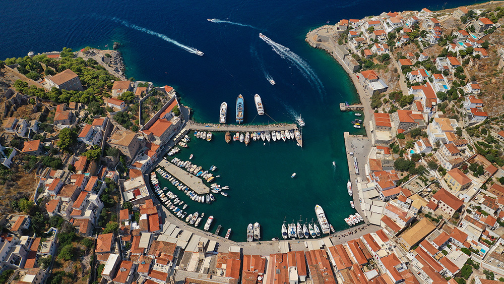
Approach
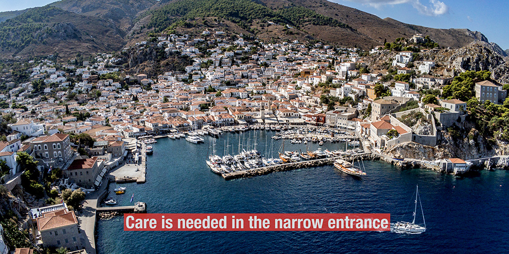
Care is needed in the narrow entrance. The harbour mouth is tight by Greek standards, especially when boats are coming and going. Slow down, hold a clear line, and watch for departing yachts that are still untangling themselves from the morning raft.
The 11:00 rule
Hydra Harbour is one of the most crowded in Greece. The last boats leave the bay at 11:00 in the morning, and by 14:00 there is no more room for visitors. Arriving in the afternoon means finding yourself in the third or fourth row of a Mediterranean mooring raft — and a difficult morning extracting yourself.
The single most important rule: Arrive by 11:00. Aim earlier if you can. The raft will already be 2 or 3 deep on busy summer days even at 11:00 — but you’ll be on the inside, not buried under it.
⚓ Mooring at Hydra Port
South Side of Arm · Facing North
Best Spots — South Side of the Harbour Arm
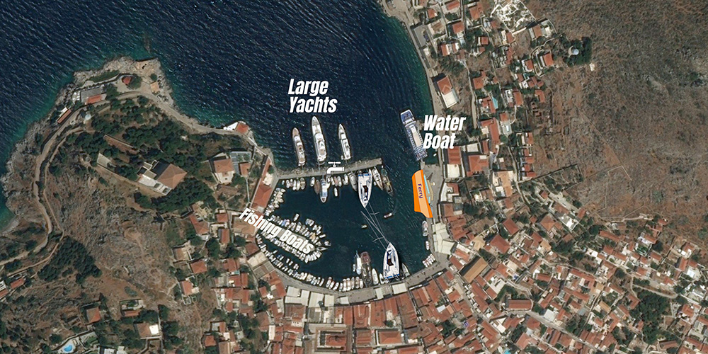
The best berths are on the south side of the harbour arm, facing north. This avoids disturbing the larger vessels on the south side of the harbour itself and keeps you in the more manageable yacht raft.
Best for: Yachts arriving by 11:00 with a chance at the inside row.
Outside the Harbour Arm · Larger Vessels
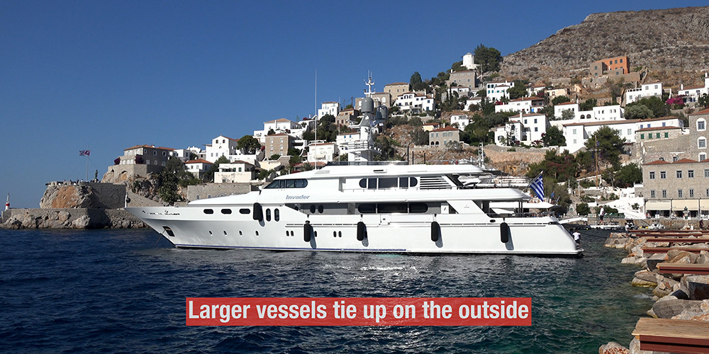
Outside the Arm
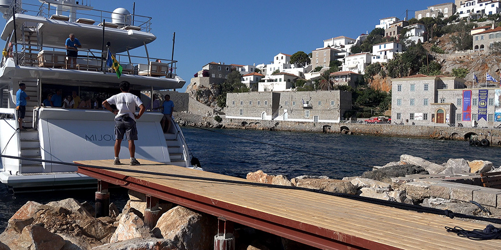
Larger vessels also tie up on the outside of the arm. Workable if you have a long passarelle or use the tender to get ashore.
⚠ Watch: Less protection than inside. Tender or long gangway needed for shore access.
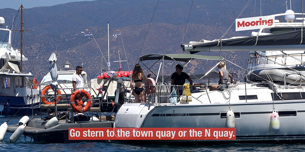
Town Quay or North Quay · Stern-To
Stern to Town Quay or North Quay
Standard Med-mooring stern-to position. Very little room for sailing boats — be prepared to moor behind others in a raft formation.
Bottom: Mud, weed, with some rocks.
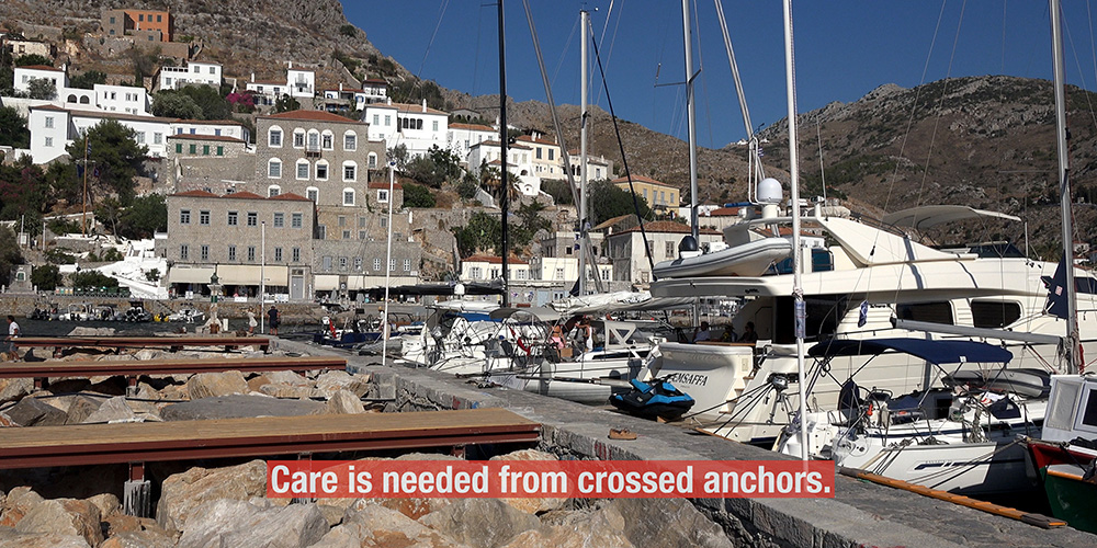
⚠ Watch: Crossed anchors are very common. Have a spare anchor rigged.
The Hydra Port Survival Rules
1. Spare anchor ready in the stern. Crossed anchors are normal here. Have a kedge or second anchor rigged on the stern in case you need to hold position while the morning raft sorts itself.
2. Don’t dive your own anchor — you’ll get a fine. Hydra has local divers who handle anchor-disentangling work. They have legal authority. If you go over the side yourself, you’re looking at a financial penalty. Use the divers, pay the fee.
3. Stay on board until sunset. The morning departure is a coordinated event among rafted boats. Stay aboard in the evening to talk with neighbours and agree the order — who leaves first, who shifts to which side, who needs to slip lines for whom. Do this conversation calmly the night before, not at 09:00 the next morning.
4. Watch the early-morning departures. The first boats leave early — be very vigilant for crossed anchors and yachts that get into difficulty as they manoeuvre. Stay alert; help if you can without endangering your own boat.
Hydra Port facilities
→ Water: Available on the quay. Remember — no natural source on the island, all delivered by ship, so don’t waste it.
→ Tavernas, cafés, bars: Plenty along the harbour-front and up the stepped streets behind
→ Provisioning: Small shops in the town — basics only
→ No fuel quay: Top up at Porto Cheli or Ermioni before arrival
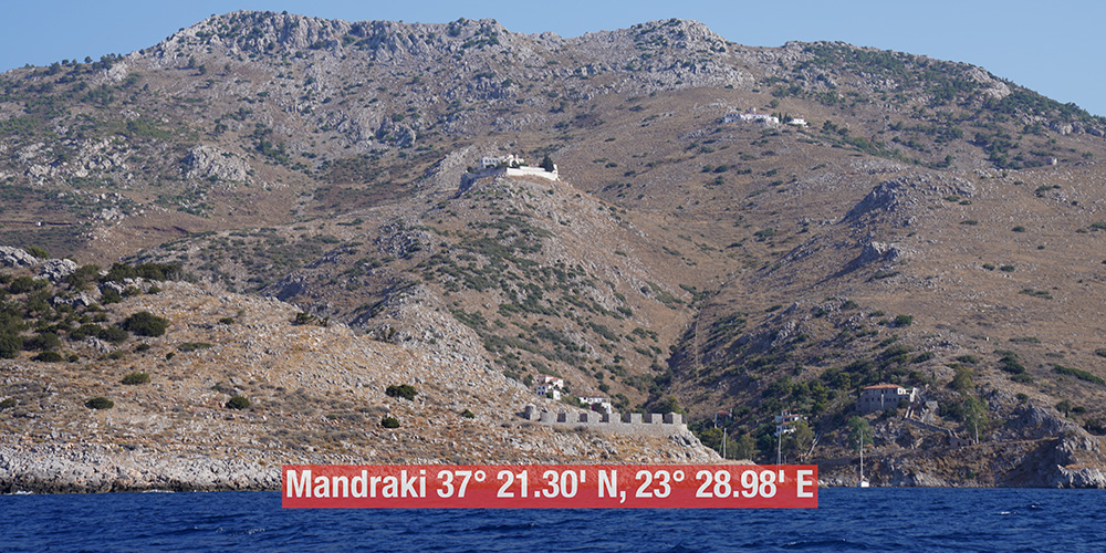
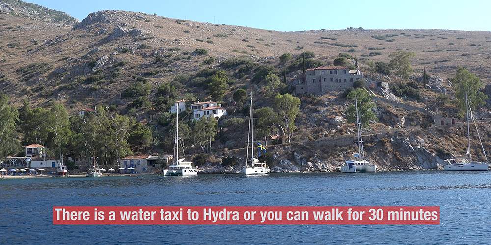
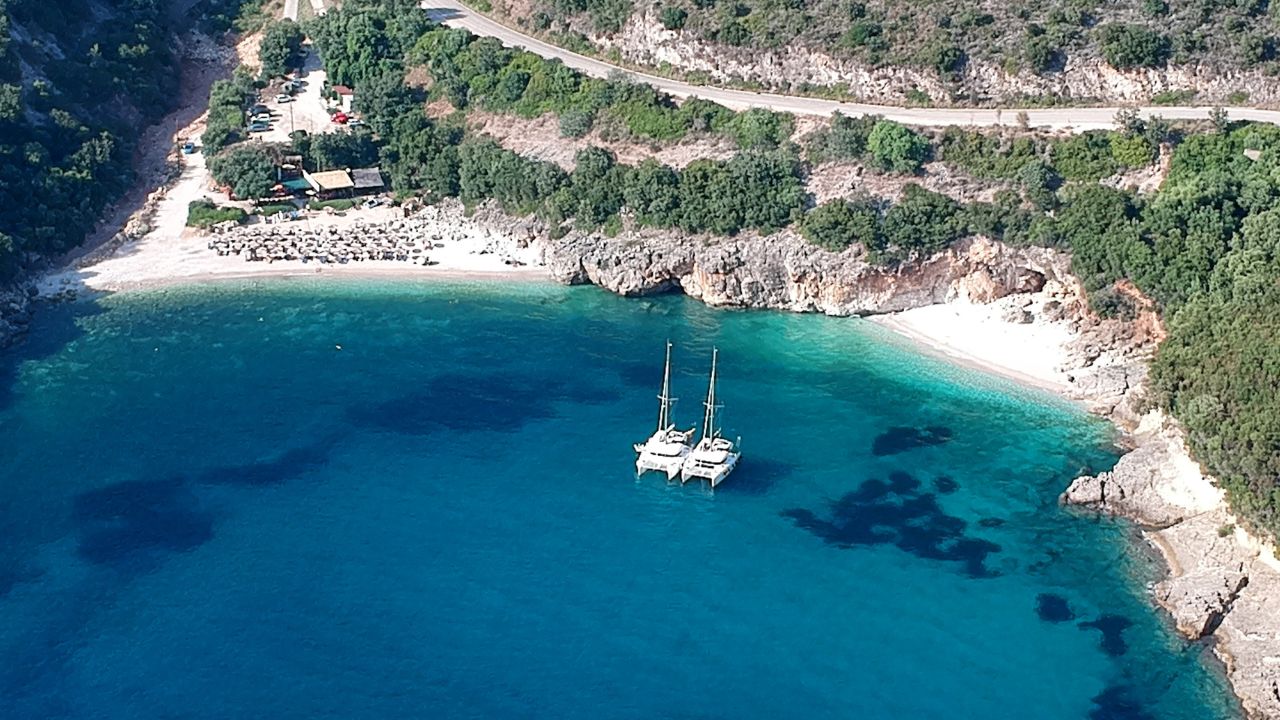
⚓ Mandraki Bay — 37°21.30’N · 23°28.98’E
The strategic alternative — about one mile east of Hydra Port. A water-taxi ride or a 30-minute walk into town, but a much calmer evening on the boat and no morning raft drama.
For most sailors, Mandraki is the better Hydra plan — anchor here, take the water taxi in for dinner, sleep peacefully, and head wherever you want in the morning without coordinating with three rafted strangers.
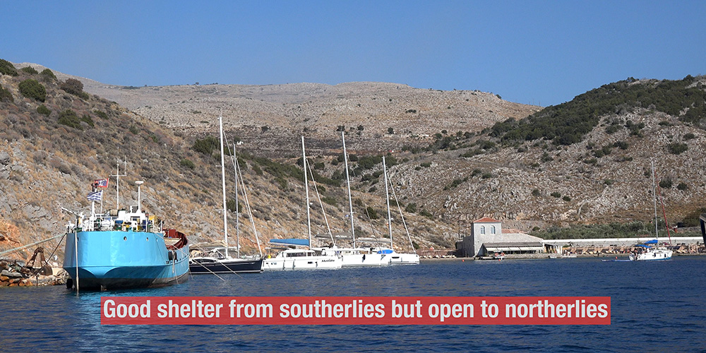
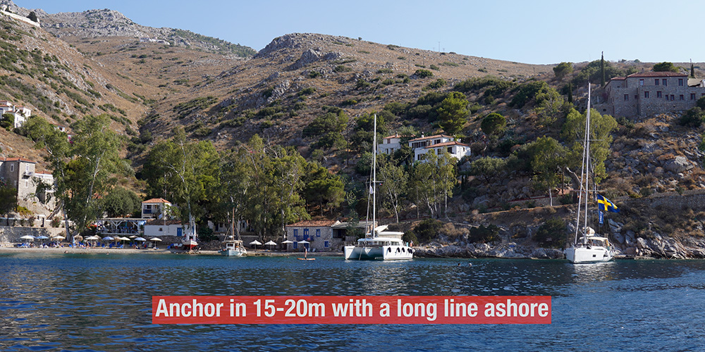
Anchor + Long Line Ashore · 15–20 m
Anchoring at Mandraki
Depth: 15–20 m
Method: Anchor with a long line ashore.
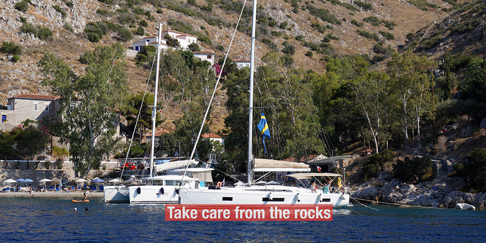
Bottom: Sand and rocks — visually identify a clean sand patch before drop. Take care of the rocks.
Stay outside the swimming area marked by buoys.
Shelter: Good from southerlies. Open to northerlies — pick this one when N forecast is light.
Town access: Water taxi to Hydra, or 30-minute walk along the coastal path.
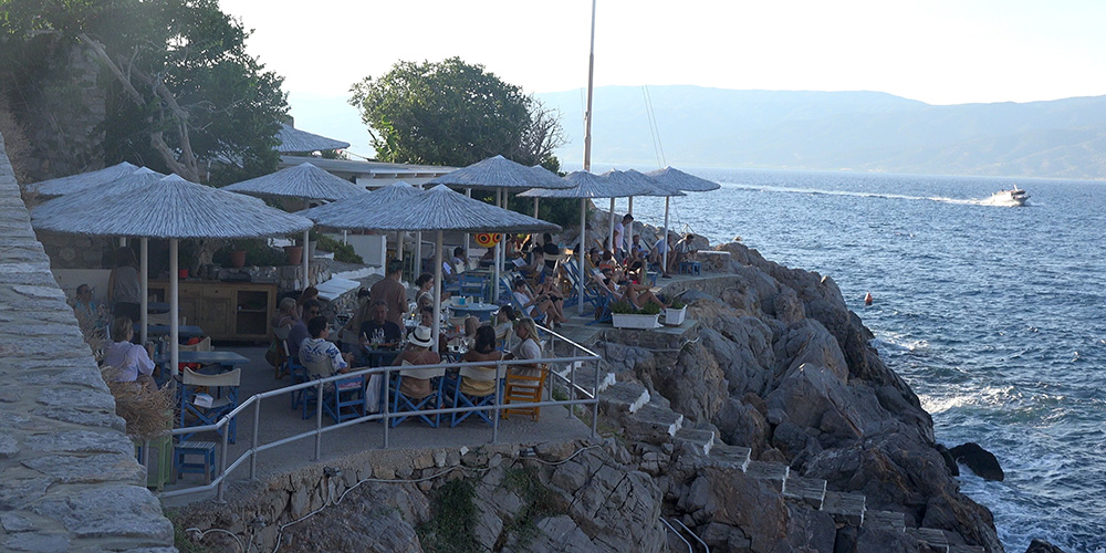
Where to Eat — Sailors’ Picks
Hydra’s restaurants are concentrated along the harbour-front and up the stepped streets immediately behind. Standards are good and prices reflect Hydra’s reputation as a celebrity-quiet retreat. Several spots are local institutions that have been there for decades.
Sunset
A long-running waterfront classic on the western edge of the harbour — fresh fish, sunset view across to the mainland, the kind of evening that defines a Hydra stop. [link]
Caprice
Up the steps from the harbour — quieter, slower-paced, traditional Greek menu with seasonal specialities. [link]
Omilos
More upscale — modern Greek, set on a small jetty just outside the main harbour. The kind of meal that earns the Hydra reputation. [link]
Pro Tips for Hydra
Default to Mandraki, not the port. Unless you specifically want the docked-in-town experience, Mandraki + water taxi is the calmer, easier choice. You still get the town. You don’t get the morning raft.
Use Ermioni as a base for a Hydra day-trip. If the boat schedule is tight, anchor at Ermioni across the channel and take the water-taxi to Hydra for the day. Dinner at Hydra, sleep at Ermioni — best of both.
Walk the steps. Hydra’s town climbs steeply from the harbour. The walk up to the Profitis Ilias monastery is the best vantage point on the island — sweeping views over the port, the channel to Ermioni, and the Saronic islands to the north.
Conserve water. No natural water source on the island. Every drop is delivered by ship. Reflect that in your usage at the boat — don’t run the deck shower, top up tanks deliberately.
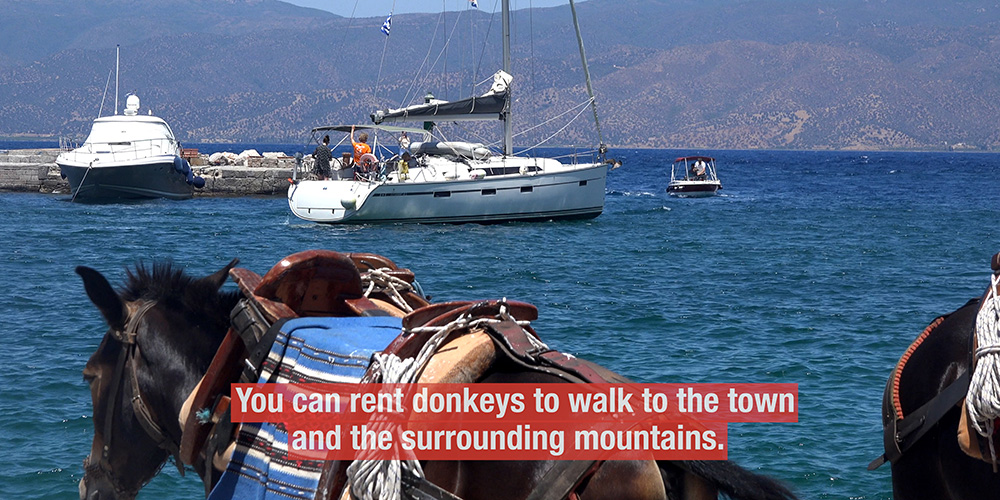
Take the donkey ride seriously. Donkeys are the working transport of Hydra, not a tourist gimmick. Cargo, building materials, luggage from the harbour — all moved by donkey. The ride to one of the higher viewpoints is worth doing once.
Suggested Routes from Hydra
SW to Ermioni (4 NM): Across the channel to Ermioni — the calm Peloponnese village with two-sided shelter and a Thursday market.
South to Spetses (12 NM): Down to Spetses Island — Baltiza Old Harbour, the love-cave at Anargiri.
SW to Porto Cheli (8 NM): Reliable shelter at Porto Cheli with marina and full provisioning.
North to Poros (12 NM): Up to Poros — neoclassical sailing town, easier docking than Hydra.
✅ Sailor’s Safety Checklist for Hydra
▢ Decision made: Hydra Port (arrive by 11:00) or Mandraki Bay (water-taxi plan)
▢ Spare anchor rigged on stern if going to Hydra Port
▢ Spare lines and fenders ready for Med-mooring raft
▢ Mandraki: N forecast checked (anchorage open to N)
▢ Mandraki rocks plotted; sand patch identified for drop
▢ Water tank topped up before arrival (Hydra has no natural water)
▢ Fuel topped up before arrival (no fuel quay on Hydra)
▢ Local diver number noted for anchor-disentangling — DON’T DIVE YOURSELF
Emergency Numbers — Saronic / Hydra
European Emergency: 112
Coastguard Distress (VHF Ch. 16): Universal
Coastguard Working (VHF Ch. 12): Per region
Olympia Radio (VHF Ch. 03/86): Greek HF/VHF maritime service
Watch the SeaTV Visual Pilot Video
Approach footage past the white monastery on the hill, drone passes over the crowded harbour and the steep amphitheatre of the town, the morning raft and the evening light, plus the alternative anchorage at Mandraki — Hydra as you’d see it from the cockpit. Free for members.
Related SeaTV Pages
Saronic · Adjacent Anchorages
→ Ermioni — 4 NM SW, water-taxi alternative
→ Spetses Island — 12 NM south, four anchorages
→ Porto Cheli — 8 NM SW, sheltered overnight
Greece · Other Regions
Continue your Saronic charter
Across to Ermioni, south to Spetses, or the calm at Porto Cheli.
→ Ermioni · Spetses · Porto Cheli · Saronic overview
“Hydra rewards the sailor who plays by its rules. Arrive by 11:00 — or anchor at Mandraki and let the water taxi carry you to dinner.”
— SeaTV Visual Pilot · Saronic & Eastern Peloponnese Edition