SeaTV · Saronic Gulf & Eastern Peloponnese · Spetses
Spetses Island — Sailing Guide & Anchorages
Pine forests, neoclassical waterfront mansions, and four very different anchorages on one small island — from the busy Baltiza creek to the quiet love-cave bay at Anargiri.
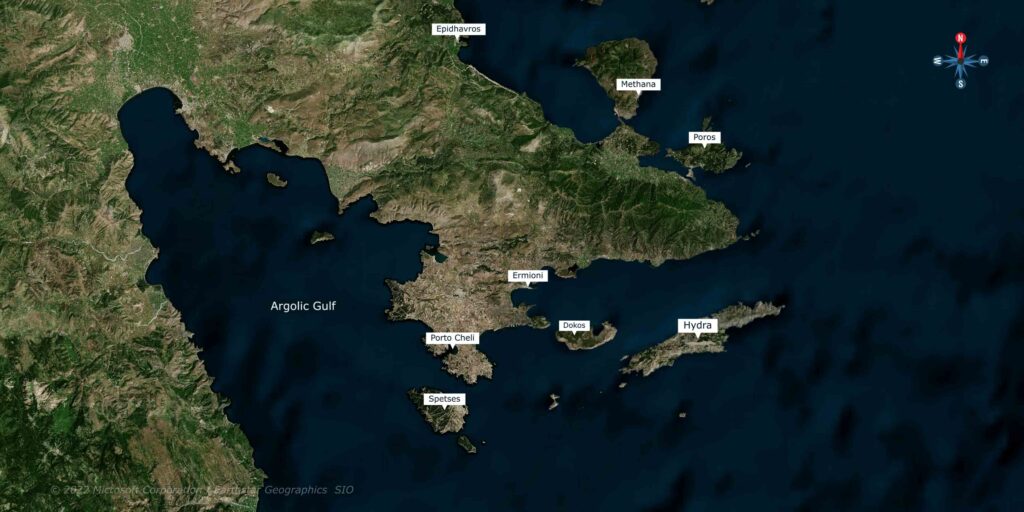
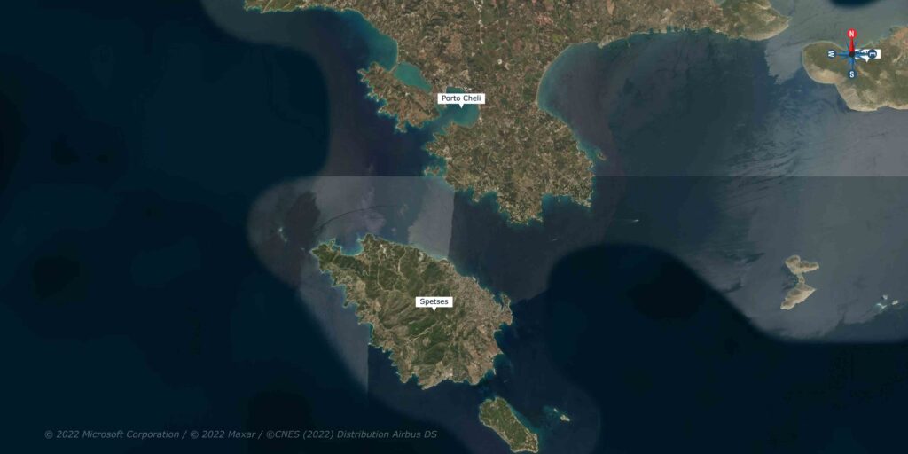
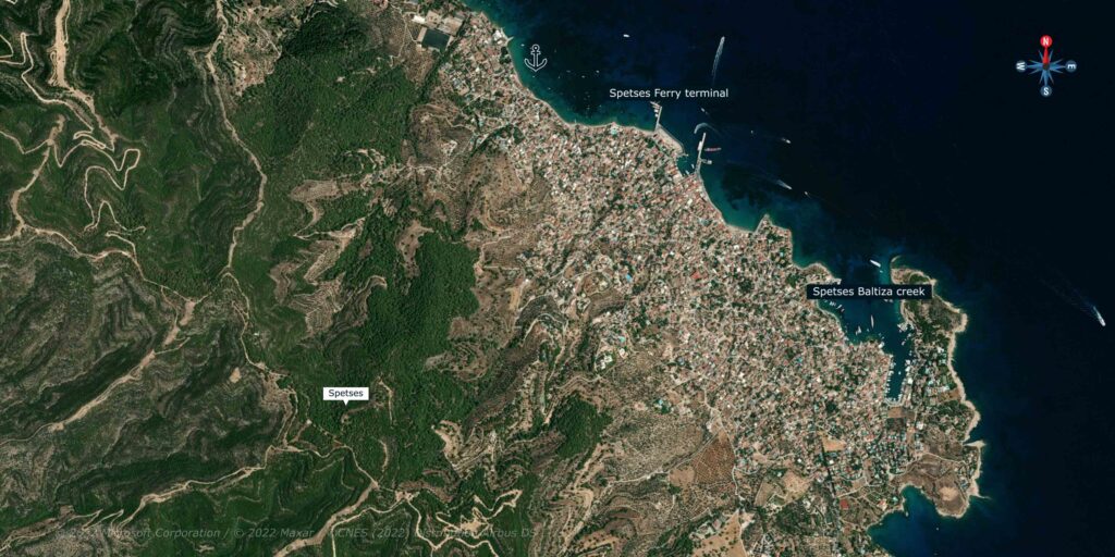
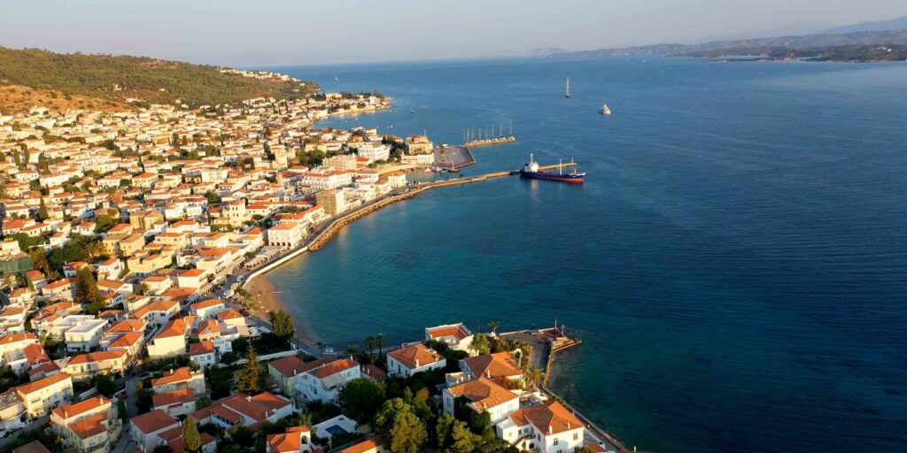
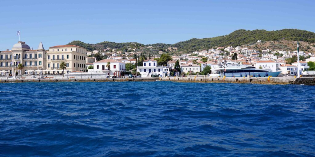
Spetses sits between the Saronic Gulf and the Argolic Gulf, just south of Porto Cheli on the Eastern Peloponnese. The island has earned a reputation for fragrant pine forests, elegant cosmopolitan architecture, secluded beaches, and gourmet dining — but for sailors, the value is the variety: four distinct anchoring options around a short coastline, each with a different character.
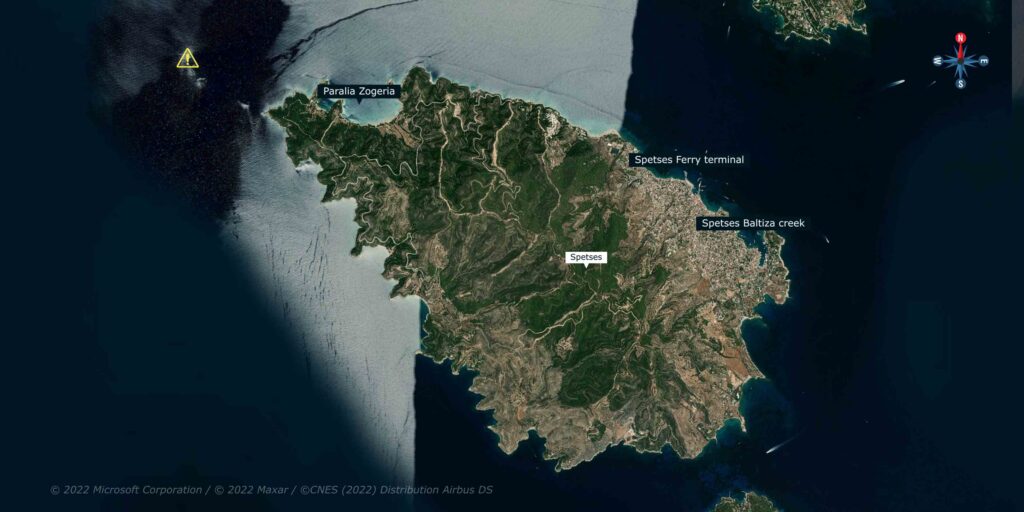
For sailors, Spetses is one of the most-loved Saronic stops. Baltiza creek is the lively old-port option (and crowded all season). The ferry terminal is the practical alternative one mile west. Paralia Zogeria is the quiet NW-coast bay for a calm-day afternoon. And Anargiri Bay on the south-west is a SeaTV must-do — a cave at the head of the bay where, according to legend, drinking the water binds you in love forever to whoever drinks it with you. Plan to visit at least two of these on a Spetses day.
⚠ Reality check: Baltiza creek has above-water rocks and a short reef on the east side of the entrance — the lighthouse marks them. South winds bring swell into the entrance. The Ferry Terminal pier has a reef between the moorings, 200 m from shore. Anargiri is open to the SW — calm-day visit only.
Regional Wind Context — The Argolic Gulf
The Argolic Gulf is an elongated bay running NW–SE, surrounded by high mountains on both sides. Winds in the gulf typically blow parallel to the shore at 10–20 knots. The mountain topography channels the wind — sometimes you’ll find a different wind direction inside the gulf than what’s reported for the open Aegean, especially in the morning and evening transition periods.
For sailing across to Spetses from Porto Cheli, this means the morning is usually lighter; the afternoon thermal builds along the gulf axis. Plan crossings accordingly.
⚓ Quick Facts for Spetses Sailing
Position
Between Saronic & Argolic Gulfs
Distance from Porto Cheli
3.7 NM south
Main Anchorages
4 — Baltiza · Ferry · Zogeria · Anargiri
Wind Pattern
10–20 kn parallel to gulf shore
Best Season
May–October
Special Feature
Anargiri “love cave”
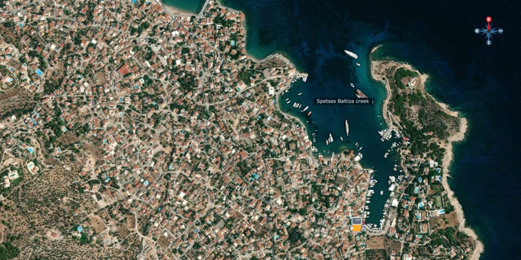
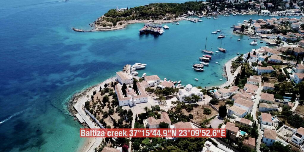
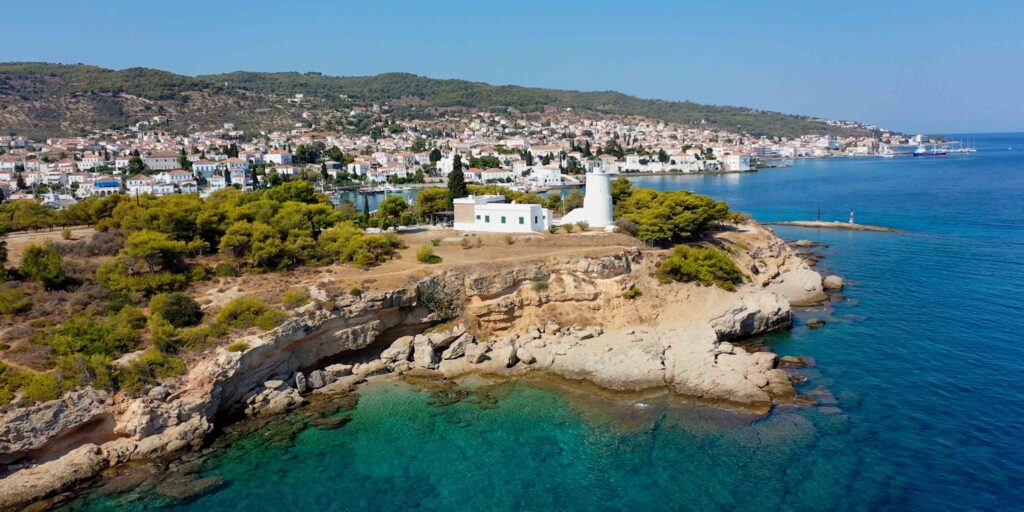
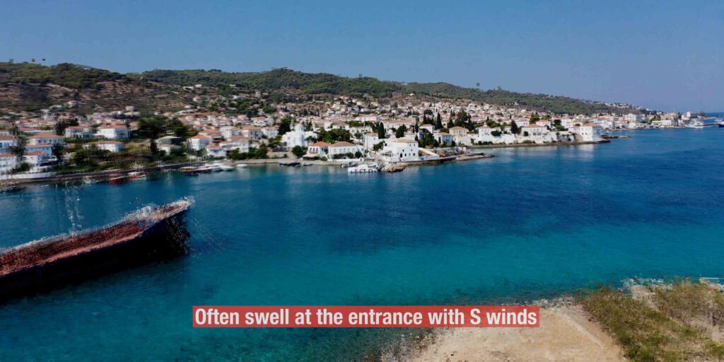
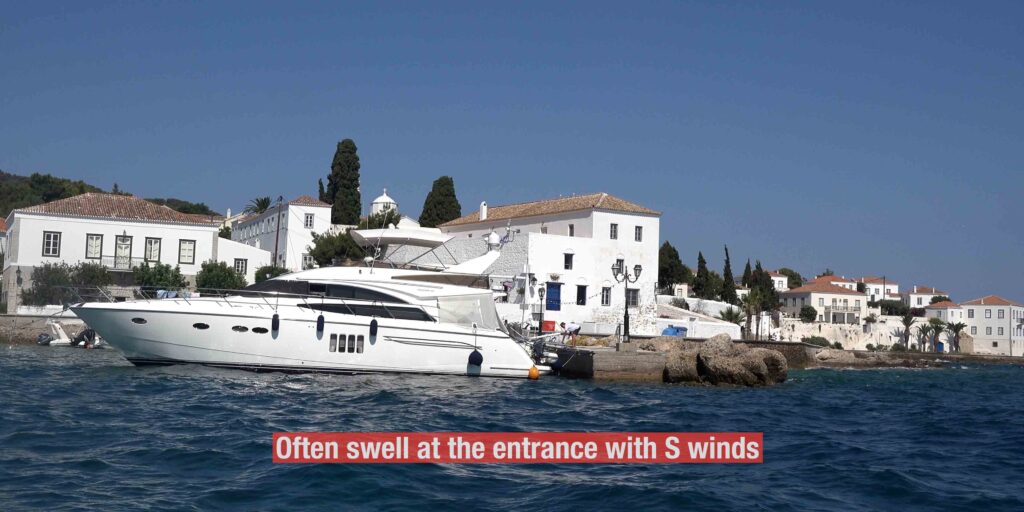
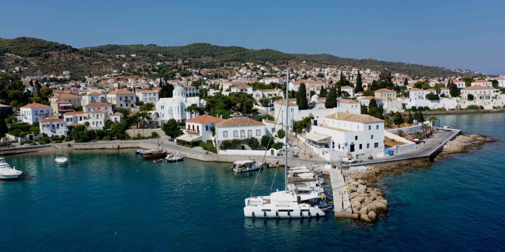
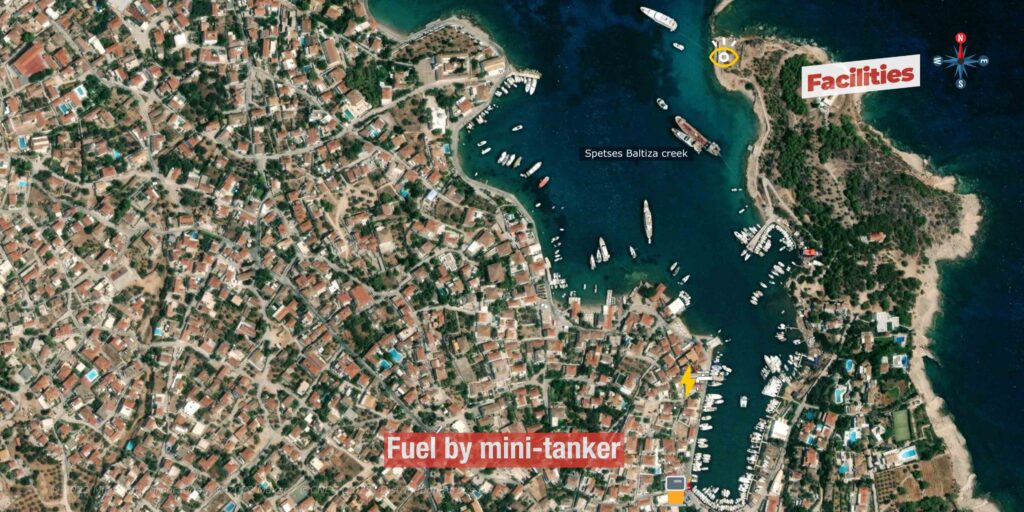
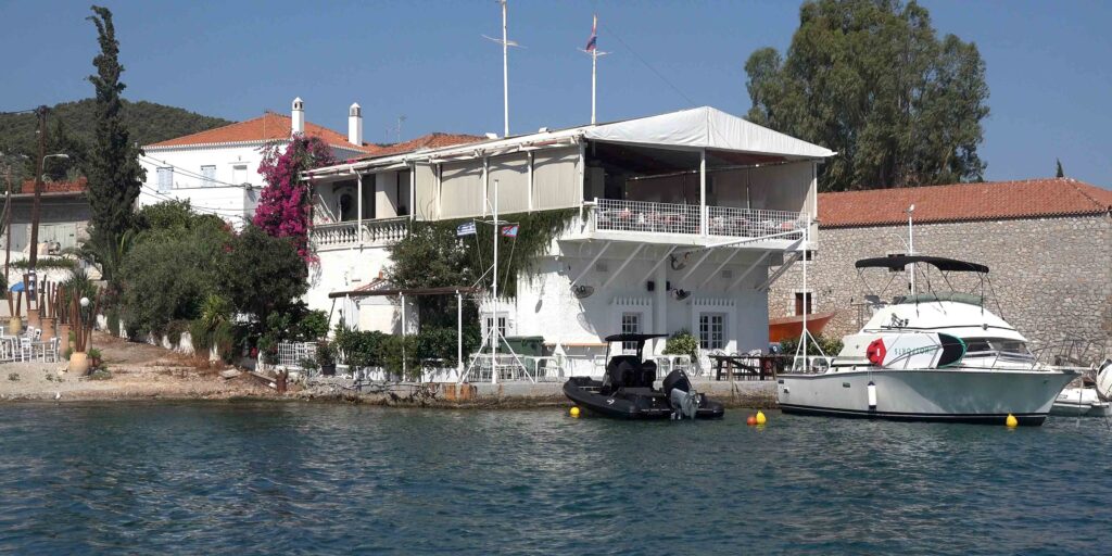
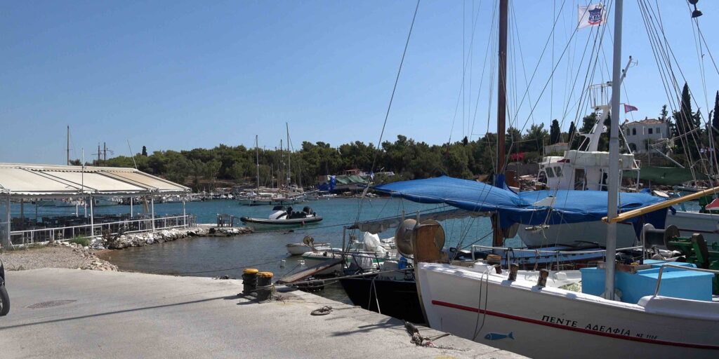
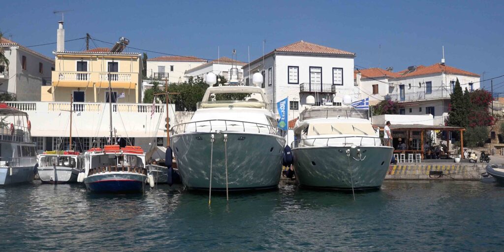
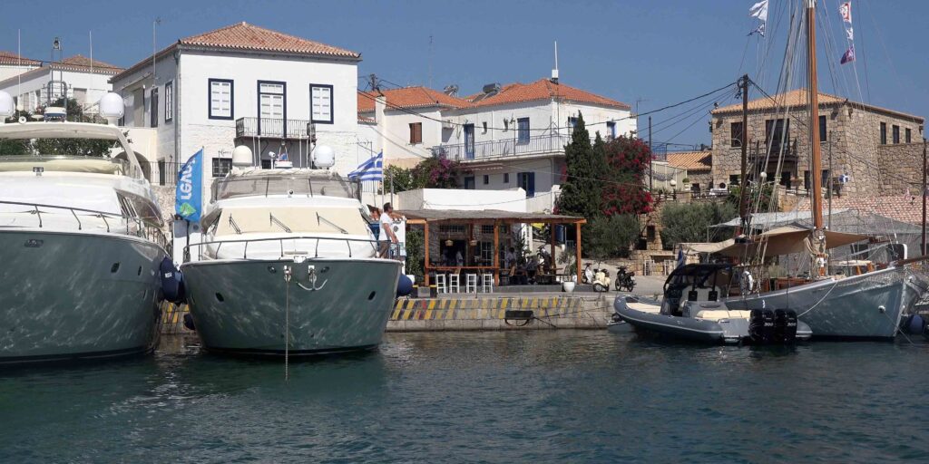
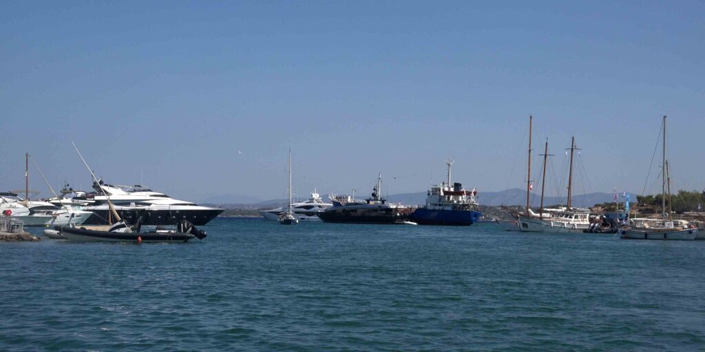
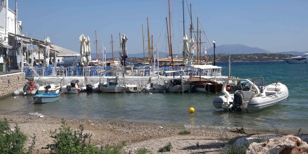
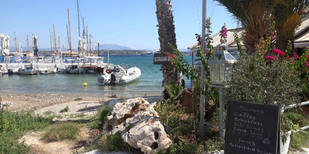
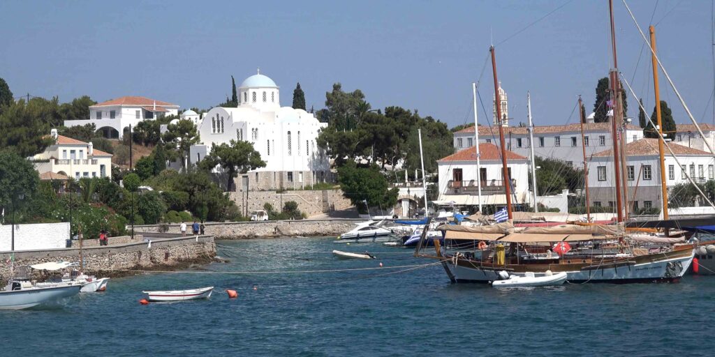
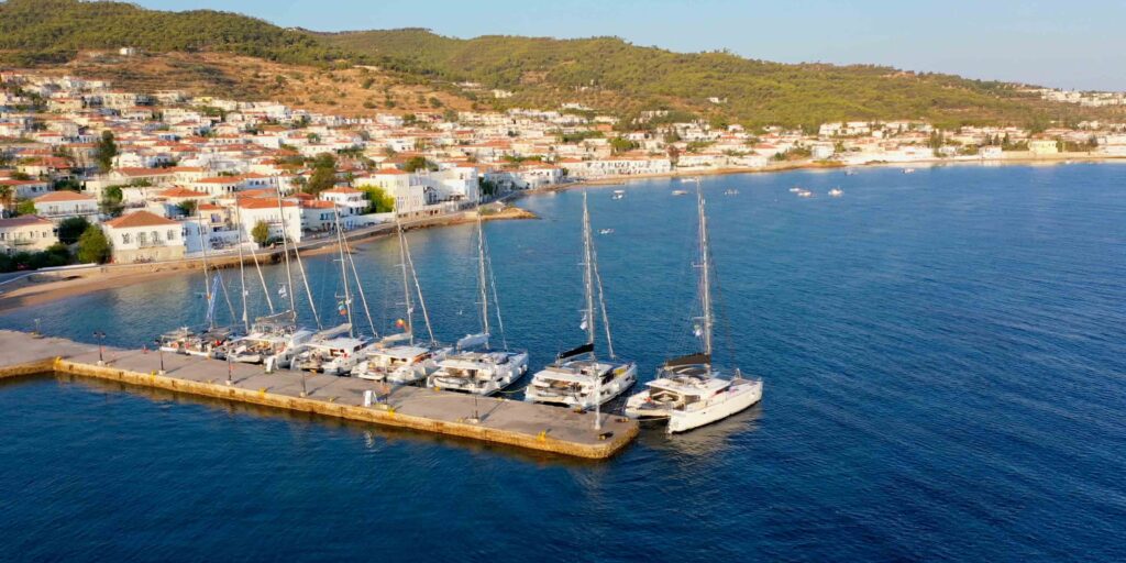
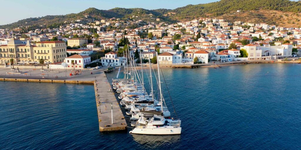
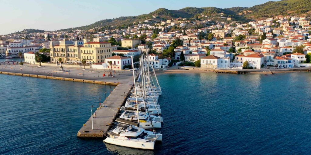
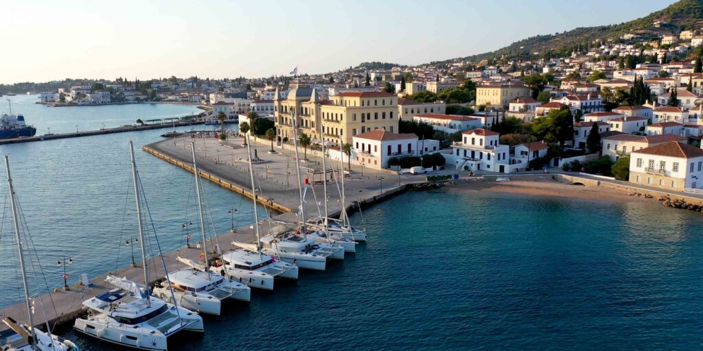
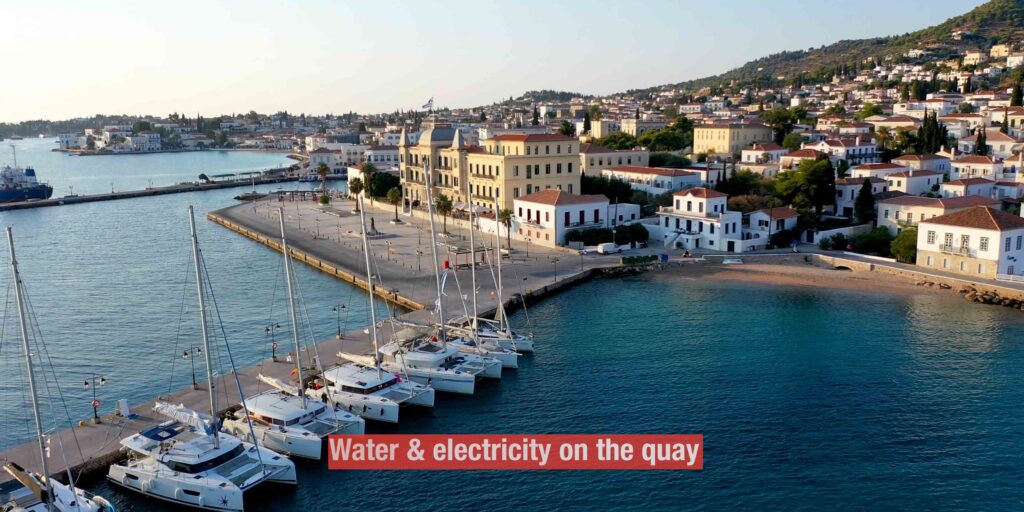
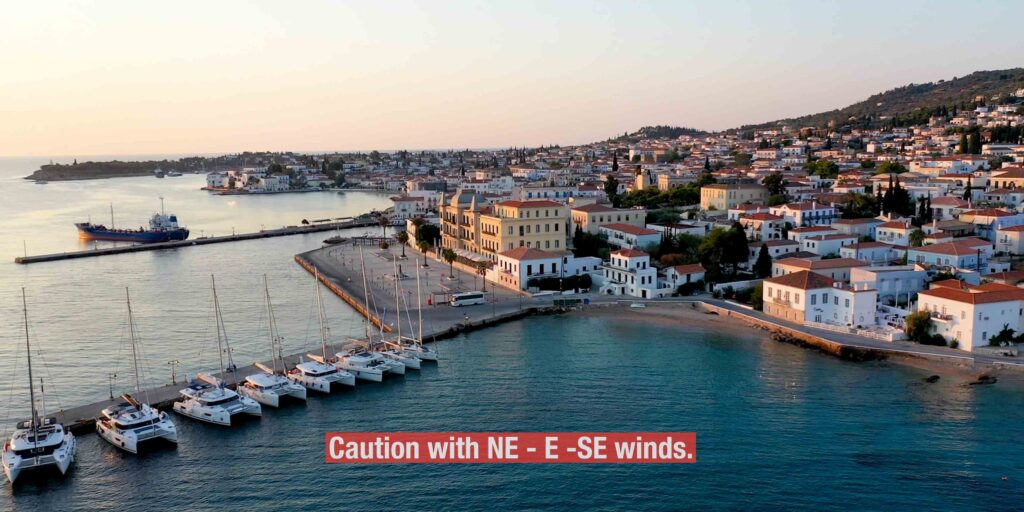
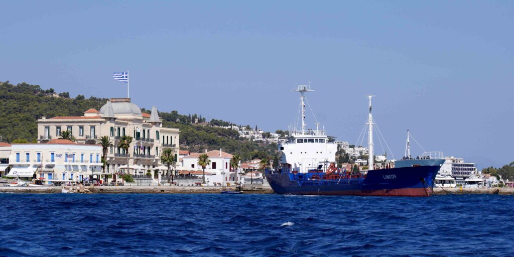
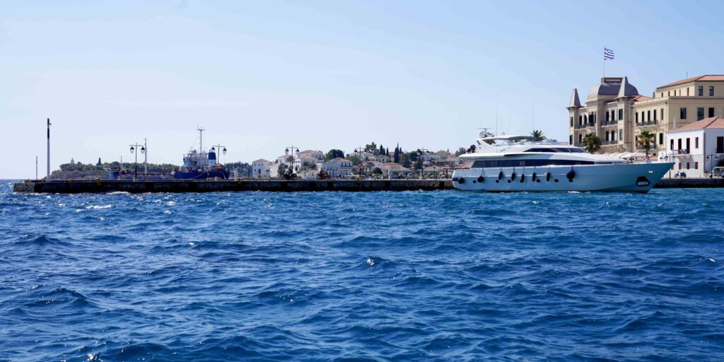
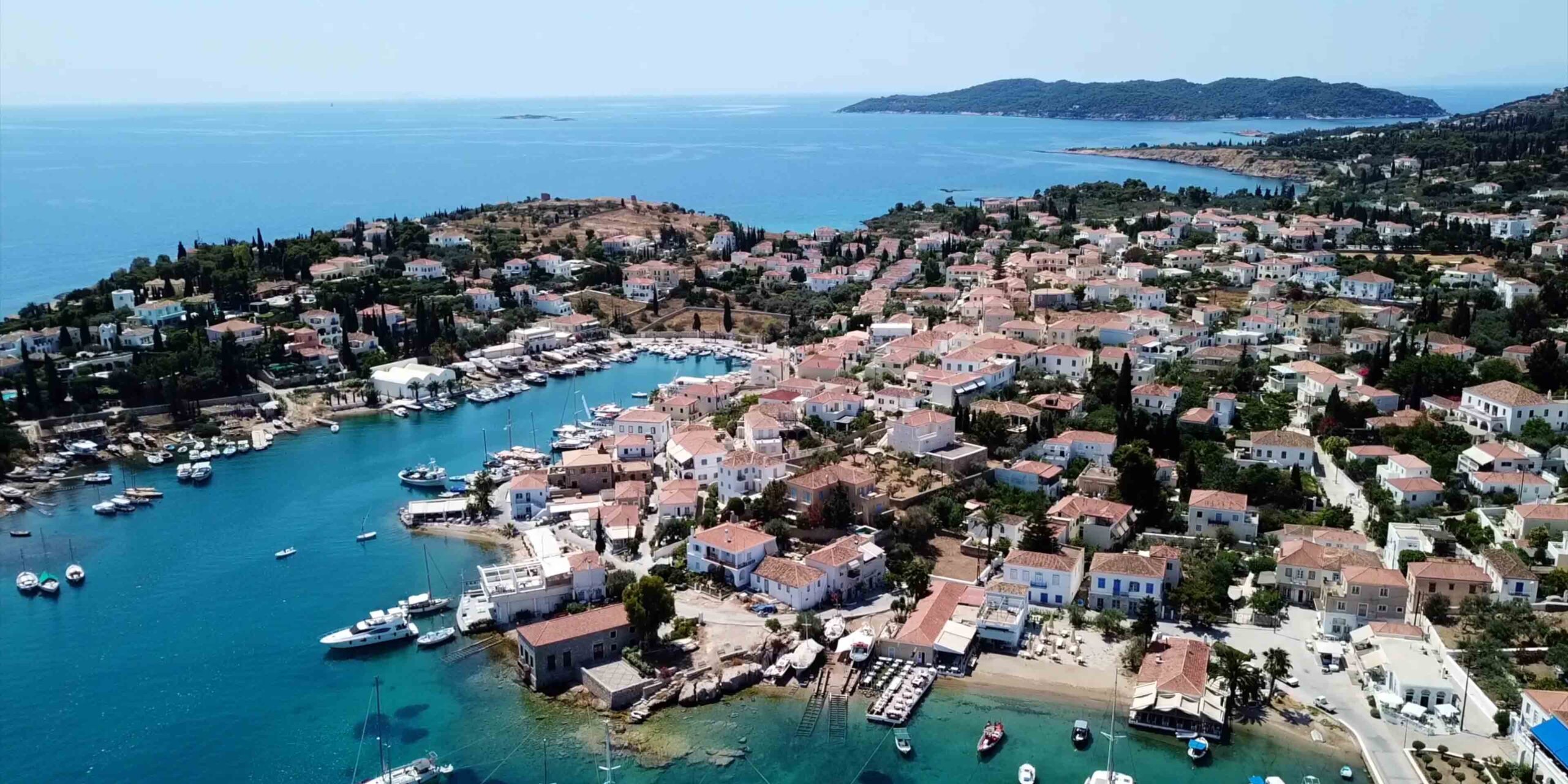
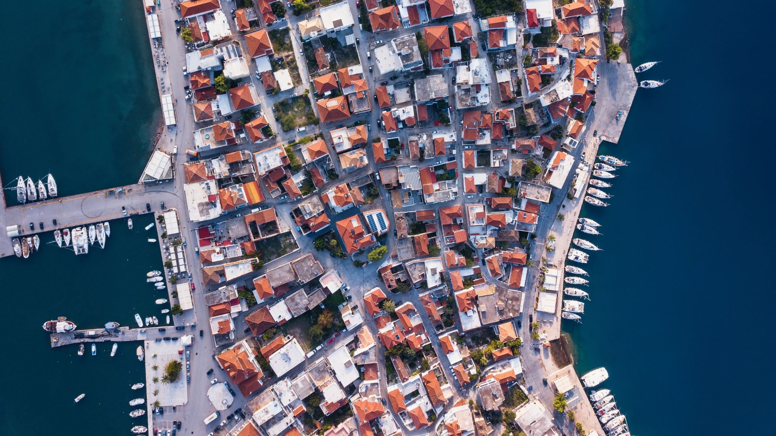
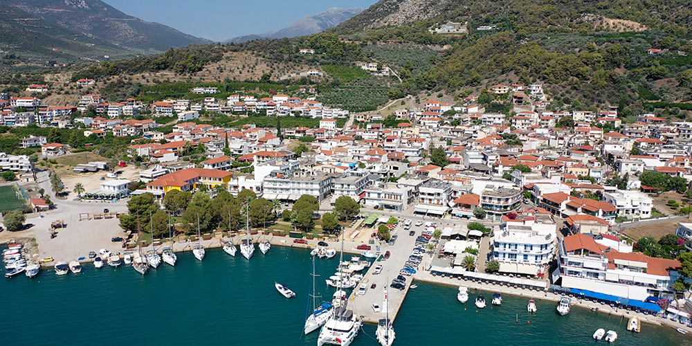
⚓ Baltiza Creek (Old Harbour) — 37°15’44.9″N · 23°09’52.6″E
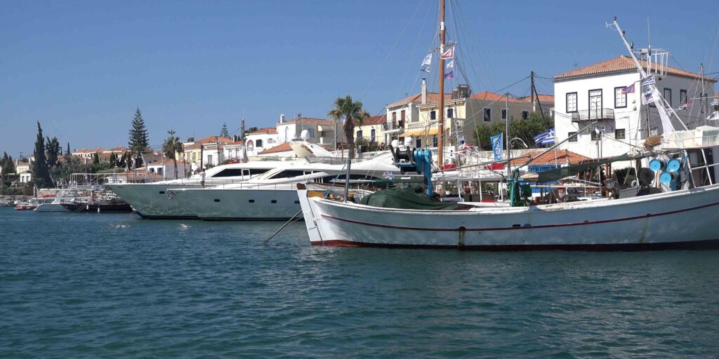
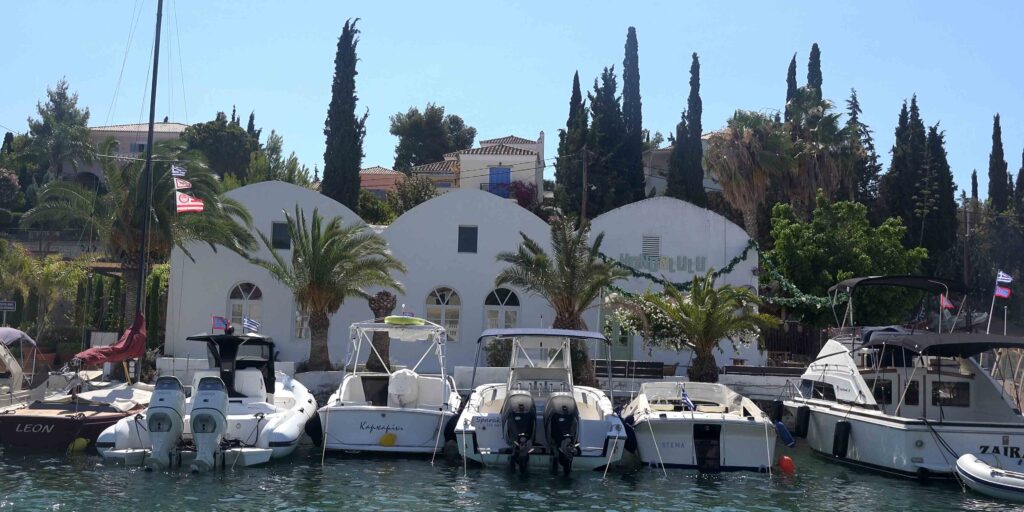
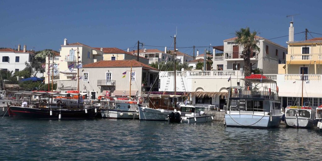
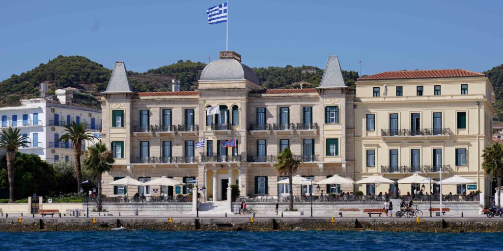
The historic old harbour of Spetses Town — a long, narrow creek lined with traditional shipyards, neoclassical mansions, and yacht-tourist energy. Lively, cosmopolitan, and crowded throughout the season with private yachts.
For sailors, this is the main town berth — direct access to the Spetses Old Town, restaurants, shops, the famous Bouboulina Museum. The atmosphere is the reason most crews come; just don’t expect quiet, and don’t show up at sunset expecting a slot.
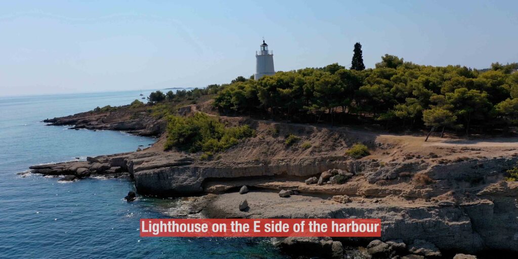
Approach to Baltiza
→ A lighthouse marks the east side of the harbour entrance — clear visual reference
→ Care needed: above-water rocks and a short reef in the entrance area
→ South winds: swell often present at the entrance — uncomfortable in southerly conditions
→ The inner creek is well-protected once you’re past the entrance
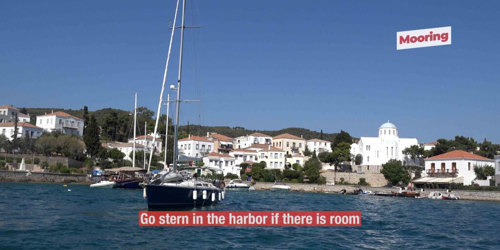
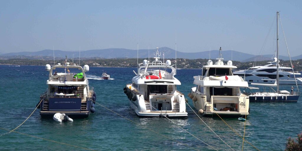
Stern-to in the Harbour
Med-mooring in Baltiza Creek
If there’s space — go stern-to in the harbour. The inner creek has good shelter once you’re inside.
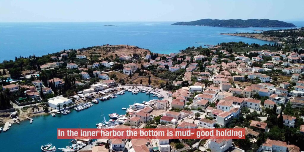
Bottom: Inner harbour is mud — good holding.
⚠ Watch: Crowded all season — arrive early (before 14:00) for a slot.
Anchor with Long Line Ashore
Anchor + Line Ashore SW
If space allows — anchor on the south of the creek or with a long line ashore on the south-west. A practical alternative when the inner harbour is full.
Bay Outside · Free Anchor + Line
Anchor in the Outer Bay
If the harbour is full — anchor in the bay outside with a long line ashore. More exposed than the inner creek but works in settled weather.
Baltiza facilities
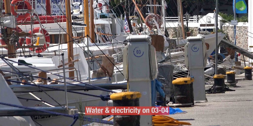
→ Water and electricity: on quays 03–04
→ Fuel: by tanker — call ahead to arrange
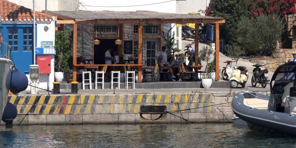
→ Restaurants: most are right on the waterfront — easy step ashore from a stern-to slot
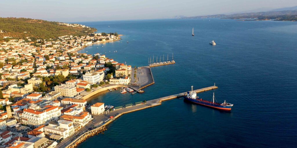
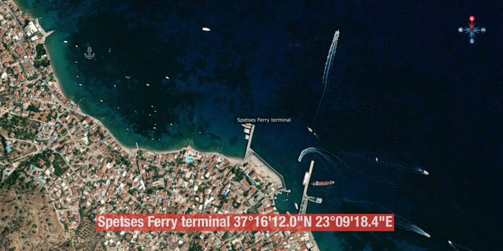
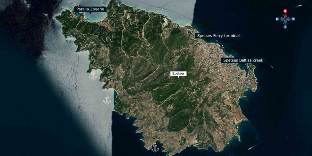
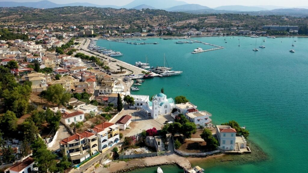
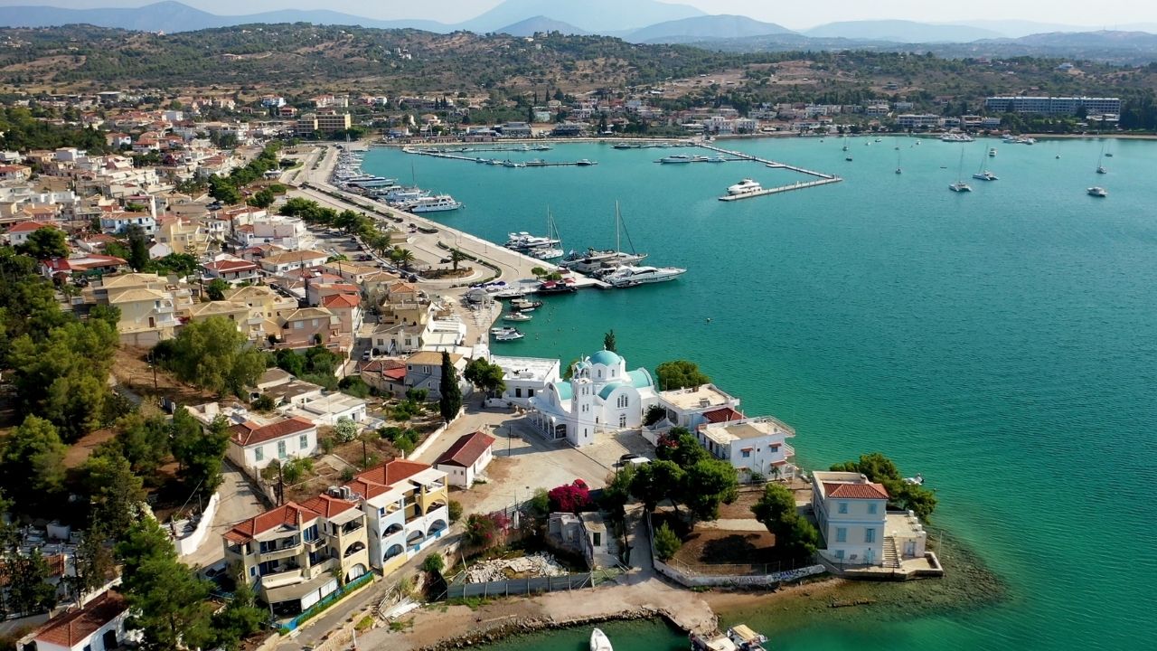
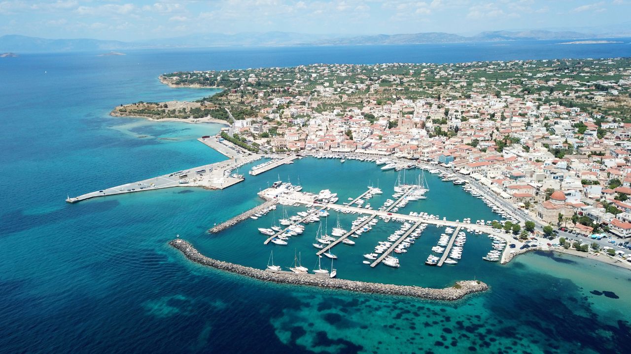
⚓ Spetses Ferry Terminal — 37°16’12.0″N · 23°09’18.4″E
Less than one mile west of the old port — a working ferry pier with a smaller pier next to it for visiting yachts. Practical alternative when Baltiza is full, or if you want a quieter berth than the old port.
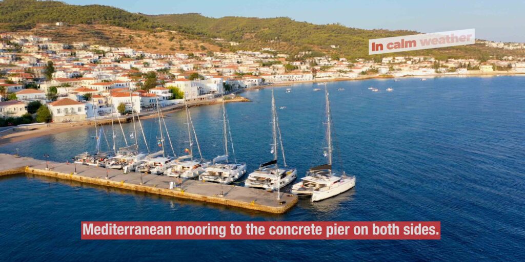
Concrete Pier · Both Sides
Med-Mooring at the Ferry Pier
Mooring: Mediterranean-style on both sides of the concrete pier.
Services: Water and electricity on the quay.
⚠ Beware the reef: A reef sits between the moorings, 200 m from shore. Plot it before approach. This is the headline hazard at this anchorage.
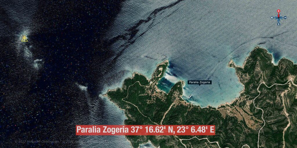
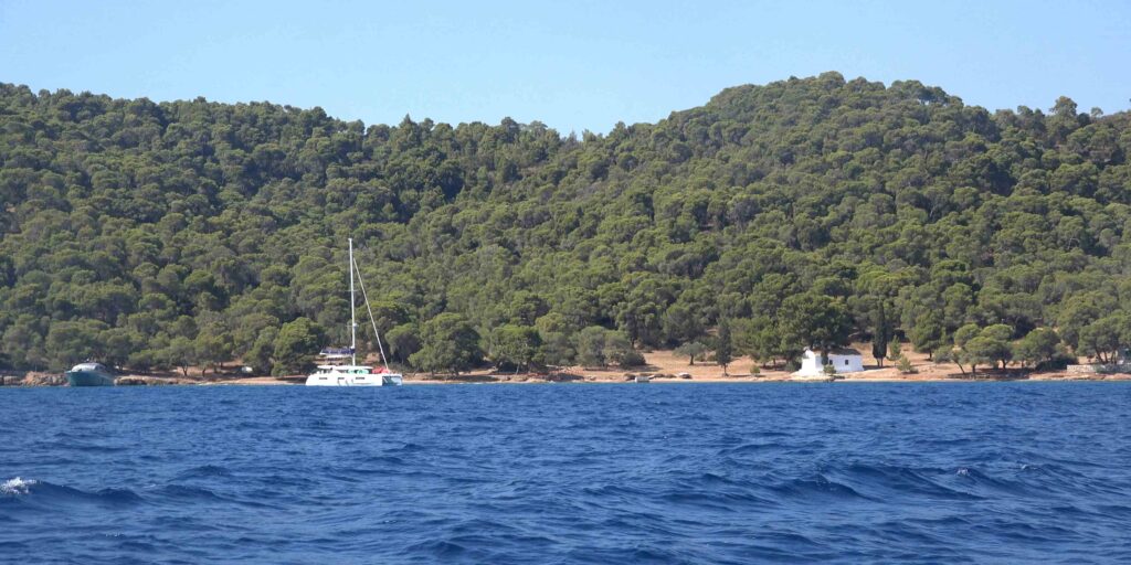
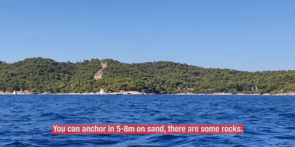
⚓ Paralia Zogeria — 37°16.62’N · 23°06.48’E
A lovely open bay on the north-west of the island. Quiet, undeveloped, perfect for a calm-day afternoon stop or a peaceful overnight in settled weather. The kind of bay that earns the description “perfect for chilling in nature”.
Open NW Bay · Calm Weather
Anchoring at Zogeria
Depth: 5–8 m
Bottom: Sand with some rocks present — visually identify a clean sand patch before drop.
Mooring: Free anchor, or take a long line ashore for added stability.
⚠ Watch: Calm-weather only. The bay is open and exposes if conditions change. Have Baltiza or the Ferry Terminal as your fall-back.
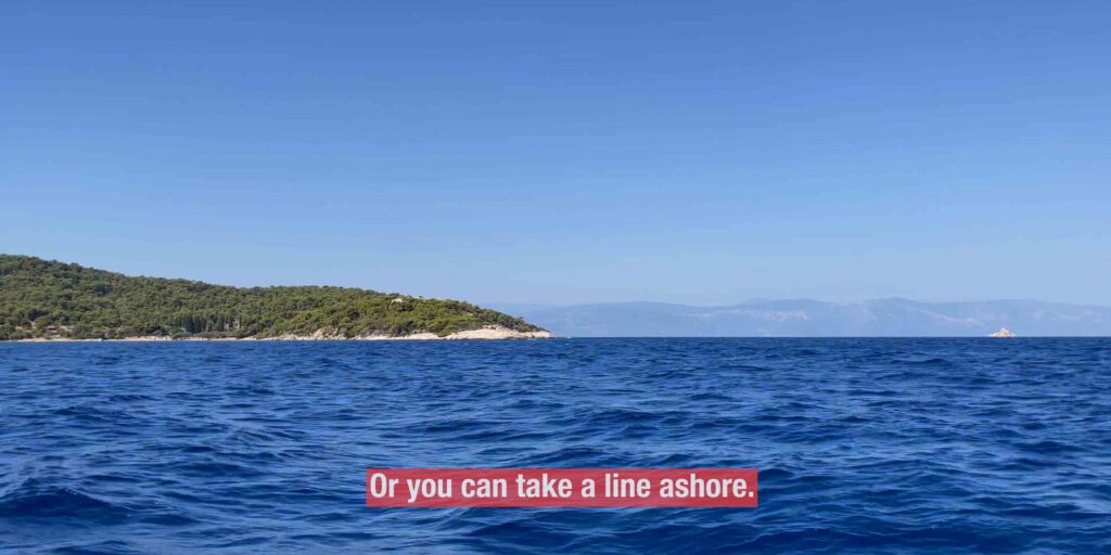
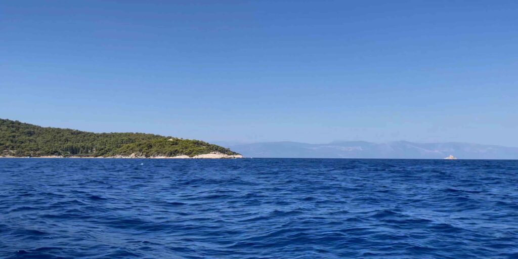
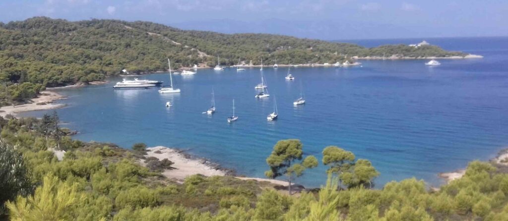
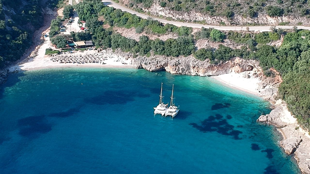
⚓ Anargiri Bay — 37°15’09.8″N · 23°06’47.8″E
An amazing clear-water bay on the south-west of the island, open to the SW. The water is exceptional even by Greek standards. There’s a tavern on the beach and — the SeaTV pick — a deep cave in the northern part of the bay, worth swimming or dinghying into.
Local legend: Those who drink from the water in the cave are said to fall in love for life with whoever drinks it with them. Whether you believe it or not, the cave is worth the visit.
Med-Style on Rocks N · Overnight
Anchor Mediterranean-Style on Rocks (North)
Method: Anchor + line ashore to the rocks on the north side. You can get very close to the rocks here — the depth allows it.
Depth: 5–10 m
Bottom: Sandy soil with scattered weeds — visually identify a clean sand patch.
⚠ Watch: Bay open to SW — overnight only in settled weather.
Free Mooring · Lunch Stop
Free Anchor for Lunch
Depth: 5–10 m on sand with scattered weed.
Best for: Day-anchor, swim-and-cave-visit, lunch on the beach taverna.
Anargiri shore
→ A good tavern with a limited menu on the beach — useful for lunch
→ The deep cave at the north end of the bay — explore by swim or dinghy. Don’t miss it.
Where to Eat — Sailors’ Picks
Spetses Town has a strong restaurant scene — gourmet dining is part of the island’s reputation. Most spots are within walking distance of the Baltiza waterfront.
Mourayo
A long-running Spetses institution at the Old Harbour — fresh seafood, modern Greek, generous portions. The kind of evening you remember. [link]
Tarsanas
A traditional taverna on the waterfront — Greek classics, good fish, fair prices for Spetses. [link]
Anargiri Beach Taverna
The single tavern at Anargiri Bay — limited menu, but the setting (water clear enough to see the anchor chain, the love-cave a short swim away) does most of the work.
Pro Tips for Spetses
Don’t try to cram all four into one day. Each anchorage has its own character. A typical Spetses day pairs Anargiri (lunch + cave) with Baltiza (overnight) — that’s plenty for one day.
Baltiza fills early. Aim arrival before 14:00 in season. If full, drop to the Ferry Terminal one mile west — quieter, less photogenic, but the night still works.
Plot the Ferry Terminal reef. The reef 200 m from shore between the moorings is the most-overlooked Spetses hazard. Mark it on the chartplotter before approach.
South wind = swell at Baltiza entrance. A southerly forecast makes the harbour entrance uncomfortable. Plan accordingly — either dock earlier or pick the Ferry Terminal.
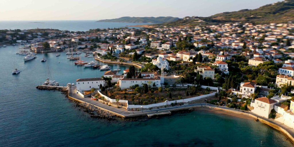
Walk the Old Town. Spetses Old Town is car-free in the centre — neoclassical mansions, a working horse-cart taxi service, the Bouboulina Museum. Worth at least one evening walk.
Suggested Routes from Spetses
North to Porto Cheli (3.7 NM): The classic short hop — Porto Cheli for full provisioning, marina if needed, all-around shelter.
North to Hydra (12 NM): Up to the car-free island of Hydra — stone mansions, gallery scene, photogenic harbour.
North-east to Poros (22 NM): Across the Saronic to Poros — neoclassical town, sailing-focused atmosphere, popular among charter crews.
West into the Argolic Gulf: A longer reach into the deep Argolic — Nafplio and the smaller Peloponnese harbours.
✅ Sailor’s Safety Checklist for Spetses
▢ Baltiza entrance rocks/reef plotted (lighthouse marker on E side)
▢ Ferry Terminal reef (200 m off shore between moorings) plotted
▢ South wind forecast checked — Baltiza entrance becomes uncomfortable
▢ Anargiri / Zogeria — only chosen for calm-weather forecasts
▢ Sand patches identified before drop (Anargiri/Zogeria mixed bottom)
▢ Baltiza arrival before 14:00 in season
Emergency Numbers — Saronic / Argolic
European Emergency: 112
Coastguard Distress (VHF Ch. 16): Universal
Coastguard Working (VHF Ch. 12): Per region
Olympia Radio (VHF Ch. 03/86): Greek HF/VHF maritime service
Watch the SeaTV Visual Pilot Video
Approach footage past the Baltiza lighthouse, drone passes over the old harbour and the Ferry Terminal, the cave at Anargiri, and the quiet expanse of Zogeria — Spetses as you’d see it from the cockpit. Free for members.
Related SeaTV Pages
Eastern Peloponnese · Adjacent
→ Porto Cheli — 3.7 NM north, sheltered overnight
Greece · Other Regions
Continue your Saronic charter
North to Porto Cheli for shelter, or push further into the Saronic toward Hydra and Poros.
“Spetses earns its reputation in Anargiri. Drink the cave water with someone you mean it with — or just enjoy the swim.”
— SeaTV Visual Pilot · Saronic & Eastern Peloponnese Edition