SeaTV · Spain · Balearic Islands · Menorca · Cala Galdana
Cala Galdana — The Horseshoe Bay of the South Coast · The Algendar Ravine Anchorage
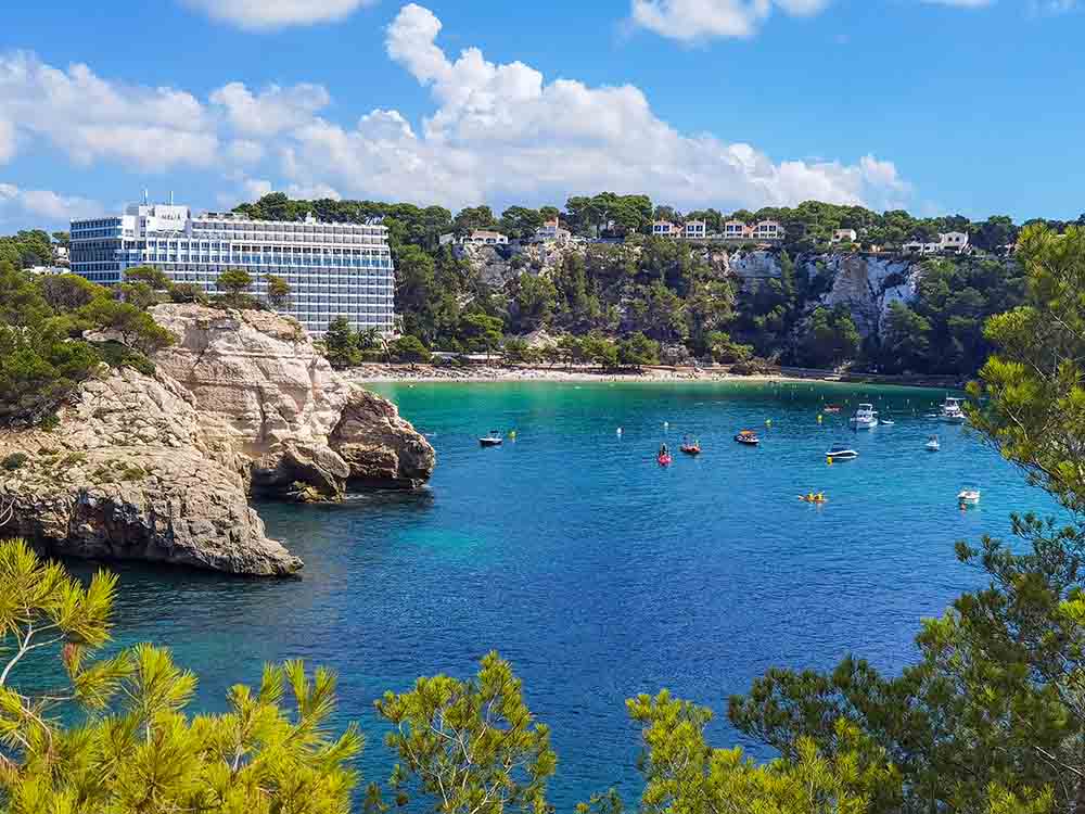
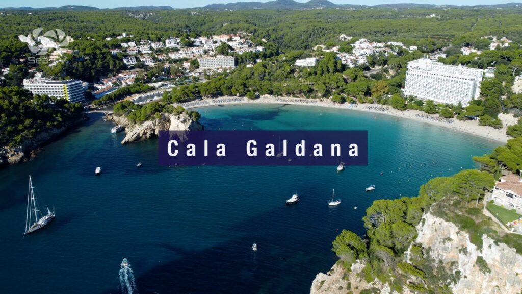
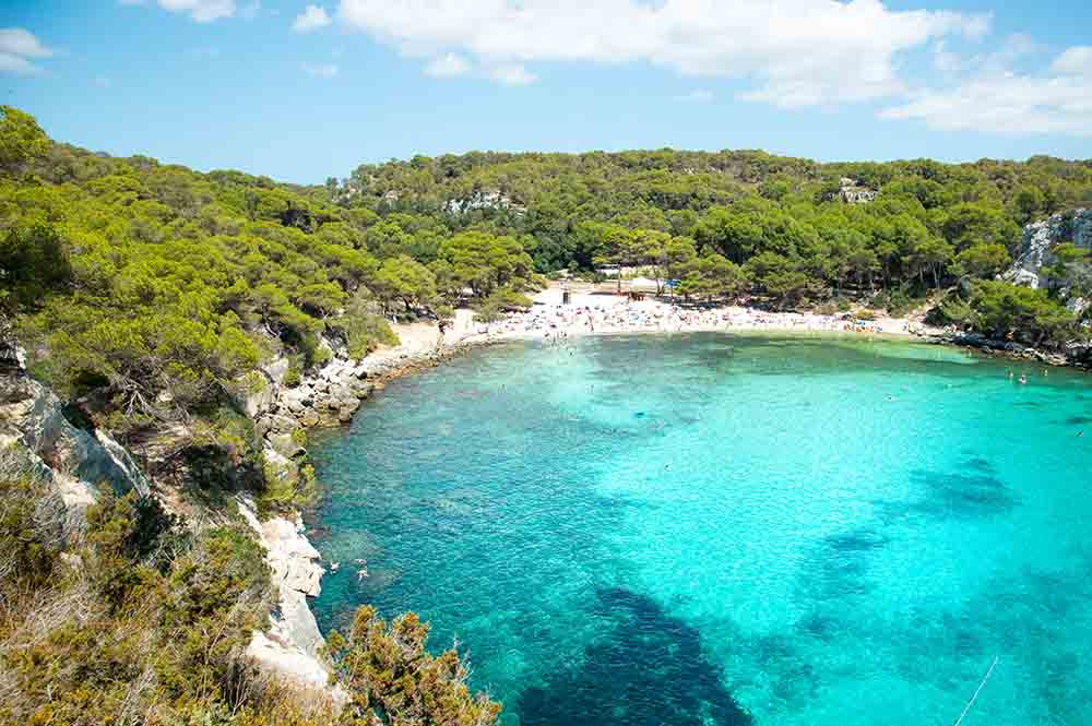
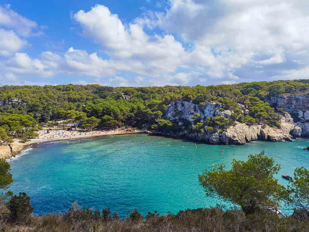
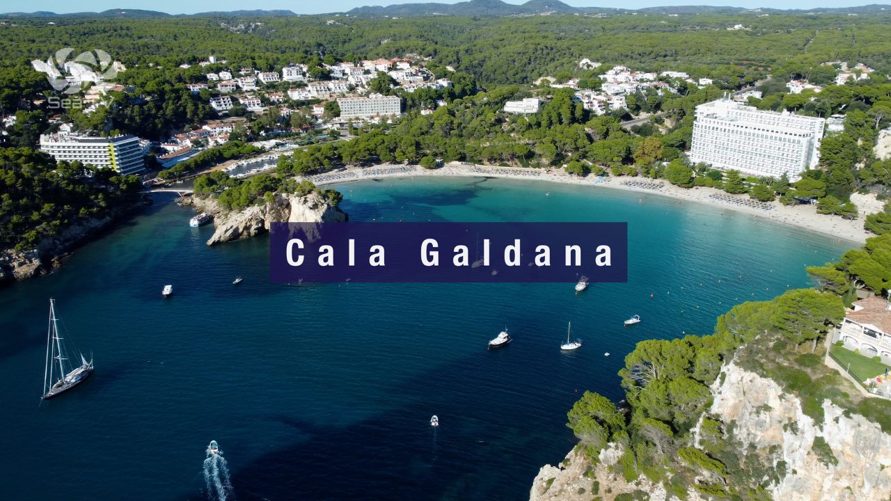
~39°56’N · 3°58’E · 400 m horseshoe-shaped sandy beach · Blue Flag · the most sheltered south-coast bay on Menorca · the natural outlet of the Algendar ravine — Menorca’s deepest gorge — flows out at the back of the beach forming a small “river” that small-draft boats use as an inner harbour · cliffs on both sides protect from S/SE swell · access by sail through a wide bay entrance · sand bottom, 3-7 m depths in the bay · 8 km S of Ferreries (the parent inland town) · ~25 km from Ciutadella · ~37 km from Maó · the so-called “Queen of the Calas” — the only south-coast bay developed enough to support a full-service resort.
⚠ Anchorage only · NO formal marina · No berthing reservations · Closest service marinas are Ciutadella (~22 NM W) or Maó (~50 NM E around)
Cala Galdana is the south-coast anchorage that doesn’t require a hike, a 4WD, or a permit. While the rest of Menorca’s southern calas — Macarella, Macarelleta, Mitjana, Trebalúger, Escorxada — are protected virgin beaches you reach on foot or by sea, Cala Galdana is the one bay that was built up: a 1970s-era purpose-built resort with hotels, restaurants, beach bars, sun-loungers, kayak rental, and a paved promenade running the entire length of the 400-m beach. For sailors, this is both the bay’s best feature and its main drawback. The horseshoe geometry creates the most sheltered S-coast anchorage on the island, with cliffs on both sides blocking S/SE swell, sand bottom for solid holding, and the deep ravine of Algendar opening at the back of the beach into a small “river” that shallow-draft boats use as an inner harbour. But it also means the bay fills with day-trippers, the buoyed swimming area is large, and Posidonia patches in the outer bay restrict where you can drop. For day sailors: Galdana is the place you anchor when the rest of the south coast is too exposed, when you want to walk to a paved promenade for lunch, or when you’re using it as a base to dinghy or kayak to the virgin beaches just east and west — Macarella + Macarelleta (8 NM SE) and Mitjana (1 NM E).
⚠ Reality check before you anchor:
→ ⚠ Anchorage only · no marina · for berths head to Ciutadella (~22 NM) or Maó (~50 NM) · day-stop or overnight anchor only here
→ ⚠ Posidonia rules apply · the bay has Posidonia patches mixed with sand · use the Posidonia Maps app to find sandy patches · €1,200+ fines for anchoring on seagrass
→ ⚠ Buoyed swimming area covers most of the inner bay · anchor in the outer half of the cala only
→ ⚠ Open to S quadrant winds · in S/SW blow the bay rolls · move out before nightfall if forecast turns
→ ⚠ Day-tripper boat traffic from Cala Galdana itself + Cala’n Bosch · expect commercial tour boats arriving 10:00-12:00 and departing 16:00-18:00
→ Schengen status: Spain · clear in/out at Palma if from outside EU
⚓ Cala Galdana at a Glance
Coordinates
~39°56’N · 3°58’E
Type
Anchorage (NOT a marina)
Beach length
~400 m horseshoe sandy
Bay shape
Horseshoe · cliffs both sides
Depth in anchorage
3-7 m · sand + Posidonia mix
Shelter
Excellent from N quadrant · open to S
Beach status
Blue Flag · lifeguard · accessible
Inner “river”
Algendar ravine outlet · shallow-draft boats only
Distance · Ciutadella
~22 NM W by sea · 25 km road
Distance · Maó
~50 NM E by sea · 37 km road
Distance · Menorca Airport
~36 km · ~35 min by road
Best for
Sheltered S-coast anchor · resort base · S-coast cala-hopping
Approach & Anchoring
From Ciutadella (~22 NM W along S coast)
→ Leave Ciutadella S past Cala Santandría and Cala Blanca · round Cap d’Artrutx (the SW corner of Menorca, with its 1859 lighthouse).
→ Continue E along the south coast past Son Saura, Cala des Talaier, Cala Turqueta, Macarella + Macarelleta — all virgin sandy calas worth a day stop in calm weather.
→ Cala Galdana opens up after Macarella · the bay is identifiable by the resort buildings on both flanks — the only developed bay on the south coast.
→ Wide bay entrance · ~250 m wide between the headlands · deep approach water.
Anchoring sequence
→ Approach the bay centre · 7 m at the entrance, shoaling to 3 m near the beach.
→ Stay outside the buoyed swim zone · the inner half of the bay is reserved for swimmers.
→ Find a sandy patch visually · the water is clear · sandy white spots = OK to anchor · darker green/brown = Posidonia (DO NOT).
→ Reverse hard to confirm hold · sand bottom holds well in summer thermals · Posidonia patches will pull anchor and result in fines.
→ Mirador Sa Punta viewpoint on the W cliff is the photo reference for “you’ve arrived” · 15 min walk up from the beach for the iconic shot.
The Algendar “river” inner harbour
The Algendar ravine — Menorca’s deepest gorge — flows out at the back of the beach forming a small narrow “river” used by shallow-draft local boats as an informal harbour. Tenders, kayaks, SUPs can reach 200-300 m inland through the ravine for a unique pine-lined paddle. ⚠ Not navigable by anything drawing more than 1 m · the bridge at the entrance limits height as well.
The Beach & Resort
What you’ll find on shore:
→ Blue Flag beach (~400 m fine sand, gentle slope, no water shoes needed) · lifeguard May-October · sun-lounger + umbrella rental (~€20/day for 2 chairs + umbrella)
→ Paved promenade the entire length of the bay · cafés, restaurants, ice-cream shops, souvenir stores
→ Water-sports rental: kayak, SUP, pedalo, snorkel gear · several operators on the beach
→ Boat-rental + boat-tour operators (small motor boats, no licence required for <6 m)
→ Several large hotels (Sol Gavilanes, Meliá Cala Galdana, Artiem Audax) and family villas on both flanks of the bay
Provisioning: a couple of small shops in the resort · Tabac open Jun-Sep · for serious provisioning drive 11 km N to Ferreries (Friday + Saturday market).
The name: “Cala Galdana” comes from the Moorish Guad-al-Ana = “Valley of St Anne” · the name has stuck since the 10th-13th-century Muslim period when Menorca was Medina Menurqa.
The Camí de Cavalls — Walking from Galdana
Cala Galdana sits on the Camí de Cavalls — Menorca’s 185 km coastal footpath that circumnavigates the entire island, originally cut for the British cavalry to patrol the coast. Two stages start/end here:
→ Stage 13 W: Cala Galdana → Cala Turqueta · 6.5 km · ~2 hours · passes the famous Macarella + Macarelleta beaches midway
→ Stage 14 E: Cala Galdana → Sant Tomàs · 10 km · ~3 hours · passes Cala Mitjana (1 km, 20 min) and Cala Trebalúger
→ Mirador Sa Punta viewpoint · 15 min walk up the W headland for the postcard shot of the entire bay
→ Algendar ravine inland walk · follow the river inland through pine-and-oak forest · spot S’hort Squella pecan trees (listed as singular trees by the Govern Balear)
⛵ Day Sails from Cala Galdana
The neighbouring south-coast virgin beaches (all daytime calm-weather only):
→ Cala Mitjana + Cala Mitjaneta (~1 NM E) · pine-fringed pair, sandy 3-5 m bottom · among Menorca’s best
→ Cala Macarella + Cala Macarelleta (~3 NM W) · the most photographed beaches on Menorca · turquoise + pine + cliffs
→ Cala Trebalúger + Cala Escorxada (~3-5 NM E) · undeveloped virgin beaches, pine forest backdrop · boat-only access
→ Cala Turqueta + Cala des Talaier + Son Saura (~5-8 NM W) · the famous turquoise beaches
→ Cala’n Bosch (~8 NM W) · resort with a small marina if you need to fuel up
Longer passages:
→ Ciutadella: ~22 NM W · the medieval capital + first proper berths W
→ Maó (Mahón): ~50 NM E around the SE corner · world-class natural harbour
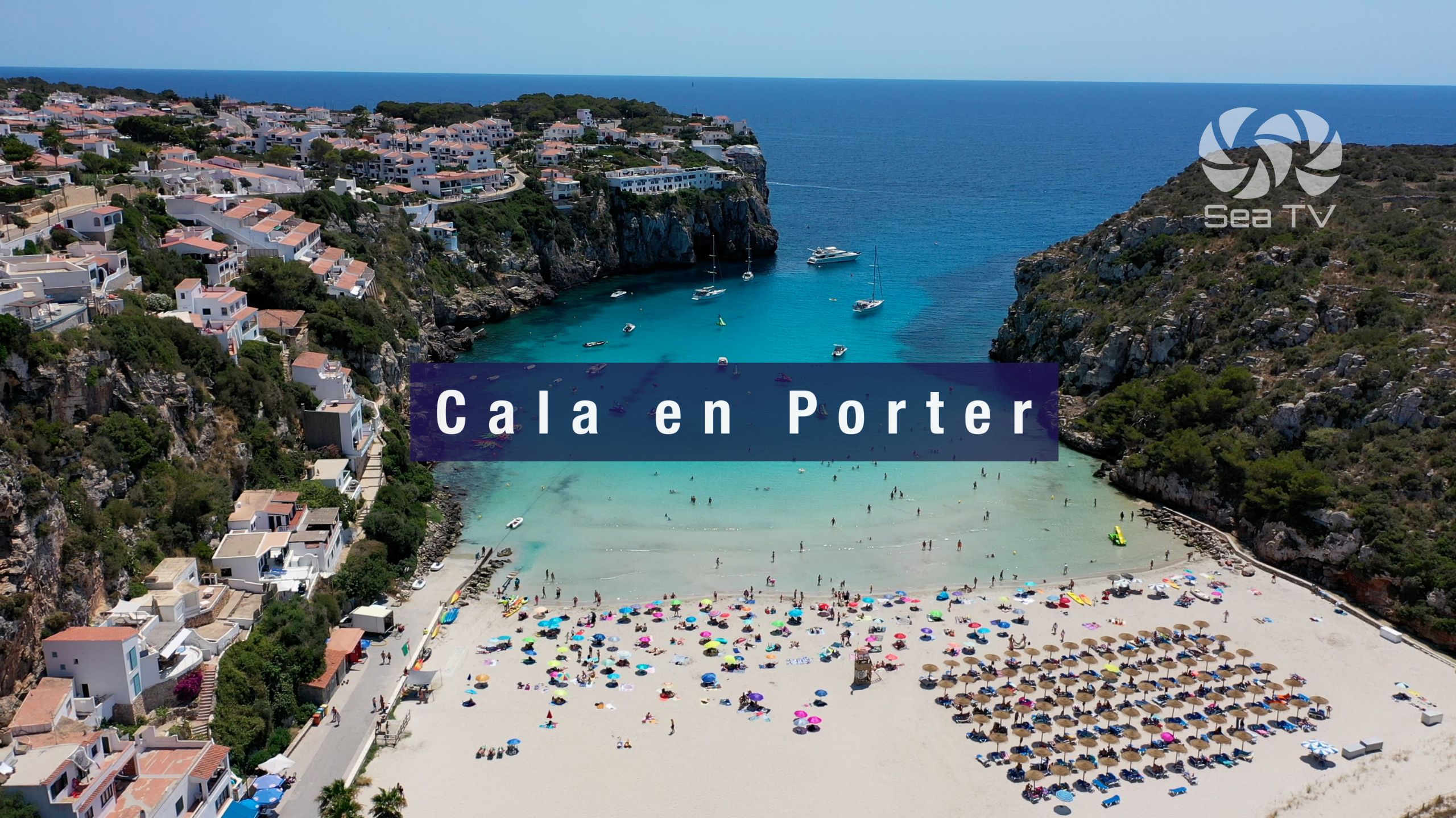
→ Cala’n Porter: ~12 NM E · the Cova d’en Xoroi anchorage
→ Across to Mallorca: Port d’Alcúdia ~40 NM SW · Pollença ~40 NM SW
Emergency & Practical Contacts
Emergency: 112 (national)
Maritime SAR (Salvamento Marítimo): 900 202 202
VHF distress: Channel 16
Beach lifeguard: May-October on the beach itself
Hospital Mateu Orfila (Maó): +34 971 487 000 (the only public hospital on Menorca · ~35 km)
Closest service marina: Club Nàutic Ciutadella +34 971 383 918
Posidonia maps app: “Posidonia Maps” by Govern de les Illes Balears (free · iOS + Android)
⛵ Continue Exploring Menorca
→ Cala’n Porter — 12 NM E · Cova d’en Xoroi cliff bar + cliff-village resort
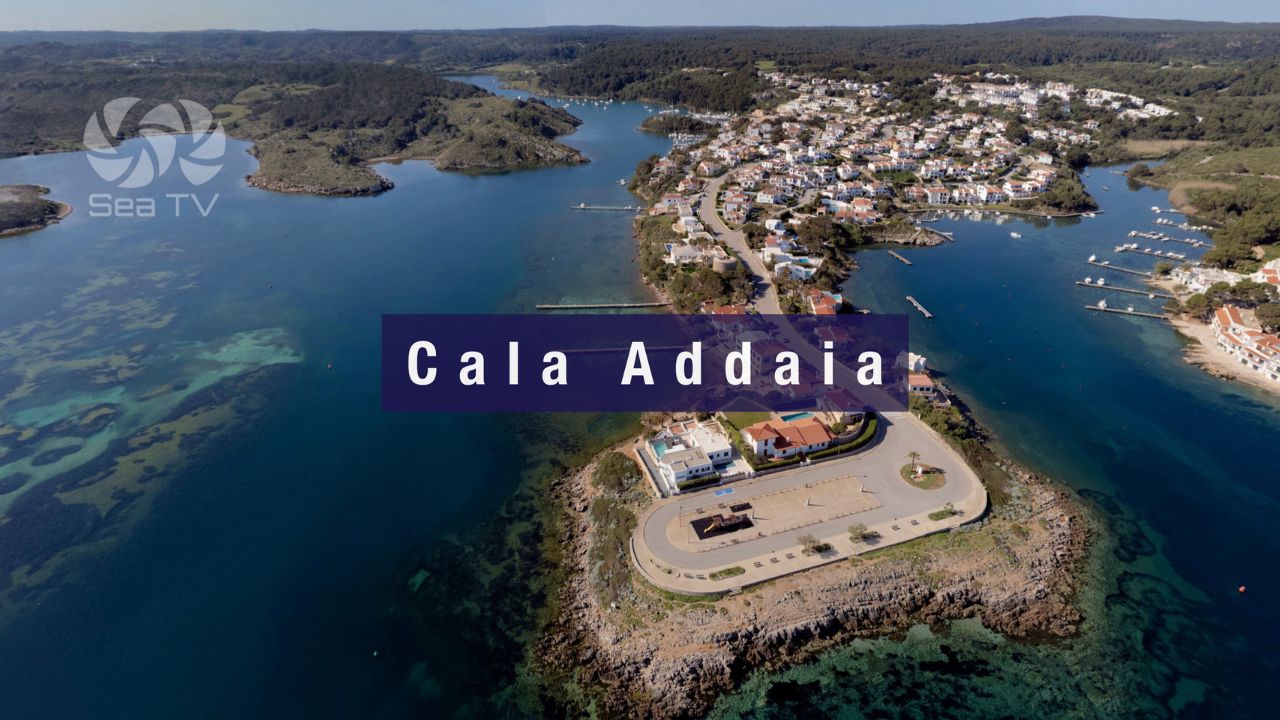
→ Cala Addaia (Port d’Addaia) — NE coast natural-harbour marina · 168 berths
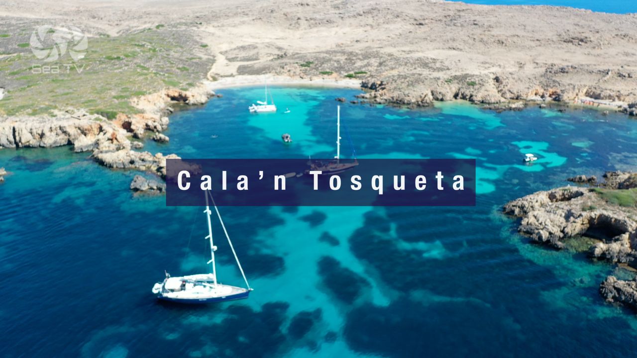
→ Cala’n Tosqueta — N-coast virgin cove on Mola de Fornells peninsula
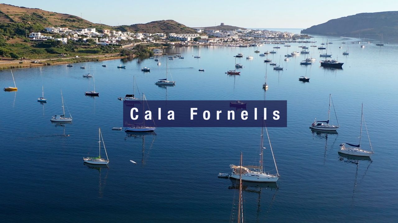
→ Cala Fornells — N-coast village swimming spot at Fornells
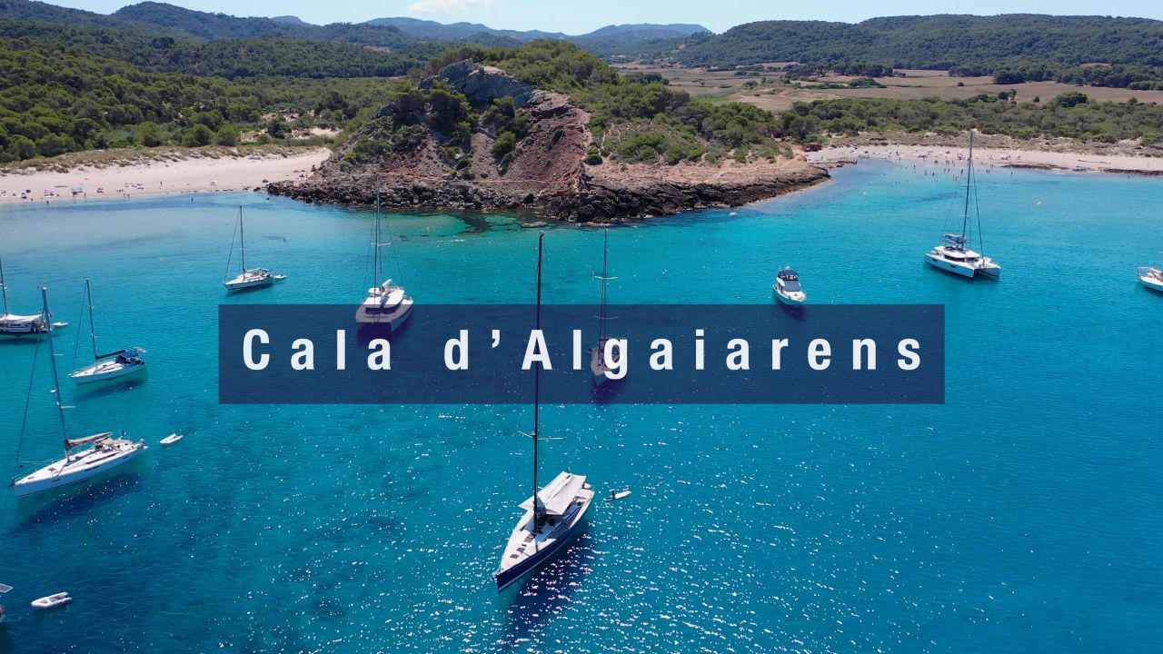
→ Cala Algaiarens (La Vall) — NW-coast virgin double bay
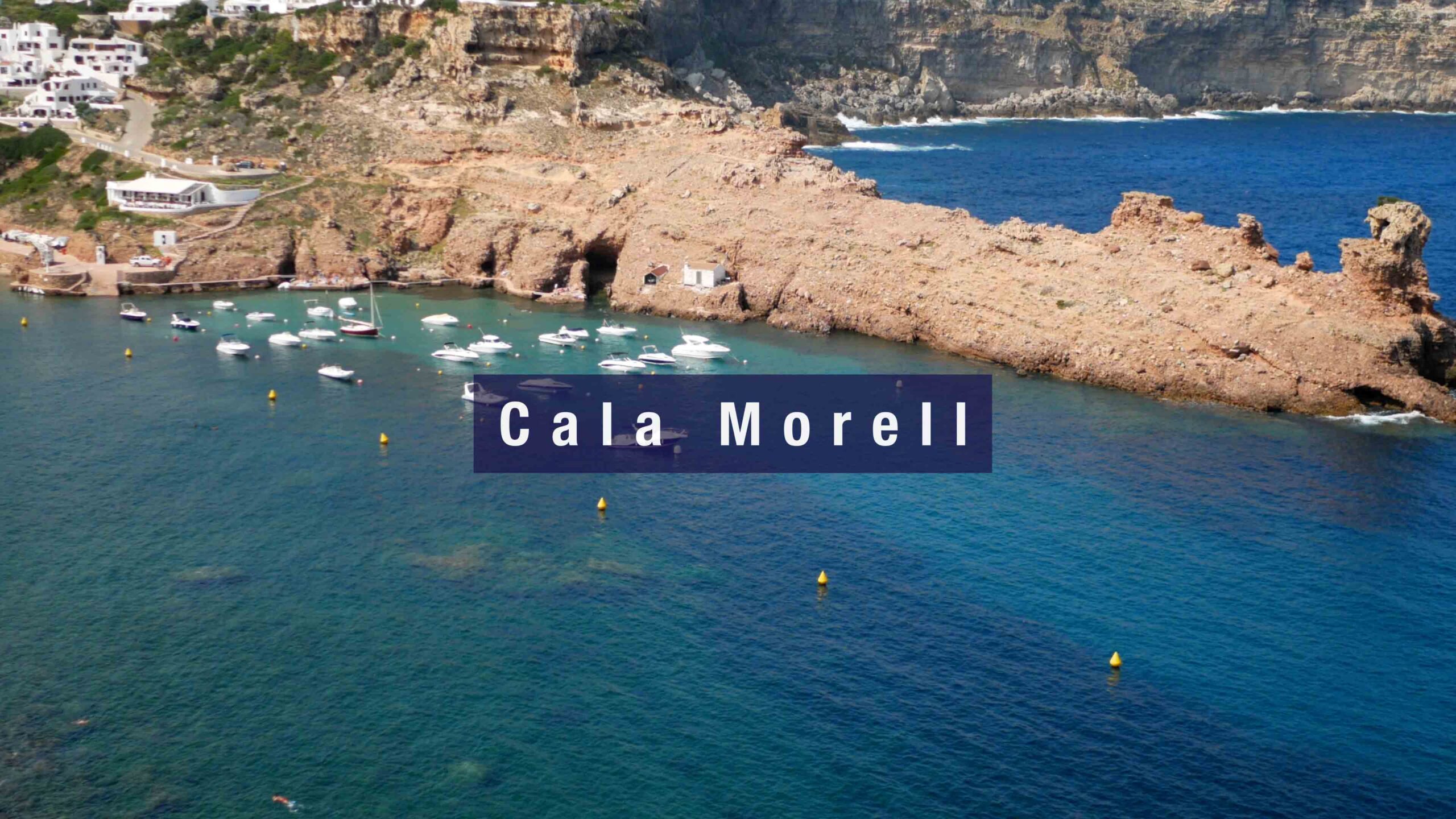
→ Cala Morell — NW natural harbour + 14C BCE prehistoric necropolis
→ Port de Ciutadella — the medieval capital · 1,170 m natural inlet
→ Ciutadella Harbour Marina — Club Nàutic Ciutadella berths
“Cala Galdana is the south coast anchorage that does not require a hike a four wheel drive or a permit · the four hundred meter horseshoe shaped sandy beach with the cliffs on both sides protecting from south and southeast swell · the Algendar ravine which is Menorca’s deepest gorge flows out at the back of the beach forming a small river that small draft boats use as an inner harbour · approach is straightforward through the wide bay entrance with seven meters at the mouth shoaling to three meters near the beach · stay outside the buoyed swim zone use the Posidonia Maps app to find sandy patches and reverse hard to confirm hold · the resort was purpose built in the nineteen seventies and gives you what no other south coast cala has the paved promenade the cafés and restaurants the water sports rental and the lifeguarded Blue Flag beach · the name comes from the Moorish Guad al Ana the Valley of Saint Anne which has stuck since Menorca was Medina Menurqa under Muslim rule · the Mirador Sa Punta viewpoint on the west cliff is the postcard shot fifteen minutes walk up · the Camí de Cavalls passes through with stage thirteen west to Cala Turqueta passing the famous Macarella and Macarelleta and stage fourteen east to Sant Tomàs passing Cala Mitjana and Cala Trebalúger · day sail to Mitjana one mile east or Macarella three miles west or the chain of southwest coast turquoise beaches Son Saura and Cala des Talaier and Cala Turqueta · the trade off is real this is the most developed bay on the south coast so the day tripper boat traffic and the buoyed swim zone and the Posidonia patches restrict where you can drop · but this is also the only south coast bay where you can anchor and walk to a paved promenade for lunch and the only place to bail to in a south swell when the rest of the south coast becomes untenable · the queen of the calas she has earned her name.”
— SeaTV · Menorca · Cala Galdana · Queen of the South Coast Calas